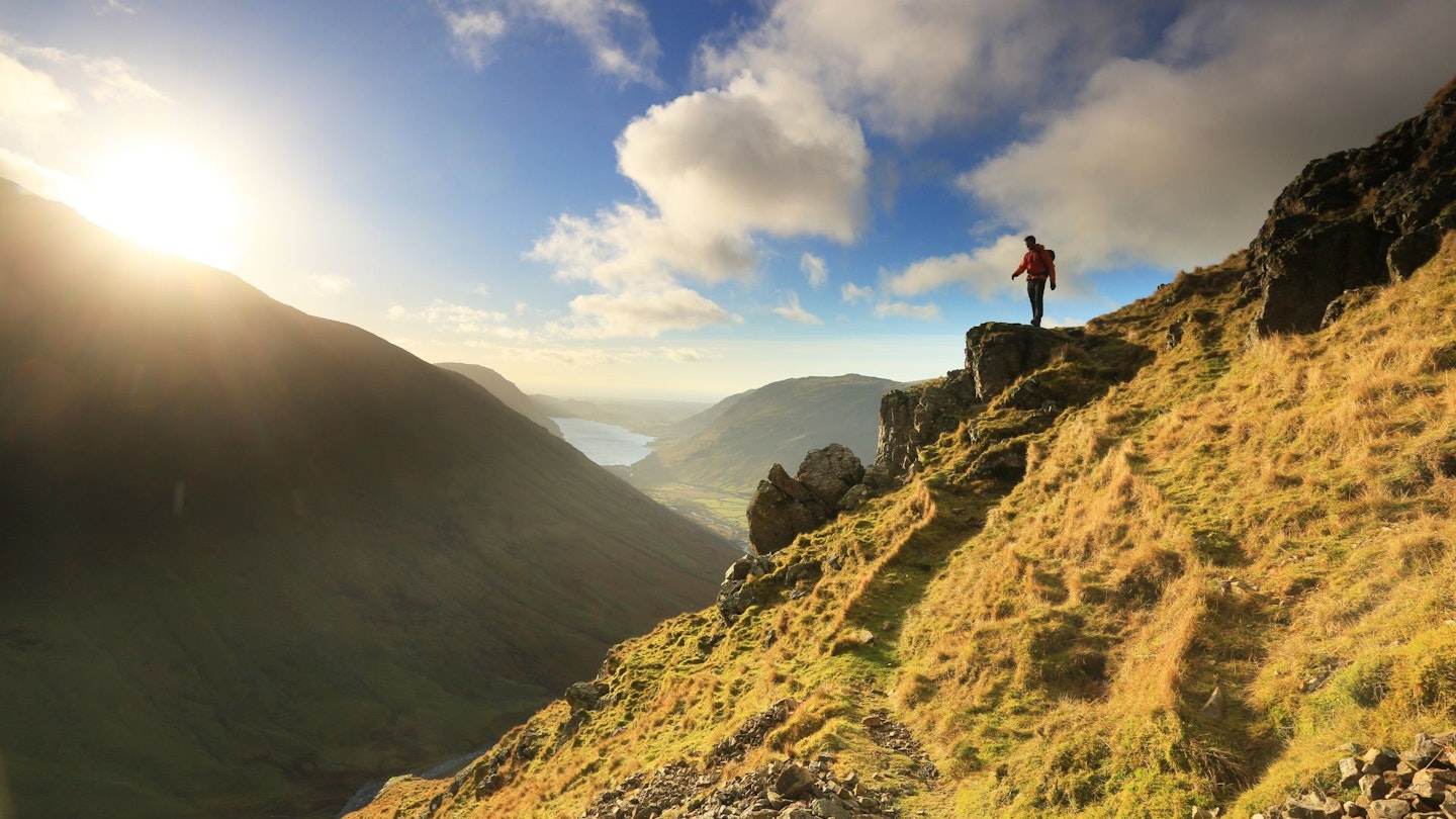
Compiling a list of the best hikes in the UK isn't a simple thing to do, because the choice is almost endless. From mountains and forests, to lakes to glens, plus thousands of miles of rugged coastline, there's plenty of adventure for anyone who loves exploring with a backpack and a good pair of boots.
One of the best things about walking and hiking in the UK is the variety on offer. For a relatively small collection of islands, our landscapes are packed full of mountain regions offering challenges of all shapes and sizes, for all ages and abilities.
The fells and valleys of the Lake District, the razor-sharp ridges of Snowdonia, and the soaring peaks and vast glens of the Scottish Highlands are just some of the highlights on offer. As a result, it can be hard to know where to start when planning a weekend of hiking, which is why we've come up with the list below.
How much you enjoy a particular walk or hike comes down to many factors, such as your levels of experience and fitness, or whether you prefer walking on established trails or scrambling on rocky ridges.
One thing we knew we wanted to focus on, though, is mountains. So all of the routes on the list below are focused on the UK's most popular hillwalking regions.
Related articles: Best walks in the Lake District | Best walks in Snowdonia | Best walks in the Peak District | Best walks in the Scottish Highlands | Best walks on the Scottish islands | Best Lake Distriict scrambles
There are some very familiar names in our collection, plus a few surprises you've hopefully never heard of. Most of all though, we hope our list of the best hikes in the UK will inspire you to get outside, head for the hills, and start ticking some big names off your bucket list.
So let's get started...
25. Glen Sannox Horseshoe, Isle of Arran
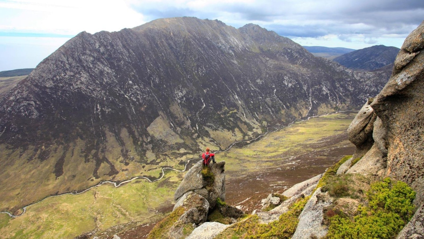
The Isle of Arran is one of the most atmospheric places in Scotland, and the Glen Sannox horseshoe is one of the best mountain days in Britain. Make no mistake, though, it’s a biggie.
The terrain is hard going at times and it will drain you. There are ridges, scrambling, scrambling over ridges, difficult route-finding, sea views, dramatic mountain views and, if you’re lucky, you might even spot an eagle or two.
Every angle you view this route from while you’re on it is quite simply awesome, and it’s only the scale of the day that keeps you moving. Back to the island itself – stay an extra day or two. Enjoy it. Swim in the sea and eat as the sun goes down. Go. Fall in love with the place.
24. Moel Siabod via Daear Ddu Ridge, Snowdonia

Moel Siabod stands guard over the village of Capel Curig at its base, offering up huge views of the surrounding North Wales mountains.
There are a wide variety of excellent ascent options including grass slopes, quarry tracks, and the spectacular ridge scramble of Daear Ddu, which all end on a summit with one of the best views of the Snowdon massif in the whole National Park.
And what a ridge Daear Ddu is. Wider and less confusing than Tryfan’s North Ridge, but with exposure and views to rival that of the Carneddau’s Llech Ddu Spur, it is simpler than both and an ideal destination for rookie scramblers.
CLICK HERE for our full route guide to Moel Siabod and the Daear Ddu ridge
23. Great Gable Climbers’ Traverse, Lake District
Great Gable is perhaps the most iconic of all Lake District mountains, standing proud at the end of the Wasdale Valley with its pyramidal profile a prominent image on the National Park logo.
Almost any angle you approach Gable’s domed summit from is memorable, but to really get to know the character of this 899m peak you need to walk the Climbers’ Traverse path.
This is an exciting and rocky trail that winds beneath crags, over boulders and across scree slopes, giving you a grandstrand view of some of the most famous features in British rock-climbing history. Napes Needle and Sphinx Rock are among the many highlights of this classic Lakeland route.
CLICK HERE for our full route guide to Great Gable and the Climbers' Traverse
22. Bidean nam Bian via the Lost Valley, Glen Coe
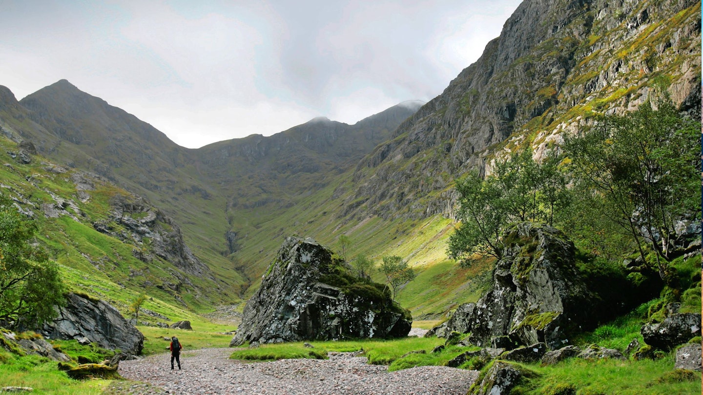
Bidean Nam Bian is generally the name given to the entire mountain range on the south side of Glen Coe. It is a sprawling, complex mass of crags, corries, ridges and summits, which is also home to two Munros. The first is the aforementioned Bidean Nam Bian (1,150m), and the second is Stob Coire Sgreamhach (1,072m).
One of the most common routes up to the ridge that links the two Munros is via the head of Coire Gabhail (the Lost Valley).
Coire Gabhail is a classic hanging valley, hidden high above the glen, that was formerly used by members of Clan Macdonald to hide livestock – either their own herds, or cattle raided from rival clans.
The Lost Valley is a great place to explore, not just for its evocative Highland history, but also for its dramatic scenery.
21. Carnedd Dafydd and Carnedd Llewelyn, Snowdonia
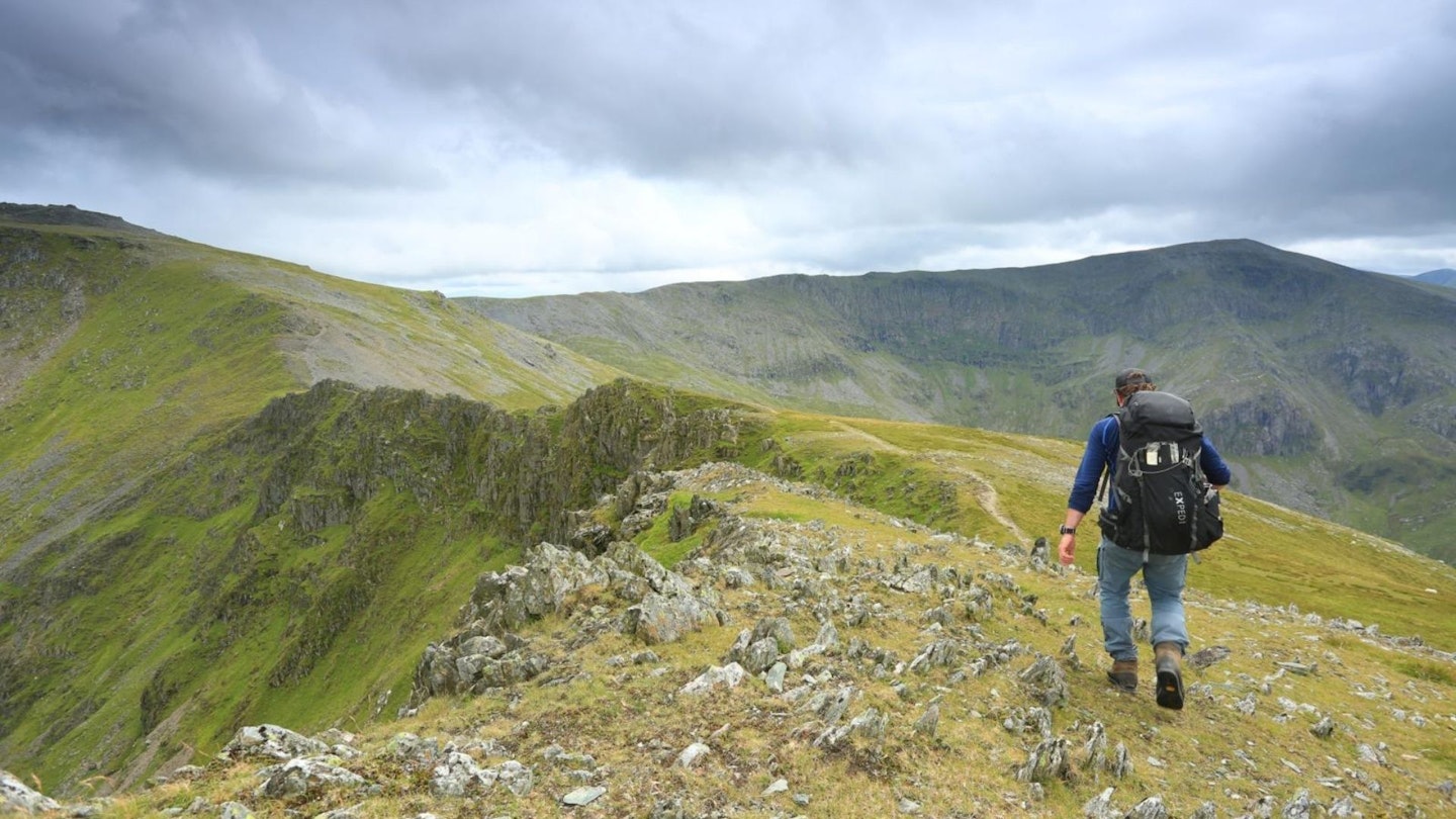
We like to think of Snowdonia’s Carneddau peaks as the Cairngorms of North Wales. Dripping in atmosphere and grandeur, they form Britain’s largest continuous area of high ground south of the Scottish border.
We also like to think you can split mountain people into two groups: those that get the Carneddau and those that don’t. Due to their proximity to sharp, pointy, ‘exciting’ peaks, they seem to go un-championed by the masses. And that’s fine by us, because it means we often get them all to ourselves.
Carnedd Dafydd and Carnedd Llewelyn are the highest in the range and can both be reached on a loop walk that starts in the backstreets of Bethesda, then quickly feels like it’s transported you into the heart of remote Scotland.
You ascend through secretive Cwm Caseg to Yr Elen, then tag the summit of Carnedd Llewelyn before walking above the Ysgolion Duon cliffs (also known as the Black Ladders) to Carnedd Daffyd. From here you’re treated to the shapely lineup of peaks across the Ogwen Valley as you descend back to Bethesda.
20. Coniston Horseshoe, Lake District
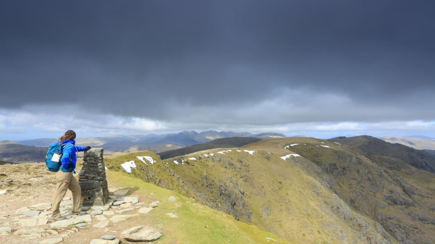
This high-level traverse of the summits and ridgelines around Coniston is a grand day out, particularly on a clear day when the far-reaching views seem to change with every turn.
From the start in Coniston village, you’ll climb first through abandoned mine workings on the Lower slopes of The Old Man of Coniston, heading past the hidden mountain tarn of Low Water (great for swimming in summer) before arriving at the huge 803m summit cairn.
The route now stays high as you stroll above Levers Water and traverse Swirl Band to your second summit of the day at Swirl How.
Then it’s down the narrow and rocky Prison Band and back up to the 762m summit of Wetherlam before swinging back down to Coniston village. This is a fascinating walk for all ages and abilities, packed with history, geology, and some of the finest scenery in the English mountains.
19. The Edale Horseshoe, Peak District
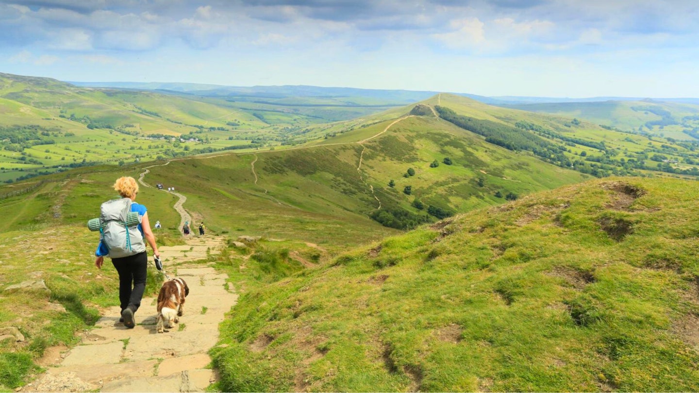
There are many reasons that the village of Edale is an absolute haven for walkers and hikers. The first is its location: bang in the heart of the Peak District’s highest and most impressive scenery, right at the foot of Kinder Scout and Mam Tor.
The second is that it marks the start (or finish if you walk from north to south) of the 268-mile Pennine Way, England’s oldest National Trail and one of the most famous long-distance walks in the world.
There are plenty of great walks you can do from Edale, and just exploring the southern cloughs, spurs and rocky outcrops of Kinder Scout is a memorable route in its own right.
But if you want a proper challenge, the full Edale Horseshoe – taking in Kinder Scout, Brown Knoll, Rushup Edge, Mam Tor, Back Tor, and Lose Hill – is about as good as Peak District walking gets. Finishing off with a pint at the Old Nags Head or the Rambler Inn.
18. Kentmere Horseshoe, Lake District
This is one of the Lake District’s classic horseshoe walks – and rightly so. It might not have the drama or majesty of others, such as Newlands or Mosedale, but the Kentmere Horseshoe is still a must-do for lovers of Lakeland.
Starting in the quaint village of Kentmere, this high-level clockwise loop offers a long but thoroughly enjoyable day of airy ridge walking, packed with beautiful views and the added bonus of ticking off nine Wainwrights in the Far Eastern Fells.
Highlights along the way include the rolling ups and downs of the horseshoe’s western arm, the impressive beacon atop Thornthwaite Crag, and the dip into rocky Nam Bield Pass with its views down Haweswater before the pull back up to Harter Fell.
CLICK HERE for our full route guide to the Kentmere Horseshoe
17. Pen y Fan and Cribyn, Brecon Beacons
If shape and form were the only measure applied to mountains then Pen y Fan, Cribyn, Corn Du and Fan y Big, the four central peaks of the Brecon Beacons, would be classed amongst the grandest in Britain.
Their sweeping, elegant lines and stately profiles put many more lofty peaks to shame. The most fulfilling way to tackle these four mountains is to complete a round of the lonely and wild valley on the south side, occupied by the Neuadd reservoirs.
This southern horseshoe exposes you firstly to the wild and remote heart of the Brecon Beacons, with its lonely corners and great expanses of open hillside set against flashing waters.
Then, on high-sculpted ridges, you can set out at a fine pace watching the world pass by below you as the four main summits are reached with relative ease.
This combination of tranquillity on the approaches and then uplifting walking around the crests is what makes this horseshoe a true classic.
16. Ring of Steall, Mamores
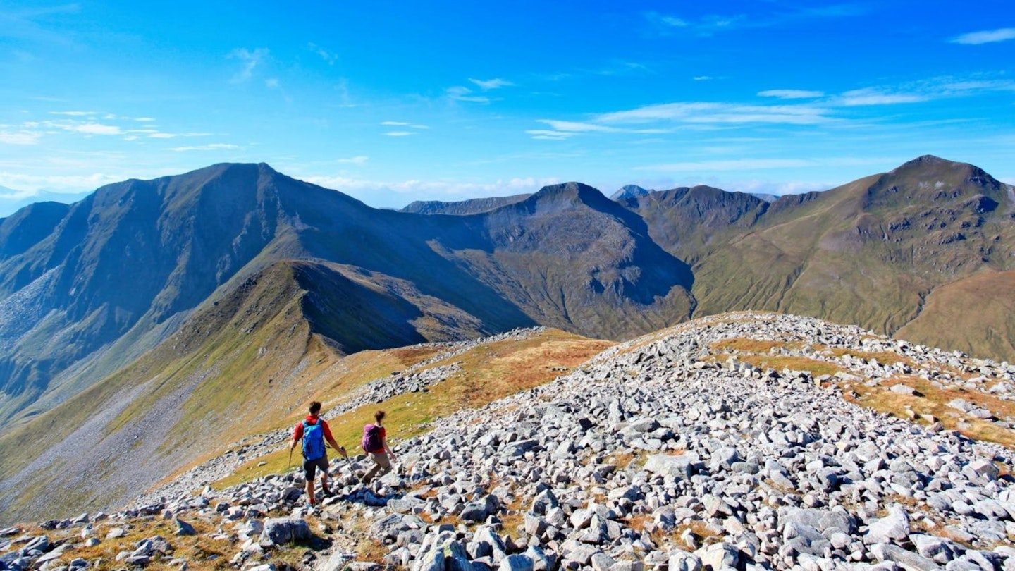
The Ring of Steall is one of the classic Scottish mountain routes that every diehard peak-bagger needs to walk at least once in their lifetime.
This highlight-packed mountain loop is often overshadowed by the popularity of nearby Ben Nevis, but the neighbouring range of Britain's highest mountain should not be overlooked.
There are few easily accessible groups of mountains with such rugged beauty that still possess the sense of being untamed as the Mamores.
There are also very few routes that have a myriad of scrambles and varieties of technical terrain you can link in one big day out. And if the mountains themselves aren’t enough, the walk-in through Glen Nevis and Steall Falls is enough to get even the most reluctant to the base of the climb.
CLICK HERE for our full route guide to the Ring of Steall
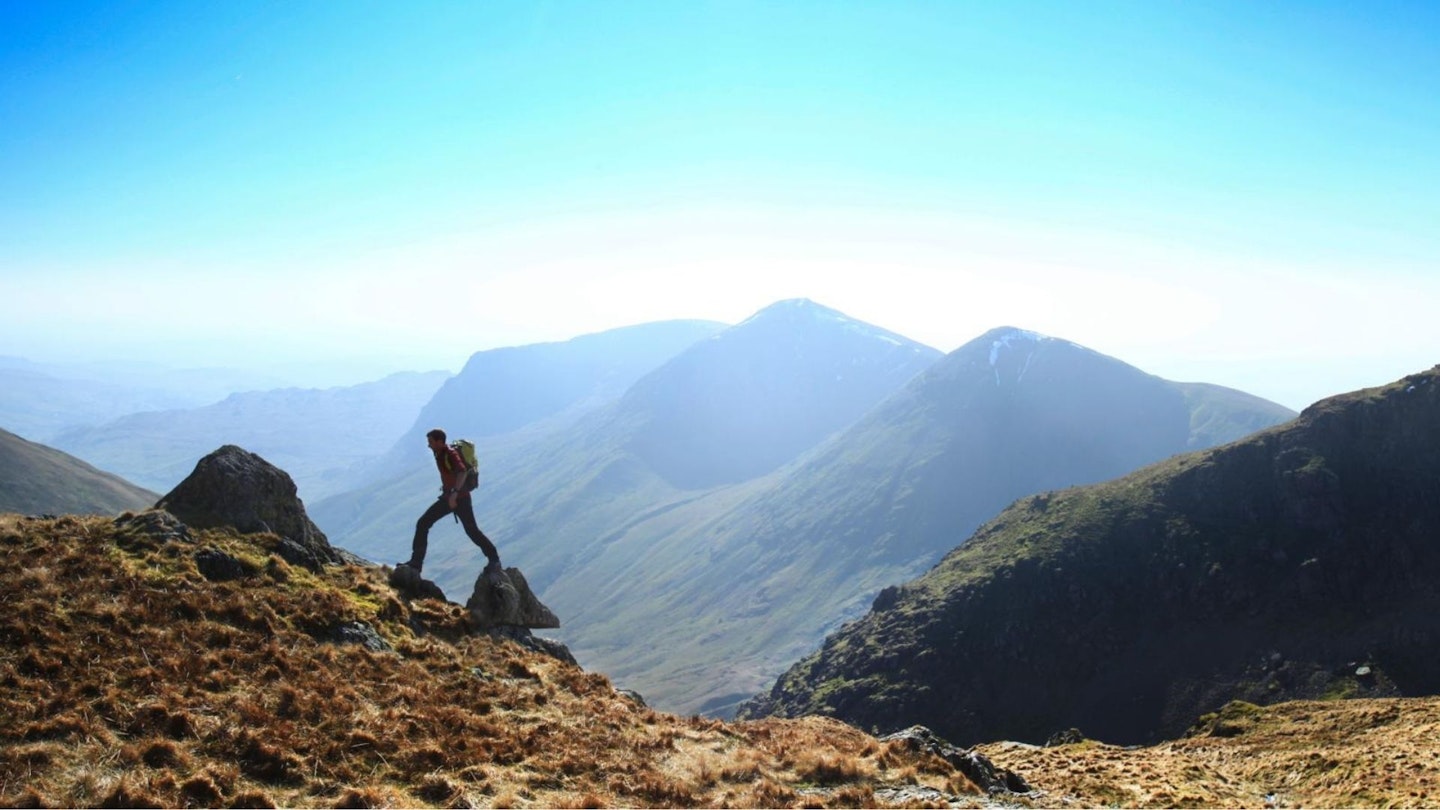
15. Ben Nevis via the CMD Arête, West Highlands
The Carn Mor Dearg Arête is unquestionably the most exciting walking route up Britain’s highest mountain – and it’s a big day out whichever way you tackle it.
The usual route starts at the North Face car park near Torlundy and winds through woodland, then alongside the Allt a’ Mhuilinn, before breaking left and slogging up the northern nose of Carn Mor Dearg, which at 1,220m is a serious peak before you even reach Ben Nevis.
From the summit of Carn Mor Dearg, you drop to the main attraction of the CMD Arête, a sprawling ridgeline that sweeps past the North Face of ‘The Ben’ to the 1,345m roof of Britain.
The arete is more exciting than exposed and although there are a few sections where you may choose to use hands to steady yourself, it’s well within the reach of experienced walkers.
CLICK HERE for our full route guide to the CMD Arete
14. Langdale Pikes, Lake District
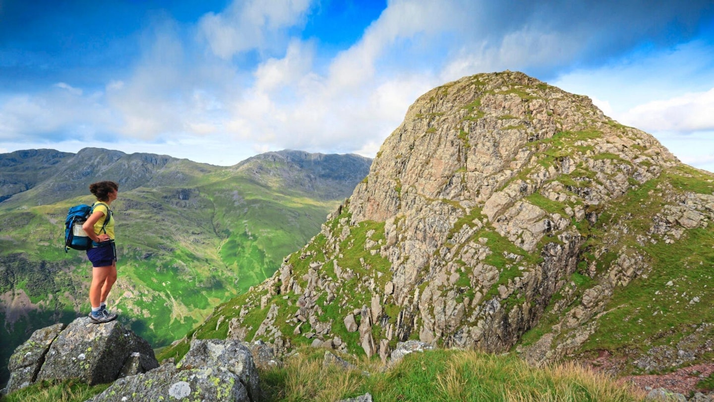
Every Lakeland fellwalker is familiar with the classic outline of the Langdale Pikes as they tower over the valley of Great Langdale, looking steep and almost unclimbable in some views.
The full traverse of the ‘Pikes’ takes in Pike of Stickle (709m), Loft Crag (692m), Harrison Stickle (736m) and Pavey Ark (697m).
Most people start the walk from the Great Langdale Valley, following the steep and stunning trail from behind the Sticklebarn pub that follows the spouts and waterfalls of Stickle Ghyll up to Stickle Tarn.
From there you can almost make up your route across the four peaks, and if you’re up for a scramble check out the Grade 1 classic of Jack’s Rake on Pavey Ark.
13. Newlands Round, Lake District
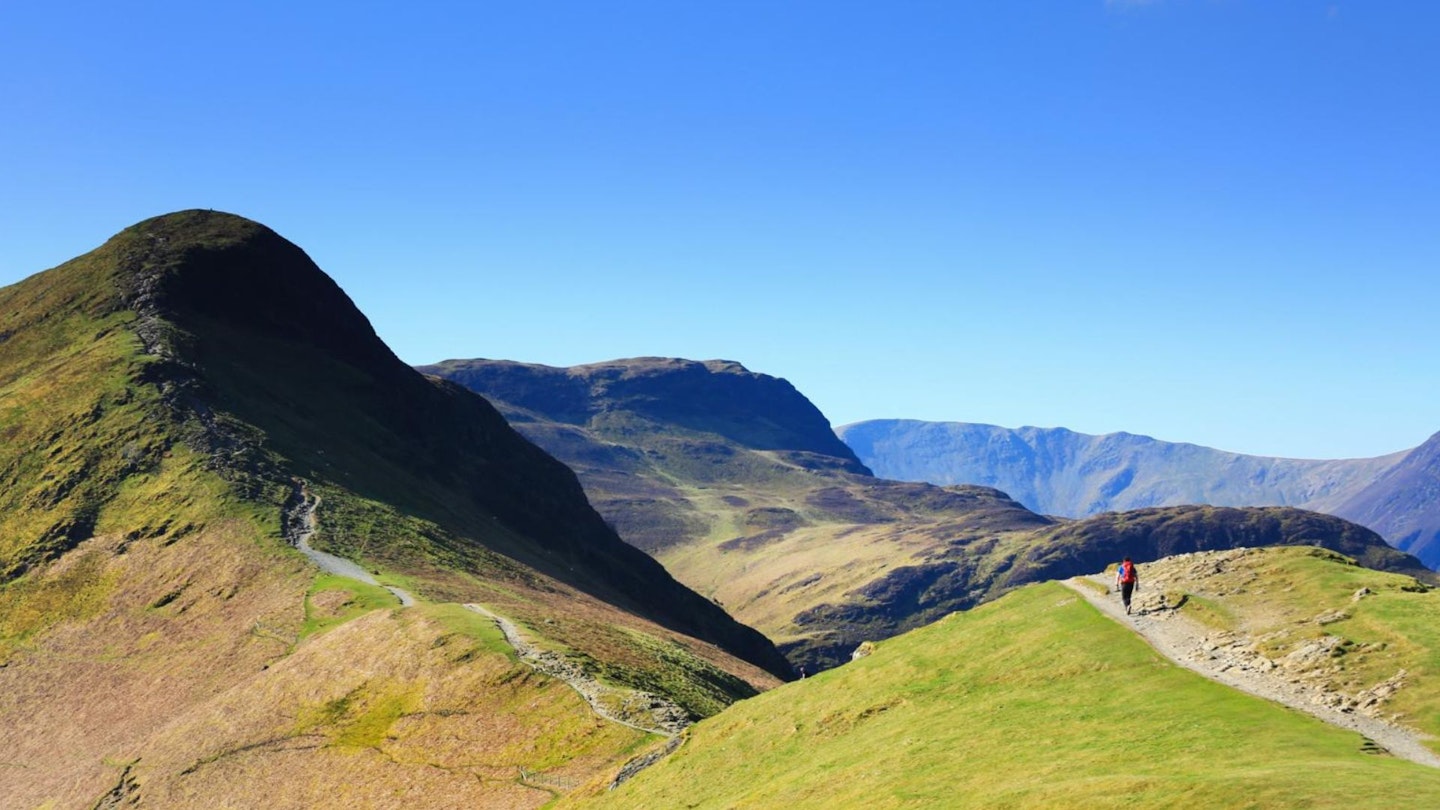
There is something very satisfying about a circular ridge walk in the Lake District. A slow ascent at the start of the day to warm you up, a nice central arc with undulating summits, then a slow descent back to civilisation.
Ideally with perfect weather and 360° views, plus mostly obvious paths and straightforward navigation so you can look up from the map occasionally.
Well, the Newlands Round ticks all of those boxes – although we can’t guarantee the weather. You start by walking the rolling fells on the western side of Derwent Water, with high views opening up across what feels like the entire Lake District the higher you go.
It’s easy to make an early exit, just past Dale Head, if the weather’s turned sour, and you can skip Cat Bells if you’re running late.
12. Cadair Idris Minffordd Path, Snowdonia
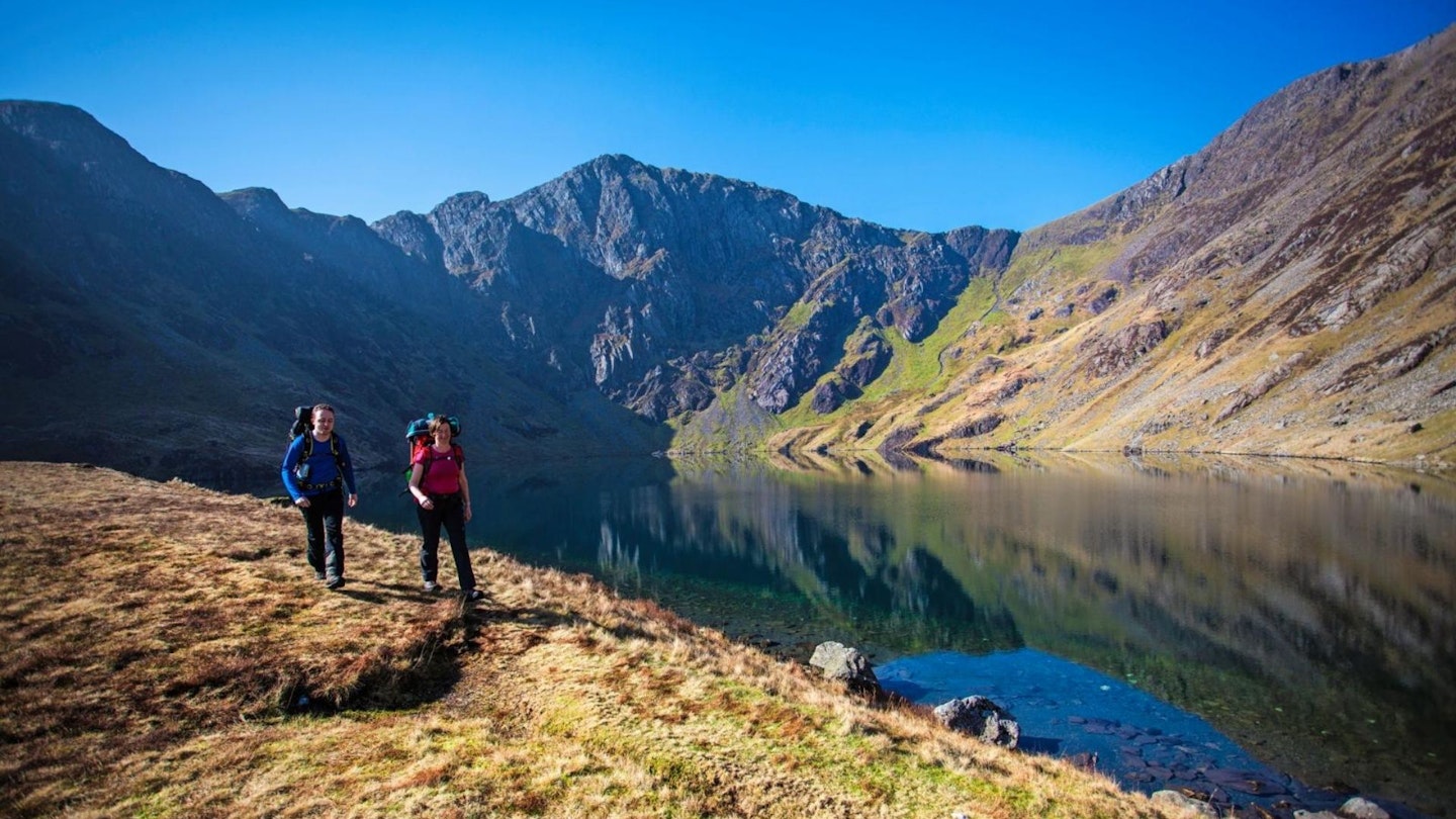
If you’re talking British mountains, Cadair Idris takes some beating. The prized summit of Penygadair is connected by a twisted chain of peaks, nine of which poke above the 2,000ft barrier, and is a prized summit for anyone whether it’s their first or hundredth mountain walk.
The Minffordd Path tours oak woods and streams before confronting you with an almost indecent display of naked rock. Sheer cliffs and splintered crags plunge 1,000ft towards the steely waters of the glacial lake Llyn Cau. It’s quite a sight. From Penygadair’s summit, it feels like you can see the whole of Snowdonia, with views that stretch out to Cardigan Bay.
This is a classic walk that shows off everything that’s great about the British mountains. Shrouded in legend and myth, with all the pomp and swagger of Snowdon, but none of the tourist hordes.
11. Scafell Pike Corridor Route, Lake District
You’ve all heard of Scafell Pike, because it’s the highest mountain in England. What you may not know is that it’s also one of the very best.
Most people reach its summit via the Hollow Stones path from Wasdale, which is a fine route that showcases the awesome cliffs and crags of neighbouring Sca Fell, plus the shadowy notch of Mickledore. But there is another way.
The Corridor Route starts from the historic mountain pass of Sty Head and sneaks in from the north, hugging the western flanks of Great End and Broad Crag before firing you out at Lingmell Col just a short distance from the Pike’s 978m summit. It’s rocky, fantastic, and the absolute best walking route to the roof of England.
10. Liathach, Torridon
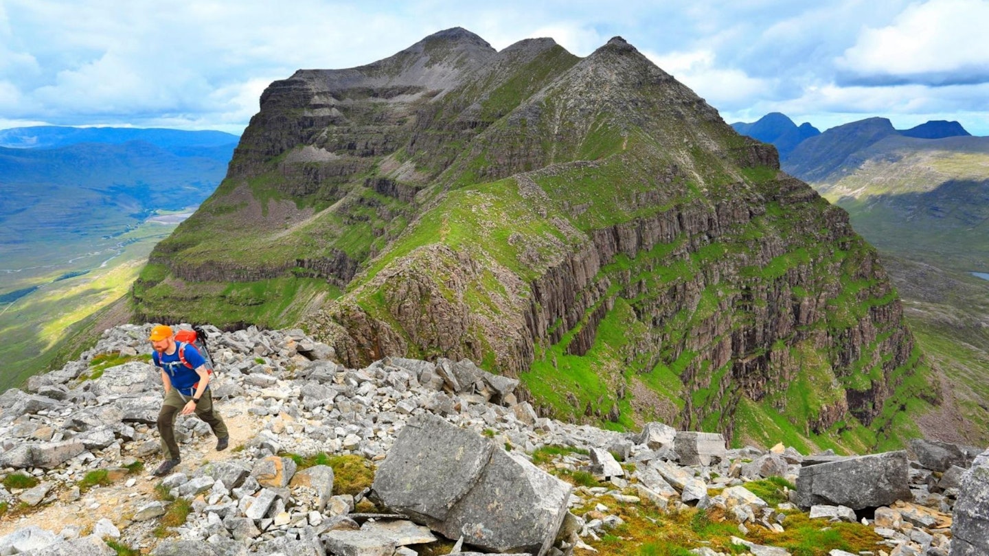
From Glen Torridon, Liathach appears as little more than a vast, scree-strewn lump. It is dark, impenetrable and imposing in the same neck-craning way as a huge concrete dam, but not particularly interesting.
To reveal the true nature of this particular beast, you need to climb it. If you stick to the true apex of this ridgeline-massif and clamber over every spike and pinnacle that stabs your way, you will be well ensconced into scrambling territory. But this is a mountain challenge for walkers, too.
The hardest and most airy obstacles can be bypassed, and this ‘easier’ route maintains all of the exposure and character of the Torridon giant.
The downside to Liathach is that, unlike the other Torridon peaks, you can’t see Liathach from it. This peak is such a staple of the local panorama that without it the skyline seems lacking.
That said, as the ridge bucks and weaves it presents glimpses of sections yet to come. Whether this has you salivating in anticipation or trembling with fear depends on your relationship with heights. But if exposure gives you a buzz rather than fills you with dread, Liathach could be your new best friend.
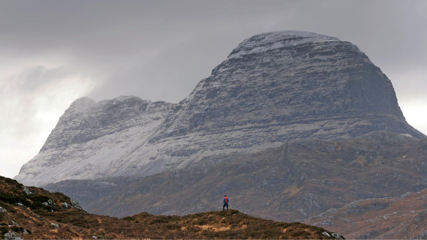
9. Suilven, Assynt
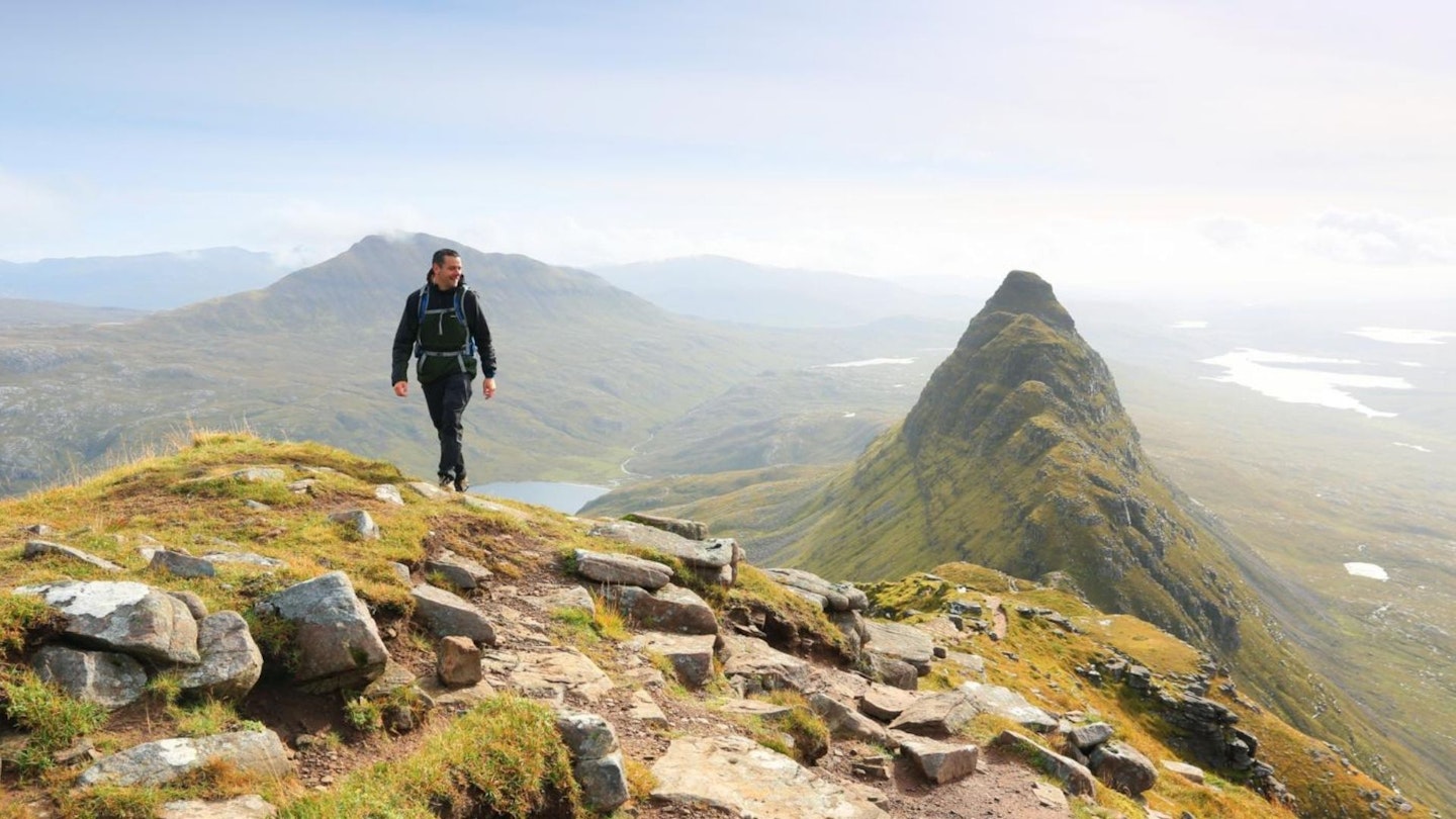
The far north-west of Scotland is a bizarre and incomparable place. Absolutely breathtaking, but slightly strange, too. For one mountain to stand out among this unusual landscape it needs to be something special.
Enter Suilven. It’s almost impossible to tear your eyes away from it on the long approach, except for when the competing lumps and bumps of the terrain get in the way. Even then, its outline remains burned into your consciousness.
The sensation of being up on its strangely sculpted back borders on euphoria, and when the time comes to leave Suilven, you’ll be glancing back over your shoulder all the way.
It’s not the only highlight of the route – far from it – but when, in reflection, your mind is trying to make sense of everything that it experienced in this far, forgotten corner of our island, it will be Suilven’s image that lingers well into your dreams.
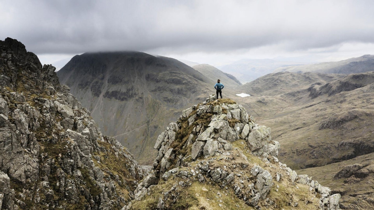
8. Bow Fell and Crinkle Crags, Lake District
It might sound like a cat-stroking Bond villain, but from whichever direction you view it, Bow Fell is a superhero peak. Throw in its side-kick, the enigmatic Crinkle Crags, plus a few supporting characters such as Oxendale, Mickleden and the ever-loyal Angle Tarn, and you’ve got yourself a winning combination of a route.
Plus, if you’re the kind of walker who likes to eke every possible peak and mile out of your hill days, there’s a troop of potential players just waiting to step in from the wings should extra muscle be required: the pikes Blisco, Esk and Rossett, plus the Stickle twins.
However long and arduous or short and sweet they are, all the best sagas have an enticing beginning, a bold middle, and a rewarding end.
The start and finish of this one is the Stickle Barn pub, so we’re off to a good start. But it’s the chunky filling of Crinkle Crags’ crenelations and Bow Fell’s burly buttresses, tantilisingly garnished with unrivalled views of the Scafells, that makes this Great Langdale-based classic so satisfying.
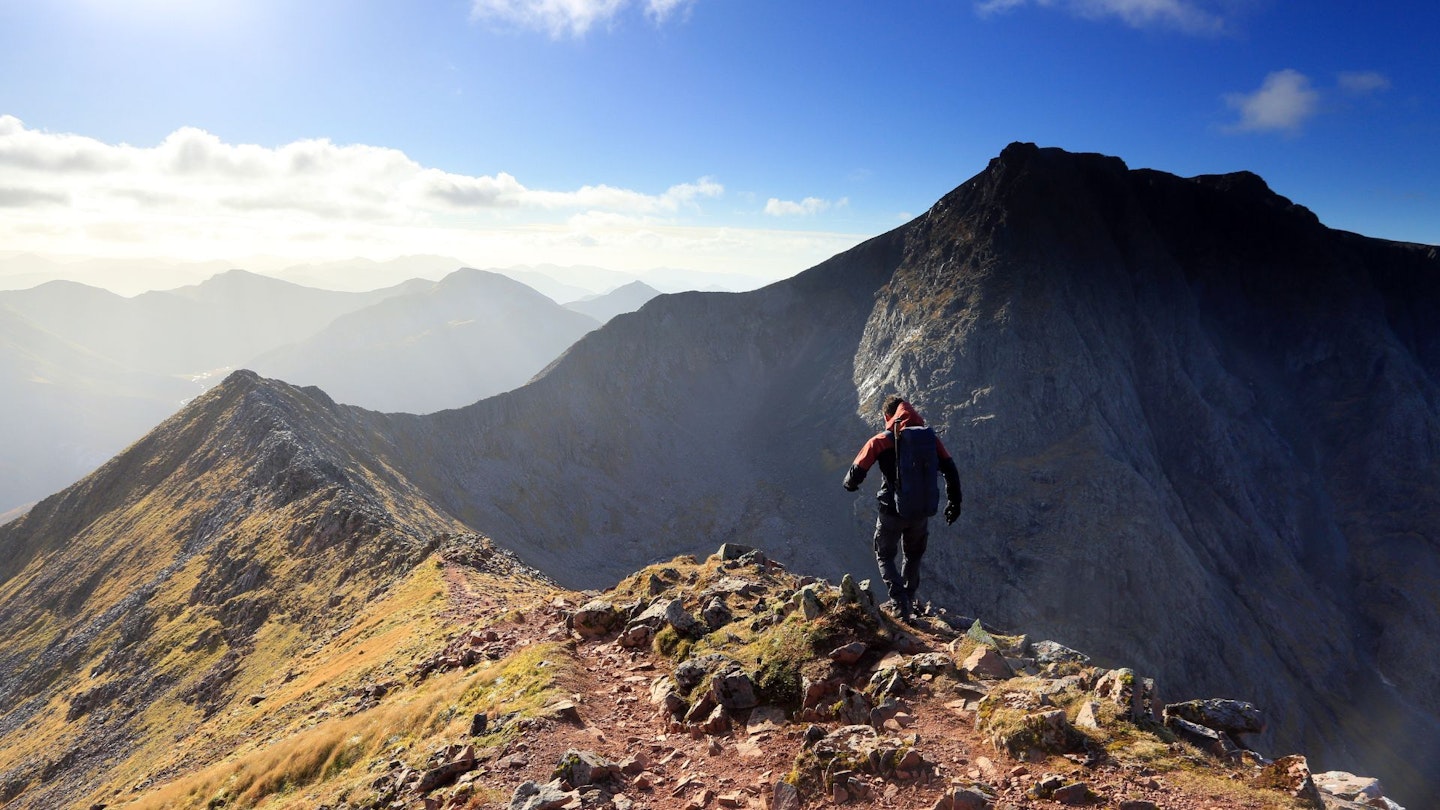
7. An Teallach, Fisherfield Forest
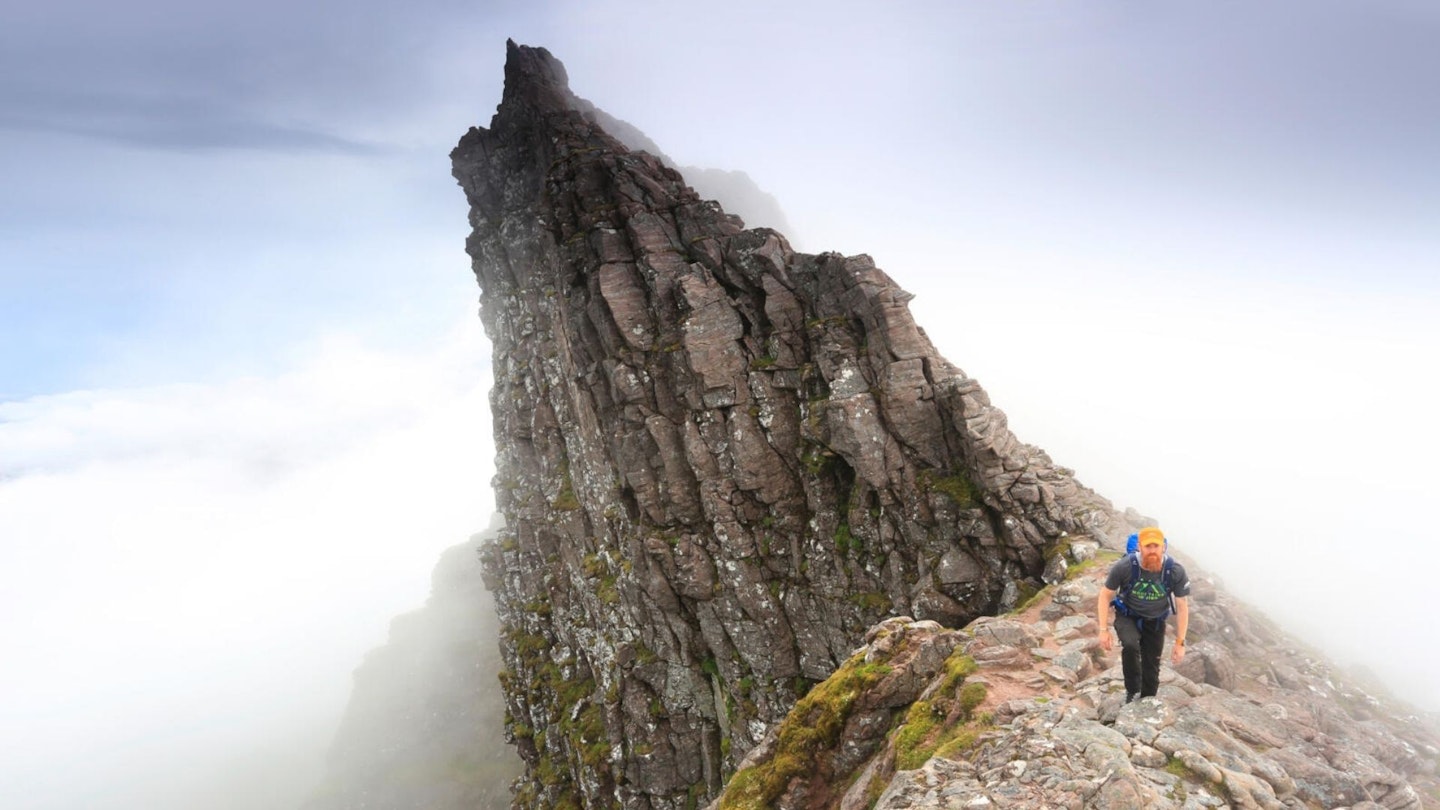
On the map it appears as a mangled mess of contours and crags. It’s hardly surprising; An Teallach is not a single mountain, but a conglomerate of peaks. The route that bags the best of them attacks the chain from the east and involves a long walk-in and a steep slog.
Once you’re on the red-hued ridge it’s either up and over the tops in turn or, if your head for heights isn’t up for high-level scrambling, a slightly lower route that bypasses the summits.
The true ridge traverse is a thrilling undertaking, and it includes the chance to dangle your legs over the edge of Lord Berkeley’s Seat and pose for a photo that’ll scare your mum.
6. Fairfield Horseshoe, Lake District
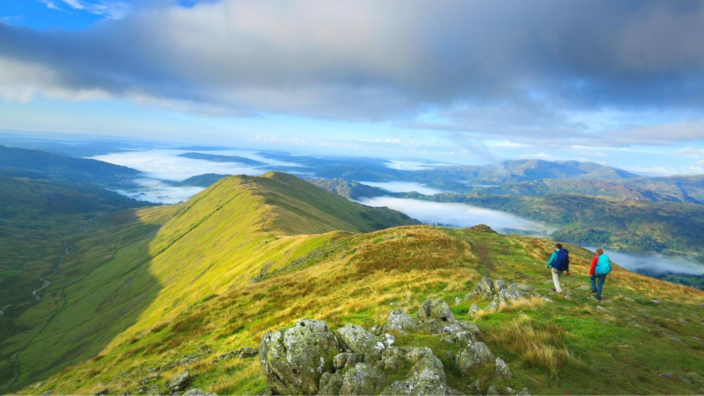
From time to time, a walker’s soul demands nothing more than a classic Lakeland round. When that longing sets in, the Fairfield Horseshoe is the tonic your heart desires.
Starting and ending in the quintessential Lake District town of Ambleside with its sprawling resource of pubs, B&Bs, gear shops and guest houses, well-defined paths take you on an orbit of Rydal Beck’s secluded valley.
Multiple Wainwrights are bagged and the views are ever-changing and never-ending as the route climbs away from the expansive waters of Windermere, swings around Rydal Head via the eponymous Fairfield, and heads back in the direction of England’s largest natural lake.
The going is, for the most part, straightforward. And unless the clouds conspire to smother the fells, easy to follow. Catch the Horseshoe on a clear day, though, and the inspiring vistas will be more than enough to set your mind free and have your spirit soaring.
CLICK HERE for our full route Fairfield Horseshoe route guide
5. Aonach Eagach, Glen Coe
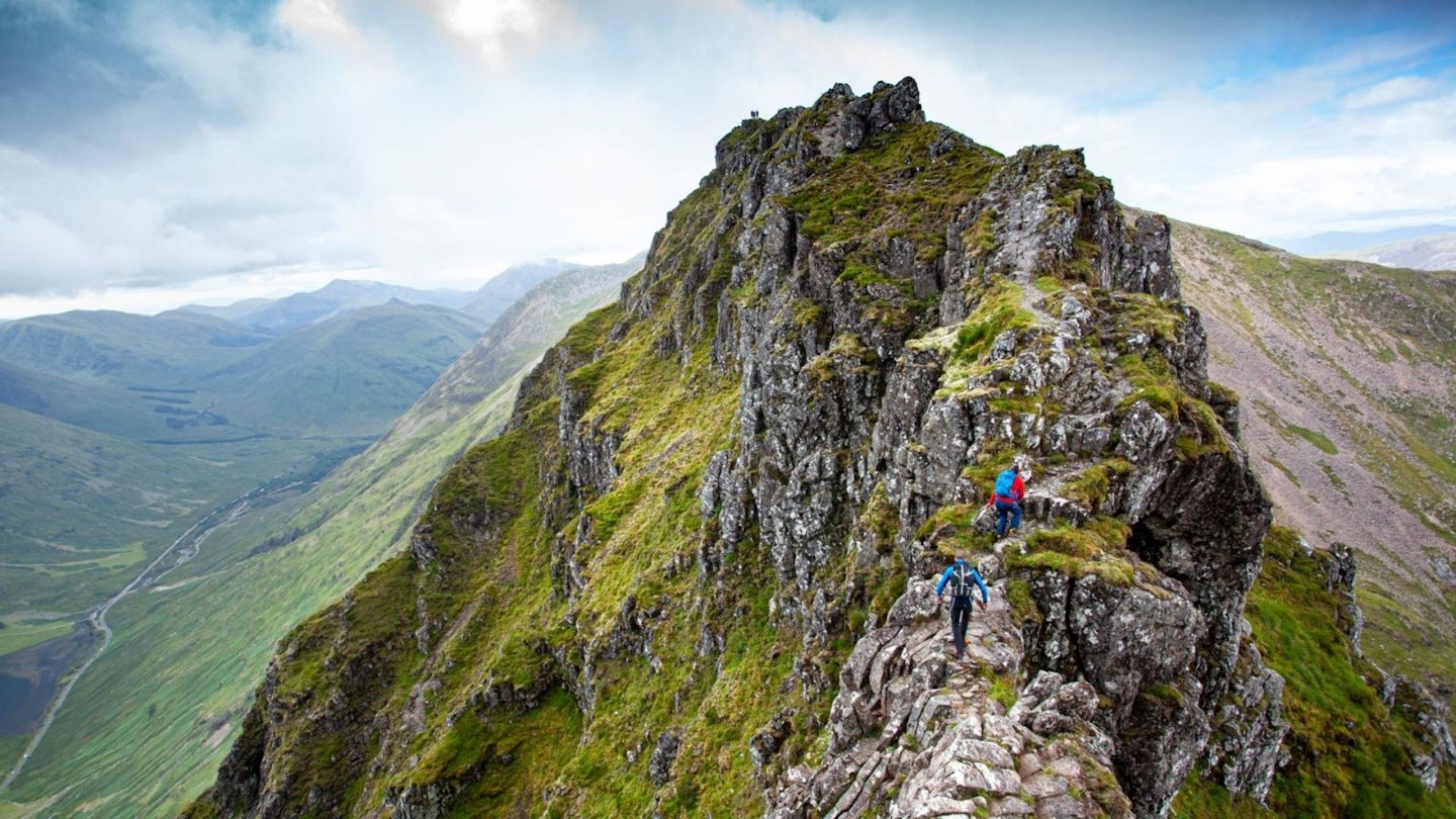
After a long day in the mountains, ending up some 5km away from your car would be the toughest part of most mountain routes. Not so with Aonach Eagach. It’ll have you gurning, sweating, and grunting (and that’s just pronouncing it).
The ridge, considered the longest and narrowest on mainland Britain, can be tackled in either direction.
Start at the east and the initial climb up is lessened. Start at the western end and you get a bit more of a warm-up before reaching the tricky parts.
But whichever way you go, there’s some pretty serious terrain to be negotiated. The Aonach Eagach is rated as a Grade 2 scramble, which barely puts it within the realms of hillwalking (Grade 3 requires ropes and is more akin to climbing). But it’s not all hard going.
The most exposed section is the fantastically titled ‘Crazy Pinnacles’ and although there are other tough manoeuvres to be made, including some rather focusing downclimbs, much of the ridge is wide and flat enough to give you time to relax and admire the scenery around you.
Which, being on the northern side of Glen Coe and within stone-throwing distance of the Mamores and Ben Nevis, is mind-blowing. It’s this and the memories of the muscular rock features, white-knuckle scrambling, and heart-pumping exposure that you carry with you long after you’ve left the ridge.
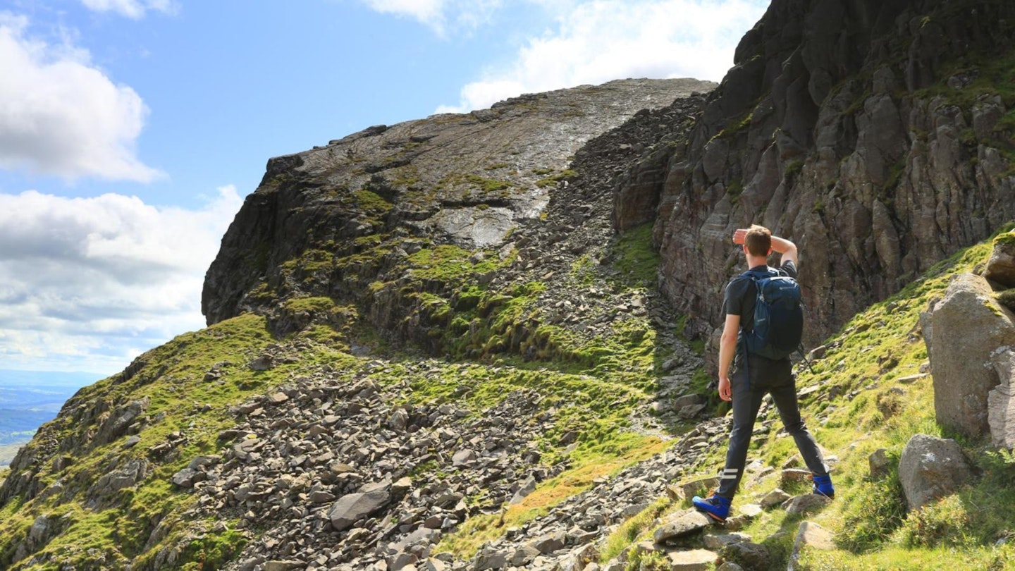
4. Blencathra via Sharp Edge, Lake District
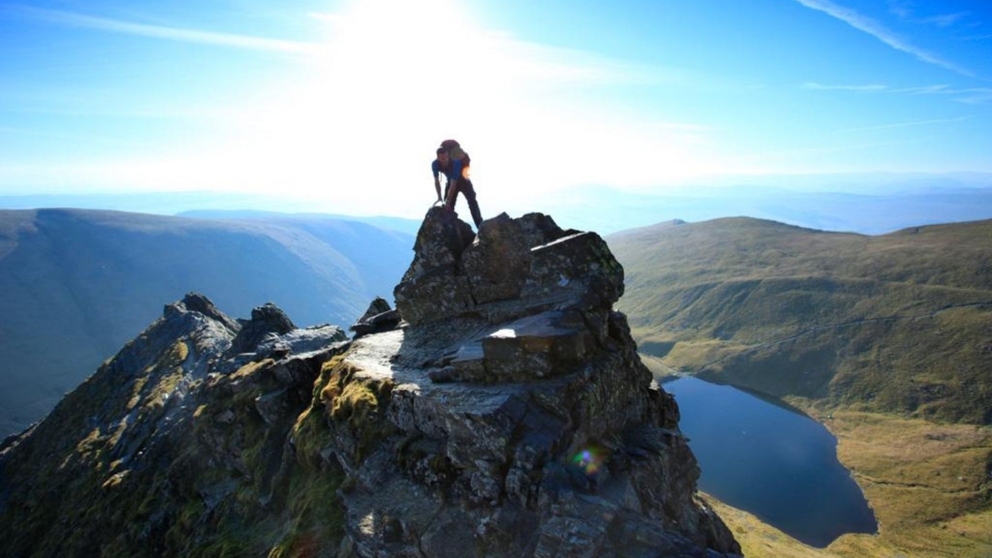
What can we learn from the names on this list? Well, if nothing else, the prevalence of narrow, spiky, rocky routes in the Top 25 tells us that many Trail magazine readers prefer their mountain days on the adrenaline-pumped side of exciting.
The top of Blencathra can be reached via a wealth of routes, and legendary guidebook writer Alfred Wainwright rated an ascent by Hall’s Fell Ridge as the finest in Lakeland.
But with its steep sides, narrow back and the potential to slip from the boot-smoothed rock in wet weather, it seems the short but exposed nature of Sharp Edge refreshes the parts that other routes cannot reach (of you crazy folk, anyway).
Plus, Hall’s Fell Ridge in descent is the perfect way to turn the simple summit-bagging of Blencathra into a scintillating horseshoe route.
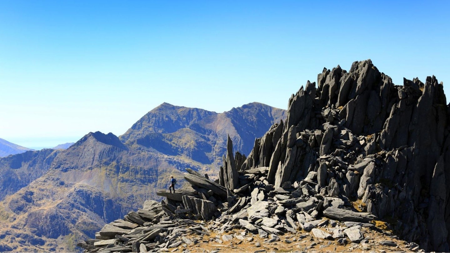
3. Snowdon Horseshoe, Snowdonia
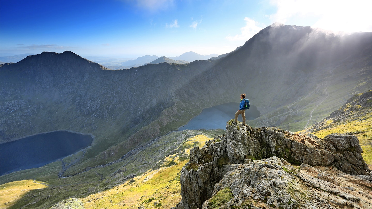
If there’s a more exciting, nerve-jangling, eye-bulging experience to be had by the humble hillwalker in the UK mountains, we don’t know what it is. The cause of that can be summed up in two words: Crib Goch.
If the steep scramble to reach the crest doesn’t prove too much of an obstacle, the view of the frankly ridiculous razor of ridge that awaits you will leave you gaping open-mouthed that such places can be found within the borders of our famously small island nation.
Crib Goch isn’t the whole Snowdon Horseshoe, though; once its spine is safely navigated the thrills continue, albeit with the fear element heavily diluted.
The red rock of Garnedd Ugain draws you onwards and upwards until you join the main tourist track to Snowdon’s summit, on the highest but least arduous section of the journey.
Then, leaving the crowds behind, you plunge down the Watkin Path to be met by the visage of Y Lliwedd’s towering twin peaks.
Both are bagged after a steep scramble up the southern arm of the horseshoe before the descent to the shores of Llyn Llydaw brings with it awe-drenched views of Y Lliwedd's north face and, a little further still, a conclusion to this spectacular route.
2. Helvellyn via Striding Edge, Lake District
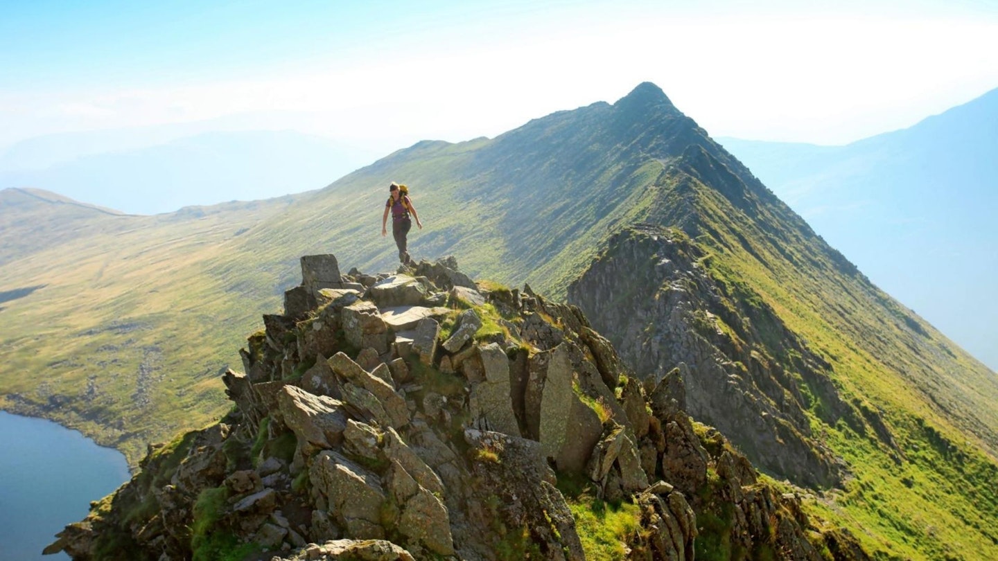
To many walkers, Striding Edge is Helvellyn. There's little doubt that this is the most famous stretch of mountainous rock in the Lake District.
As a result it seems that more hikers have made the airy transition from walking to scrambling between the ridge’s launch at High Spying How and its termination on Helvellyn’s broad top than anywhere else in the UK.
Such an exciting route of ascent has the potential to leave fellwalkers with little to look forward to once the summit is reached. But in Swirral Edge you’re gifted with the perfect way to keep the excitement going in descent, with yet more narrow, scrambly rock to keep your thrill buds titillated.
Of course, you could equally choose to go up Swirral and down Striding (Mountain Rescue recommends this, particularly in winter), but however you choose to tackle the famous Edges of England's third highest mountain, you won’t be disappointed by either.
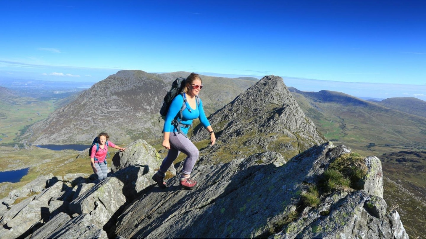
1. Tryfan and Bristly Ridge, Snowdonia
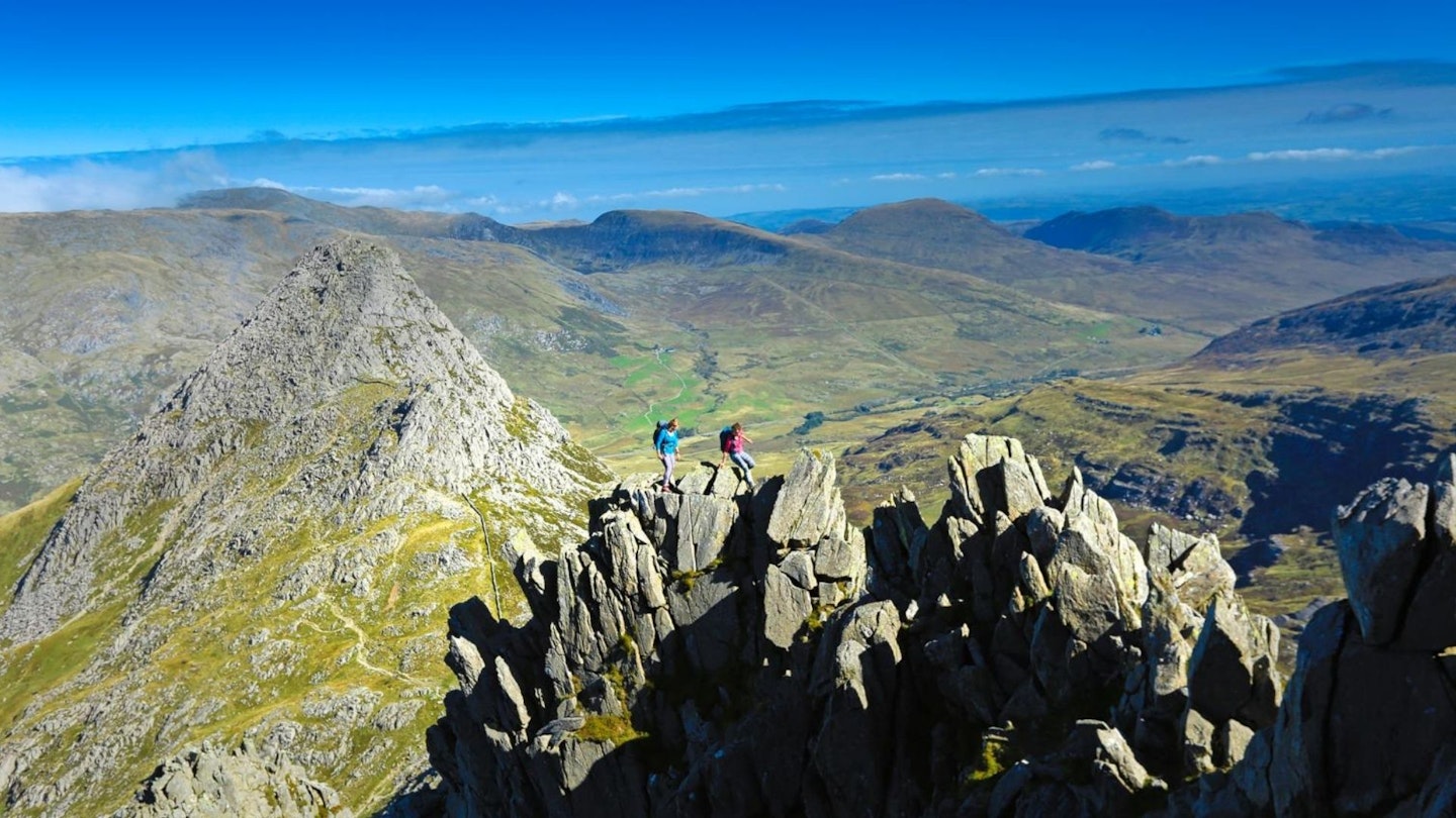
Tryfan has been voted Britain’s favourite mountain by Trail magazine readers in the past, so it’s no surprise that a route involving this most affectionately held peak has also topped this poll. And deservedly so. The north ridge of Tryfan is an epic start to this exquisite Welsh mountain day.
Once you’ve topped out by Adam and Eve, this roller coaster ride of a route takes you down the other side of Tryfan, then up the infamous Bristly Ridge to Glyder Fach’s summit plateau. Here you get a respite from the gradient, but there’s no let-off in adventure.
The incredible rock formations of the Cantilever Stone and Castell y Gwynt are there to be explored, before the onward route drops and rises once more to the other-worldly top of Glyder Fawr.
The descent via the Devil’s Kitchen’s gorge squeezes every last drop of thrill from the journey, while there can be few better locations through which to walk the tail end of a mountain journey than the atmospherically saturated Cwm Idwal. This route is the very definition of a hillwalking classic.
How did we rank the 25 best hikes in the UK?
To help us come up with a definitive collection of the best hikes, we consulted the readers of Trail magazine, which for more than 30 years has been the UK's most trusted source of advice and inspiration for hikers and backpackers.
We asked Trail readers to rank their favourite single-day hillwalking routes. There are many great long-distance backpacking trails in the UK, such as the West Highland Way and Coast to Coast Path, but we wanted this list to focus on 25 routes that can all be started and finished on the same day. And the Trail readers have done a great job!