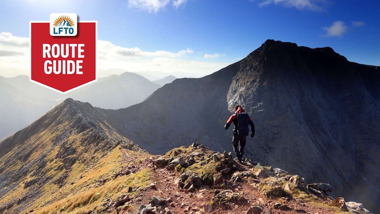
Arguably, the CMD arête (full title, the Carn Mor Dearg arête) is the most exciting, awe-inspiring, and view-saturated route to the top of any British mountain. The fact that mountain is Ben Nevis, which also happens to be our highest, only adds to the appeal.
How hard is it? Well, the entire route is challenging enough to burn your thighs and narrow enough in places to give you a heady dose of airy thrills. You get views into the depths of The Ben’s brutal North Face and over the seemingly endless peaks of the Scottish Highlands beyond.
It’s rugged and exposed, but never really strays beyond the remit of a walking route. There really are few finer mountain scrambles in Britain, so scroll down for our full guide on how to do it.
How long does it take to climb the CMD Arête?
Distance: 16.5km (round trip) | Ascent: 1500m
This is a big, full, and very challenging mountain day, so there's a good chance you'll be walking from dawn to dusk. Or even completing sections of it in the dark if you attempt it between November and March.
Think less about the number of hours involved and more about the objective you have to complete, which includes two of Scotland's 10 highest mountains, a rocky ridge, lots of ascent and descent, and sections of off-path walking.
How hard is the CMD Arête?
Scramble rating: Grade 1
Best time of year: Mid to late summer, when snow should have retreated from the summit.
Officially this is a Grade 1 scramble and there are sections where you will be grateful for the use of your hands, but for most of your time on the ridge you'll be walking on rocky and blocky terrain.
The biggest challenge is the sheer scale of the route, which involves a long walk to reach the base of Carn Mor Dearg, followed by a punishing pull to the summit, a big drop down to the CMD Arête, then another steep pull to the top of Ben Nevis. This is by no means an easy day in the mountains.
If you're walking in fine conditions, the CMD Arête should hold few technical issues for experienced hillwalkers. But in snow or ice, you'll need good winter skills before even thinking about attempting it.
How does it compare to Striding Edge or Crib Goch?
It's natural that people compare the CMD Arête to both Striding Edge and Crib Goch, because all three are very famous Grade 1 scrambling routes on equally famous British mountains. But unlike its English and Welsh counterparts, the CMD Arête offers up no easy access to walkers.
In terms of the challenge of the ridge itself, you could argue the CMD Arête is simpler than both Striding Edge and Crib Goch. There are probably fewer areas of great exposure and no awkward obstacles to match the Bad Step (Helvellyn) or the Pinnacles (Snowdon). However, the whole route itself is far more challenging in terms of height, length, and physical exertion.
And that's before you even factor in the unique weather Ben Nevis generates, where you can expect brutally challenging conditions even in the height of summer.
Route guide: The CMD Arete
Step 1
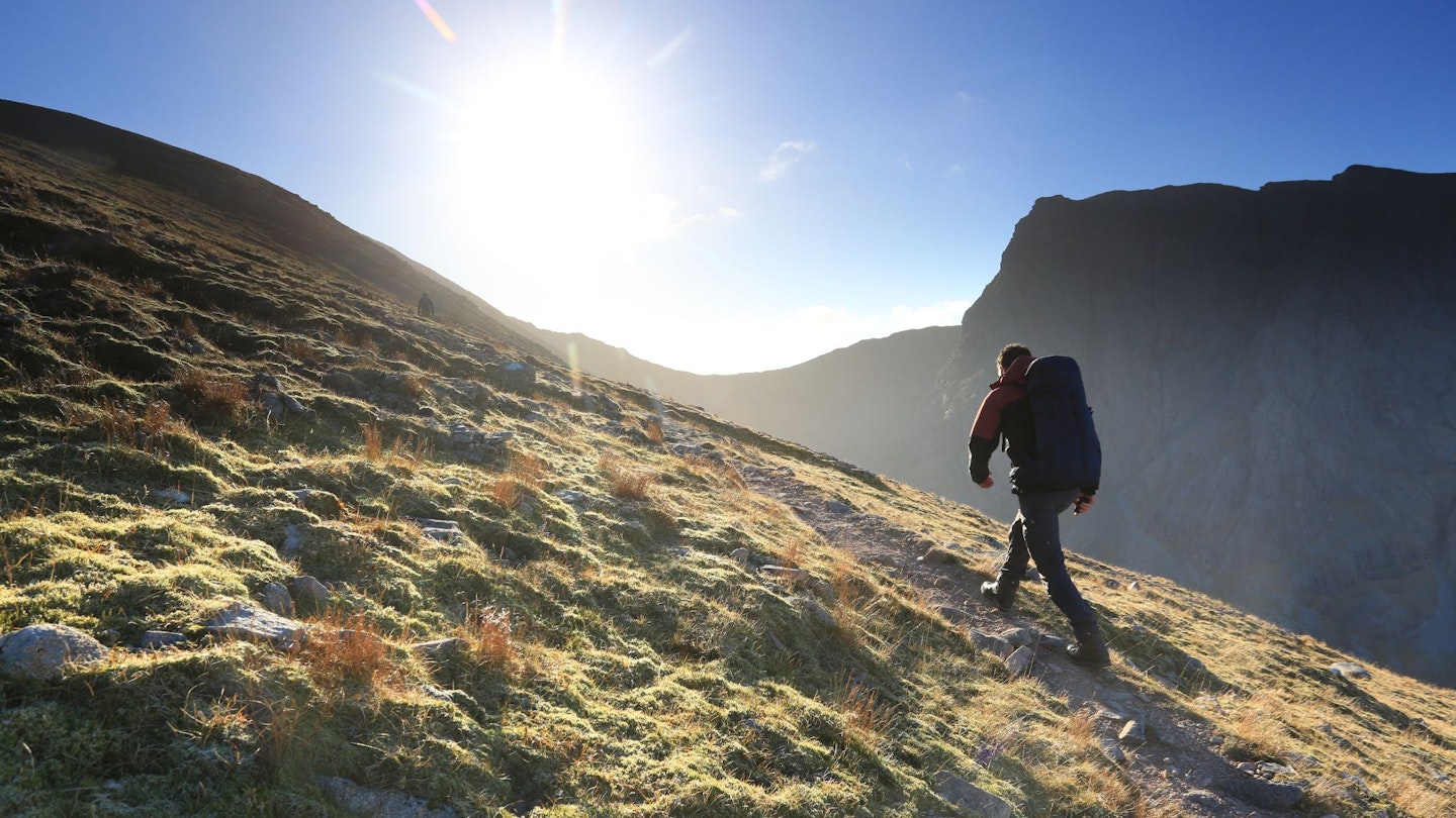
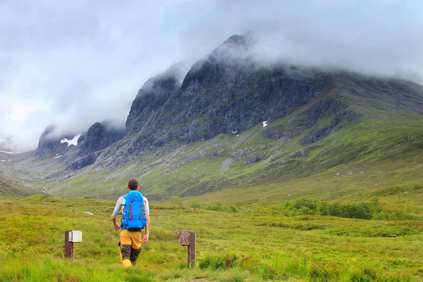
Park in the North Face car park near Torlundy (NN144763). In summer this can be a real midge-fest, so come prepared! Take the winding uphill track through the woods, following signs for the North Face path. Where it leaves the trees, follow the path along the Allt a’ Mhuilinn. As you gain height, the first glimpses of the North Face come into view.
Step 2
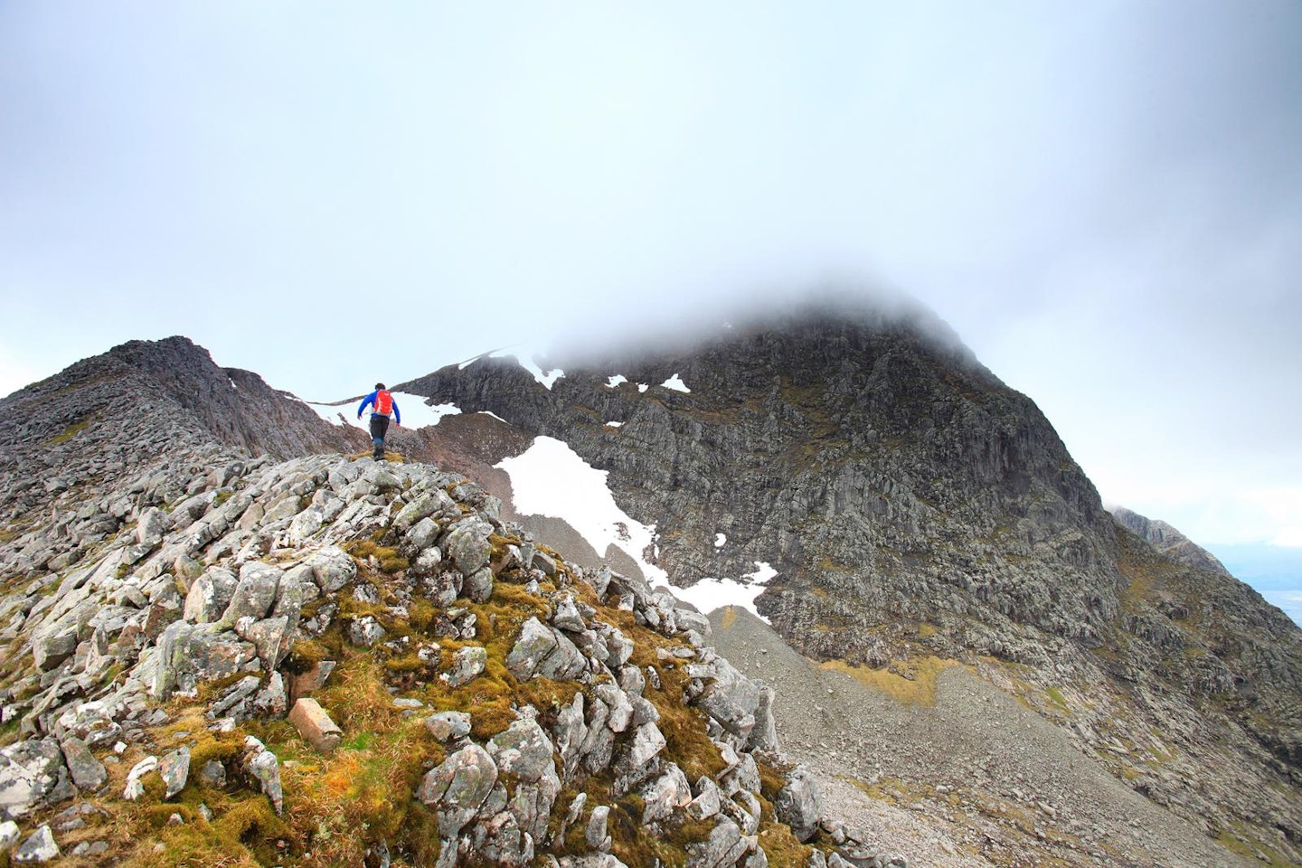
Fork left off the main path and follow the steep trudge up to the ridge of Carn Beag Dearg. Once on top, continue along the ridgeline, passing over Carn Dearg Meadhonach before arriving on the summit of Carn Mor Dearg – the peak that gives the CMD arête its name. The incredible views of The Ben’s North Face from here are worth pausing to enjoy.
Step 3
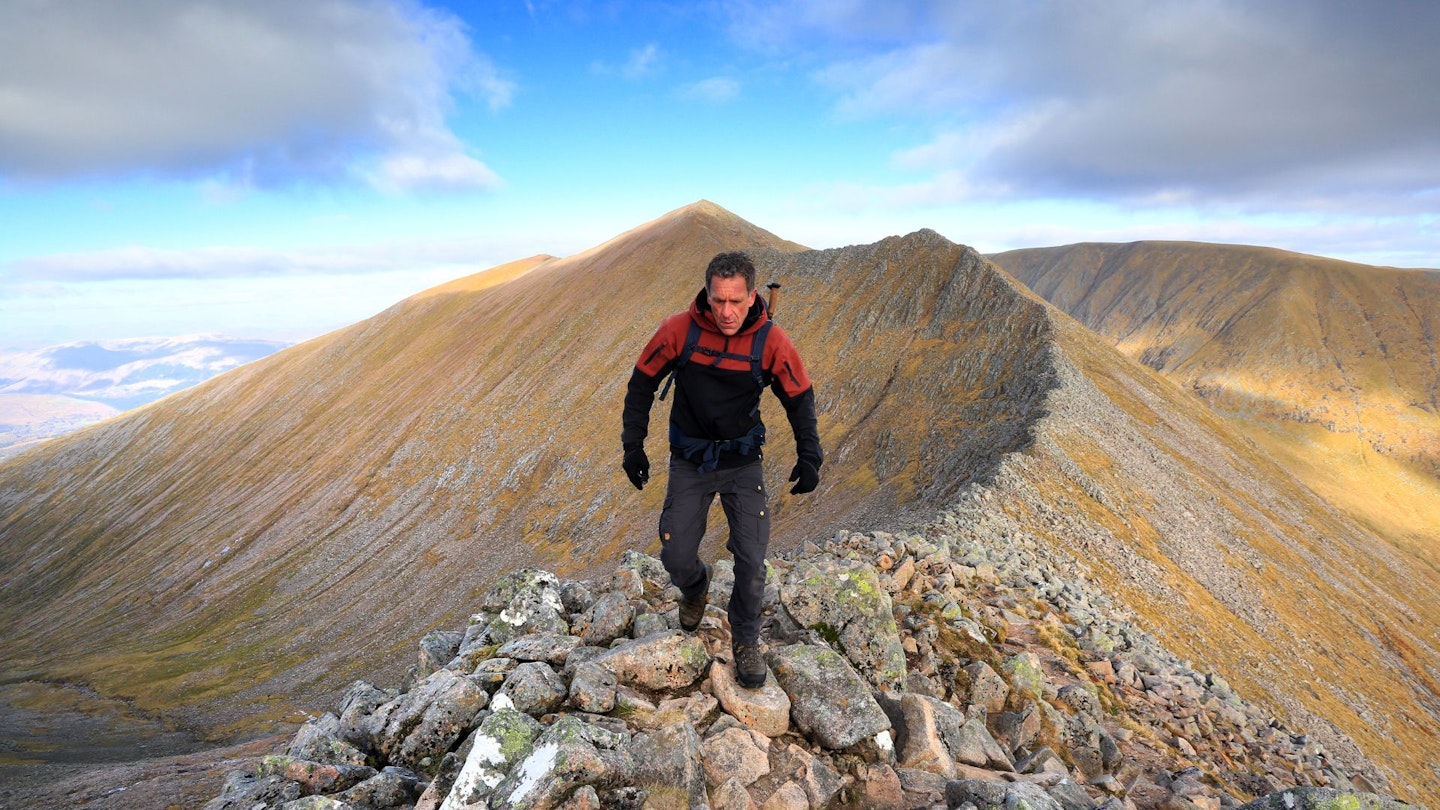
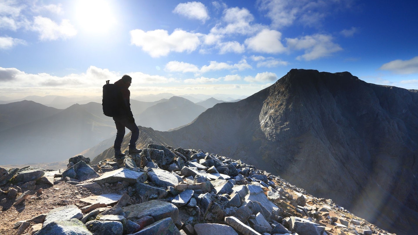
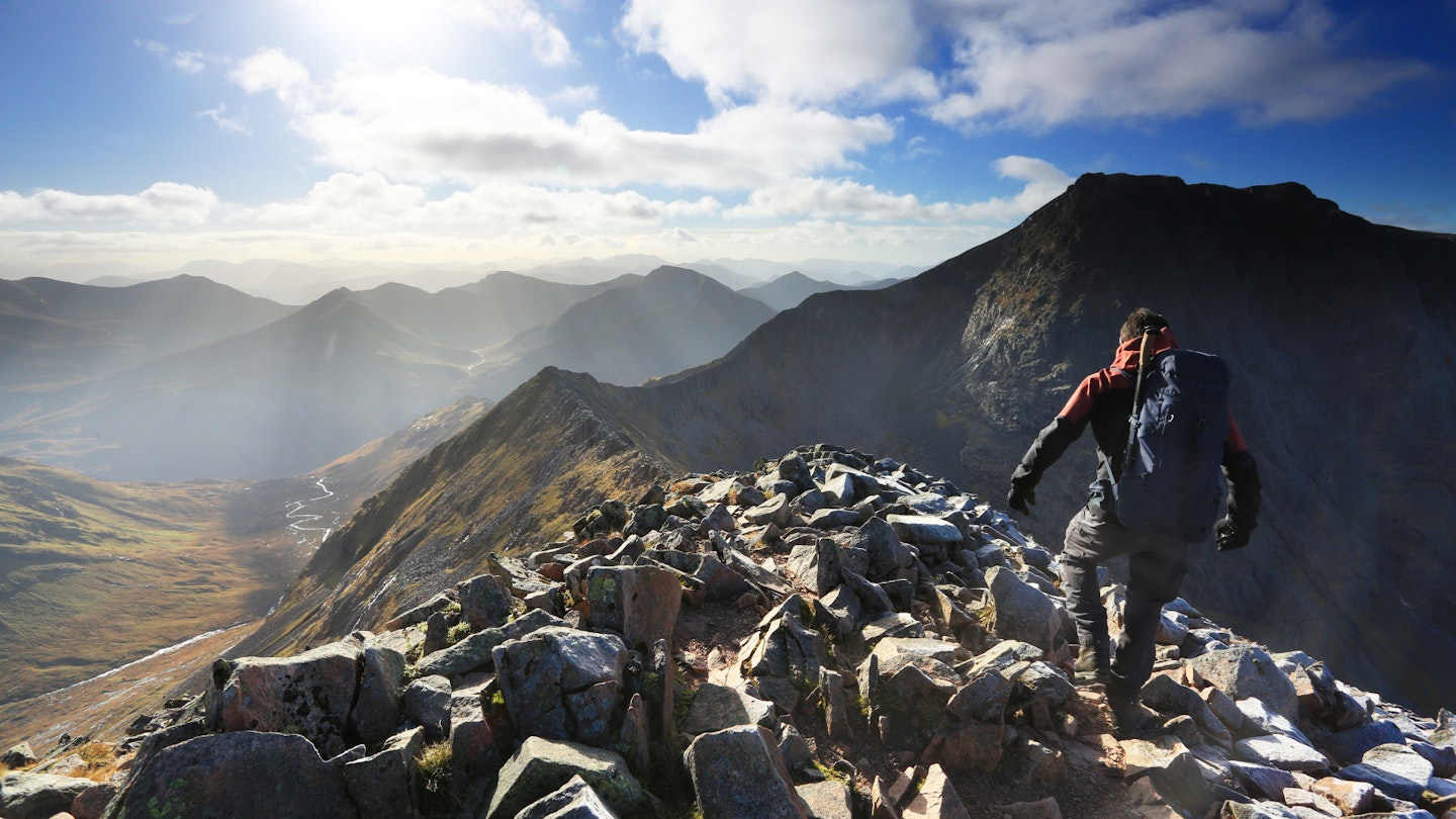
From Carn Mor Dearg the ridge begins proper, narrowing as it drops from the summit before sweeping around to the right to join up with the shoulder of The Ben. Take your time; although high and exposed, the ridge requires little actual scrambling and often provides the option of a lower bypass route just below the crest. Again, brief pauses to gawp at the views of Ben Nevis and the Mamores to the south are well worth it in clear weather.
Step 4
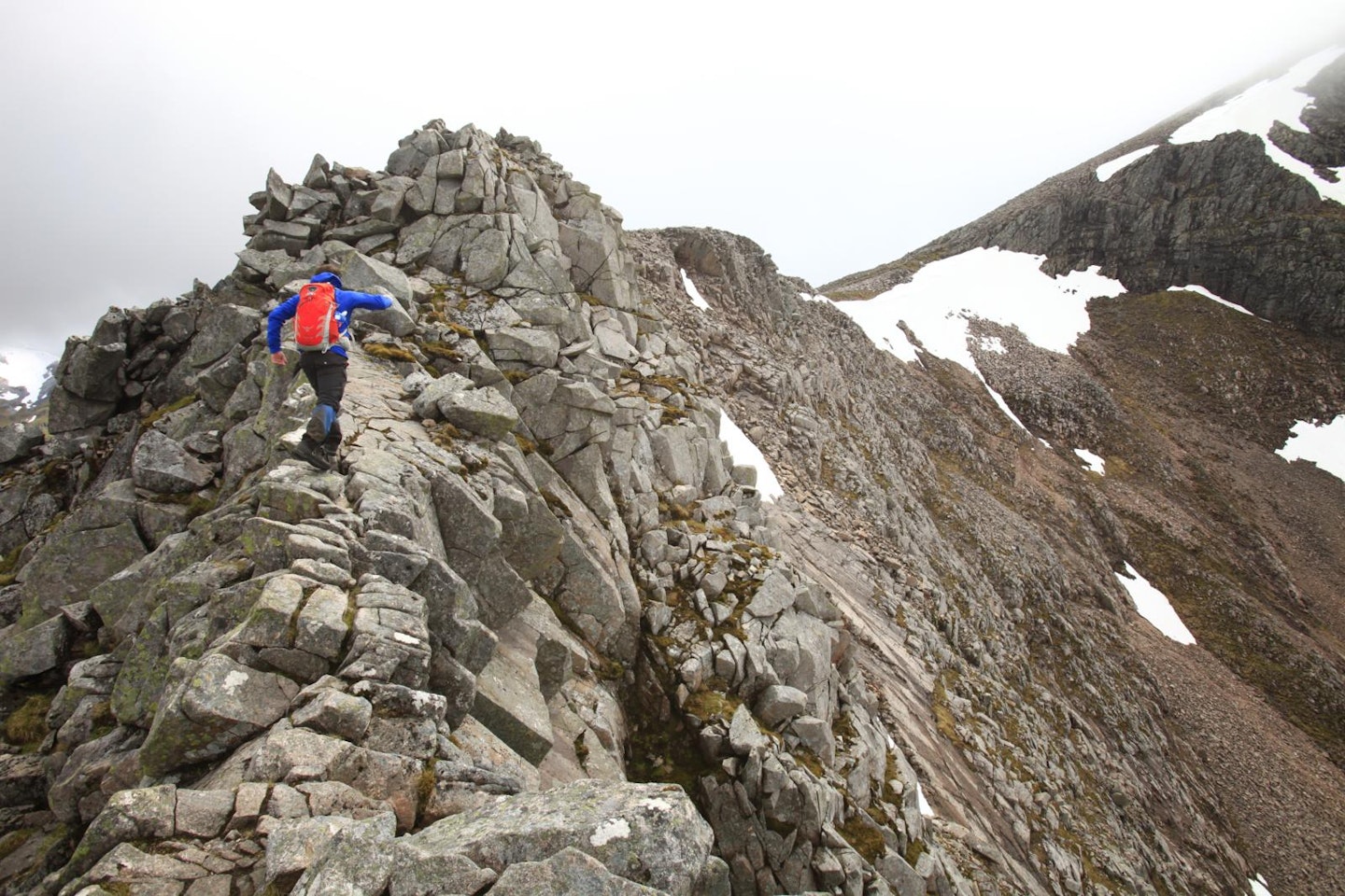
The ridge narrows again as it gets close to The Ben, with a few airy steps and a bit of hands-on-rock clambering. Once off the ridge and onto the mighty shoulder of Ben Nevis, an awkward boulder field has to be ascended to reach the summit. Keep away from the right-hand edge as you climb. The drops here are sudden and long!
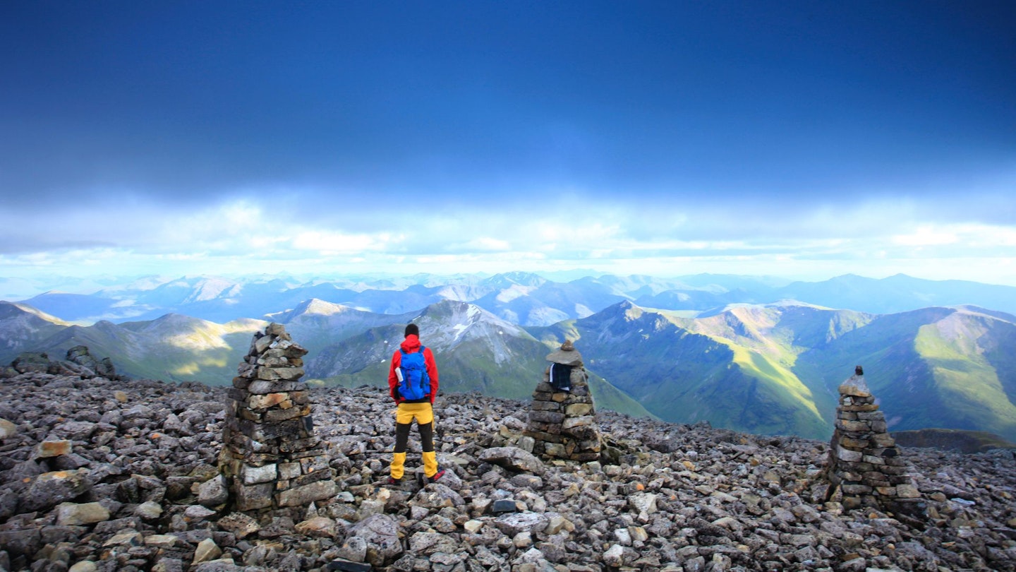
Step 5
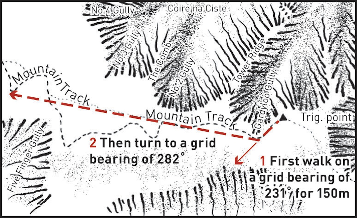
Walk to the summit cairn to relish your achievement, admire the views, and inspect the remains of the observatory and hotel that once stood at the highest point in Britain. When leaving, follow the cairns from the summit to the top of the Mountain Track. In poor conditions take a bearing of 231° from the summit trig pillar and follow it for a distance of 150m. Then turn to a grid bearing of 282° and follow this until it hits the Mountain Track.
Step 6
Drop down the zig-zagging path to Lochan Meall an t-Suidhe. From the end of the lochan head just east of north, following the line of old fence posts towards where the Allt a’ Mhuilinn meets the woodland. Cross the deer fence via a style and then cross the river 300m downstream by a bridge. Re-enter the forest and follow the paths back to the car park.
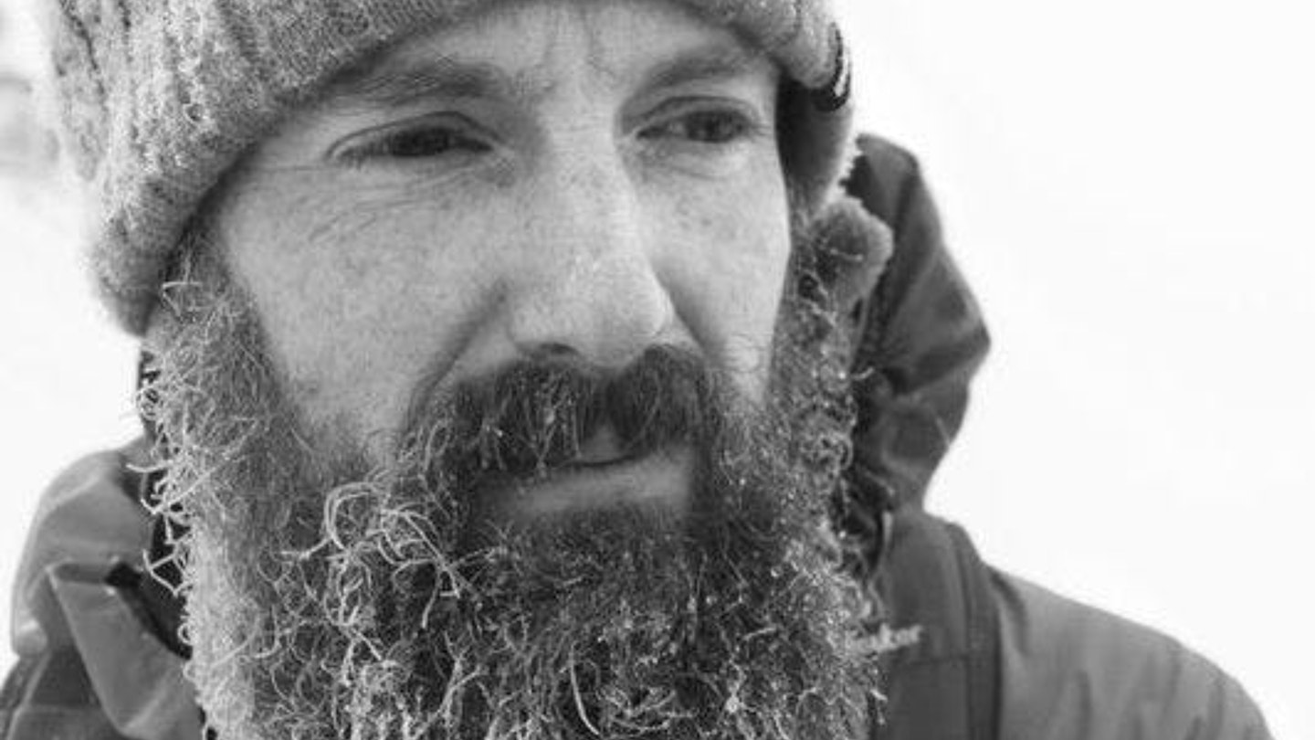
About the author
Ben Weeks is Trail magazine's gear editor and has spent decades walking and climbing in the Scottish Highlands. Ben Nevis is his favourite winter climbing destination and he's also walked and scrambled all of the other major routes on Britain's highest mountain. Basically, what Ben doesn't know about The Ben isn't worth knowing!
Follow this route with HALF-PRICE digital Ordnance Survey Maps for the whole of Great Britain by subscribing to Trail magazine.
