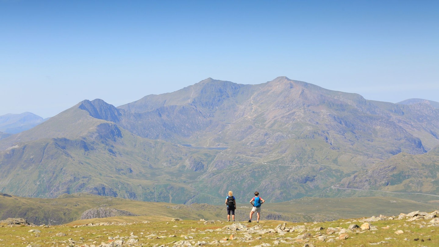
Our collection of the best hikes in the UK takes us to the mountains of north Wales, where a hidden rocky ridge guides you to the panoramic summit of Moel Siabod and possibly the best view in Snowdonia National Park.
A distinctive peak suddenly fills the windscreen once the A5 road has wriggled through Betws-y-Coed. Moel Siabod resembles an ancient pyramid which could have been built to guide outdoor pilgrims towards the heart of Snowdonia. But, having battled with the traffic around Llangollen, there’s often a temptation to pull in right here and head straight for the hills.
Thomas Telford, sometimes called the ‘Colossus of Roads’, cleverly engineered the A5 in the early 19th century when it became the first state-funded highway since Roman times. We very much doubt he found time to climb the surrounding mountains, but if any of his surveyors made it up Moel Siabod they probably gasped when they saw what lay ahead: the high bastion of the Glyderau on the left and the mighty Carneddau on the right.
The next stretch of road was going to be tricky. And then, as they finally got their breath back, they would have looked west to Snowdon, the knife-edge of Crib Goch and the shadowy crags below Y Lliwedd. The views can’t have changed much since Telford’s time – apart from some inevitable blankets of forestry – and Moel Siabod stands as proud and aloof as ever.
Park up by the waterfalls at Pont-Cyfyng, climb to the shores of Llyn y Foel and scramble up the Daear Ddu ridge to enjoy that full 360° panorama. It’s said all but one of the 14 highest peaks in Snowdonia can be seen from the top.
CLICK HERE to download our Moel Siabod digital route guide in OS Maps
How hard is climbing Moel Siabod?
This is a classic, rocky north Wales mountain route. It’s not too long or too high, but you’ll need to be comfortable with Grade 1 scrambling terrain on the Daear Ddu ridge.
The terrain is a real mixture of road, track, boggy moorland, plantation, deciduous woodland, riverside path, rocky mountain ridge, boulder fields, and a mountain stream crossing.
How long does the route take?
We clocked the overall distance at 10.7km (6.5 miles) with 790 metres of ascent. So it isn't overly long or high, but you'll want to take your time along the way to look at the views and make sure you're fully focused when scrambling the Daear Ddu ridge.
We estimate experienced hikers should be able to complete the route described below in around 4-5 hours, but that depends on weather conditions, your own fitness, and the pace you like to walk at.
Where does the walk start from?
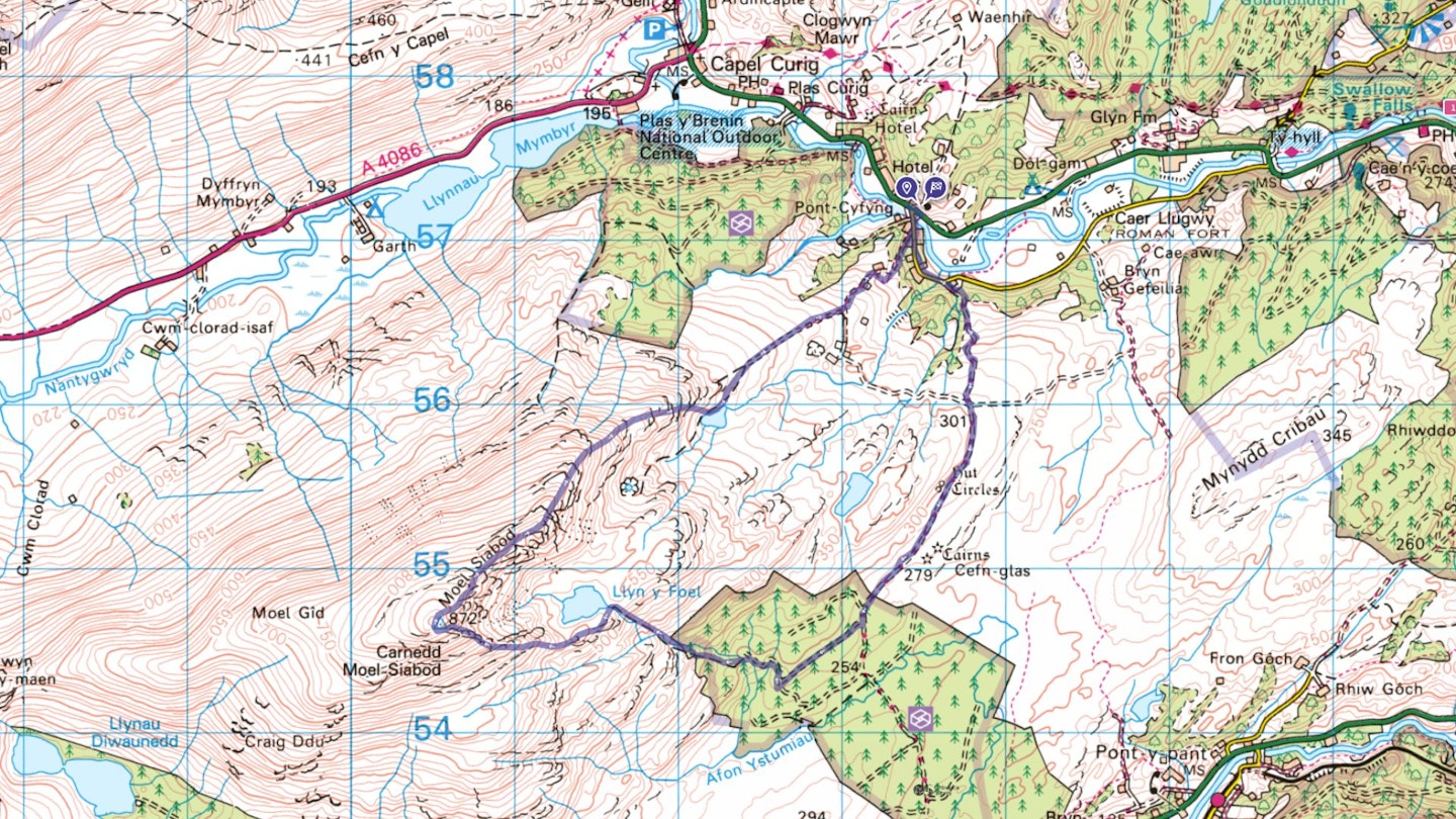
You’ll start and finish in one of the laybys on the A5 at grid ref SH735571 at Pont-Cyfyng. The nearest town is Betws-y-Coed, a few miles east down the A5. If travelling by public transport, the nearest train station is Betws-y-Coed, with bus links through to Capel Curig. The Snowdon Sherpa bus service (S2) also provides good connections. See gwynedd.llyw.cymru for timetables
What map do I need?
The route is covered by OS Explorer OL17 & OL18 (1:25k), plus OS Landranger 115 (1:50k). You can order printed maps from the Ordnance Survey's map shop or download our digital route guide from OS Maps HERE.
Moel Siabod, Daear Ddu Ridge | Step-by-step route guide
Section 1
From the parking lay-by, cross the bridge over Afon Llugwy and follow the narrow lane for 550m to the house at Capel Tan-y-garth. Fork right here and take the track, which soon passes through a gate next to a stream. Continue ahead, uphill on rough zig-zags through woodland, and emerge onto the moor near the start of Open Access land. Pass through a gate and carry on along the track for 900m to another gate at the edge of a large forestry plantation.

Section 2
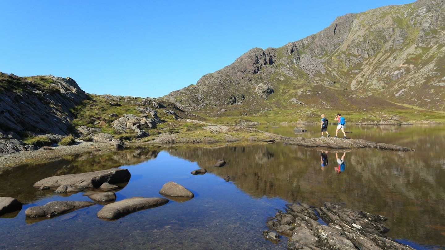
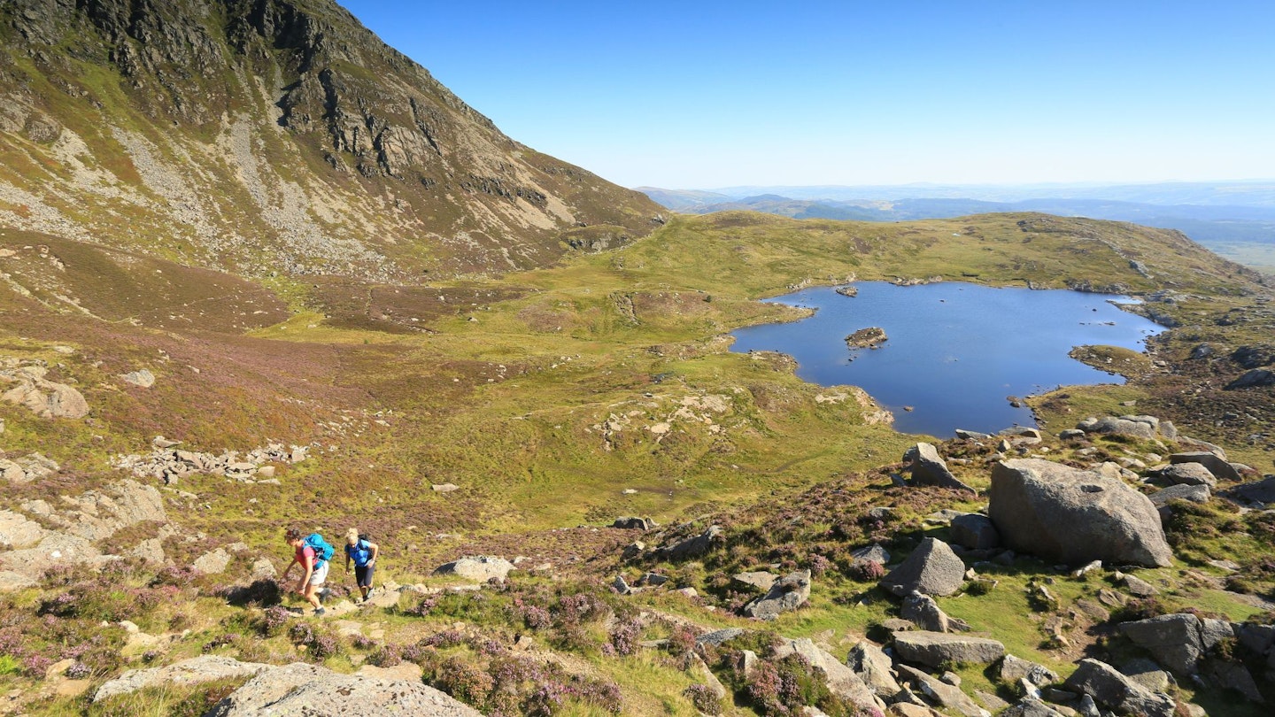
Go through the gate and walk ahead for 100m to a junction. Go left for 100m and then fork right on the next forestry track. Follow this for 650m – it runs straight south-west and slightly downhill – to a T-junction. Turn right here for 350m to an area of gravel at the end of the track. Go over a sturdy footbridge and follow a path rising along the south side of a stream. The trees have been cleared here but a stile crosses the edge of the old plantation and a minor path crosses the stream and continues uphill for 500m to reach the eastern shoreline of Llyn y Foel.
Section 3
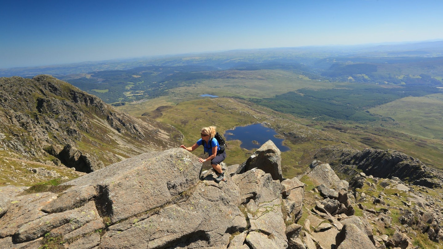
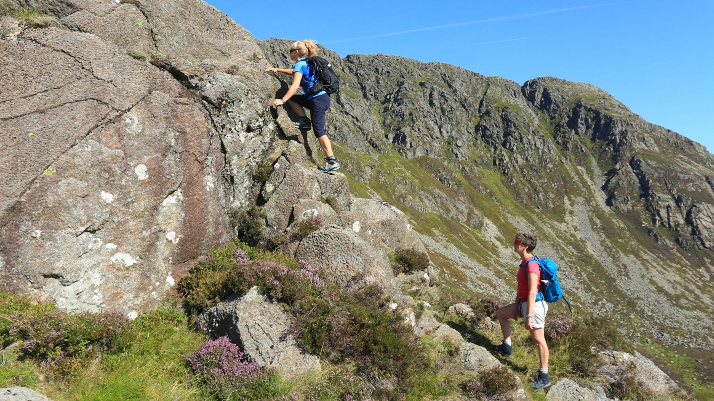
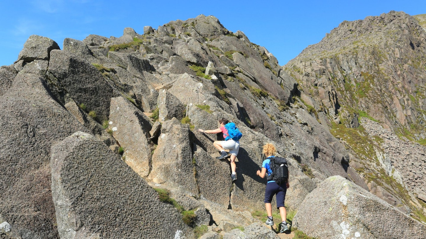
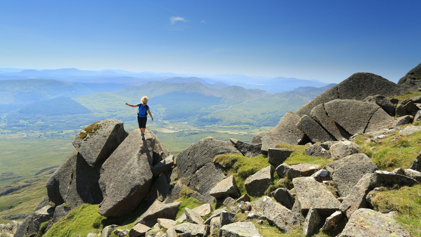
This classic mountain lake nestles at the foot of a steep bowl below the cliffs and crags of Moel Siabod. Turn left and follow the shore west over damp ground for 300m. Leave the lake and continue uphill to the foot of the serrated spur known as Daear Ddu. The full line of the ridge can be seen against the sky and an established route is followed over a series of rocks and ledges.
Initially, Daear Ddu is broad and undefined, but it narrows as it climbs, presenting a series of rock steps and boulder clambers. The steepest, most severe drop is to the right, and although it’s possible to stick fairly closely to the ridge, some obstacles may require by-passing and this is best done on the left.
A little over halfway up, the ridge gears up a notch. The drops close in and the scrambling becomes more acute with fewer route options. It’s no harder than anything that’s gone before, although the exposure may be slightly challenging for those who get nervy at height. The summit trig point only pops into view when you’re almost upon it, with a stone shelter nearby.
Section 4
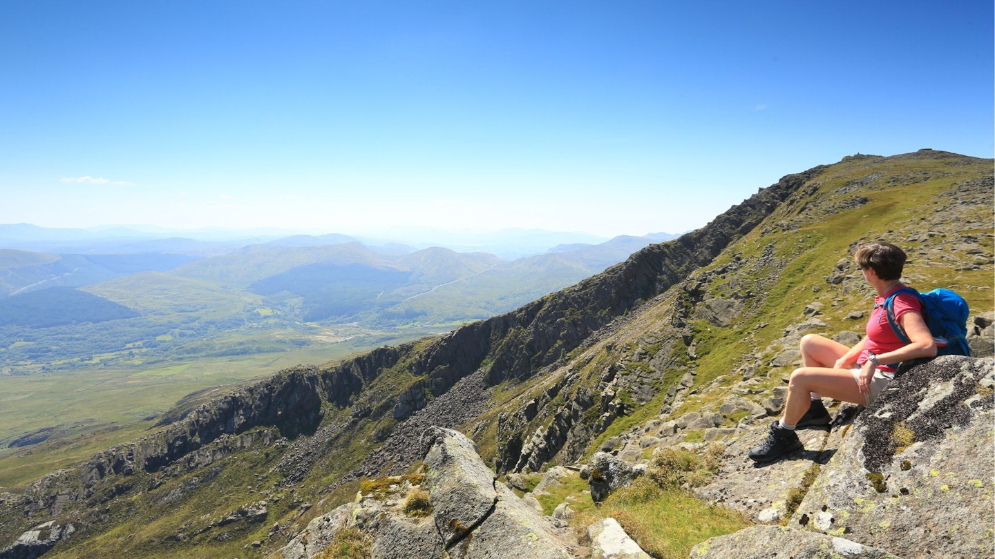
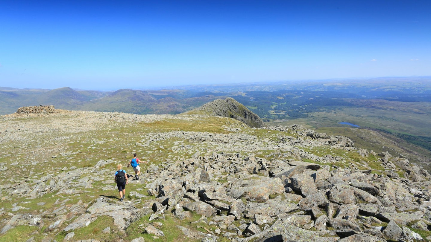
Leave the summit in a northeast direction, with crags on the right, and keep ahead over the sloping stony plateau when a well-worn path forks left towards Capel Curig. Continue over grass and rocks, cross a subsidiary top, and join a path that clambers through outcrops and descends over steepening gradients towards an old wall at the foot of the ridge. Veer right to join a track by a small lake.
Section 5
Turn left and go through a gate after 300m. Several quarrying remains, including an old incline, are located on the right. Keep on the track for 550m to cross a stile and carry on, now downhill, over another stile near cottages. Follow footpath fingerposts to turn right, then left, to join the track below the farm at Rhôs. Continue steeply downhill to meet the lane and turn left to return to the start – but don’t forget to look at the waterfalls in the gorge below the A5.
What walking gear do I need for this route?
Here's a selection of the best walking gear selected by LFTO's testing team: Walking boots | Hiking shoes | Hiking daypack | Waterproof jacket | Walking trousers | Walking poles | Walking mid-layers | Base layers
Where's the best place to stay near Moel Siabod?
The Rocks at Plas Curig is very fancy for a ‘hostel’, the Plas y Brenin National Outdoor Centre has B&B rooms and bunkhouse options, and there are good YHA hostels at Pen-y-Pass and Betws-y-Coed. Also, Expedia and Booking.com are good places to look for accommodation deals in nearby Betws-y-coed.
About the author

Tom Bailey has been Trail magazine’s photographer for more than 20 years and is one of the most experienced hillwalkers and wild campers in Britain. He’s climbed more mountains than most people could dream of and is an oracle of knowledge on everything from routes and gear to geology and nature.
This route originally appeared in the October 2019 issue of Trail magazine. CLICK HERE to become a Trail magazine subscriber and get 50% off a whole year of digital OS Maps
