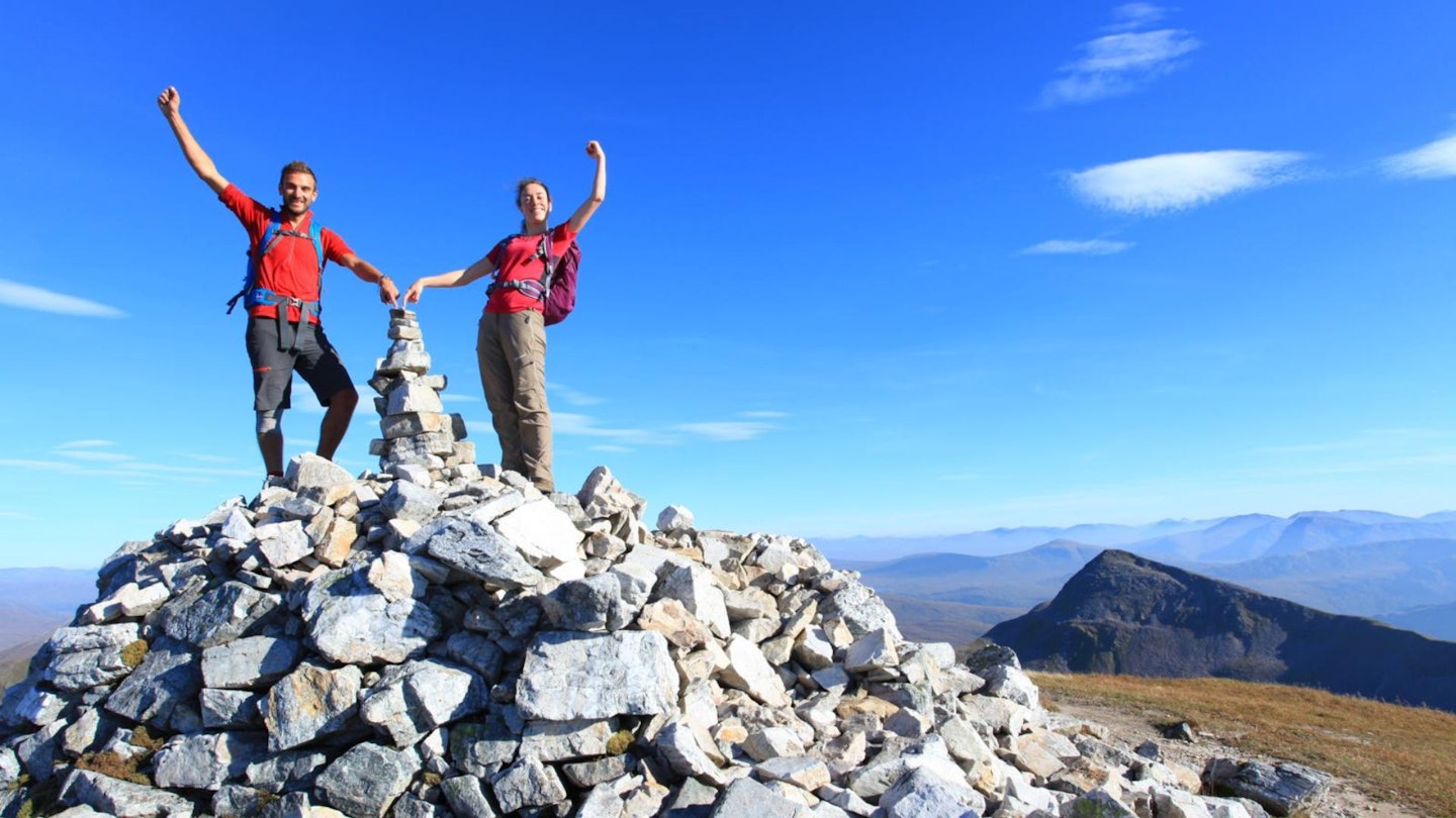
Our collection of the best hikes in the UK wouldn't be complete without this Scottish Highlands classic. By our reckoning, the Ring of Steall has one of the most exciting starts of any mountain walk in the world, then goes on to traverse ridges that will make your knees wobble, and bags four Munros – all in one loop that starts and finishes in picturesque Glen Nevis.
Fingers crossed for beautiful summer weather for this big mountain day, on its rollercoaster of rough and rocky mountain tops. But you’ll also want a fair amount of prior rainfall to feed the impressive An Steall waterfall on a route that features (blink and you’ll miss it!) in the fourth Harry Potter movie, when our hero fights the dragon.
Do this walk in mid-September and you may be surprised to see people running – yes, running – along these precipitous summits as part of the Ring of Steall Skyrace, a 29km route from Kinlochleven with 1000 metres more climbing than this one.
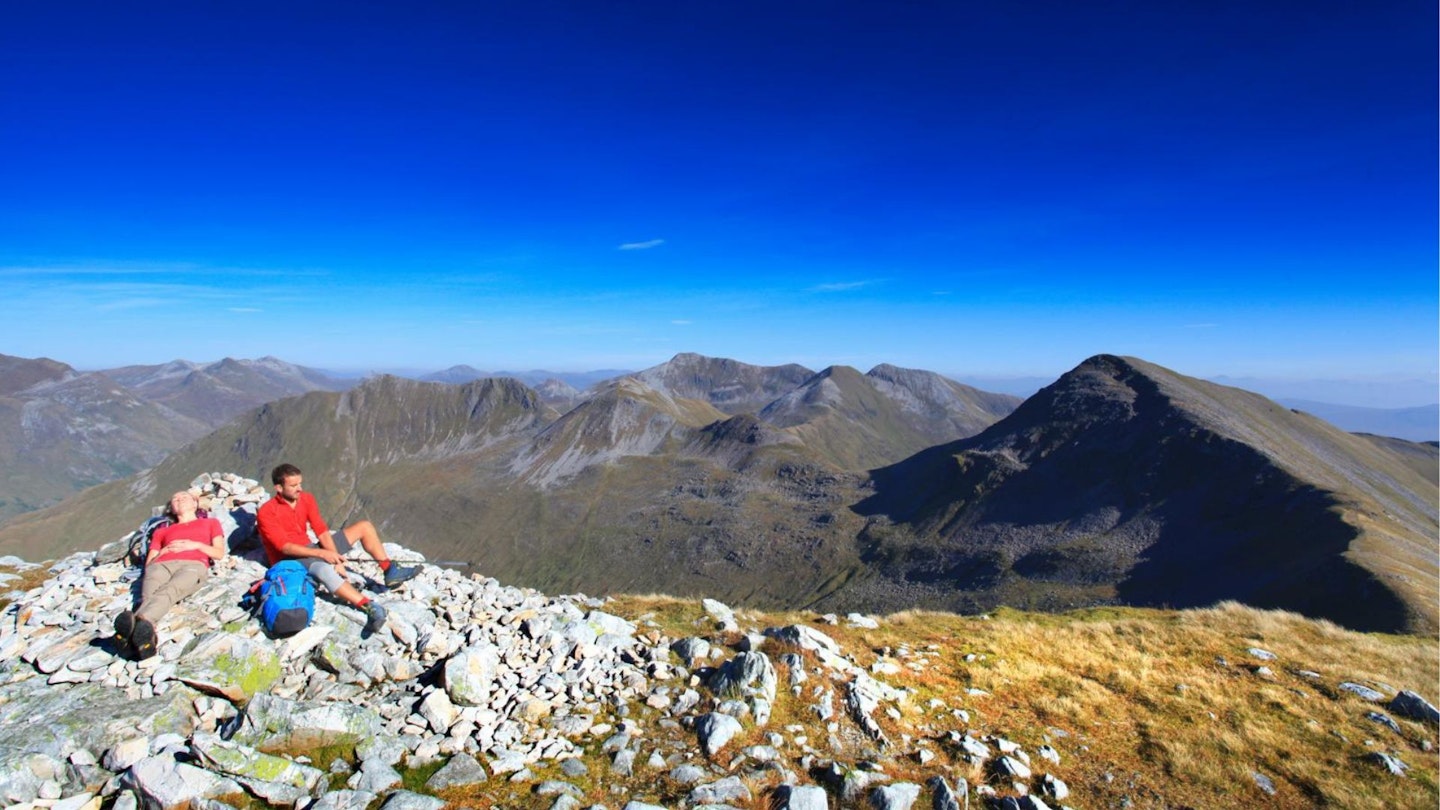
The wonderful thing about the Ring of Steall horseshoe is not only the stupendous view (on a clear day you get a wonderful and seldom-seen angle on Ben Nevis) but the multiple options for different ability levels within the party, or unforeseen bad weather.
In fact, you could turn this horseshoe into a single-Munro affair if conditions worsened, taking paths that skirt around the flanks of first and second Munros An Gearanach and Stob Coire a’ Chairn, plus a path below the airy, knife-edge scrambling section (the Devil’s Ridge on Stob Choire a’ Mhail), and missing out the ascent of the final Munro, Sgurr a’ Mhaim.
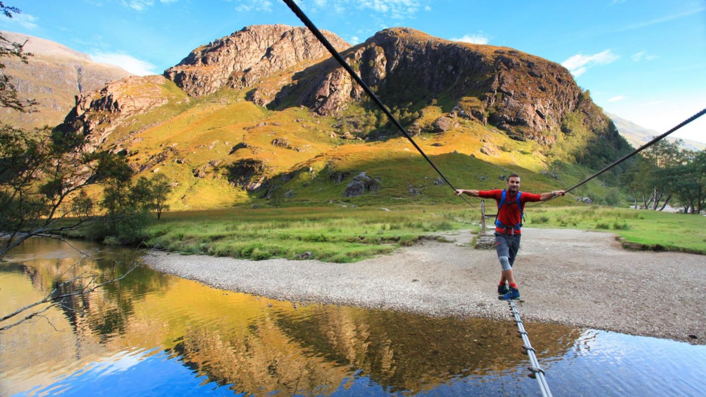
You can’t avoid the wire bridge over the Water of Nevis right at the start, but where would be the fun be in that, anyway?
CLICK HERE to download our Ring of Steall digital route guide in OS Maps
How hard is walking the Ring of Steall?
Make no mistake, this is a very challenging mountain walk. The initial ascent of An Gearanach is steep and relentless, and the final descent is a real knee-cruncher too. In between you'll mostly be walking on high summits and wide ridges, but there are also short sections of fairly exposed Grade 1 scrambling. The Ring of Steall certainly isn't a route for newbies to walking in the British mountains or hillwalking beginners.
The terrain is mountainous but mostly on clear paths all the way, with a mixture of rocky ridges, scrambling, steep slopes, grass, mud, scree, and that wonderful wire bridge crossing near the start (see below).
How long does the Ring of Steall walk take?
We clocked the overall distance at 15.2km (9.5 miles) with a whopping 1550 metres of ascent along the way. So although it isn't a particularly long route, it's the scale of the challenge overall that will stretch you on the Ring of Steall. We estimate experienced hikers should be able to complete the route described below in around 6-7 hours, but that depends on weather conditions, your own fitness, and the pace you like to walk at.
Where does the route start from?
There is parking at the end of the Glen Nevis road, at grid reference NN167691. If you're traveling by public transport, take the train to Fort William, then the N42 bus to Glen Nevis SYHA and Lower Falls (runs May to October only).
What's the best map?
This route is covered by OS Explorer 392 (1:25,000), plus OS Landranger 41 (1:50,000). You can order printed maps from the Ordnance Survey's map shop or download our digital route guide HERE.
Ring of Steall | Step-by-step route guide
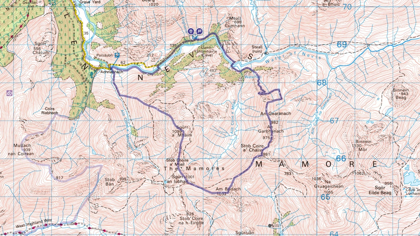
Section 1
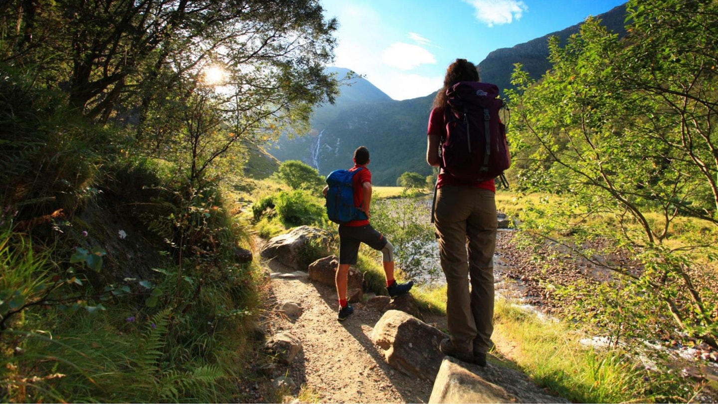
Walk straight on out of the car park (north-east) with the woods and Water of Nevis on your right. Follow the path through the trees as the river curves right, and cross the wire bridge – hold on tight! It’s a thick wire for your feet with two more wires at arm height on either side for balance. Turn left and follow the path around Steall Hut (a great place to stay!) through the woods towards the impressive An Steall waterfall, a Harry Potter film backdrop.
Section 2
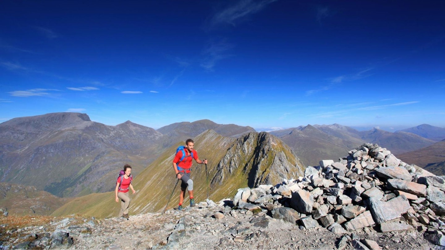
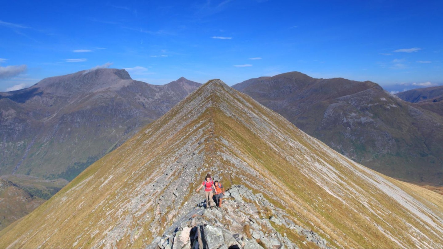
Cross at the base of the falls, continue on the same path, cross a smaller river, then turn right up a steepening gully on a path that zigzags upwards and skirts the crags to gain the first Munro of the day, An Gearanach (982m). Follow the narrowing ridge to the neighbouring, rocky top of An Garbhanach (975m) before descending a very steep rocky section to a crossroads of paths at the saddle, Bealach a’ Chadha Riabhaich.
Section 3
Continue straight on for a steep climb of Stob Coire a’ Chairn, the second Munro of the day at 981m, and admire the views as you continue along this high, rollercoaster of a ridge, branching left (southwards) to climb steeply on loose ground to the summit of the third Munro, Am Bodach (which means The Old Man). This is the highest of the day so far at 1032m.
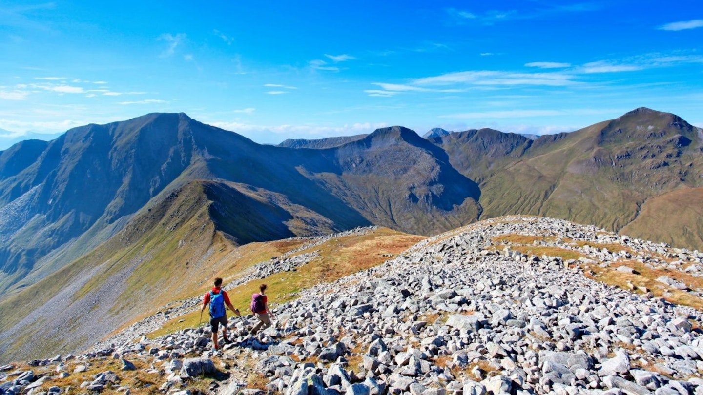
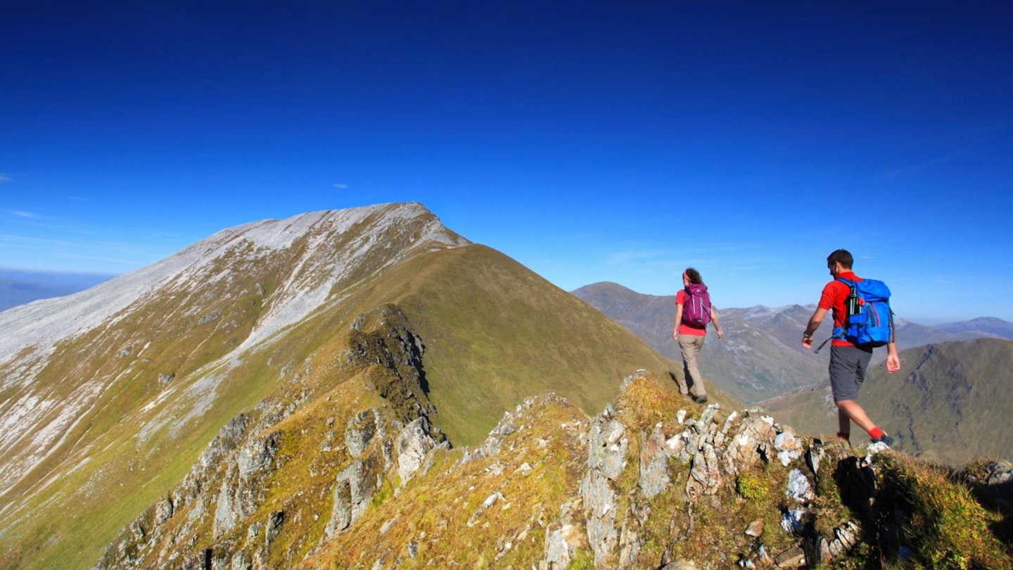
Turn right and descend westwards to the saddle before another stiff climb to Sgurr an lubhair at 1001m, following a well-worn north-westerly path to its summit. Descend north-west to the saddle.
Section 4
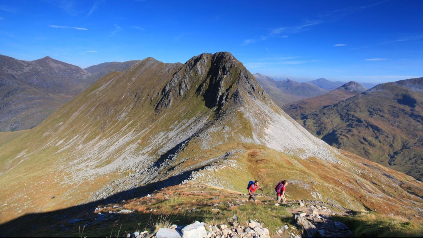
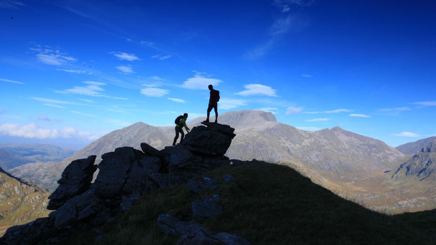
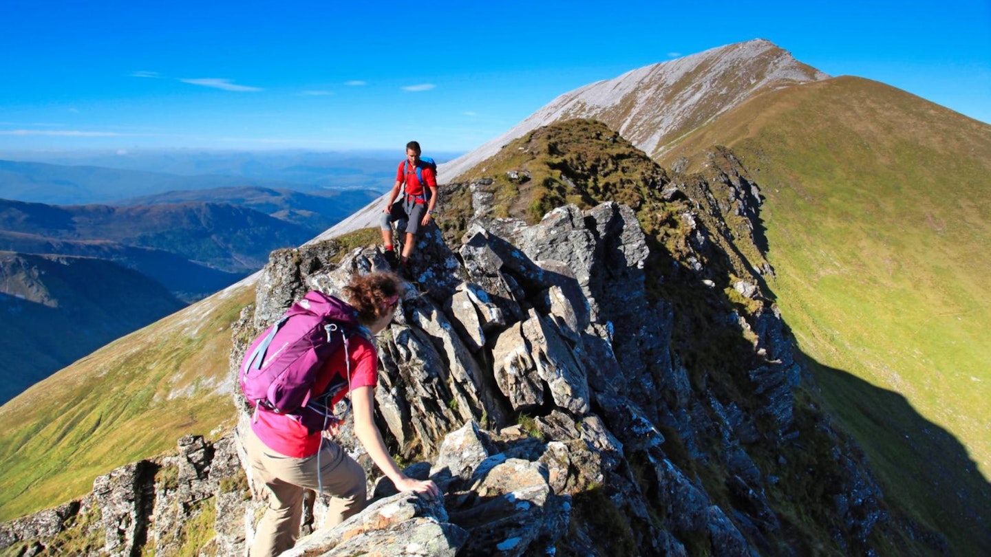
To avoid the Devil’s Ridge scramble, descend on a path to the right here that skirts right around both peaks and rejoins the route at Sron Sgurr a’ Mhaim. To complete the scramble, head up Stob Choire a’ Mhail’s southern spur, following the line of least resistance along the Devil’s Ridge, an exciting knife-edge arête with easily clamberable boulders and plenty of solid handholds and foot placements along the crest of the mountain. The scrambling eases off as the ascent begins to Sgurr a’ Mhaim, the final Munro and the highest point of the day at 1099m.
Section 5
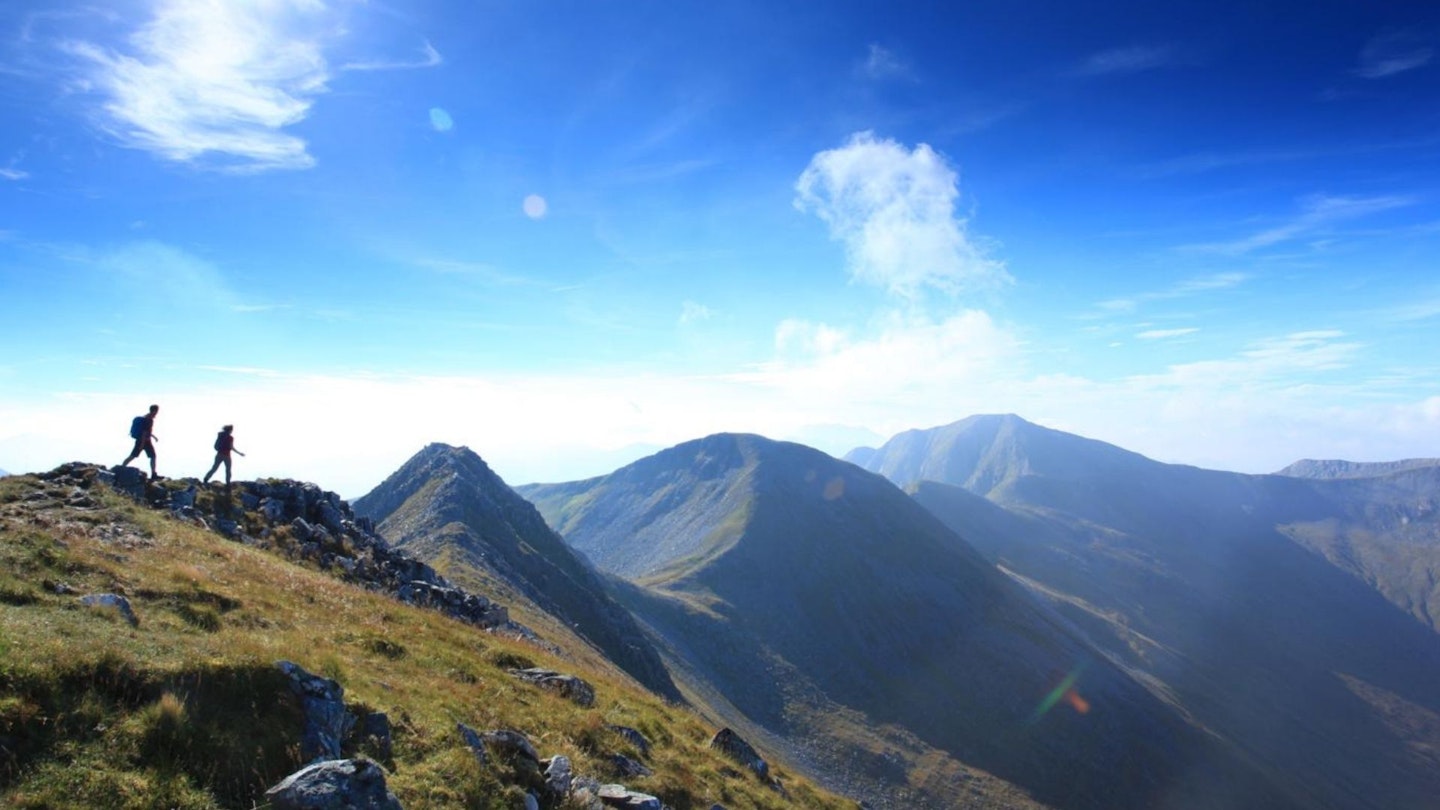
From the summit, take a look back at the Devil’s Ridge and the whole horseshoe that you’ve walked, then descend its north-west ridge on a clear but loose, steeply zigzagging path to Sron Sgurr a’ Mhaim (NN155674). Here, meet up with those in your group who may not have done the scramble, and continue downwards. The ground eases its gradient and you meet a path running to the right of the Allt Coire a’ Mhusgain. Follow this to the road that leads to the Lower Falls car park.
Section 6
Turn right at the road, and just before the bridge over the Water of Nevis, turn right to follow a path alongside the river, keeping it to your left for 1.5km until you reach a footbridge next to some buildings which crosses it and takes you back to the road you drove in on. Turn right to walk the last 1km or so back to the car park.
What walking gear do I need for this route?
Here's a selection of the best walking gear selected by LFTO's testing team: Walking boots | Hiking shoes | Hiking daypack | Waterproof jacket | Walking trousers | Walking poles | Walking mid-layers | Base layers
Where's the best place to stay near the Ring of Steall?
If you want to base yourself right near the start of the walk we'd recommend Glen Nevis SYHA or Glen Nevis Caravan and Camping Park. Also, Expedia and Booking.com are good places to look for accommodation deals in nearby Fort William.
About the author
Claire Maxted is a former writer for Trail magazine and the former editor of Trail Running magazine. She's written countless route guides and gear reviews for LFTO and is the founder of www.wildgingerrunning.co.uk