
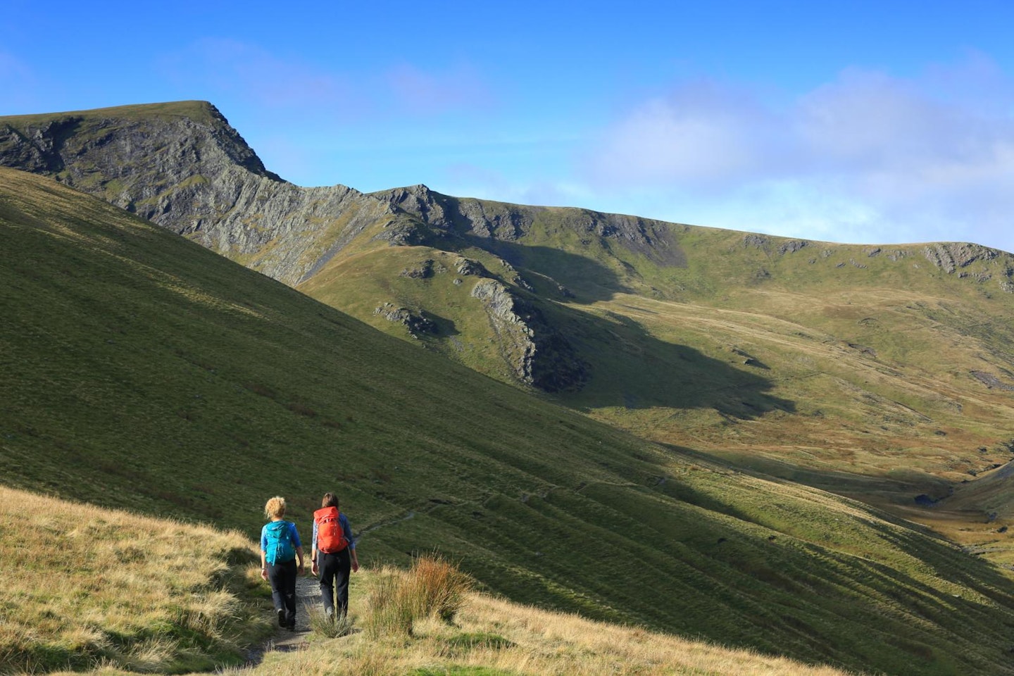
The Lakes is England's largest and most mountainous national park, making it an ideal destination for anyone who loves exploring in a pair of hiking boots. So to help you do just that, we've picked out 10 of the very best Lake District walks below.
Cumbria is home to England’s highest mountain Scafell Pike, plus many more iconic peaks including Helvellyn, Blencathra, the Langdale Pikes, and family favourite Cat Bells. And it's the variety of routes on offer that makes this famous region so popular with walkers of all ages and abilities.
The Lake District is somewhere you can stroll through wooded valleys, tiptoe beneath waterfalls, walk around some of England's most famous lakes, scramble rocky ridges, backpack long-distance trails, sleep wild in the fells, and bag England's highest mountain summits.
It's the kind of place you could visit every weekend for 10 years and always find somewhere new to walk. So where to start? Read on for descriptions of 10 of our favourite Lake District walks, complete with LFTO route guides and downloadable OS maps.
10 of the best walks in the Lake District:
• Helvellyn via Striding Edge | 12.8km | 838m ascent
• Cat Bells | 8.46km | 629m ascent
• Great Gable | 10.5km | 1130m ascent
• Scafell Pike | 12.5km | 1047m ascent
• Blencathra via Sharp Edge | 7.76km | 740m ascent
• Langdale Pikes via Jack's Rake | 11.8km | 799m ascent
• The Old Man of Coniston | 8.46km | 750m ascent
• High Street via Riggindale | 9.28km | 643m ascent
• The Buttermere Fell | 15km | 1263m ascent
• Fairfield Horseshoe | 16.83km | 996m ascent
We've included routes ranging from beginner to expert difficulty. It doesn't take long to go from one end of the skill gap to the other, but this is still serious mountain terrain with very changeable weather conditions, so always go prepared.
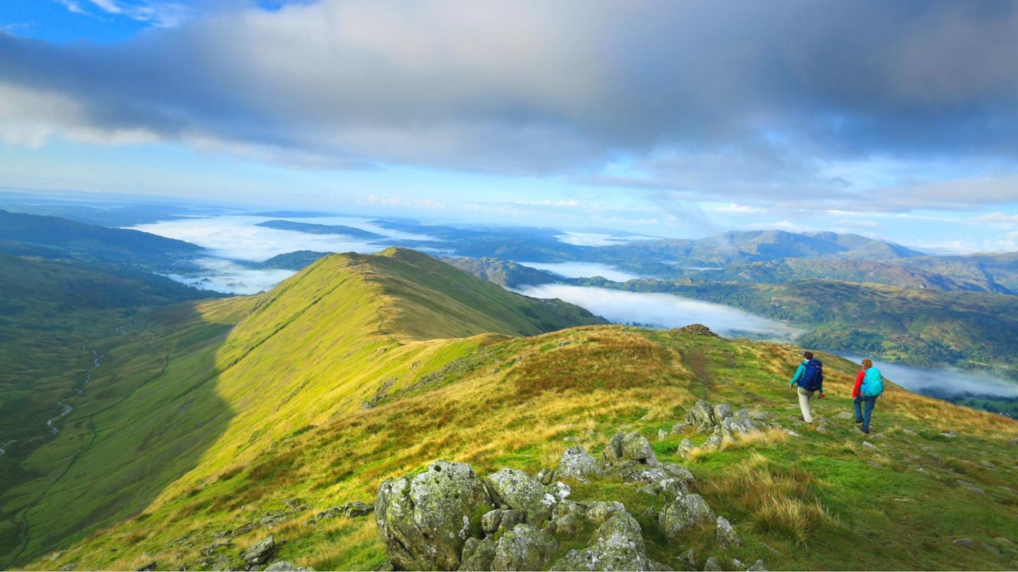
10. The Fairfield Horseshoe
Distance: 16.83km / 10.5 miles
Elevation Gain: 996.72m
Difficulty: Advanced
This is one of the Lake District’s classic hillwalking rounds, a peak-bagging circuit that starts and finishes in the picturesque town of Ambleside which is overflowing with great gear shops, pubs and B&Bs.
If you’re into bagging Wainwright fells (the 214 peaks included in Alfred Wainwright’s Pictorial Guides to the Lakeland Fells) this walk chalks off eight of them with relatively little effort, in the sense that there isn’t much ascent and reascent between each peak.
The horseshoe is named after the 873m mountain of Fairfield, the highest point of this route and a fantastic viewpoint where you can look south down the entire stretch of Lake Windermere or north to the famous ridges of Helvellyn.
For the best way to walk the Fairfield Horseshoe, check out our guide. Download the Fairfield Horseshoe digital route from OS Maps.
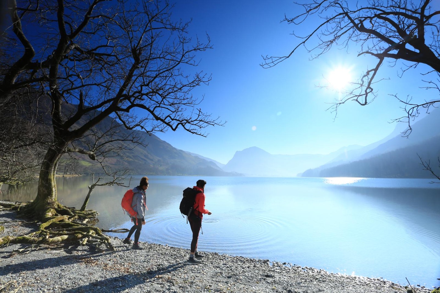
9. The Buttermere Fells
Distance: 15.08km / 9.37 miles
Elevation Gain: 1262.25m
Difficulty: Moderate
In terms of spectacular Lake District scenery, Buttermere takes some beating. An idyllic lake framed by mountains, including two of the most distinct in the National Park.
Fleetwith Pike may only be 648 metres tall but its shapely north-west ridge forms the backdrop to many a Lakeland postcard, while neighbouring Haystacks (587m) cuts a craggy silhouette against the skyline.
The best way to get to know these fells is with a long route that also takes in Red Pike, High Stile and High Crag, giving you great views into the Ennerdale valley and the nearby peaks of Great Gable, Pillar and Scafell Pike. There are even two bothies tucked beneath Fleetwith Pike’s summit, which are great options if you want to turn this into an overnight trip.
Download the Buttermere Fells digital route from OS Maps.
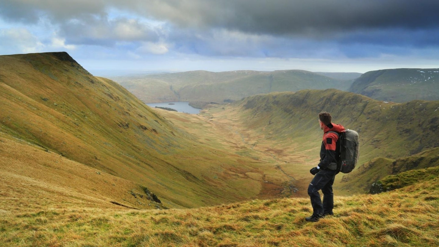
8. High Street via Riggindale
Distance: 9.28km / 5.76 miles
Elevation Gain: 643.07 m
Difficulty: Moderate
The plateaued summit of High Street marks the highest point in the Lake District’s Far Eastern Fells and is named after the Roman Road which once ran over the summit, linking together the towns of Penrith and Ambleside. The most spectacular route of ascent is up the broad Riggindale ridge from the secluded shores of Haweswater.
Until recently this was the home of England’s last resident eagle, who sadly disappeared in 2016. This is a great hillwalk rather than a daring scramble, but if you link it with a descent via Mardale Ill Bell and the Nan Bield Pass, you’ll mix in plenty of dramatic and rocky scenery too.
Download the High Street via Riggindale digital OS Maps route.
7. The Old Man of Coniston
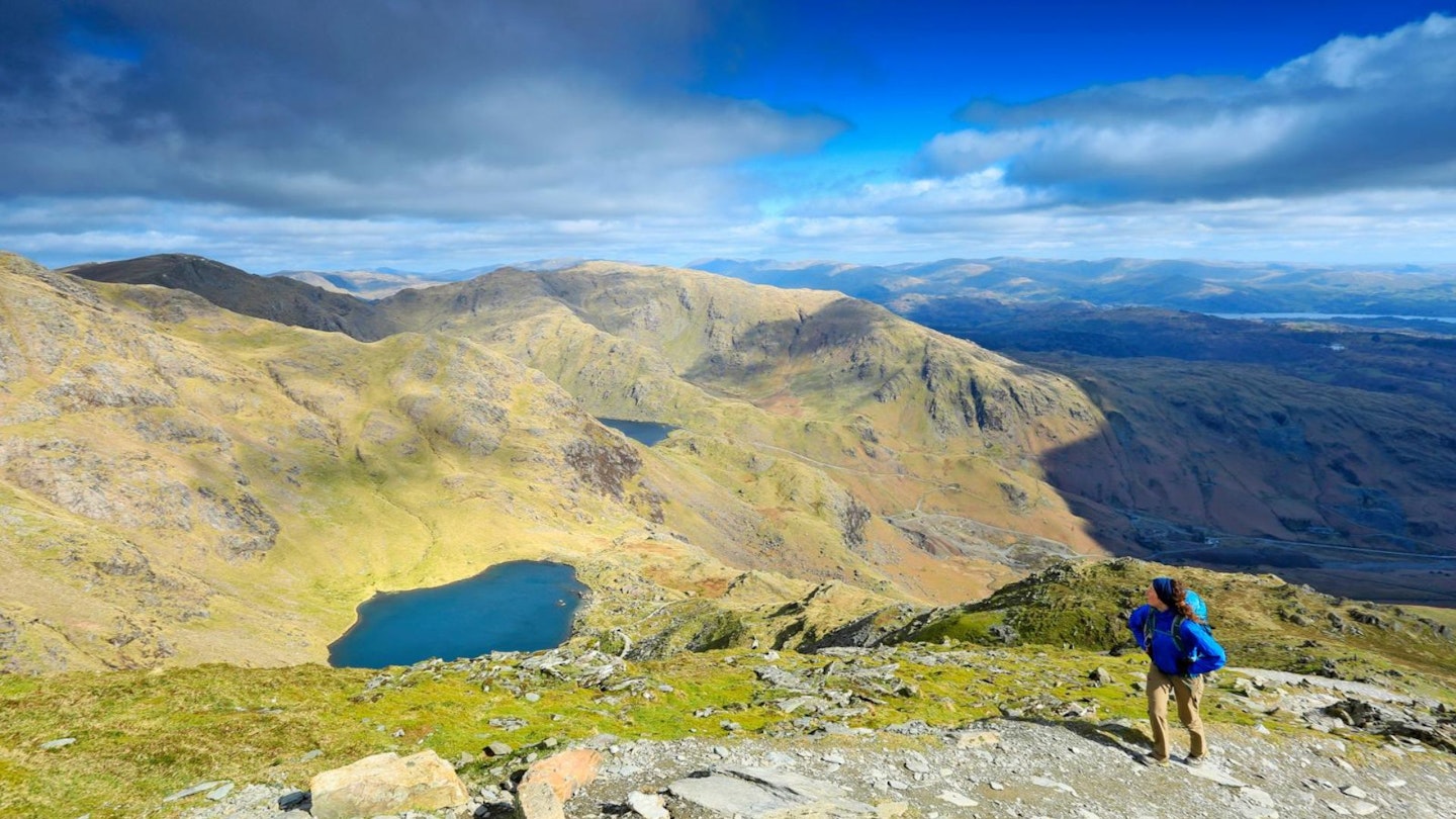
Distance: 8.46km / 7.53 miles
Elevation Gain: 750.53 m
Difficulty: Moderate
Possibly the perfect beginner mountain, offering everything from dramatic cliffs and hidden tarns to historic mines and aircraft wrecks. The most popular way to climb the Old Man is directly from Coniston village, with huge views over Coniston Water opening up behind as you ascend.
The awesome mountain tarn of Low Water is a great spot for a rest (possibly even a wild swim in summer) before making the final push to the mountain’s giant summit cairn.
There are plenty of great options for onward routes from the top, including a descent via Dow Crag to the west, or carrying on north for a full round of the Coniston Fells taking in Swirl How, the Prison Band and Wetherlam.
If you fancy more of an adventure, check out our guide to climbing the Old Man of Coniston via Boulder Valley, which promises to be exciting as it's mostly pathless.
Download the The Old Man of Coniston digital route from OS Maps.
6. Langdale Pikes via Jack's Rake
Distance: 11.87km / 7.38 miles
Elevation Gain: 799.72m
Difficulty: Expert
There are few more iconic mountain profiles in England than the Langdale Pikes, cutting an instantly recognisable figure on the skyline when approached from the southern Lake District.
There’s plenty of variety to be found when exploring these peaks, from the cliffs and gullies of Pavey Ark to the perfect rocky summit cone of Pike of Stickle and the Neolithic axe factory on the steep slopes below slopes below.
Climb the steep path beside Stickle Ghyll to Stickle Tarn, then if you’re feeling brave tackle the Grade 1 scramble of Jack’s Rake to the summit of Pavey Ark. From there, the summits of Harrison Stickle, Loft Crag and the Pike of Stickle are just a short walk away before descending back to the valley.
You can download the Langdale Pikes via Jack’s Rake digital route here. If you don't fancy a scramble, check out our Langdale Pikes walking route.
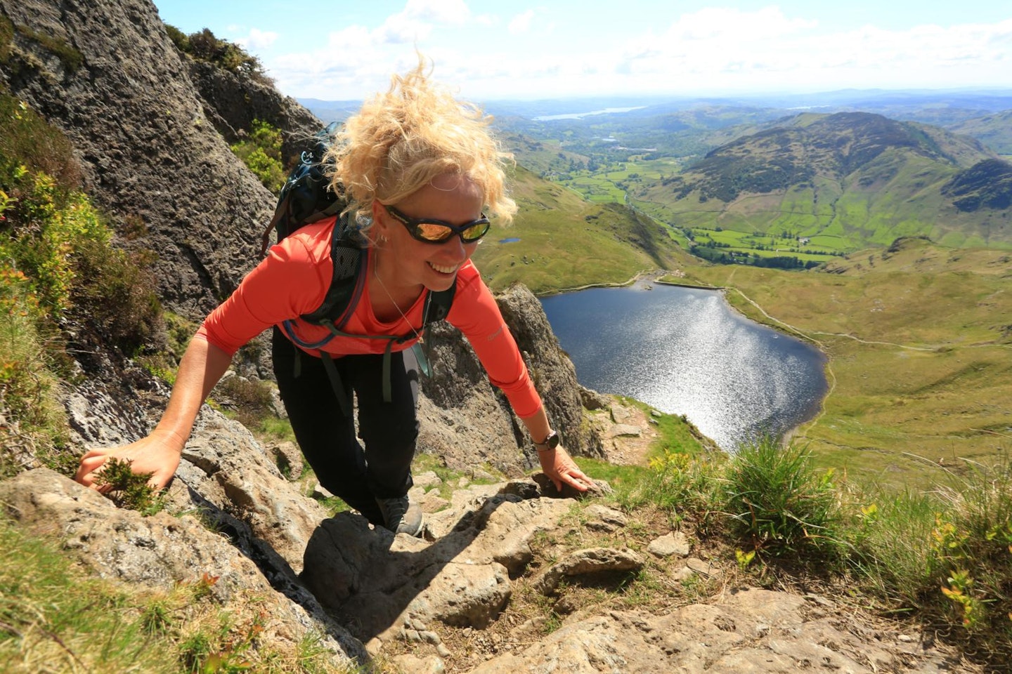
5. Blencathra via Sharp Edge
Distance: 7.76km / 4.8 miles
Elevation Gain: 740.43m
Difficulty: Expert
From Threlkeld in the north of the Lake District, you can squeeze two of the Lakes most exciting ridges into a neat 10km walk to remember. Sharp Edge isn't overly technically difficult and is classed as a Grade 1 scramble (the lowest scrambling level) but it does require a very good head for heights and sure hand and foot placements.
Sharp Edge is also no place to be in bad weather, so take a look at our guide to scrambling Sharp Edge for more info on this fun but challenging mountain route.
That moment when you pop out on top of Blencathra (868m) is a feeling like no other and you'll go home glowing with a sense of achievement and exhilaration. But if you include Hall’s Fell ridge as your descent route, the fun isn’t over yet.
This airy ridge isn’t quite as exposed as Sharp Edge, but it will still have you reaching for the rock to steady yourself on the way down. This is a great walk to do if you want to test your mettle and if conditions are good!
Get the Sharp Edge digital route from OS maps.
4. Scafell Pike and Sca Fell
Distance: 12.5km / 7.8 miles
Elevation Gain: 1047.43m
Difficulty: Intermediate
No list of must-do Lakeland walks could omit the highest peak in England. There are many well-trodden routes up Scafell Pike, some include Grade 1 and 2 scrambles, while others are just fine mountain walks.
If you don't fancy the scrambles, check out our favourite Scafell Pike walking route, which also visits the summit of neighbouring Sca Fell on a great mountain day.
Surrounded by England's highest peaks, the views are incredible and you can include several summits in one outing. Start at Wasdale Head so you can experience the birthplace of British climbing at The Wasdale Head Inn when you arrive back in the valley at the end of an awesome day.
Get our Scafell Pike digital route from OS Maps.
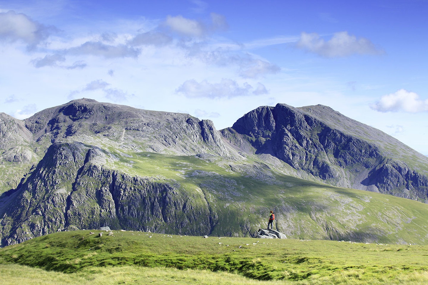
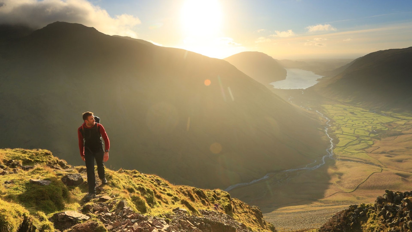
3. Great Gable Climbers' Traverse
Distance: 10.5km / 6.5 miles
Elevation Gain: 1130m
Difficulty: Advanced
This historic hulk of a mountain can be tackled via many routes, and on a fine day, the views from its 899m summit rival that of any in the Lakes.
One superb option for a great mountain day out is the route from Wasdale, which starts on the Moses' Trod path before climbing to the saddle of Beck Head then up to the summit.
The mountain has long been a training ground for some of the earliest British rock climbers who cut their teeth on classic climbs like Napes Needle. That rich climbing history can all be viewed on the rocky Climbers' Traverse that cuts across Gable's south face. And this is the trail you'll take from Sty Head on your descent back to Wasdale.
Every Remembrance Sunday (November) hundreds of people make the ascent of Great Gable for a memorial service held at the summit for members of the Fell & Rock Climbing Club who died in World War One.
For the best routes up this iconic mountain, check out our Great Gable route guide. Download our Great Gable walking route from OS maps.
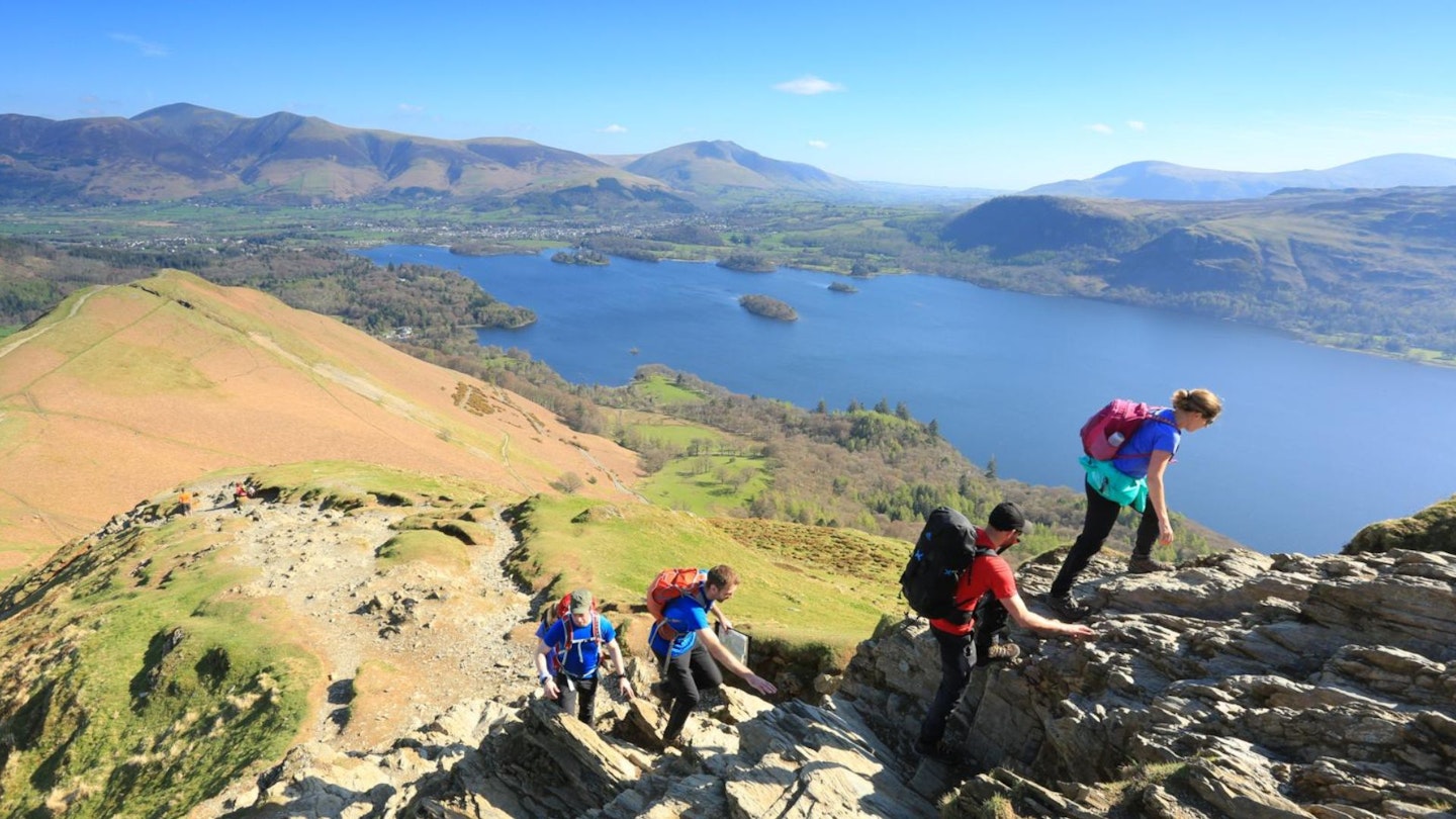
2. Cat Bells from Hawes End
Distance: 8.46km / 75.3 miles
Elevation gain: 629.39m
Difficulty: Intermediate
No trip to the Lakes is complete without a quick blast up Cat Bells. This small peak overlooking Derwent Water provides stunning views of the northern Lakes and is a great introductory hill for beginners wanting to sample their first small steps into mountain walking.
Starting from Hawse End, its 451m summit is reached in no time at all, with various options from the top. Even for seasoned hillwalkers, it's a great little hill, oozing with character, with easy access from Keswick. Perfect for when time is short.
To see our favourite way up, check out our Cat Bells walking route guide. You can download the Cat Bells digital route from OS Maps.
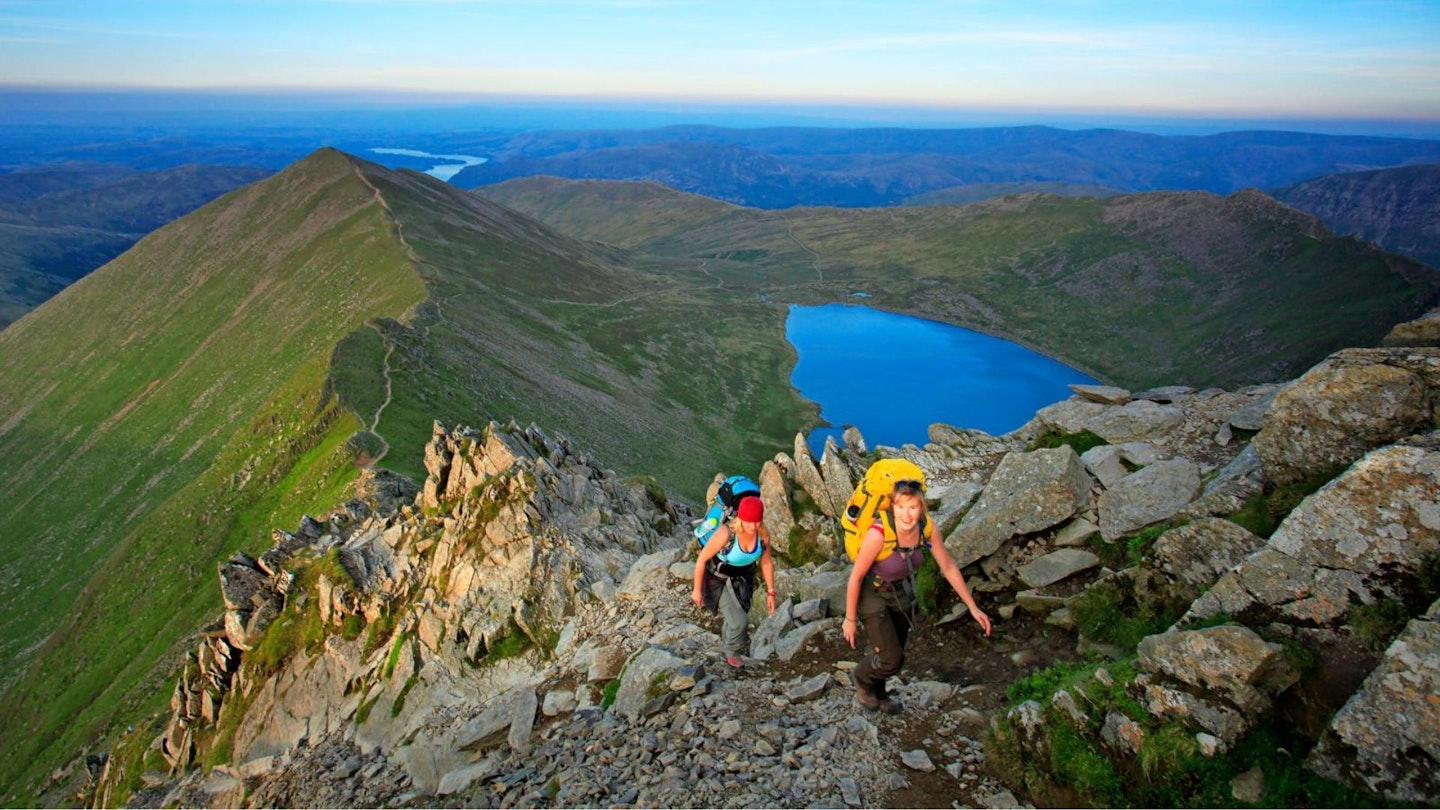
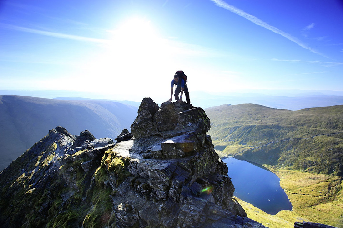
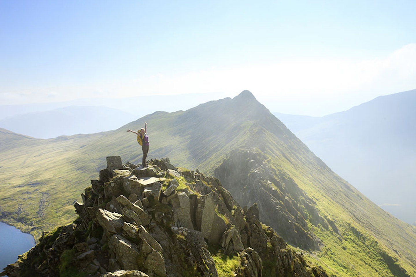
1. Helvellyn via Striding Edge
Distance: 12.8km / 7.9 miles
Elevation Gain: 838.7m
Difficulty: Advanced
There's a reason Striding Edge is the most famous of all Lake District scrambles. This ascent of Helvellyn is a classic of a mountain day and rightly regraded as one of the best hillwalks in Britain.
The Grade 1 scramble across the rocky spine of Striding Edge is exposed and very narrow in places, so not one for anyone who doesn't have a good head for heights and confidence in high mountain terrain.
If this route doesn’t get you hooked on scrambling, nothing will. There’s something magical about picking your way through the tangle of rock with careful foot and hand placements that connect you to the mountain. The 12km route reaches the top of Helvellyn at 950m then descends by Swirral Edge, your second ridge of the day.
Many people also choose to tackle this route in reverse, ascending Swirral Edge and descending Striding Edge, particularly in winter conditions.
For more info, check out our guide on how to scramble Striding Edge. Download the Striding Edge digital route from OS maps.
How to plan your Lake District walking trip
How hard are the walks?
Regions like the Lake District offer a diverse range of landscapes, from grassy rolling hills to rugged rocky mountains. We'd recommend researching the hiking routes you want to undertake and making sure they match your experience and fitness level.
You also want to make sure you've got the appropriate gear, such as a durable pair of hiking boots that can handle rougher ground.
Suggested walking kit: Walking boots | Hiking daypack | Waterproof jacket | Walking trousers | Walking poles | Walking mid-layers | Base layers
When should I visit the Lakes?
As you might've guessed, summer and winter are worlds apart when it comes to hiking in the Lake District. However, you may be surprised to learn that every season comes with its fair share of advantages and disadvantages.
Sure, spring and summer will likely offer pleasant weather and beautiful scenery, but things can take a turn in hayfever season.
Summer is also when hiking – pardon the pun – peaks in popularity. So, prepare to deal with crowds, or seek out lesser-known routes for a better experience. Autumn, meanwhile, can showcase some stunning sights with less than half the crowds. The weather can start getting hairy around here, so be sure to pack a waterproof jacket.
Winter brings some peace and quiet, along with chances to see breathtaking snow-covered landscapes. It also brings the most severe challenges, including low temperatures and icy paths. Insulated jackets are a must-have. Additionally, you'll want to consider researching the best winter hiking boots.
Where should I stay?
To camp or not to camp? The choice is yours; both approaches have their merits. Cumbria is furnished with dozens of warm and welcoming inns, hotels and B&Bs. They provide a great opportunity to mingle with the locals and meet some fellow hikers.
Not to mention immediate access to hearty meals and a brew or two. Be sure to find the right location for your hikes, and book well in advance. The nice rooms sell like hotcakes, especially during peak seasons.
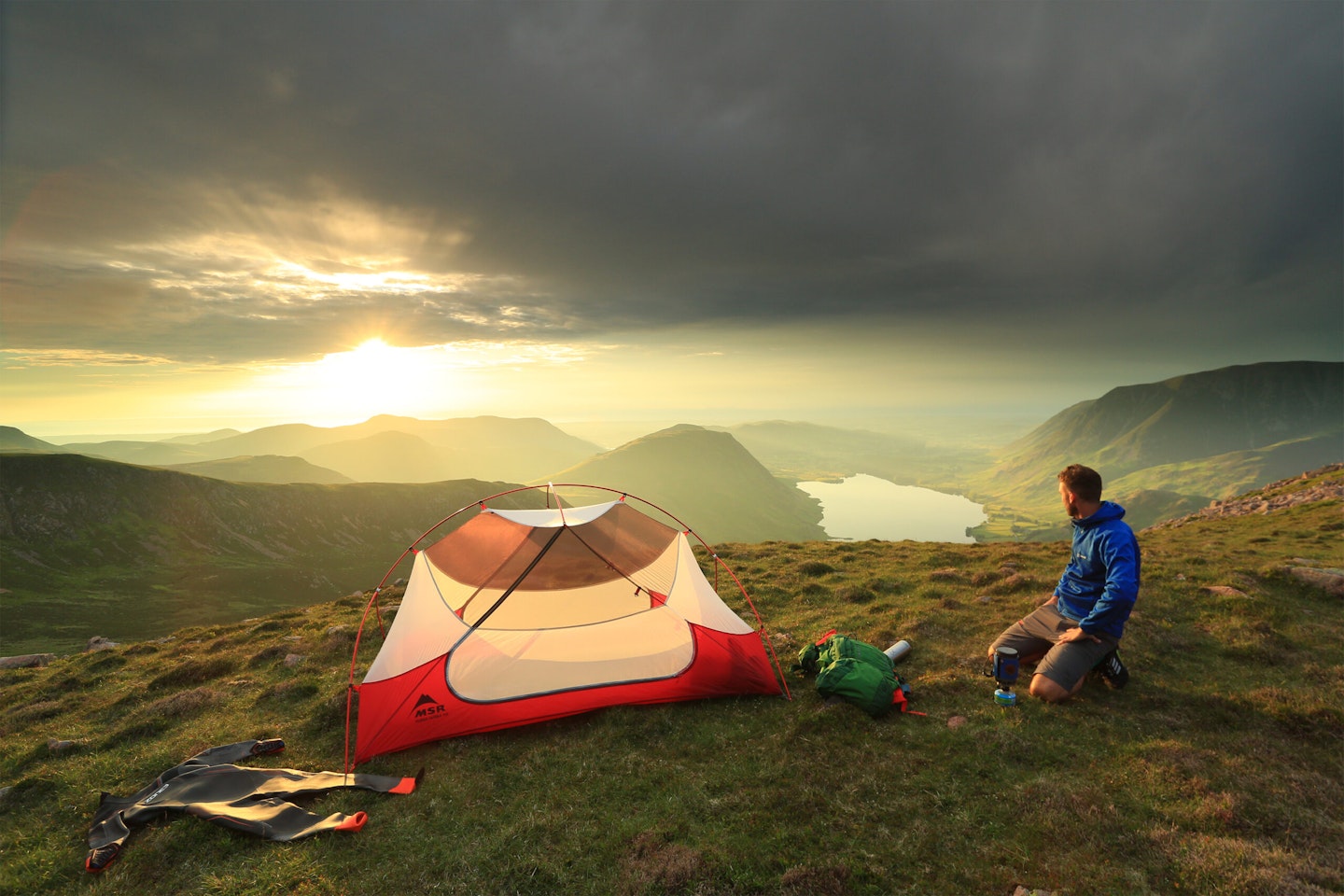
Of course, you can always save yourself the hassle (and cost) of hotels by simply pitching a tent. Camping in the Lake District is an excellent way to immerse yourself in the National Park. There are dozens of well-equipped campsites, of if you're feeling adventurous you could explore wild camping in accordance with the Wild Camping Code.
Undoubtedly, this option has the highest effort-reward ratio. It can be a hassle to pitch in the wilderness, but you may also wake up to your new all-time favourite view. Check out our wild camping guide to learn more.
Mountain Safety
Walking in the UK mountains can be dangerous, with rough terrain, exposure and changeable weather. Always check weather forecasts and make sure you have suitable clothing and navigation tools. Ice axes and crampons are essential for walking in snow and ice – as are the knowledge and skills to use them.
Useful Resources
Mountain Rescue: Call 999, ask for police, then mountain rescue
Don't forget Trail magazine subscribers get 50% off an annual subscription to OS Maps, where you can download digital routes for every walk.
