
Cadair Idris is a mountain that has it all. Located in the south of Snowdonia, away from many of the National Park's more famous names, this sprawling giant of a peak is a firm favourite with hikers of all ages. And the Minffordd Path route described below is one of the greatest hillwalks you'll find anywhere in Britain.
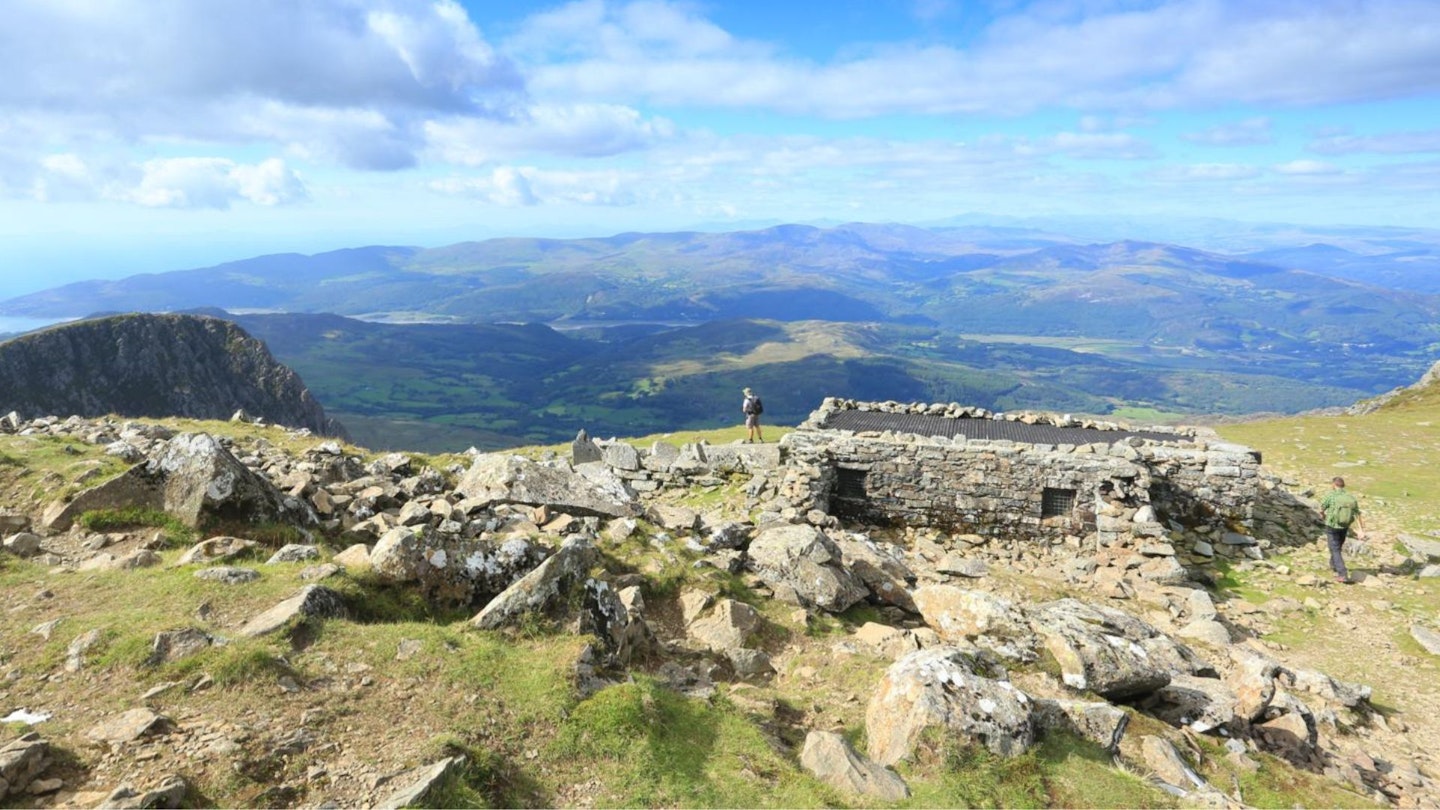
Steeped in legend, the Cadair Idris massif is a landscape of dramatic crags, sinuous ridges and some of the best views in southern Snowdonia; with the rugged Rhinogydd to the north, the rolling Cambrian Mountains to the south, and the sparkling waters of Cardigan Bay to the west. There’s even a handy summit shelter at the top, which local legend suggests that if you spend the night in, you'll emerge the following morning as either a poet or a madman.
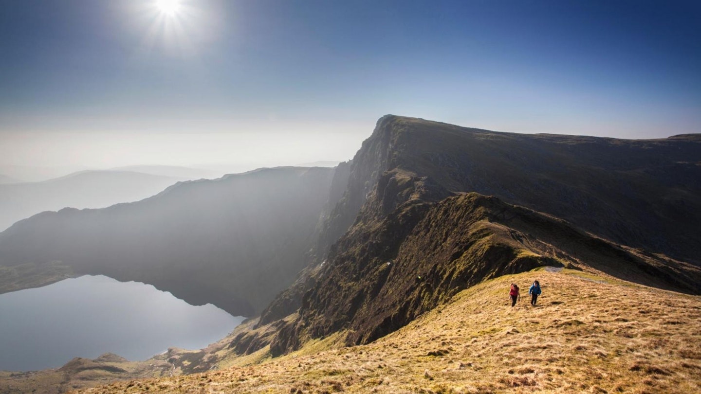
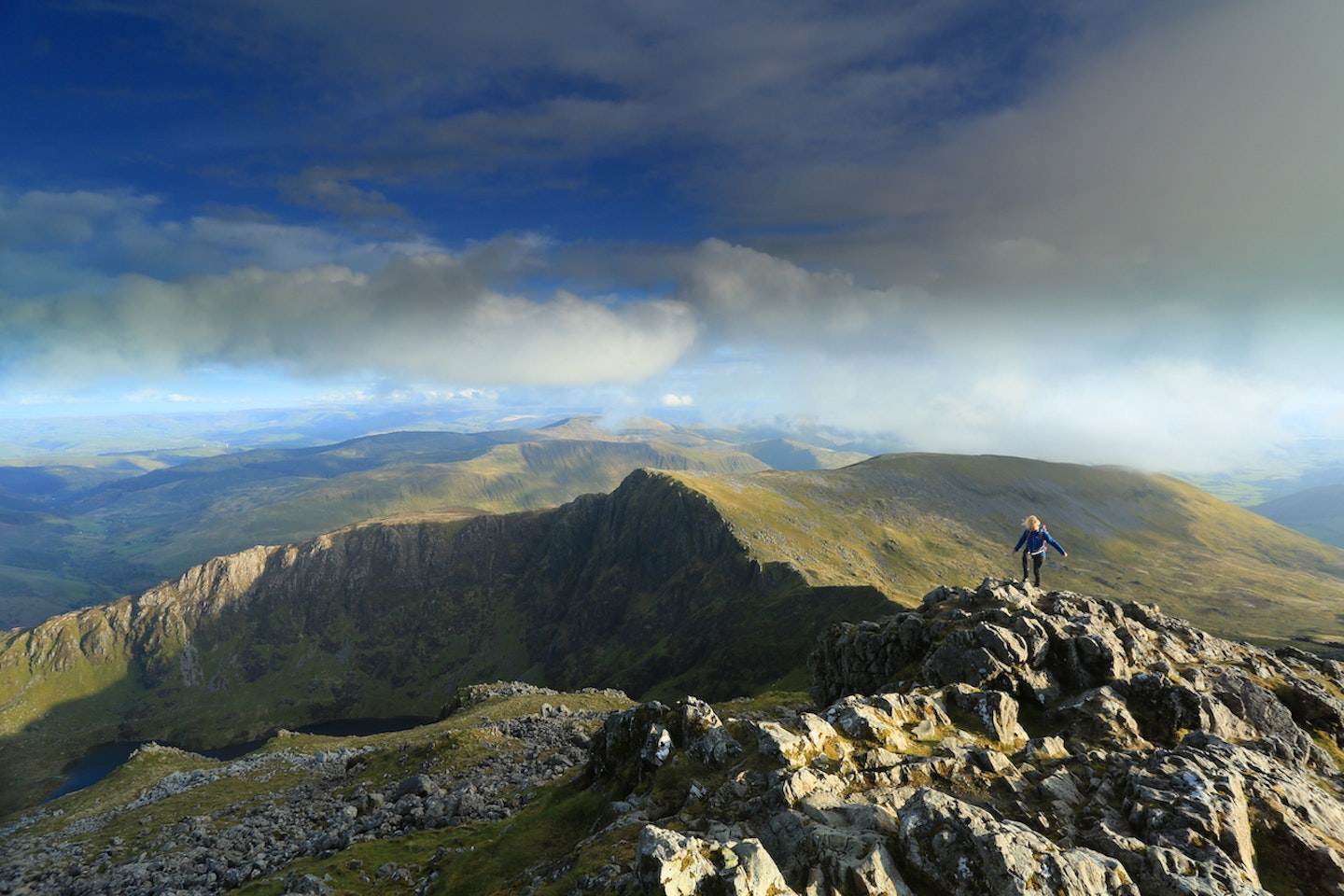
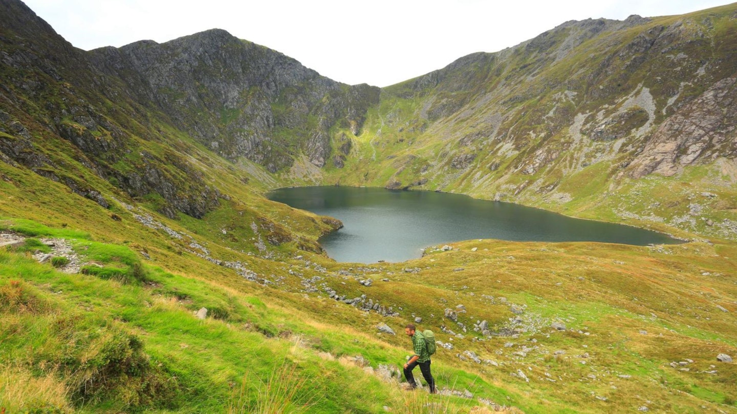
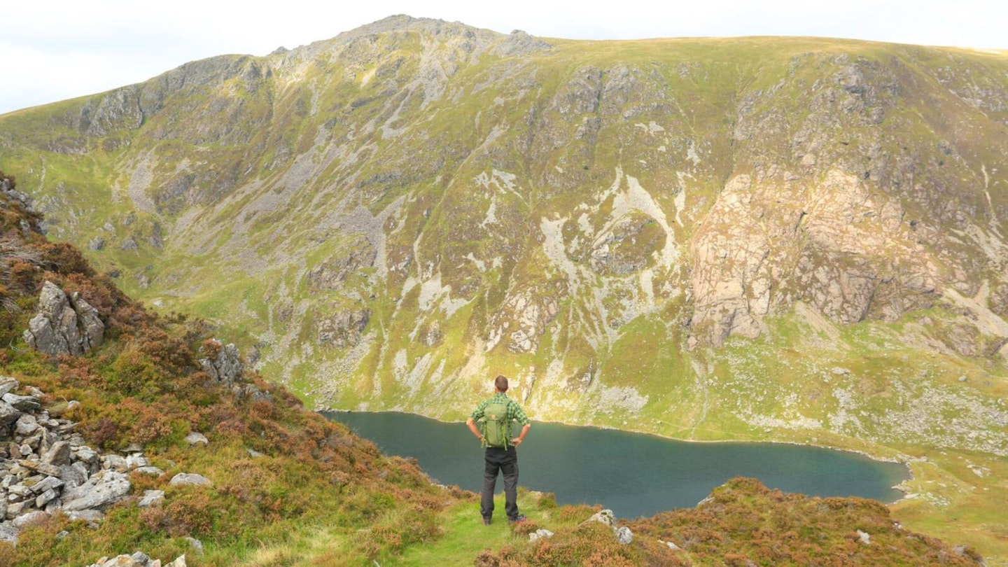
The spectacular Minffordd Path starts in thick oak woodland and rises to the immense rocky amphitheatre that surrounds the hidden lake of Lyn Cau. The approach to Cadair’s true high point traverses a broad rocky ridgeline, climbs to a perfect pyramidal summit, then drops again before leading upwards through an ancient volcanic landscape to the trig point and shelter at Penygadair.
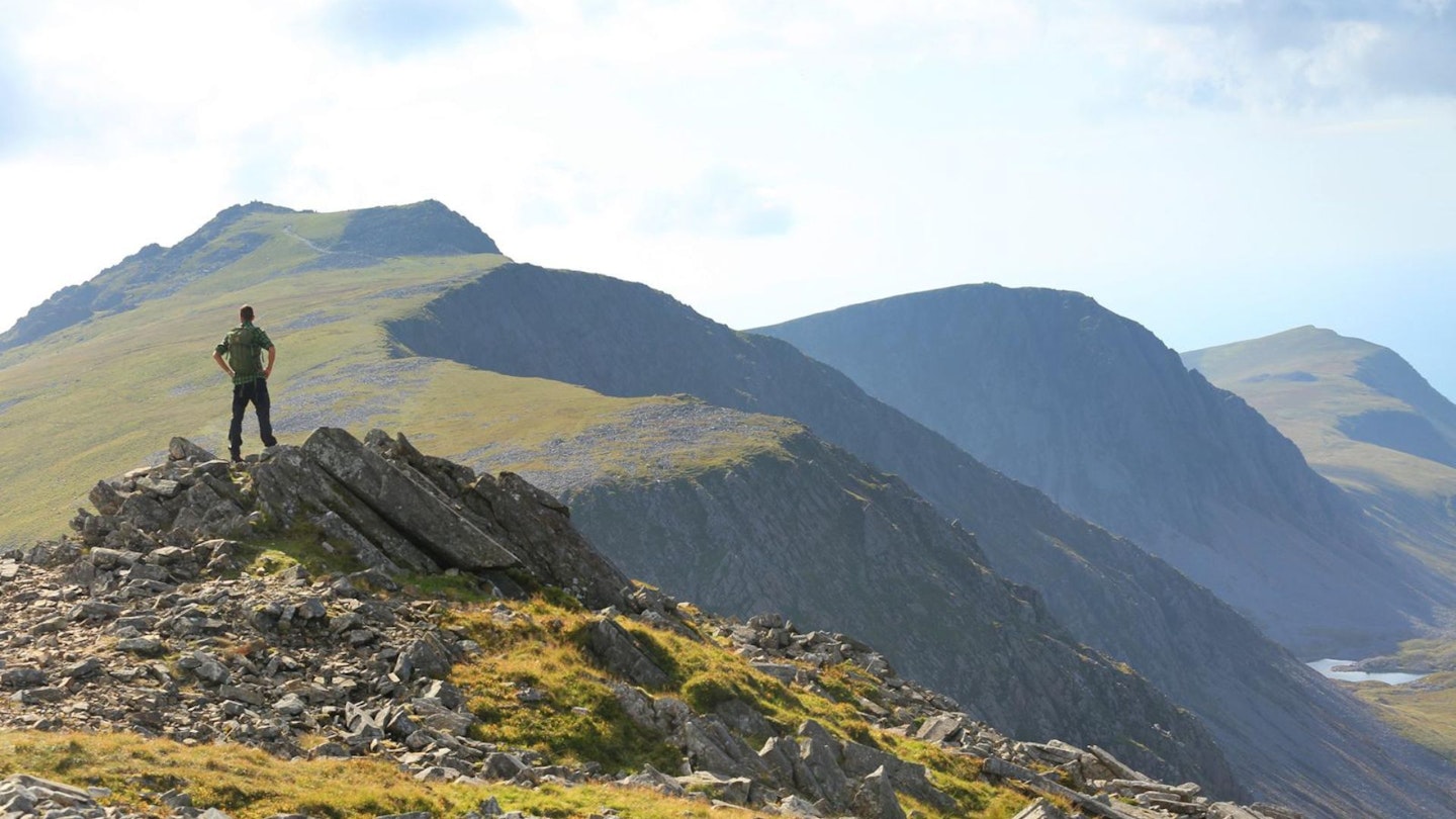
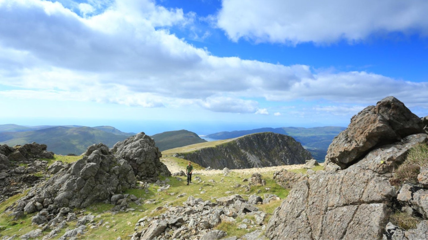
From the 893m summit you’re treated to magical views across the surrounding peaks and lakes, out to the west coast, and north to the Llŷn Peninsula and the distant mountains of northern Snowdonia. Go prepared for all weathers, with good outdoor gear and plenty of refreshments, and you’ll come back telling tales of soaring peaks forged by mythical giants, crowned by rocks older than the dinosaurs.
CLICK HERE to download our Cadair Idris digital route guide in OS Maps
How hard is climbing Cadair Idris?
This is a rocky and steep mountain route that isn't best for complete beginners, but is well within the capabilities of anyone with decent fitness and hillwalking experience. The paths are mostly good, but areas of the Minffordd Path require care and navigation skills in low visibility as there are some vague sections. You'll come across occasional scree and boulders the higher you climb, but mostly the route is clear and easy to follow on the ground.
People often ask if Cadair Idris is harder to climb than Snowdon, as they're both famous north Wales mountains, but of course the answer depends on which route you take. Both Snowdon and Cadair Idris have tricky and technical routes that are reserved for very experienced mountaineers, but they both also have routes – such as this one – which are suited to beginner walkers as well as more experienced hikers.
How long does it take to walk up Cadair Idris?
This circular route up the Minffordd Path and back to your start point covers 11km (7.8 miles) and around 1065 metres of ascent. We estimate experienced hikers should be able to complete the route described below in around 5 or 6 hours, but that depends on weather conditions, your own fitness, and the pace you like to walk. Plus the views are magical, so make sure you take the time to enjoy them
Where does the Cadair Idris Minffordd Path start from?
The Minffordd Path route starts from the pay and display Dol Idris car park at grid reference SH732116, postcode LL36 9AJ. The nearest town is Dolgellau. If arriving by public transport, the number 30 bus service from Dolgellau runs to Tal-y-lyn near the start of the route, except Sundays.
What's the best map for Cadair Idris?
This route is covered by OS Explorer OL23 (1:25,000), plus OS Landranger 124 (1:50,000). You can order printed maps from the Ordnance Survey's map shop or download our digital route guide HERE.
Cadair Idris | Step-by-step route guide
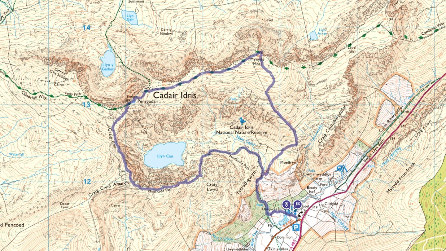
Section 1
Start at the gate near the toilet block in the car park. The route is signposted for ‘Cader Idris'. Follow the track for about 100m and turn left to pass the Tŷ Te. At a small river, take the gate on the right that leads very steeply uphill into and through the woodland. Another gate leads you back out to open land.
A split in the path appears soon after you leave the woodland – keep to the main path, don’t cross the river. Continue along the path past some ruined buildings and more steeply uphill again until you near Llyn Cau, which is definitely worth nipping up to for a closer look and a photo.
Section 2
The route turns south about 250m before you reach the Llyn, to climb even more steeply up towards Craig Lywd, where it takes you up along the broad ridge. You shouldn’t need to come too close to the steep terrain on your right, though a few little tracks here and there lead to viewing points of Llyn Cau. If you do have a look, be conscious of the drops.
The path is messy, confusing and sometimes you have to have a little look around but there are a significant and unnecessary number of cairns along this stretch of the route, so getting lost shouldn’t be an issue. Please don’t add to the cairns. The final part of this section crosses a stile at the summit of Craig Cau.
Section 3
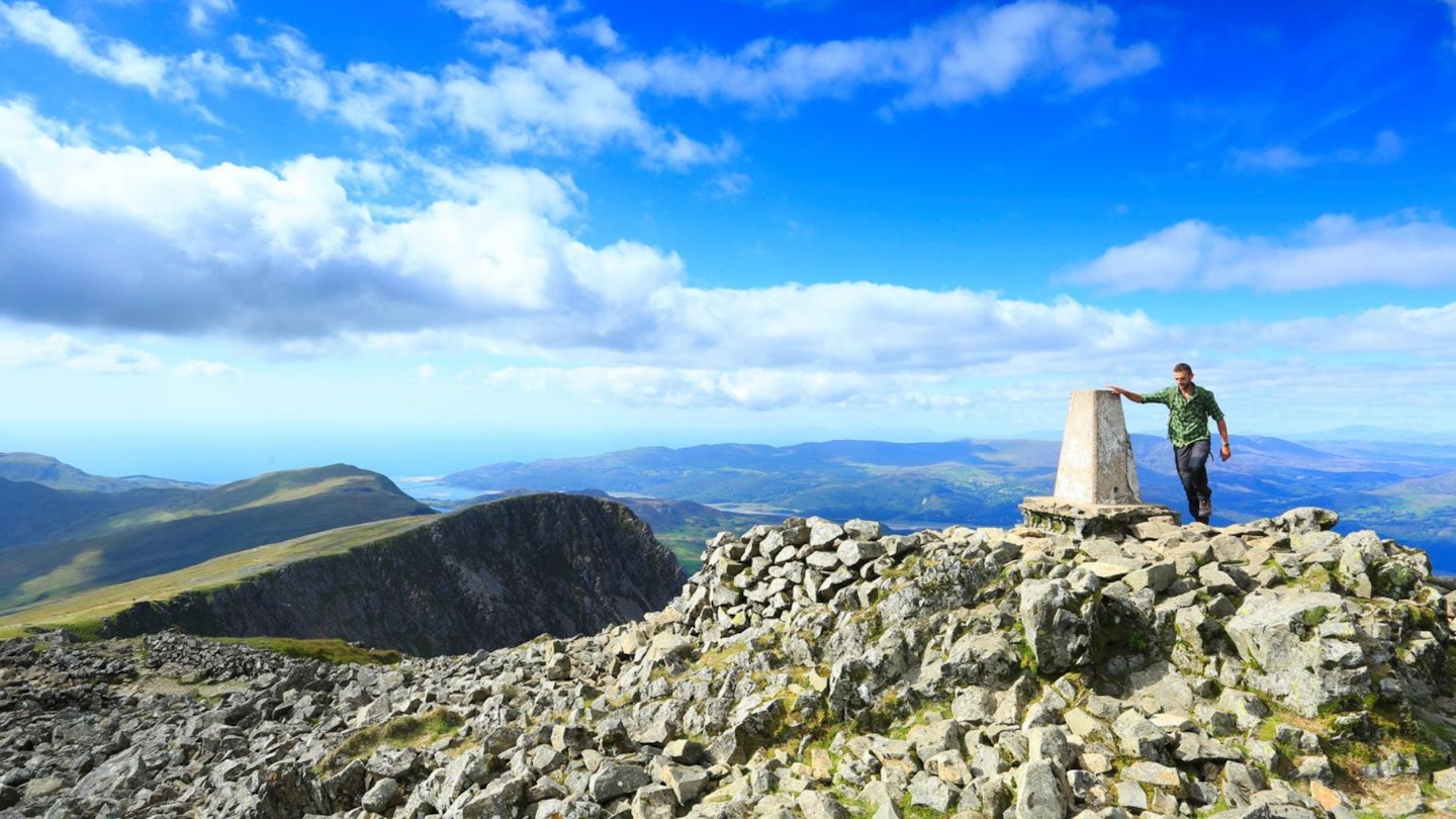
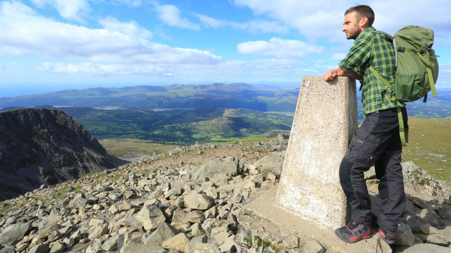
A short but sometimes awkward descent leads down to Bwlch Cau and then back up the other side, to approach Pen y Gadair. The upper section could be difficult to follow in poor visibility, as there are lots of small split tracks, but as with the earlier section the cairn builders have been active. A gradual rightward curve, to the north-east, will eventually lead you to the summit. There is a brilliant little shelter on the summit to rest in, protected from the elements.
Section 4
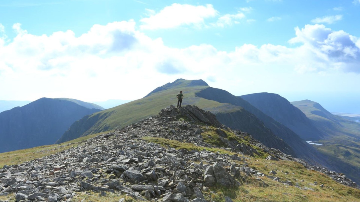
After leaving the rocky summit of Pen y Gadair, the link to Mynydd Moel is a lovely, almost 2km grassy walk across a gentle, broad ridge, in a north-eastern direction. Take care not to push too far left and descend down to Llyn y Gadair. You'll reach a fence and stile where you can descend from if you’re short on time. Otherwise, continue the short distance to the summit.
Section 5
The descent from Mynydd Moel takes a straightforward southward bearing down a gentle, grassy slope until you reach the lower section of the fence you crossed just before the summit of Mynydd Moel. Ignore the stile and keep left of the fence.
The route becomes rougher and rockier, though a path has recently been built to take the edge off it and reduce erosion. Follow the path down, curving back rightwards (south-west) crossing a few stiles to a slate bridge across Nant Cadair. Rejoin the path from the start of the route and head back down through the woodland.
What walking gear do I need for this route?
Here's a selection of the best walking gear selected by LFTO's testing team: Walking boots | Hiking shoes | Hiking daypack | Waterproof jacket | Walking trousers | Walking poles | Walking mid-layers | Base layers
Where's the best place to stay near Cadair Idris?
Our local route experts recommend camping at Bird Rock Camping or Fferm Cedris, or booking rooms at the Ty’n y Cornel Hotel or Pen-y-Bont Hotel. Expedia and Booking.com are good places to look for good accommodation deals around Dolgellau.
About the author
Oli Reed is the editor of LFTO and Trail magazine. He's walked the Cadair Idris Minffordd Path in both summer and winter conditions and rates it as one of his favourite routes in the north Wales mountains.