
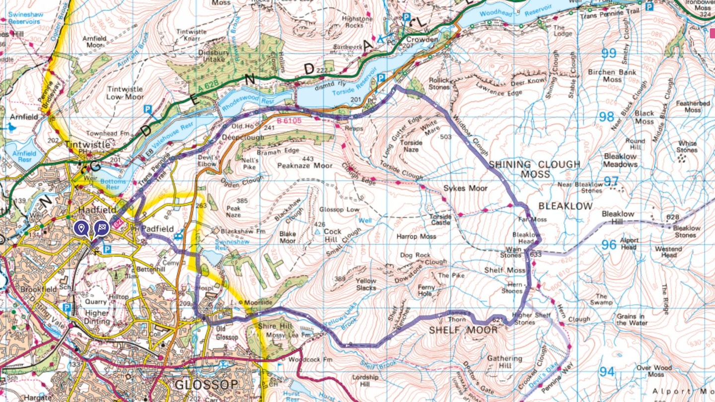
This hugely enjoyable hiking route starts at Hadfield, easily accessible by train or car and familiar to many as the setting for the iconic TV show The League of Gentlemen. This is the beginning of the easy Longdendale Trail, which leads you to the foot of Wildboar Clough, and the classic hard route onto Bleaklow.
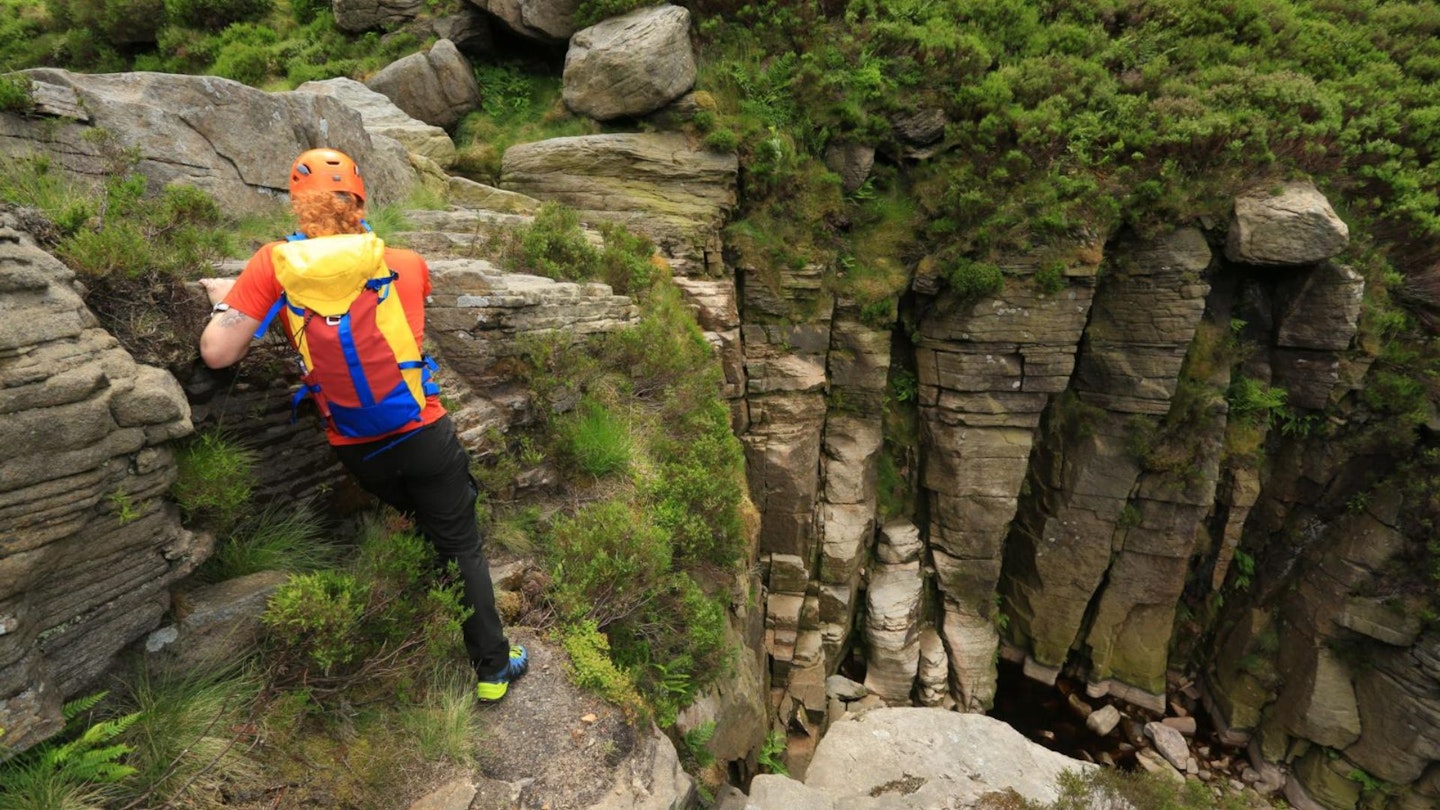
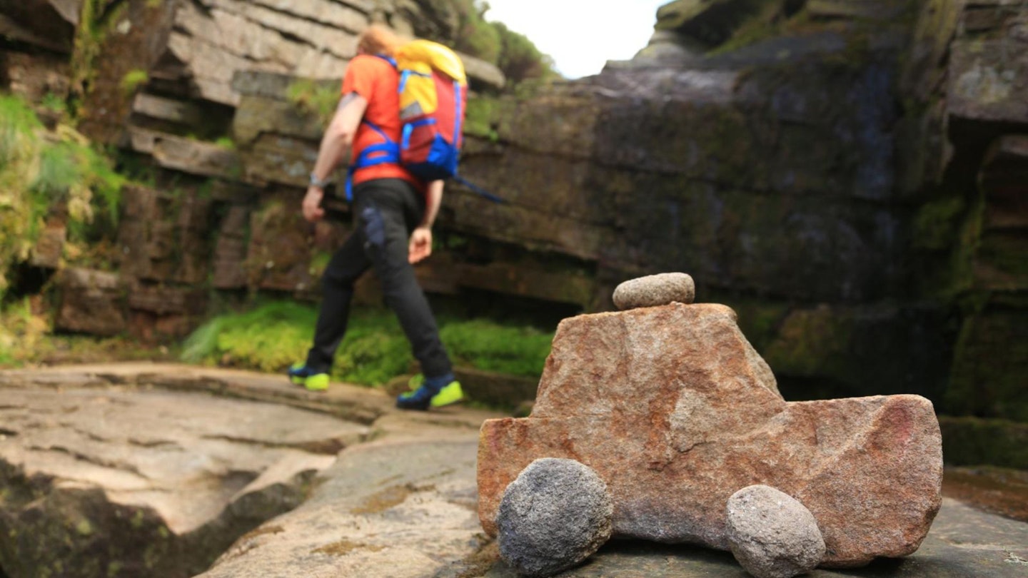
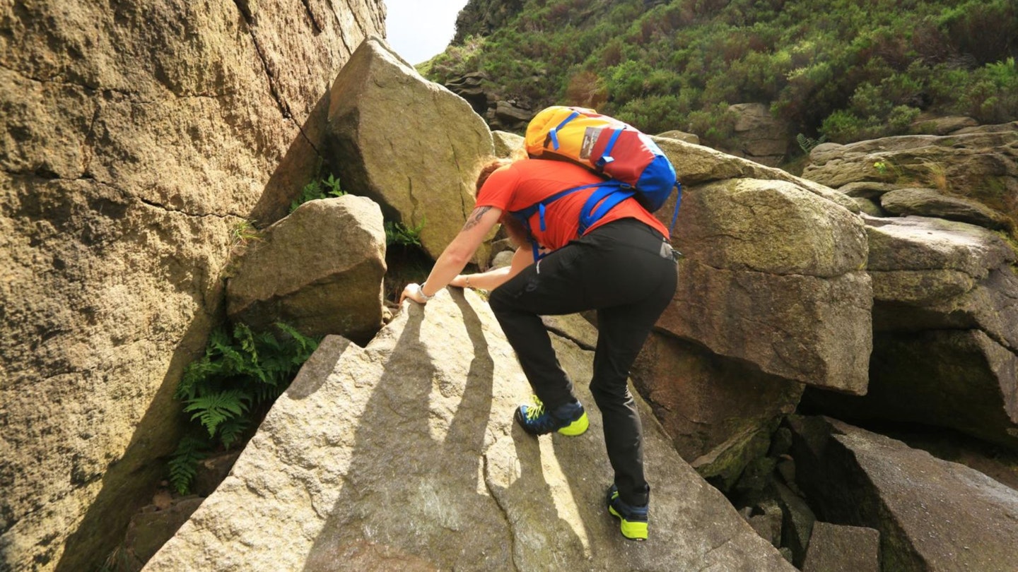
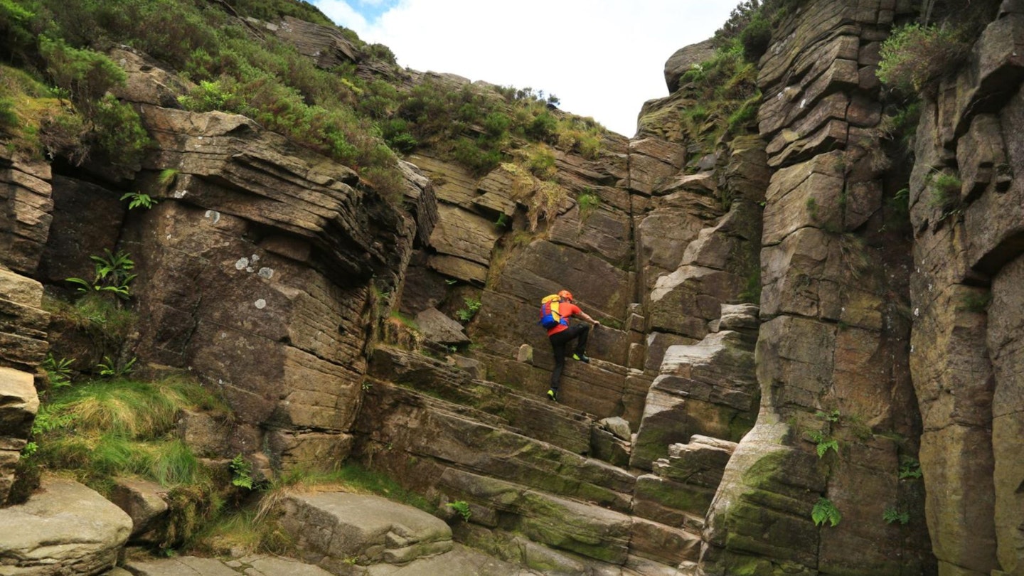
There are several vertical wall sections with waterfalls up this Grade 2/3 scramble in the ascent of the clough, which can prove a little challenging. However, it is possible to pick an accessible route up the north-eastern flank without scrambling hard rock. After topping out it is a short stroll across the moor to the Pennine Way and on to the cairn marking the summit at Bleaklow Head, the Peak District’s second-highest summit.
This high moorland landscape is shrouded in cloud for much of the time, so good navigation is a must. The route then visits the air crash site of the B29 ‘Over Exposed’ before descending via Higher Shelf Stones into Old Glossop. This full day out across wild moorland terrain will bring a sense of isolation and achievement that makes it a trip to be remembered.
How hard is scrambling Wildboar Clough?
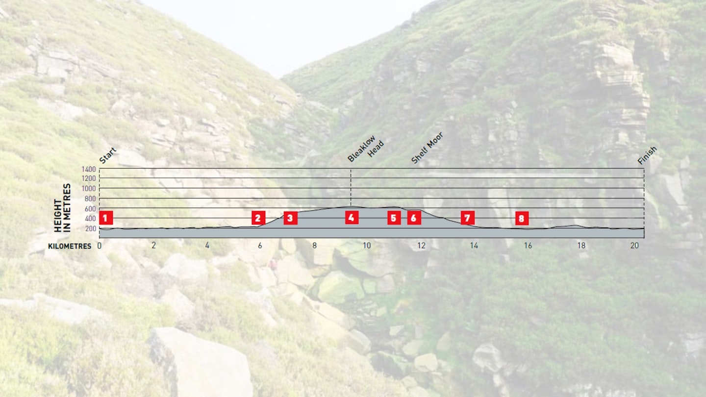
DIFFICULTY: Hard | DISTANCE: 20.2km | TIME: 7 hours | TOTAL ASCENT: 640m
FITNESS: You need to be in decent shape, both for the long walk and the multiple scrambles.
TERRAIN: Hill trails, footpaths and moorland, plus rocky Grade 2/3 scramble.
NAVIGATION: Good attention to detail is needed when picking scrambling lines, and when walking on the featureless upper slopes of Bleaklow.
Where is the start of the walk?
Start and finish the route at Hadfield Station, which is easy to reach by car, train and bus.
What's the best map for Bleaklow and Wildboar Clough?
-
CLICK HERE to view and download our digital route guide in OS Maps
-
OS Explorer OL1 (1:25k)
-
OS Landranger 110 (1:50k)
-
Harvey Superwalker XT25 Peak District North (1:25k)
Wilboar Clough and Bleaklow | Step-by-step route guide
-
Access to Hadfield by train from Glossop costs just £2.50, making Glossop a worthwhile base for the walk, and alleviates the need to cross the fields at the end of the day to get back to Hadfield. From the station turn right along Platt Street to access the Longdendale Trail. If arriving by car, park at the trail head car park, SK13 1DW. Take the short ramp up onto the trail and head east for 5.9km, crossing the B6105 along the way.
-
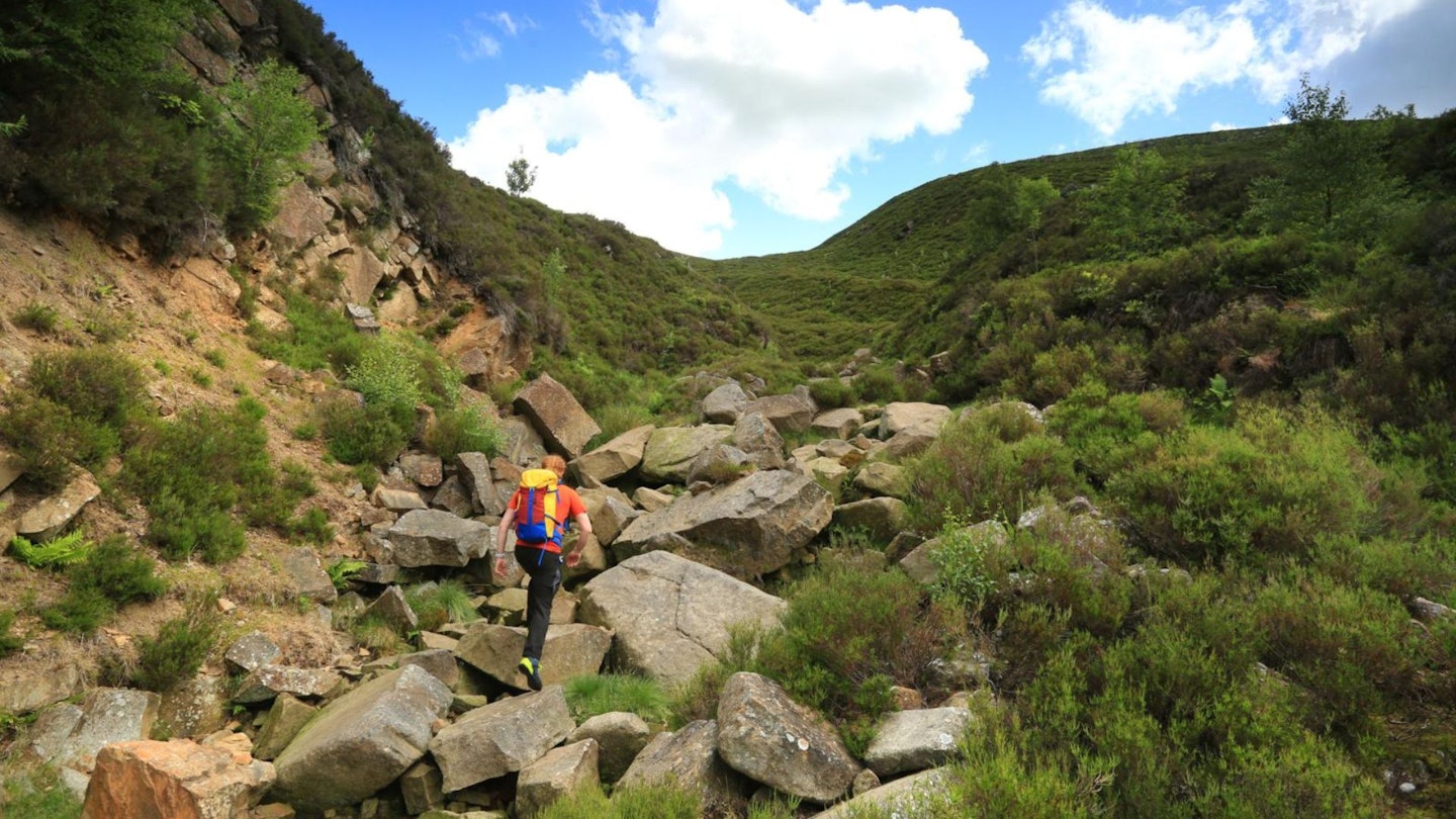
Follow the fingerpost for Wildboar Clough to the right of the trail over the stile and begin to ascend, following the footpath through woodland and across a broken stile to enter the boulderfield at the base of the main section of Wildboar Clough. The left-hand side is generally driest with the best handholds but this is dependent on the weather. The rock can be slippery at any time. The scramble is progressively more difficult as the three vertical sections are reached. The final crux is the hardest and generally the wettest. At any time a thin path up the left-hand flank of the clough can be accessed for safety.
-
After topping out of Wildboar Clough, head south-east to Bleaklow Head. The route follows a grough (a deep incision in the peat made by a stream) across Shining Clough Moss. Keep on course using a compass as you navigate the bleak landscape for 1.5km to the well-defined Pennine Way on Far Moss, then follow the trail to the large cairn at Bleaklow Head.
-
Head south down the Pennine Way for 800m until the National Trail turns south-east at Hern Stones, then veer south-south-west for 500m to the crash site of the B29 ‘Over Exposed’. Please do not disturb or remove any items.
-
From the crash site head south-west to the Ordnance Survey triangulation pillar at Higher Shelf Stones.
-
Go north for 100m along the footpath then follow it west along the edge to James’s Thorn. Keep your height until the path descends south-west down a grass track and over a fence stile. Maintain your descent through a wall besides shooting butts that are located below Shelf Benches and arrive at the corner of a walled enclosure.
-
Stay on the track, keeping the wall to your right. Crossing Yellowslacks Brook take the right-hand bridge and continue along the track, arriving at the turning circle by the factory in Old Glossop.
-
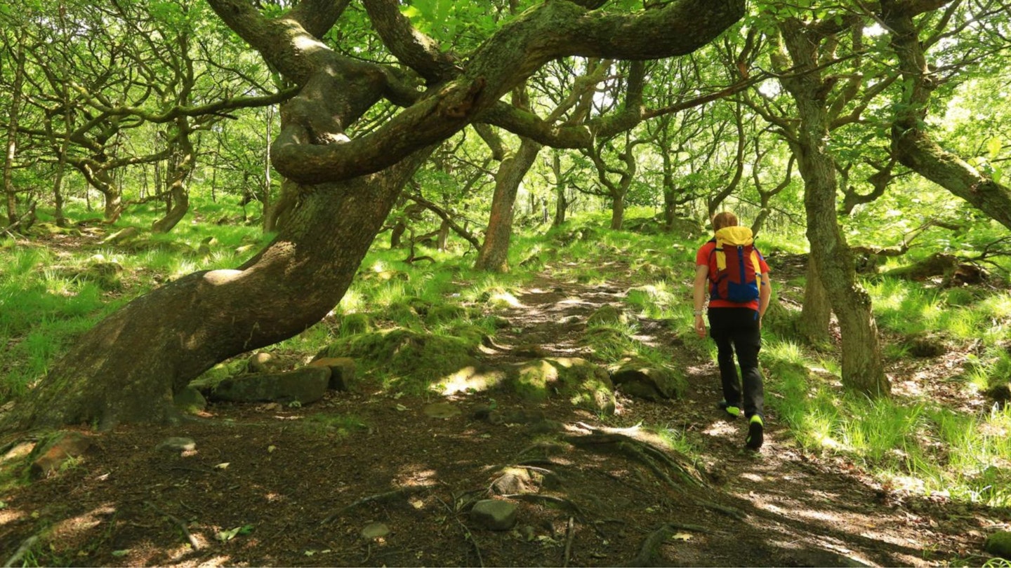
Walk straight ahead along Shepley Street to the Queens Arms Inn. If staying in Glossop or returning to Hadfield by train, go left down Manor Park Road to the junction with the A57 and turn right to the centre of Glossop and the train station. If walking back to Hadfield go right then right again at the junction into Well Gate. Take the first left then continue north east along the road until you enter woodland along a footpath. On emerging from the wood follow the path north to Swineshaw Reservoir and at the dam turn west, eventually crossing the B6105. Follow the path west to Little Padfield Farm. Walk south-west down the farm lane and take the footpath first right across fields to emerge from between houses on to a minor road. Go left then take the footpath first right along a walled lane. Just before the walls finish, take the footpath left across the field on to the Longdendale Trail. Go left to the end of the trail and Hadfield station.
What walking gear do I need for this route?
Here's a selection of the best walking gear selected by LFTO's testing team: Walking boots | Hiking daypack | Waterproof jacket | Walking trousers | Walking poles | Walking mid-layers | Base layers
Where can I eat and drink?
There are plenty of pubs and cafés near the start of the route, and we recommend the The Queens Arms in Old Glossop.
Where's the best place to stay?
Even better, you can stay at the The Queens Arms too. Not quite as characterful, but the Travelodge in Glossop has plenty of rooms.
About the author
Paul Belsey is the author of multiple guidebooks and has been walking in the Peak District National Park his entire life. Paul's a longtime contributor to Trail magazine and LFTO, and is one of our Peak District gurus.
This route originally appeared in the November 2019 issue of Trail magazine. CLICK HERE to become a Trail magazine subscriber and get 50% off a whole year of digital OS Maps