
This is a very fine hiking route indeed up a wonderfully sculpted mountain ridge, and hitting Wales’ highest peak Snowdon (Yr Wyddfa) is the cherry on the top.
On your way, take in the glory of finding a quiet way onto the majestic peaks of Y Lliwedd and work hard to gain height towards Snowdon’s summit on the steep, upper section of the Watkin Path.
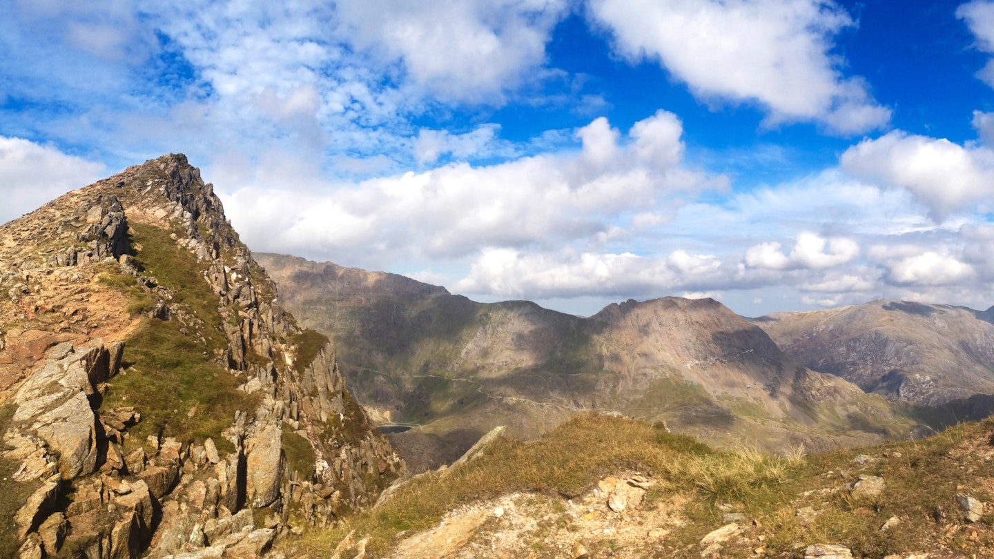
Regardless of your relationship with the summit cairn on Snowdon, it’s a breathtaking vista on a clear day – to the Glyderau in the north, Moel Hebog and the Nantlle range to the south-west and the Moelwynion to the south-east.
And whisk yourself away along the mountain’s attractive Bwlch Main and southern ridge, towards your final triumph, Yr Aran. This beautifully shaped peak stands guard over Snowdon’s southern hemisphere, protecting the beguiling Cwm Llan below from the worst of weather coming in from the coast.

This final peak is a fitting finale to a robust route over rocky ground and slender, enticing rocky ridges. It's a great route for a dry, calm, long summer’s day.
And why not try an ‘alpine start’ to get ahead of others heading to Snowdon’s summit from other directions? Enjoy the challenge!
How hard is climbing Snowdon from the south?
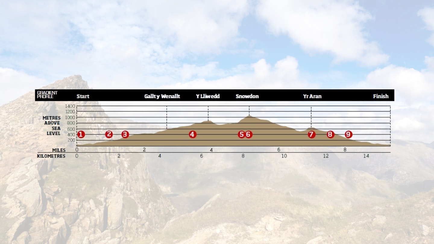
DIFFICULTY: Medium | DISTANCE: 15km (9¼ miles) | TIME: 7-8 hours | TOTAL ASCENT: 1312m
FITNESS: This is a big hike up the highest mountain in Wales, taking in two ridges and a lot of ascent and descent. You'll need good fitness and experience of hillwalking to handle the physical challenges.
TERRAIN: Engineered paths; steep, grassy uplands; mixed boulders; narrow ridges; steep slopes on occasion.
NAVIGATION: As with many mountain walks, navigation is simple enough when visibility is good. But if the cloud comes down, as it often does in Snowdonia, you'll need a map and compass and the skills to use them.
Where is the start of the walk?
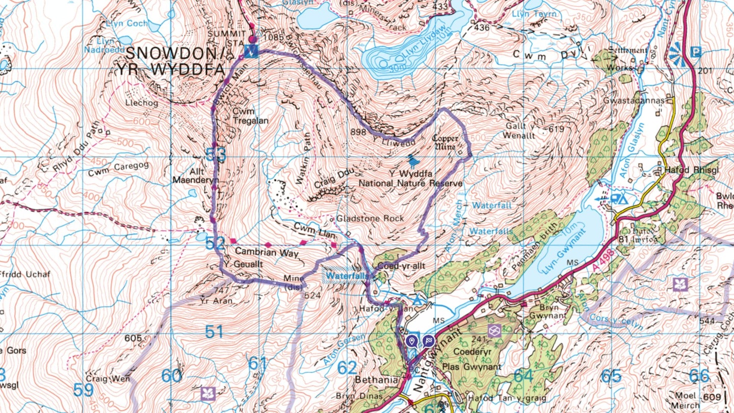
The nearest town is Beddgelert. Start and finish at Eryri National Park Authority car park at Bethania.
What's the best map for Southern Snowdon?
-
CLICK HERE to view and download our digital route guide in OS Maps
Snowdon South Ridge | Step-by-step route guide
-
At this point you’ll be standing at the start of what’s signposted as the start of Snowdon’s Watkin Path – having parked in the SNPA car park. Start easily through native woodland, on a good track which ascends gradually towards the dramatic waterfalls spilling out from Cwm Llan.
-
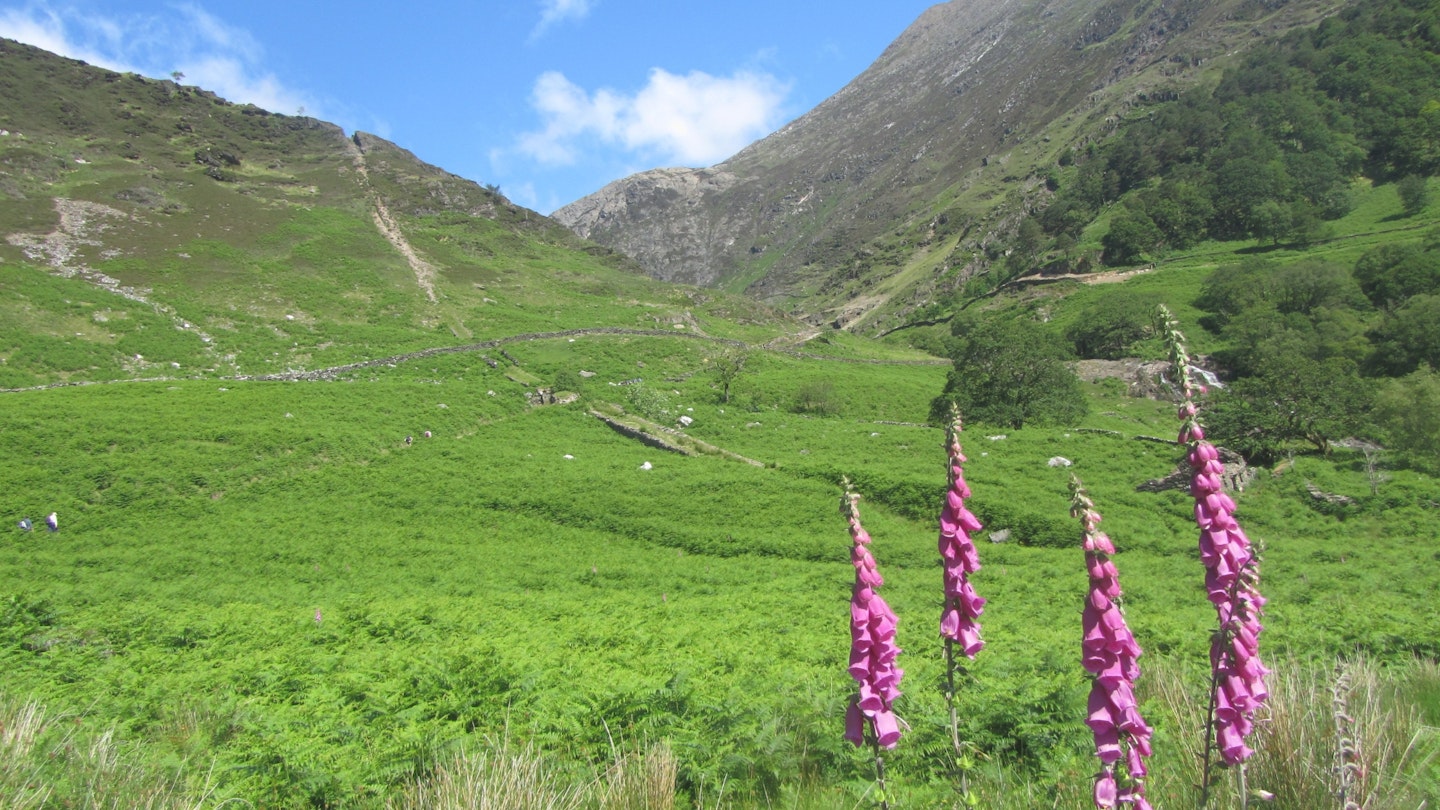
At a gate marked ‘Access Land’, take a faint path descending towards the river below you and cross a flat, slate bridge. On the other side there are plenty of picnic spots. You may see people taking a dip here on a hot day, even though the water’s always cold. With a boundary wall on your left, climb away from the river towards a stile taking you into woodland. Now you’re gaining height towards Cwm Merch on a fairly clear path.
-
Use a gate through a stone wall here, and continue along a rough path to the remains of an old quarry at the head of the cwm. Once there, cross a stream and gain an old stone wall rising away from it. You are now on open, grassy slopes where you can easily pick a steady route north-east towards the skyline above you.
-
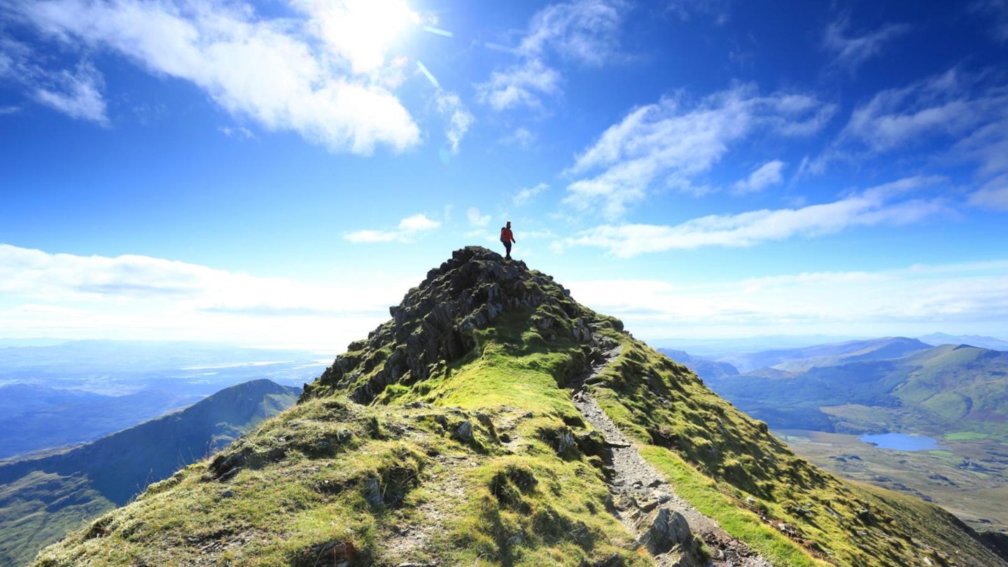
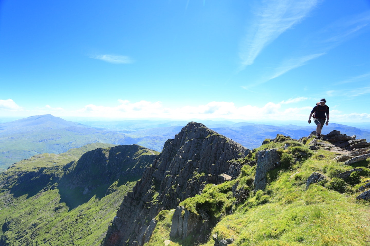
Lliwedd Bach (Small Lliwedd) is a fitting title for this fin-shaped rocky outcrop. A wonderful view into Snowdon’s cwms is attained from this start of the fun, scrambling over Y Lliwedd’s east and west peaks. Always take note of the steep drops to your right on Y Lliwedd’s ridgeline, and you’ll always be able to hunt out route options slightly away from the crest of the ridge if needed. See the mighty Snowdon rising from Bwlch y Saethau at what looks like an impossible angle.
-
After a rocky descent and crossing a good path across the wide bwlch to Snowdon, you’ll have to gain further height towards Snowdon’s summit. Route-find carefully, keeping to a scree path away from rocky bluffs and the precipitous edge of Snowdon’s very steep eastern ridge. On reaching the ridge above, turn north-east to Snowdon’s summit area – it will be obvious when you reach Hafod Eryri, the Visitor Centre building.
-
From Snowdon summit, your descent route heads south-west, back to the point your ascent route met the ridge (signposted towards the Watkin Path). Continue onwards and descend along Bwlch Main, Snowdon’s southern ridge. There are a couple of rocky steps, but this is a wonderful descent route. Reach Bwlch Cwm Llan and pick up an old stone wall that hugs Yr Aran’s rocky northern ridgeline – a couple of rocky steps to negotiate will take the mind off the ascent in the legs!
-
Reach a small flattening after a stony ascent, then use a good path to the south-west up towards Yr Aran’s summit – and enjoy the views! Return to grid reference SH607516 and use a prominent stone wall to 'handrail' in descent, in an east-south-east direction. A path follows the wall.
-
Keep a lookout here for where the path drops off the ridge, down a stony chute onto steep grass below the ridge. All the while there is a faint track to follow, where passage of feet have found a weak line in the ridge. Descend carefully, roughly north east, finding traces of path here and there as you negotiate past an old copper mine, towards an old tramway (now path). From here, you’ll see the lower section of the Watkin Path below you.
-
Now you’re back on the Watkin Path, above the waterfalls and river you crossed at the start of the day. Retrace your steps back to Bethania.
What walking gear do I need for this route?
Here's a selection of the best walking gear selected by LFTO's testing team: Walking boots | Hiking daypack | Waterproof jacket | Walking trousers | Walking poles | Walking mid-layers | Base layers
Where can I eat and drink?
Caffi Gwynant, Bethania, www.cafesnowdon.co.uk
Where's the best place to stay?
Red Dragon Holidays, Nantgwynant, www.reddragonholidays.co.uk
About the author
If you find a route written by Kate Worthington in Trail magazine or on Live for the Outdoors, you can be sure it's a cracker. Kate lives and works in the mountains of north Wales, where she's a director of RAW Adventures, plus a qualified Mountain Leader, Winter Mountain Leader and Fell/Trail Leader in Running Fitness. Kate has been hiking, climbing, scrambling and running in the mountains her whole life, and is a master at creating inventive route guides that take her all over Britain in search of adventure.
This route originally appeared in the June 2017 issue of Trail magazine. CLICK HERE to become a Trail magazine subscriber and get 50% off a whole year of digital OS Maps