
Malham Cove and Gordale Scar link up with the stunning waterfall of Janet's Foss to create the most spectacular circular walk in the Yorkshire Dales. It can be a busy route in peak season but it's popular for a reason. Here's our guide to walking it.
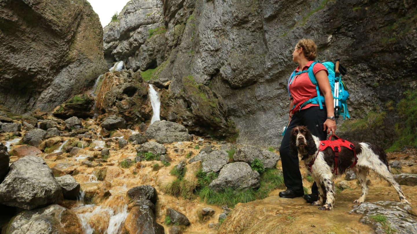
You won’t find Gordale Scar in most scrambling guides but, while brief, the few metres of exposed, hands-on ascent is exhilarating enough to make it well worth the effort.
It's a perfect introduction to the joys of steeper ground (click here for some scrambling tips), the holds are good – if a little polished in places – and the setting, surrounded by the towering Gordale crags, is truly spectacular. After heavy rainfall you may be in for a soaking, so consider an alternative route.
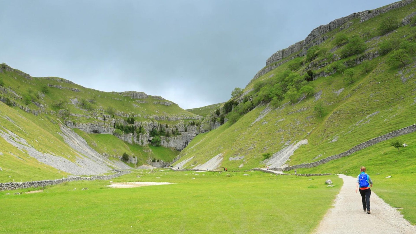
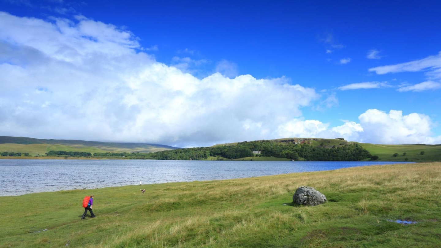
This walk tackles the Scar early on, and from here there’s a good climb up onto the higher fells to reach the shores of Malham Tarn. At 380m, this peaceful tarn is said to be the highest limestone lake in Britain. Rich in wildlife, from aquatic plants to water birds, it’s also a good place to spot otters and bats in the crepuscular hours.
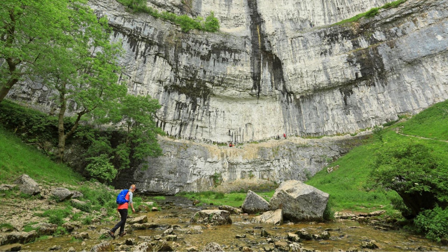
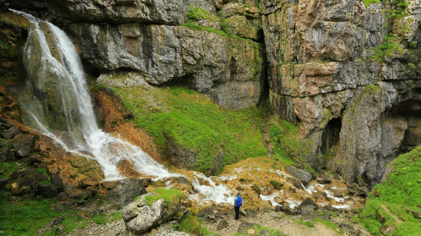
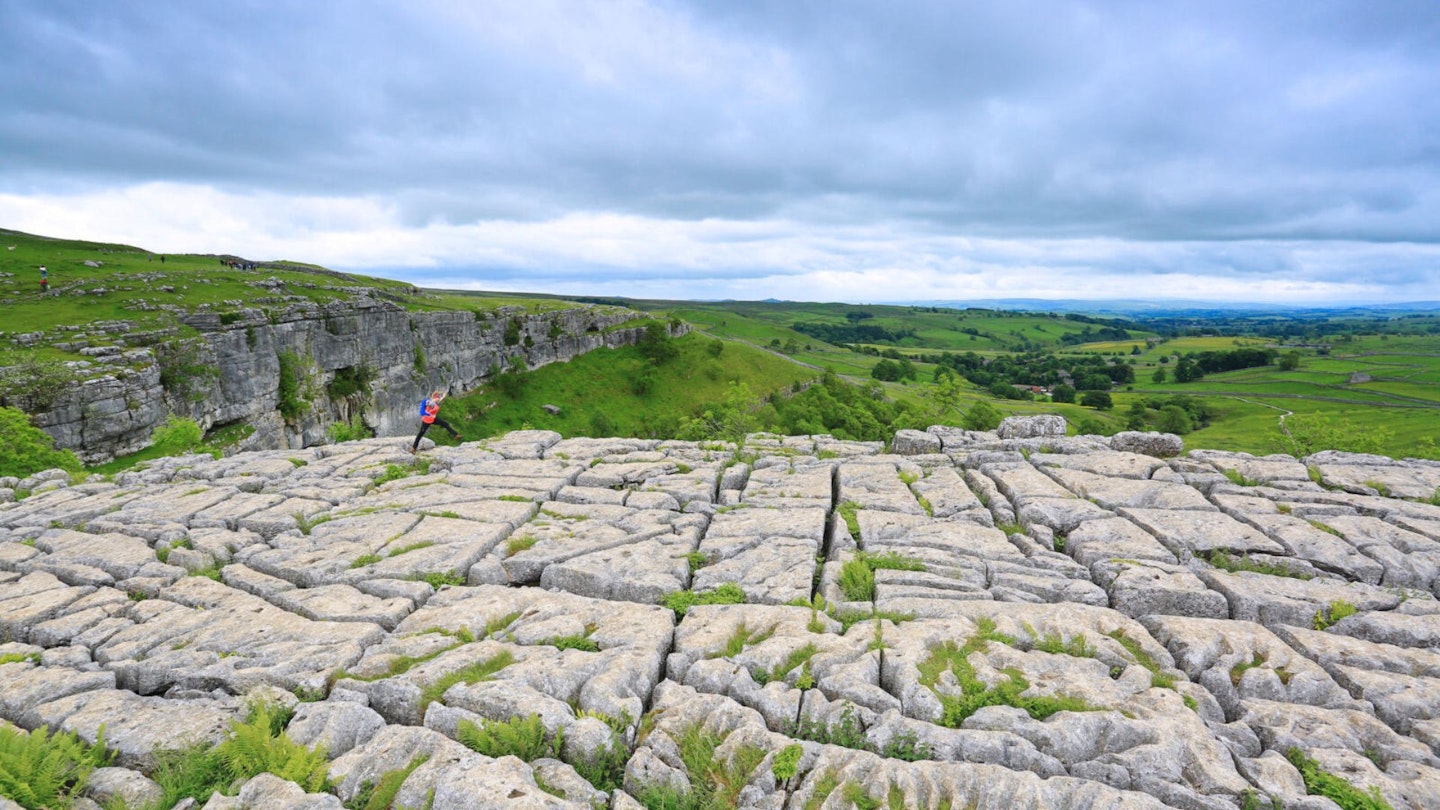
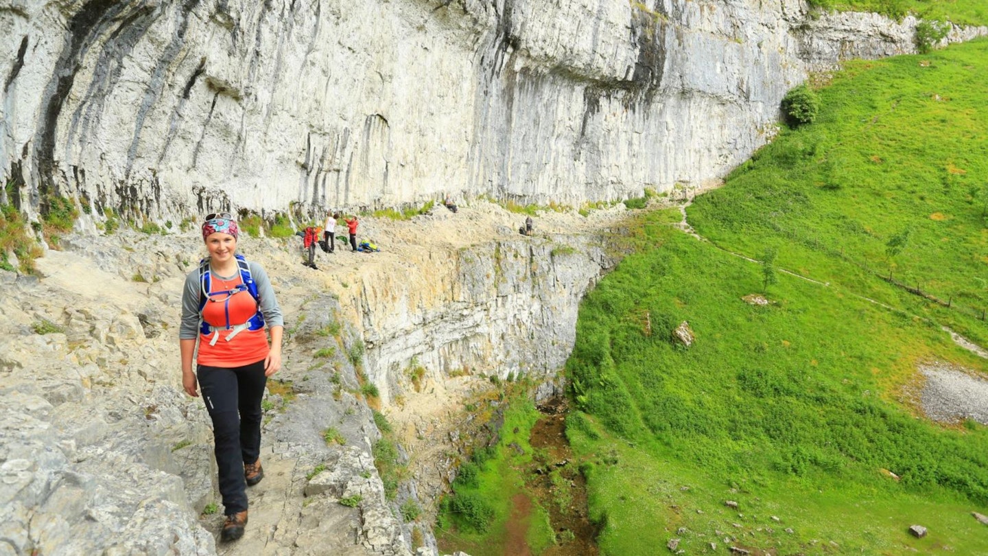
From the tarn it’s mostly downhill, following the Pennine Way on its winding course through Malham’s classic dry valleys and crossing the extraordinary limestone pavement before dropping into Malham Cove to gaze up at the vast amphitheatre, home to many improbable sport climbing routes.
The final mile is a gentle jaunt down into Malham village, straight into the welcoming embrace of the Lister Arms.
CLICK HERE to download our digital route guide for Malham Cove and Gordale Scar in OS Maps
How hard is walking Malham Cove and Gordale Scar?
If you're a regular walker this walk should hold no serious challenge for you in terms of fitness, but you do need to be comfortable with heights for the very short section of rocky scrambling up Gordale Scar. Apart from that, and two steep descents, the rest is fairly level.
The route follows mainly good paths with straightforward navigation, which can get a little boggy near Malham Tarn. There are also rockier sections up Gordale Scar and down the dry valley above Malham Cove.
How long does the route take?
The whole walk past Janet's Foss, up Gordale Scar to Malham Tarn, and back via Malham Cove covers 11.6km and around 320m metres of ascent. We estimate it takes around 4 hours, depending on how energy you're feeling and how much time you want to spend stopping at all the beauty spots.
Where do I start the walk?
Start at the Yorkshire Dales National Park car park in Malham, postcode BD23 4DA. You can get there on public transport by catching a train to Skipton or Gargrave, then bus 210/211 from Monday to Friday or seasonal bus 75 on Saturdays and Sundays.
What map do I need?
This route is covered by OS Explorer OL 2 and OS Landranger 98. You can order both printed maps from the Ordnance Survey's map shop or download our digital route guide HERE.
Malham Cove and Gordale Scar walk | Step-by-step route guide
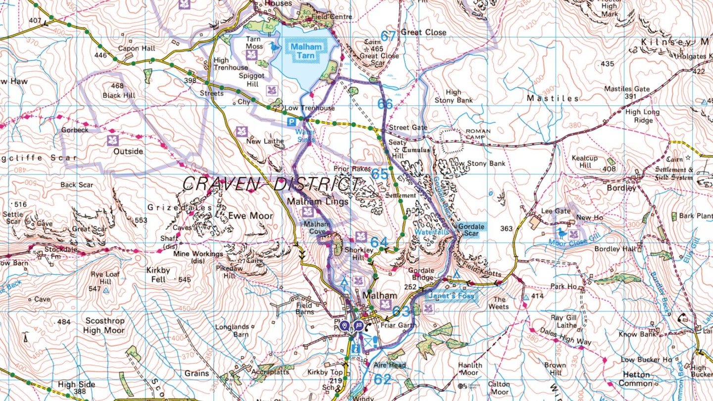
Section 1
Turn left out of the car park, walking past the visitor centre and turning left onto Chapel Gate road. Follow the road for a short distance until you can turn right and cross the footbridge over Malham Beck. Turn right onto the surfaced Pennine Way and follow this downstream to a path junction.
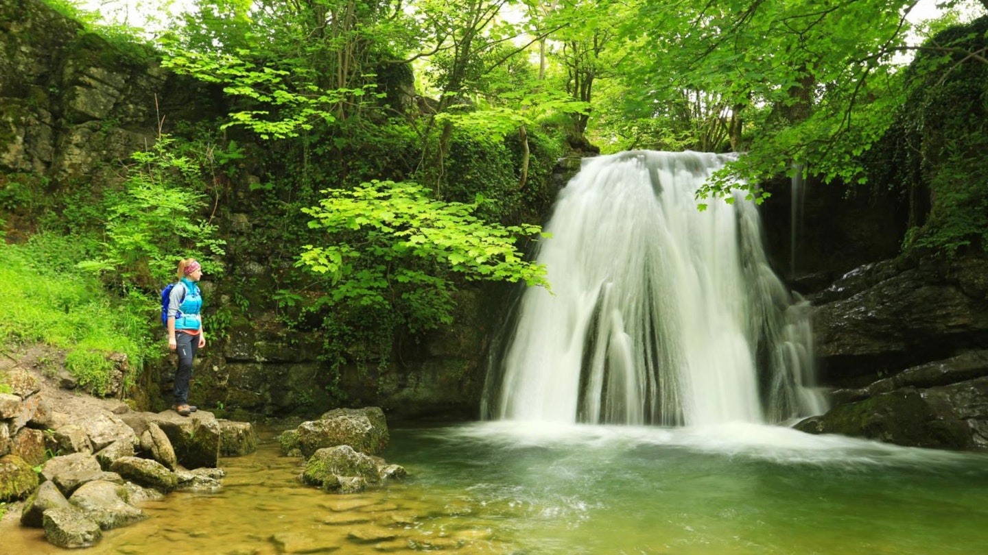
Turn left here, leaving the Pennine Way and following signs to Janet’s Foss. Continue along the footpath until you reach Janet’s Foss, a pretty woodland waterfall that flows into a wide, clear pool, then carry on up Gordale Beck to reach Gordale Lane. Turn right and follow the lane downhill and across the beck to a left turn onto a footpath through Gordale Scar campsite.
Section 2
Follow the trail through the campsite and into the impressive, steep-sided ravine of Gordale Scar. The path gets rockier as you ascend and then bends to the right when the waterfall and scramble comes into view. Choose your line up either side of the waterfall, following the best holds for the 5-or-so metres to the top.
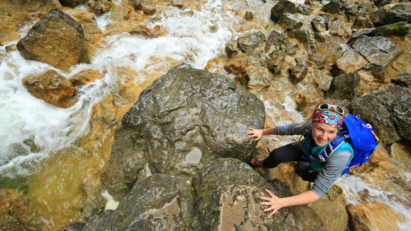
Some of the holds have been polished by many ascents so take care, particularly if it’s wet. From the top, continue up the gorge and climb the steep steps on the left, emerging to the west above Gordale Beck. Follow the path north-west between areas of limestone pavement until you reach a wall with a stone stile through to Malham Rakes road.
Section 3
Turn right, following the road for a short distance before branching right onto a track heading north along a wall. Carry on until you reach the junction at Street Gate (grid reference SD904656), then continue on the same bridleway, staying on the left of the wall. Follow this to the next path junction near Great Close Plantation.
Section 4
Turn left and follow the path west towards Malham Tarn. Turn right at a track junction beside Lings Plantation and then sharp left onto the Pennine Way heading south-west across moorland. Stay left at the next junction, taking the obvious path across the moor to reach Watersinks car park and the road.
Section 5
Turn right onto the road and cross Malham Beck then turn left, re-joining the Pennine Way and heading south down the dry valleys towards Malham Cove. Where the path splits, stay on the Pennine Way, bearing left over a stile and down some steps into Watlowes and emerging at the limestone pavement above Malham Cove.
Section 6
Stay right, on the Pennine Way, crossing the limestone pavement until you can turn left down the steep, stepped path to Malham Beck. Take some time to explore the cove, then follow the obvious path alongside the beck to reach Cove Road above Malham Village.
Section 7
Turn left onto Cove Road and follow it south through Malham to the junction by the road bridge. Turn left across the bridge to finish the walk at the Lister Arms or continue south onto Chapel Gate, joining your outbound route and following it around to the right and back to the visitor centre and start.
What walking gear do I need for this route?
Here's a selection of the best walking gear selected by LFTO's testing team: Walking boots | Hiking daypack | Waterproof jacket | Walking trousers | Walking poles | Walking mid-layers | Base layers
Where's the best place to stay in Malham?
We recommend staying over at the Lister Arms or dog-friendly Beck Hall, or going self-catering at the National Trust’s remote Darnbrook House or camp at Gordale Scar campsite. Expedia and Booking.com are good places to look for deals.
About the authors
Jen and Sim Benson are experienced hillwalkers, trail runners and guidebook writers. They're passionate about exploring wild places with their young family and have been writing route guides and gear reviews for LFTO for many years. Find out more about their adventures and their work at: jenandsimbenson.co.uk
This route originally appeared in the April 2020 issue of Trail magazine. CLICK HERE to become a Trail magazine subscriber and get 50% off a whole year of digital OS Maps