
One of the most stunning features of the Eden Valley in Cumbria is the U-shaped glaciated valley known as High Cup Nick. Our step-by-step walking route shows you how to explore one of Britain's best hikes.
Often referred to as 'England's Grand Canyon', High Cup Nick is an awe-inspiring example of 500 million years of natural formation. The views from the top are breathtaking, with the valley stretching out beneath you and the Lake District mountains rising in the distance.
Exploring this iconic North Pennines landscape is a truly magical experience, and one that must be seen to be believed. The walk itself is a moderate climb and takes around 4 hours to complete, with plenty of time to stop and take in the views.
The most popular route starts from the pretty village of Dufton and traverses around the basin, past the grey-blue dolerite crags, before reaching the top of the valley. Once there, you can take in the spectacular scenery of the surrounding countryside, with rolling hills, lush green fields, and distant mountains on the horizon. Make sure you have your camera fully charged!
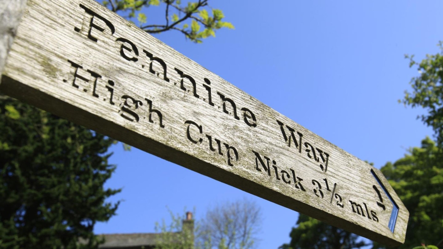
CLICK HERE to download our High Cup Nick digital route guide in OS Maps
How hard is the High Cup Nick walk?
Although the scenery is dramatic, the walk itself is a piece of cake. You need a decent level of fitness but neither the distance or the terrain will stretch you too far, and you won't cross any technical terrain unless you actively go looking for it.
How long does the walk take?
The route described below is an out-and-back to the head of High Cup Nick, initially following a clear bridleway that is well-used and easy to follow, followed by a grassy climb and a few slightly rockier sections before you reach the top. But really, there's nothing to trouble you.
This route covers 12.3km (7.5 miles) and around 460 metres of ascent. We estimate experienced hikers should be able to complete the route described below in around 3.5 to 4 hours, but that depends on weather conditions, your own fitness, and the pace you like to walk.
There's also the option to extend the route by walking the whole way around High Cup Nick, as described in this extended walk. Or by taking the exciting option of clambering down into the valley on the chunky boulders that flow towards High Cup Gill. Both of these options add time and distance to the route, but are well worth it if you have the time.
Where does the High Cup Nick walk start from?
The route starts from grid reference NY689250 in the Cumbria village of Dufton, three miles north of the town of Appleby-in-Westmorland. There's a small car park in the centre Dufton, plus plenty of free parking around the green or outside the church. The closest train station is in Appleby – check thetrainline.com for times and prices.
What's the best map for High Cup Nick?
This route is covered by OS Explorer OL19 (1:25,000), plus OS Landranger 91 (1:50,000). You can order printed maps from the Ordnance Survey's map shop or download our digital route guide HERE.
High Cup Nick | Step-by-step route guide
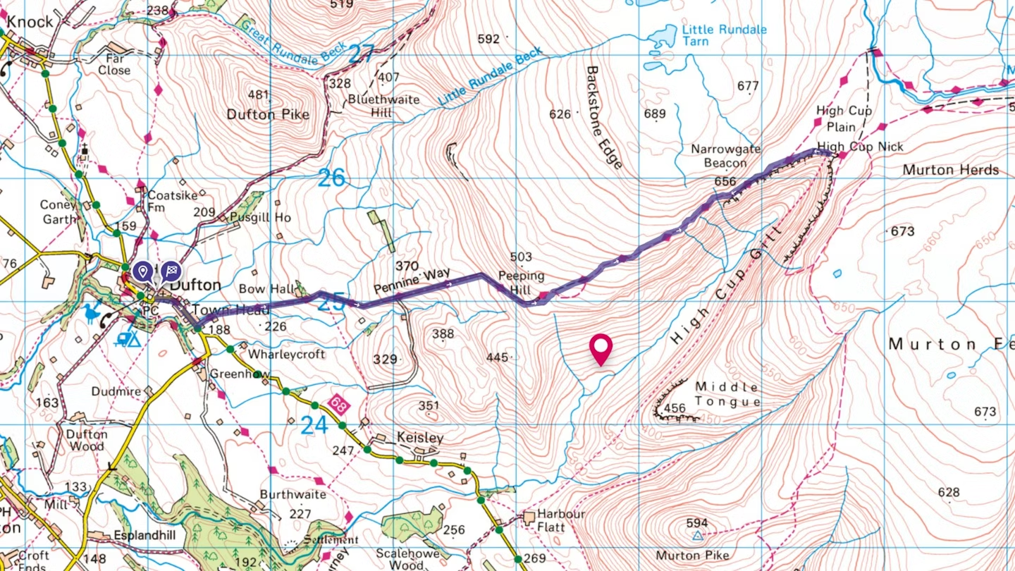
Section 1
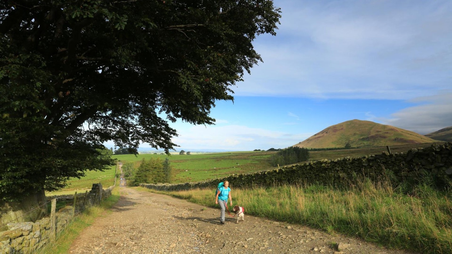
Set off through the village of Dufton in the direction of Appleby. Follow the road round a sharp left, then a sharp right and out of the village towards Billysbeck Bridge at Town Head. On crossing the small bridge, take the minor lane that heads towards the grandly named Bow Hall. Keep following the road.
The views that are awaiting you are beautiful, in every direction. You also get a wonderful view of Dufton Pike, a distinctive landmark of Cumbria, standing proudly at 481m above sea-level.
Section 2
Here you start the gentle climb, following the lane as it turns into a track. As you ascend, it’s worth taking time to look back. You get some amazing views across the Eden Valley with the Lake District mountains as the backdrop. It's a sight that's been enjoyed by locals and visitors to the area for centuries.
Section 3
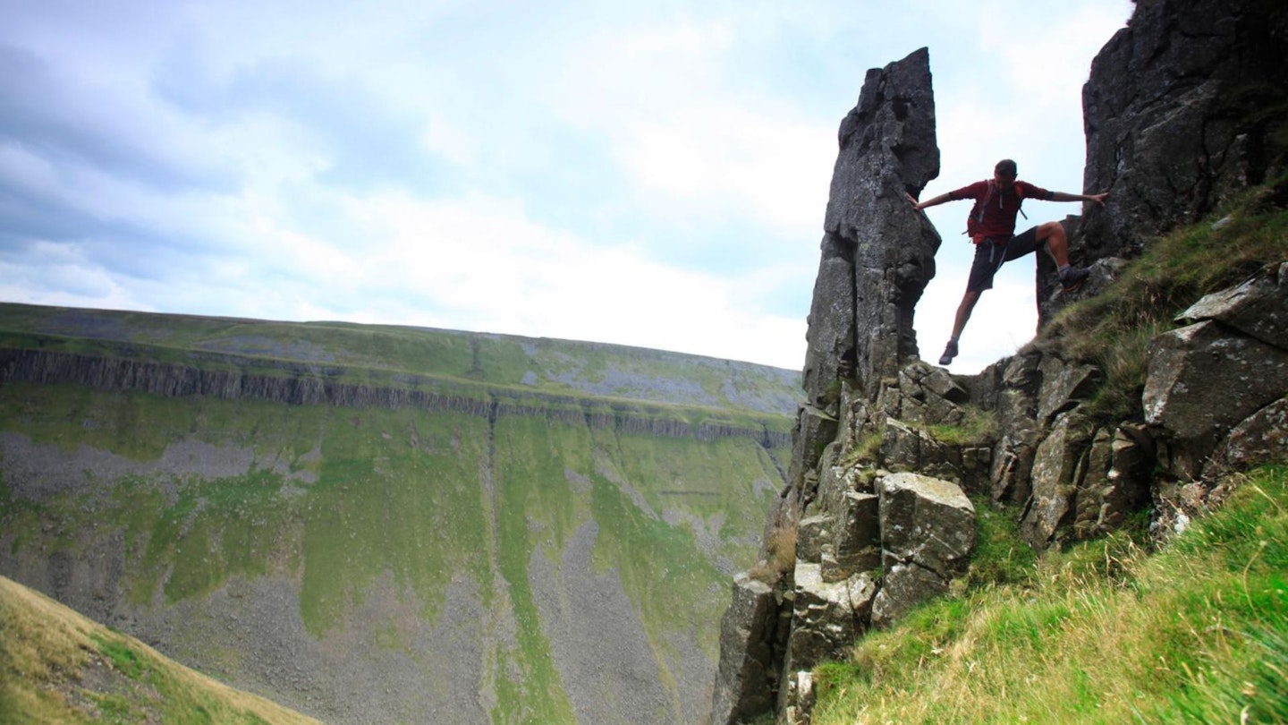
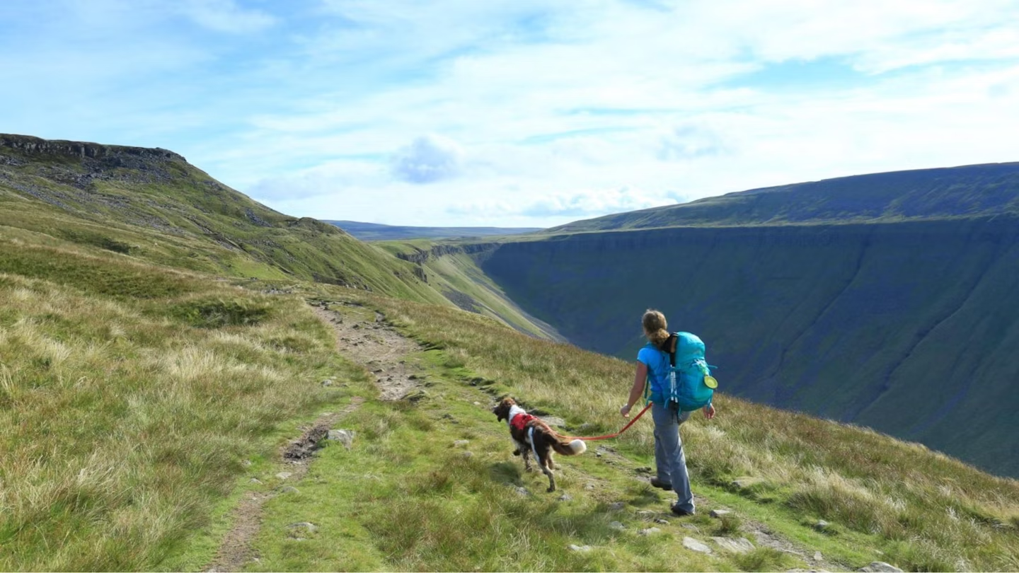
So far the bridleway is well-trodden and clearly defined but the terrain is rocky, so pick your route carefully. If using an all-terrain wheelchair or a puschair, be prepared for a bumpy ride! To the left is Dod Hill.
There is a steep grassy climb to conquer before the track levels out just after Peeping Hill. The cairn is a good spot to catch your breath and take in the first sights of High Cup Nick. There are great views too of Dufton Pike and Murton Pike.
Section 4
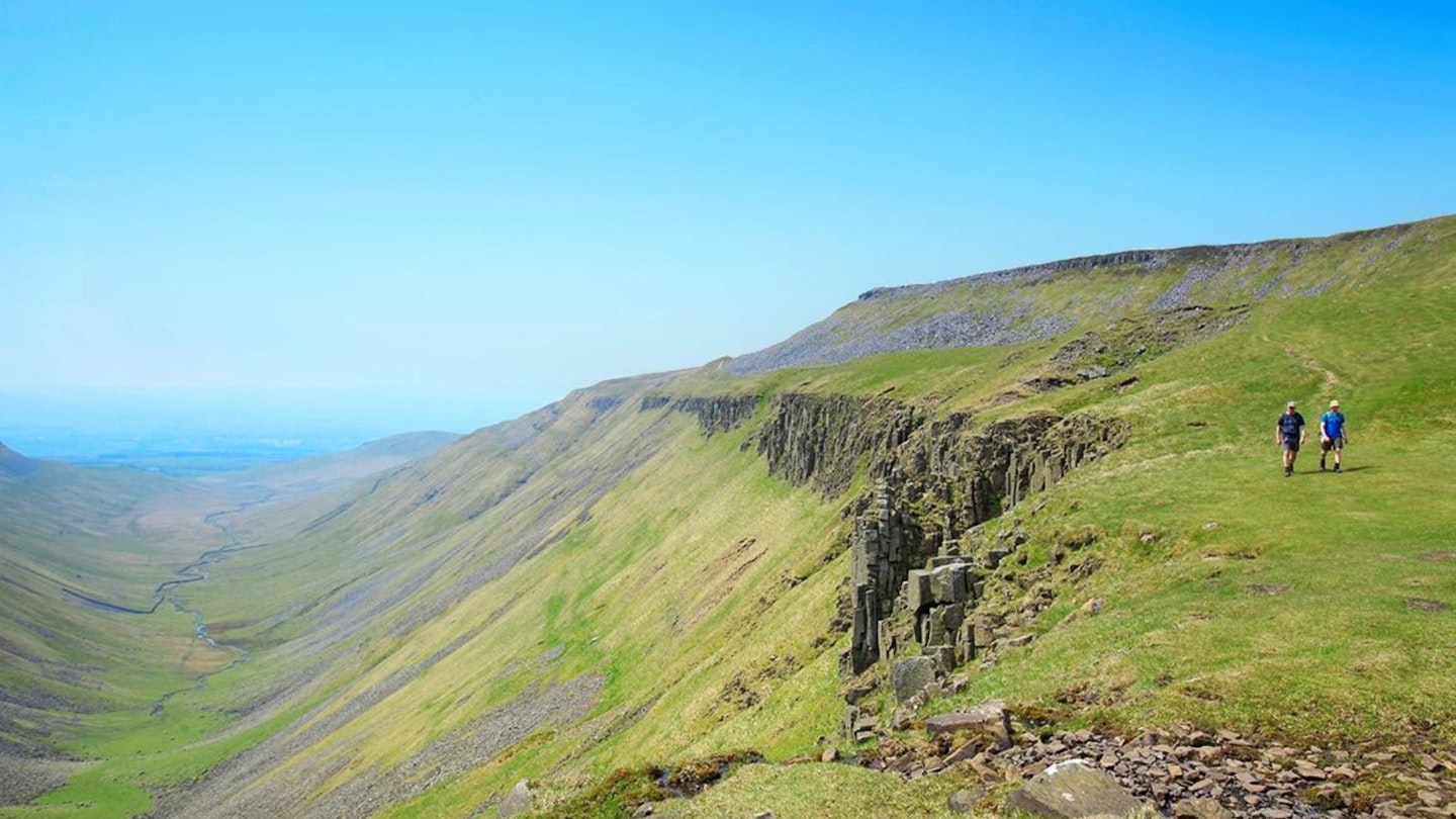
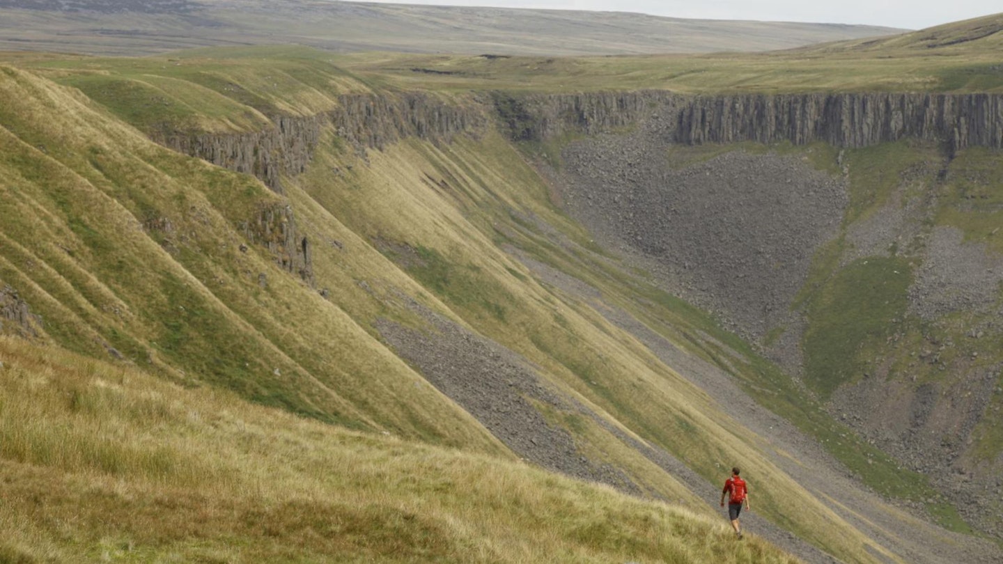
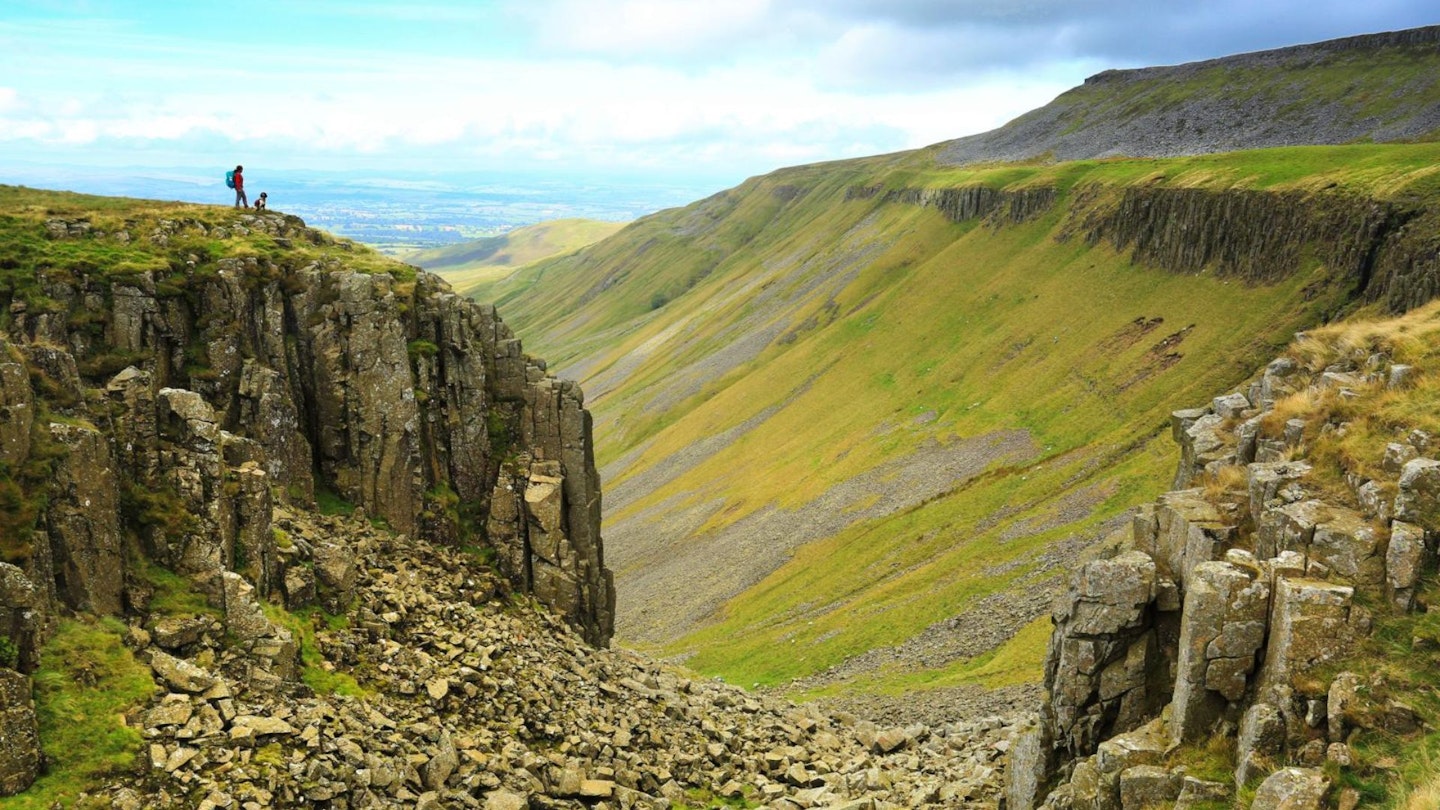
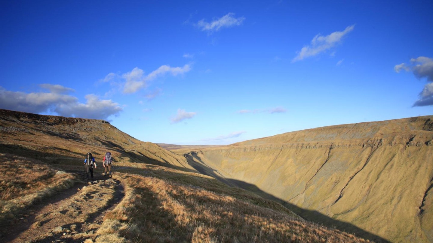
This path is known (and labeled on OS Explorer maps) as Narrow Gate Path. The path is indeed narrow and there are a few large boulders to climb over, but the hard climb is over and the ascent to the head of High Cup Nick is gentle. The path skirts around the rim of the scar before reaching the head of the valley.
Section 5
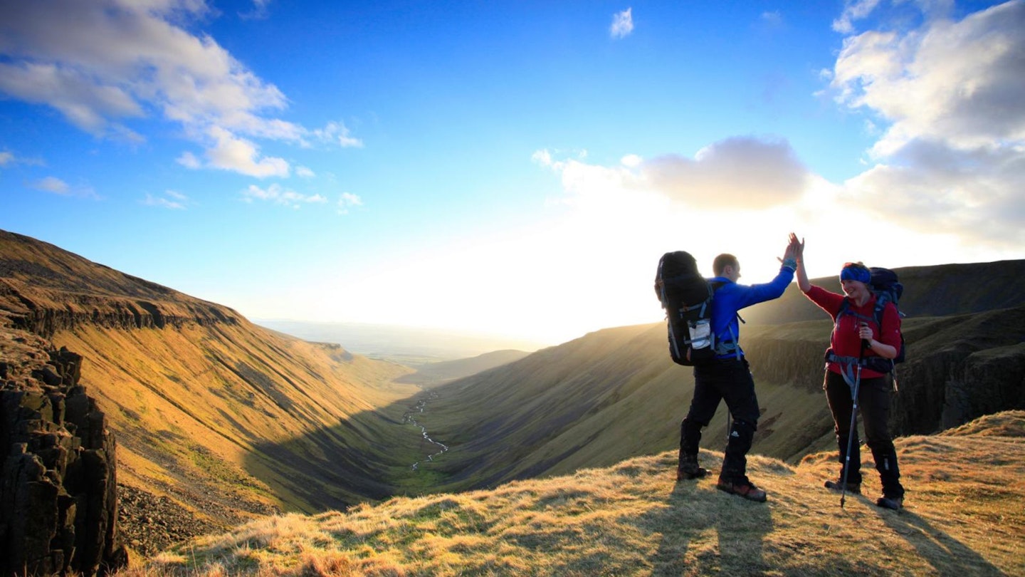
Standing at the top of the valley is an experience like no other. From this vantage point, you can look down the centre of the valley and out into the stunning landscape beyond. The view is framed perfectly by the crags and the valley sides, creating an unforgettable sight.
Guidebook writer and famous fell walker Alfred Wainwright describes High Cup as “a great moment on the journey” in his book Pennine Way Companion. Unless you're up for the full valley loop or the scramble down into High Cup Gill, this is your turnaround spot. Follow the track you used in ascent back down into Dufton.
What walking gear do I need for this route?
Here's a selection of the best walking gear selected by LFTO's testing team: Walking boots | Hiking shoes | Hiking daypack | Waterproof jacket | Walking trousers | Walking poles | Walking mid-layers | Base layers
Where's the best place to stay near High Cup Nick?
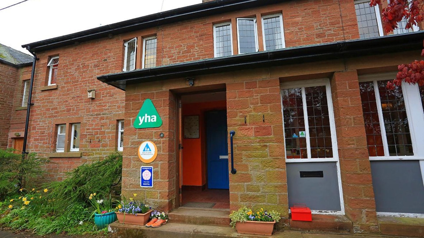
If you want to base yourself right near the start of the walk then Dufton YHA is a good option, and the nearest wheelchair-accessible B&B is The Hollies in Appleby. Expedia and Booking.com are good places to look for good accommodation deals near Dufton.
About the author
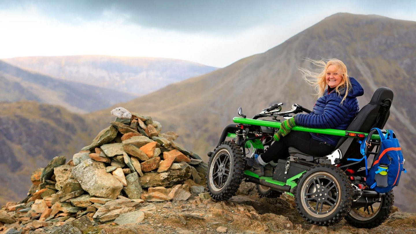
Debbie North is an all-terrain wheelchair user and a passionate ambassador for accessibility for all in the outdoors. She's written numerous route guides and articles for Trail magazine and Live for the Outdoors, and is our go-to expert for tackling stile-free routes in Britain's hills and mountains.
This route originally appeared in the Spring 2024 issue of Trail magazine. CLICK HERE to become a Trail magazine subscriber and get 50% off a whole year of digital OS Maps