
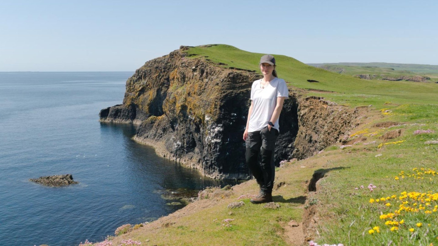
Bisected by the Highland Boundary Fault, the Isle of Arran is both Highland and Lowland. Its northern mountain range dominates coastal views from much of south-west Scotland, with Goatfell the highest and best-loved of all the island’s peaks.
While climbing this mighty Corbett is essential for any Arran hillwalker, a circular route adding North Goatfell, The Saddle and Glen Rosa involves Grade 1 scramblingand gives fine views from different perspectives.

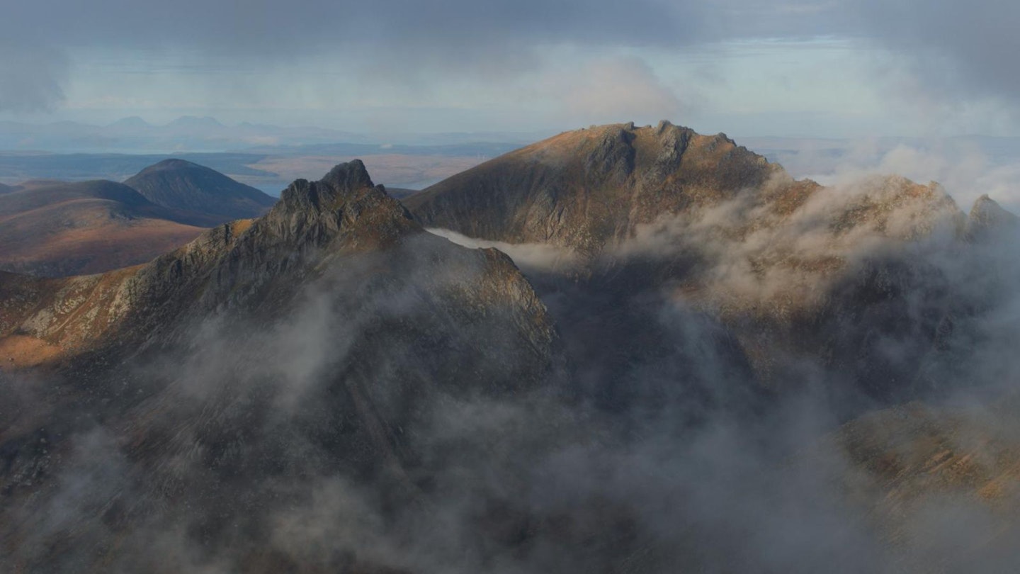
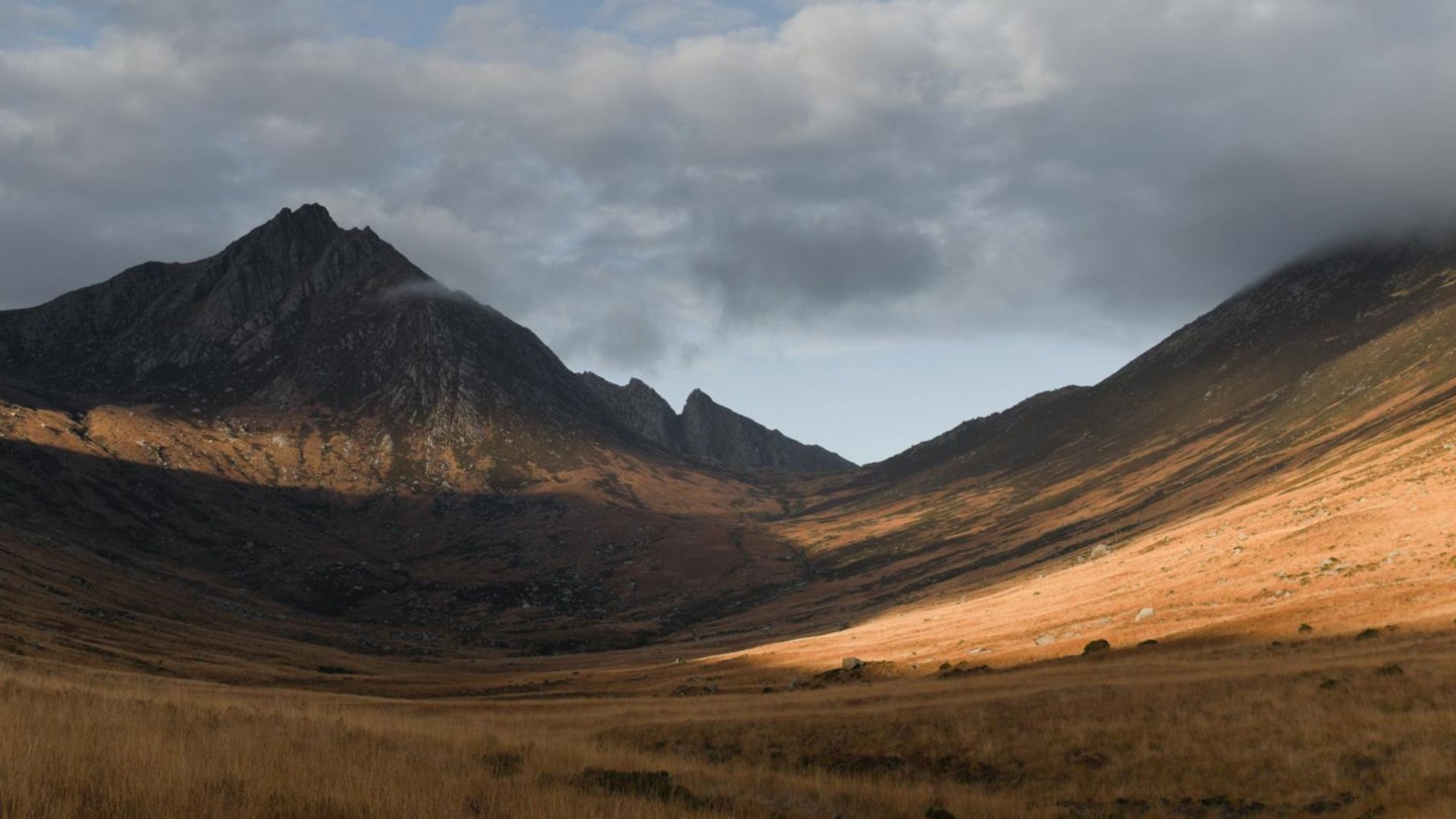
Cir Mhor’s imposing pyramid dominates the north-west, with Beinn Tarsuinn across the sweeping valley of Glen Rosa in the west; the Firth of Clyde to the east.
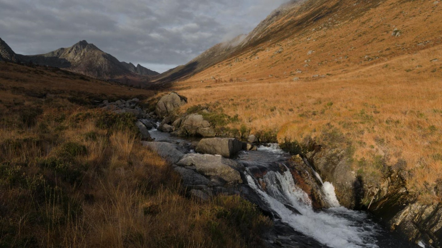
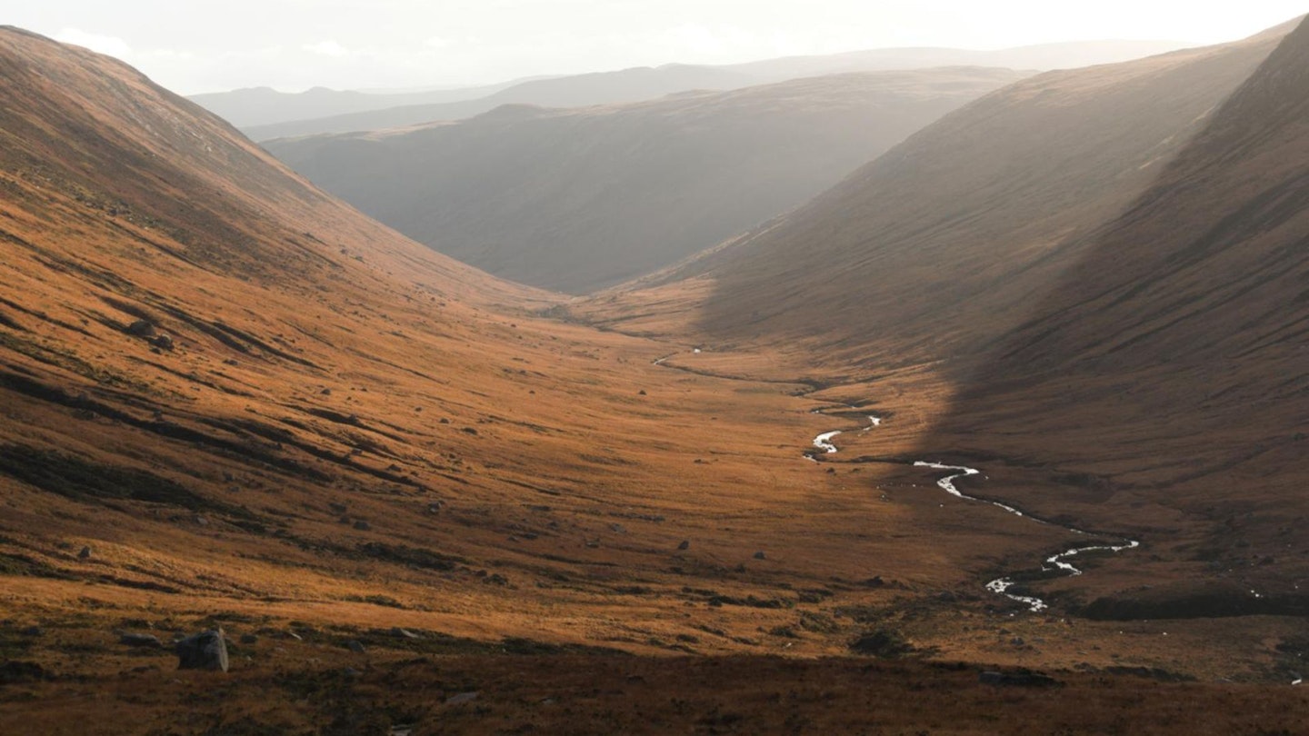
Continue along the ridge and around the rocky tors to North Goatfell, then head down to The Saddle for more scrambling, less company, and glorious views of Glens Rosa and Sannox. The gentle return along Glenrosa Water is very welcome.
The scrambling on this route is not really technical, but wet or icy conditions could prove tricky and potentially dangerous, while proper winter conditions would be a serious prospect and only viable for the experienced and prepared.
How hard is climbing Goatfell?
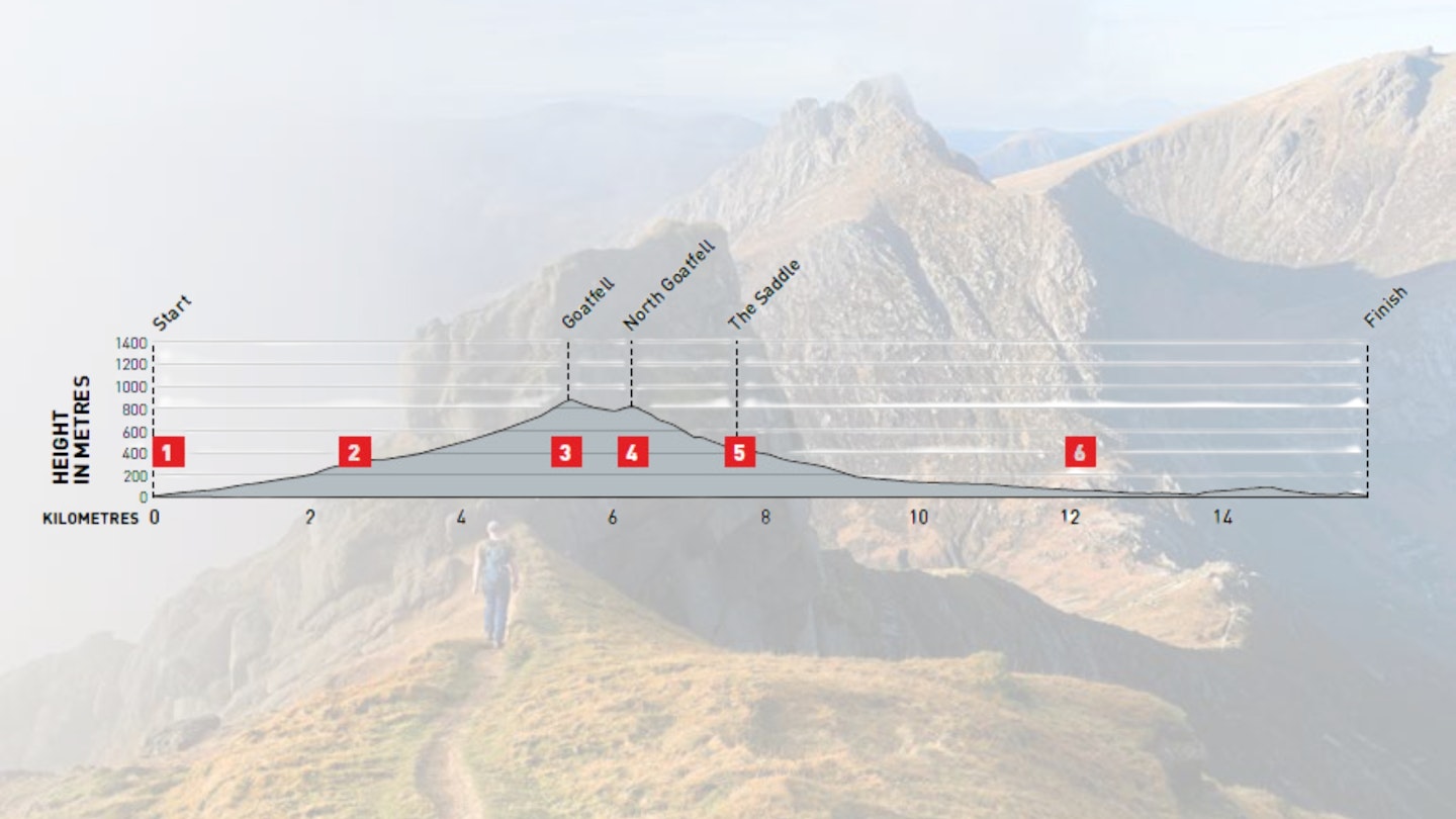
DIFFICULTY: Hard | DISTANCE: 15.9km | TIME: 7-8 Hours | TOTAL ASCENT: 939m
FITNESS: A fairly demanding route, with nearly 1000m of ascent.
TERRAIN: Forest tracks, unmarked path across moorland, and steep narrow paths with moderate scrambling around granite boulders around the peaks. A good path out through Glen Rosa.
NAVIGATION: In clear conditions, the higher reaches of the route are fairly obvious, but the route is not marked.
Where is the start of the walk?
There is a bus stop next to the car park in Cladach.
What's the best map for Goatfell and Glen Rosa?
-
CLICK HERE to view and download our digital route guide in OS Maps
-
OS Explorer 361 (1:25k)
-
OS Landranger 69 (1:50k)
-
Harvey British Mountain Map Superwalker XT25 Arran (1:25k)
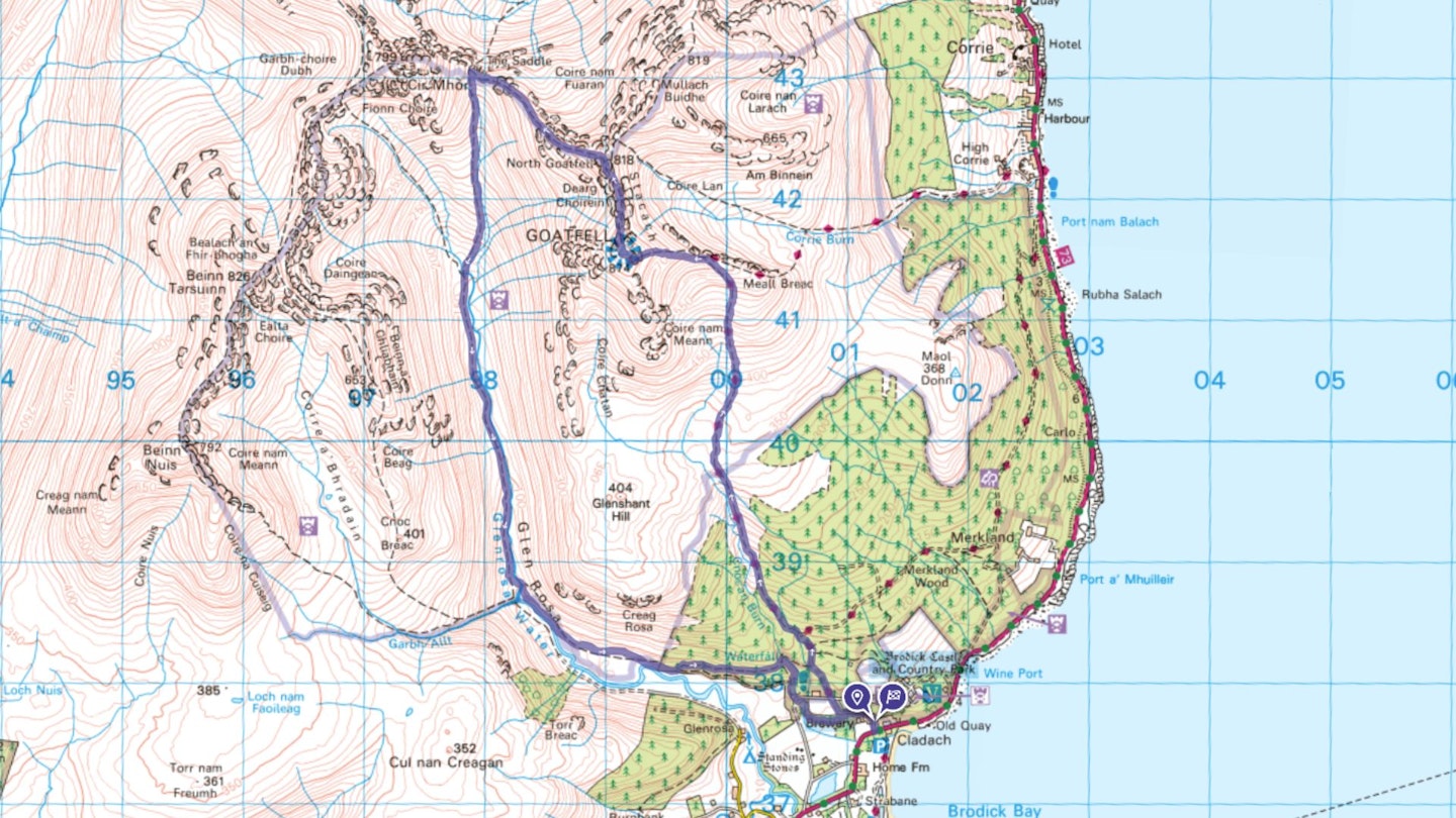
Goatfell and Glen Rosa | Step-by-step route guide
-
From the bus stop and car park in Cladach, walk north along the track, passing Cladach Sawmill on your right and the Wineport Restaurant, then Arran Brewery, also on your right. Head uphill on the obvious track through woodland, following signs for Goatfell Path. Ignore tracks to the right and left, continue straight and cross a tarmac road. Walk uphill into forest and keep straight ahead on the main path for 500m, ignoring intersecting minor paths, until the main one swings sharply right. Here, continue northwest along a rougher path, which soon emerges from the trees. Follow this path across moorland as it ascends, reaching a footbridge after 1.5km.
-
Cross the wooden bridge over a burn, then pass through a gate in a deer fence. Follow the path as the gradient eases and the terrain is scattered with boulders amongst the heather, then continue as it ascends north towards Meall Breac. Here, bear left to continue steeply uphill following the main path over and between the boulders along the ridge towards Goatfell’s summit (874m). Reaching Arran’s highest point, the views are nothing short of spectacular, particularly west and north-west to Beinn Tarsuinn, Cir Mhor and Caisteal Abhail, with the Paps of Jura visible beyond on a good day.
-
Descend north, following a path through boulders towards North Goatfell. The way narrows along Stachach ridge, where a series of granite tors and outcrops can be avoided by keeping to the path running beneath them on their eastern side; the option of scrambling over them is not particularly technical unless it is wet or icy. When you reach the grassy plateau beneath North Goatfell at 760m, follow the left path fork to climb to the rocky summit (818m).
-
From the summit of North Goatfell there is some scrambling and a little exposure as you descend the western ridge towards The Saddle. The way down first goes around and over boulders, followed by an exposed step. Continue to descend, following path sections until you reach a buttress, which you should pass around to the left on the Glen Rosa side. Follow a worn path over loose ground down to The Saddle. Head to the foot of Cir Mhor’s imposing, steep slopes, just beyond The Saddle’s lowest point, before turning left to descend south into Glen Rosa on a good path.
-
Staying to the right of a burn, which eventually feeds into Glenrosa Water, follow the increasingly well established path through Glen Rosa. The river grows as it’s joined by burns flowing down from the mountains – continue beside it for 4.5km until there is a footbridge on your left just before the Garbh Allt and Glenrosa Water merge.
-
Cross the bridge and climb along the narrow footpath contouring around the southern foot of Glenshant Hill, then below Creag Rosa with Glenrosa Water now down on your right. Follow the path to a gate at a forest boundary; go through this and continue along an indistinct path along the forest’s southern edge. Reaching a drystone wall, bear left, then go through a gap and continue east, following the obvious grassy track as it climbs near the forest boundary. After 950m, turn right at the first junction and descend along a well-made trail beside nocan Burn. When you reach a road at a stone bridge, cross over and continue down the path to a wooden footbridge – cross this and follow a track through woodland. At the next junction, turn right onto the track from the approach, which passes Arran Brewery and returns to the start.
What walking gear do I need for this route?
Here's a selection of the best walking gear selected by LFTO's testing team: Walking boots | Hiking daypack | Waterproof jacket | Walking trousers | Walking poles | Walking mid-layers | Base layers
Where can I eat and drink?
The Wineport could not be any more conveniently located, and pop into Arran Brewery to buy local beer.
Where's the best place to stay?
Basic camping at Glen Rosa Campsite. For self-catering, check out cottagesonarran.co.uk
About the author
Katie Featherstone is an experienced outdoor writer and guidebook author based on the Hebridean island of Islay in Scotland. She's a regular contributor to Trail magazine and has written for the Guardian and Independent, among many other publications.
This route originally appeared in the November 2024 issue of Trail magazine. CLICK HERE to become a Trail magazine subscriber and get 50% off a whole year of digital OS Maps