
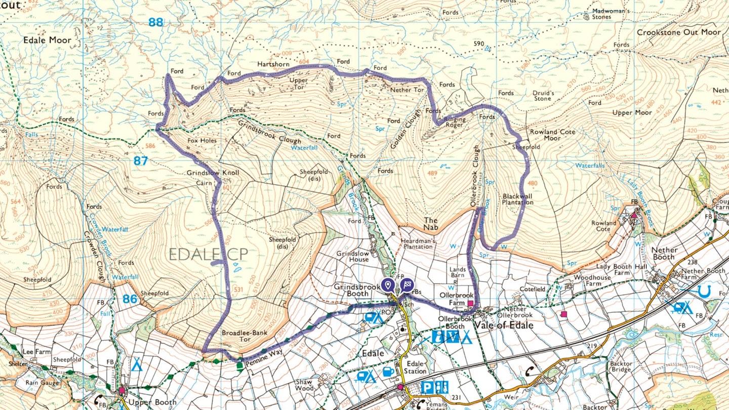
Sat in a broad U-shaped side valley behind the Hope Valley, Edale’s five 'booths' (hamlets) are surrounded by a fine ring of Peak District peaks.
To the south, Mam Tor commands the view along the Rushup Edge to Lose Hill. To the west, there’s the high Brown Knoll plateau while the Kinder plateau forms the northern skyline. This route seeks out a little-walked ridge above Edale for the ascent – and discovers that near solitude is possible above the village, even on a sunny Sunday!

An old plantation has bilberries aplenty and great views back over the main Edale valley, with no trees. But the rocks are harboring several animal shapes further ahead: can you find the seal and gorilla’s heads, and is the more human-carved tortoise still there?
There are fantastic views over the ancient gritstone boulders of Ringing Roger across to Grindsbrook. A ford provides entertainment on the northern headwaters of the Grindsbrook Clough and then there’s a quieter and very steep, but fun, descent off Grindsbrook back to Edale. Poles are useful here, as is a bit of fell-runners’ technique in descent – if you have neither, just take it gently and enjoy the fabulous views across to Mam Tor.
How hard is this walk?
DIFFICULTY: Easy | DISTANCE: 10km | TIME: 4 Hours | TOTAL ASCENT: 525m

FITNESS: If you're a regular walker with experience of the hills, you'll have no problems.
TERRAIN: Broad but surprisingly steep grassy ridges onto Kinder Plateau; faint paths in places on grass through rougher bilberries/areas of rabbit holes; Grindsbrook Clough ford is tricky after heavy rainfall across narrow, exposed ledge; very steep descent off Grindsbrook.
NAVIGATION: The Kinder plateau can be a disorientating place in poor visibility, but you should be sticking close to the edges on this walk to keep it simple. Even so, carry a map and compass and know how to use them.
Where is the start of the walk?
The Old Nags Head pub in Edale, postcode S33 7ZD.
What's the best map for walking Edale's ridges?
-
CLICK HERE to view and download our digital route guide in OS Maps
Edale ridges | Step-by-step route guide
-
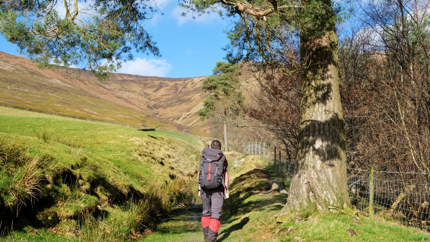
From the Old Nags Head pub take a footpath east across Grindsbrook Clough. This joins a track contouring below the base of the Kinder massif for roughly 500m, to Ollerbrook Booth. Turn sharp left and up Ollerbrook Clough on a grassy vehicle track through fields to access land.
-
Fork right to cross the brook on a hairpin bend. Continue along a gently rising track below Blackwall Plantation (a broad open grassy ridge) until it starts to bend left to join the main Edale valley.
-
Look for a series of grassy grooves in the hillside to the left – these ease the way to the crags below the plateau edge. It's steep going and rough underfoot where bilberries and the occasional rabbit warren encroach on grass.
-
Cross a stile by a ruined drystone wall, zigzag right then left on a rough path through steep heathery/bouldery terrain onto the plateau edge top, looking for the ‘seal’s head’ rock as you go. Head 10m right along a narrow edge top path, then left along a clearer path along the edge. There are numerous braiding paths along the top, some cutting the corner of Ringing Roger. Stay left on the edge for best views, avoiding the paths which clearly descend off the edge.
-
From Ringing Roger, head west around the edge line, with the largest of the braiding paths rejoining by an eroded slight rise. Continue along the edge, with rocky outcrops framing the views down into the valley. Spot the gorilla and tortoise rocks – the gorilla is natural and harder to spot, the tortoise is rather more hand-carved and behind you.
-
Cross an easy slabby ford, then go through a gate to gain the upper reaches of Grindsbrook Clough. Stay on the edge path leading to the more awkward slabby crossing of a larger stream, the northern headwaters of Grinds Brook.
-
In dry summer conditions you'll encounter little water flowing and the ford is relatively easy. After prolonged rain (or spring snow melt) the steps may be fewer, high and/or slippery in places. The edge side path on the far side is narrow, exposed and eroded in places.
-
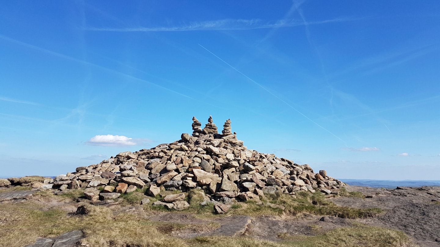
Cross the (dry) western headwaters of Grinds Brook – there’s a sprawling cairn just beyond. Avoid the obvious slabbed stone path shortcutting across the spur to Kinder, instead stay by the edge and go up a grassy knoll on the skyline ahead (Grindslow Knoll).
-
There are some fantastic views down into Edale below; now take the right of two paths descending from the immediate (and steep) summit. This does a slight dog-leg right at a fence to a gate on to the broad and grassy southern ridgeline.
-
At a corner of three ruined drystone walls, cross one, then follow down beside the lowest. The path gets rather steep now, but always stays just right of the wall.
-
At the base of the steep descent, bend left on a contouring path. Leave access land and head gently down to the busy Pennine Way. Go left on the gently descending path through fields. Turn right beside Grinds Brook, and follow the stream back to your start point.
What walking gear do I need for this route?
This is a classic Peak District hillwalk, so you'll need the obvious basics of walking boots or hiking shoes, a good hiking daypack, a reliable waterproof jacket (essential in this National Park!), and a pair of quick-drying walking trousers or shorts. Depending on the season you walk this route you may need some extra essentials, so check out our hiking gear section for our latest reviews and recommendations.
Where can I eat and drink?
The Rambler Inn, Edale: theramblerinn.com
Where's the best place to stay?
We're big fans of YHA Edale and there is a wide range of pubs, hotels and B&Bs in the Hope Valley. Check Booking.com and Tripadvisor for deals and availability.
About the author
Chiz Dakin is an award-winning photographer and guidebook writer, specialising in hiking, cycling and outdoor photography. Her expert guides have been a regular fixture in the routes section of Trail magazine for many years and she's one of the most respected outdoors writers in Britain.
This route originally appeared in the August 2017 issue of Trail magazine. CLICK HERE to become a Trail magazine subscriber and get 50% off a whole year of digital OS Maps