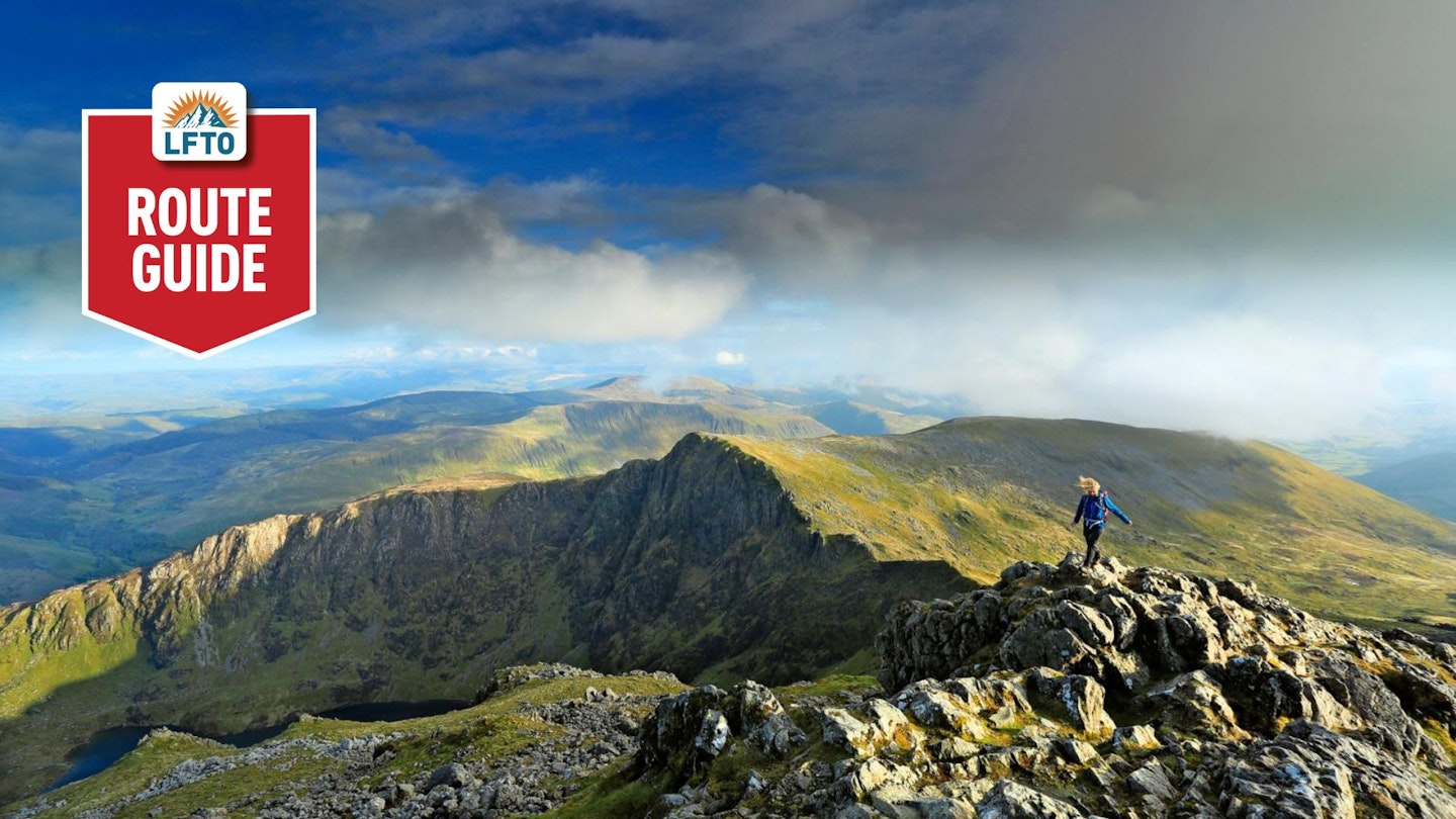
Regal and dignified, Cadair Idris is the favourite of many who roam the uplands of North Wales, and while most suitors fixate on its summit Penygadair, Cadair is a multi-topped massif deserving of more earnest exploration.
The blazed paths of the Pony and Minffordd attest to Cadair’s enduring popularity. But beyond these heavily-peopled highways, miles of quiet ridge wandering is there for the taking, punctuated by several peaks which you will almost certainly have to yourself.
On this outstanding mountain walk, six of Cadair’s 2000ft tops are visited, with the option of bagging the seventh open to strong walkers unconcerned with the aesthetic shape of the day. The expedition begins on Mynydd Gwerngraig where, on weekdays, the horrific shriek of low-flying jets will startle even the stoutest of hearts. Conversely, at journey’s end, Llanfihangel y Pennant presents as peaceful an idyll as is possible to imagine.

That which lies between these disparate paradigms is of such a vintage that you will not want it to end, but on the warmest of days, however, you may fear that it never will. Read on for details of how to walk this unforgettable route.
How hard is traversing the Cadair Idris massif?
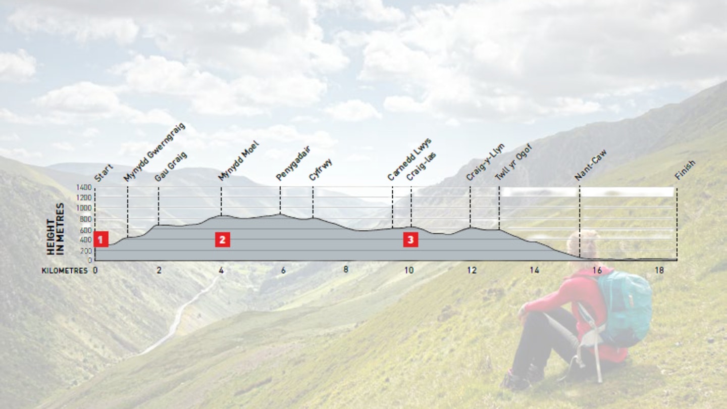
DIFFICULTY: Hard | DISTANCE: 18.6km | TIME: 8-9 hours | TOTAL ASCENT: 1,030m
FITNESS: This is a tough, full day walk requiring an above average level of fitness.
TERRAIN: Standard hillwalking terrain on broad ridges.
NAVIGATION: Good paths and fence lines make for easy navigation, although the descent route from Craig y Llyn can be vague in places.
Where is the start of the walk?
This is an end-to-end rather than a loop. Start at SH752135 ‘Cad West’ car park. Finish at SH672088 Llanfihangel y Pennant. Leave a vehicle at both ends, or find a friendly local to hitch back with.
What's the best map for traversing Cadair Idris?

-
CLICK HERE to view and download our digital route guide in OS Maps
-
OS Explorer OL17(1:25k)
-
OS Landranger 124 (1:50k)
-
Harveys British Mountain Map Snowdonia North (1:40k)
Cadair Idris Traverse | Step-by-step route guide
-
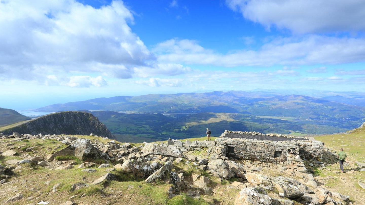
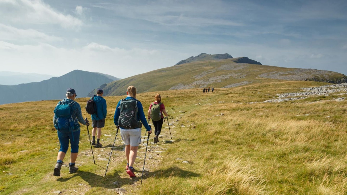
From the parking area, go through the gate and turn right to follow the contouring path to a fence. Climb steeply to a stile and cross the fence before continuing upwards. Before long the angle relents and offers a brief respite. Remain with the fence until the path steepens once again, grassy at first and then loose with several short scrambly steps. After a brutal climb, the situation improves as you gain Gau Graig. A beeline can be made for the cairn, although it is easier underfoot to stick with the fence for 200m before dog-legging north-east to bag your first peak of the day. As fine a spot as Gau Graig’s summit is, any temptation to loiter should be resisted, for there is still much to done. Return to the fence and, where it adjoins another, cross over and follow it for 1km. The fence is then abandoned as the path firms up and steepens for the final assault on Mynydd Moel.
-
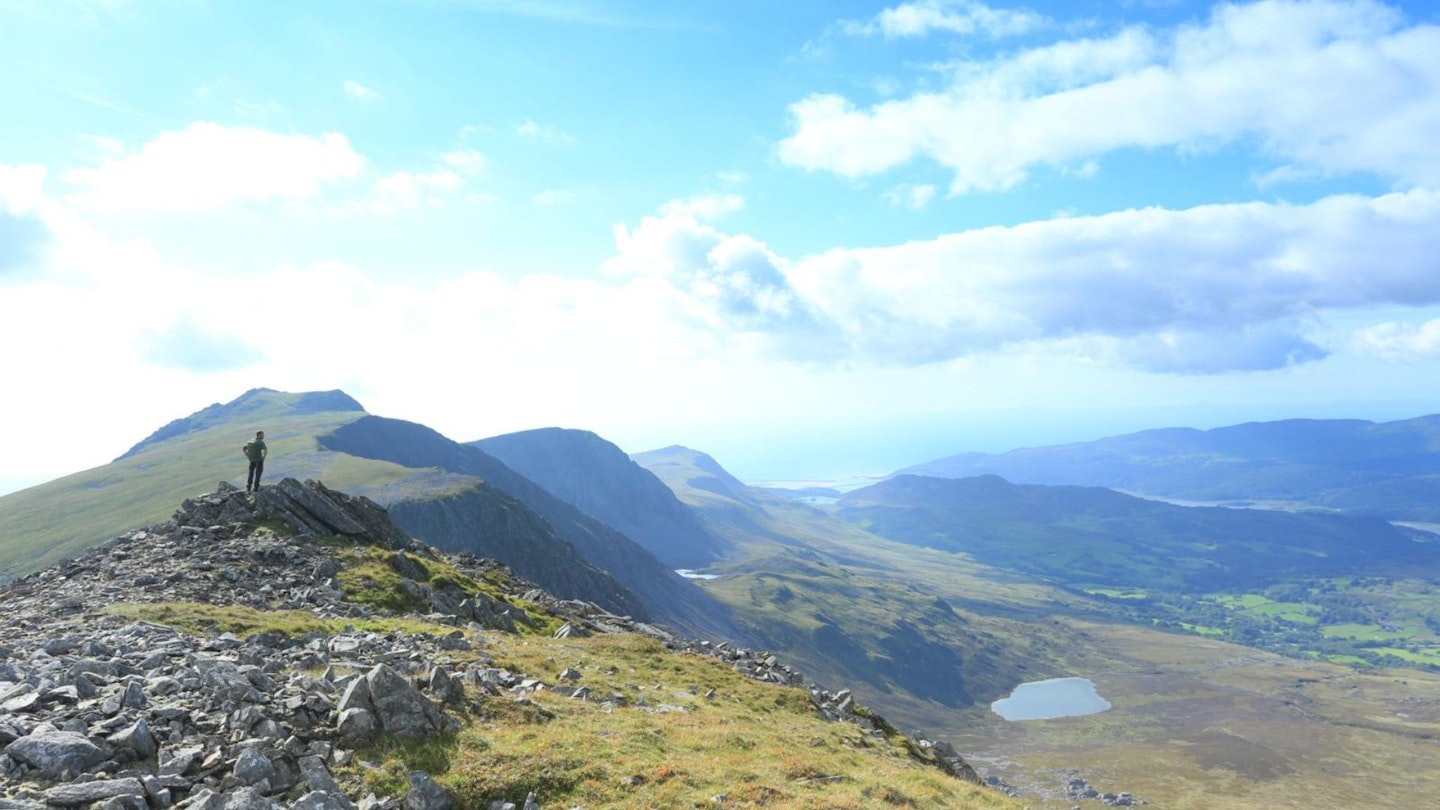
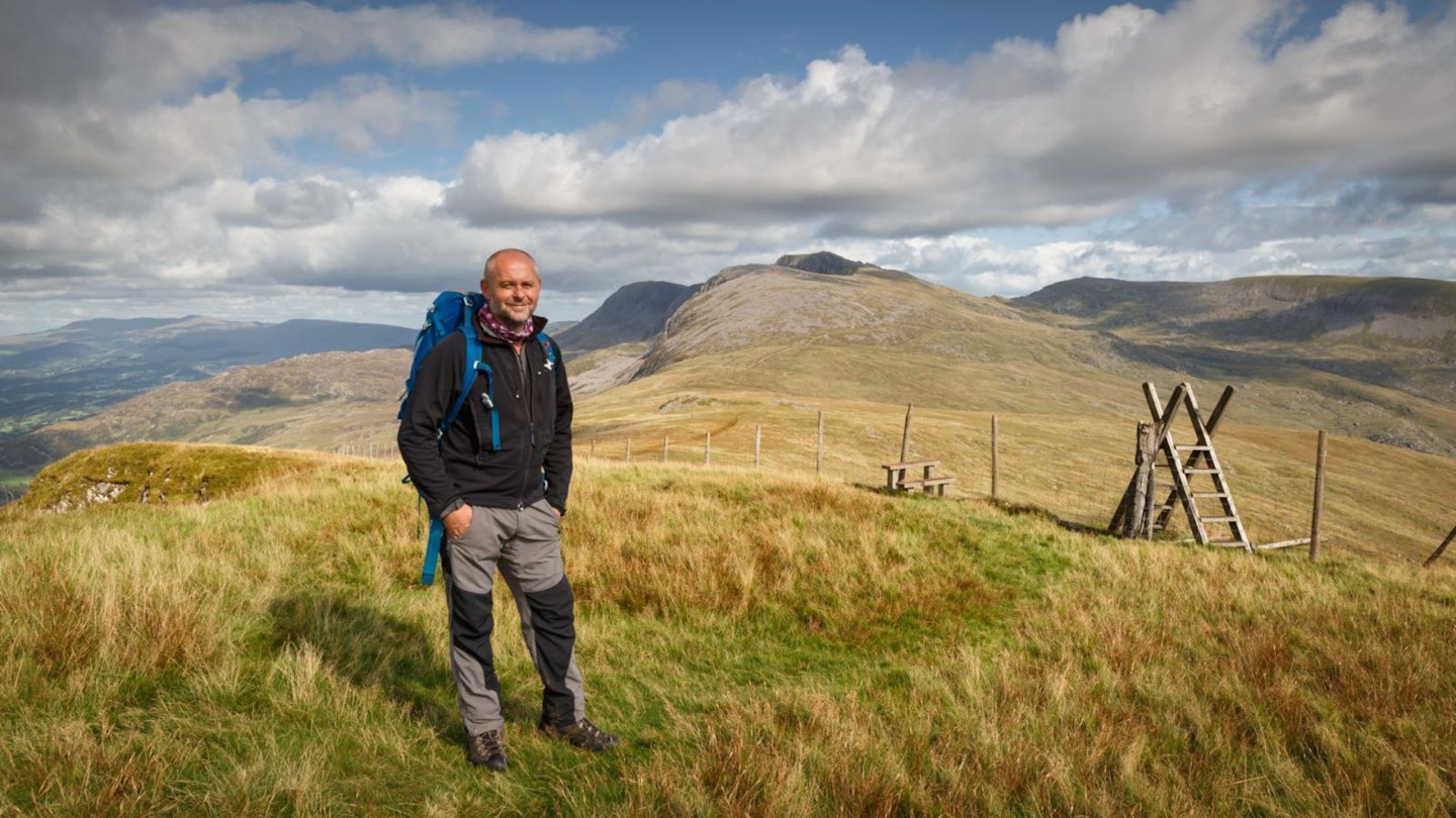
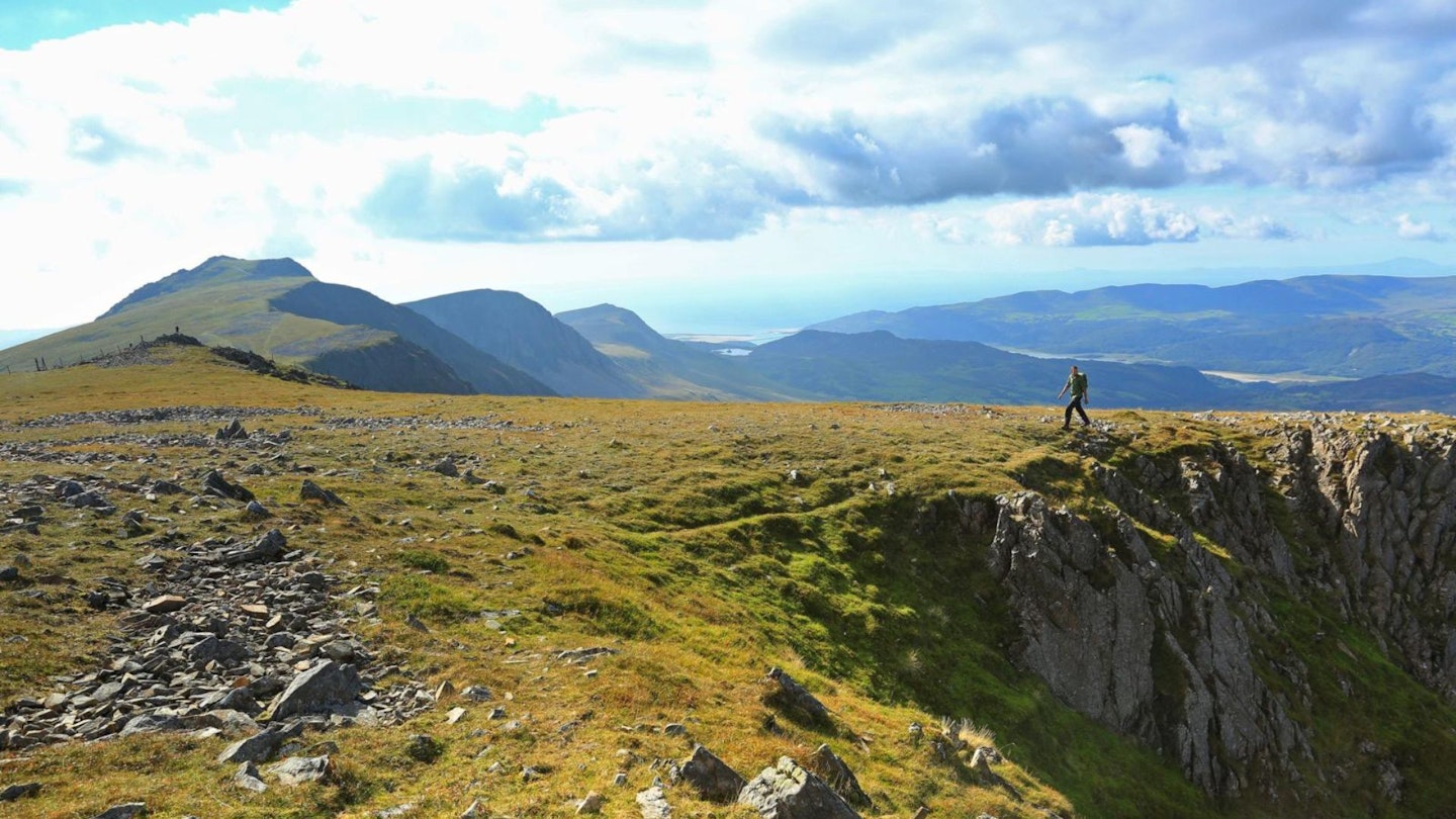
From Mynydd Moel, Penygadair is an inspiring sight and the way to it couldn’t be simpler. Handrail steep ground on your right to enjoy the stupendous sweep of Cadair’s northern escarpment, or follow a well-marked path all the way to the trig point. The view is extensive and has, it must be said, a touch of the sublime. Should the weather be inclement and the vista not particularly stirring, the summit hut offers shelter and seating away from the elements. With steep ground still to your right, leave the summit and descend a slaty runnel to gain the Pony Path. Avid baggers will elect to make an out-and-back visit to Craig Cwm at the cost of an hour, while others will tear down the Pony Path at great speed. While you’re here, however, it would be a shame not to make the pilgrimage to Cyfrwy by following the rim of the cwm before returning to the Pony Path bound for Rhiw Gwredydd, a major meeting of ways and a bailing-out point down the Pony Path for those who may have had enough exercise for the day. From the bwlch, carry on straight ahead for the gentle climb to Craig-las (aka Tyrrau Mawr), passing the conspicuous cairn of Carnedd Lwyd as you go.
-
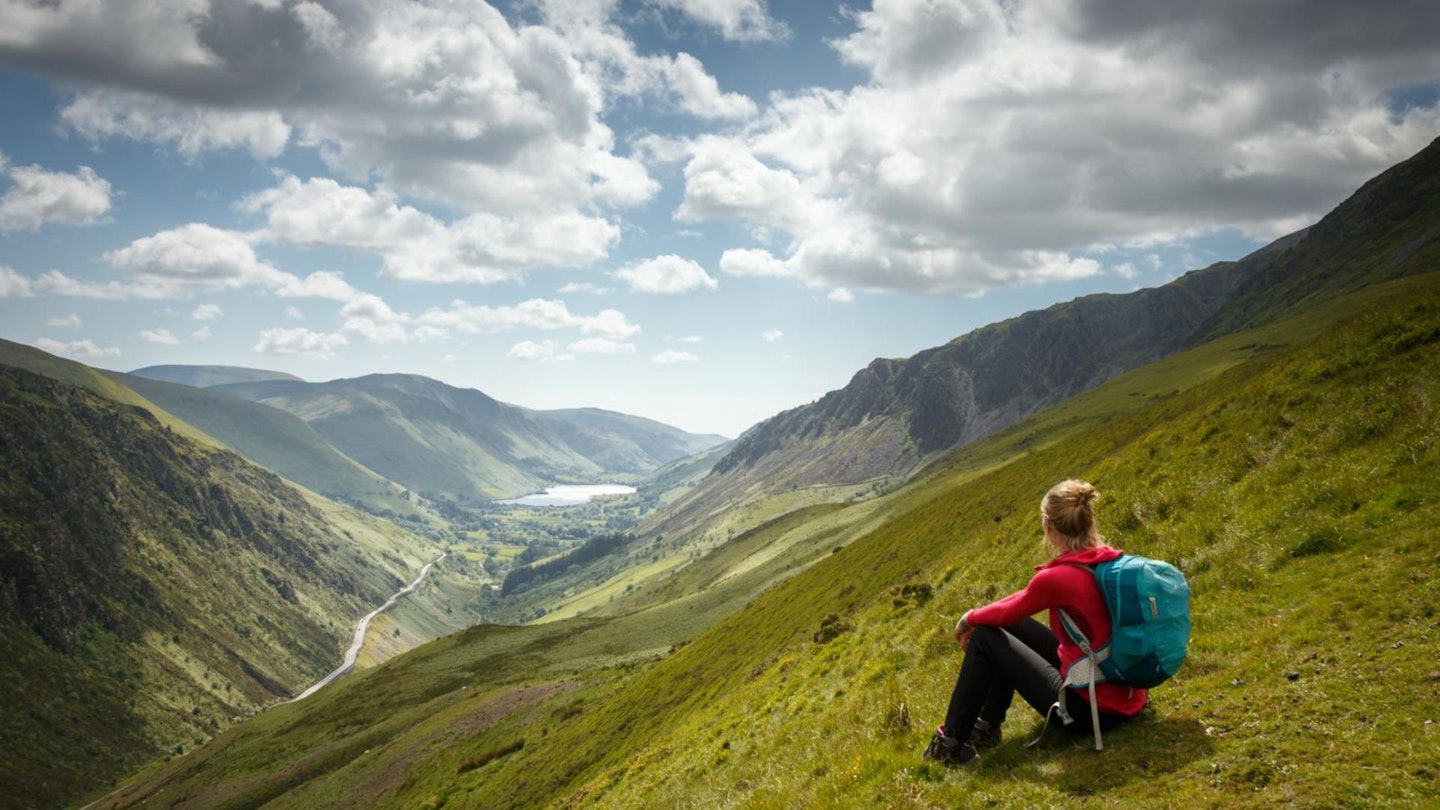
Craig-las is a great place to down tools and enjoy a view which an hour ago you thought couldn’t get any better! The final peak of the day is Craig-y-llyn, an undistinguished top which is reached by following the ridge fence, at times steeply, for two kilometres. From the summit continue with the fence for 900 metres to Twll yr Ogof and then descend to another fence which comes in from the left. Follow the fence to a bulldozed track. The temptation to follow the track is strong, but carry on a little further to pick up the right of way above a stream system and aim for a large sheepfold, after which a track is followed briefly before a small ruin becomes your next target. From the ruin, a diagonal descent through several fields arrives at Nant-Caw-fawr. Beyond the farm buildings take the track forking left. After crossing the stream, head south towards the old chapel and pick up the pleasant wall-side path which eventually joins the river at Maes y Llan. Stay with the river until reaching a lane, where a right turn will soon see you at Llanfihangel y Pennant and the car park.
What walking gear do I need for this route?
Here's a selection of the best walking gear selected by LFTO's testing team: Walking boots | Hiking daypack | Waterproof jacket | Walking trousers | Walking poles | Walking mid-layers | Base layers
Where can I eat and drink?
The Cross Foxes near Dolgellau is a great pub serving good food.
Where's the best place to stay?
We recommend Pen y Bont Hotel, Tal y Llyn, or Cwmrhwyddfor Farm Camping.
About the author
Nick is a Snowdonia-based author and photographer, who's been writing features and route guides for Trail magazine and LFTO for over a decade. He's also a Mountain Leader who's passionate about sharing the experience of walking in his native North Wales peaks with other people.
This route originally appeared in the October 2024 issue of Trail magazine. CLICK HERE to become a Trail magazine subscriber and get 50% off a whole year of digital OS Maps