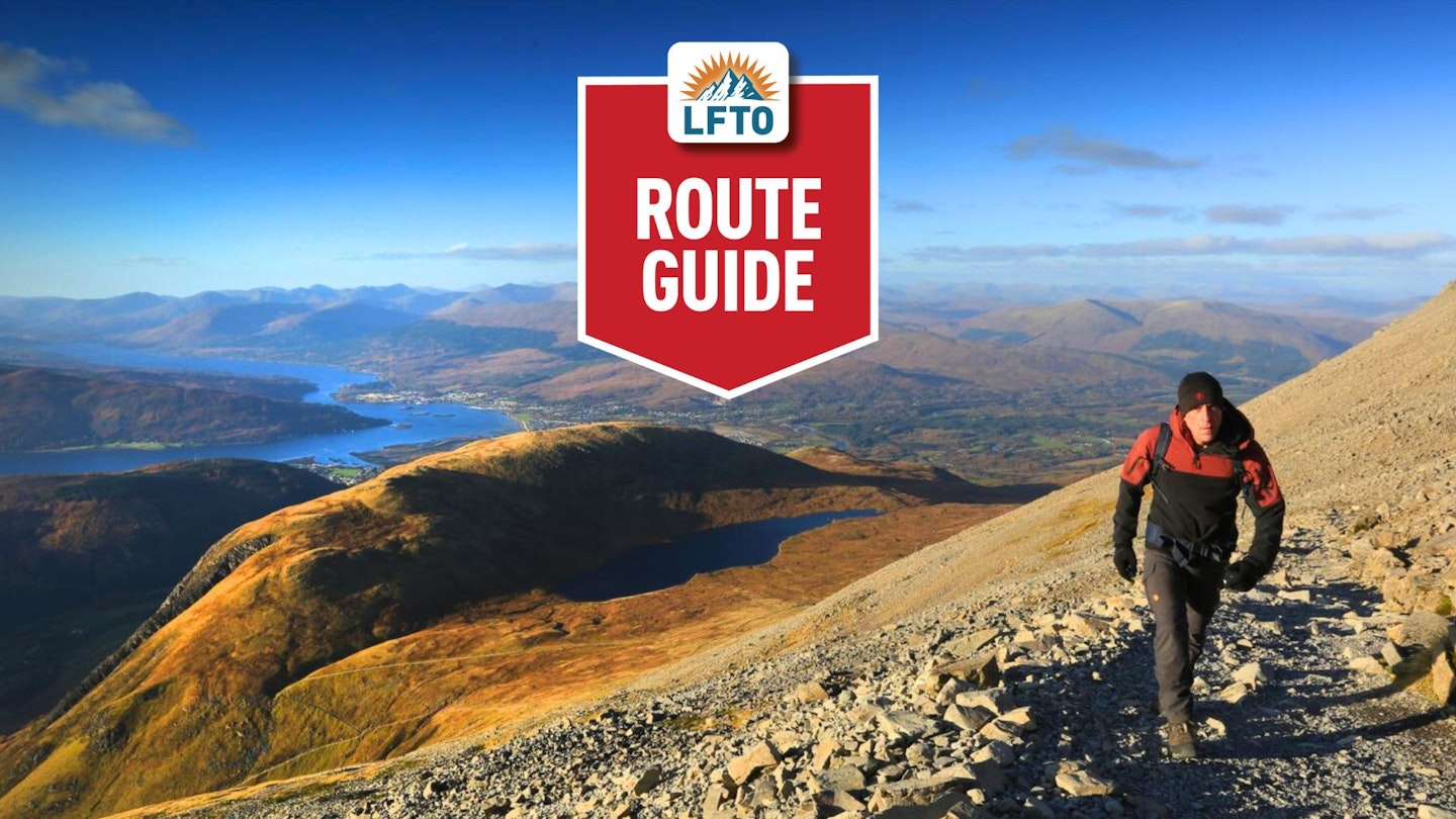
There's simply no escaping Ben Nevis. If you're passionate about hiking and exploring Britain's highest mountains, then sooner or later your adventures will lead you to its legendary 1345m summit. The Mountain Track is regarded as the 'easiest' route up Ben Nevis, but it's certainly no pushover, as Jamie Rooke explains in this guide.
In terms of the sheer scale of Scotland and its scope for adventure, there’s no equivalent in the UK for walkers and mountaineers. You could spend your whole life walking only on Ben Nevis and never fully know it all, in its entirety.

I’m very lucky that I’ve experienced a bit of it, mostly while writing route guides for you lovely people, and to be honest, it’s easy to become a little dismissive of the ‘Tourist Path’ (also known as the Mountain Track and Pony Track) up Ben Nevis, or as those who are more familiar with it than me call it: ‘The Ben’.
Let’s be fair though – it is the biggest mountain in the whole of Scotland (and indeed Britain), it’s not exactly ugly to look at, and as a starting point for exploring the beautiful mountains of the Highlands you could do a lot worse.
Standing on the summit of Ben Nevis for the first time, and looking around the 360° view of far-ranging and jagged peaks, is something to remember forever. With 1300m of ascent, this mountain is also no pushover – you will have to earn those views. But you will feel enriched for the experience, that’s for sure. Go and get it done!
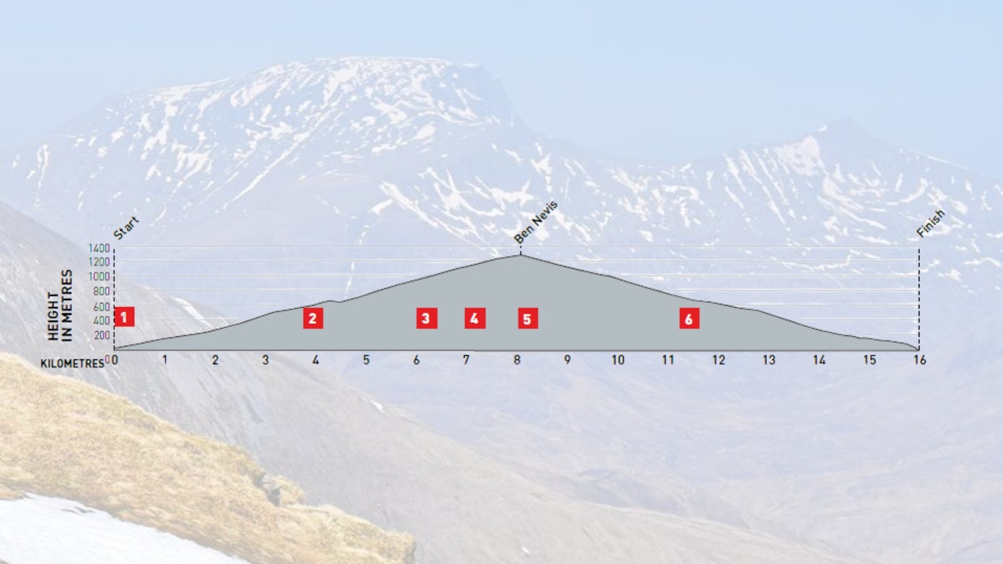
How hard is the Ben Nevis Mountain Track?
DIFFICULTY: Medium | DISTANCE: 15km (round trip) | TIME: 6-8 hours | TOTAL ASCENT: 1300m
FITNESS: If you’ve never walked in Scotland before then the relentless ascents can be a shock, but there are some restful sections on this route. Snow can lie on the mountain well into June.
TERRAIN: Mostly solid paths but some boulder fields closer to the top.
NAVIGATION: On a busy day, there will be hundreds of other walkers on the Ben Nevis Mountain Track, especially around the summit. It can feel very vague on the summit plateau when visibility is poor, which can be often, so the instructions below can be vital to help you stick to the path and avoid surrounding cliffs. Especially if climbing Ben Nevis in winter conditions.
Where is the start of the Mountain Track?
Glen Nevis is easily accessible from Fort William, which is also easily accessible by train, bus and car. Most people access Fort William via the A82, which can be followed all the way from Glasgow in the south via Loch Lomond, Rannoch Moor, and Glen Coe.
What's the best map for Ben Nevis?
-
CLICK HERE to view and download our digital route guide in OS Maps
-
Harvey British Mountain Map Ben Nevis & Glencoe (1:40k)
-
Harvey Superwalker XT25 Ben Nevis, Mamores & Grey Corries (1:25k)
Ben Nevis Mountain Track | Step-by-step route guide

-
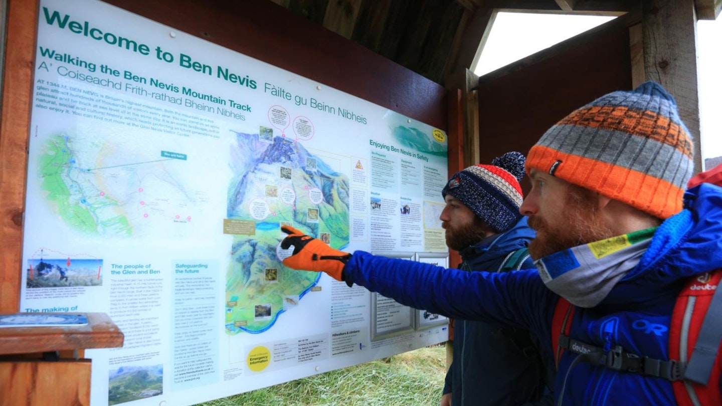
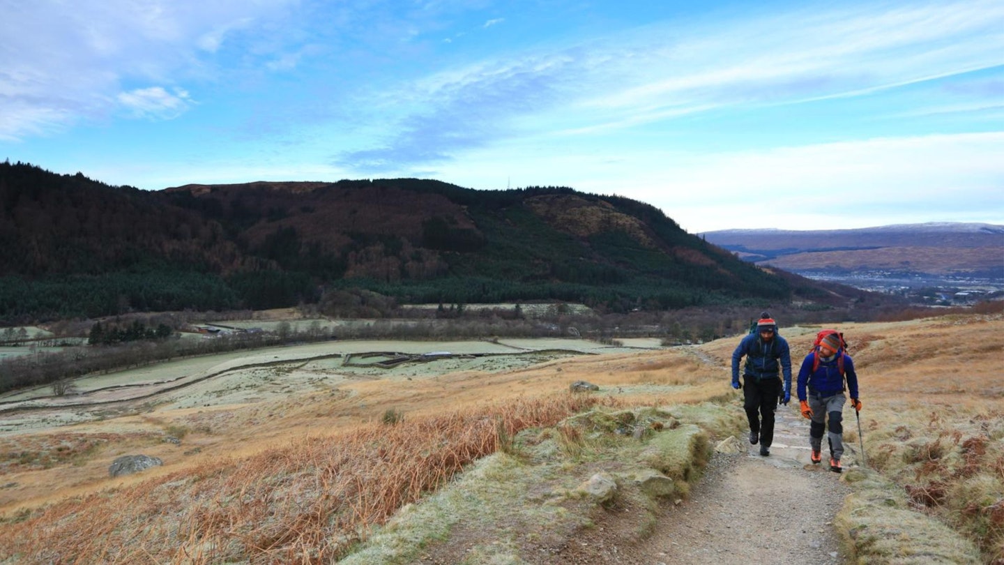
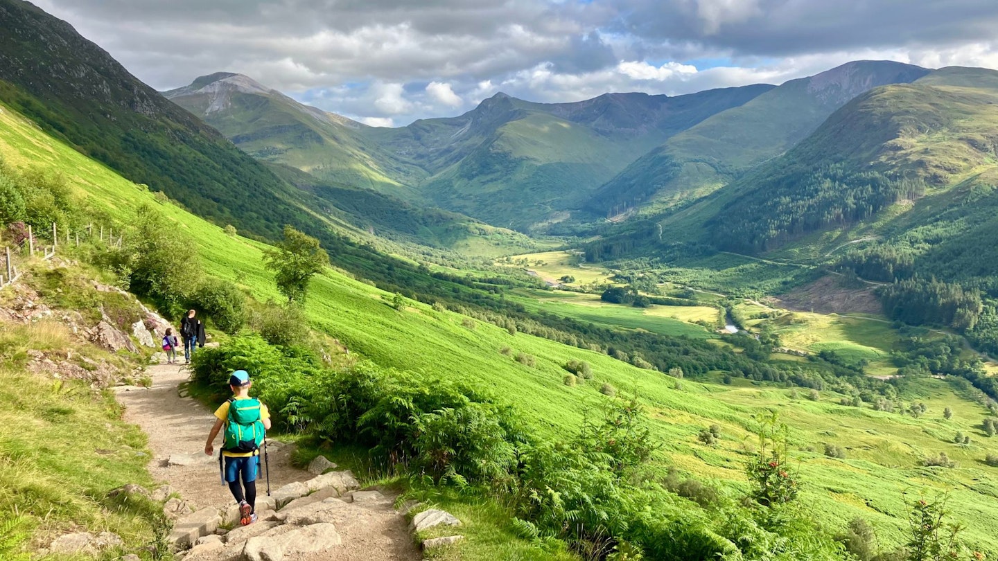
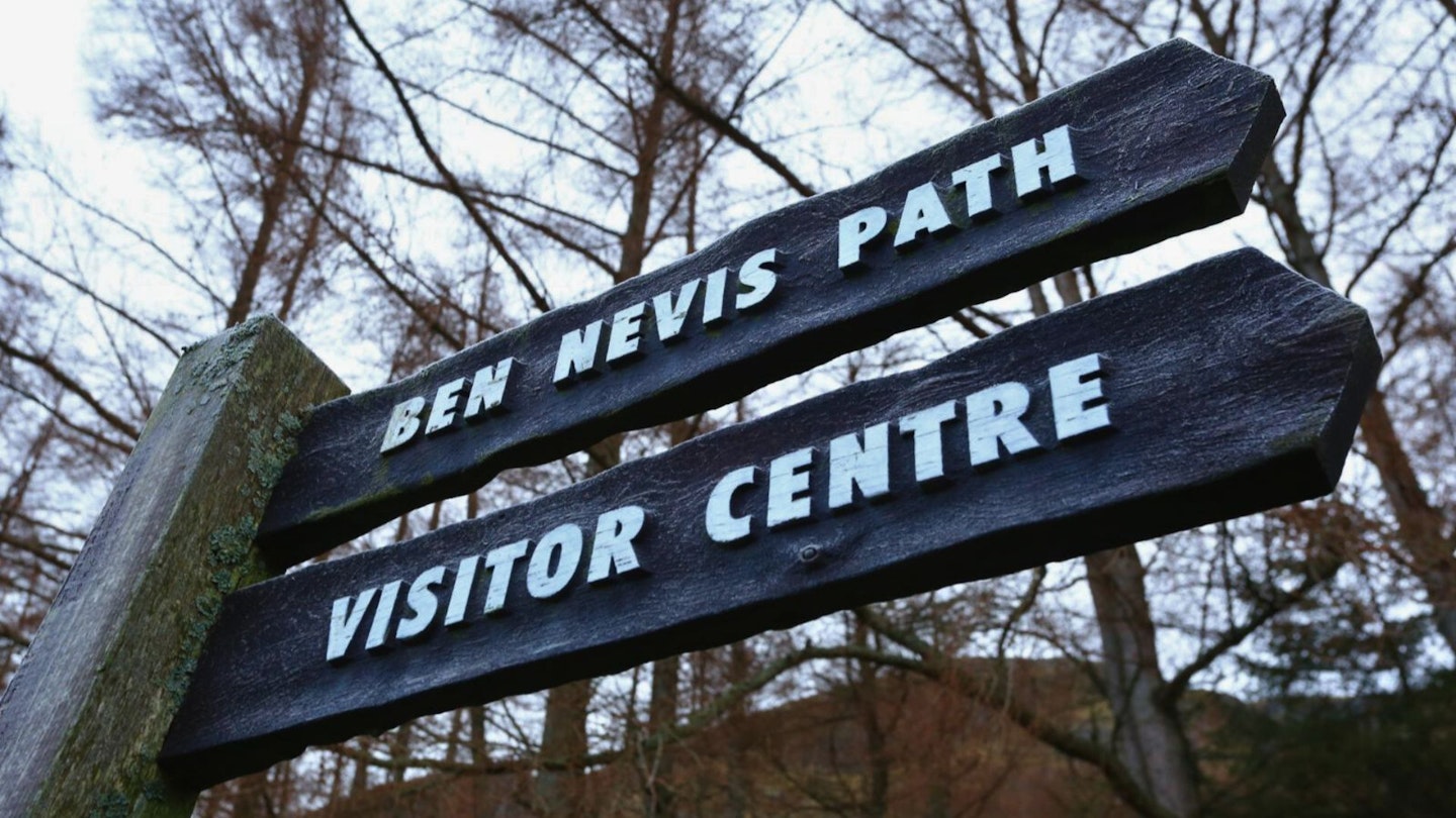
The route starts at the Ben Nevis Visitor Centre in Glen Nevis. There are toilets available. The first section of the route is a gradual ascent to the Halfway Lochan (Lochan Meall an t Suidhe) on a solid path, though there are some trickier sections. From the centre, cross the bridge and turn right then left. It should be signposted. After about 250m you reach the stile and the start of the mountain path. It takes a rising south-east traverse to the junction of the youth hostel turn-off. Ignore it or you’ll be in for a short day. The path zigzags then continues in the south-east direction, and after crossing a few awkward steps and a bridge, you reach the Red Burn where the steepness increases for almost half a kilometre.
-
When the climb eases, the route takes a sharp turn left for the Halfway Lochan. You might notice another path cutting right across the hillside. Ignore it and stay on the main path. The path crosses more open ground, still gently climbing, past the lochan, then cuts back to the right (south) to once again, climb in a rising traverse. This section has a shallow river crossing. In wet weather, it can become tricky. People make a meal out of it. Use a walking pole for stability. There are usually some stepping stones clear of the water. Shortly after this come the zigzags.
-
The path changes to become rougher, looser and bouldery. It can be made worse when it’s busy. It’s a consistent climb up towards the summit area, from 750m to 1345m. Thankfully, it zigzags a lot, but it’s rough and relentlessly uphill to the top. When you think it’s done, there’s probably more to come and when it is done, there will still be a bit more!
-
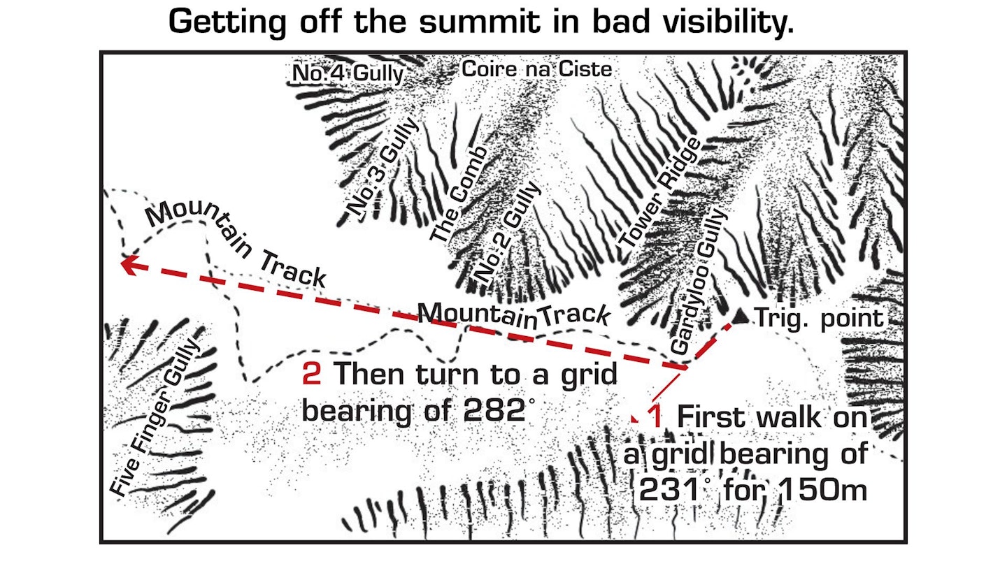
The zigzags straighten out and it’s an almost easterly bearing to the summit. This is where the route can start to feel confusing in poor visibility. Pay attention to the ground because it can be easy to wander off-route. This is also where the snow ends to lie well into the spring. On the northern side of the mountain (your left approaching the summit) there are steep cliffs and gullies and the danger lies in walking on old, unstable snow that hangs on these steep edges. Keep well away. If the visibility is poor and there is snow on the ground and your Spidey senses are telling you it’s wrong to be there, just stop and turn back. It really is that simple.
-
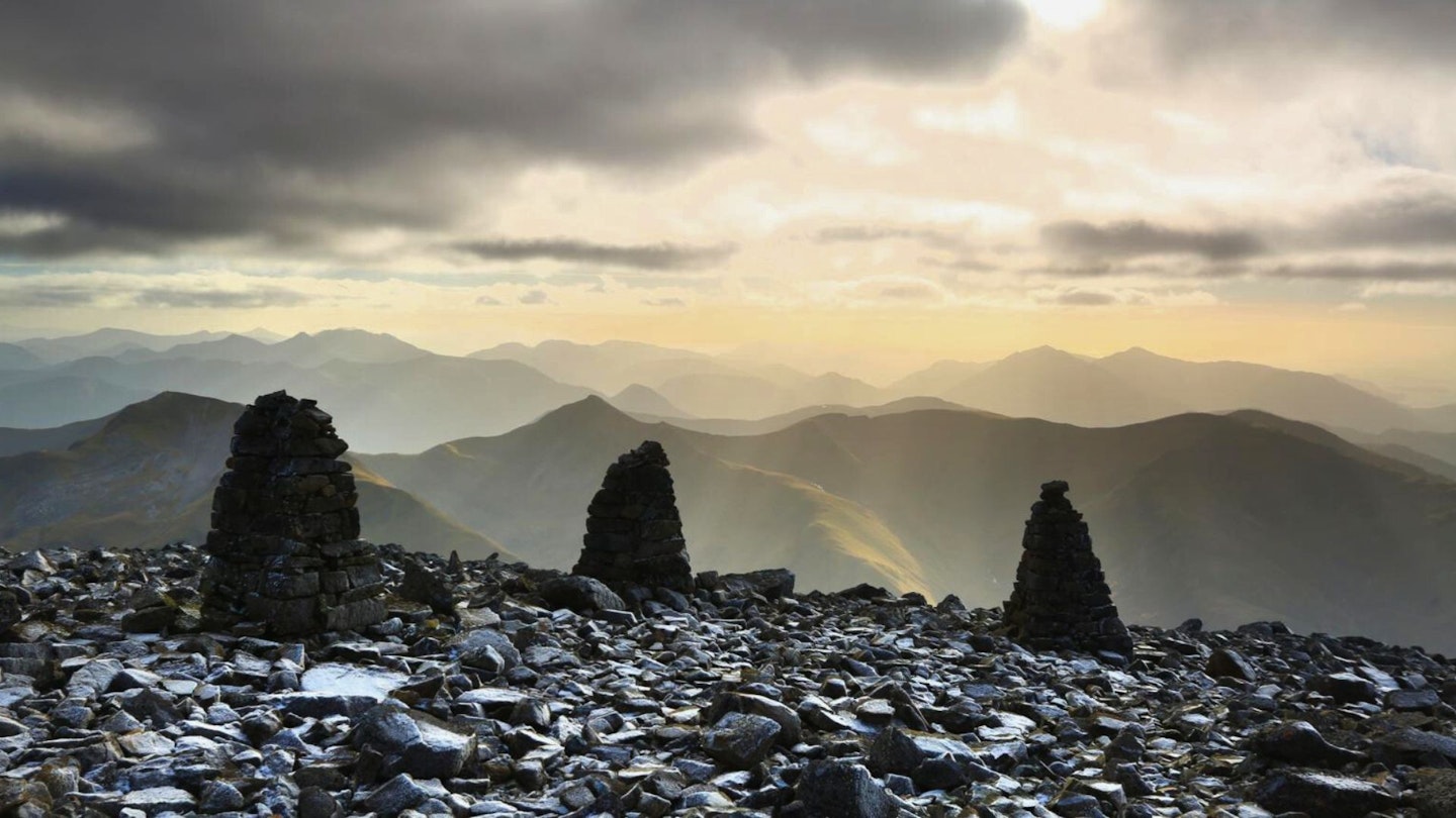
If you make it to the summit, well done. Enjoy a hard-earned rest. Again, it can still feel very wintry well into spring, so take some extra layers and maybe a nice hot flask. Enjoy. When you turn to head back down, there is a significant gully just near the summit area. If there is snow, keep well away from it. The general rule is to walk on a bearing of 231° for 150m then a bearing of 282° (see above). This will keep you clear of the gully. Return to the zigzags and descend on to the burn crossing.
-
Immediately after crossing, you’ll probably see people cutting across to the top of the Red Burn path. Please do not follow, but instead stick to the main path. This section is very eroded and becoming worse. It’s safer and better for the mountain to just stick to the path all the way back to the car park. After the crossing, it’s all fairly straightforward anyway.
What walking gear do I need for this route?
Here's a selection of the best walking gear selected by LFTO's testing team: Walking boots | Hiking daypack | Waterproof jacket | Walking trousers | Walking poles | Walking mid-layers | Base layers. Also bear in mind that in winter conditions, which can cover this mountain for much of the year, you'll dedicated winter kit such as an ice axe and crampons.
Where can I eat and drink?
Ben Nevis Inn is right near the footpath at the end, and the Grog and Gruel in Fort William is well worth a visit.
Where's the best place to stay?
You can stay at the Ben Nevis Inn, and there is also a good campsite and an excellent youth hostel all in Glen Nevis. All great places. There is even more choice in Fort William.
About the author
Jamie is a qualified Mountain Leader with a passion for helping people explore Britain's hills and mountains. He's been writing articles and route guides for Trail magazine and LFTO for years and is also one of our go-to experts for navigation tips and advice.
This route originally appeared in the August 2024 issue of Trail magazine. CLICK HERE to become a Trail magazine subscriber and get 50% off a whole year of digital OS Maps