
Isolated on the shores of Loch Hope, close to the north coast of Scotland, the craggy wedge of Ben Hope makes a fitting northernmost Munro.
Surrounded by moor and water, and uncomplicated by satellite tops, the mountain's commanding dome-like summit has an air of spaciousness unequalled on the mainland. To the north is only sea.
It is no coincidence that, to celebrate the completion of a Munro round, many Munro baggers elect to leave Ben Hope until last. It’s a summit that you simply don’t want to leave, one of the finest peaks of the Scottish Highlands, and a star name on our Trail 100 bucket list.
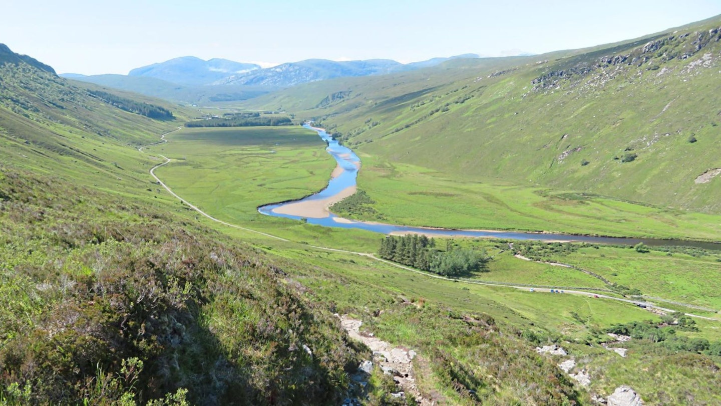
It must have been a stirring sight to the Vikings of old after their hazardous journey across the sea and it is the only mountain of Munro height that they named. Hope is the Norse word for ‘bay,’ referring to nearby Loch Eriboll. Thanks to a band of crags that runs all the way along the mountain’s north-west flanks, and endless moors to the east, the only easy approach is from the south-west, where the single-track Road of Desolation runs past its foot through wild Strathmore.
The ascent from here is made possible by a grassy shelf that breaches the guarding crags to reach the easy south ridge and gain access to the summit.
CLICK HERE to download our digital route guide for Ben Hope in OS Maps

How hard is climbing Ben Hope?
We'd say that in terms of mountain walks this is of medium or moderate difficulty. It's a fairly relentless ascent, which is steep in parts, and requires good mountain legs and fitness. The terrain is rough to begin with, on a rugged path beside a rocky stream, which eases with height on open hillside. There are also some off-path stretches of walking, but on good terrain.
You'll need good navigation skills, especially on the descent, where you'll negotiate featureless terrain around the crags guarding Ben Hope's south ridge.
How long does it take to climb Ben Hope?
This route covers 8 kilometres and around 940 metres of ascent in total. We estimate experienced hikers should be able to complete the route described below in 4 or 5 hours, but obviously that depends on weather conditions, your own fitness, and the pace you like to walk at.
How do I get to the start of the walk?
This route begins at grid reference NC462476 on the Road of Desolation – a single-track road that links Hope on the A838 to Altnaharra on the A836. There is no public transport to the start of the walk.
What map do I need?
This route is covered by OS Explorer 447 and OS Landranger 9. You can order both printed maps from the Ordnance Survey's map shop or download our digital route guide HERE.
Ben Hope walk | Step-by-step route guide
Section 1
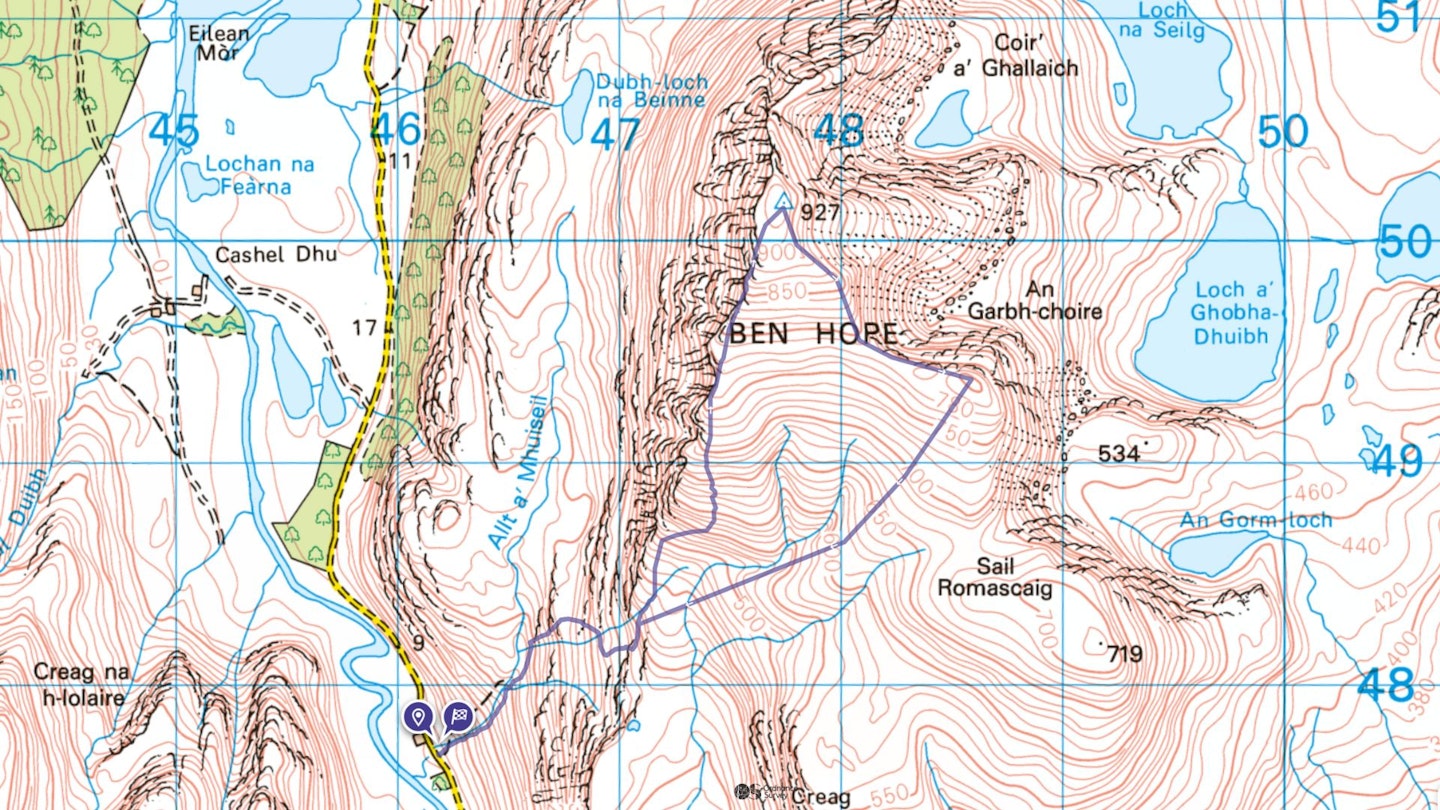
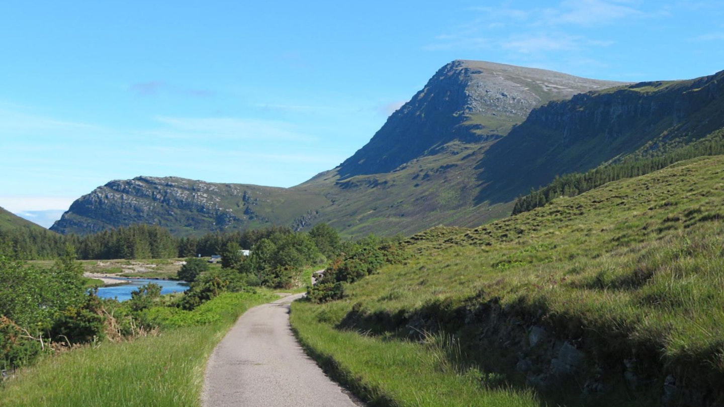
Begin in Strathmore at the bridge over the Allt a’ Mhuiseil on the Road of Desolation. If approaching from the south, the bridge lies 3km north of Dun Dornaigil broch – one of the best-preserved Iron Age drystone towers in Scotland.
There’s a large farm building on the north side of the bridge and parking spaces on the south side. A signpost points the way upward, following a rugged path that climbs the right-hand side of the cascading Allt a’ Mhuiseil (NB not the left-hand side, as erroneously shown on current OS maps).
The going is initially steep, rough, rocky and muddy, with some high-stepping up rocks unavoidable. Various lines can be taken to ease the going. As compensation you’ll pass a succession of enticing waterfalls and pools (make a note of the most alluring for a dip on descent). The angle then eases for a while as the path bears left to follow the Allt a’ Mhuiseil onto a broad grassy shelf (Dubh-loch-na-Beinne sits on this below beneath Ben Hope’s north-west crags). The path crosses one side stream and reaches a second.
Section 2
Immediately beyond the second stream, the path bears right, away from the Allt a’ Mhuiseil, to climb steeply again, although on easier ground than before. The angle relents again as the path bears even further right to re-cross the second stream.
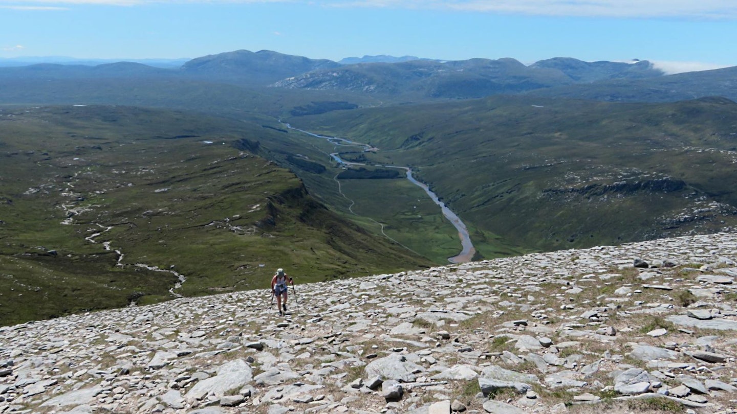
Another steep ascent leads to a grassy tongue that gently ramps up left and crosses the second stream for a third time to reach a brief levelling above the crags at the foot of the south ridge. At a height of around 400m, this is a good spot to pause for a breather and admire the view back down Strathmore.
Section 3
The convex slopes of the broad south ridge now rise ahead, steep and rocky, hiding the summit. To tackle the ascent at an easier angle the path climbs diagonally right, away from the cliff-edge overlooking Strathmore. With a mixture of grass and rocks underfoot, the route becomes indistinct for a while. Cairns mark the best line. After a nearly 400m climb you come to another levelling on the south ridge at the rim of the north-west cliffs.
Section 4
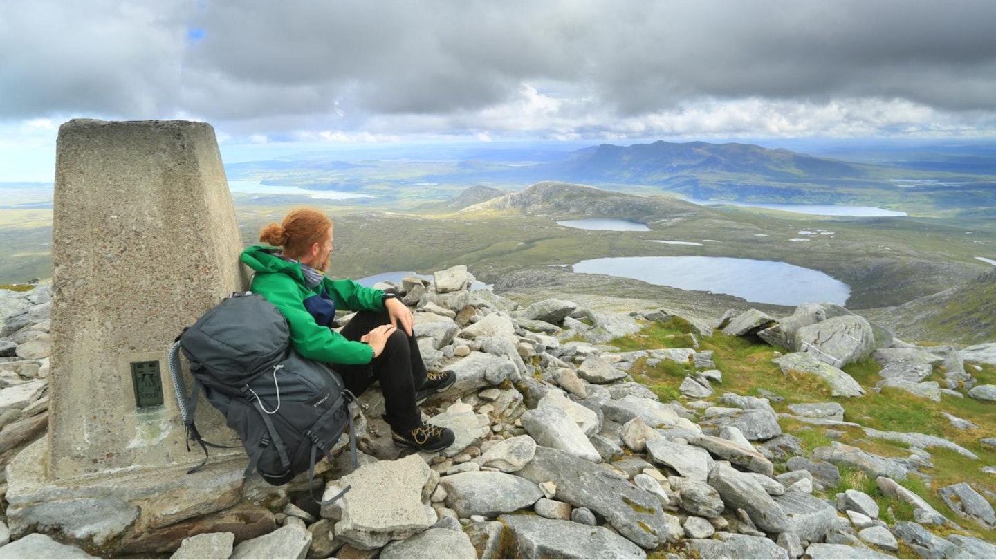
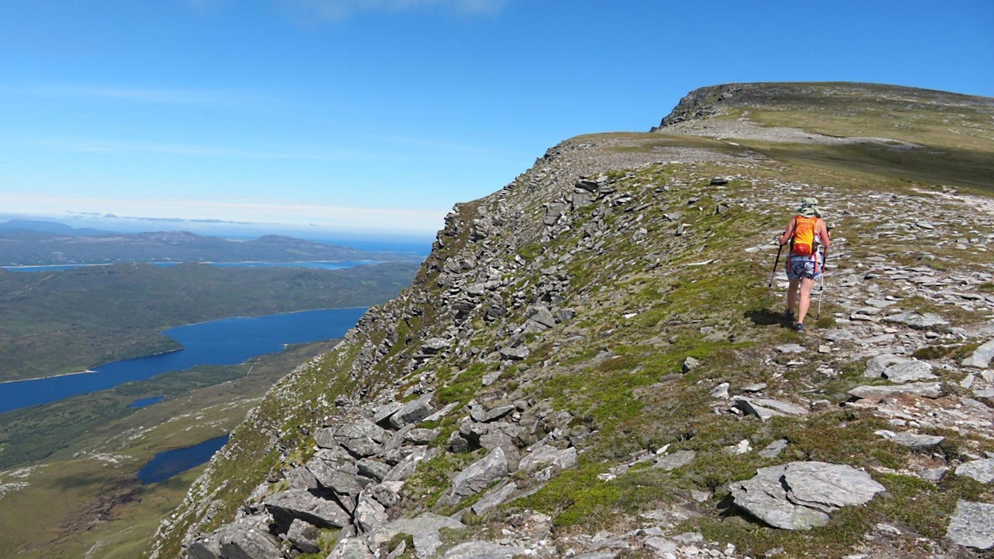
This is another good spot to pause and take in the expanding views before tackling the final 150m to the summit. Again it’s a convex slope that hides the summit itself, but this time it’s much easier and shorter. Stick to the cliff-edge path and it will soon bring you to the summit dome and trig pillar, complete with a comfy rock seat in a windbreak.
Section 5
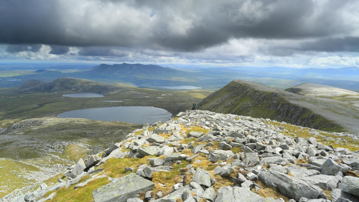
Stroll across to the north-west rim of the summit plateau to maximise cliff-edge views over the Pentland Firth. To prolong the sky-high ambience, and to find a less steep (if pathless) route back down the summit slopes, begin the return trip by wandering down the broad gentle south-east ridge to the minor rise at the head of An Garbh-choire (just before the ridge turns south and descends more steeply).
With views ranging from sandy seaside bays to a kaleidoscope of lochans on the desolate moors, you’ll not want this stretch to end. Note especially beautiful Ben Loyal to the immediate east, famously titled ‘Queen of Scottish Peaks’ by photographer and author W. A. Poucher.
Section 6
From the minor rise cut back right (south-west) down gentle grass slopes to rejoin the ascent route at the foot of the south ridge (map point 3). All that remains now is the steep descent beside the Allt a’ Mhuiseil and an opportunity to take a closer look at those enticing pools on the way back down to the car park.
What walking gear do I need for this route?
Here's a selection of the best walking gear selected by LFTO's testing team: Walking boots | Hiking daypack | Waterproof jacket | Walking trousers | Walking poles | Walking mid-layers | Base layers
Where's the best place to stay near Ben Hope?
We recommend the cliff-top campsite at Sango Sands, Durness, in the warmer months of the year. There are also plenty of hostels, cottages, and hotels in Durness and Tongue. Expedia and Booking.com are good places to look for deals.
About the author
Ralph Storer is an experienced hillwalker, backpacker and guidebook writer, best known for his love of the Scottish hills.
This route originally appeared in the April 2024 issue of Trail magazine. CLICK HERE to become a Trail magazine subscriber and get 50% off a whole year of digital OS Maps