
Wild Boar Fell stands like a barrier between the rolling Howgills and the wild moors above the Yorkshire Dales. It always sounds a little special and this exhilarating walk takes in the full extent of its high plateau and long escarpment edges, finishing very close to the Fat Lamb Country Inn.
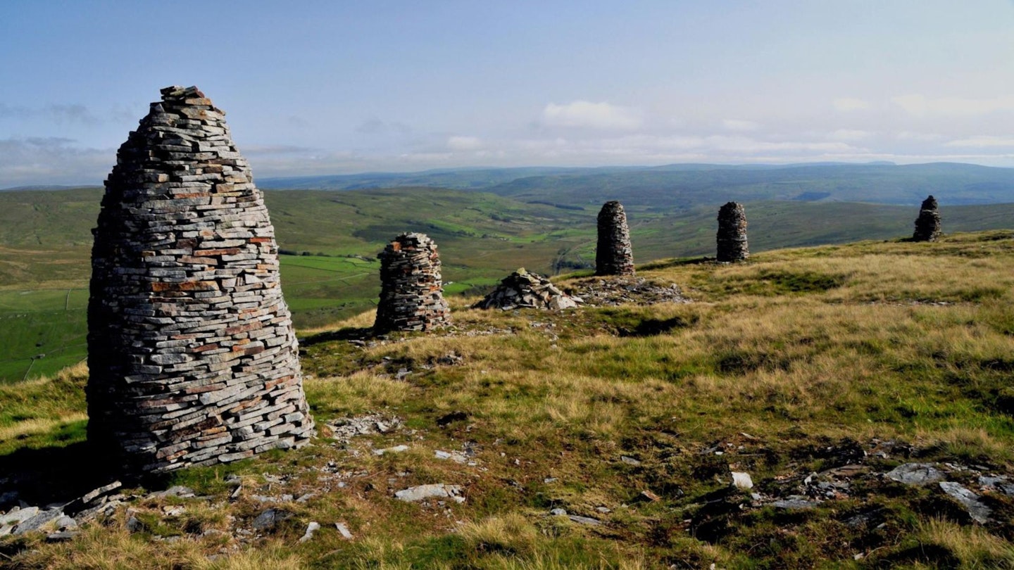
Seen from the south, the broad summit could almost be mistaken for Ingleborough, but from the north a prominent ‘nose’, known as The Nab, looks like the sort of pointy peak a child would draw at primary school. Up here, many decades ago, a row of tall cairns was erected above the deep gulch of the Mallerstang valley. No-one seems to know who built them but, as dusk descends, they might easily be mistaken for a group of shepherds or a stand of soldiers.
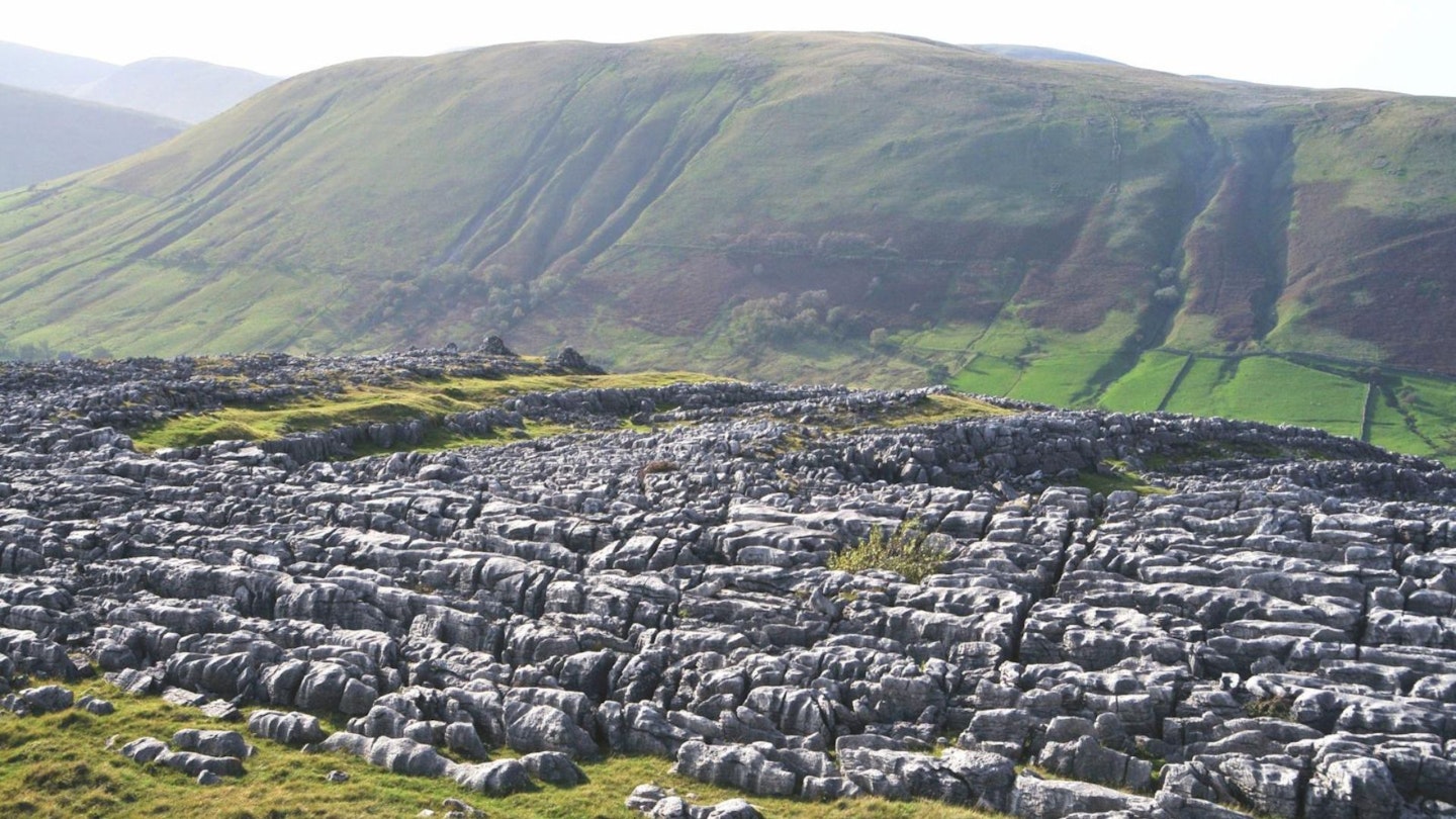
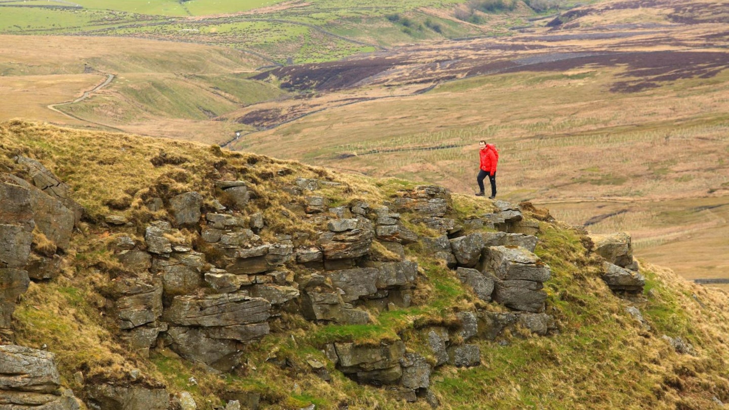
The descent via Sand Tarn leads down to great sweeps and swirls of limestone pavement. You might have left the top but, even if it’s bright sunshine, you’ll still be metaphorically stuck in the mist since these outcrops are curiously named Fell End Clouds and Skennerskeugh Clouds.
How hard is climbing Wild Boar Fell?
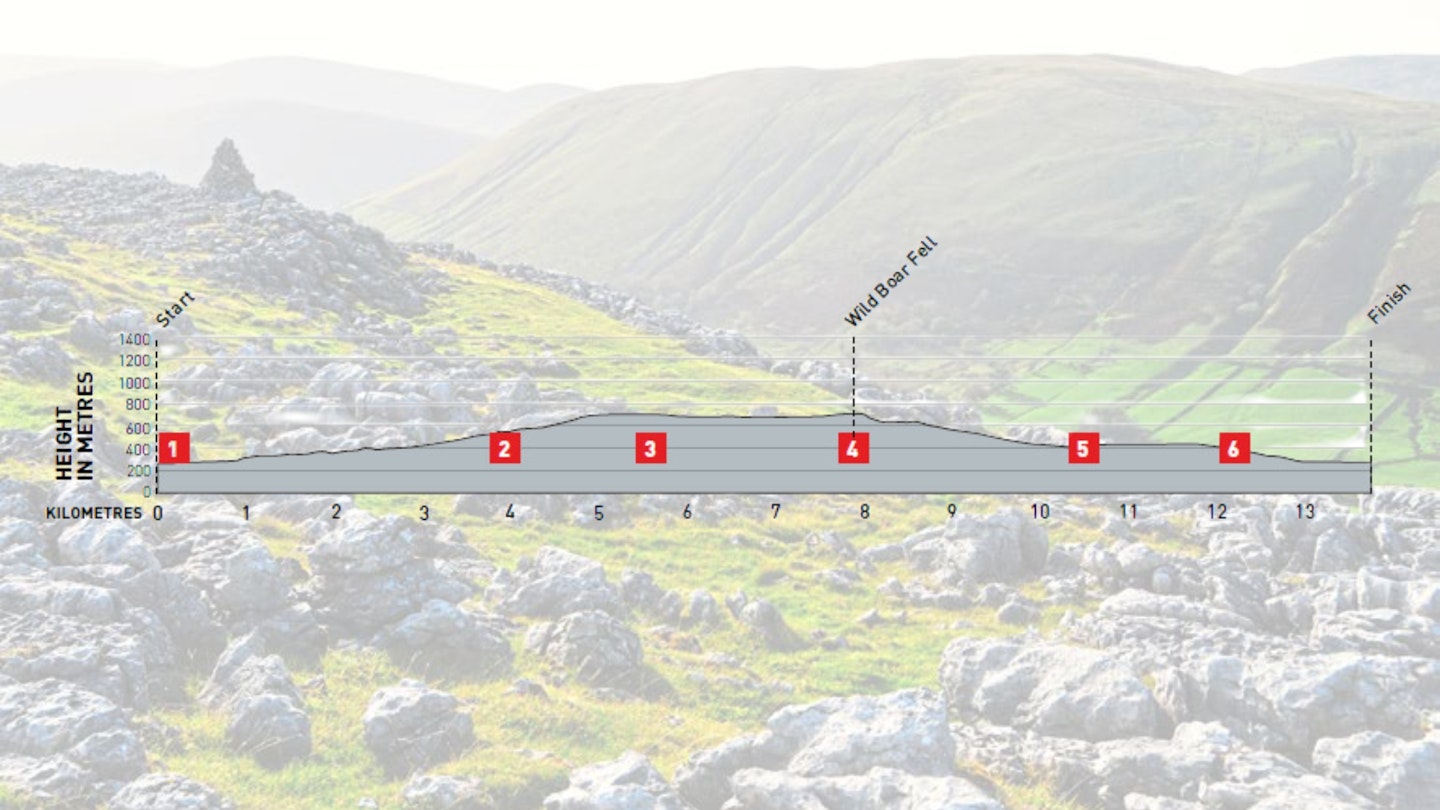
DIFFICULTY: Medium | DISTANCE: 13.75km | TIME: 6 Hours | TOTAL ASCENT: 545m
FITNESS: Regular fell walkers will find this to be a straightforward walk, and the ascent is fairly gradual.
TERRAIN: Rough moorland and limestone pavements – some established paths but some sections with no path at all.
NAVIGATION: An obvious well-used path at the start, but the main plateau and steep escarpments will require careful navigation in mist.
Where is the start of the walk?
The nearest town with a station is Kirkby Stephen – see westerndalesbus.co.uk for bus connections along the A483.
What's the best map for Wild Boar Fell?

-
CLICK HERE to view and download our digital route guide in OS Maps
-
OS Explorer OL19 (1:25k)
-
OS Landranger 91 and 98 (1:50k)
Wild Boar Fell | Step-by-step route guide
-
From the north end of Cote Moor by the A683 (off-road parking available here), take the track leading south to meet a narrow open lane. This turns left by the gates at The Street – continue for 300m and turn sharp right up a walled track. Go through a gate after 400m to reach Open Access land and keep ahead on the well-maintained track (part of the Pennine Bridleway) to contour south-east over the moor. Cross the ford over Hashy Gill and keep on to cross the bridge over Scandal Beck. Proceed through a couple of gates at the wall, soon after followed by another ford at Long Gill. Continue to the gate in the wall at High Dolphinsty – surely one of our strangest hill names!
-
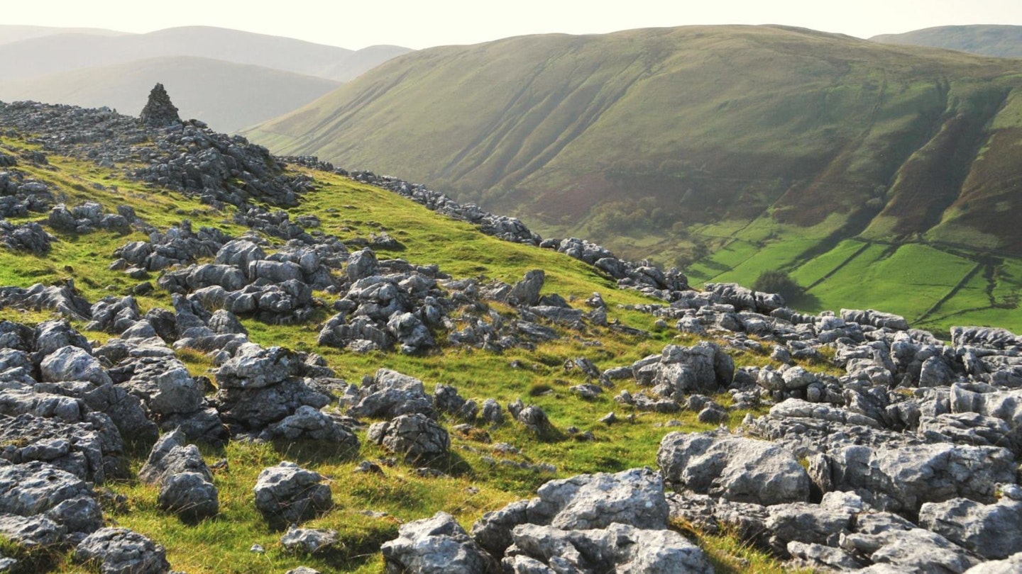
Leave the bridleway and turn right up the edge of a long spur to a high promontory known as The Nab, with rough screes called Scriddles on the left. This marks the start of the summit plateau with excellent views into the long lonely valley of Mallerstang. Continue south along the edge, above Blackbed Scar, pass a stone shelter and cross a stile in a fence to arrive at the cluster of tall cairns.
-
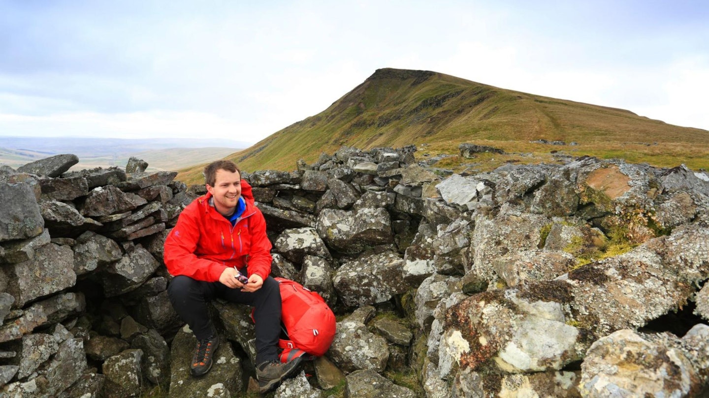
Continue along the edge, which bends to the right and runs above Aisgill Head and slopes named The Band. Complete a circuit of this wild plateau by turning north near a couple of cairns. The escarpment turns north-east to the trig pillar and walled shelter – both rebuilt by local volunteers in 2019 – from where there’s an extensive panorama towards the Howgill Fells.
-
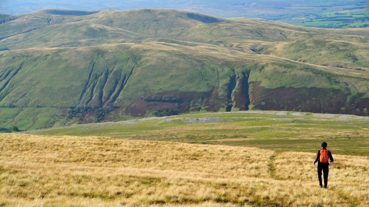
Leave the summit and descend north to the eastern end of Sand Tarn. Follow the outlet stream for almost 2km to reach impressive bands of limestone with terraced outcrops as well as crags and pavements.
-
Turn right here, along the limestone, and walk above the outcrops known as Fell End Clouds. You can explore at leisure or simply stand and appreciate the grey swirls and lines of rock. Pass a dip at Dale Slack, where a rough track descends towards an old farmhouse and walled enclosures. Continue ahead and wander through Skennerskeugh Clouds with a scattering of shake holes. Keep a fence on your left and meet a track coming down from High Whiterigg.
-
Turn left and walk down to the gate to retrace your steps back to the start.
What walking gear do I need for this route?
Here's a selection of the best walking gear selected by LFTO's testing team: Walking boots | Hiking daypack | Waterproof jacket | Walking trousers | Walking poles | Walking mid-layers | Base layers
Where can I eat and drink?
The Fat Lamb country inn is very close to the start/finish of this route. There are also two pubs in Ravenstonedale and a wider choice in Kirkby Stephen.
Where's the best place to stay?
Great options include Kirkby Stephen hostel and Low Greenside campsite. Take a look at ravenstonedale.org for several local choices.
About the author
Roger Butler is one of the most experienced walking route guide writers in Britain, with a passion for climbing mountains and exploring remote Hebridean islands. His articles and photographs have featured in countless outdoor magazines over the past few decades, and he's been a long-term contributor to Trail and LFTO.