
Combine Stanage Edge with little-visited Bamford Edge to make a superb Peak District outing, with our local expert Steve Goodier as your guide.
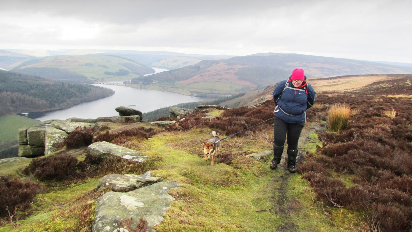
Bamford Edge and Bamford Moor rise to an airy 426m and occupy a prominent position overlooking Ladybower Reservoir and Winhill Pike in the Dark Peak’s Hope Valley.
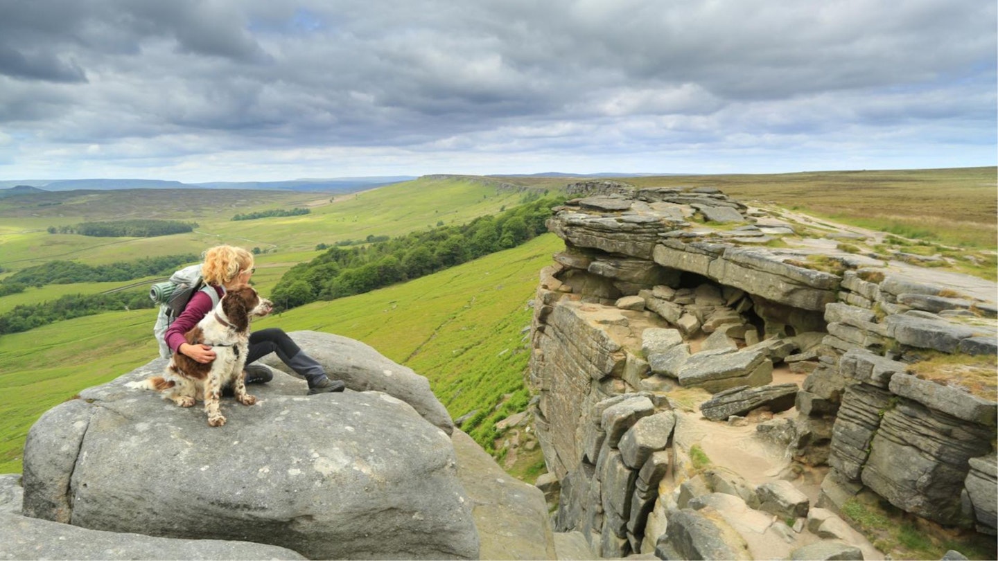
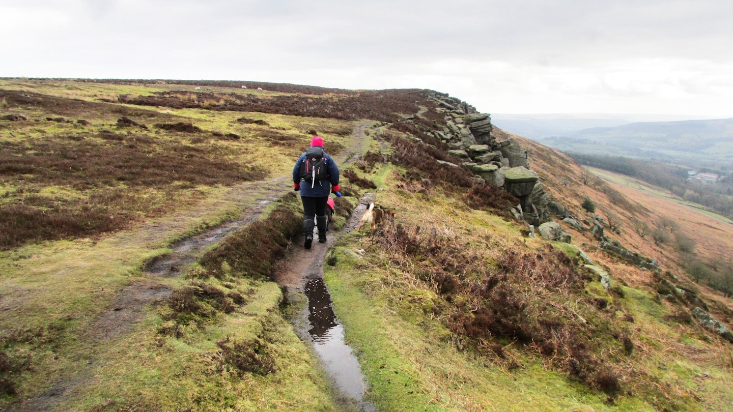
The edge makes a little-known skyline walk in a high position north of the village of Bamford. Views from the path traversing the overhanging gritstone rock found here are stunning and the walking is rough and exhilarating.
The good news for walkers is that access land and concessionary paths make a walk along (and over) this stunning moor very straightforward. The downside is that dogs are not allowed off the public rights of way here, so if you normally take yours then make sure you check the details first about where they can and can't go.
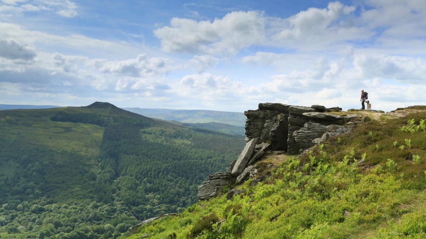
To make a great circuit and superb Peak District day out, combine Bamford Edge with an airy clifftop walk along Stanage Edge and a visit to the top of High Neb (458m), with great views all the way.
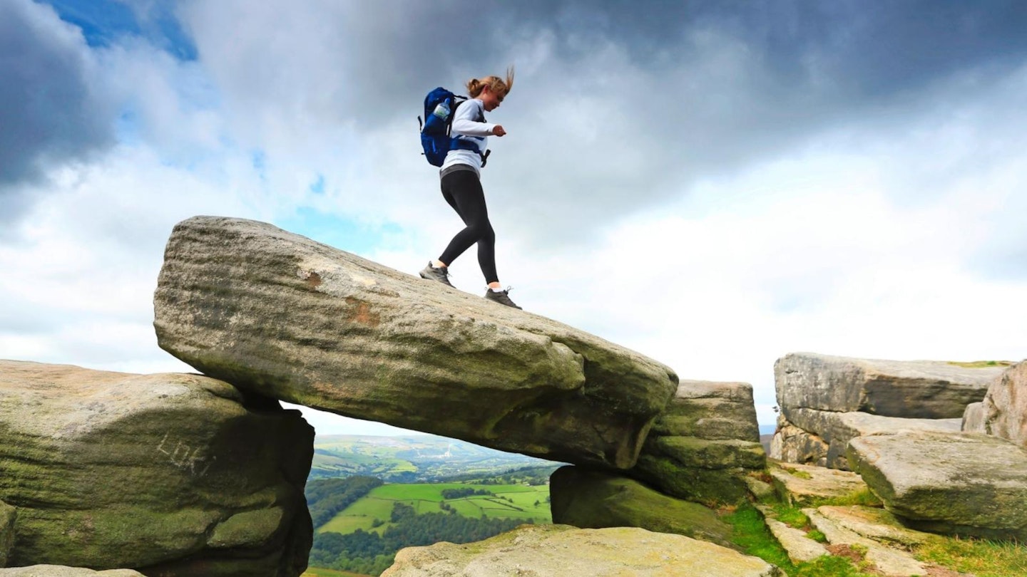
Bamford Edge and Stanage Edge together will give you a wilderness outing over high and rough ground that you’ll enjoy best if you save it for a day of settled weather and clear skies. There are also some options for light scrambling if the mood takes you.
Is Stanage Edge a difficult walk?
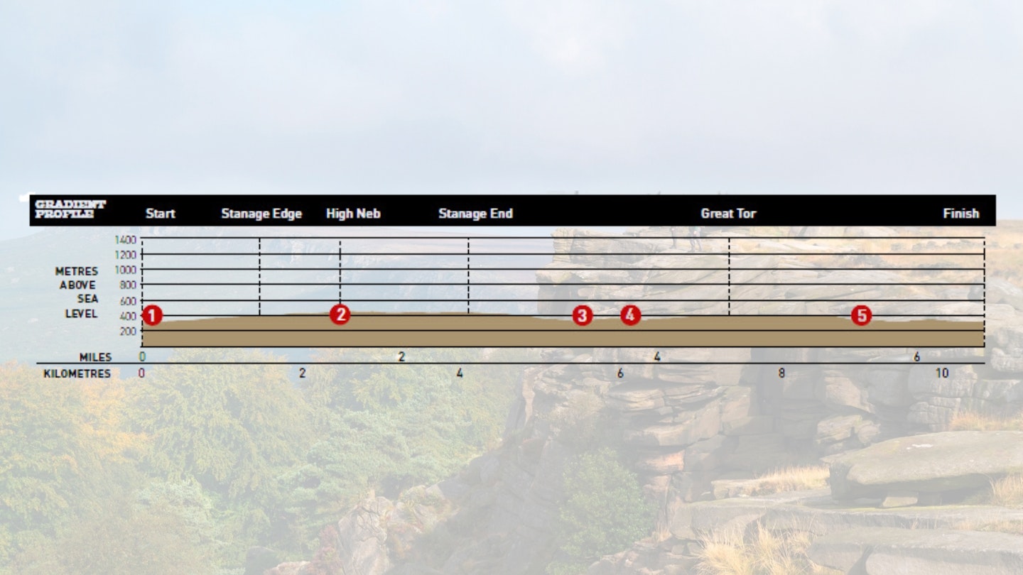
DIFFICULTY: Easy | DISTANCE: 10.5km (6½ miles) | TIME: 4 hours | TOTAL ASCENT: 300m
FITNESS: No problem for experienced walkers. This is a relatively short route with fairly minimal ascent by hillwalking standards.
TERRAIN: Mostly good paths and tracks that can be wet and muddy in places. There is a stretch of road walking with some steep ups and downs.
NAVIGATION: Some steep and rough ascents and descents and one or two confusing areas where careful navigation is required. Best avoided in mist or bad weather.
Where is the start of the walk?
Car park at Dennis Knoll, and the nearest big town/city is Sheffield.
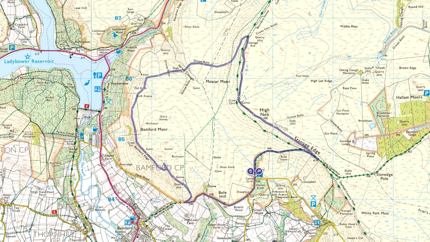
What's the best map for Stanage & Bamford Edge?
-
CLICK HERE to view and download our digital route guide in OS Maps
Stanage & Bamford Edge | Step-by-step route guide
-
Exit the car park taking the track northerly towards Stanage Edge past a green barrier. Pass two small plantations right and curve right with the track. Follow the rising track (with a fence left) to pass under the rocks of Stanage Edge (left). Continue rising under rock outcrops on the track and when they end, reach a path cutting back left. Take this following the path to cross a stile in a fence. Next, dip then rise and follow the path along Stanage Edge to reach the trig point on High Neb.
-
Continue ahead on the edge path descending and curving right gradually. Descend past a cairn and continue along the edge past a ruined building (right). Follow the path past a quarry. Shortly after, go left at a path junction going down through quarry ruins. Cut left at a path junction a bit further on passing a standing stone to reach another path junction after the quarry. Go left passing below the quarry following a path below outcrops.
-
Just before a large slab left reach a path junction. Go right downhill. Go left at the next junction, continuing to just before a wall up left to reach a path junction right. Go right downhill towards Jarvis Clough. Descend through boulders following the path past shooting butts and posts left. After the last post continue to a track junction. Go left beside Jarvis Clough. Curve right around the clough head below a building.
-
Continue ahead on a rising track to follow an old wall soon curving left. Walk up the moor, passing fenced-off shafts staying ahead at all times. As the path narrows continue along it as it turns into a better track through heather. At a fork stay ahead, following the again narrowing path through heather to cross a track and dip over a very marshy area. Continue following the vague path by marsh grass in a small groove. If needed, use GPS point SK209860 to reach a stone pillar.
-
From the pillar go left on a path-cum-sheep track towards the left of two tracks ahead. At the head of a clough go left on a path. Climb past a shooting butt on the left track you were aiming for. Rise to join a path at a junction. Go left rising to a wall corner. Continue up the side of the wall. As the path fades go right through a section of the wall that is broken.
-
Take a path half-left, curving left as you join another path. Follow the rising path over an old wall. Continue along Bamford Edge. Further on, at a marker post (‘No Dogs’) bear left, rising to a path junction and shooting butt. Go left to the summit of Bamford Moor. Retrace your steps to the shooting butt, going ahead on the edge path. Then descend to cross a stile to a road.
-
Go left, along the lane to a junction. Then turn left back to the car park.
What walking gear do I need for this route?
Here's a selection of the best walking gear selected by LFTO's testing team: Walking boots | Hiking daypack | Waterproof jacket | Walking trousers | Walking poles | Walking mid-layers | Base layers
Where can I eat and drink?
The Yorkshire Bridge Inn, Bamford, yorkshire-bridge.co.uk
Where's the best place to stay?
- Look for good local deals on booking.com
- The Plough Inn, Hathersage, theploughinn-hathersage.co.uk
- Laneside Caravan Park, lanesidecaravanpark.co.uk
About the author
Steve Goodier is an experienced hillwalker and freelance outdoor writer specialising in hiking routes in the Lake District, Yorkshire Dales and Scottish Highlands. He's walked and climbed all over the world and produces regular walking routes for Trail magazine and LFTO.
This route originally appeared in the September 2017 issue of Trail magazine. CLICK HERE to become a Trail magazine subscriber and get 50% off a whole year of digital OS Maps