
The peaks of northern Snowdonia may get more fame and footfall, but this hike to the summit of Rhinog Fawr shows off a different side to Wales' most mountainous National Park.
The Rhinogydd is characterised by unruly and seemingly impenetrable slopes of scree, crags and heather. To the uninitiated they seem like a difficult proposition, however, for those who don’t mind doing a bit of judicious bypassing, these rocky peaks are the perfect playground.
A popular way to tackle the summits is to do them in one full-range traverse as this is a superb outing but, in the process of covering the distance, each peak tends to merge into a blur. These fine mountains deserve more than just being another tick on a long list, so why not do one at a time and enjoy exploring this hauntingly beautiful corner of Snowdonia.
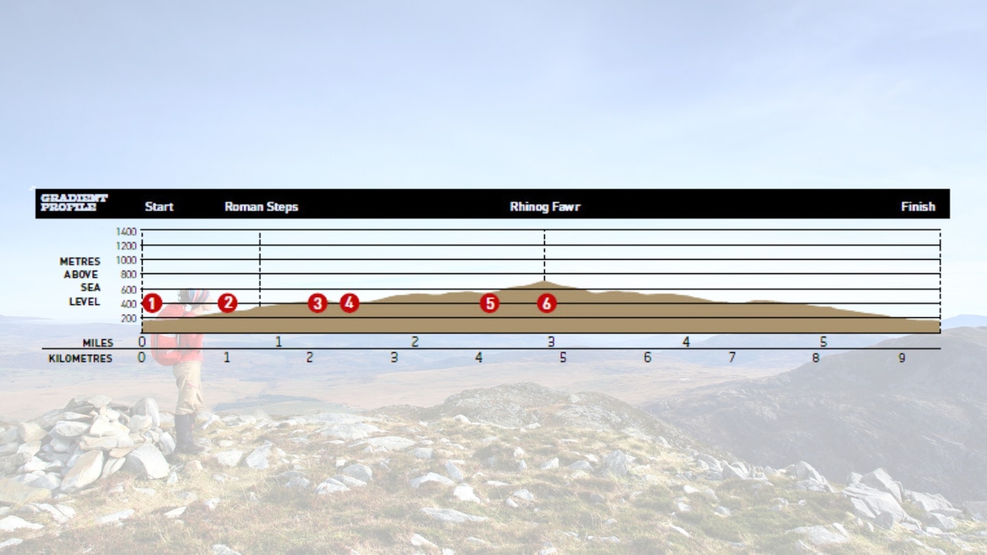
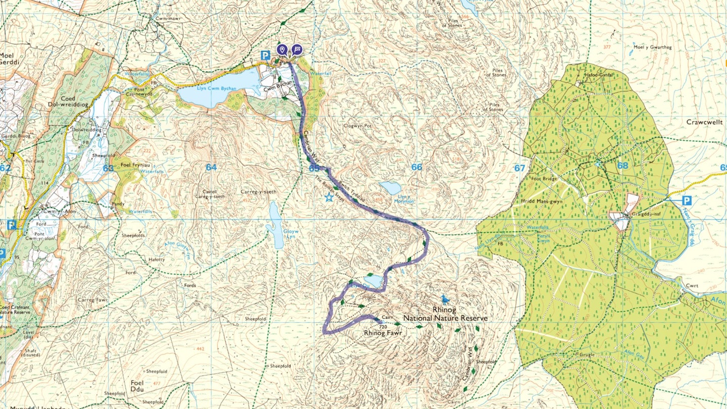
Rhinog Fawr is a prime mountain for an out-and-back walk. It sits reasonably close to its twin Rhinog Fach, but there is little around it to block the view and it has a grandly independent air. By starting off at the beautifully situated road head at Cwm Bychan you can exploit the well-graded footpath that climbs steadily to the Roman Steps.
From here a brief descent over Bwlch Tyddiad, a crafty sidestep via Llyn Du and then a handrail beside an old drystone wall gets you into the perfect position to ascend the more forgiving slopes of the north-west face to the summit.
How hard is climbing Rhinog Fawr?
DIFFICULTY: Medium | DISTANCE: 9.2km (5¾ miles)| TIME: 5 hours | TOTAL ASCENT: 750m
FITNESS: The terrain can feel rough and rugged at points but this isn't a long walk so no issues for experienced walkers.
TERRAIN: Steep-sided valley; woodland; rocky summit; packhorse track; narrow pass; hanging corrie; rough mountainside; llyn.
NAVIGATION: There are plenty of clear paths on Rhinog Fawr but these peaks can feel featureless quickly when the cloud comes in. Carry map and compass – and know how to use them!
Where is the start of the walk?
The head of the road at Cwm Bychan. The nearest town is Llanbedr.
What's the best map for climbing Rhinog Fawr?
-
CLICK HERE to view and download our digital route guide in OS Maps
Rhinog Fawr | Step-by-step route guide
-
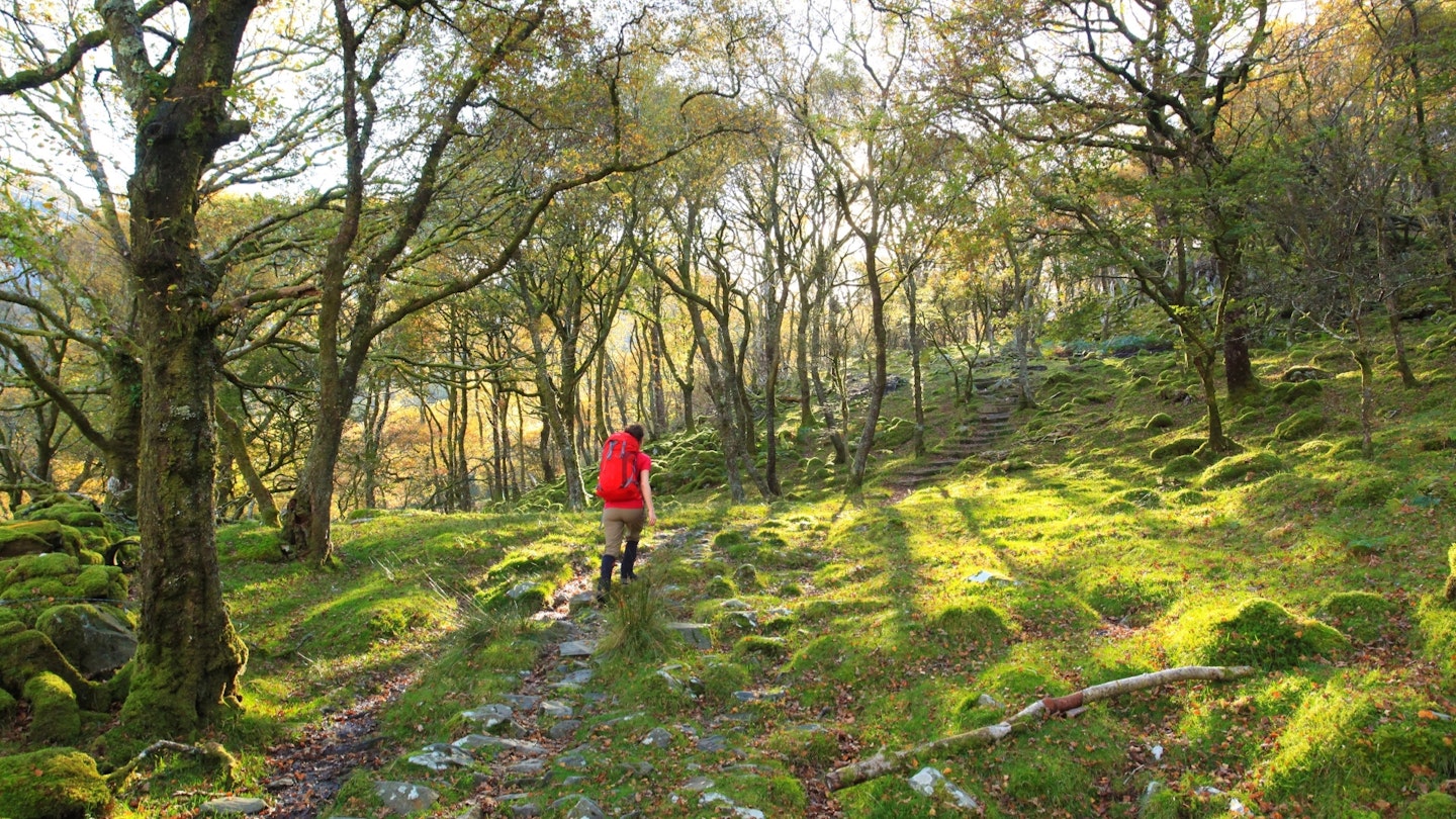
There is pay parking near the road head in Cwm Bychan. The path (a packhorse track) leads straight from Cwm Bychan and is signposted for clarity. It climbs steadily south up through the trees to emerge at a stream crossing.
-
Cross the stream and take the path that trends south-east. The Roman Steps path is an ancient communications link that probably pre-dates Roman activity. It was an important military road used by Edward I when his forces occupied Harlech Castle in the 1280s. The path is constructed with large slabs and is easy to follow – take it all the way to the top of Bwlch Tyddiad.
-
The top of the pass is in a narrow col – if you have time it’s worth making a short out and back climb up the north side to get an impressive overview of it. Continue over Bwlch Tyddiad on the main path and descend for about 100m to a narrow path on the right.
-
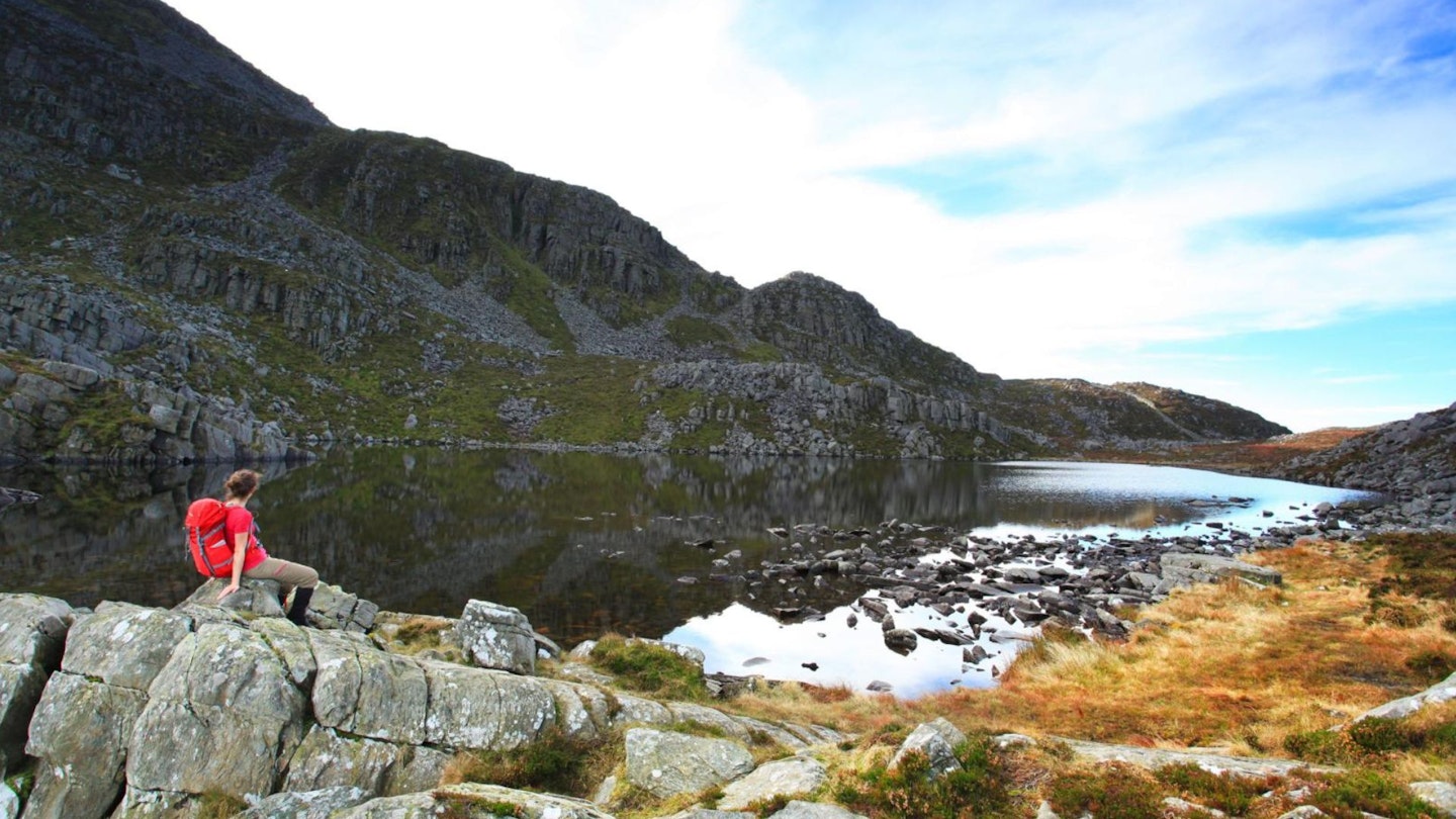
Take the narrow path and follow it south then south-west as it climbs to the hanging corrie occupied by Llyn Du. Surrounded by rock ramparts the llyn is both dramatic and sheltered, and is a great place to explore or have a bit of a break. The route heads around the south side of Llyn Du and then heads west until you encounter a wall. Handrail the wall south-south-west for about 200m until a path breaks off left.
-
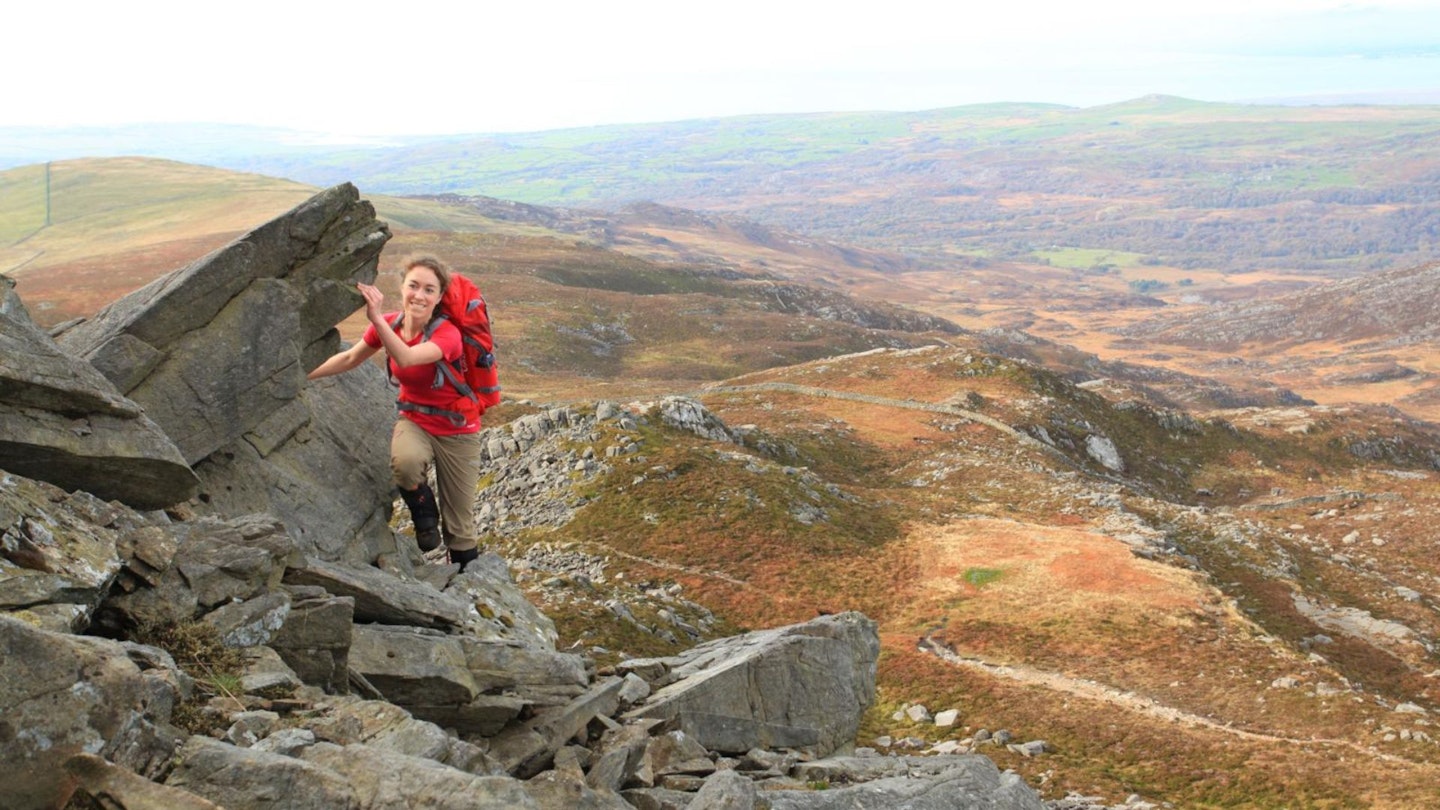
The path climbs east and heads directly for the summit of Rhinog Fawr. There is a section of scree but also an alternative which bypasses this short obstacle. A good path then leads straight to the summit cairn and trig point.
-
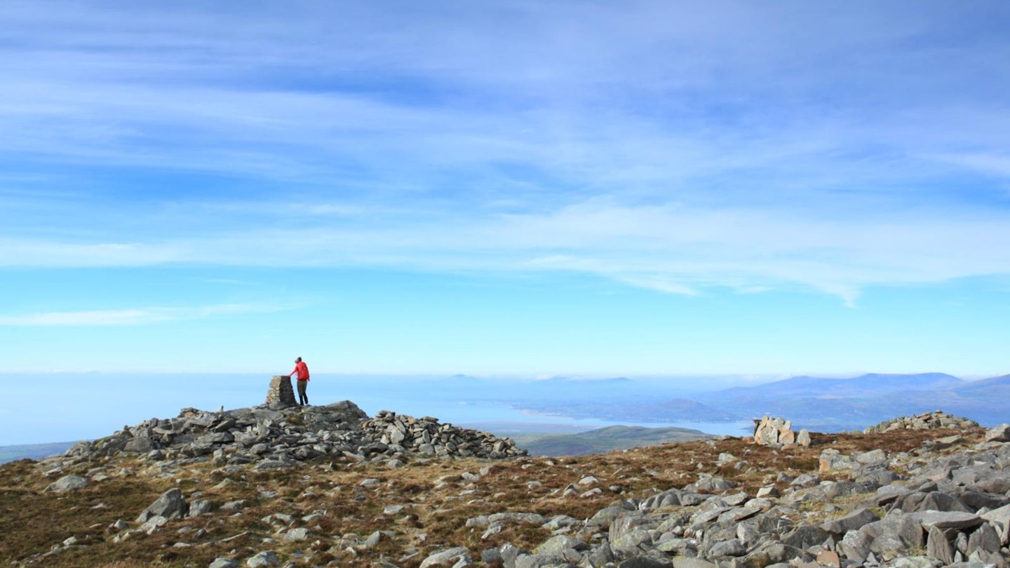
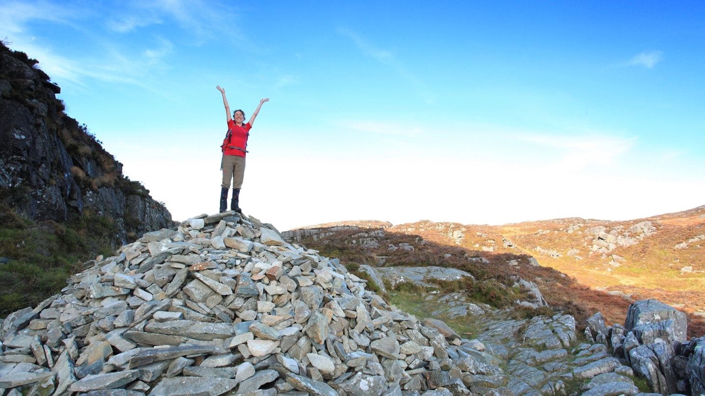
Rhinog Fawr is a particularly fine summit with rocky outcrops and a dramatically positioned trig point. The views are extensive and are wide ranging, both of the main bulk of the Snowdonia mountains, and also of the closer peaks and the coastal plain and estuaries. To avoid problems with encountering crags on your walk, the best descent is to retrace your steps back to Cwm Bychan via the wall-side path, Llyn Du and Bwlch Tyddiad.
What walking gear do I need for this route?
This is a proper mountainous hillwalk, so you'll need the obvious basics of walking boots or hiking shoes, a good hiking daypack, a reliable waterproof jacket (essential in Snowdonia!), and a pair of quick-drying walking trousers. Depending on the season you walk this route you may need some extra essentials, so check out our hiking gear section for our latest reviews and recommendations.
Where's the best place to stay?
Dinas Farm Caravan and Camping is near the start of the route. Alternatively, there are lots of hotels and B&Bs on the coast near Harlech and Llanbedr – but no YHA nearby. Check Booking.com or Trip Advisor for accommodation options and the best deals.
About the author
Sarah Ryan is a long-time contributor to Trail magazine, Trail Running magazine and LFTO. She's a qualified Mountain Leader and hugely experienced writer who has recently spent months hiking through the mountains of Nepal.
This route originally appeared in the September 2017 issue of Trail magazine. CLICK HERE to become a Trail magazine subscriber and get 50% off a whole year of digital OS Maps