-3.jpg?ar=16%3A9&fit=crop&crop=top&auto=format&w=1440&q=80)
Trail magazine’s 'Walks of a Lifetime' series takes you on a guided tour of the greatest mountain routes in Britain. This time we’re heading to Snowdonia and the rough, tough terrain of The Rhinogs with experienced mountain connoisseur Tom Bailey as our guide.
Click here to download this walk of a lifetime route from OS Maps
Dangling beneath the main cluster of mountains in Snowdonia is a thin strand of peaks that are often overlooked but provide a real challenge. More than once when I’ve visited the Rhinogydd (Welsh plural of Rhinog), I’ve prayed for the agony to end, regretting the length of the route chosen.
These mountains are rough, not dissimilar to the great wilderness of the Knoydart peninsula in western Scotland. But that roughness is their best asset. There are fewer paths, fewer people, more adventure, more mountain. I’ve never walked them the same way twice. Modest in stature, the Rhinogydd were brought up the hard way. They don’t suffer fools. But if you get them on your side, they’re solid friends to have.
A walk in the woods
Approaching the plantation to the east of the Rhinogydd you’ll pass over the Crawcwellt river, an area great for moorland birds such as short-eared owls and hen harriers. A sure sign this is a quiet area. Park in the car park by the plantation at the end of the public road (map point 1, SH684302). From here, with the morning light behind you, the shattered peaks of the Rhinogydd – some of the oldest rock to be found in Snowdonia – sit brooding, indifferent to your intentions. The first 2km of the day is spent in woodland, following a public path. Heading south-west from the car park, at a track junction at the southern end of Graigddu-isaf (point 2, SH679298), take the left path heading south, then south-west after a kilometre.
Plantation can be a rich place for birds, particularly in such a harsh mountain environment. Listen for the thin calls of goldcrests and crossbills. In late June and early July, the spires of hundreds of foxgloves will add a dash of much needed colour. On still days the scent of the resin from the trees is intense.
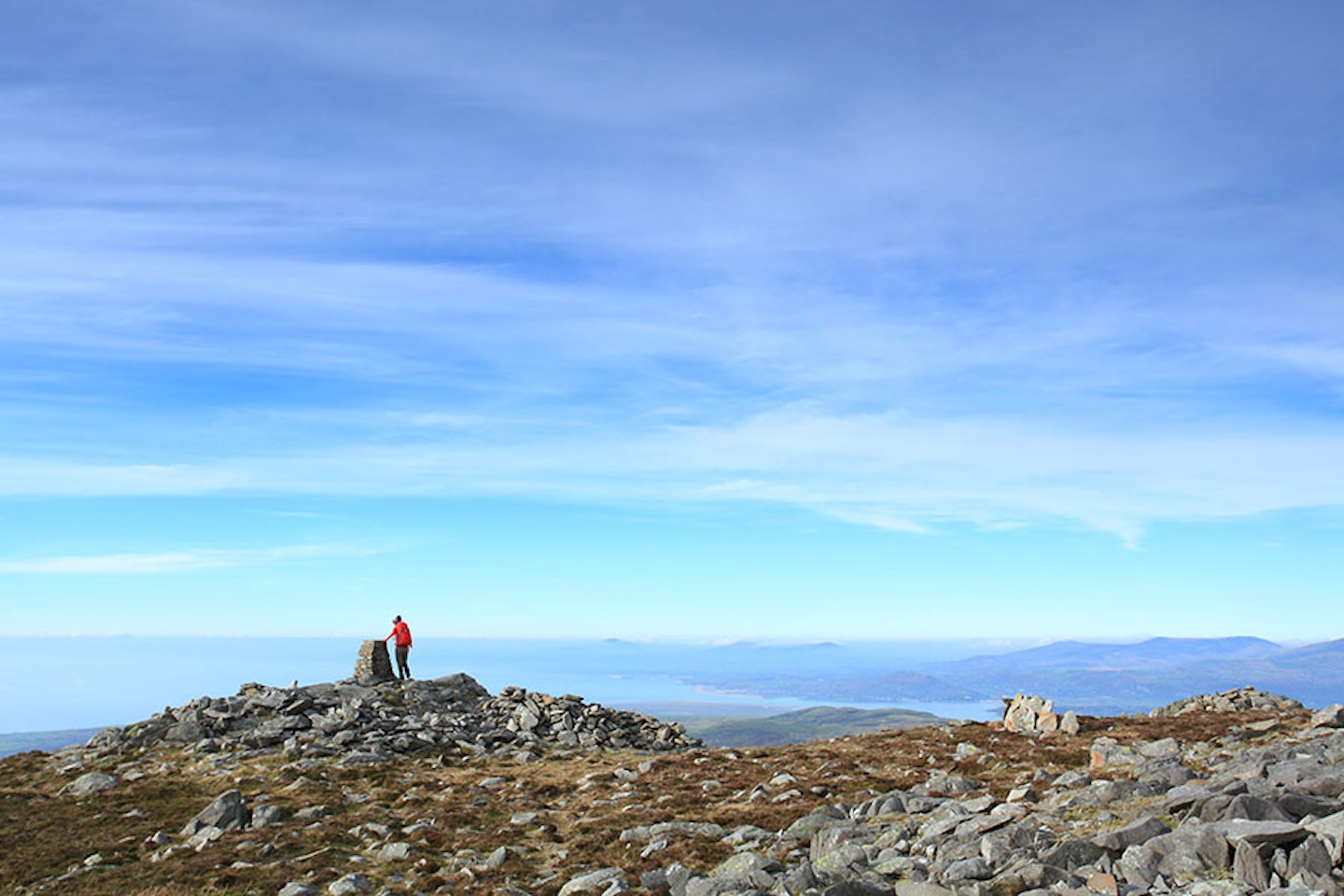
A tributary of the Afon Gau is crossed just before you leave the forest, and this area has been clear-felled recently so will now be open for years to come. There will be less forest than your maps suggest, but the plantation boundaries are still in the same place. That’s the thing with plantation – it’s a living, ever-changing thing. The path, freshly made from boulders in its lower section just after leaving the woodland, roughly follows the main stream up towards Bwlch Drws-Ardudwy. At point 3 (SH664282) you’ll be standing on a mound, next to a cairn. Look west to the blue horizontal line of the sea, only a day’s walk away.


Hidden mountain world
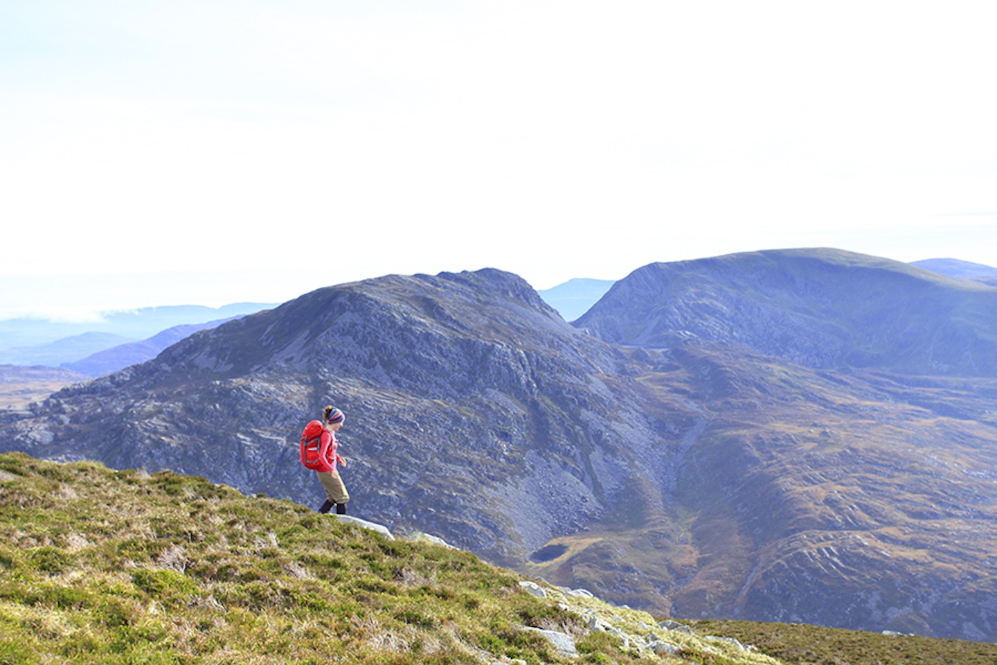
The challenge now is a little more daunting. To the south, the vast northern end of Rhinog Fach looks you in the eye. Hold its gaze because it’s not as bad as it looks. A thin path cuts directly up from the wall at the base of the bwlch. This is easily followed once you’re on it. Trust me, at the pace you’ll be going up here, you’ll have plenty of time to keep an eye on where the track is going.
As soon as you’ve got some height the views of Rhinog Fawr to the north will start to impress. To its right in the distance is the familiar outline of Snowdon. The path eases off, snaking up through a hidden world of mountainside, until you break out onto the northern end of the summit ridge. When I was here last, I was greeted by a large herd of the legendary feral goats that roam these hills. Complete with kids (young goats), they wouldn’t let us get too close but they couldn’t resist being curious. I can picture it now: 20 horned devils peering down at us from above.
The path heads south towards the summit, which would make a great summer bivvy spot. Vast views stretch out to the east for sunrise, and west for sunsets over the sea.
Elephant in the room
At Rhinog Fach’s summit (point 4, SH664270), the best way off is to follow the wall that heads east for a short distance before following the path as it swings to the south for a steep, but spectacular, descent down to Llyn Hywel. The path gives dramatic views but is hard to follow in its lower section. Heading east to a wall that runs in a southerly direction gives safe passage down this, the most characterful side of Rhinog Fach.
If you have time, check out the view of the mountain from the southern shore of the llyn. At point 5 (SH665266) you’ll be aware of an elephant in the room. The peak that looms above you to the south is Y Llethr, and many people include it in a day trip to the Rhinogydd. In reality it’s a dull hill, with one of those summits that give you too much foreground and not enough view. So for today, stick to Fach and Fawr. You can always come back to bag Y Llethr, and I reckon you will.
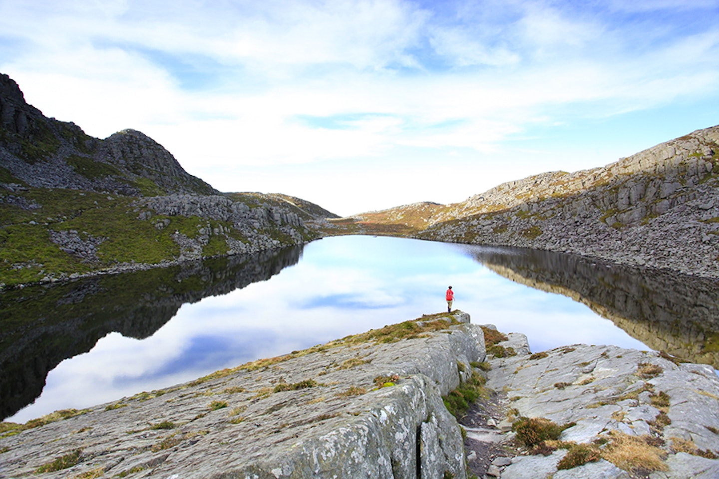
The path leads north-west to the northern side of Llyn Hywel, passing over boulder fields, then swinging in a more northerly direction as it starts to lose a significant amount of height. Rhinog Fach towers to your right (east), in front of you (north) is the next objective Rhinog Fawr. This section of path gives you ample time to study the complicated mountainside in front of you, before passing by tiny Llyn Cwmhosan and dropping back into Bwlch Drws-Ardudwy (point 6, SH660280).


The toughest section
Take a break here, drink long and hard, put sugar into your system, because you’re about to climb the hardest path of the day. Standing on the stile over the wall, survey the route ahead. The path leads northwards, over a mound of glacial moraine, through heather and grass until it reaches the screes at the base of a shallow gully that runs north-north-east up the face. The path follows this pretty much all the way, only breaking off to the left through a rock gap towards the top of this part of Rhinog Fawr.
This ascent provides plenty of opportunities to look back to the south. It’s now that Y Llethr looks the most impressive, tucking in close to our friend Rhinog Fach. By the time you’ve turned to the west and seen where the summit of Rhinog Fawr lies, you’ll have that indestructible, walked-in feeling. Pride will rise in your chest as you complete the ascent to the top (point 7, SH656290).
Best view in Wales?
A cairn with a basic shelter marks the true summit. Further to the west, a trig pillar gives one of the best views in Wales. The Llyn Peninsula out to sea in the west, Snowdon in the north, with the Arenigs, Arans, and Cadair Idris completing the panorama.
Rockier on top than its lower relative, you’re now standing on the most popular of the mountains in the Rhinogydd. From here we plug into path systems that appear almost ‘normal’. The way heads off down the loose, rocky north-western flanks, curving back around to the north, then dropping steeply to the south-east corner of Llyn Du. The large grey slabs of rock plunge alarmingly into the water, giving it a cold, grey feel. More a case of Llyn Don’t, than Du...
Cantering now, you’ll be full of that feeling of a walk almost complete. A tough, rough day behind you. But don’t rush it. This side of Rhinog Fawr is a wild and wonderful place. You’re well into the National Nature Reserve at this stage, where the mountainside teems with life.
The Roman Steps
At point 8 (SH660299) the path drops onto the medieval packhorse route through Bwlch Tyddiad, known as The Roman Steps. The majority of the steps are on the western side and will have to wait for another day, but as you head down to the east you’ll tread on a few, half-hidden steps that give you a taste of what lies on the other side of the pass. Where the name ‘Roman Steps’ came from isn’t known, as they’re meant to date from much later. This would have been a route used by the Romans however, so maybe there’s more truth in the name than is believed.
The top end of the plantation, as you enter it, has been felled recently. It was here that I once got really close to whinchats, a striking bird and cousin of the more familiar stonechat that frequented the path on the walk in.
The last part of the day passes through rides in the plantation that are wide and fringed with native deciduous trees, giving the area a more natural feel. At point 9 (SH679298) you’ll be on familiar ground and it’s just a case of returning to the start for a well-deserved sit down.
This walk will hopefully be the start of a long relationship with the Rhinogydd, where you return as and when the need arises. Quiet, challenging places make those busy higher mountains all the more tolerable.


Fact file
WHERE DO I START?
From the plantation car park at the end of the public road at SH684302. The nearest town is Dolgellau, down the A470 to the south.
WHAT’S THE TERRAIN LIKE?
This is tough walking terrain, with a mixture of forest tracks, steep mountain paths, bogs, rough rock, mountain ridges and scree. Take a good pair of boots!
HOW HARD IS THE WALK?
Harder than it looks on the map! Don’t let the short-ish distance fool you – these rugged peaks need good fitness and navigation in poor conditions. The definition of challenging hillwalking.
WHAT MAP SHOULD I USE?
The OS Explorer OL18 and Harvey Maps Superwalker Rhinogs maps cover the route at 1:25,000 scale. Other options are OS Landranger 124 (1:50,000) and Harvey BMM Snowdonia South (1:40,000).
WHERE CAN I STAY?
The Torrent Walk Hotel in Dolgellau is a decent option, as is Pandy Isaf Country House B&B. The YHA Kings Hostel near Dolgellau is good for individuals, families and groups, with stunning mountain scenery.
Click here to download this walk of a lifetime route from OS Maps

Get HALF-PRICE digital Ordnance Survey Maps for the whole of Great Britain by subscribing to Trail magazine.
Need help with OS Maps? Try the OS Maps online FAQ and OS Maps quick start guide for further assistance
