
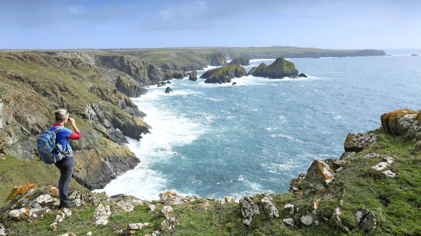
The Cornish coast is wild and windswept, raw and rugged. There are plenty of popular beaches and hidden coves, but a breezy walk along the jagged clifftops of the Lizard Peninsula creates abiding memories of crashing waves, classic geology and cavorting choughs.
The glossy black chough, with its distinctive red feet and hooked bill, was once known as the Crow of Cornwall and still appears on the county crest.
But by the early 1970s, the birds had departed the cliffs and close-cropped headlands of its former West Country stronghold. Thankfully, they found their way back in 2001 and the Lizard’s coastal paths are now among the best places to spot this rare playful acrobat.
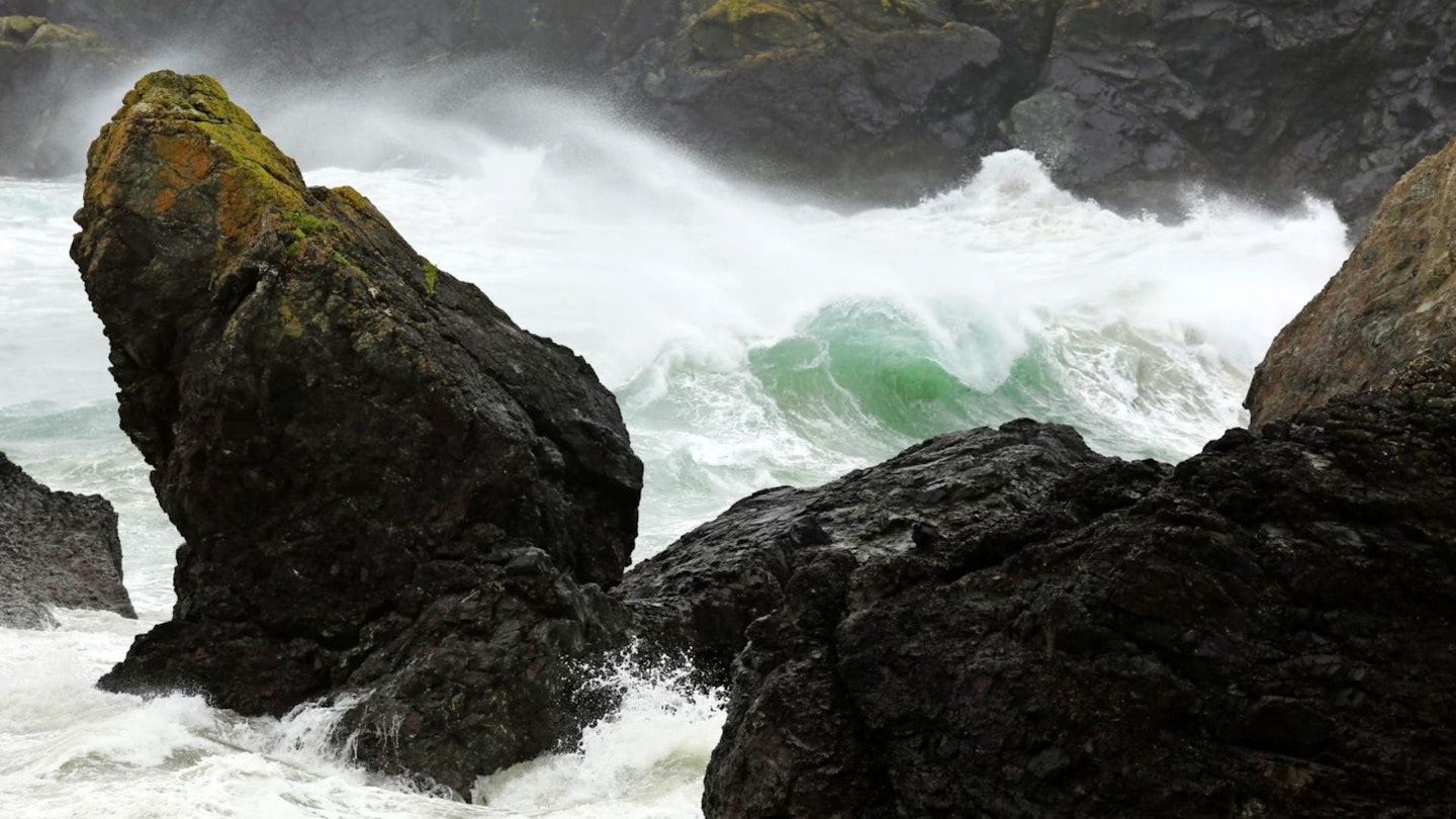
But there are other reasons to explore this part of Cornwall. The ancient rocks and oceanic crust have thrown up blobs and boulders of stripy red and green serpentine, whilst strange adder-rich heathlands stretch inland towards the satellite dishes at Goonhilly Downs.
These once beamed the moon landings around the world, and in 1901, by the start of the walk at Poldhu, the very first transatlantic radio signals were sent to a certain Mr Marconi over in Newfoundland. Kynance Cove is the place for a picnic, with dark caves, tidal islets and glorious pristine sand. Enjoy a paddle or a dip before climbing back up to the cliffs and striding out to Lizard Point.
This is the southernmost point of the United Kingdom and, if you arrive at the end of the day, you’ll be able to stand in silence on the last rocky ledge and imagine yourself as the person who first spotted the Spanish Armada from here in 1588.
How hard is this walk?
DIFFICULTY: Medium
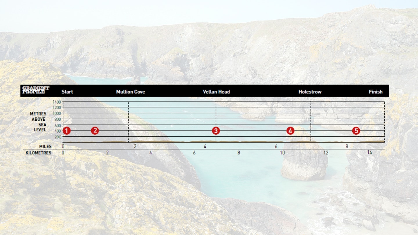
DISTANCE: 14.5km (9 miles)
TIME: 6 hours
TOTAL ASCENT: 630m
FITNESS: No problem for regular walkers and hikers.
TERRAIN: Undulating clifftops – part of the South West Coast Path.
Where is the start of the walk?
Start at Poldhu Cove and finish at Lizard village. The nearest town is Helston.
What's the best map for The Lizard Peninsula?
The Lizard Peninsula | Step-by-step route guide
-
This walk makes use of the local bus for a linear route along the cliffs on the west side of the Lizard Peninsula. Start the day by parking at Poldhu Cove and take the narrow lane running along the south side of the bay.
-
The route is signed as the South West Coast Path and for most of the walk it’s simply a matter of keeping to obvious clifftop trails whilst enjoying the sea air and the wheeling sea birds. Much of the route lies within the Lizard National Nature Reserve, with a wealth of flora and fauna.
-
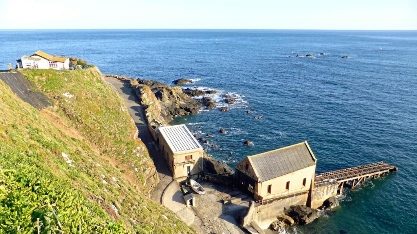
The cliffs turn south at Poldhu Point and shortly afterwards pass the Marconi Centre (free admission, varied opening times), built in 2001 to celebrate the centenary of the first pioneering transatlantic radio messages. Continue along Angrouse Cliff, pass a monument to Marconi and descend past a white cottage to cross the stream at Polurrian Cove.
-
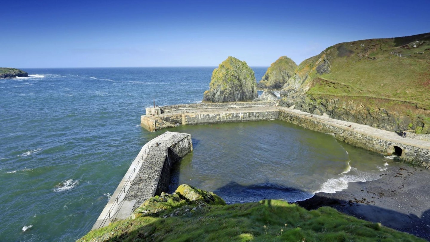
Continue south, uphill on a flight of steps, to meet a track with a line of houses on the left and carry on for 500m until Mullion Cove comes into view. This is a classic Cornish fishing hamlet and breakwaters protect the exposed harbour. Walk down steps, cross the quayside and follow the path signs up to Mullion Cliff.
-
Continue out to Higher Predannack Cliff, crossing streams, to stand above an inaccessible rocky inlet called The Chair. Pass over a stile and continue around Lower Predannack Cliff and Parc Bean Cove and after another 1km reach Vellan Head, where the cliffs are the highest of the walk. Flat coastal heathland has now replaced the pattern of enclosed fields and pasture.
-
The path turns south-east and after 1km crosses a steep gully at Soap Rock, leading onwards to Kynance Cliff and the descent, via steps, to scenic Kynance Cove, with tidal Asparagus Island forming a bookend to the beach. Steps climb east out of the cove, from a shingle beach below the cliffs, but these can be cut off by the tide – a simple alternative route follows the track up the valley next to the café.
-
Back on the clifftops, keep to the right of the National Trust car park and keep ahead on the signed path. Cross a valley at Caerthillian Cove, with more steps, and continue south for another 1km to Lizard Point. Look out for the choughs! The cliffs now turn east and the path drops through another steep inlet, with steps, to emerge by the lane and car park next to the most southerly point.
-
Keep on the South West Coast Path for another 100m, with the lighthouse looming ahead, and take a permissive path on the left. Another permissive path then runs parallel to the lane for 800m and leads into the heart of Lizard village. The bus stop is by the crossroads next to the green.
What walking gear do I need for this route?
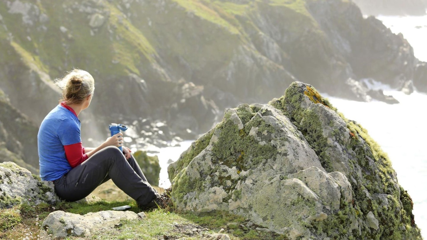
We'd recommend the obvious basics of walking boots or hiking shoes, a good hiking daypack, a reliable waterproof jacket, and a pair of quick-drying walking trousers or shorts with some packable waterproof overtrousers in your bag. It can get wet and wild on the South West Coast Path, so it's always best to go prepared.
About the author
Roger Butler is one of the most experienced walking route guide writers in Britain, with a passion for climbing mountains and exploring remote Hebridean islands.
His articles and photographs have featured in countless outdoor magazines over the past few decades, and he's been a long-term contributor to Trail and LFTO.