
The Peak District, in direct contrast to its name, is hardly full of pointy peaks. In fact it contains one of our flattest mountains, Kinder Scout, which at 636m only just qualifies for a mountain. So, what is the ‘point’ (see what I did there?) of climbing one of our smallest, flattest mountains? Well, quite a lot actually, especially if you go via Kinder's edges. Here are three reasons to start you off.
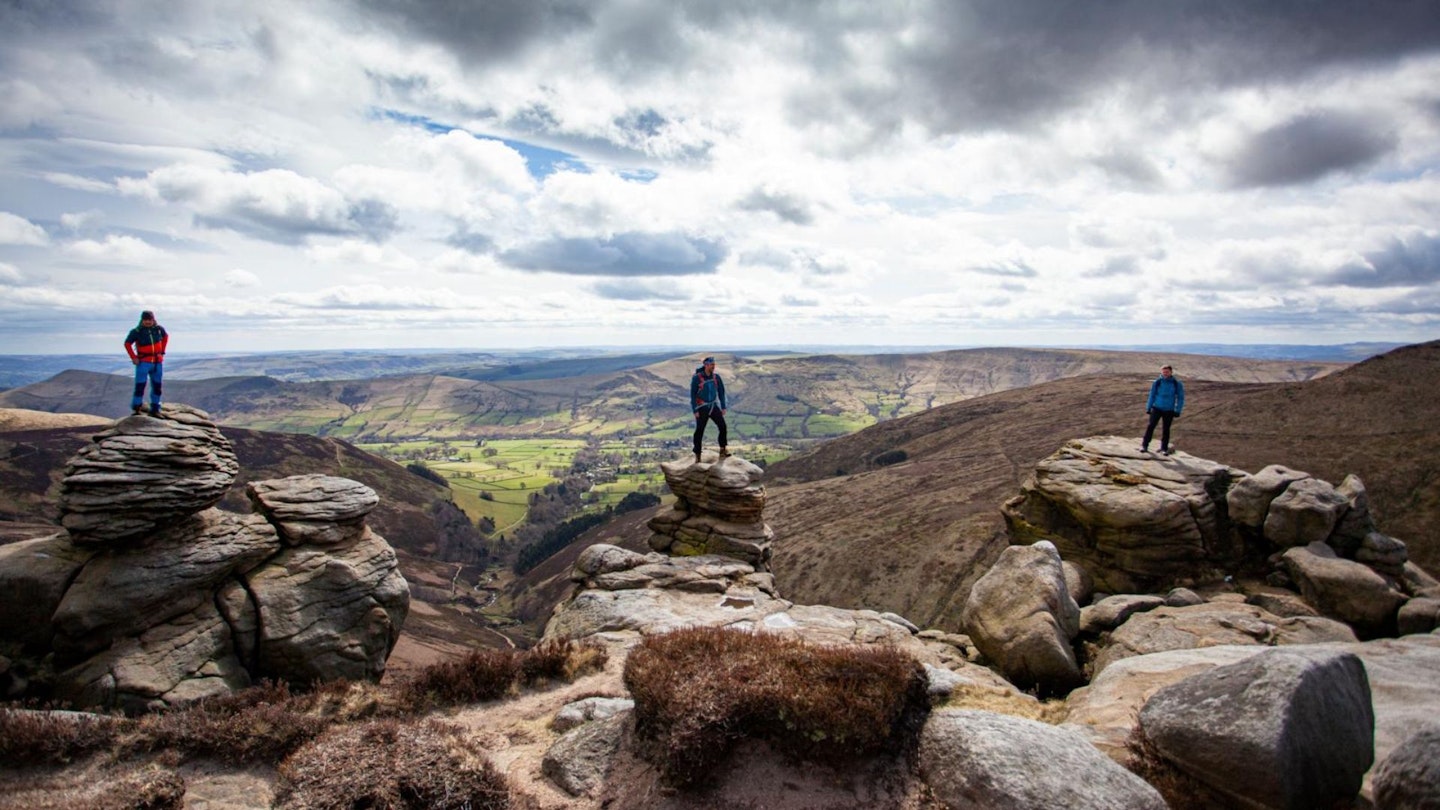
First point – it is one of the most accessible mountains in Britain. Secondly, it has some exciting scrambles. Thirdly, it contains a multitude of gritstone edges that provide continuous views for miles around.
So, it is little surprise that this route takes in all three points in climbing this peak. We scramble up Grindsbrook Clough to traverse the southern edges, then in an unusual twist cross the plateau to the northern side to take in the more remote northern edges.
After this we explore the eastern side of the plateau, visiting folklore landmarks like ‘The Madwoman’s Stones’ and return via a rocky scramble on ‘Ringing Roger’. This area is flooded with folklore history, including where all these rambling shenanigans started with The Kinder Trespass. So, pack up your guidebook, compass and maps and take a journey to climb this awesome flatness!
How hard is climbing Kinder’s Edges?
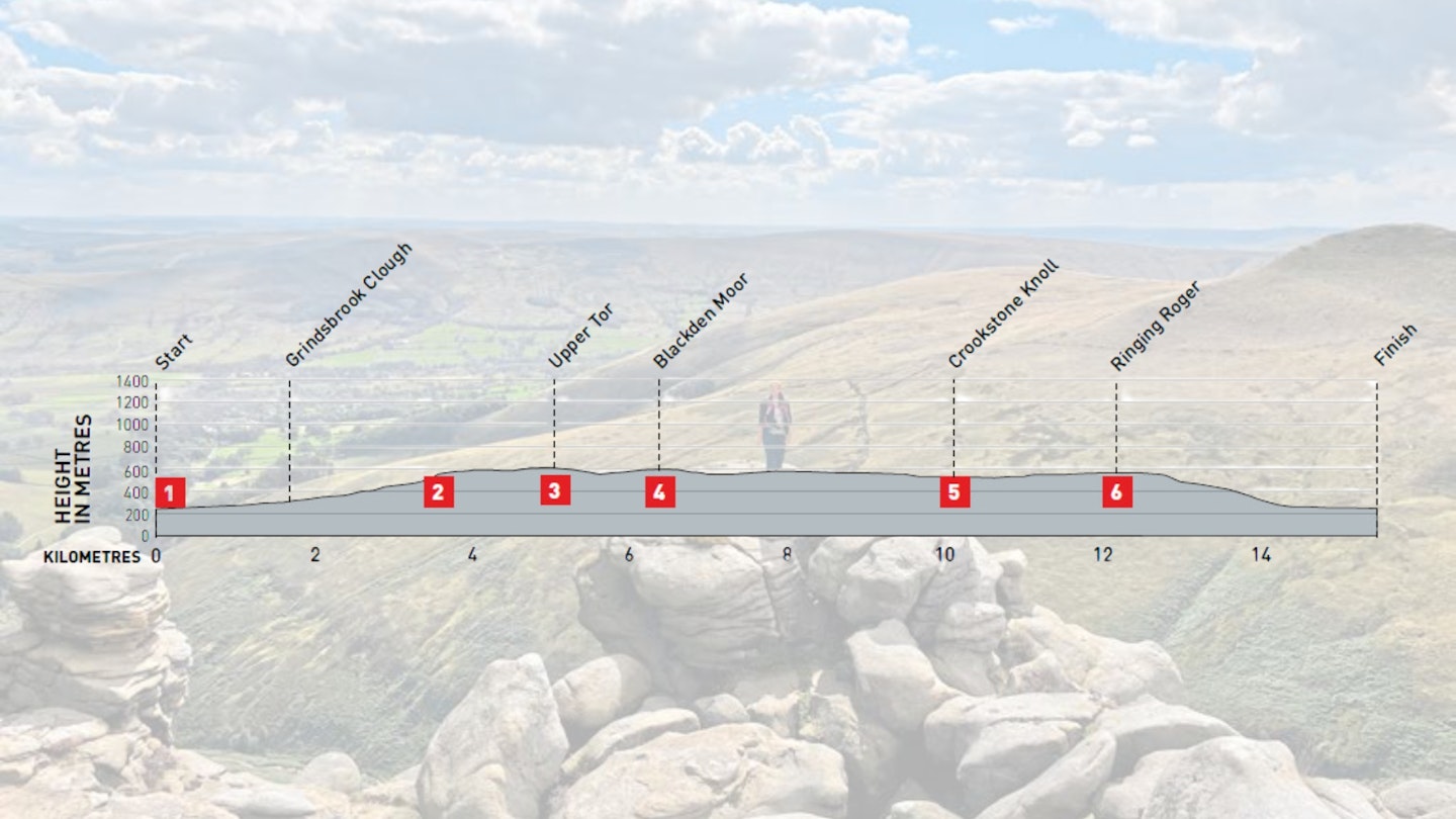
DIFFICULTY: Medium | DISTANCE: 16KM | TIME: 5 hours | TOTAL ASCENT: 530M
FITNESS: Average hill fitness required
TERRAIN: Scrambly rocky ground that can be avoided, easy paths most of the way. Short tough section of heather bashing and peat hags across the plateau.
NAVIGATION: Good clear paths most of the way. Featureless ground crossing the plateau, where navigation can be challenging in both good and poor visibility |
Where is the start of the walk?
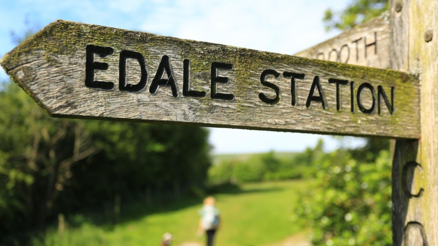
Edale is on the Hope Valley railway line, which runs between Sheffield and Manchester Piccadilly. Or park in Edale’s car park.
What's the best map for Kinder’s Edges?
-
CLICK HERE to view and download our digital route guide in OS Maps
-
OS Explorer OL1 (1:25k)
-
OS Landranger 110 (1:50k)
-
Harvey British Mountain Map Dark Peak (1:40k)
Kinder’s Edges | Step-by-step route guide

-
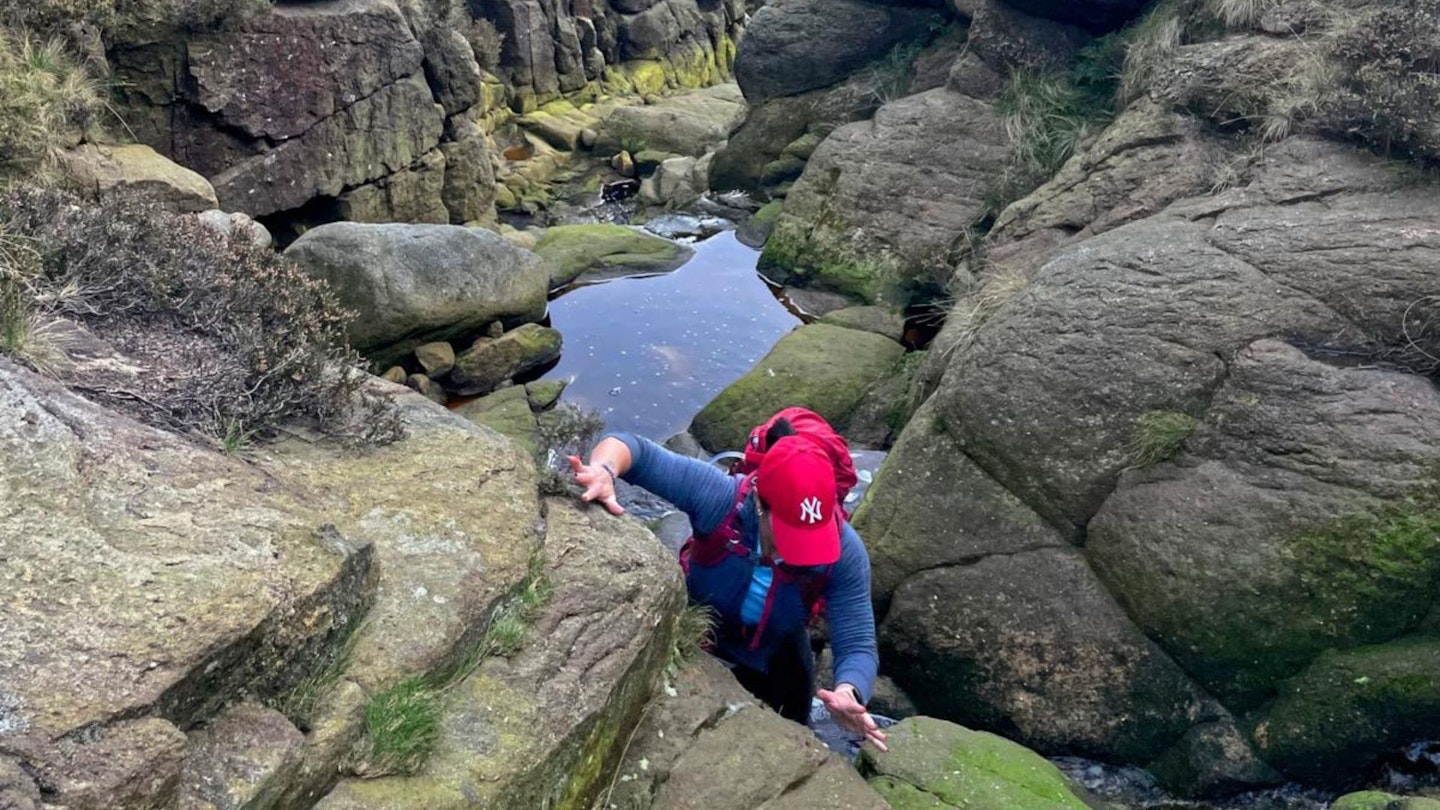
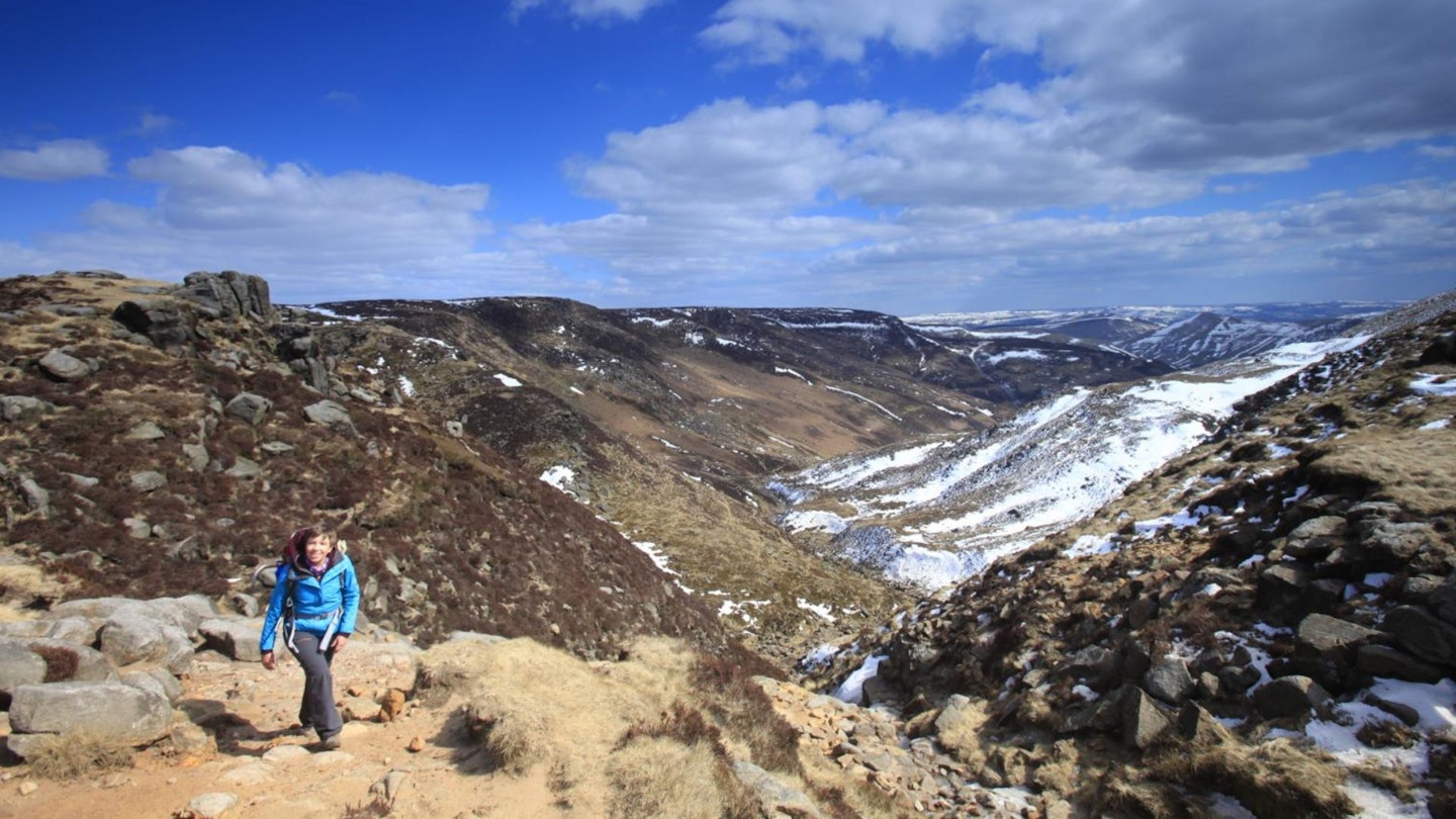
From Edale car park at the T-junction take a right on the road into Edale and continue through this pretty village and past the Old Nags Head. This is the starting point for The Pennine Way, the first National Trail in England. Head up the road until it turns into a track and take the right-hand footpath and cross the footbridge into a large field. From this point handrail the path at the side of Grinds Brook, enjoying the views up to the southern edges of Kinder Scout. Continue until you reach the confluence of Grindsbrook Clough (left) and Golden Clough (right) and take the left-hand rocky scramble up to the top of the clough and the plateau edge.
-
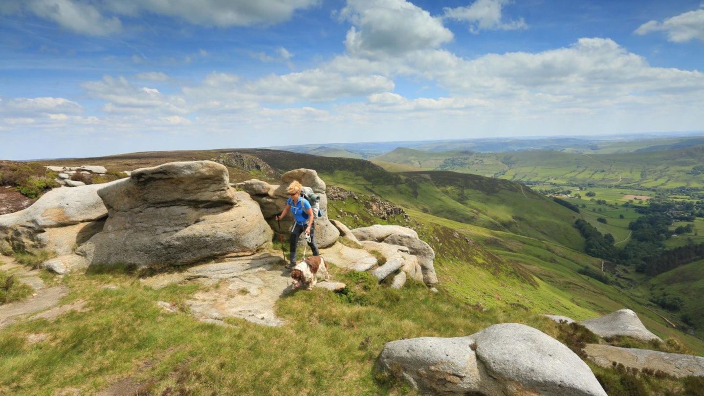
From the top of Grindsbrook Clough you can visit the E.T boulder (left 50m), one of many gritstone landmarks, or turn right and follow the well-worn footpath along the side of the southern edges. This path crosses two major clough inlets before it reaches the most prominent gritstone outcrop which is Upper Tor. This tor has three distinctive flat-topped boulders which are an excellent photo opportunity and viewpoint towards the Vale of Edale and The Great Ridge.
-
In the middle of the rocky outcrop take a bearing of 20° across the plateau to Fords at the top of Blackden Brook. This can also be reached by walking due north-east for 600m; however, an accurate bearing is advisable. The ground is rough peat hags and heather and tough-going. You are now at the northern edges, once you’ve reached Blackden Brook take a left and handrail the edge to gain a broad shoulder at Blackden Moor.
-
Here there is another series of interesting gritstone outcrops and plenty of hidey holes to take shelter for lunch. Now retrace your steps to Blackden Brook and then east along Blackden Edge for around 4km until you meet the very eastern end of Kinder Scout at Crookstone Knoll, not forgetting to call in at The Madwoman’s Stones. The name comes from a jilted lover who, so distraught with her loss, came to this place and bashed her head on the stones (not recommended) to escape the pain of her lost love.
-
Crookstone Knoll is another great vantage point with views over towards Ladybower Reservoir and Derwent edges. Wave goodbye to the north and take an about turn south-west to regain the southern edges. Traverse these edges on the higher path with gaining interest as you cross various clough inlets, eventually passing The Druid’s Stone where folklore tells of the sacrifice of many a Druid. Shortly after this point the path bends right and then left to meet some major gritstone boulders which present the start of Ringing Roger.
-
Ringing Roger is a small ridge of gritstone which can be easily circumnavigated on a path to the right or downclimbed at various scrambling grades from 1-3 for further interest. From the bottom of Ringing Roger turn left (south) on a well-worn footpath to The Nab for excellent views across The Vale of Edale. This is the last high point as you now descend back on yourself right on the zigzag path towards Heardman’s Plantation. This is named after Fred Heardman, a landlord at The Odd Nags Head who was one of the first ports of call in the early days of what was to become Edale Mountain Rescue. Go through the stile at the right of the plantation and descend left across the field to meet your original path out of Edale and retrace your steps back to the Nags Head for a pint and pub lunch.
What walking gear do I need for this route?
Here's a selection of the best walking gear selected by LFTO's testing team: Walking boots | Hiking daypack | Waterproof jacket | Walking trousers | Walking poles | Walking mid-layers | Base layers
Where can I eat and drink?
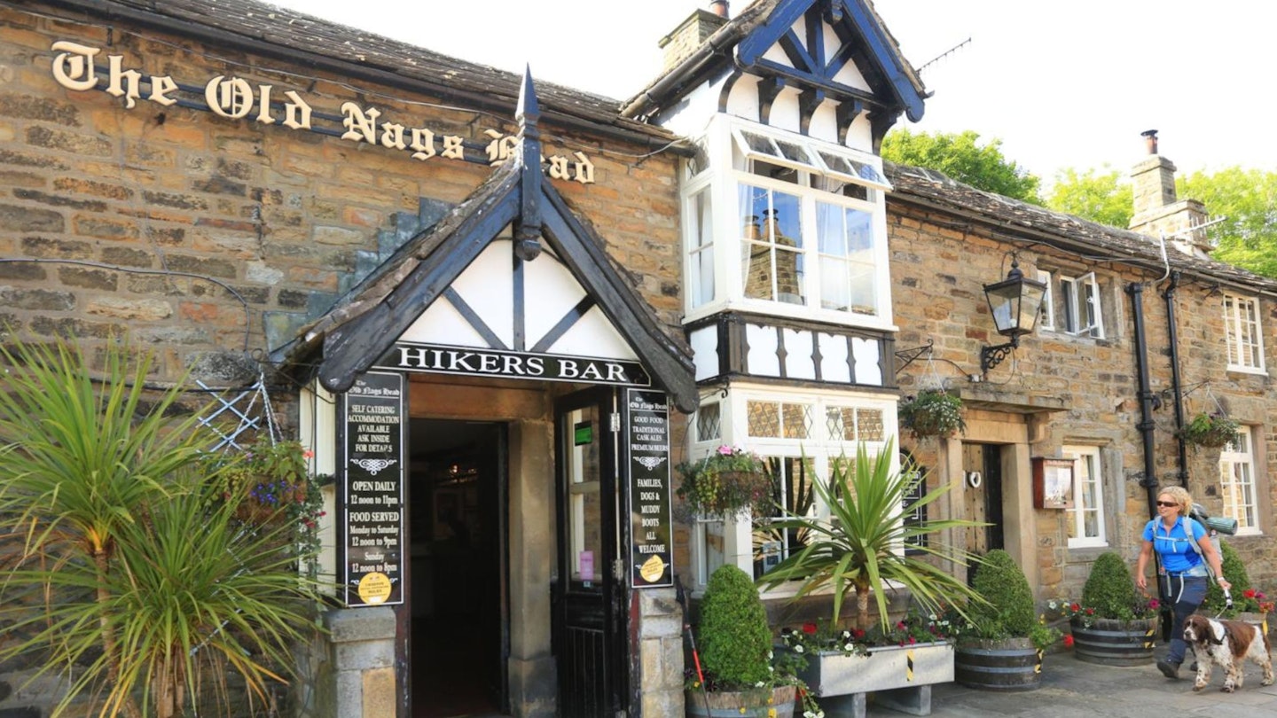
Options in Edale – try The Penny Pot Café for coffee and cake, or The Old Nags Head for pint and pub lunch.
Where's the best place to stay?
All choices of accommodation from hostel, camping and bunkhouses to Airbnb, at Edale, Hope and Castleton. YHA Edale is one of the highest residences in the Peak District, with great access to Kinder.
About the author
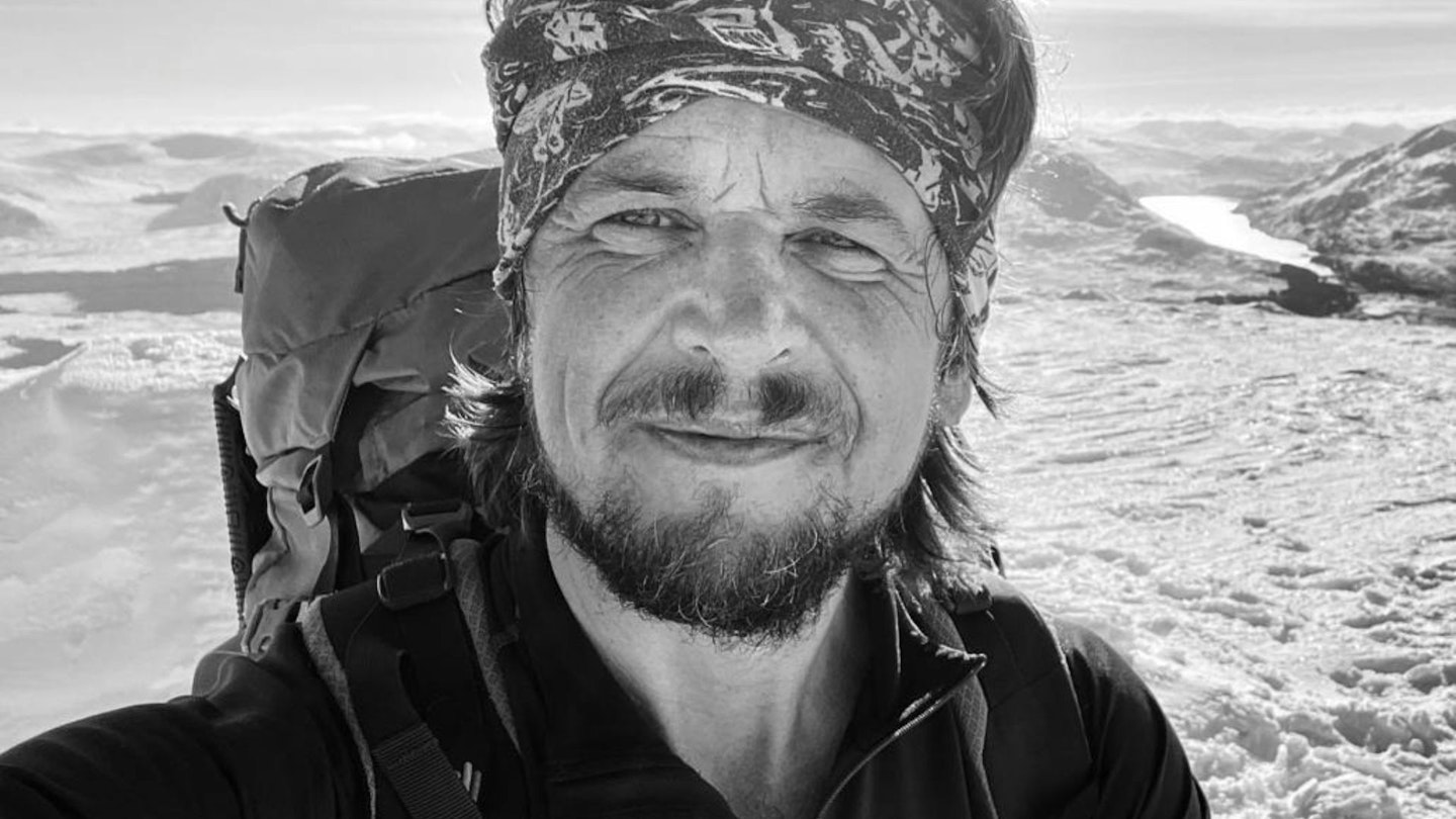
Simon Stokes is an outdoor instructor who runs regular Rock Climbing, Winter Skills, Navigation, Mountaineering & Hiking, Abseiling, and Scrambling courses through his company Peak Outdoor. He also writes regular articles and route guides for Trail magazine and LFTO.
This route originally appeared in the August 2024 issue of Trail magazine. CLICK HERE to become a Trail magazine subscriber and get 50% off a whole year of digital OS Maps