
Even on the most perfect of sunny days, Aran Fawddwy’s high summit lays clear of crowds. Lays clear of anything, in fact – except the inquisitive raven who’s met just enough humans to recognise the extra source of food.
The sweeping, whalebacked ridgeline of Moel Ffenigl, Aran Benllyn, Aran Fawddwy, Glasgwm and more carves its way into the sky from the south-western toe of Llyn Tegid, all the way to the east of Cadair Idris. The highest peak, Aran Fawddwy (peak of Mawddwy), shoulders proudly, and slightly aloof, at 905m. Higher than any other summit in Britain now, south of the Snowdon massif.
So, why so alone? The quality walking of the jumbled volcanic rock atop the highest peaks, set atop smoother mudstone and slate hills is all there.
Meandering upland streams and steep-sided valleys, the haunting darkness imposing on the high water of Creiglyn Dyfi all beckon. This route purposefully curves from the ‘fence handrail’ most usually taken from Cwm Cywarch, choosing to hug the mountain’s secret edges just a little longer.
Take in the quiet splendour of Gwaun y Llwyni (heath of the shrubs), before taking a thoughtful summit route through strewn aircraft wreckage that remembers two pilots of 1944. The more direct descent also offers up memorial to a lost RAF Mountain Rescue team member. Walk alone and stand awhile and remember, on Aran Fawddwy and the Aran hills.
For more inspiration, check out our selection of the best hikes in the UK.
How hard is climbing Aran Fawddwy?
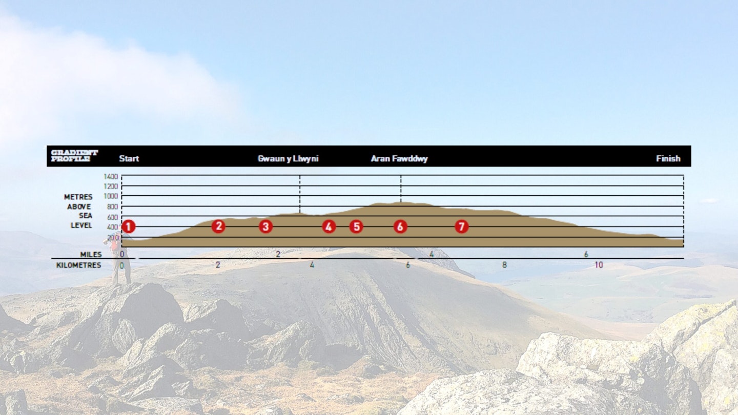
Difficulty: Medium
Distance: 12km (7½ miles)
Time: 6 hours
Total ascent: 910m
Fitness: Medium
Terrain: Faint paths, steep grass and heather, rocky mountain.
Navigation: Paths are faint at times. On rocky sections, you'll need to keep an eye on directional bearings in poor visibility.
Where is the start of the Aran Fawddwy walk?
Cwm Cywarch car park at SH852187 (grid reference searchable in the OS Maps app). Nearest town/village is Dinas Mawddwy or Dolgellau.
What's the best map for Aran Fawddwy?
The best map for this route is the OS Explorer OL23.
Aran Fawddwy | Step-by-step route guide
-
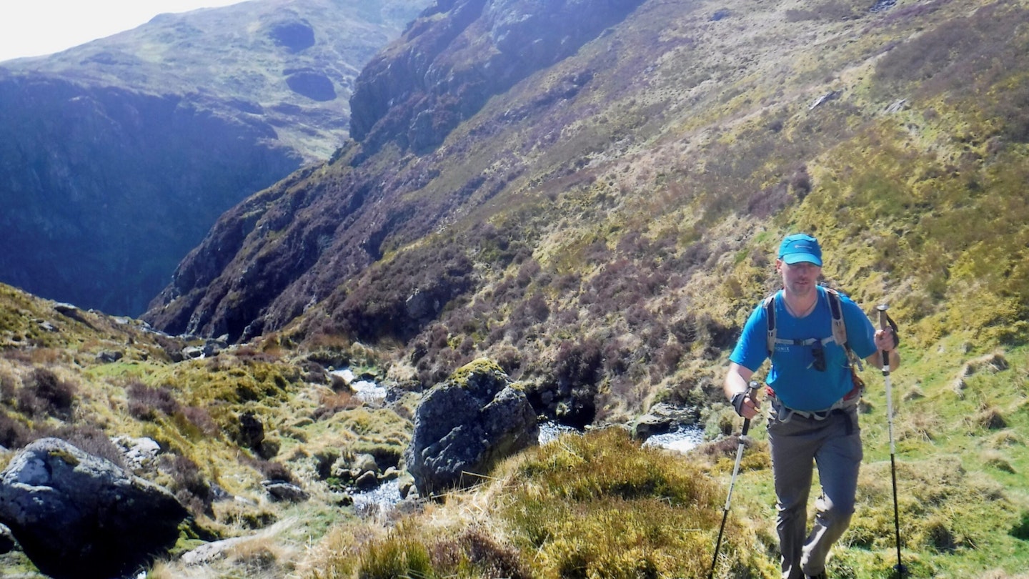
Park at SNPA Cwm Cywarch car park. Marked Public Right of Way leads through farm and onto open hill, rising gradually into a dramatic cwm. Cross a good bridge to ascend into a ‘ravine’, keeping a stream on your left. Path is faint sometimes, but logical progression prevails until grassy ground begins to flatten again, with a fence on your left.
-
Wander through heather and bilberry, contouring above Creigiau Camddwr, with views opening out on the field systems of Cwm Cywarch below and Aran Fawddwy’s summit ahead. Hunt out your own path towards an obvious low point, stream crossing of Camddwr (‘crooked water’). Good spot to refill water on a warm day.
-
Work to gain height again from the stream, but rise atop Pen Main for a delightful high, faint path, keeping you close to the ridge of Gwaun y Llwyni (685m Hewitt/Nuttall). Great view of onward journey to Aran Fawddwy on a clear day! Descend to spot height 657m and angle north from here, cross country.
-
Journey across drier ground than that of Waun Camddwr below you (‘heath of the crooked stream!‘) and thread through grass and an increasing amount of jumbled, rhyolitic boulders – reminiscent of so many familiar Snowdonia mountains of volcanic origin. This section takes you through a poignant site of wreckage from a De Havilland Mosquito LR412 aircraft. It was mid-testing flight from RAF Benson in Oxfordshire and crashed here on 9 February 1944, killing its two pilots. Memorial crosses have been placed in some of the wreckage.
-
Above 700m now, the landscape begins to change, bringing in more boulders and strewn rocks. Nowhere is difficult to move through, it’s quite a welcome change finding hard rock underfoot, but keep an eye on directional bearings and distance in poor weather. Above the aircraft site, a NNE direction will bring you to a handy stile to cross on to the summit plateau, strewn with more boulders. It’s a 700m flatter walk to the summit, but looks further away! Glorious views to the Rhinogau mountains, the massif of Cadair Idris, Rhobell Fawr and Llyn Tegid (Bala Lake). Say hello to the solitary summit raven.
-
Take a slightly different path from the summit in descent – SSW, covering new ground. Handrail the steep drop to your left initially before easier ground and picking up a faint path towards a stile. Volcanic boulders and montane heath below your feet. In poor visibility, choose shorter navigational legs to descend from the summit. On flatter grassy ground a clearer path leads to a memorial cairn at Drws Bach (’small door,’ a name often seen where there are notches in a ridgeline). This prominent cairn remembers an RAF Mountain Rescue Team member tragically struck by lightning near this spot in 1960.
-
A grassy, gentle descent down to 571m spot height, all the while handrailing the steep slope into Hengwm on your right. At this low point on the broad hill, before it rises again to Waun Goch (red heath), turn downhill on a path crossing wooden boards at a few points. A now welcome descent into Hengwm, with impressively steep sides, colliding into the valley floor. Now keep on this Public Right of Way as it consistently loses height back into Cwm Cywarch, crossing Afon Cywarch, before turning right up the road towards the car park. A day to remember on Aran Fawddwy!
What walking gear do I need for Aran Fawddwy?
We’d suggest starting with the essentials: sturdy walking boots or hiking shoes, a comfortable hiking daypack, a dependable waterproof jacket and lightweight walking trousers backed up with packable waterproof overtrousers.
It’s also worth packing some warm layers, as temperatures can drop quickly on the exposed summit.
Where's the best place to stay?
Bryn Sion Farm B&B is well placed for this walking route.
About the author
Kate Worthington lives and works in the mountains of north Wales, where she's a director of RAW Adventures, plus a qualified Mountain Leader, Winter Mountain Leader and fell/trail Leader in Running Fitness. Kate has been hiking, climbing, scrambling and running in the mountains her whole life.
This route originally appeared in the August 2018 issue of Trail Magazine. Subscribe to Trail Magazine and get 50% off a whole year of digital OS Maps.