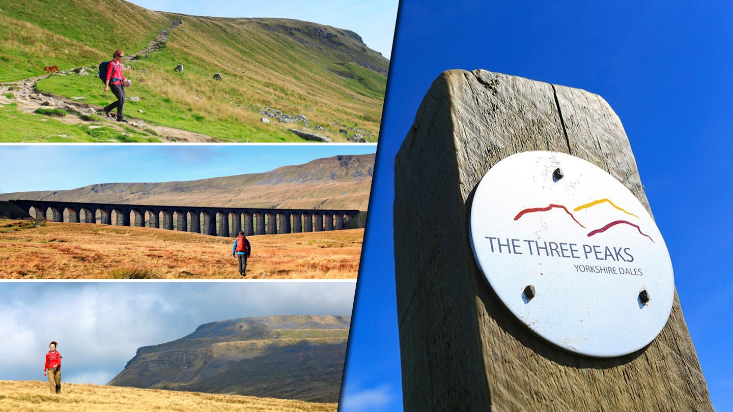
The Yorkshire Three Peaks Challenge is the most famous single-day challenge walk in England. It's 24.5 miles long, ascends three 2000ft mountains, and features a lot of hard trekking in between them.
Its nearest rival is the National Three Peaks, but the difference is obvious: the Y3P is one, single, non-stop walk. The National Three Peaks is three walks punctuated by an awful lot of sitting in a car or a minibus trying to remember what sleep feels like. As a walking exercise, the Y3P is purer, healthier – and a lot less heavy on the carbon footprint.
The peaks in question are Pen-y-ghent, Ingleborough and Whernside. Each are unique and present their own challenges, but we wouldn't say any of them are particularly tough for the average hillwalker. Hitting all three in a day is a tiring challenge, but you can absolutely smash it with the right preparation.
So, with that in mind, let's meet these peaks, and discuss everything you need to know ahead of trying the Y3P.
Where does the Yorkshire Three Peaks start and finish?
Most walkers start and end the challenge from the Yorkshire Dales village of Horton-in-Ribblesdale, a 20-minute drive from the A65 at Settle, via the B6479. Parking costs £4.50 for over two hours. The Settle to Carlisle Railway can also smoothly deliver you to the village, with the first train from Settle arriving at 6:30am (on weekdays) and last train back leaving at 8:41pm.
Horton-in-Ribblesdale is a tiny village, and you'll begin on the main road if you follow our recommended route.
Like every great walk, the Three Peaks Challenge finishes at a pub. Two, in fact. And besides the pair in Horton, there are plenty more nearby to satisfy a 24-mile appetite.
Try The Golden Lion Hotel at the north end of Horton or The Crown at the south end. Both serve hearty meals, but the latter is cheaper.
Is the Yorkshire Three Peaks difficult?
No, not really. But it is long. We certainly think you shouldn't underestimate the walks between each peak – those really do pack on the miles. However, any decently fit hiker shouldn't have too much difficulty, provided you're well prepared.

If you're not sure you can tackle the distance and elevation of the Yorkshire Three Peaks, we'd definitely recommend taking a day and walking non-stop. Your feet and knees will certainly be sore by the end, but it's a tolerable (and quite pleasurable) twelve hours.
There are only a couple of spots on these peaks that require hand-on-rock scrambling, but these are simple to navigate and don't feature any hazardous exposure.
How long does it take to do the Yorkshire Three Peaks?
Usually, it takes around 12 hours to walk the Yorkshire Three Peaks. The 'challenge' is to come in under 12, but we don't recommend spoiling the views by rushing to the finish. Make sure to move at a comfortable pace and start early.
But, if you really want the challenge, go nuts. Eighty-seven years after Wynne-Edwards and Smith set a benchmark time, Lancastrian Jeff Norman ran the route in 2 hours, 29 minutes and 53 seconds. His incredible record still stands.
Whether or not you choose to walk against the 12-hour clock, you’re best setting aside a full summer’s day for it, waiting for a window of favourable weather. And if you can, avoid bank holidays. Horton gets seriously busy.
Do I have to complete the peaks in a day?
Of course not! If you want to double down on the Wainwright walking-for-pure-pleasure spirit, you can walk Yorkshire’s Three Peaks as a multi-day linear station-to-station tour.
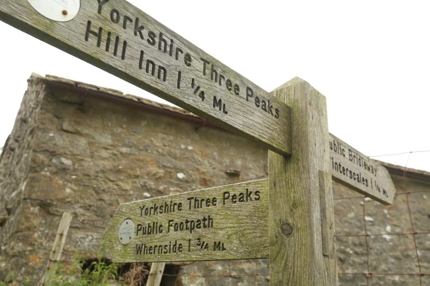
Beginning in Settle, take paths north to Pen-y-ghent, dropping into Horton for the night. Head up and over Ingleborough via Sulber Nick, Gaping Gill and Crina Bottom to reach a second stopover in Ingleton.
From here, you’ll traverse Twisleton Scars to finish on the final and highest peak, ending your walk at Ribblehead. In all, you’ll have clocked up 32 miles over three days. Doing this allows you to explore the quieter and quirkier nooks on the hills; it's a great choice if you want to soak in the area over a weekend.
What gear will I need?
This walk isn't as punishing as other iconic UK routes like The West Highland Way or The Coast to Coast Path, but that doesn't mean you can do it in Converse. A decent pair of walking boots will protect your feet throughout the slog. Or if you're looking to beat the heat, a lighter-weight hiking shoe would also do you just fine. We'd also recommend a breathable pair of walking trousers.
Now that you're set up, here's a rundown of each of the three Yorkshire peaks.
How to walk The Yorkshire Three Peaks in detail

Pen-y-ghent (2277 feet)
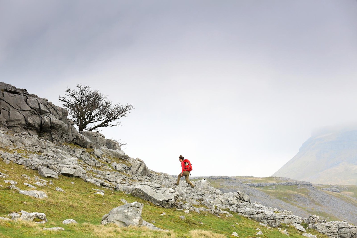
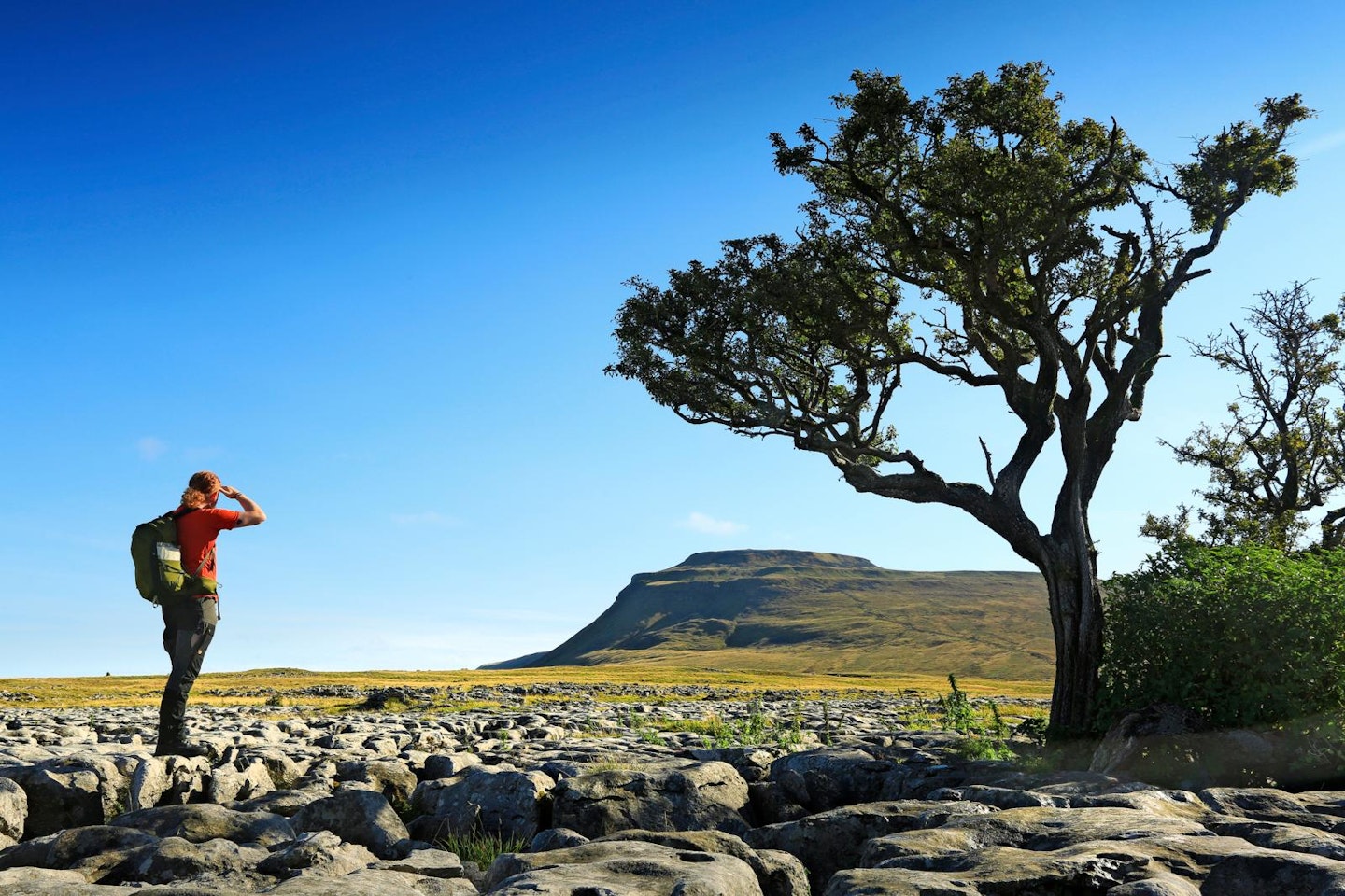
Pen-y-ghent is the lowest of the three peaks. But don’t let that lull you into thinking it will be a doddle. When eyeing it up from the west, some have compared its long, sharp-nosed outline to a ‘crouching lion’ or the prow of a ship. Capped with millstone grit, jagged bands of rock wrap around its imposing flanks, like castle walls.
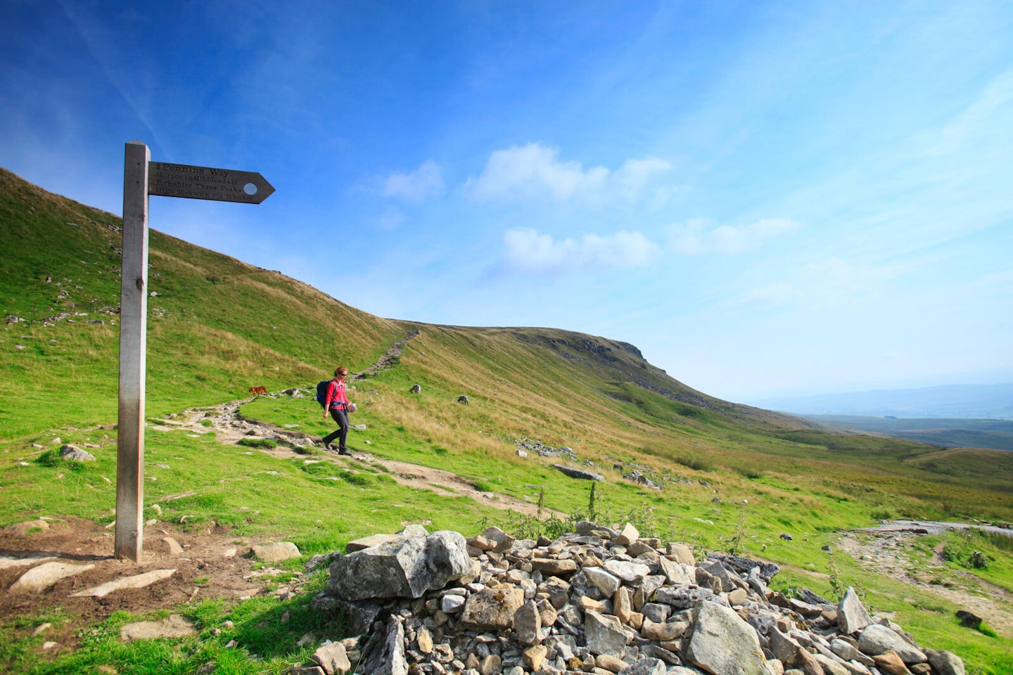
Making a break from the main road through Horton, a back lane slips away from the village towards Brackenbottom Farm. From here, a footpath strikes east up the sheep-nibbled lower slopes of Pen-y-ghent. Fissured seams of limestone interrupt the path before a trail of stone slabs brings you to a junction with the Pennine Way, directly under the peak’s craggy nose.

Here, you'll start some serious incline. Before long, scrambly switchbacks give way to easy-going flagstones that lead on to the trig point and S-shaped shelter at the top.
One down, two to go. From Pen-y-ghent’s grassy summit, the trail resumes through a gap in the wall that straddles the mountain top. With around 100,000 people enjoying the Three Peaks every year, wear and tear takes its toll on the paths, which are periodically renewed and patched up. By sticking to the paths, you’ll help keep erosion to a minimum.
Tucking across the west flank of Pen-y-ghent, the trail zags down to Horton Moor. The next six-or-so miles can feel the hardest, as the route endlessly pitches and rolls through Ribblesdale, delaying your next fix of summit fever. You flit from stony path to wheel-scored track, the route is clearly marked all the way. Look for the Three Peaks discs fixed to every signpost.
Between High Birkwith and Nether Lodge, you cross God’s Bridge – a fluke of erosion providing a natural crossing point over Brow Gill Beck. Beyond the next burbling stream, a crushed stone track leads to the ex-military Bailey bridge spanning the young River Ribble. You'll soon meet the B6479.
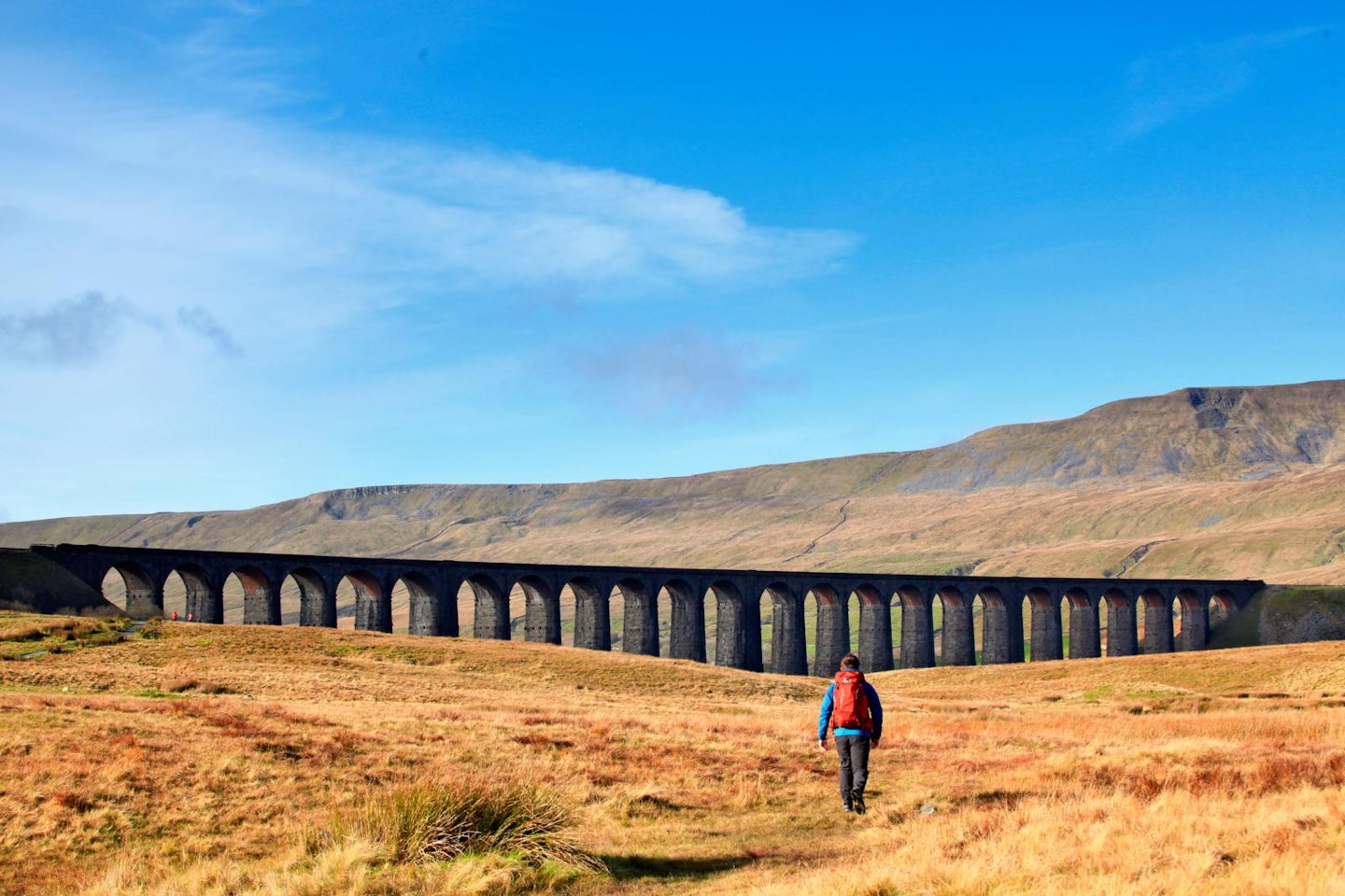
The next mile of tarmac and measly verge won’t be a highlight of your day. The road’s blind bends and dips call for extra care, but escape beckons when the much-photographed viaduct at the foot of Whernside sneaks into view. Time your walk right and you may arrive at Ribblehead just as a vintage train is steaming across.
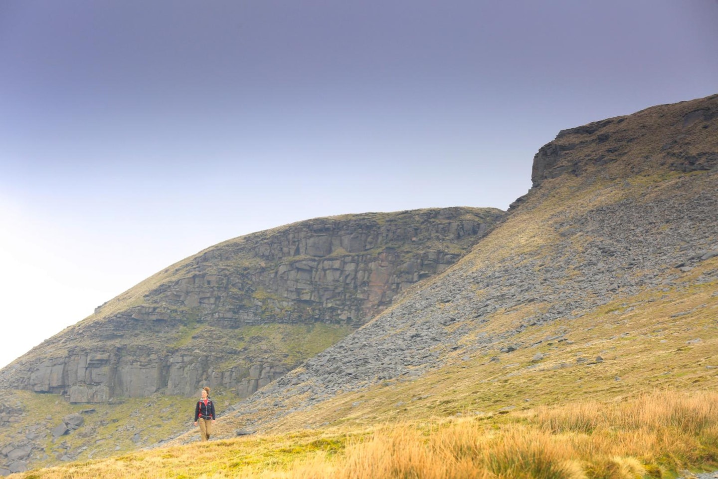
Whernside (2415 feet)
Ranged above the 24 stone arches of the Ribblehead Viaduct like an apocalyptic tidal wave of rock and peat, Whernside is your next objective.
The official path takes a dogleg approach, following the Settle to Carlisle Railway as it climbs northward, burrowing into the spongy mass of Blea Moor. Here the path also leapfrogs the railway, following freshly sprung waters uphill. Give or take a few yards, the railway bridge also marks the challenge’s halfway point.
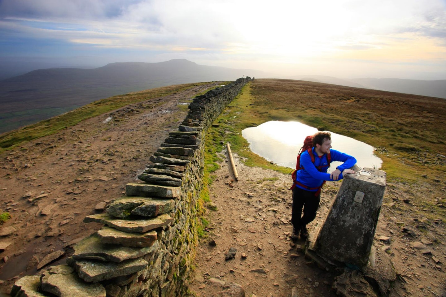
Turning up the sun-warmed slopes of the mountain, the trail eases you across a string of flagstones to gain the summit ridge. The rocky path traversing Whernside’s crest feels like a promenade. To the west, the land tilts amiably into Cumbria. On your left, turf spills across a precipice into the dale below.
As you stride south, Whernside’s true summit may catch you unawares. A ram’s horn shelter and obligatory trig point mark the top. Reached through a bum-squishing slot in the wall, this Ordnance Survey relic lies a metre into Cumbria. Back in Yorkshire, you’ll be the highest person in the county for the duration of a well-deserved snack break.
The way up Whernside is long and circuitous. The way down is not. It tips you headlong into the dale, losing altitude with every step. As compensation, Ingleborough fills the view in front. Down in the valley, the Three Peaks route picks up a lane, weaving between farms and pastures to meet the Low Sleights Road near the Old Hill Inn.
But there’s no time for a snifter before psyching yourself up to climb the third and final peak.
Ingleborough (2372 feet)
The superstar of the trio. If the Three Peaks are Destiny’s Child, Ingleborough is Beyoncé. There was a time when folk believed Ingleborough was the highest peak in all England. Like Pen-y-ghent, it’s a lung busting, show-stealing crowd favourite.
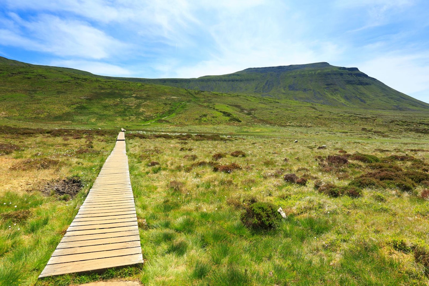
From the road, the going is easy at first. The path rises across a grassy bank, but ahead limestone outcrops bar the way. Where exposed, the pastel grey bedrock of the Dales can fracture into limestone pavements. The path tucks across Southerscales Scars, dodging caves and potholes to reach the open moor in Ingleborough’s shadow.
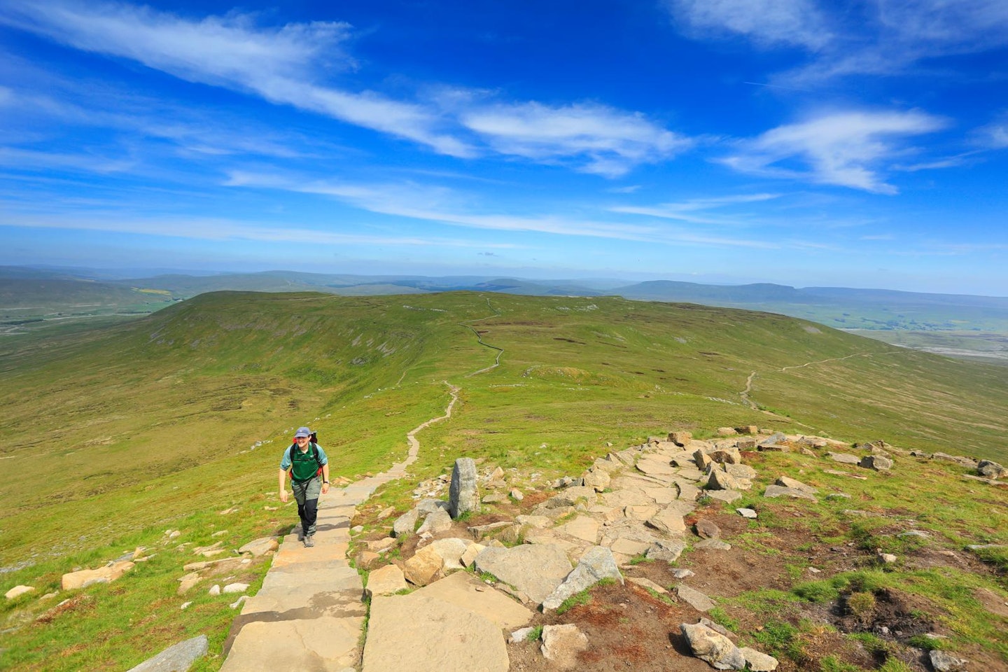
Duckboards and flagstones lead across the perennially soggy moor, and a final push sees you clamber up to a saddle in the wind-lashed crest. At last, its bouldery summit is in your sights, where triumph and more ache-quelling views await.
Turning for the top, you trace a rocky path edging its way up the last few metres. As you aim for the summit’s cross-shaped shelter, ancient rubble remains tally with Ingleborough’s evocative name, which merges the Old English words for ‘peak’ and ‘fortified place.’
After backtracking, the downhill route peels east for the final, deceptive four miles back to Horton-in-Ribblesdale. Aches and niggles may slow you down, but the thought of the finish line keeps you going. With two miles still to go, you stagger into the labyrinthine limestone pavements of Sulber.
Finding the groove of Sulber Nick, the undulating path ahead delivers you into the final straight. Once back across the railway and river, you’re home and dry – and ready to lift a glass to celebrate.