
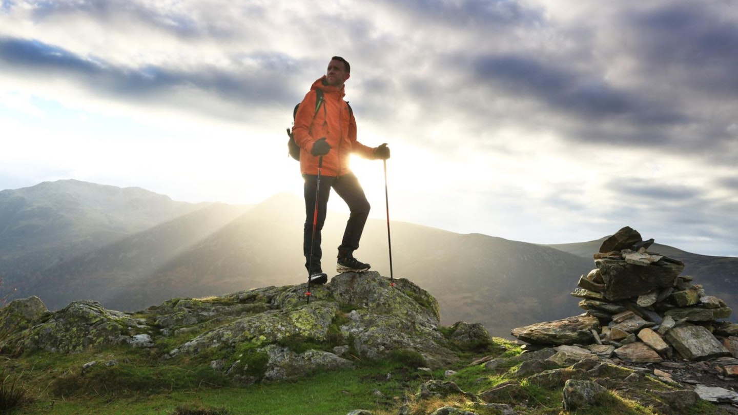
Much has been written about Haystacks, a relatively lowly Lake District fell in terms of stature, but one that is big on features and interest.
The moment you clap eyes on its rough, knobbly outline is the moment you will fall in love with it. This love will be carried on throughout a traverse of its varied and interesting top, full of impressive scenery and fabulous views. This is a short walk packed to the rafters with delight.
Famously, this fell was both the favourite and final resting place of renowned Lake District guidebook writer Alfred Wainwright.
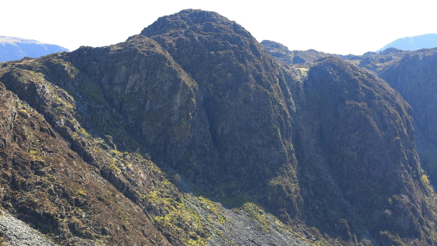
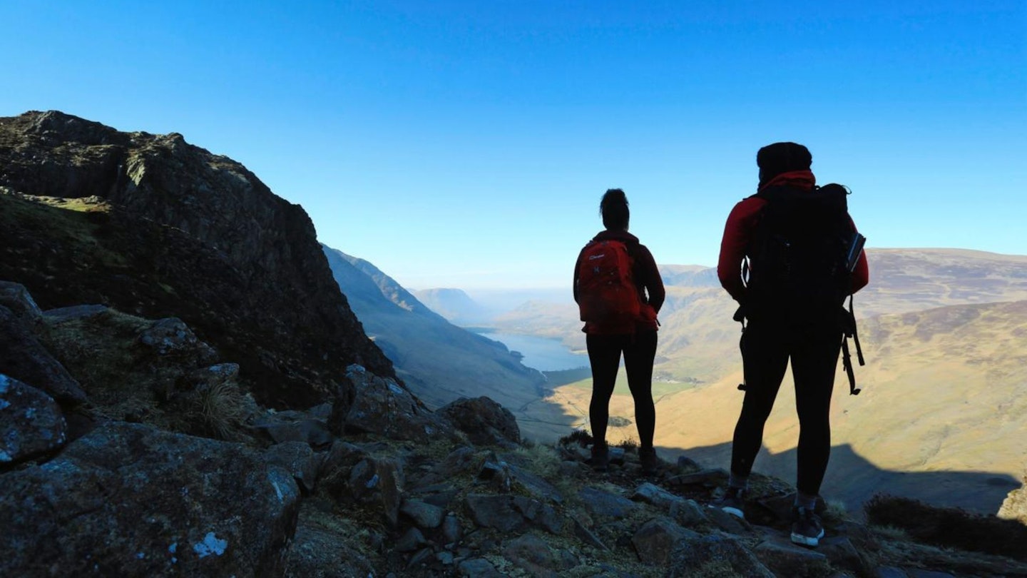
Our route starts at the foot of the north-western side of Honister Pass and almost immediately heads into the hidden Warnscale Bottom. Indeed, the crags and gullies of Haystacks tower above during this section, giving a taste of adventures ahead.
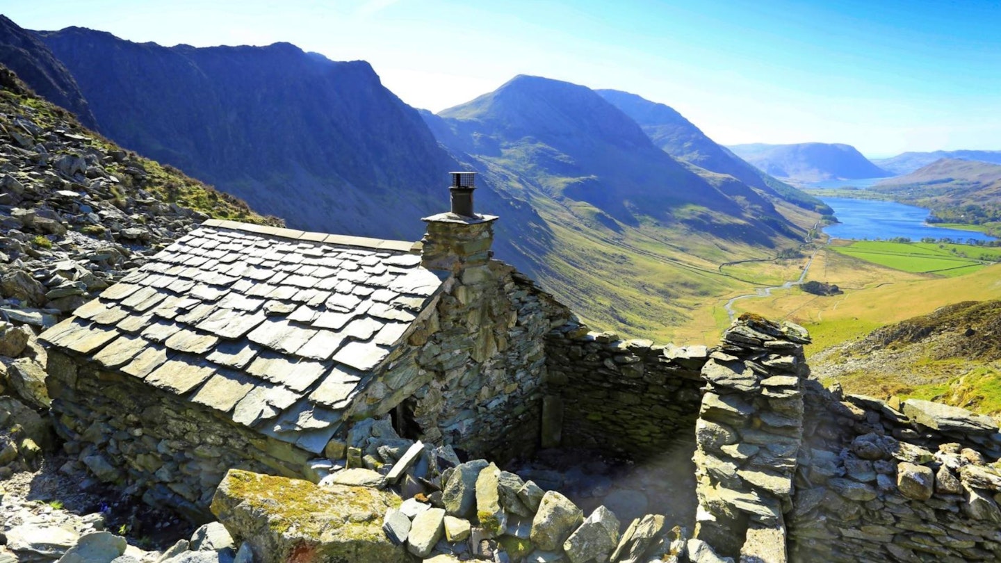
The old path is beautifully graded and climbs past the familiar-to-many Warnscale Bothy, the perfect place for a rest and a great photo opportunity.
Once above the bothy, and on the Haystacks summit plateau, the path is strikingly obvious. But for the more adventurous hikers there are many delights and side routes to explore.
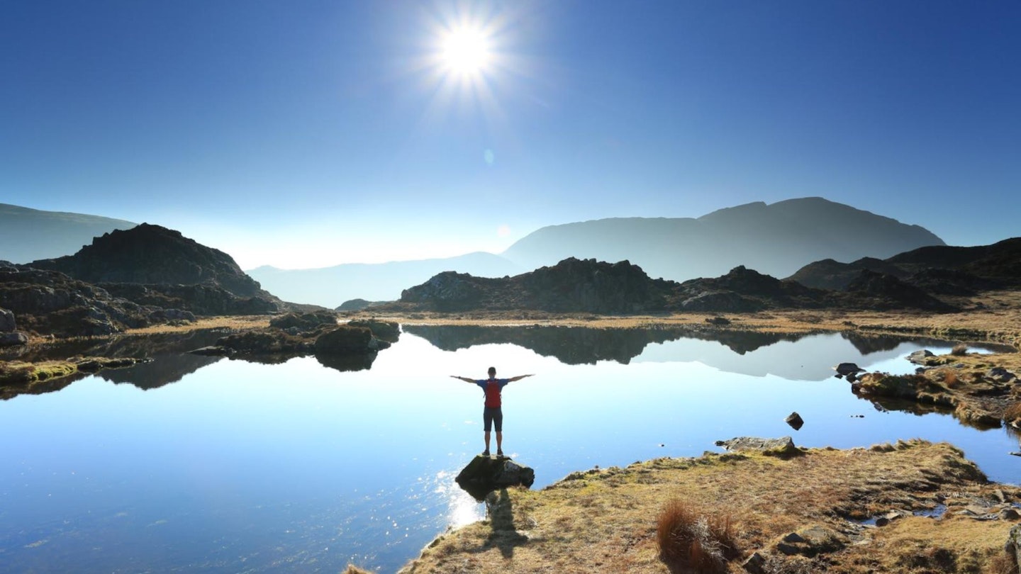
Even the short walk around the tarns offers a worthy detour, and if the weather is good enough there are many places to sit in contemplation of the grand scenery.
Beyond the summit is a steep descent to reach Scarth Gap; from there, the descent to Buttermere is once more a beautiful gradient, with every step delivering a spellbinding view.
How hard is climbing Haystacks?
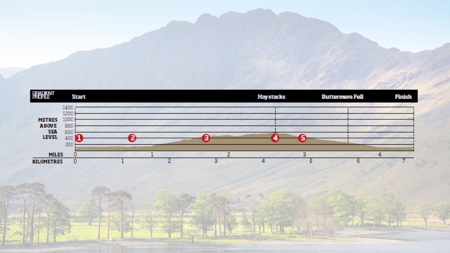
DIFFICULTY: Easy | DISTANCE: 7.2km (4½ miles) | TIME: 3 hours | TOTAL ASCENT: 562m
FITNESS: No problem at all for experienced hikers or hillwalkers.
TERRAIN: Typical Lake District terrain with grassy and rocky sections
NAVIGATION: Clear paths most of the way. The rocky summit of Haystacks could be a little bit confusing in poor visibility.
Where is the start of the walk?
Car park at Gatesgarth, at the base of Honister Pass. The nearest town is Keswick, around 11 miles and 30 minutes away by car.
What's the best map for Haystacks?
-
Printed map: OS Landranger 90, (1:50:000)
-
Printed map: OS Explorer, OL4 (1:25,000)
Haystacks | Step-by-step route guide
-
From the car park at Gatesgarth, head south-east along the road towards Honister Pass. At the wall corner immediately after Gatesgarth Cottage turn right and head along the track. The going is easy along this level section and the scenery all around is superb.
-
Bear right at the small cairn across the grass. Two paths can be seen; the more distinct one is an old quarry road, but the one we will follow heads towards the waterfalls. Cross the footbridge and climb straight ahead, fording a small stream and climbing directly towards the waterfalls in front of you.
-
This is a great path that zigzags across differing surfaces but is nicely graded throughout. Cross a small stream on a level section, then follow the line of cairns up to Warnscale Bothy, a perfect ‘room with a view’. Continue to climb from the bothy, following the line of cairns to reach a junction of paths.
-
Directly opposite the path junction is the prominent Great Round How. Turn right along the path, which is now clear throughout to the summit of Haystacks. The route is interesting and is criss-crossed by various paths, should you wish to explore the area.
-
The main path first descends to cross the head of Blackbeck Tarn before climbing to Innominate Tarn, the place where Alfred Wainwright’s ashes were scattered. This is a lovely tarn, a place to linger on a good day with a great view to Pillar across Ennerdale. Continue on the path to reach the summit of Haystacks.
-
The ridge across the summit of Haystacks has a cairn at each end with a tarn below it, the northern-most one being regarded as the summit. Continue westwards across the summit to descend steeply to Scarth Gap. Some handholds are required on this section.
-
Scarth Gap is a junction of paths, and is marked with a large cairn. Take the path descending gently northwards towards Buttermere. From the path, much of the route walked can be seen, with a good view into Warnscale.
-
Continue through a gate, then down to and alongside a small conifer plantation. At the fence corner, cut back diagonally right to reach the lakeshore path then go through the gate to cross the track back to Gatesgarth… and the ice creams!

What walking gear do I need for this route?
Haystacks may not be the highest peak in the Lakes but it's still a proper hillwalk, so we'd recommend the obvious basics of walking boots or hiking shoes, a good hiking daypack, a reliable waterproof jacket and a pair of quick-drying walking trousers with some packable waterproof overtrousers in your bag.
Depending on the season you walk this route you may need some extra essentials, so check out our hiking gear section for our latest reviews and recommendations.
Where can I eat and drink?
The Fish Inn is a great place for food and drink after your walk, as is the extremely popular Syke Farm Tearoom in the centre of the village.
Where's the best place to stay?
Below are some recommendations from our team:
- YHA Buttermere, yha.org.uk/hostel/buttermere
- The Bridge Hotel, Buttermere, thebridgehotel.uk
- Syke Farm Campsite, sykefarmcampsite.com
- Cragg House Farm, cragghousefarm.com
About the author
Sean McMahon is a Lake District resident, photographer, outdoor writer and passionate hillwalker. He's written dozens of excellent hillwalking routes for Trail magazine and LFTO.