
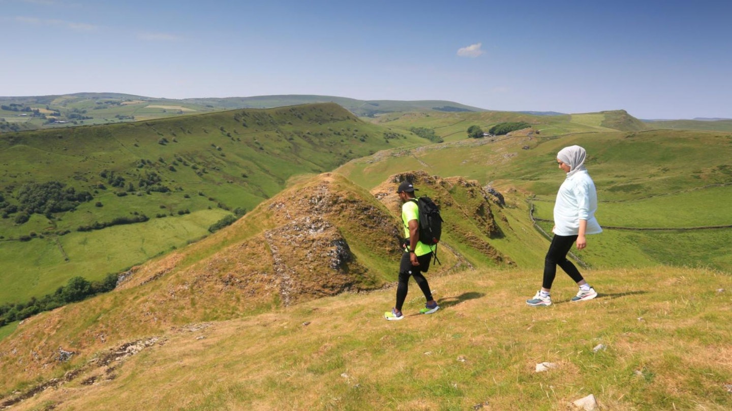
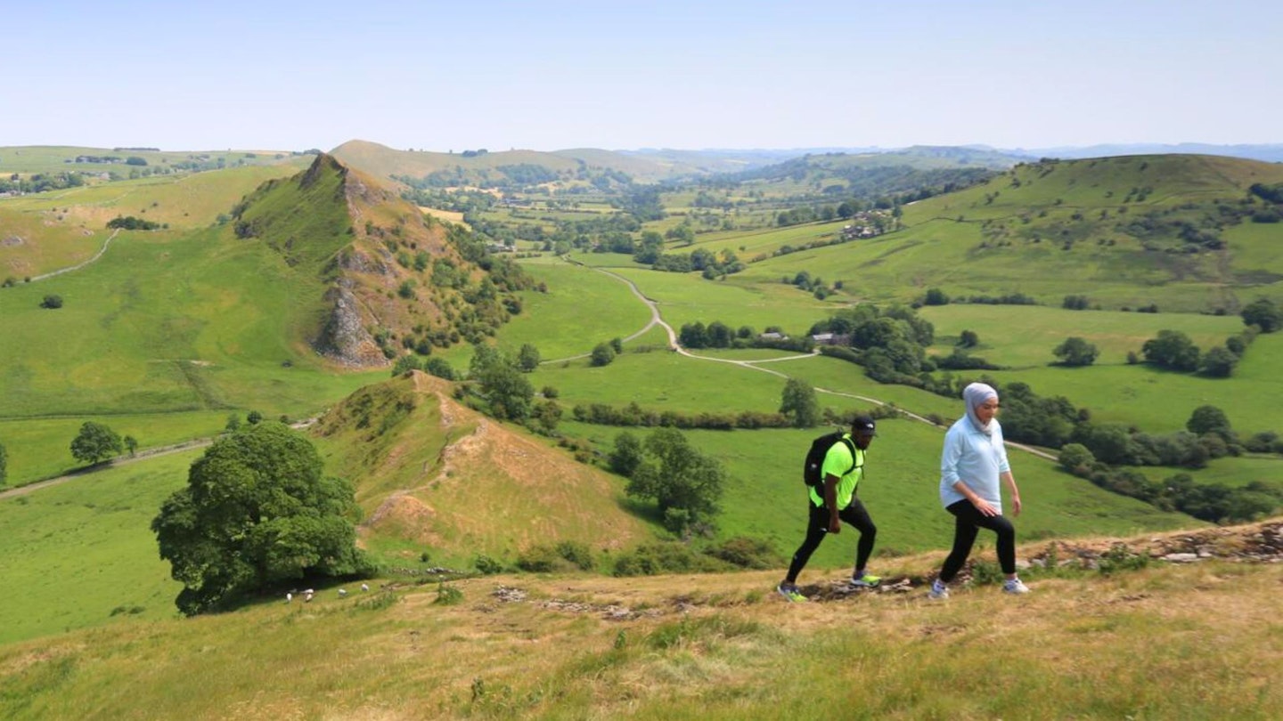
Chrome Hill and Parkhouse Hill aren't particularly high in the general world of hills and mountains, but together they're often referred to as the only ‘true peaks’ in the Peak District.
The ridge path along the crest of these two hills is known as The Dragon’s Back, and when viewed from the valley beneath it is easy to see why.
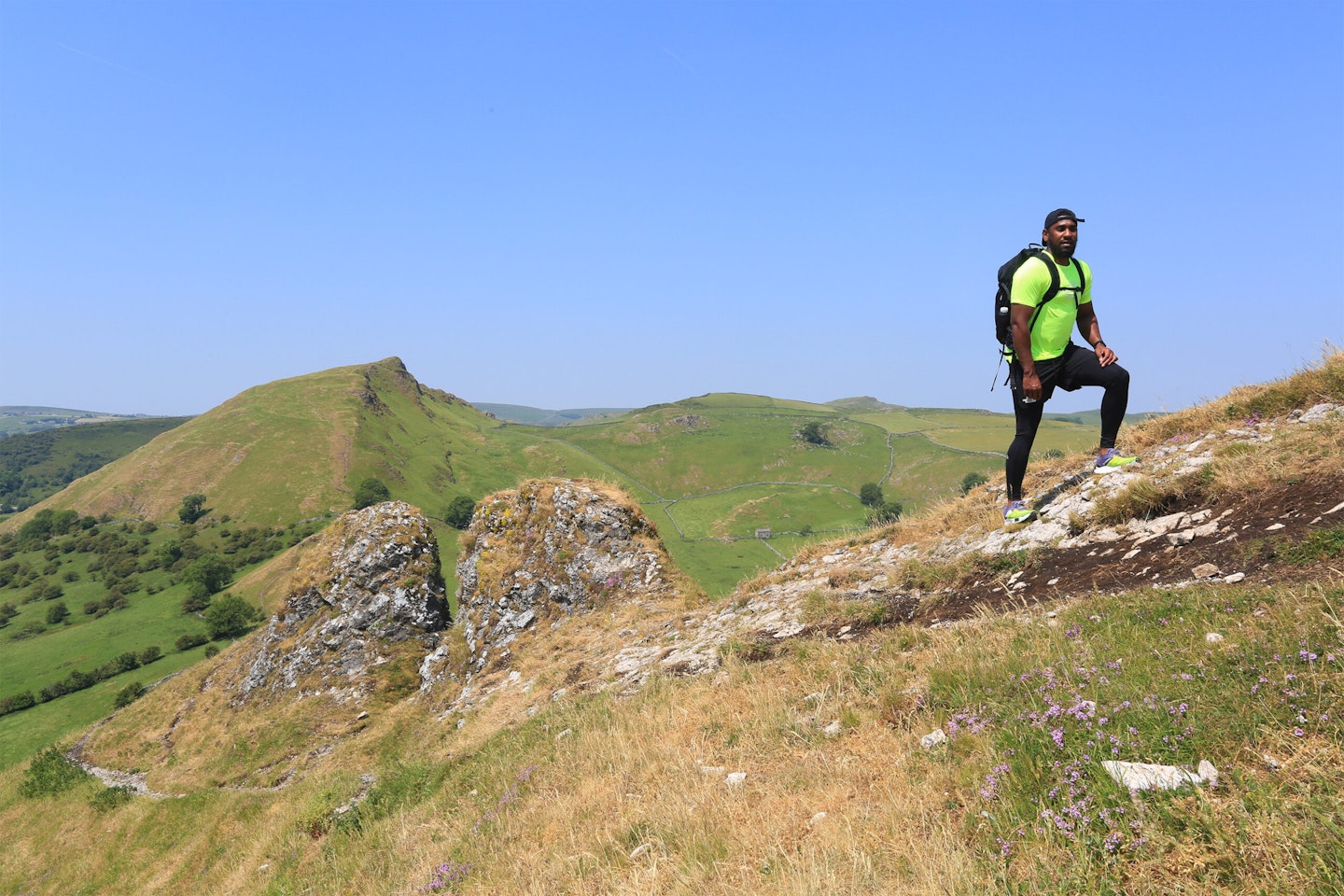
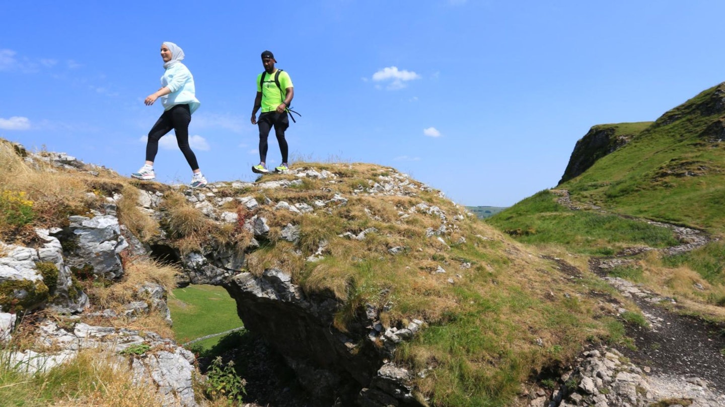
These miniature mountains are set in the White Peak’s Dove Valley and geologically are the remains of ancient limestone reefs. This route traverses both tops on the ridge and has several steep climbs, with the ascent of Parkhouse Hill being quite exposed in places.
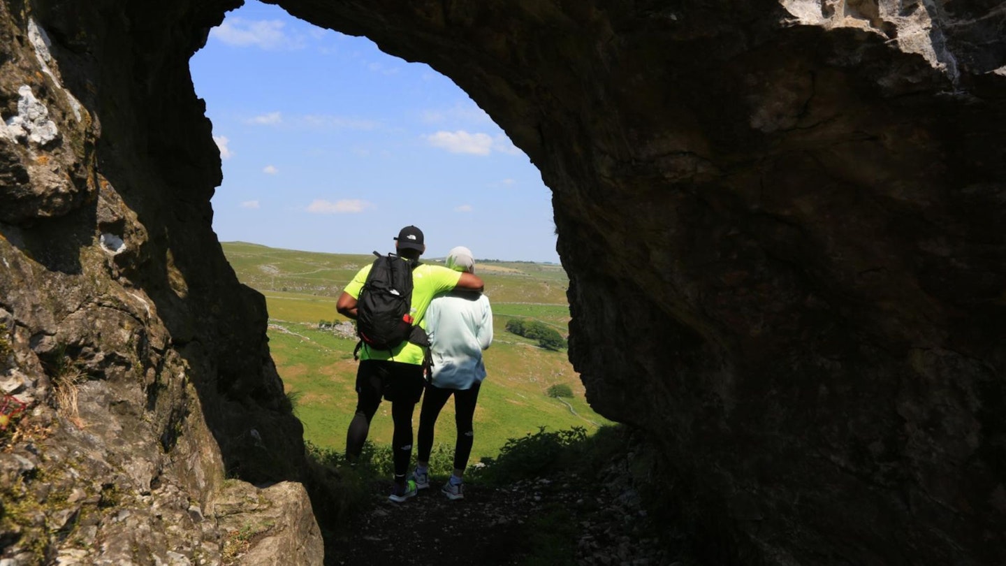
This exhilarating route also has some easy scrambling and the views from the higher parts of the ridge are simply stunning. As a bonus top, the walk starts with a climb to the summit of High Wheeldon (422m), another limestone peak with awesome views from the trig point.
The walk starts in the pretty village of Earl Sterndale and must rank as one of the most exciting of all Peak District walks, and is at its best on days of clear sunny weather.
Is Chrome Hill and Parkhouse Hill a difficult walk?
DIFFICULTY: Medium | DISTANCE: 13km | TIME: 4 hours | TOTAL ASCENT: 411m
FITNESS: There are some steep ups and downs, with lots of rough going, plus some easy scrambling in places.
TERRAIN: Mostly good stony or grass paths throughout the route. It can be tough going in places, with some exposure on the route, particularly on the ascent of Parkhouse Hill.
NAVIGATION: Paths and tracks are all generally easy to follow, with the route being fairly obvious for most of the way.
Where is the start of the walk?
The Dragon's Back walk starts in the pretty Peak District village of Earl Sterndale, around a 5-mile and 15-minute drive from Buxton. There is limited roadside parking near the church. If travelling by public transport, the High Peak bus 442 runs to Earl Sterndale from Ashbourne.
What's the best map for Chrome and Parkhouse Hill?
Ordnance Survey: OS Explorer OL24
Ordnance Survey: OS Landranger 119
Harvey Maps: Harvey British Mountain Map White Peak
The Dragon's Back | Step-by-step route guide
-
With the church on the left, exit the village south-easterly. Fork left at a road junction before a duck pond. Rise up the lane to where a track forks right to Wheeldon Trees farm and take the footpath on the right through a gated stile. Descend through another gate and go right, then left after a few paces to rise steeply through a rock band to the summit of High Wheeldon.
-
Take the descending ridge path north-westerly, and as the path becomes vague, watch for a large tree with a telegraph pole right of it. Cut right to head for the telegraph pole descending to a path junction by a wall (grid reference: SK099663). Go left to descend through a gate to a lane. Go left along the lane to shortly take a track on the right before a stone barn.
-
Continue on the track passing through a farmyard. Pass through three gates to reach farm buildings and continue on to a T-junction at Glutton Bridge. Go left, then right on a lane (after a phone box). Follow this to a track junction and stay left for ‘Hollinsclough’. Stay ahead on the track to go left for ‘Hollinsclough’ at a junction. Turn right when the track meets the lane – continue to Hollinsclough.
-
Go right past the church in Hollinsclough. Shortly after, take a footpath on the right through a gate. Keep ahead on the path descending to cross a bridge via two gates. Rise to go left on a track by a signpost. Follow the track through a gate and continue rising beyond. Follow the track past a farm and go right down a lane. Follow the lane to take a permissive footpath on the right over a stile.
-
Pass through a gate, cross a stile and cut left uphill. Cross a track and follow the path through two gates. Descend to go left through a kissing gate. Follow the path past outcrops and through another kissing gate. Go left rising by a wall. Keep the wall on the left to continue up the ridge of Chrome Hill. Further on cut right away from the wall and follow the ridge path to the unmarked summit of Chrome Hill.
-
Descend the ridge south-easterly, passing through a kissing gate, eventually reaching a stile to a lane. Go right to a ‘no parking’ sign. Leave the lane to follow a path on the left, which cuts up to the left of a limestone pinnacle. After it forks right and onto the ridge of Parkhouse Hill at a notch. Cut left climbing steeply up the exposed ridge to reach the unmarked summit of Parkhouse Hill.
-
Descend the ridge steeply easterly. At the bottom head for a wall corner with two gates. Go through the right one (gated stile) to cross a field descending to pass through a gate. Rise up the next field passing through a gate to a lane. Cross over to climb steps and pass through a gate. Follow a rising path, cross a stile and continue through a kissing gate. Cross through fields and gates to cut left at the Quiet Woman pub. Turn right through a gate back to Earl Sterndale.
What walking gear do I need for this route?
Although Chrome Hill and Parkhouse Hill aren't the highest peaks you'll ever climb, this is still a proper hillwalk covering a decent distance, so shouldn't be taken too lightly.
We'd recommend the obvious basics of walking boots or hiking shoes, a good hiking daypack, a reliable waterproof jacket (it rains a lot in the Peak District!), and a pair of quick-drying walking trousers with some packable waterproof overtrousers in your bag.
About the author
Steve Goodier is an experienced hillwalker and freelance outdoor writer specialising in hiking routes in the Lake District, Yorkshire Dales and Scottish Highlands. He's walked and climbed all over the world and produces regular walking routes for Trail magazine and LFTO.