
Pitlochry is an ideal hillwalking base, with plenty of restaurants and accommodation, as well as a good selection of outdoor shops. Ben Vrackie lies to the north of the small hamlet of Moulin, which is an extension of Pitlochry itself. It’s a standalone hill which means you can get some great views from the top.
This Corbett makes a great introduction to some fantastic walking in the area. With good paths and clear waymarkers, the route up to the summit is an enjoyable walk that is suitable for many.
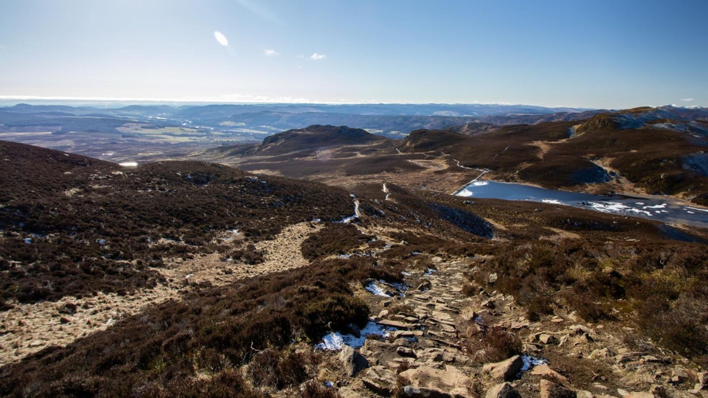
The walk is one of contrast, starting in a peaceful mixed woodland setting but soon changing into a rugged moorland with some great views. You might be lucky and spot a red squirrel in the woodland at the start of the walk. The sense of space you get once reaching the higher moorland is fantastic, and surprising given its proximity to Pitlochry.
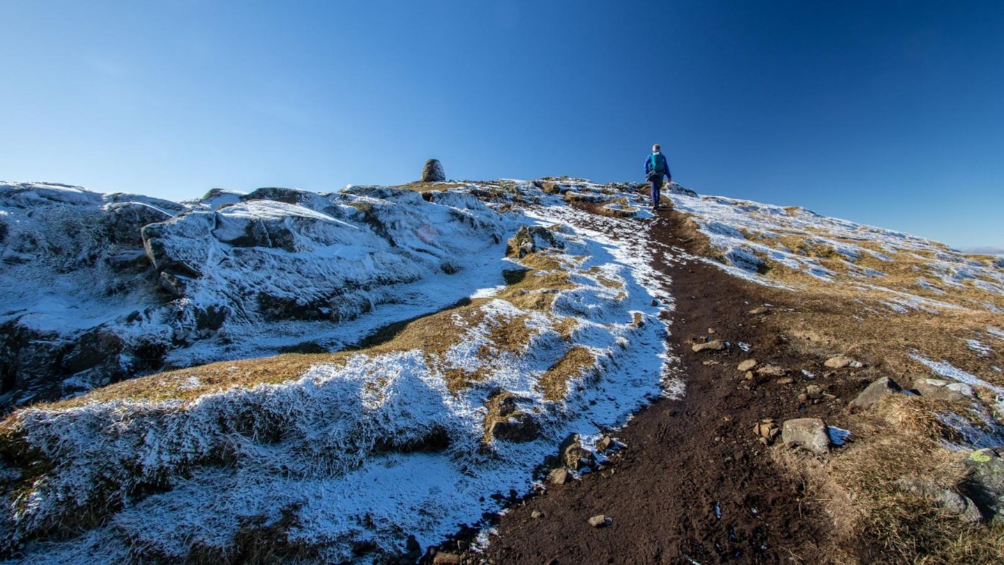
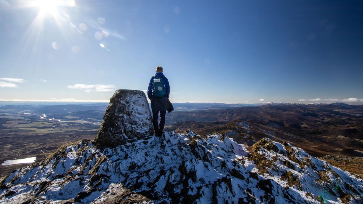
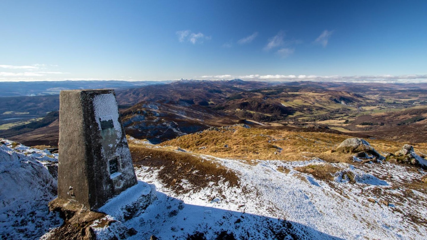
Once you reach the top at 841m, the views all round are beautiful and well worth the climb. A couple of strategically placed benches make for a very comfortable hill walk!
How hard is climbing Ben Vrackie?
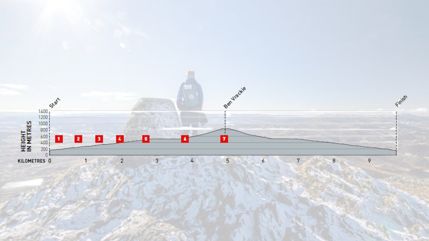
DIFFICULTY: Medium | DISTANCE: 10km | TIME: 3.5 hours | TOTAL ASCENT: 727m
FITNESS: Most of the walk is relatively easy, with a steep climb to the summit.
TERRAIN: Good paths, with the steepest section including some steps at the final 500m before the summit.
NAVIGATION: This is a popular walk in the area and is clearly signposted.
Where is the start of the walk?
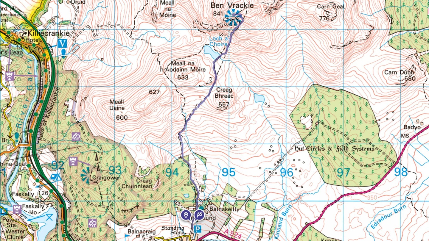
Start and finish at the Ben Vrackie car park just off the A924. It is easily reachable by car (just off the A9), or walk from Pitlochry train station, which is about 1.3km from the car park.
What's the best map for Ben Vrackie?
-
CLICK HERE to view and download our digital route guide in OS Maps
-
OS Explorer OL49 (1:25k)
-
OS Landranger 43 & 52 (1:50k)
-
Harvey British Mountain Map Pitlochry, Loch Tummel & Blair Atholl (1:40k)
Ben Vrackie | Step-by-step route guide
-
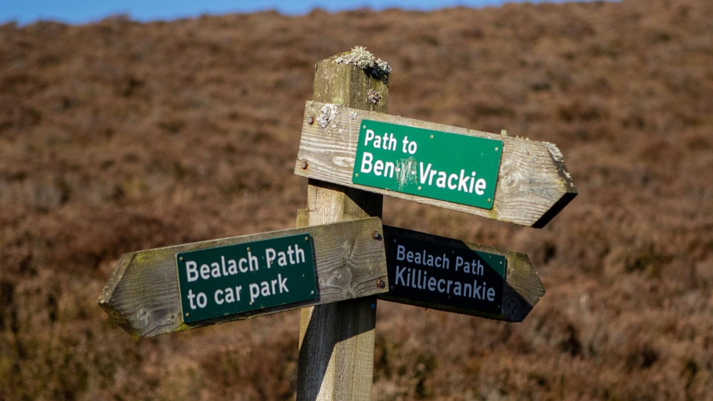
There are two parking areas for Ben Vrackie. To reach them, take a left from the A924 directly behind the Moulin Inn. The main car park is 500m from there on the right, with a second smaller one slightly further up. From the main car park you head north over the road until you reach the second car park. Cross the car park and follow the trail up some steps through a woodland. Signposts show you the way.
-
Cross the road and go through a gate, following the footpath along the riverside deep down below. The mixed woodland of beech, birch and rhododendrons is home to a variety of birds which in late winter and early spring gives you a wonderful dawn chorus. The path joins a wider path which you continue to follow steadily up.
-
At a fork in the road turn right onto a smaller path, following the waymarkers. You will cross two footbridges after which another gate appears. Once through the gate, the landscape opens up and you can see the moorland that you will cross to get to the summit of Ben Vrackie.
-
Turn right across a small burn, using stepping stones to keep your feet dry. You are now leaving the forest behind and enter a completely different landscape of heather, moorland and some higher hills. The route passes a couple of benches which have been strategically positioned to give wonderful views back over Pitlochry and the River Tay.
-
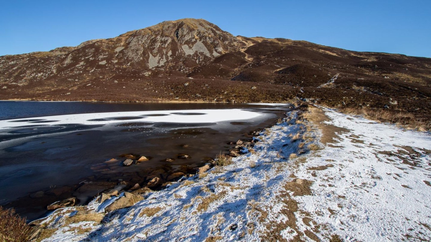
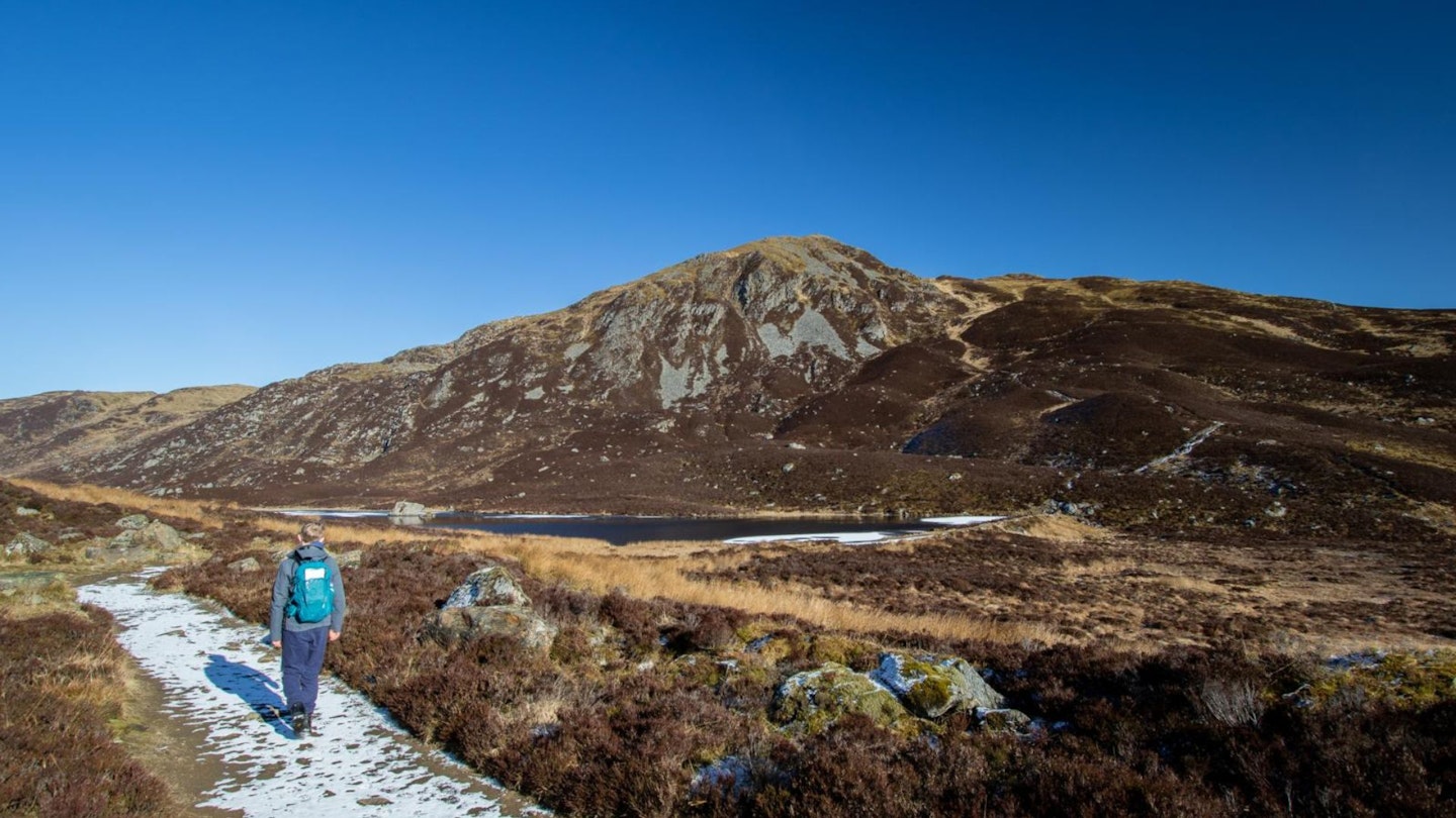
Turn right at the junction which once again is signposted. The track on the left is part of the Bealach Walk. You can choose to end up here on your way down from the summit. Continue to follow the path through yet another gate. The landscape changes here again, feeling more remote. You lose the views of Pitlochry and now see Ben Vrackie straight ahead. Soon you will reach Loch a Coire, a small loch at the foot of the hill.
-
A level path runs to the right of the loch, with benches at either end. You may see people swimming here, even in winter! After the loch the steepest section of the walk starts, up a steep path with some steps that ends at the summit. The path is well maintained and although it’s steep, it is very doable, and the views at the top are a wonderful reward.
-
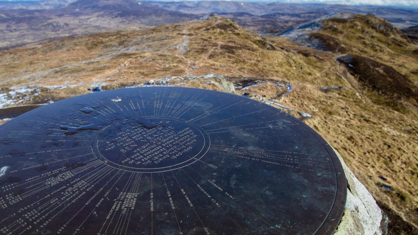
From the summit you can see the Lawers range in the south-east, the Cairngorms to the north and Glenshee to the east. A marking stone identifies the various hills. After taking in the views, turn back the way you came and either just retrace your steps or, for a little more variety, turn right as you reach Loch Coire and follow the path round. This will meet up with the Bealach Walk. At the T-junction turn left, to meet up with the original path. This route will involve a little more of an ascent, but is similar in distance to the original trail.
What walking gear do I need for this route?
Here's a selection of the best walking gear selected by LFTO's testing team: Walking boots | Hiking daypack | Waterproof jacket | Walking trousers | Walking poles | Walking mid-layers | Base layers
Where can I eat and drink?
The Moulin Inn has a great bar and restaurant, with traditional pub food and a selection of real ales brewed on-site in the Moulin Brewery.
Where's the best place to stay?
Stay local at the Moulin Inn, or check out some of the many options within Pitlochry.
About the author
Marieke is a photographer and writer who loves exploring the Scottish mountains. She's a scout leader in Aberfeldy and has written for many outdoor magazines since moving to the UK in 2001. She is a regular routes contributor to Trail and LFTO.
This route originally appeared in the February 2024 issue of Trail magazine. CLICK HERE to become a Trail magazine subscriber and get 50% off a whole year of digital OS Maps