
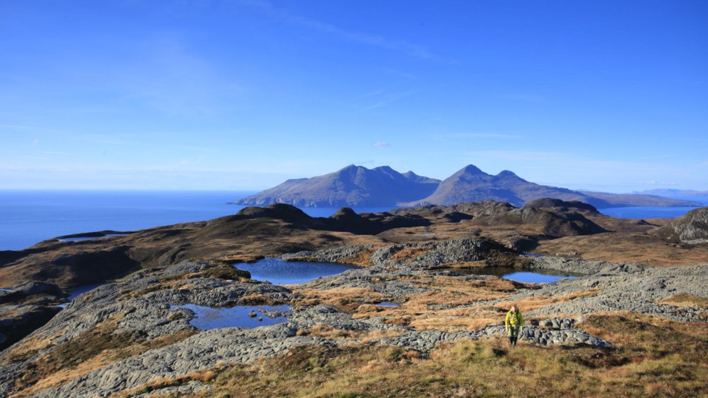
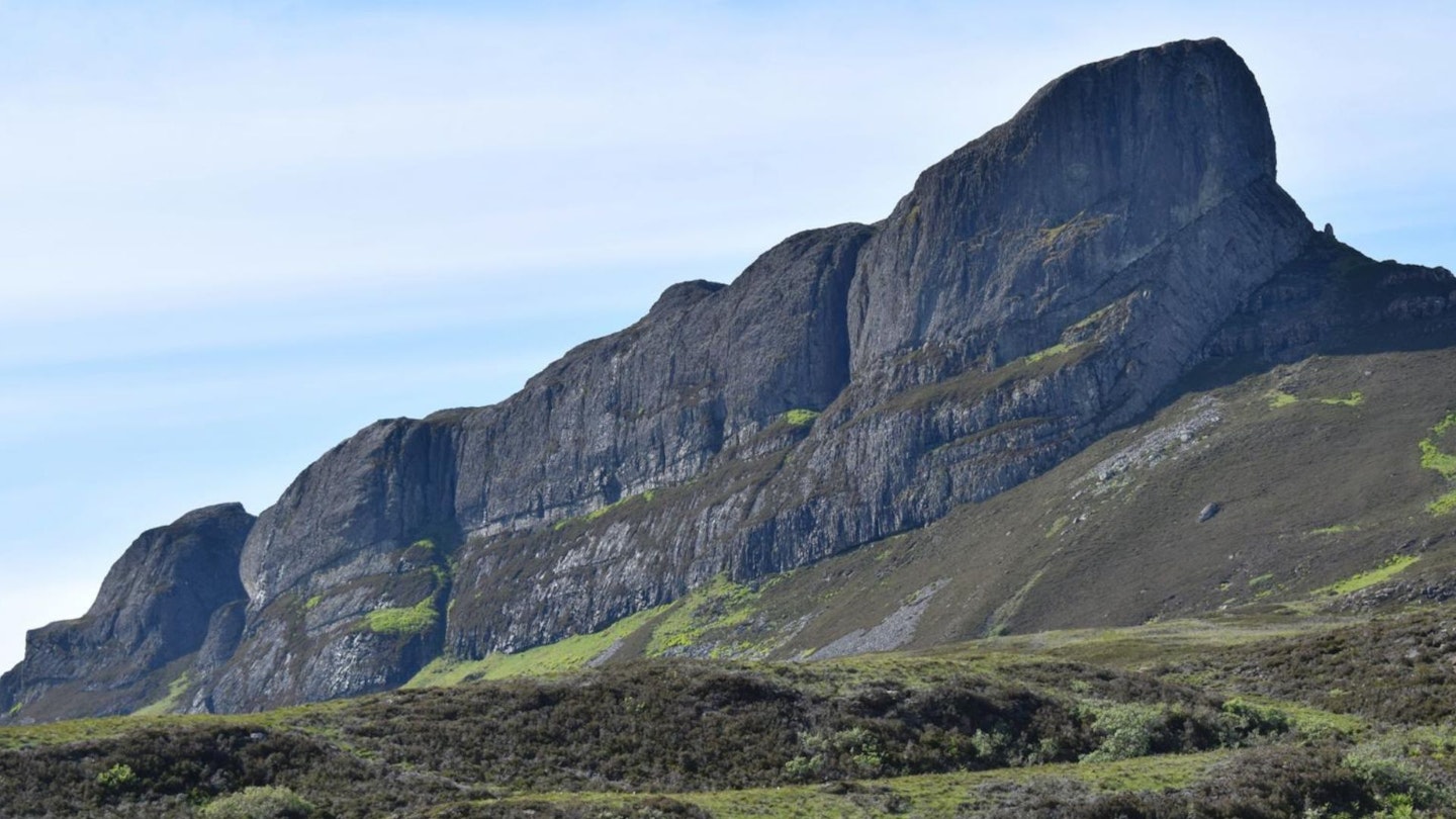
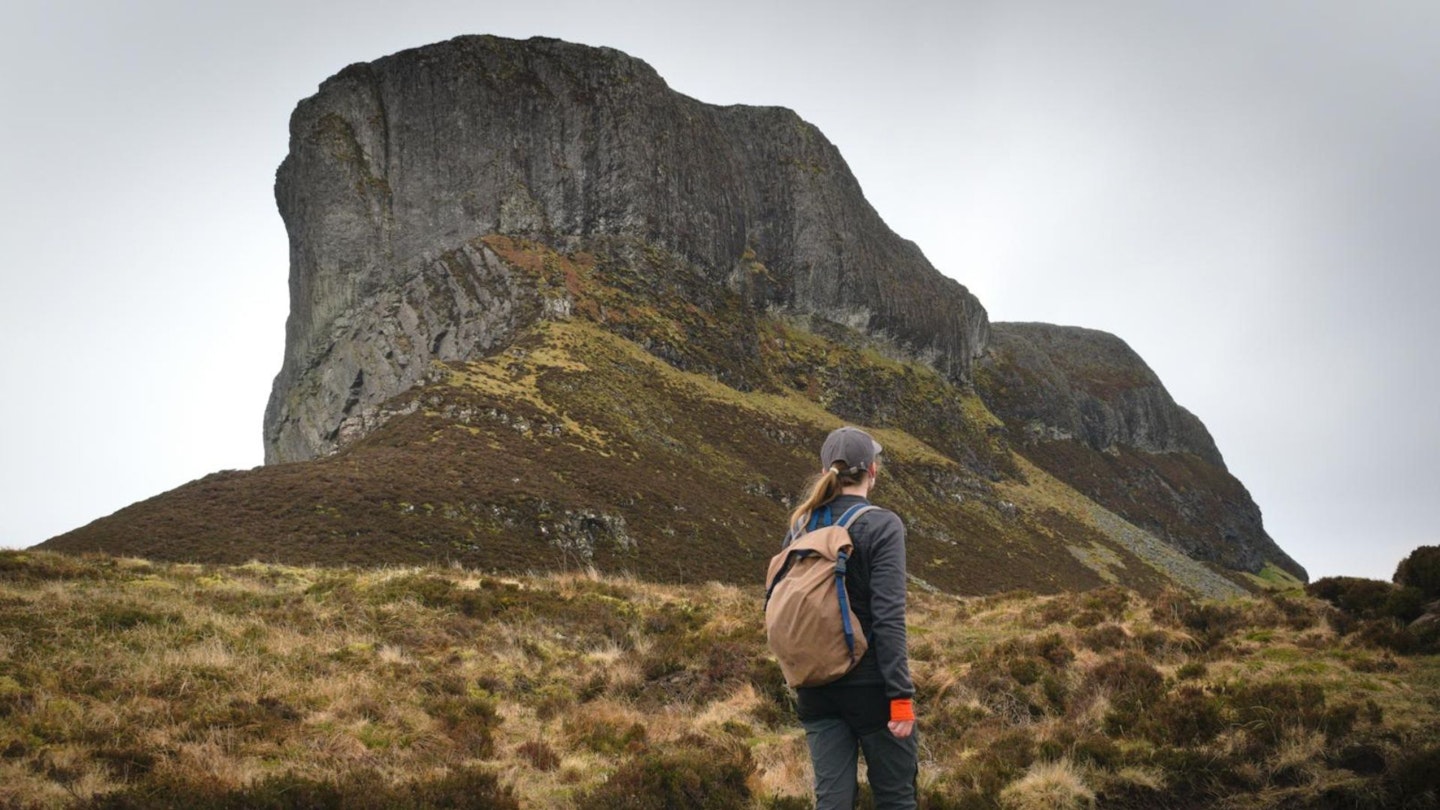
Owned by its community of roughly 110 people, the dramatically beautiful Isle of Eigg is dominated by mighty An Sgurr – a towering pitchstone monolith formed 58 million years ago by a volcanic eruption. And this route to its summit is a walk you'll never forget.
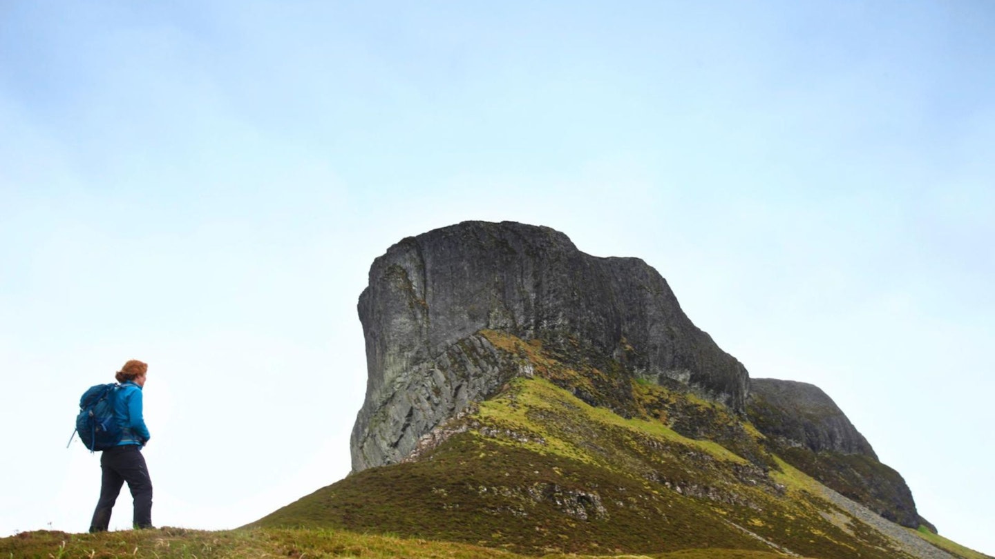
Looking up at An Sgurr's sheer, columnar cliffs from the south-eastern approach, the 393m hill looks to be the preserve of rock climbers, but the ascent from the north turns out to be untechnical and surprisingly straightforward.
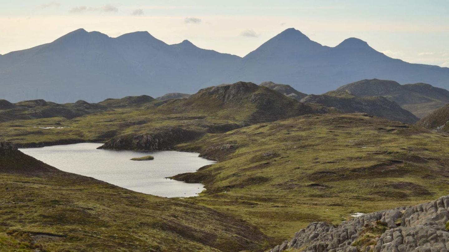
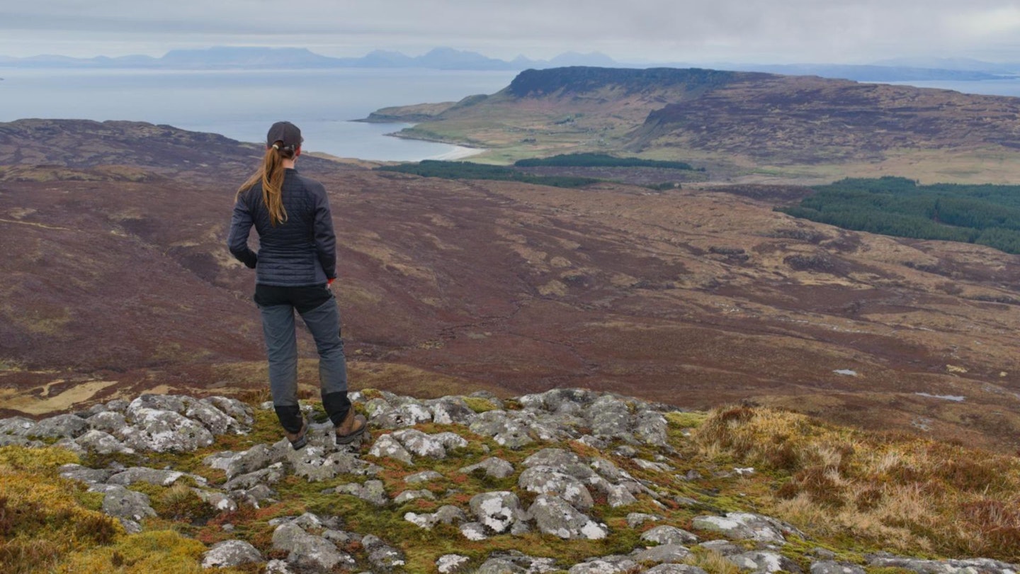
An isolated high point, a rocky summit ridge leads to the real summit, with three precipitous cliff-faced sides and unrivalled views of the scattered Hebrides and mountainous West Highlands. On a clear day Rum, Coll, Muck, the Western Isles, Skye, Ardnamurchan and the mountains of Lochaber form a panoramic backdrop to the cliffs and coastline of Eigg.
While the most obvious course of action is to retrace your outward steps, this route tackles a wild, moorland landscape of miniature lochans and heather before descending to the ruins of pre-Clearance settlements Grulin Iochdrach and Grulin Uachdrach (Lower and Upper Grulin), the most extensive of their kind in the Small Isles.
Is climbing An Sgurr hard?
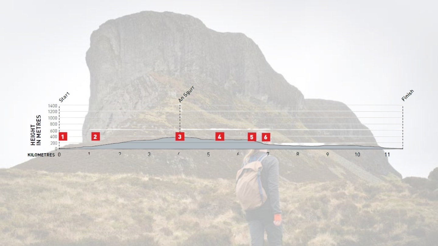
DIFFICULTY: MEDIUM | DISTANCE: 11.5km | TIME: 4.5 hours | TOTAL ASCENT: 415m
FITNESS: No great altitude or distance, but heather moorland between An Sgurr and Grulin Isochoric makes for a couple of tough kilometres.
TERRAIN: Boggy approach, good grip on pitchstone summit ridge, then rough, heathered ground between An Sgurr and Grulin.
NAVIGATION: Quite straightforward to the summit of An Sgurr, but tricky and often pathless to Grulin Iochdrach.
How do I get to Eigg?
You can’t take a car to Eigg, but foot passengers and bicycles can travel with Calmac ferries from mainland Mallaig, which has a train station with links to Glasgow. The walk starts at Galmisdale, which is also the site of the main ferry port.
What's the best map for An Sgurr?
-
CLICK HERE to view and download our digital route guide in OS Maps
-
OS Explorer 397 (1:25k)
-
Harvey Superwalker Rum, Eigg, Muck and Canna XT25 (1:25k)
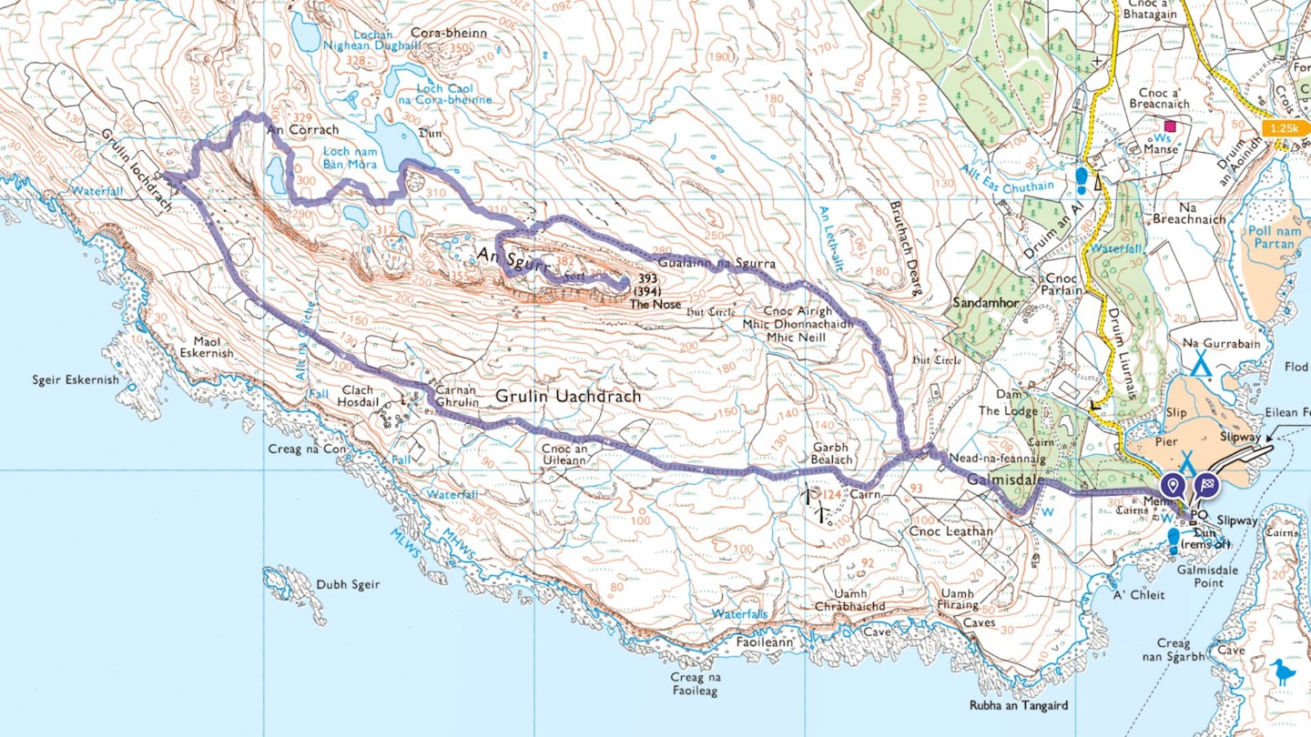
An Sgurr, Isle of Eigg | Step-by-step route guide
-
From Galmisdale pier, take the road heading north-west (left fork), passing some camping pods on your right. Follow the road for 500m, as it climbs gently through woodland. Ignore the right turn to the community hall and continue straight on (bearing left). After 30m, ignore a left-hand turn and continue following the track uphill, before emerging from the woods through a gate into a grassy field. The Nose, An Sgurr’s imposing eastern face, is now ahead. Follow the track up across the field towards a house and pass through a gate on its right-hand side. Turn left onto a track and walk for 80m until a cairn marks the turning to a welltrodden path, leading to An Sgurr on your right.
-
Take this path – which can be boggy at times – as it climbs past An Sgurr's eastern cliffs, before traversing beneath the northern flank of the summit ridge as the ground begins to level out. To ascend, follow the path as it turns south, climbing steeply up through an obvious gully to a narrow grassy saddle across the spine of the ridge. From here there are great views northwest over Loch nam Ban Mora (Loch of the Great Women) to the Rum Cuillin, and south across to Muck beyond the ruins of Grulin. Turn left and follow the remnants of a few painted red waymarkers leading east up onto the exposed rock of the summit ridge, then continue for 500m to reach the summit. On a clear day, the views from the trig point are spectacular.
-
To continue on to Grulin Iochdrach, descend the same way via the gully to the foot of the northern flank of the summit ridge. From here, look for a faint trodden path heading west-north-west towards Loch nam Ban Mora. Follow this to the south-eastern end of the loch across heathery, boggy ground. Across the small loch, the circular islet by the northern shore was used as the foundation for a prehistoric dun (a small defensive enclosure). Skirt the south-east shore on a vague path for 170m until you begin to approach its most southerly point.
-
From here, walk directly south (you might be able to follow an intermittent path) over an area of lower ground until you’re standing above a lochan just below An Sgurr. Bear right (west) and follow lengths of path where available, passing north of a second small lochan and continuing until you reach the eastern shore of a third. Walk north just above the third lochan’s eastern shoreline and then head north-west for 220m.
-
When you’re clear of An Sgurr’s crags, begin to descend south-west to Grulin Iochdrach. The dense heather cover can make walking awkward, but choose a good line of descent from above and make a gradual traverse – the string of stone ruins should soon be obvious below.
-
At the foot of the slope, after taking a look around Grulin Iochdrach, follow a distinct path leading south-east to Grulin Uachdrach where you will find a track. There are traces of at least 59 ruined buildings between the neighbouring settlements, whose inhabitants were evicted in 1853 to make way for sheep, which were more profitable. Of the 14 families forced out, 12 were sent to Nova Scotia, while the remaining two made lives in other parts of Eigg. Continue in an easterly direction, following the track, which contours along beneath An Sgurr with fine views of its impressive southern cliffs, until you reach the cairn-marked turn-off to An Sgurr after 1.8km. Continue on the track for a further 80m, then turn right through a gate and retrace your outward route back to Galmisdale.
What walking gear do I need for this route?
Here's a selection of the best walking gear selected by LFTO's testing team: Walking boots | Hiking daypack | Waterproof jacket | Walking trousers | Walking poles | Walking mid-layers | Base layers
Where can I eat and drink?
Visit Galmisdale Bay Café and Bar for good, simple food that’s mostly homemade and local, best enjoyed with a pint from The Isle of Eigg Brewery.
Where's the best place to stay?
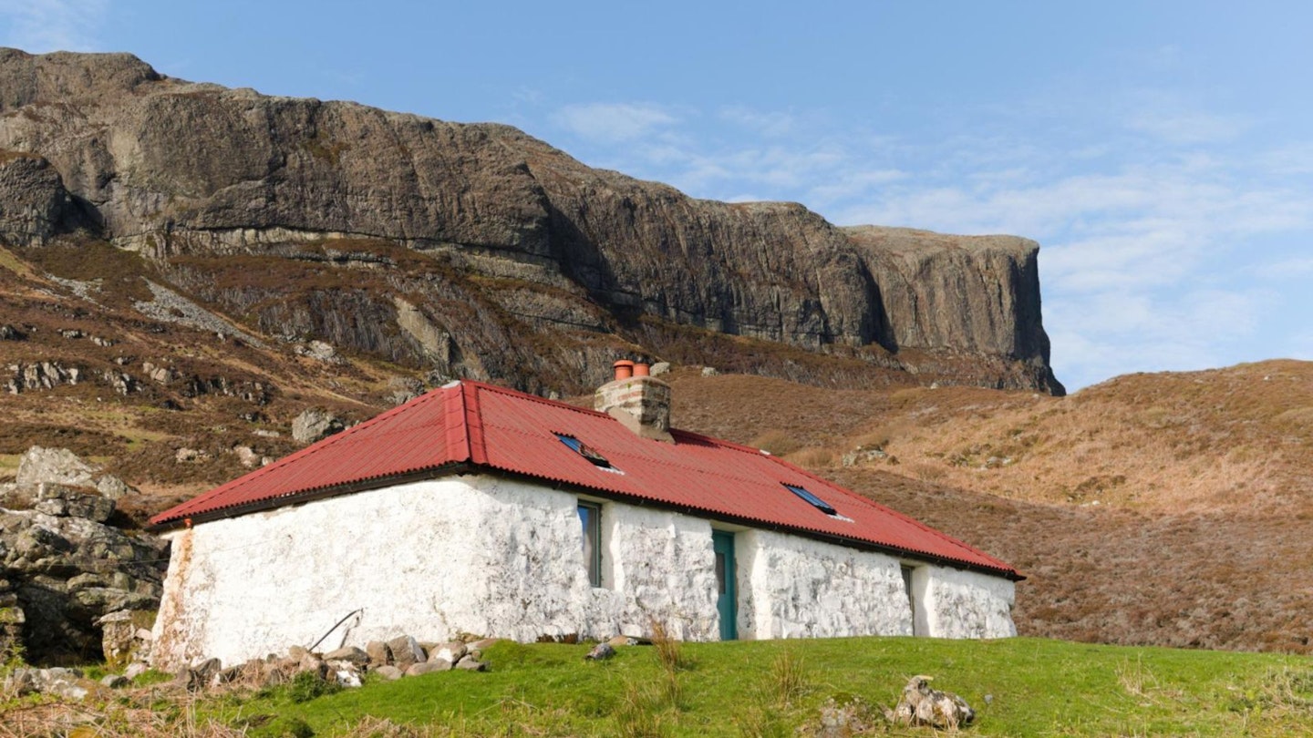
Glebe Barn is a comfortable hostel with spacious communal areas and incredible views from the conservatory over to the mainland. There are also cabins available.
About the author
Katie Featherstone is an experienced outdoor writer and guidebook author based on the Hebridean island of Islay in Scotland. She's a regular contributor to Trail magazine and has written for the Guardian and Independent, among many other publications.
This route originally appeared in the November 2024 issue of Trail magazine. CLICK HERE to become a Trail magazine subscriber and get 50% off a whole year of digital OS Maps.