
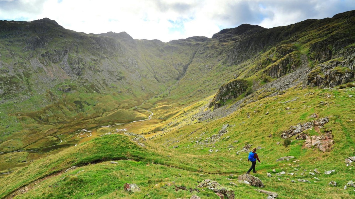
The name Glaramara suggests this mountain has Norse origins and links with a romantic past, similar to nearby Blencathra. Its bulk dominates Borrowdale, particularly the striking feature of Combe Gill, a hanging valley gouged from the earth by ice.
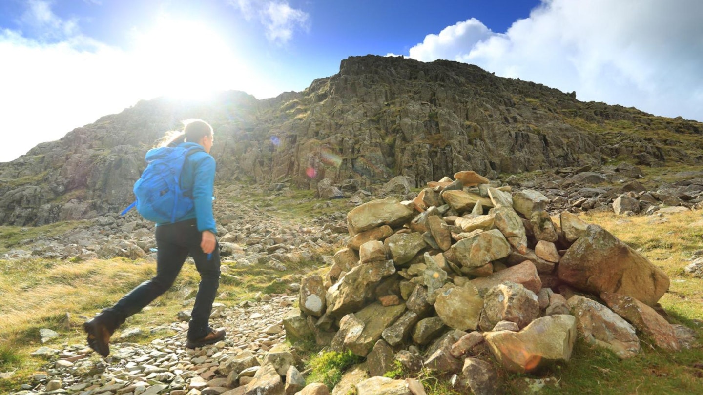
Despite the appearance of Combe Gill – the ravine being a great gash in the fell side – there is a relatively easy scramble to climb it, which makes an interesting and alternative way to reach the summit of Glaramara.
Climbing it can be steep at times, as you would expect; but the exposure is never worrying and the climb is mainly on grass. Exiting neatly at Combe Door, much of the ground in this area is boggy and there are few paths; this isn’t a place to try to navigate in mist but it makes an interesting area to explore on a good day.
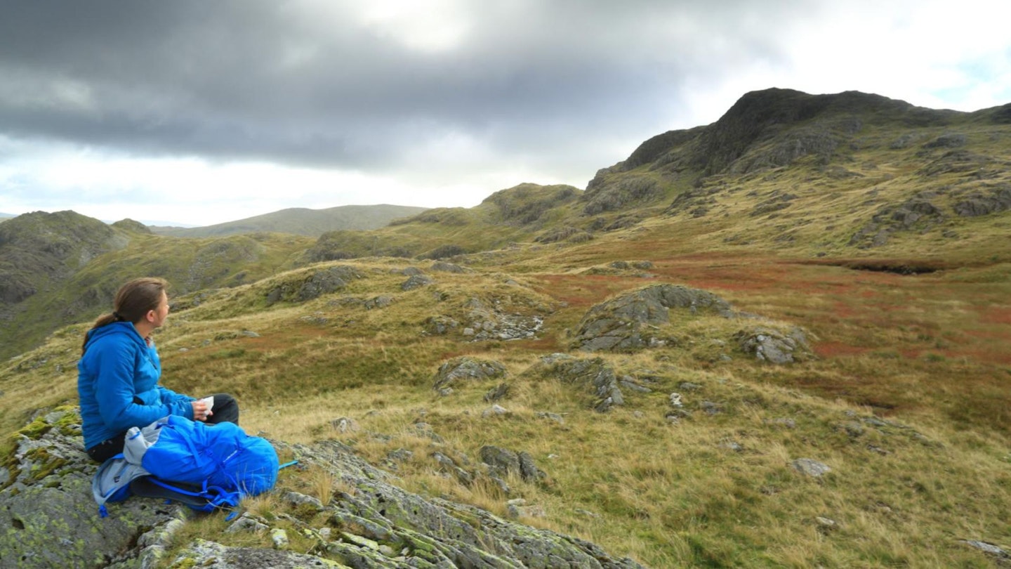
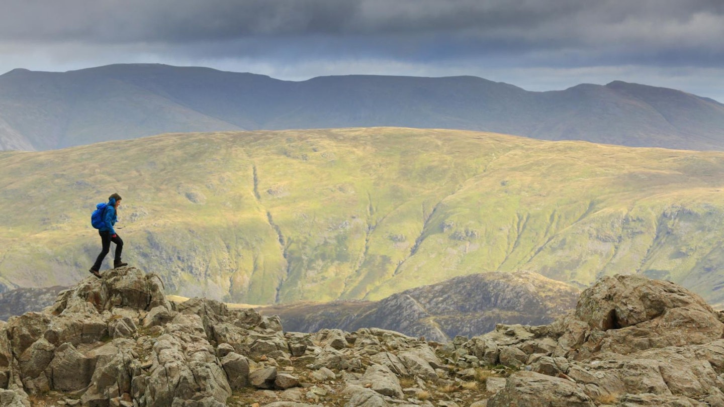
From Combe Door, it’s a short walk to reach the rock turret of Glaramara, whose isolated views provide a 360 degree panorama.

From Glaramara, the descent of Rosthwaite Fell is a point-to-point exercise as again there are few paths to speak of, which makes the walk more interesting. Bessyboot sitting above the intriguingly named Tarn at Leaves is the recognised summit of Rosthwaite Fell, although not necessarily the highest.
There are other lumps on this sprawling fell that stand higher, the obvious high point of Dovenest Crag also being visited on this walk.
How long does it take to climb Glaramara?
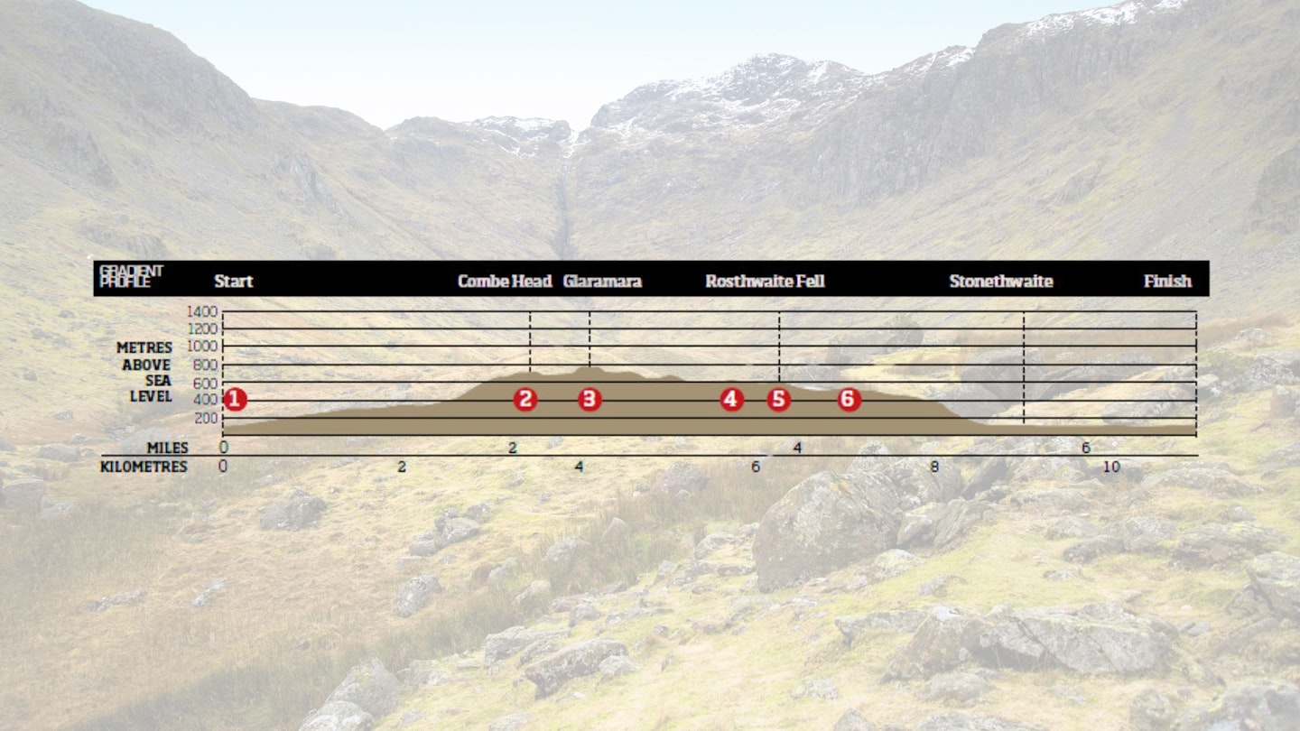
DIFFICULTY: Medium | DISTANCE: 11km (6¾ miles) | TIME: 4 hours | TOTAL ASCENT: 830m
FITNESS: This is a proper mountain walk, so your legs and lugs will need to used to hours on foot with some steep ascent and descent. No problem for regular hikers though.
TERRAIN: Mainly grass; much of the area is boggy. Handholds required on climb of Combe Gill and climb to Glaramara summit. This area can be confusing and should not be attempted in mist
NAVIGATION: You'll need to know your stuff in low visibility. The top of Glaramra is sprawling and undulating with paths that are either faint or sometimes non-existent. Take a map and compass, with the skills to use them.
Where is the start of the walk?
Parking on the grass, off the track, at grid reference NY249134, or in nearby Seatoller. The nearest town is Keswick.
What's the best map for Glaramara?
-
CLICK HERE to download a digital route in OS Maps
Glaramara via Combe Door | Step-by-step route guide
-
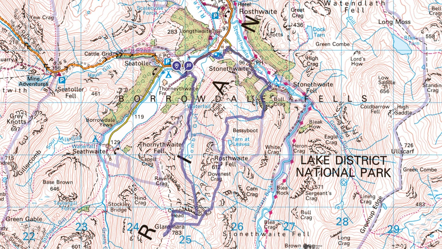
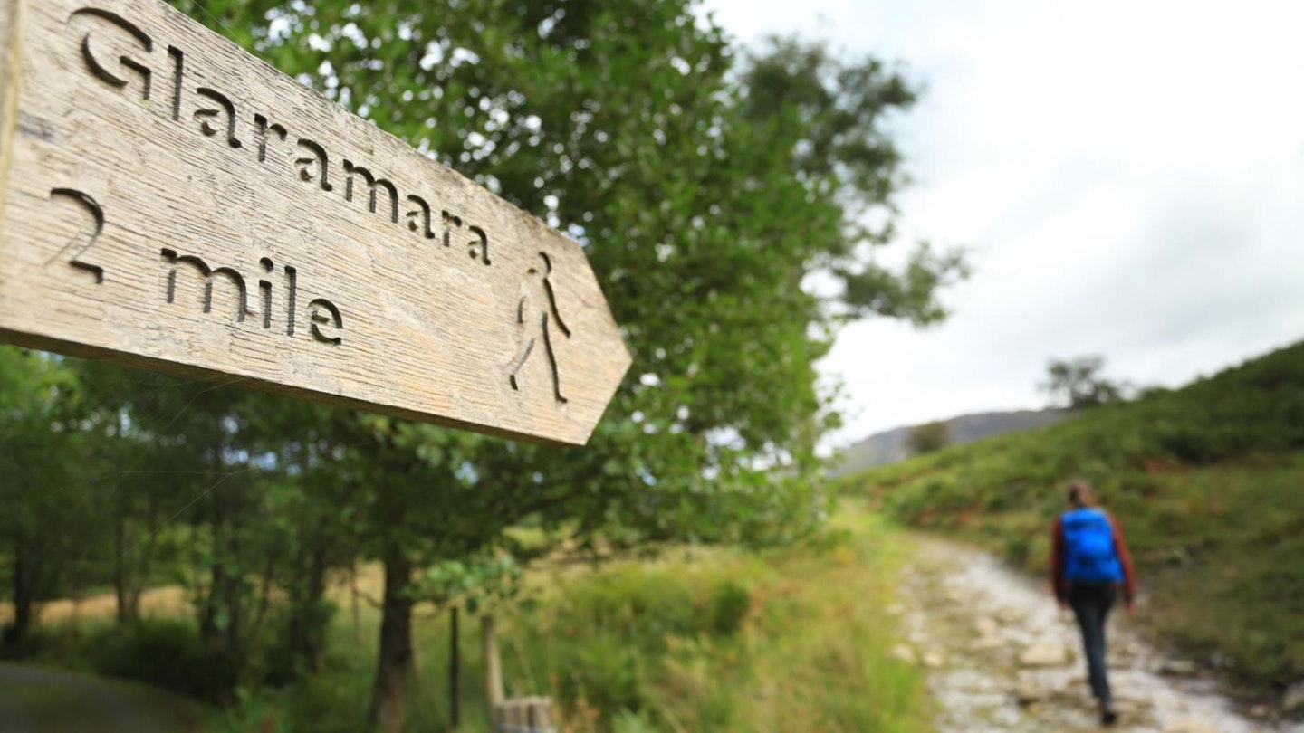
Head north-east from the car parking area along the track for 100m then through a gate (sign-posted ‘Glaramara 2 miles’), following the clear track that curves around to climb southwards up to a kissing gate. Continue directly ahead, ignoring the path climbing to the right, to a cairn at NY250127. Keep left, heading for the Combe Gill ravine, which is visible directly ahead.
-
The vague path arcs around the basin of The Combe to the right, keeping above the worst of the boggy areas. Pass by an old sheepfold at the foot of Combe Gill ravine. To climb the ravine, keep to the right; there's no need to get close to the edge and the first half is over grass and boulders. Towards the top, the ravine narrows and becomes steeper, requiring hands to be used at times; but it never feels exposed. The gradient eases to reach the plateau of Combe Door. Beyond the tarn, climb the steep slope to the right and follow the ridge to reach Combe Head.
-
Scramble (optional) Combe Head is marked with a cairn and offers a grandstand view over The Combe and into Borrowdale to Derwent Water. To the south, the rock turret of Glaramara is visible a short distance away. Descend west to pick up the main path heading directly towards Glaramara and choose a way to reach the summit, either directly by climbing a 6m rock step (which requires hand-holds) or around to the right and contouring around the crags to climb up the back way.
-
Glaramara has two cairns, the north-easterly one being the accepted summit. Its central position offers a great view, especially down into Borrowdale to Derwent Water with Skiddaw beyond. Descend back to the main path then cross the plateau between Glaramara and Combe Head (no paths) bearing north-east. Cross above the tarn at Combe Door visited earlier before heading north towards the conspicuous twin mounds of Dovenest Crag, which are visible below. Pass a large tarn in a hollow before crossing an old wall and then turning immediately left to reach the summit.
-
Dovenest Crag top is marked with a cairn and makes a suitable target to aim for among the many confusing lumps and bumps between Stonethwaite Fell and Rosthwaite Fell. From here the next aim should be Rosthwaite Cam, whose outline can be seen conspicuously below. Return to the path and follow it, curving around the edge of Great Hollow leading directly to Rosthwaite Cam.
-
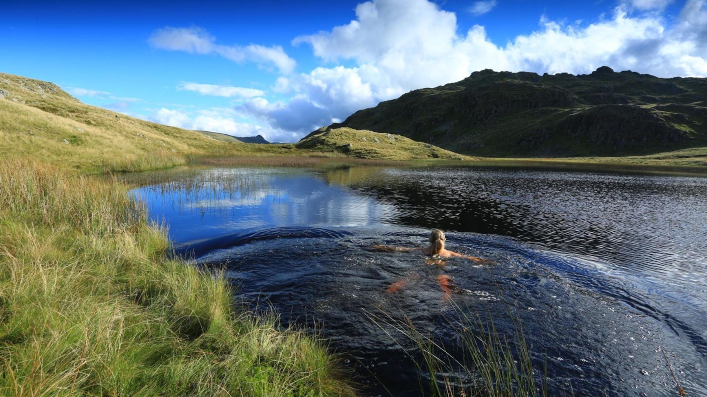
Rosthwaite Cam can be climbed if desired by picking a way from its southern edge. To the north the delightfully named Tarn at Leaves can be seen; and immediately beyond is Bessyboot, the summit of Rosthwaite Fell. Continue from below Rosthwaite Cam, following a natural line of descent. The path becomes obvious down a narrow ravine and leads directly to Tarn at Leaves. Follow the path above the tarn, climbing right at the cairn below Bessyboot.
-
Bessyboot (the summit of Rosthwaite Fell) has a cairn but the views from it are sadly not as extensive as those on the descent from Glaramara. Continue north along the summit ridge to descend to the main path, which continues for 100m before turning east.
-
At a small, colourful cairn (grid ref NY263129) descend into the ravine and cross Big Stanger Gill. From here the path is clear and drops steeply through woods before exiting onto a track. Turn left along it to head into Stonethwaite; follow the road past the school. Beyond, at the signpost ‘Borrowdale Church’, turn left to pass the church then go through a farmyard. Turn right at a signpost across a field to the main road. Turn left along it for a short way to Strands Bridge. A track opposite cottages leads straight to the nearby parking area.
What walking gear do I need for this route?
This is a typical Lake District hillwalk, so you'll need the basics of walking boots or hiking shoes, a good hiking daypack, a reliable waterproof jacket, and a pair of quick-drying walking trousers. Depending on the season you climb Glaramara you may need some extra essentials, so check out our hiking gear section for our latest reviews and recommendations.
Where can I eat and drink?
- Langstrath Country Inn, Stonethwaite
Where's the best place to stay?
- Chapel House Farm Campsite, Stonethwaite
For more accommodation deals and options check out Trip Advisor, Booking.comand Sykes Cottages.
About the author
Sean McMahon is a Lake District resident, photographer, outdoor writer and passionate hillwalker who loves exploring mountains with his dogs. He's written dozens of excellent hillwalking routes for Trail magazine and LFTO.
This route originally appeared in the July 2016 issue of Trail magazine. CLICK HERE to become a Trail magazine subscriber and get 50% off a whole year of digital OS Maps