
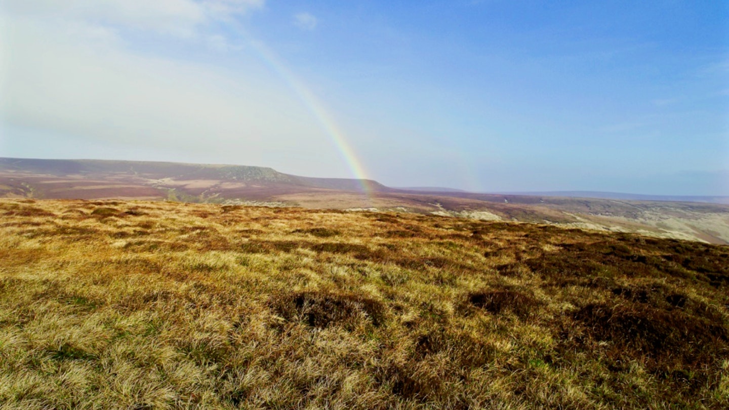
When you're dreaming of escaping to some exotic mountain range where the sun always shines, it’s easy to forget that Britain is a very special place to go hillwalking – and there's no better time than spring.
When snow and ice begin retreating from our mountains and the green shoots of new life fill their slopes and valleys. It’s the season when most of us take our walking boots out of the loft, pick out a peak on the map, then go climb it without the need for ice axes and avalanche forecasts.
To celebrate that fact, we’ve created a collection of the best excuses to explore Britain’s hills and mountains on foot this spring. Here, you’ll find a list of adventures and locations that not only showcase the bountiful variety Britain’s uplands have to offer, but also the almost endless variety of locations you can do it in.
From the Cornish coast and Dartmoor’s ghost trails, through Yorkshire’s hills and Cumbria’s waterfalls to southern Scotland’s golden eagles, almost all of us are just a short drive away from a great hillwalking region (sorry East Anglia residents).
So choose the one you can do or, even better, make a list and work through them all as soon as you can!
13. Get high on a mountain ridge
Brecon Beacons
Ridges are a true mountain-head’s favourite way to the top for a reason. The feeling of being the highest thing around, the thrill of the exposure with nothing but air either side is like nothing else, and it’s intoxicating.
And Wales is crammed full of the things. Snowdonia’s gnarly dragon’s backs of Crib Goch, Tryfan and Bristly are all unashamed show-stoppers, but further south in the Brecon Beacons you’ll find a less arrogant proposition of edges.
The hills of south Wales aren’t friends with their northern rivals. While the likes of Snowdon bully their way into the limelight, aggressively touting for attention, snarling at anything that dares to step foot on its rock, the Beacons are quite content to save their magic for those willing to look a bit harder for it.
They have nothing in common, their characters and attitudes are opposites, but if you’re looking for a friendlier way to do some ridgeline walking, a trip to the Brecon Beacons is like reuniting with a long lost best mate.
That’s not to say that they’re a walk in the park, or that these aren’t proper mountains. Far from it, the ridges of Pen y Fan are known for presenting the toughest challenge faced by SAS recruits in training.
But for those not carrying an 18kg Bergen and racing to finish, the emerald-green, serrated escarpments and cwms of the Brecon Beacon greats that gouge out a myriad of angled ways to the top reward those who look further than the obvious, with an experience that is guaranteed to satisfy any hillwalker.
Choose a ridge approach to Pen y Fan or combine two of them to make a horseshoe.
Read our guide to the Pen y Fan Horseshoe – one of the best walks in the Brecon Beacons.
12. Plug into a long-distance path
The Pennine Way
The Pennine Way really needs no introduction, being the oldest and most renowned long-distance footpath in Britain. It was officially opened in 1965 and since then has become iconic in the world of multi-day trails and challenges.
Most take 16-19 days to walk its 268 miles (431km), which eat up the Peak District, Pennines, Yorkshire Dales and The Cheviots along the backbone of Britain. The route starts or finishes at Edale in the Peak District (in a pub), or with Kirk Yetholm in the Scottish Borders at the other end (in another pub).
It is known as being one of the toughest National Trails, but you don’t have to walk it end to end. For those who don’t have the time or inclination to walk for three solid weeks, there are many highlights along the route that can be scooped up in a day or in smaller chunks.
The best bits include Kinder Scout, Malham Cove, Pen-y-ghent, Cauldron Snout waterfall, High Cup Nick, Cross Fell, Hadrian’s Wall and The Cheviots – all worthy walking objectives in their own right which will take in a sample of the Pennine Way.
But for the purest Pennine experience there’s no easy way around it, you’ve got to do it all! The rewards of passing through such a huge variety of ever-changing landscapes – from moorland, rocky mountaintops, forest, waterfalls and lakes, through to pretty villages, open fell and bog – all in one epic journey is an experience you’ll never forget.
But it’s the achievement of completing Britain’s most celebrated long-distance path that has to be the biggest reward.
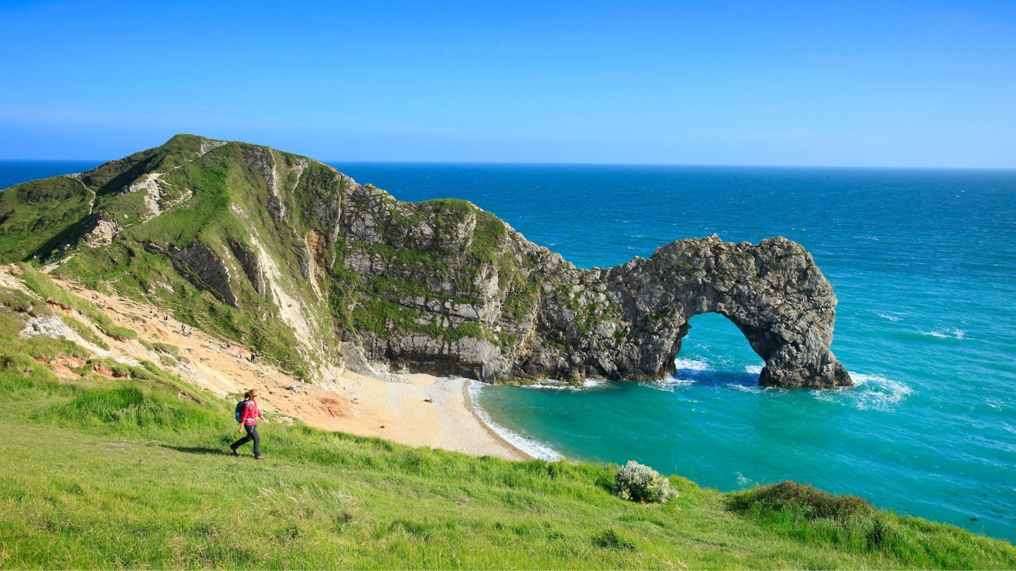
11. Explore Britain’s wild coast
The South West Coast Path
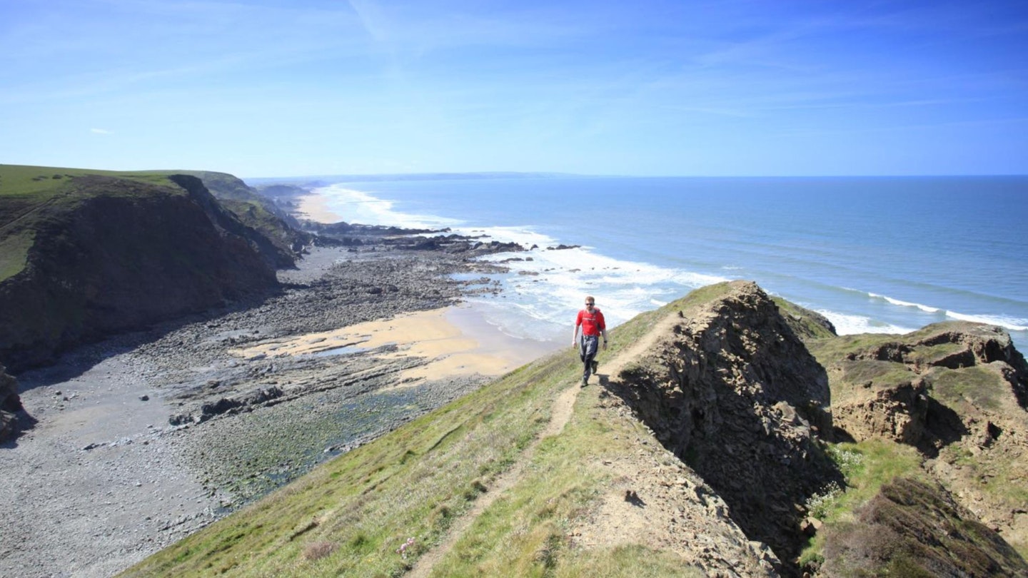
If you love mountains, you might think the seaside is just for sunbathing, but some of Britain’s most rugged, lofty and spectacular terrain can be found on our coastline. You’re really spoilt for choice, with awesome walking where land meets sea around Pembrokeshire, Llyn Peninsula, Cumbria, Northumberland, Fife and Dorset (to name a few).
All will get you up high and wild without a mountain in sight. The South West Coast Path, though, is the coastal trail of choice for many, having been voted one of the best long-distance walks in the world many times over.
It’s magnificently epic in proportions at a colossal 630 miles around the furthest reaches of Somerset, Dorset, Devon and Cornwall, making it the longest of England’s National Trails.
The ascent and descent you’ll do is often more akin to climbing a mountain than coastal walking, as you'll find in our selection of the three toughest days on the SWCP.
In fact, in its entire length you’ll scale the height of Everest four times! But unlike the mountains, the south-west coast is known for its microclimate of warm, sunny weather.
Highlights are too numerous to mention, but SWCP-ers will be treated to the delights of Dorset’s Jurassic Coast, where Durdle Door’s sea arches are just one of many views that will stop you in your tracks.
Kyance Cove on the Lizard Peninsula is more reminiscent of Koh Samui than the Cornish coast, with its sea stacks and turquoise waters. And Hartland Quay in north Devon is arguably the most rugged and impressive section – with also some of the toughest, roughest walking to rival many mountain routes.
Top all this off with colourful, eccentric villages, a plethora of accommodation and some spectacularly good pubs, and what’s not to love?! The entire length will take you anywhere from four to seven weeks to walk, but for most it takes years… one chunk at a time.
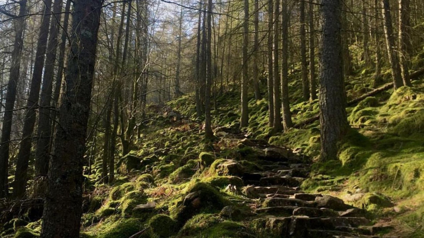
10. Take a walk in the woods
Kielder Forest, Northumberland
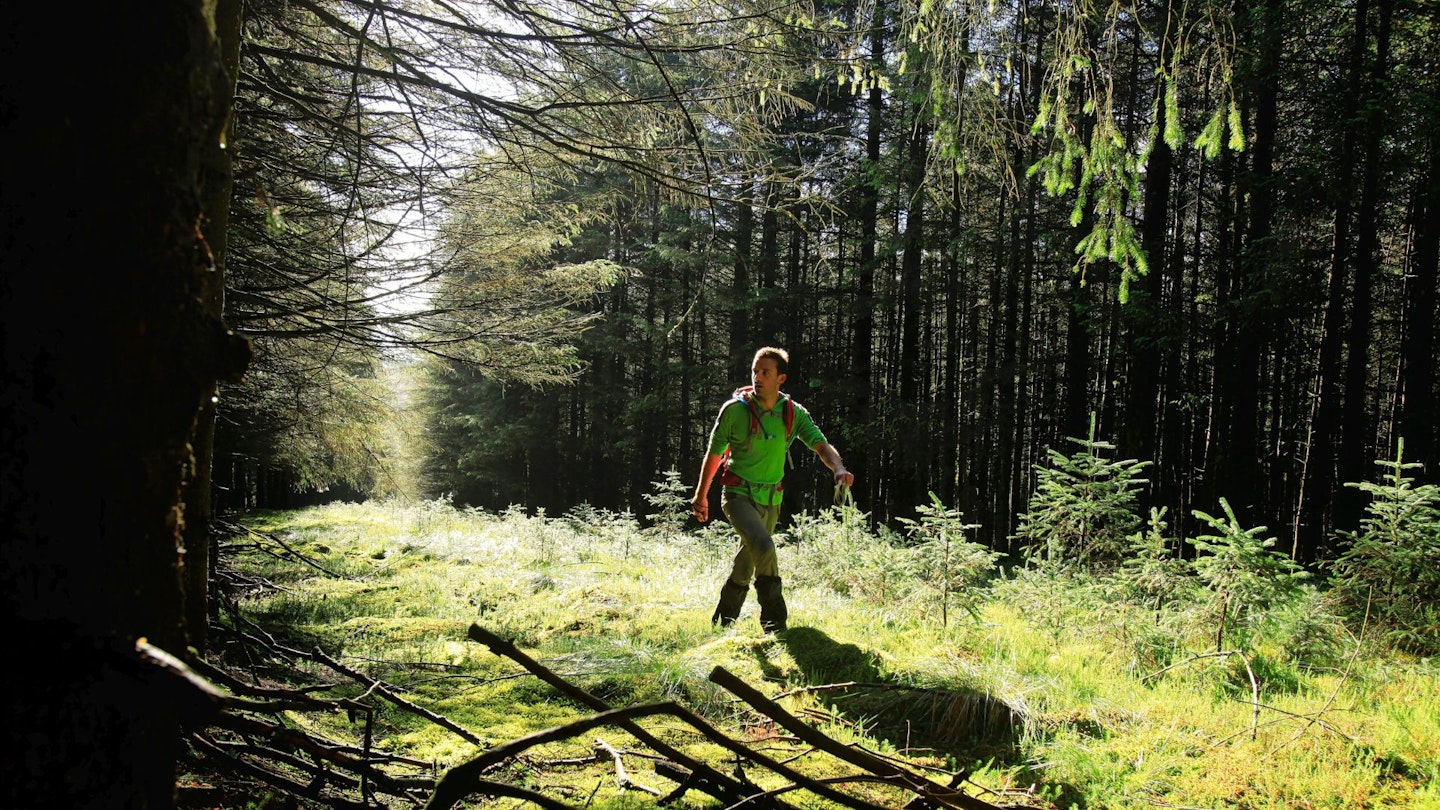
Kielder Forest isn’t your stereotypically excellent hillwalking area. For a start, there are hardly any hills. And secondly, the whole thing is basically fake.
The forest itself is a large-scale plantation covering 250 square miles, while Kielder Water – the giant body of water lying at its centre – is the largest man-made lake in northern Europe.
So why go to Kielder? Well, for a start it’s a beautiful place to walk. Somewhere you can either join the crowds on popular paths including the 27-mile Kielder Water shoreline trail, with 20 pieces of outdoor art along the way; or somewhere you can really get away from it all by heading deep beneath the canopy.
So far away from it all, in fact, that if you chuck the 10-figure grid reference NY5800085879 into your GPS system of choice, you’ll find yourself heading towards the furthest point from a public road anywhere in England.
Early morning is a special time here, with mist lifting off the lake and trees. Buzzards, sparrowhawks, goshawks and Kielder’s famous nesting ospreys (the first to recolonise naturally in Northumberland for over 200 years) are common sights.
The night skies above the forest are thought to be the darkest in England so are great for stargazing, and if you want to see as much of the area as possible then hiring a mountain bike is a good option too. Mix all that with a few days exploring the Cheviot Hills, and you’ve got a seriously good trip.
9. Bag a mini mountain icon
Roseberry Topping, North York Moors

What is it that makes Roseberry Topping, the Matterhorn of Yorkshire, so special? Well, at just 320m it’s not height.
It’s not even close to being the highest on the North York Moors; there are 15 higher. But despite this it has a presence that demands attention. This comes in part from its location.
Roseberry Topping is an outlier of the North York Moors, sitting separate and distinct from the bulk of the high-ground. It also has an immediately recognisable profile.
It used to be a fairly run-of-the mill cone-shape, but in 1912 a geological fault, potentially aided by nearby mining, caused the west face of the hill to collapse, creating the snub-nosed outline we see today.
Because of its position and tumbledown physique, it is a hill surrounded by expansive views and draped in character, and it’s been appreciated throughout history. A Bronze Age hoard was discovered on the slopes of the hill, and walled enclosures and the remains of huts dating from the Iron Age are visible nearby.
The Vikings who settled in Cleveland gave Roseberry Topping its name, Roseberry being an evolution name of Othenesberg meaning Odin’s Rock.
And such is its continuing popularity that proud locals refer to the 4,478m Swiss Matterhorn as the Roseberry Topping of Zermatt.
Find our Roseberry Topping route guide here**.**
8. Take a leap of faith
Tryfan, Snowdonia
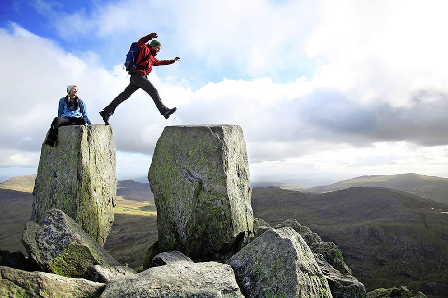
Tryfan is a regular winner in ‘favourite mountain’ polls, and you don’t have to climb it to see why. Heading west into the Ogwen Valley, drivers have to work hard to stop their eyes drifting up the striking north ridge and onto the tri-topped summit.
Passengers in the same vehicle can trace an imaginary ascent from Llyn Ogwen up onto the mountain’s northern tip. From here, the line of the Heather Terrace draws the eye across Tryfan’s eastern flank then up the crags of the rugged north ridge to its apex.
Upon reaching the top, the keen-sighted will spot two figures silhouetted against the sky. These are Adam and Eve, two monolithic protrusions of rock stood on the summit of the mountain.
This freakish coincidence of geology has created a famous challenge. Jumping from the top of Adam to Eve is said to award the leaper the freedom of Tryfan.
But before you rush up there to claim your mountain, be aware: although the distance is small, so is the landing platform. And it slopes away, is slippery when wet, and is poised above shattered rocks and the steep drop of Tryfan’s east face.
However, despite these risks, it’s an ever popular challenge, and on a sunny weekend you may well have to join a queue!
Find our guide on how to scramble Tryfan's North Ridge here. You can also climb Tryfan via Little and North Gullies, or combine it into a three peak hike with Glyder Fach and Glyder Fawr.
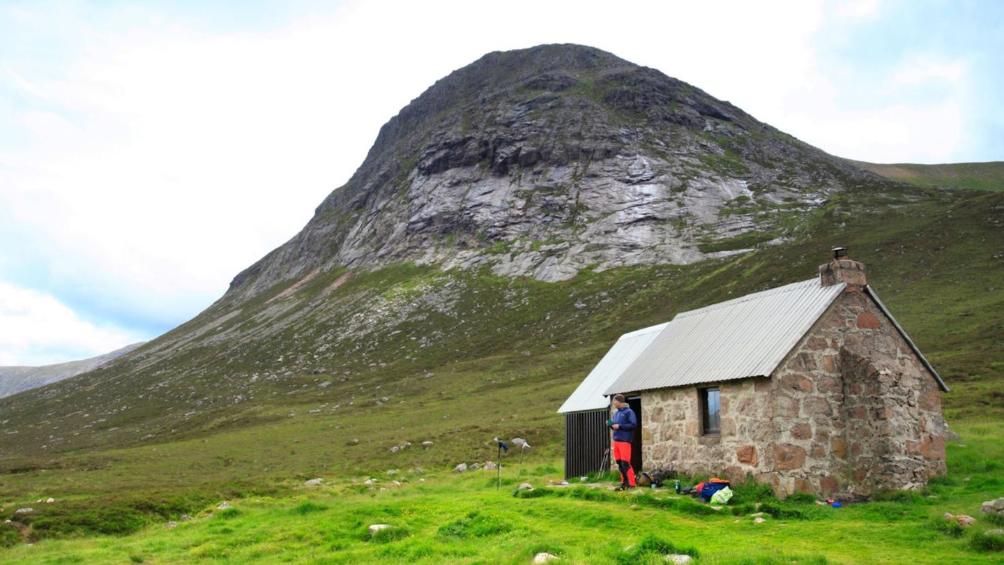
7. Explore a wild mountain valley
Ennerdale, Lake District
True wilderness is harder to find than you might think. Humans have changed and adapted almost every square inch of Britain to serve our growing population and our ever-expanding needs.
Even in the countryside, much of the mixed native woodland has been replaced with sterile plantation. Diverse fellside habitat are now sheepshorn grassy deserts. Wildlife clings to the scraps of nature that remain.
But fortunately, another thing is changing too, as after centuries of blind ignorance to our impact on the planet, finally we are waking up – and hundreds of projects are springing up all over the UK to reinstate, preserve, and nurture the biodiversity we have lost.
Ennerdale is one shining example of this, where work is ongoing to slowly evolve the Ennerdale valley back to its natural state. Plantation is being thinned and felled to be replaced with native species, sheep grazing is being limited, and habitats that support butterflies, birds, red squirrels and pine marten are encouraged.
Being the only Lake Districtlake not to have a busy road running by it, Ennerdale is one of its most remote valleys. It’s a walker’s heaven, being surrounded by some of the most impressive peaks in England – including Great Gable, Pillar and Haystacks.
But due to its inaccessibility by road, it remains free from the usual Lake District footfall. You can even stay at the YHA Black Sail Hut right in the heart of the Ennerdale valley, where you can put down your rucksack and really immerse yourself in one of England’s wildest valleys.
6. Walk a ghost trail
Dartmoor, South-west England

Dartmoor is an eerie place. Perhaps it’s the bleak openness of the elevated moorland interrupted by craggy tors of granite. Perhaps it’s the cloak of prehistory that lays across it; stone circles, cairns, burial cists and other ancient constructions scatter the map.
Or maybe it’s the wealth of myths, legends and ghostly tales that have their origins on the moor. The most famous is Sir Arthur Conan Doyle’s Sherlock Holmes novel The Hound of the Baskervilles.
While a work of fiction, it is said to have been based on the tale of a pack of hounds that ran howling across Dartmoor following the death of an evil squire.
More deathly hounds, these belonging to the Beelzebub himself, are said to drive travellers to their deaths off the top of the Dewerstone, a 100m high granite outcrop. The ghost of Lady Howard is also said to travel the moor in the form of a black dog, running alongside a coach made from the bones of her dead husbands.
Canine spectres aside, there are plenty more ghostly goings on, from haunting Roman legionnaires and Tudor hunting parties to an evil sprite who accosts drunks, and disembodied hands that grab the wheel to force drivers off the road.
Some are focused on physical parts of the moor, such as the Coffin Stone, the coffin of an evil man that was split apart by the wrath of God. Or Crazywell Pool, which shows the next parishioner to die if looked into on Midsummer’s Eve.
Or rock outcrops transformed from the bread and cheese offered by a cloven-hoofed stranger to a wary bishop and his servant. Wherever you go on Dartmoor you’ll be walking in a landscape of legend, and quite possibly not on your own…
Take a look at our guide to Dartmoor's highest tors.
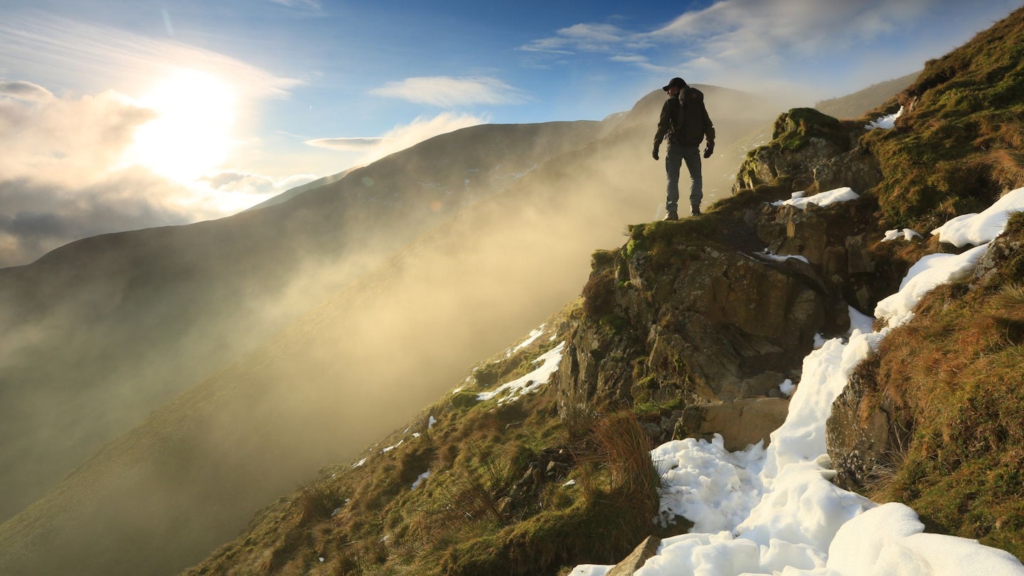
5. Immerse in big mountain scenery
Devil’s Point, Cairngorms
Where mountains pile one upon the other forming tight valleys and crowded skylines, the result is always spectacular, but can also feel closed in and claustrophobic. However, there are landscapes where the bulk of the mountains is matched by the space around them.
The scenery is vast, the views huge; this is Big Country. The UK’s Big Country is almost exclusively found in Scotland, where the combination of soaring landforms and expansive panoramas co-exist most harmoniously because there’s space for it.
The Cairngorms are perhaps the best example. The mountains are big; six of the British Isles’ seven highest peaks are found here, and four of those are found along a continuous chain of summits on the western side of the Lairig Ghru pass.
Which brings us on to the second aspect of the Cairngorms that makes it Big Country: the space between the mountains. Glaciercut passes and wide river-bottomed glens are as much a feature of the Cairngorms as the high ground, but it’s the combination of these that makes the landscape special.
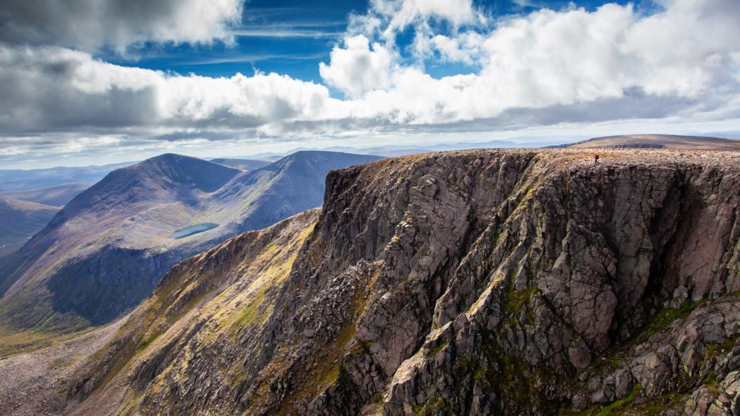
If there’s one peak from where these qualities are exemplified, it’s the sordidly named Devil’s Point. Its Gaelic name, Bod an Deamhain, actually means ‘Penis of the Demon’; when Queen Victoria asked her ghillie John Brown for a translation, he erred on the side of euphemistic to avoid Her Majesty’s blushes, and the name has stuck.
The best way to reach its summit is to traverse those four of the UK’s highest peaks to arrive at the end of the chain of mountains and the summit of the Devil’s Point at the finale of a day whose scenic revelations have been building up to this moment.
Directly below its steep nose, a confluence of valleys yawns between the hills. The steep-sided Lairig Ghru cuts north below another Cairngorm giant, Ben Macdui.
The wide, green, water-patterned Glen Dee rolls away to the south, fed by the burn winding joyfully out of Glen Geusachan from the west.
Opposite, the water of Allt Preas nam Meirleach begins its journey east towards Luibeg Burn, Lui Water, the River Dee, and eventually the sea. It’s Big Country all right, and this is the best view in the house.
For more inspiration, read our Cairngorms guide.
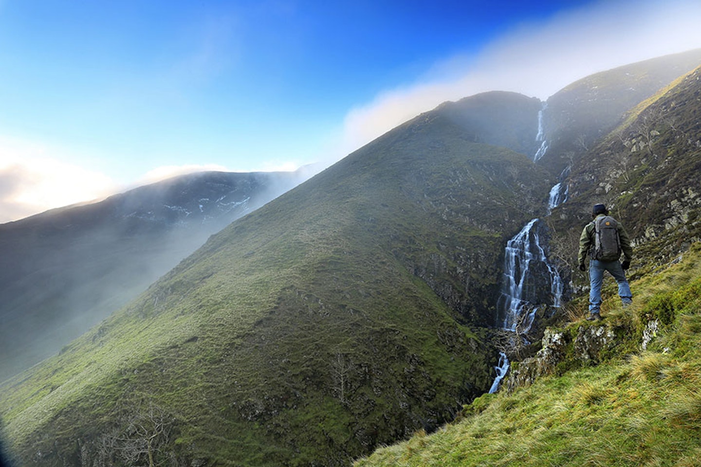
4. Climb a waterfall
Cautley Spout, Howgills
There’s nothing like a good waterfall to enhance a walk. In fact, us humans seem to be irresistibly drawn to the things.
Scientific studies have tried to identify just why we’re so in love with waterfalls, with some suggesting that the ‘negative ions’ are increased around them, causing an actual boost in our serotonin and therefore our happiness!
Whatever the chemical impact on our bodies, the drama and beauty of waterfalls are obvious, and Cautley Spout is one of England’s most impressive, being its highest waterfall above ground.
Cautley Spout can be found nestled between the Lake District and the Yorkshire Dales, in the rolling green hills of the Howgills – an often neglected haunt of hillwalkers. The 198m falls tumble down a vegetated ravine that cuts into the head of the valley, framed by the cliffs of Cautley Crags to the left and scree slopes to the right.
A steep path intimately accompanies the waterfall, so you can peer deep into its depths, feel its force when in spate and wonder at its deception as its waters swirl benignly in rock pools at its source before hurling themselves at full throttle into the abyss.
It’s truly an impressive spectacle. But the magic doesn’t end there. You discover that there’s far more to the landscape of the Howgills than it seems from afar.
The sleeping elephants, as Wainwright described them, upon closer exploration become a maze of mini habitats, hidden in deep gorges and cut by peaceful becks as they flow from the undulating plateau.
Here you’ll find The Calf, the highest peak of the Howgills at 676m. It’s a fine vantage point over to the Lake District and a grand place to explore the quiet of these fells, which are so unusually devoid of fences and walls.
The Dales High Way bridleway passes through, or you can head off-path and explore this unique place that will do its best to test your navigation skills if the mist comes down.
Find here a Howgills walking route with excellent views of the Cautley Spout.
3. Explore golden eagle country
Southern Uplands
Five years ago, England’s last golden eagle vanished from the Lake District. Having been a sole resident in Riggindale near Haweswater since 2004, its disappearance marked the end of an era.
Golden eagles arrived in the Lakes from Scotland in the 1950s, but the sight of them crossing the border has decreased dramatically in recent decades because, although still numerous in northern Scotland, their numbers have plummeted in the Southern Uplands.
That could all soon change though, thanks to the early success of the South of Scotland Golden Eagle Project, which has worked hard over the past few years to reinforce the vulnerable population of Scotland’s national bird in the Borders and Dumfries and Galloway.
Using a process known as translocation, where chicks born elsewhere have been relocated and released into the wild at a secret location in the Moffat Hills, it’s hoped that numbers will soon start thriving in the area once again.
Having been named by local schoolchildren, a young golden eagle named Beaky is already on his way to becoming a star, crossing over the border and having been spotted flying as far south as England’s Pennine Hills.
It’s still early days for the project, but this is a great time to walk in the Borders, because there’s really no feeling quite like locking your eyes on a soaring golden eagle.
2. Hike through history
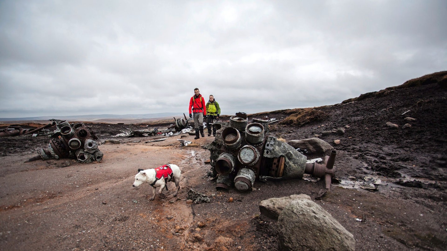
Bleaklow, Peak District
The British mountains are awash with history. From field systems and burial cairns to Iron Age forts and hut circles, these archaeological remnants crop up on many a hillwalk.
But there’s a particular historical phenomenon that is found in the hills more than anywhere else: aircraft crash sites.
Sadly, before the various safety protocols and technology of modern aviation, more than a few aircraft were lost when, often due to a combination of poor weather and navigational errors, they collided with high ground the aircrews weren’t expecting to be there.
There are crash sites all over the UK mountains, but few are as expansive and evocative as that on Bleaklow in the Peak District. On the 3 November 1948, a US Air Force Boeing RB-29A Superfortress bearing the name Over Exposure collided with the Peak moorland at 610m above sea level.
It was immediately engulfed in flames and all 11 crew members and two military passengers were lost. The debris was scattered over a large area just north of Higher Shelf Stones on the south-west flank of Bleaklow, where much of the wreckage can still be seen today.
Although the featureless moorland of Bleaklow isn’t the easiest to navigate, the site can be reached from the Pennine Way which lies 700m to the east, while the trigpoint at Higher Shelf Stones serves as a useful guide, sitting just 150m south-west of the wreckage.
The bleak brutality of the impact site and the violent deformation of the metal remains are at odds with the natural landscape around it. But so long as the site (which was given a permanent memorial in 1988) is regarded with the respect it deserves, it is a fascinating and emotive place to explore.
Here's a classic scrambling route up Bleaklow via Wildboar Clough, which takes in the crash site.
1. Visit a mountainous island
Isle of Skye
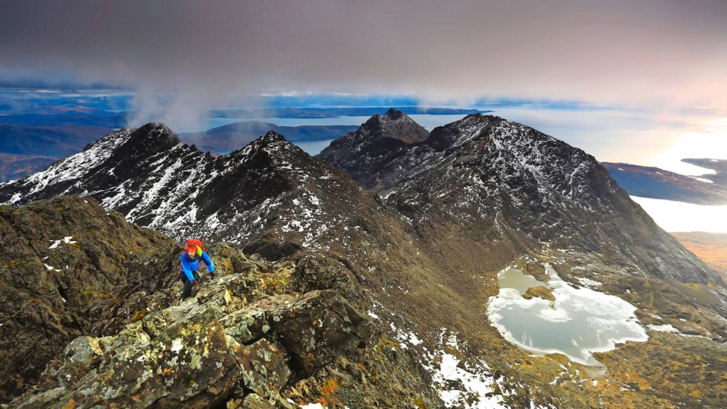
Great Britain has over 6,000 offshore islands, many of which are tiny and uninhabited, a handful of which are wild and mountainous. Rum, Arran, Eigg, Jura, Harris and Lewis are all names that fire the heart of hillwalkers, but there’s one island that stands head and shoulders above all others in terms of mountain superstar status...
People flock from all over the world to visit Skye, and for the mountain-lover Britain’s second largest island has just about everything. From the fearsome Black Cuillin peaks in the south, to the green landscapes of the Quiraing, Storr and Trotternish Ridge further north, there’s nothing you can’t do here.
Skye will always be inexorably linked with climbing and mountaineering, but the hillwalking trails are also some of the finest Scotland has to offer.
There are daring ascents for scramblers onto the Cuillin Ridge, rolling peaks alive with the sound of golden and white-tailed eagles in the neighbouring Red Cuillin hills, and possibly the best mountain view anywhere in Britain from the summit of scraggy outlier Sgurr na Stri over Loch Coruisk.
All that good stuff comes at a cost though, because Skye can be ridiculously busy – in high season beauty spots such as Sligachan Bridge and the Fairy Pools attract busloads of tourists.
So visit in the quieter months and get off the beaten track. Walk among the peaks, bays and bothies that aren’t marked by brown signs, and experience a mountainous island like no other.