
It takes a certain sort of person to want to walk a long way for no particular reason. But they’re out there, in countries all over the world. In the USA for example, there’s a particular breed of hiker known as ‘Triple Crowners’.
These are people who have completed all three of America’s most legendary long-distance trails: the 2653-mile Pacific Crest Trail (the ‘PCT’); the 2194-mile Appalachian Trail (the ‘AT’); and the 3028-mile Continental Divide Trail (the ‘CDT’). It’s a beast of a challenge.
Their total length is about 7875 miles and the cumulative ascent is over 300,000 metres. That means walking the equivalent of more than a quarter of the way around the entire globe, while climbing Everest 33 times along the way.
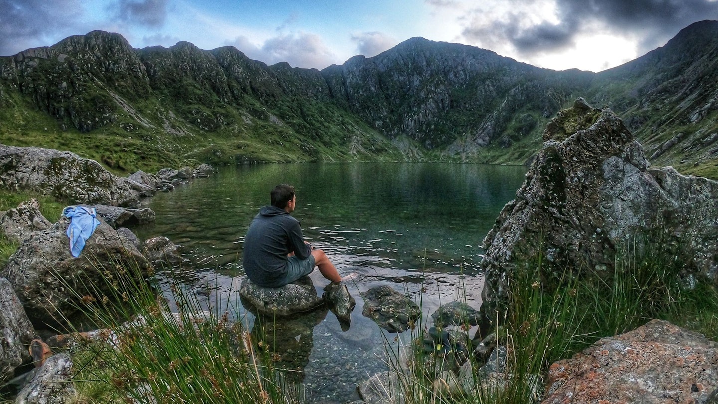
Impressively, 665 people are recorded as having successfully hiked a Triple Crown to date. Last spring, I happened to meet one such hiker, outside Glendhu bothy, a few days from the end of Scotland’s demanding Cape Wrath Trail.
Ted was in his mid-30s and hailed from Michigan. Having conquered all the really long ‘thru-hikes’ in his native US, he had come here to tackle some of ours. He was your classic ultralighter – lean as a whippet, kitted out in shorts and trail running shoes, and carrying a small pack that appeared to have almost nothing in it.
He seemed to be a bit of a loner – but then, he was probably well accustomed to his own company. Eschewing the cosy and convivial bothy, he pitched a single-skin trekking-pole tent that weighed about 400g, pulled out a gossamer-thin air mat and a featherweight down sleeping bag, and went to bed.
His only trail luxury was a paperback novel, which he read until dusk fell. He turned in early and was long gone by the time we woke up next morning at 6am. Clearly, that’s the kind of dedication it takes if you want to walk serious miles.
There’s no commonly acknowledged ‘Triple Crown’ in the UK. But maybe there should be.
Okay, the numbers would pale in comparison. After all, our island nation is pretty small compared to the USA. But as all backpackers know, there’s a lot more to a long walk than simply how far you’ve come.
For the purposes of picking a British Triple Crown, you’d surely want three walks that showcase the finest of our landscapes, especially our upland areas, while giving walkers a real sense of remoteness.
Such criteria probably rule out the 630-mile South West Coast Path, which traces the undulating coastlines of Somerset, Devon, Cornwall and Dorset. Same goes for the 870-mile Wales Coast Path.
For me, neither of those are wild enough – nor mountainous enough. There is a case to be made that any British triple crown should include LEJOG, the famous Land’s End to John O’Groats challenge, which essentially necessitates walking the length of England and Scotland.
There’s also Cameron McNeish’s Scottish National Trail, which runs from Kirk Yetholm to Cape Wrath. But neither of those are continuous long-distance paths, and to walk them means following bits and pieces of various different marked trails, as well as other rights of way, canal towpaths and minor roads.
A true British Triple Crown should surely comprise a trio of long and difficult long-distance paths that can be walked from end to end, each with distinct and different characters. Not necessarily national trails per se, but certainly recognised walking routes that can be backpacked from start to finish – or ‘thru-hiked’, as they say across the pond.
On balance, I reckon the most compelling candidates are probably the venerable Pennine Way, the rugged Cambrian Way and the remote Cape Wrath Trail. There’s a nice symmetry to the fact that those three also happen to be in England, Wales and Scotland respectively.
And having backpacked them all, I’m perhaps in a decent-ish position to assess their respective merits and challenges – as well as answering the inevitable question: of the three, which is the toughest?
Now, there are multiple ways you could rate the comparative difficulty of each trail. The most obvious would be to look at the stats: how long each path is, and how much ascent there is on each route.
But even those numbers only tell part of the story. Because ideally, you’d also need to know how easy it is to follow the path on the ground (for example, is it waymarked, and if not, how difficult is the navigation?).
Then there are measures of how tough the actual walking is (which is all admittedly rather subjective). But here we’re talking about the remoteness of the route and the difficulty of the terrain underfoot – including how boggy it is.
Lastly, there are the key questions of logistics – like how easy is it to get to the start and finish points, and how many options there are to resupply with food and other essentials along the way.
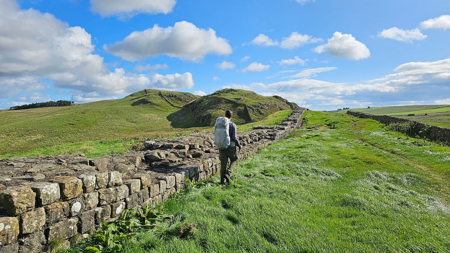
The Pennine Way – 268 miles
Location: England/Scotland | Start/finish: Edale/ Kirk Yetholm
Ascent: 11,225m | Highest point: Cross Fell, 893m | Time: 16/19 days
The OG of all Britain’s big walks deserves a place in the UK’s Triple Crown by virtue of its age and notoriety alone. Many will be familiar with the route, which traces a sinuous path up the spine of England.
It is usually walked in a northerly direction, setting out from the village of Edale in the Peak District and finishing at Kirk Yetholm in the Scottish Borders. In fact, it’s technically a pub-to-pub walk, since the traditional start is The Old Nag’s Head, while the end point is the well-worn gable wall of the Border Hotel.
If you make it to Scotland, the bar staff will stand you a free half-pint (a custom initiated by the great Alfred Wainwright himself). But between these two much-loved watering holes, the route crosses an energy-sapping mix of boggy plateau, tussocky moorlands and wind-scoured uplands.
As a National Trail, it’s fully waymarked from end to end with the famous acorn symbol, while the route is entirely on footpaths and other public rights of way. This means that navigation is arguably slightly easier than its two Triple Crown rivals (though in poor weather, it’s a different matter).
The going underfoot can be tricky though, as the Pennine Way has some famously boggy stretches. Flagstones have now been laid across the worst bits, but there are still some challenging stretches in the Peak District, as well as in places like the North Pennines, beyond Hadrian’s Wall in Northumberland, and in the soggy Cheviots when you’re approaching journey’s end.
Put it this way: sooner or later, your feet will get wet, and if you’re backpacking, they’ll probably stay wet, at least for a while. For many Pennine Way walkers, the single toughest stretch of all is the hike up and over Cross Fell. At 893m, this is the highest point on the entire walk.

Famously, it’s also the only mountain in Britain with its own named wind: the Helm Wind – a strong north-easterly that usually results in a heavy bank of cloud shrouding the summit. Expect a long, cold, hard, wet day enveloped in clag.
The saving grace is Greg’s Hut, a bothy that offers some welcome respite from the elements. For my part, I particularly hated schlepping over Sleightholme Moor, which lies beyond the famous Tan Hill Inn.
In his Pennine Way guidebook, Wainwright described walking this bit as ‘a journey of despair’. Even in sunshine, he says, it is ‘like walking in porridge’. After heavy rain it is ‘like walking in oxtail soup.’ He isn’t wrong.
Apart from these bits, however, the Pennine Way isn’t particularly remote or difficult – at least, in comparison to the next two trails on my list. You also pass plenty of towns and villages on the way, which makes resupply relatively easy.
And lastly, there are some very welcome examples of ‘trail magic’ on the route too. These are places where friendly locals stash walking snacks and suchlike, just off the path. Most have honesty boxes for payment.
It’s a custom that’s a big part of US thruhiking and one that, happily, has also made its way over here. On the Pennine Way, we encountered a tiny tuck shop in an upcycled henhouse, an open barn with a groaning table loaded with flapjacks and other delights, and an old stable complete with fridge stocked with cold drinks.
‘Pit stop –>’, declared a sign scrawled in black marker on the lid of an old feed tub. Sometimes, it’s the small things.
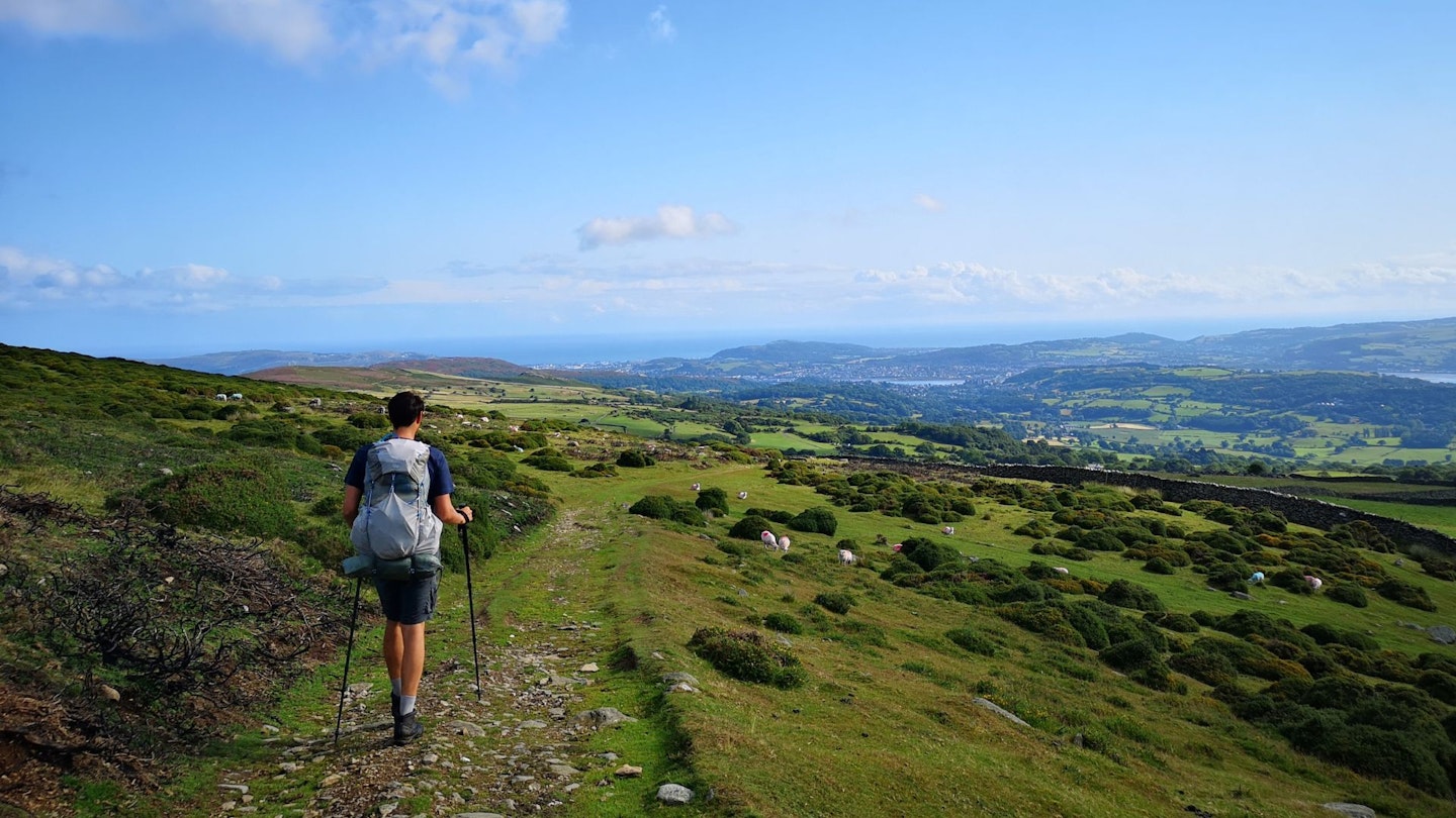
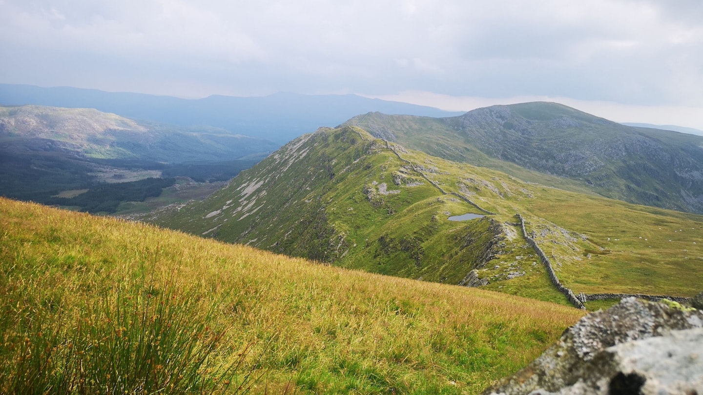
The Cambrian Way – 298 miles
Location: Wales | Start/finish: Cardiff/Conwy
Ascent: 22,500m | Highest point: Snowdon, 1085m | Time: 17/21 days
Dubbed ‘the mountain connoisseur’s walk’, the Cambrian Way is indisputably a trail for those who like plenty of up and down. The total ascent profile is 74,000ft – that’s two and a half times the height of Everest – traversing the Black Mountains, the Brecon Beacons, the Cambrian Mountains, and then, just when you’re really knackered, all of Eryri (Snowdonia).
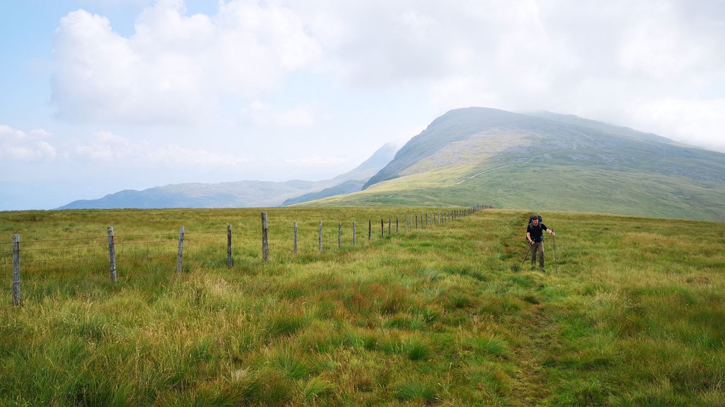
By the end of it you will have climbed 46 peaks, including Yr Wyddfa (Snowdon) and nine other Welsh peaks over 3000ft, as well as Pen y Fan, Pumlumon, Cadair Idris and several other big hitters.
It’s just under 300 miles long and takes most backpackers about three weeks to complete. Or in other words, it’s 30-odd miles longer than the Pennine Way, but twice as hilly.
The Cambrian Way has a chequered past, and for decades it existed as an unofficial long-distance trail. However, it is now marked on OS maps and recognised by local authorities.
It’s waymarked in places with a distinctive ‘black hat’ roundel, but not in the more remote sections, in order to preserve the wildness of the landscape. The route follows rights of way or crosses access land throughout – but you’ll probably still have to battle through a fair bit of undergrowth.
My Cambrian Way adventure was eventful to say the least. I endured heatwaves, thunderstorms and to top it all off, a gut-twisting stomach bug. The toughest days were classic examples of Type 2 fun – I didn’t really enjoy it at the time, but I look back with genuine fondness and a certain degree of pride at the fact that I got through it all.
And of course, at almost any time of year, the Welsh weather might roast you in desert-dry heat or soak you to the bone. However, there were a litany of life-affirming moments too – re-energising dips in remote lakes, epic wild camps, serene valleys and, of course, majestic mountain panoramas.
Most walkers agree that the toughest bit is the stretch through the notoriously rugged Rhinogydd mountains of central Eryri. It’s ankle-breaker territory in some places, especially with a big pack; a stout pair of trekking poles definitely comes in handy.
Be prepared for two days of good old fashioned, head-down slogging. What’s more, the Cambrian Way is nowhere near as popular as the Pennine Way, so it doesn’t yet have the same provisions in terms of handily placed pubs and accommodation.
To backpack the trail from end to end, you’ll need to have wild camping experience and on occasion be prepared to carry a couple of days’ worth of food and water. It’s one for experienced hillwalkers with sound navigational skills.
It’s also the most demanding UK trail of all when it comes to fitness and endurance. By the end of the Cambrian Way, you’ll either be utterly broken or a hillwalking machine. There’s no denying that walking the entirety of the Cambrian Way in one go is long and difficult, passing through some of the emptiest parts of Wales.
But those same places also feel wild, spectacular and virtually untouched. And that is really the appeal of this unique route. In other words, it’s a proper adventure.
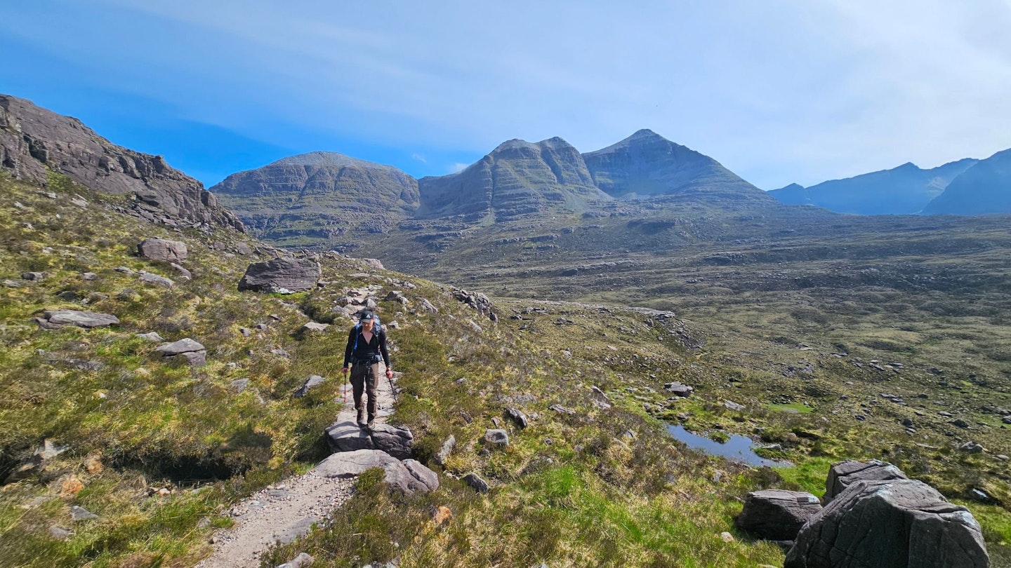
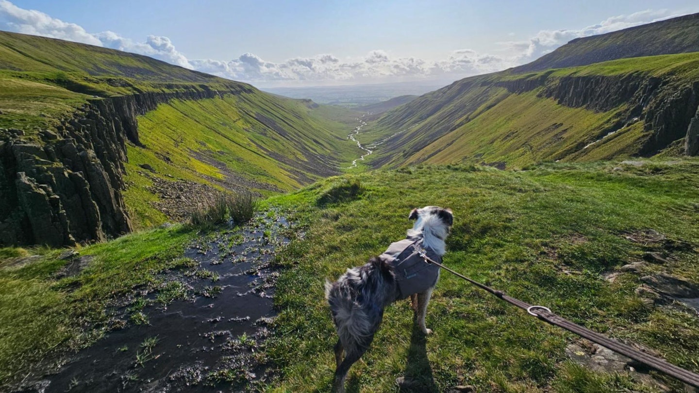
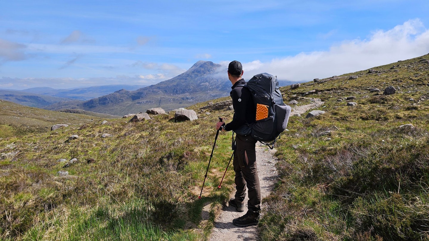
The Cape Wrath Trail – 230 miles
Location: Scotland | Start/finish: Fort William, Cape Wrath
Ascent: 13,249m | Highest point: Bealach Coire Mhalagain, 700m | Time: 15/20 days
This two-to-three-week backpacking route through the Scottish Highlands has a well-deserved reputation for toughness. The most commonly cited reasons for this are the remoteness of the route and the difficulty of the terrain.
The trail itself is entirely unmarked and occasionally trackless, which means miles of tramping across heather, tussock and bog. In fact, there are several areas, such as Knoydart, Assynt and Sutherland, which are about as close as you can get to true wilderness in the UK.
As such the walking is arduous, the weather can be fickle and the navigation challenging. Added to which, opportunities for resupply are limited. And if you do end up getting into trouble, places to go for help are few and far between.
Some hikers choose to post supply packages to post offices or hotels along the route, while also stocking up at local shops in out-of-the-way places like Shiel Bridge, Strathcarron, Kinlochewe, and Kinlochbervie.
But diverting to Ullapool (the trail’s approximate halfway point) is the only option for a full resupply. One good thing about the Cape Wrath Trail, compared to the Pennine Way or the Cambrian Way, is the comparatively high number of bothies along the way.
These are basic but very welcome shelters for weary backpackers. There are a few small inns and bunkhouses on or near the route too, but you’ll still spend plenty of nights under canvas (or ripstop nylon, as the case may be).
This probably means passing plenty of time in your own company, which introduces a mental element to the challenge that shouldn’t be underestimated. All of this means that it’s a trail best suited to experienced backpackers who are comfortable with being uncomfortable.
You’ll need to be pretty much self-sufficient for days at a time in terms of provisions and power, since multiple miles of the trail are completely off-grid. You must also be able to navigate the old-fashioned way, with a map and compass, and have the ability to negotiate several tricky hazards.
Unlike the Cambrian Way, the Cape Wrath Trail isn’t a high-level route. As such, there’s no steep scrambling or exposed ridges, but there are some decent climbs (including the highest point on the trail, the 700m mountain pass at Coire Mhalagain) as well as knee-jarring descents like the Falls of Glomach.
And you will cross many, many bogs. However, river crossings are the chief hazards. Some of the rivers can be extremely dangerous in spate. This means you might have to camp while you wait for water levels to subside, or walk miles upstream to seek an easier crossing.
Then there’s the resident wildlife. Ticks and midges can be a real nuisance in summer. You’ll need a tick removal tool, midge repellent and a headnet. There are also various other wonderful examples of wee beastie to deal with, from clegs (horseflies) to keds (deerflies).
Forbearance is key here. Sooner or later your feet will get wet. There seems to be two schools of thought on how to deal with this. The first is to wear sturdy, high-ankle waterproof boots, often backed up with waterproof socks or gaiters, in order to fend off the all-conquering ooze for as long as possible.
The second option is to wear nonwaterproof trail running shoes, or hiking shoes, that will get a soaking but also dry out again quickly. Either way, try to look after your feet in order to keep blisters at bay. Lastly, it’s worth noting that Cape Wrath itself lies beyond a live firing range, with access strictly controlled by the Ministry of Defence.
Call Range Control before you reach the boundary fence to check there isn’t any planned activity (red flags or lamps should also be visible when military exercises are underway). If you get the all clear, proceed with caution. And never touch any military debris.
As multiple signs make abundantly clear, it may explode and kill you. For some this might all sound a bit daunting, for others it’ll simply be exciting. For me, it was a bit of both.
The CWT undoubtedly demands proper planning and preparation, as well as the ability to deal with the unexpected when things go wrong (as they undoubtedly will at some point). But as well as being the toughest big walk I’ve ever done, it was also – on balance – the most exhilarating.
Reaching the lighthouse at Cape Wrath after 18 days on the trail felt like a real achievement. And after all, isn’t that what true adventure is?