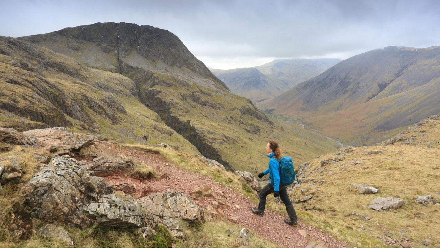
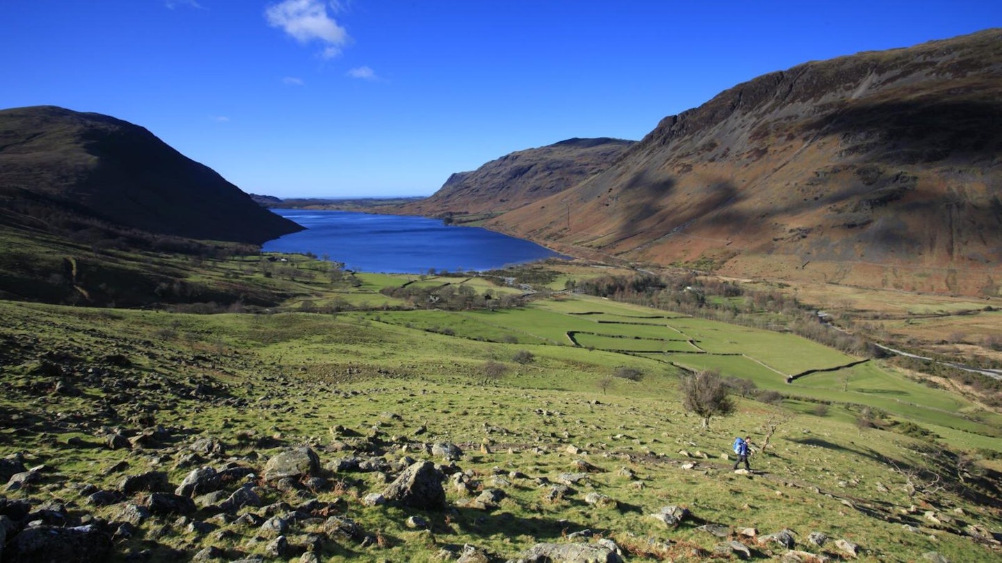
Scafell Pike is England's highest mountain, making it a must-climb peak for anyone who hikes regularly in the UK. Without doubt our favourite walk to its 978m summit is the rocky and dramatic Corridor Route, which sneaks in from the north and avoids the crowds ascending via the much busier Hollow Stones path.
The walk described in detail below is widely regarded as one of the best mountain routes in England, with huge views across to the impressive crags of Great Gable and neighbouring Lingmell. We've walked the Corridor Route in all weather conditions at all times of year, and we still find something new to excite us every time we do it.
This is the Lake District at its scowling, mountainous best, brilliantly described by our expert Chiz Dakin, who's been writing route guides for LFTO and Trail magazine for more years than we can remember (sorry Chiz).

Scafell Pike is known to all, thanks to its infamous position as ‘the midnight mountain’ on the National Three Peaks Challenge. Lesser known to many is that it's also England’s highest war memorial, having been given to the National Trust by Lord Leconfield as a living war memorial after WWI.
Shortly after this, the Fell and Rock Climbing Club acquired, then gifted an additional 12 mountains nearby, including Lingmell. This route avoids nearly all of the Three Peaks route, instead preferring the Wasdale Valley approach, then a sneaky corridor traversing along the mid-level slopes of the Great End and Broad Crag massif. The scree path up to the col between Scafell Pike and Broad Crag is less popular than the main routes, which means it's pleasingly quieter.
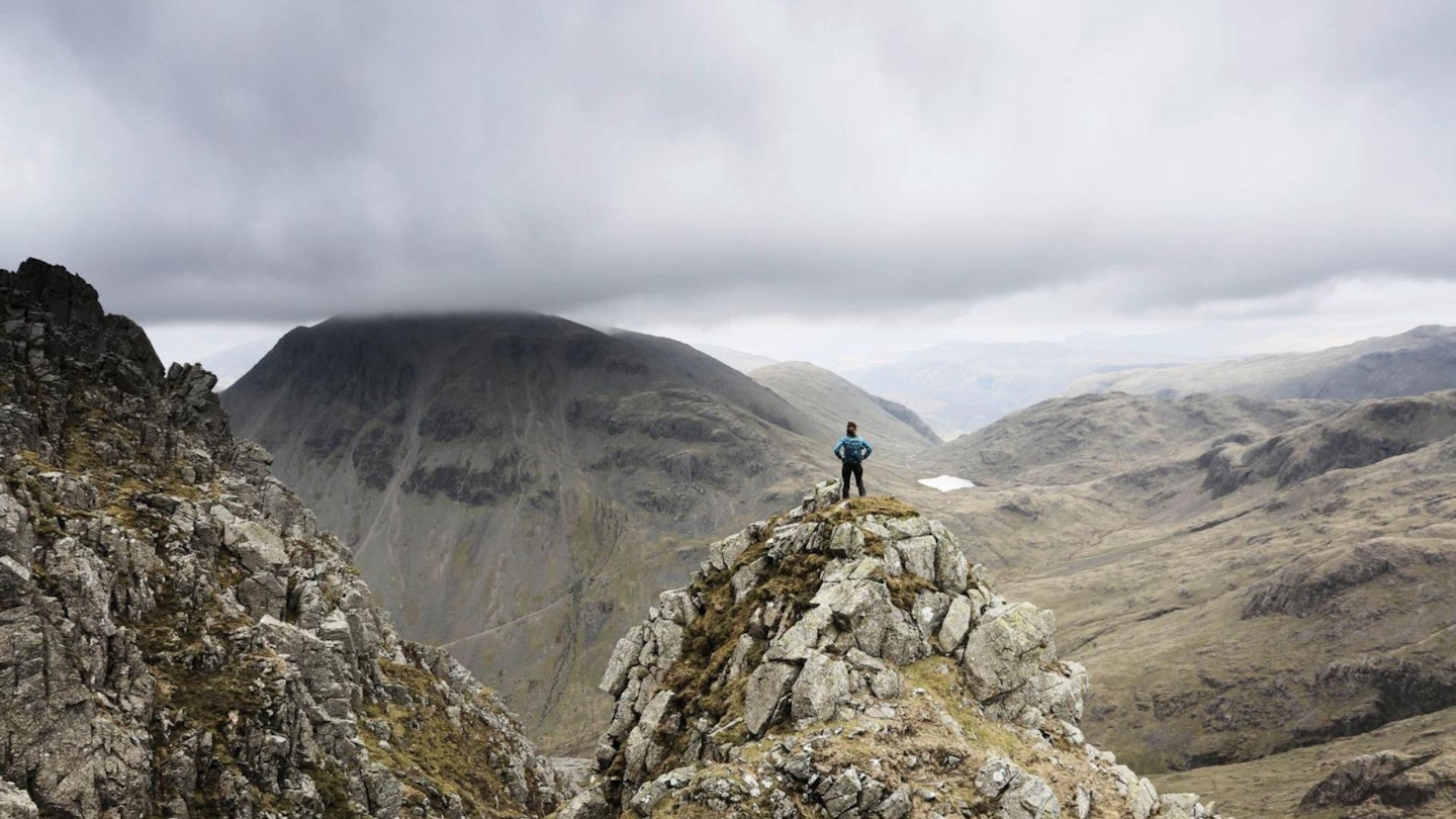
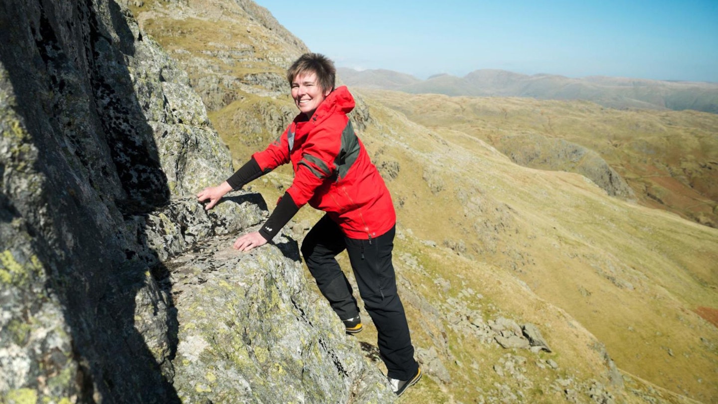
And of course, there’s that short scrambly descent on the Corridor. In dry and non-iced conditions, this usually presents few problems other than figuring out where your next footholds are from above. But it’s an amazing location that will leave a lasting impression.
CLICK HERE to download our digital Scafell Pike Corridor Route guide in OS Maps

How difficult is the Corridor Route up Scafell Pike?
Whatever route you climb Scafell Pike by, you'll reach the highest piece of land in England, so this walk is no picnic. The terrain is mostly on good rocky paths with some scree near the summit and a steep descent. Navigation can be quite challenging in poor visibility, particularly near the top.
In dry and non-icy conditions, the Corridor Route is a rough hillwalk with a scrambly downclimb. In the wet it’s a lot more challenging – so be prepared to turn back if you aren't confident or comfortable in these surroundings. Beware of iced stream crossings, cornices, and avalanche risk at over 600m outside of summer.
How long does it take to climb Scafell Pike via the Corridor Route?
This circular route from Wasdale Heads covers 12.5km (8 miles) and around 1050 metres of ascent. We estimate experienced hikers should be able to complete the route described below in around 4-and-a-half hours, but that depends on weather conditions, your fitness, and the pace you like to walk.
Where do you park for the Corridor Route on Scafell Pike?
There are two popular starting points for the Corridor Route – either Wasdale Head (like in this article) or Seathwaite Farm in Borrowdale. From Wasdale, start at the National Trust car park by the campsite. This isn't an easy route to reach via public transport, unless you fancy a long walk in from Drigg railway station.
What's the best map for Scafell Pike?
This route is covered by OS Explorer OL6 (1:25,000), plus OS Landranger 90 (1:50,000). You can order printed maps from the Ordnance Survey's map shop or download our digital route guide HERE.
Scafell Pike via the Corridor Route | Step-by-step guide

Section 1
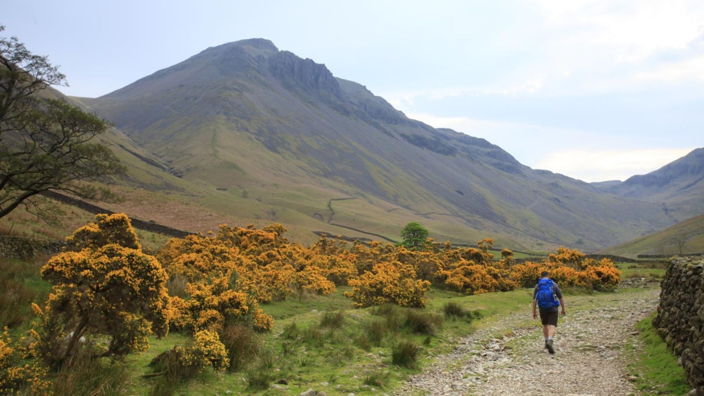
Take a track southeastwards towards Scafell Pike from the car park end. Immediately after a cattle grid, fork left through two large gates onto a bridleway track at the upper edge of the campsite. Take a National Trust concessionary path which forks right over a boardwalk where the bridleway fords the river. Cross a footbridge over the river, then head through pasture to the Wasdale road. Turn right along this.
Section 2
Fork right onto a track at the village green car park, then follow signs across Burnthwaite farmyard. Rise up the valley towards Great Gable, crossing the Gable Beck. Fork left and rise diagonally across the hillside below the flanks of Great Gable, crossing a slightly scrambly rock band below Lower Kern Knotts.
Section 3
A large boulder and the Mountain Rescue stretcher box mark a junction of paths at Sty Head. Fork right onto a faint path. This becomes clearer as it takes stepping stones across a boggy part of the col.

Section 4
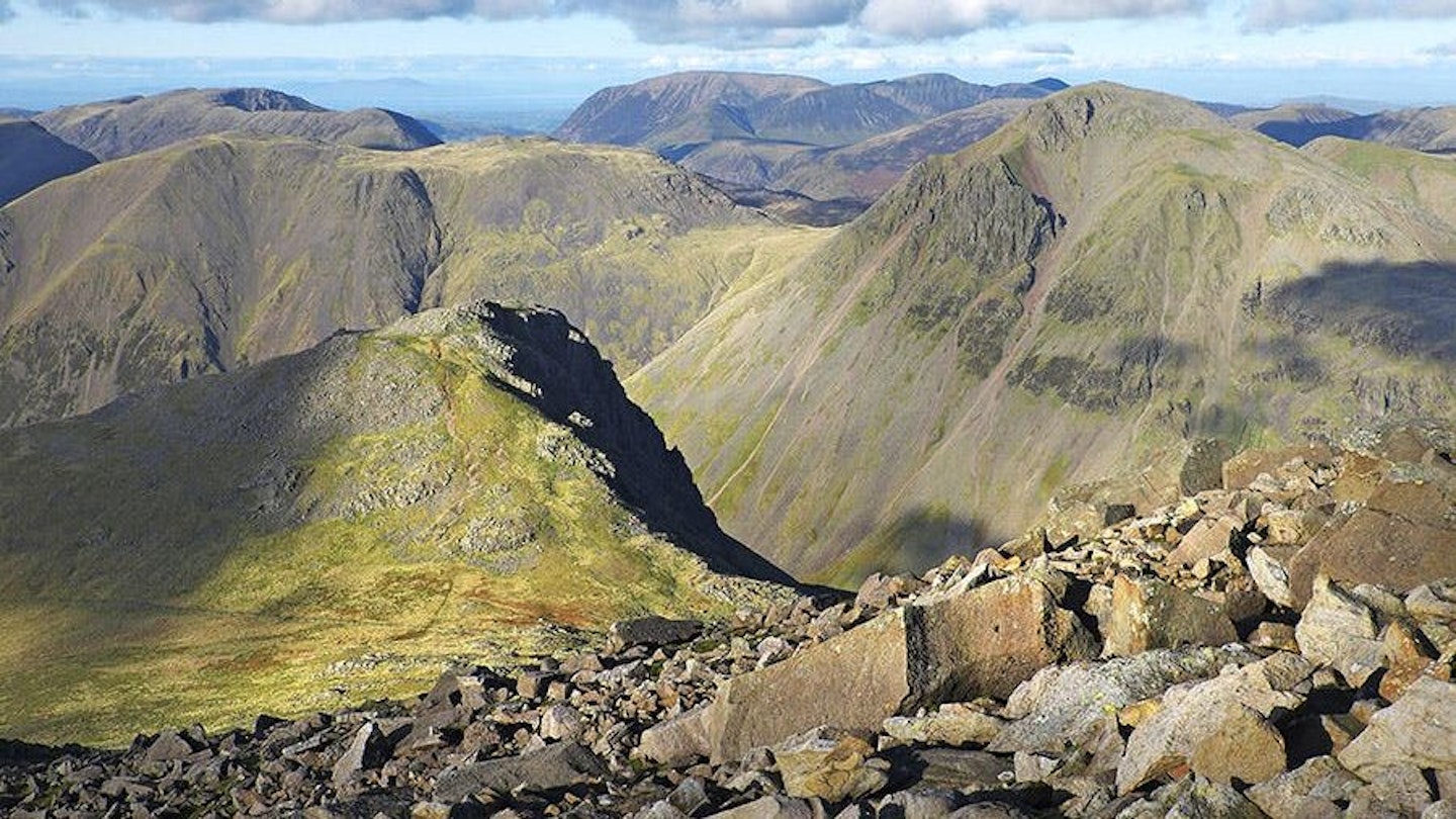
Look for a path heading right by a large cairn. This dips down briefly, with a good view across towards the deep chasm of Piers Gill, then rises gently along a rugged narrow and meandering path between bands of impassable rock. Skew Gill usually presents few problems, but a short scrambling descent of a ‘bad step’ as you bend left before Greta Gill’s headwaters could be more problematic under ice/snow or in the wet.

Section 5
After Greta Gill’s headwaters, the terrain opens up into a shallow bowl under the eastern flanks of Scafell Pike. Don’t cross a stony ford by an unnamed headwater, instead fork left for a more direct route up to the col between Broad Crag and Scafell Pike. (NB under snowy conditions, beware of avalanche risk.)
Section 6
A cairn at a slight knoll marks the start of a sharp turn left into a steep scree-filled headwall valley. The path fades briefly in the jumble of rocks, but then becomes clearer as it zigzags its way up the headwall, forking left for the lower col halfway up as it divides around a rocky outcrop. Head right up to the cairn at the col for views down into Eskdale.

Section 7
Turn right to ascend the rocky/ bare scree ridgeline. Cairns soon guide the way to the summit viewing platform. Descend north-west past the trig point, following a series of large cairns across the summit plateau (NB beware multiple other cairns on the plateau!), then descend the wide path towards Lingmell Col. As the main path bends left, ignore a distinct path forking right, then fork right on a much fainter/ intermittent path across to Lingmell Col. Cross a tumbledown wall in the col then rise up to Scafell Pike's large summit cairn.
Section 8
Beware cornices over sheer gullies on the summit, then turn left in a dip before a second top. Follow faint/intermittent path towards Wast Water heading right of scree, then bear left across a grassy saddle towards a tumbledown wall, aiming towards the left of the next stony raise. A steeper section follows. The path is vague through broken ground, before becoming clearer as the ridgeline flattens once more.
Section 9
A larger cairn marks the end of gentle descent and the start of the steep final descent. A pitched path initially eases the way before depositing you at the top of a tougher scree section. Below this, the main obstacle on the steep grassy ridgeline is a tall stile over a wall. The final 400m to rejoin the Hollow Stones path is steep, then follow National Trust signs to the car park.
About the author
Chiz Dakin is an award-winning writer, photographer, filmmaker, and avid traveler. She's written countless guides and articles for Trail magazine and LFTO about walking and hiking all over the UK and is one of the most trusted route hiking experts out there.
This route first appeared in the December 2019 issue of Trail magazine. Subscribe today for more route guides like this, plus endless inspiration for hiking and backpacking in the UK's mountains