What if we told you there’s a 3-day walking route through the Peak District that ticks off all of the National Park's best bits? And, even better, that each day ends at a different pub, is accessible by public transport, and you can even take your dog along. Allow us to introduce the Peak District Peak to Pub Trail.
There’s nothing not to love about the multi-day trek described below. You’ll stand on trig-topped summits, cross gritstone escarpments, and explore weird caves, rock formations, woodland, rivers and lakes. And if that’s not enough, there’s also wide open moorland, dramatic cloughs and quaint villages.
The scenery is enchanting and shifting, with three classic country pubs punctuating the route, complete with real fires, real ales and well-deserved meals after a long day of walking.
Peak District Peak to Pub Trail – Route Guide
This route first appeared in the March 2023 issue of Trail magazine when it was walked by deputy editor Jenna Maryniak and her spaniel Jerry. So if you like the sound of three days of hills, ales, inns and special scenery in Britain's oldest National Park, scroll down for a full description of one of the finest multi-day routes we've ever walked.
CLICK HERE to view and download our 3-day digital Peak District Peak to Pub route on OS Maps
DAY 1 – The Edges
Start/finish: Grindleford train station/Yorkshire Bridge Inn | Distance: 11 miles (17.8km) | Ascent: 468m
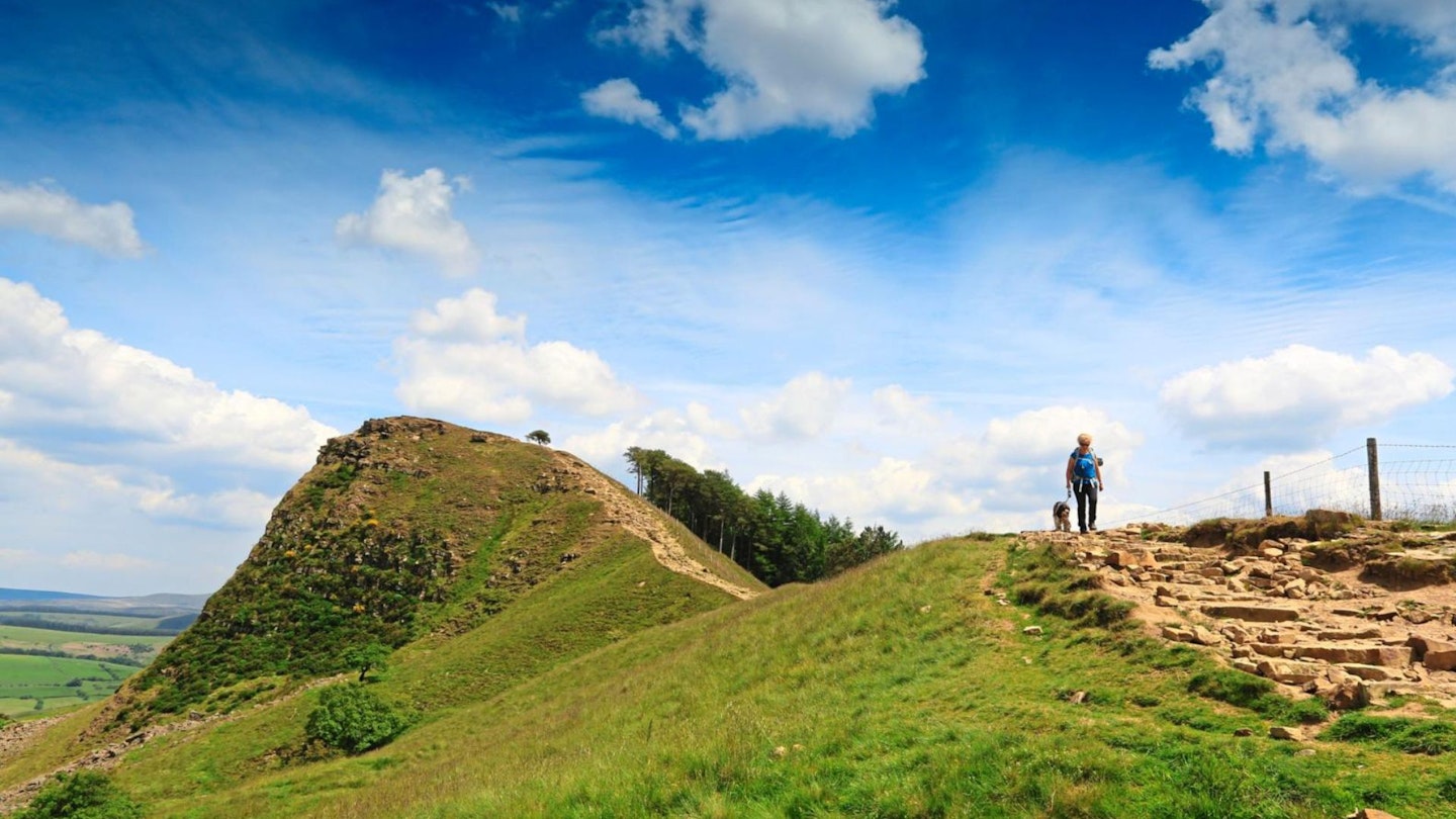
Perhaps the most dramatic features of the Peak District are found at its ‘edges’, made from a coarse sandstone known as gritstone, which was historically brilliant at milling grain to flour, pulping wood to make paper, and sharpening metal. Since the demise of the milling industries, the grit is now hailed instead by rock climbers as ‘God’s own rock’, due to its grippiness.
Day one of the Peak District Peak to Pub Trail began at Grindleford, pretty much slap-bang in the middle of the famous climbers’ edges of Frogatt and Stanage. It's also right on the Hope Valley Railway line, with its own quaint station in the woods, and direct and easy access to the national railway network from Sheffield.
The 11-mile route takes you via Burbage, Stanage and Bamford Edges before dropping down to the Yorkshire Bridge Inn near Ladybower Reservoir. There’s just something so special about walking to a destination, instead of the usual circular, with everything you need for three days on your back.
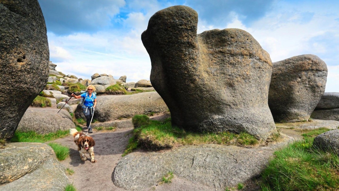
Before we could get up high onto the edges, we headed deep into Padley Gorge – a wonderful woodland of ancient oak and birch that shelters the clear waters of Burbage Brook. It’s a Site of Special Scientific Interest, home to endangered birds and rare plants. From the concrete and bustle of the station, it was a deep dive into nature, and submerged in woodland, something just clicked into place as though accessing something primal.
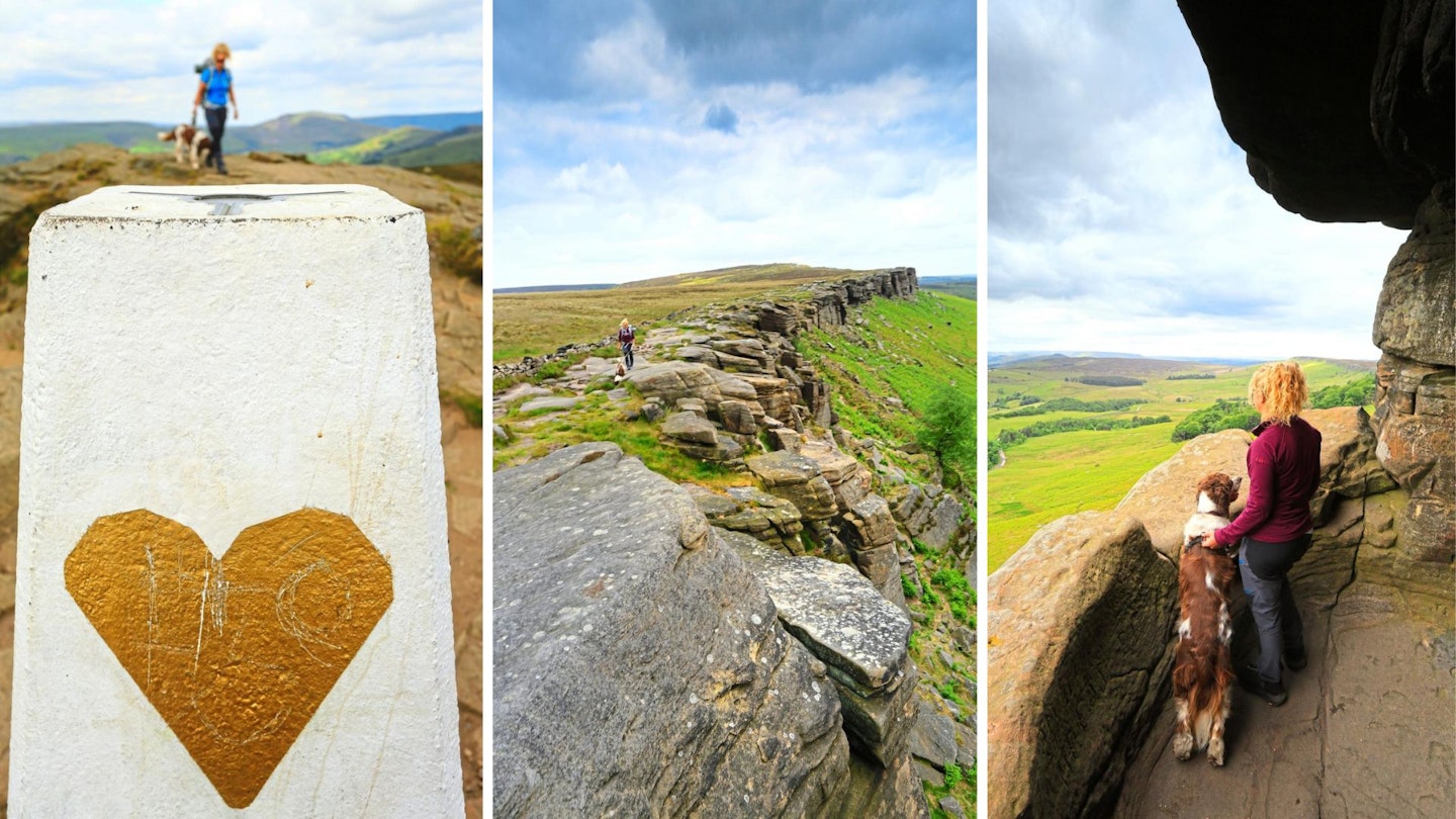
Following the stream, we emerged out into the open moorland of Longshaw Estate, down to the road before making the climb up to Burbage Rocks. Some tall and strong, others toppled by the erosion and the uplift of the Earth’s crust, huge blocks piled up in Jenga-like stacks to make up the emerging escarpment that gathers in height and drama as it becomes Stanage Edge.
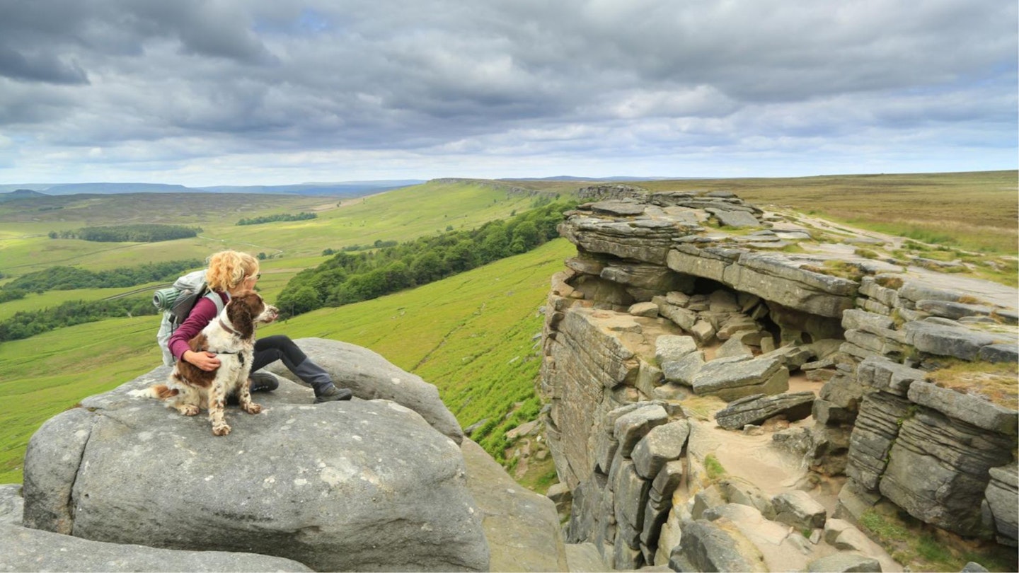
The whole place is a Mecca for climbers and boulderers, with over 650 climbing routes of all grades. Gritstone tors, caves and gigantic rock formations make it an amazing place to explore. We crossed a rocky slab, ducking under a low roof, to reveal Robin Hood’s cave – and a tunnel that led us out to a platform which nature has constructed for a picture-perfect view across the valley.
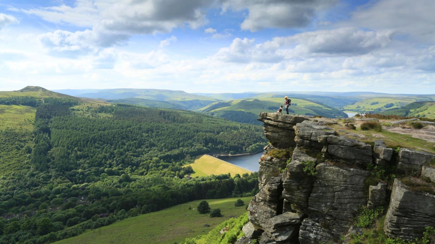
As well as being hideouts for outlaws, the signs of human history are everywhere on these edges, from abandoned millstones to discarded prehistoric tools. Away from Stanage, an indistinct path took us across Bamford Moor and onto our final edge, where the low sun of the afternoon gave a magical glow to the tumbledown cliffs and the shimmering expanse of Ladybower Reservoir.
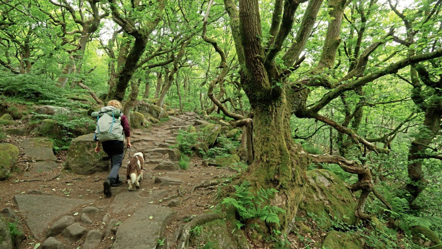
The view was huge. Win Hill stood proud in the distance, but would have to wait until tomorrow as our pub for the night was far below in the valley, via a beautiful sessile oak woodland.
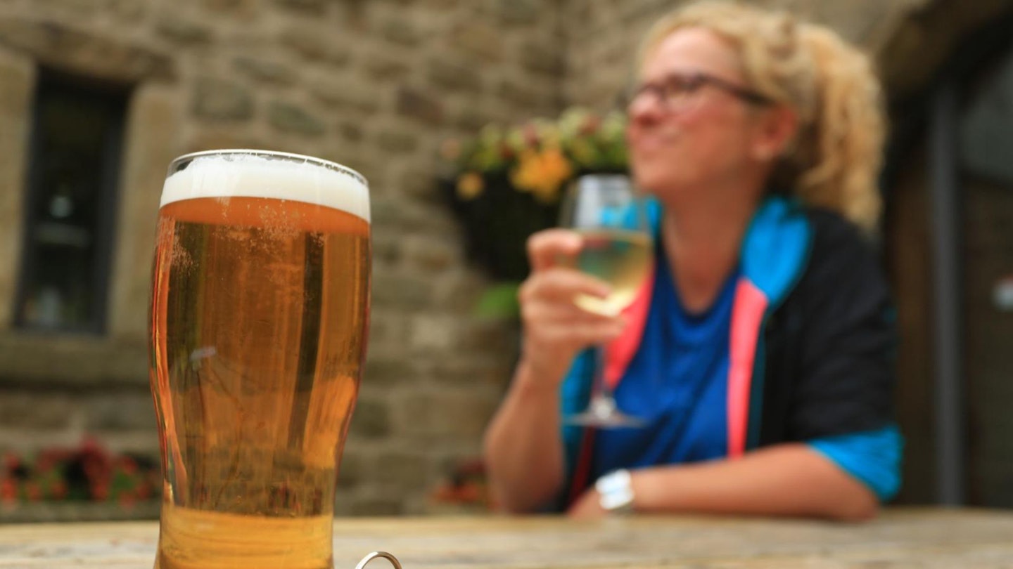
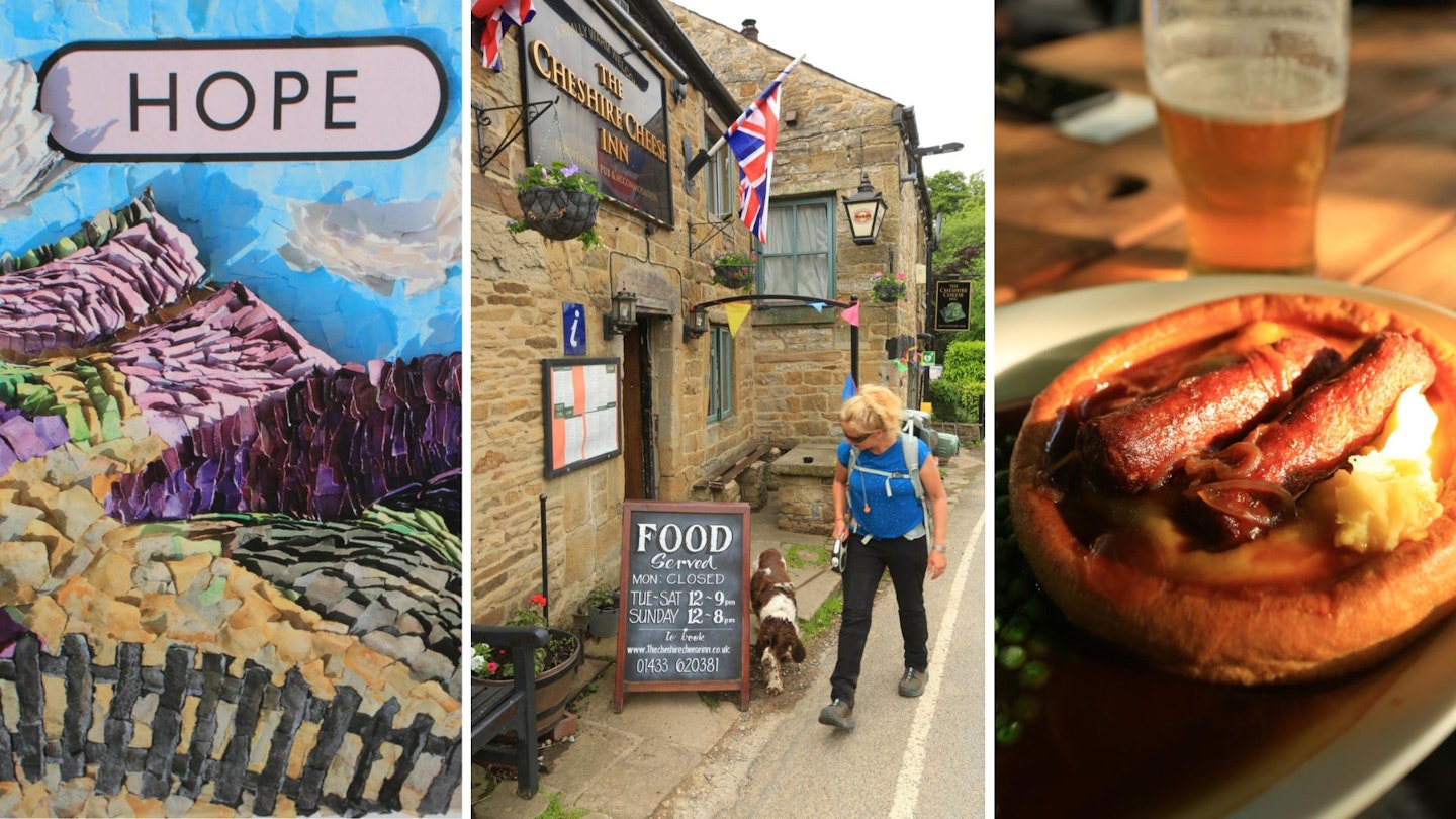
Best pub: The Yorkshire Bridge Inn has a welcoming atmosphere, offering dinner, B&B, plus packed lunch. Amazing homemade ginger biscuits provided in the room were perfect for tea-dunking. Even dogs get their own bed, water bowl and Bonio. yorkshire-bridge.co.uk
DAY 2 – Kinder Scout
Start/finish: Yorkshire Bridge Inn/Edale | Distance: 14.5 miles (23km) | Ascent: 847m
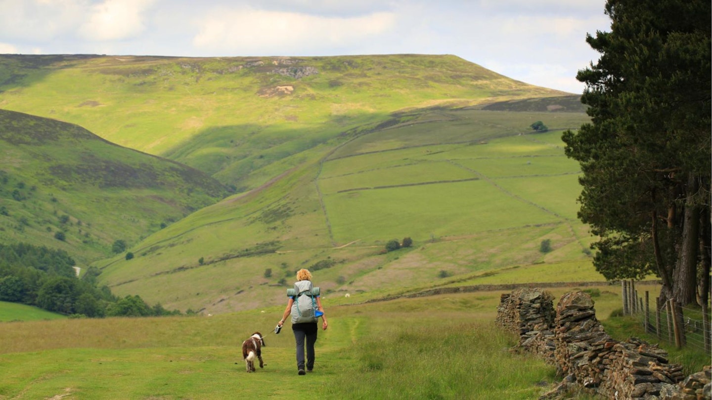
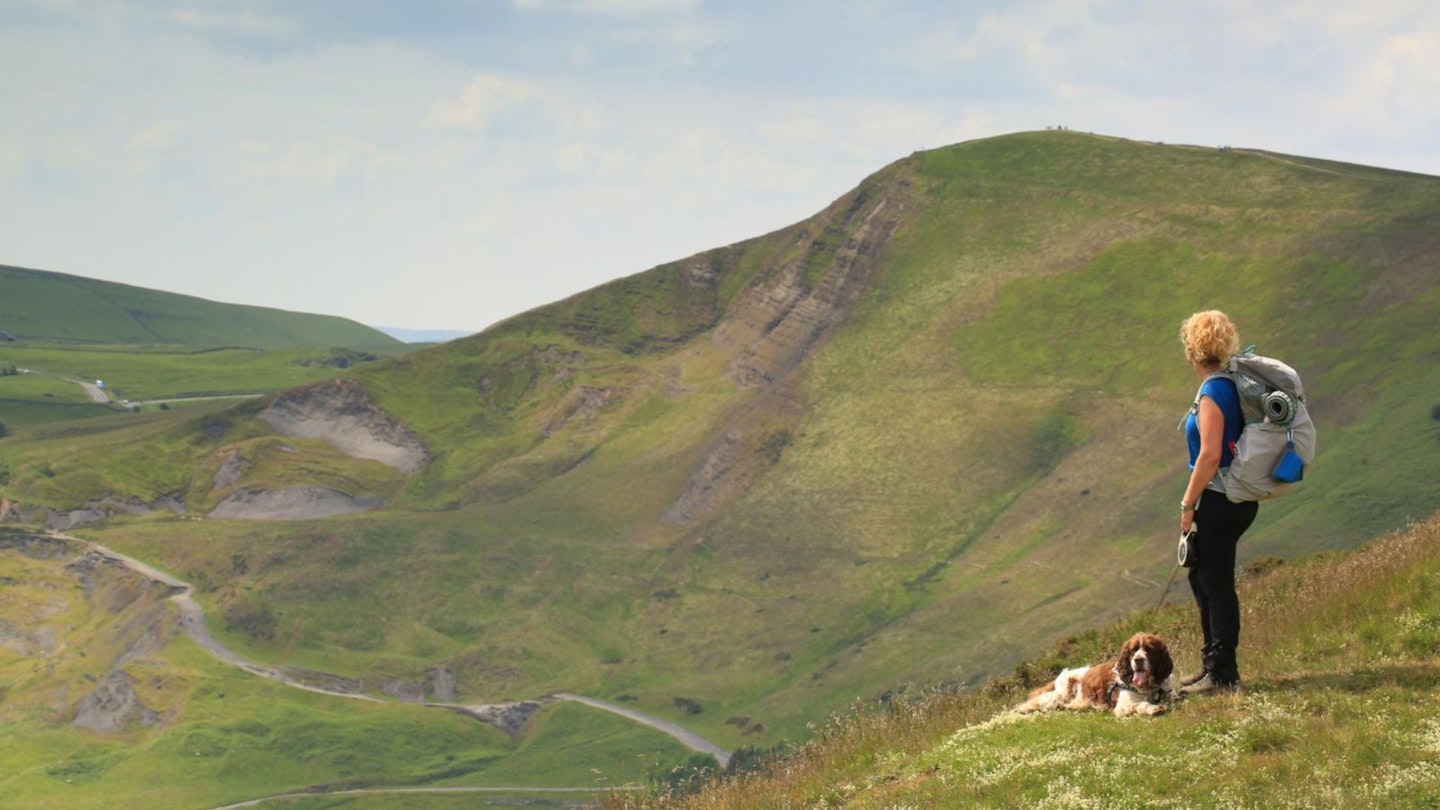
Day 2 is the longest stretch of the Peak to Pub Trail, at 14.5 miles, so we were grateful for the excellent hospitality at the Yorkshire Bridge Inn. With lunch packed we headed out to Ladybower Reservoir for a sneaky peak at the sinkholes before making the steepest ascent of the day through woodland directly upwards to the pleasing 462m-high peak of Win Hill.
Its trig-topped summit has a shapely ridge of rock weathered like the scales of a tortoise, and the views encompassed our entire 3-day route back to ‘The Edges’ and over to Kinder Scout and the Great Ridge of Mam Tor.
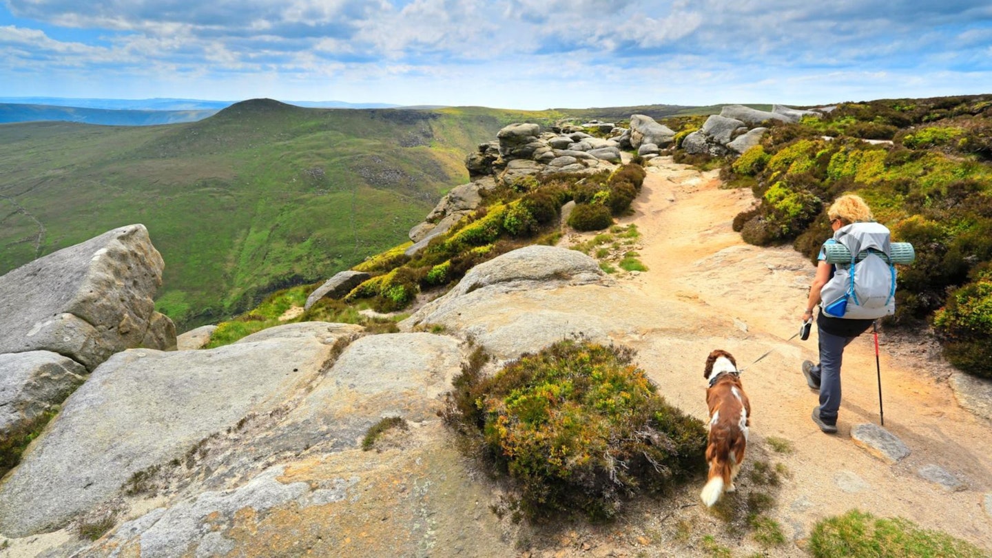
A grassy stroll soon took us from Win Hill up onto the southern edge of the Kinder plateau without too much loss of elevation. The landscape once again took on the form of a gritstone escarpment, but the run-off from the moorland plateau has carved huge cloughs into its battlements. We investigated the giant tors that have been eroded into ever increasingly weird and wonderful shapes as we progressed along the edge, with constant views down into the Vale of Edale and across to Mam Tor.
Kinder was, of course, the birthplace of the ‘Right to Roam’ in England, which began with the mass trespass of 1932. A chap was sitting looking out at the view, taking a break from his walk. A short chat revealed he was an ex-miner from Sheffield, an electrician at the coal face. He explained the coal fault was so narrow he would be on his knees all day because they only dug away the coal, not the rock, around it. He spent his working life in the pits, and his days off in the hills of the Peaks. An escape, as it was – and still is – for so many city dwellers that surround it.
We ticked off Ringing Roger, Crowden Towers, the Woolpacks (above) – all natural masterpieces worthy of a visit in their own right – and made our way to the 633m-high Kinder Low as a nod to the summit of Kinder. It’s not actually the summit at all, but it is conveniently marked with a trig point, and much easier to find than the true summit, which is only 3m higher.
By this point in the day I was dreaming of a pub, so we started the final descent via Jacob’s Ladder. Which is much more enjoyable going down than up! It’s still a good workout due to the steepness, but the views out into the Vale of Edale draw you down slowly but surely, treading in the footsteps of the first stage of the Pennine.
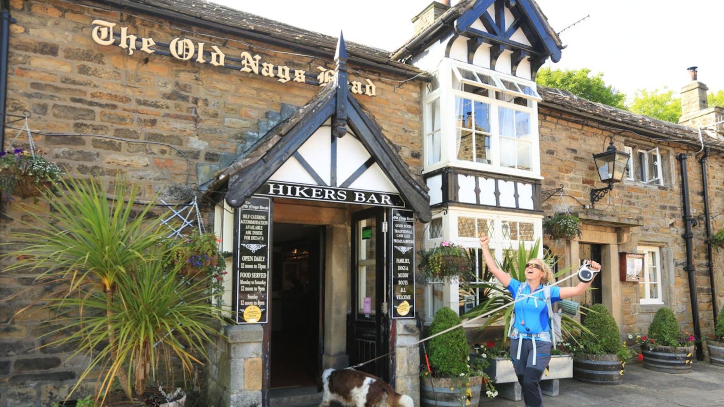
Best pub: The Old Nags Head is an iconic pub at the start of the Pennine Way in Edale, which also does good pub grub. Sausages and mash anyone? the-old-nags-head.co.uk
Accommodation: The Nags Head doesn’t allow dogs in its rooms, so after our pub meal, we stayed at Ollerbrook Barn guesthouse just down the lane, where we enjoyed a cosy bed, plus a hearty breakfast and packed lunch the next day. ollerbrookbarn.co.uk
DAY 3 – Mam Tor and The Great Ridge
Start/finish: Edale/Hope train station | Distance: 10 miles (15.9 km) | Ascent: 543m
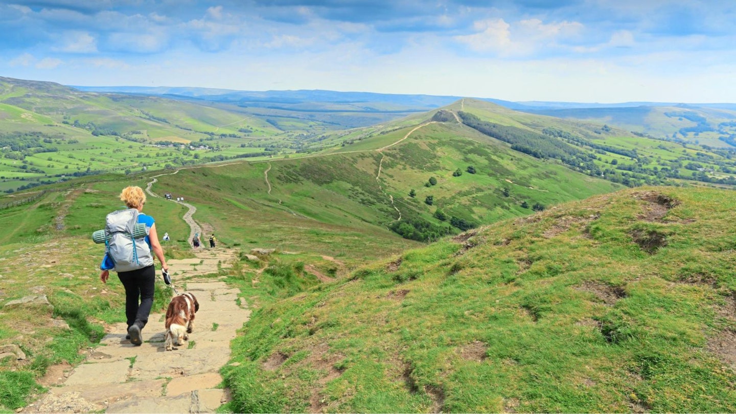
The final day of our Peak to Pub adventure delivered glorious weather for sunbathing, but hot work climbing hills – and the ascent ahead from the valley floor onto the Great Ridge looked like an effort. But before long we were up on Lord’s Seat and the rolling ridge line, valleys falling steeply to each side, snaked away in front of us. It was easy airy walking.
Then it was Mam Tor. The famous one. And people were everywhere, buzzing around like bees. It was a strange juxtaposition, from the wide open space of the hilltops we’d been on, to having so many people around. One woman had even collapsed with the heat.
Mam Tor (Mother Hill) is home to the Peak District’s most famous walk – and everyone should do it at least once – but a fine summer’s day at the weekend is probably not the best timing. We hurried through the crowds and were soon out the other side where the quieter Hollins Cross and the imposing-looking Back Tor soothed the soul once more. But, even up high, the air was completely still and the sun was beating down.
We bagged the last peak of the day, Lose Hill, then made our way back to the Cheddar Cheese Inn at Hope in time for dinner before our train ride home.
Best pub: Located in Hope village, this cosy Cheddar Cheese Inn is a great way to finish off your Peak to Pub Trail. Dogs are allowed in the pub and restaurant, but not in the rooms. thecheshirecheeseinn.co.uk
Accommodation: If you’re staying overnight, the Old Hall Hotel down the road is a good choice that allows dogs. oldhallhotelhope.co.uk
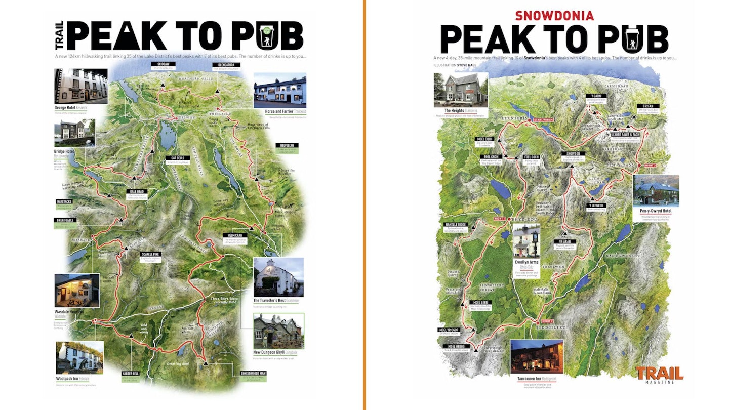
More Peak to Pub Trails:
Lake District: CLICK HERE
Snowdonia (Eryri): CLICK HERE