
The Grand Tour was a clever title for a TV show. For one thing, ‘GT’ was a cheeky reversal of the letters ‘TG’, by which Clarkson and pals subtly flipped the bird to the BBC after their departure from Top Gear. But for another, it drew on the historic concept of the original Grand Tour.
From the 17th century to the 19th, monied young gentlemen (and a few pioneering ladies too) would embark on a journey around Europe and marinate themselves in its cultural riches and geographical splendour.
The Grand Tour invariably included the Alps, whose sights would blow their minds so profoundly that they’d come back to their home nations and immediately start looking for places that might remind them of Zermatt and Chamonix.
Places that were slightly mountainous, yet easy to access. Where impressive scenery could be traversed on gentle footpaths. Where picturesque villages layered themselves into the folds of a hillside. And where the weary Grand Tourer might find rest and rejuvenation courtesy of ‘healing waters’.
The reason was partly cultural, but also (and especially in Victorian England) commercial. If the Victorians could build a railway, bill the destination as ‘Little Switzerland’ and sell it as something exotically European, you can bet your lamb chops they would do exactly that. Ker-ching.
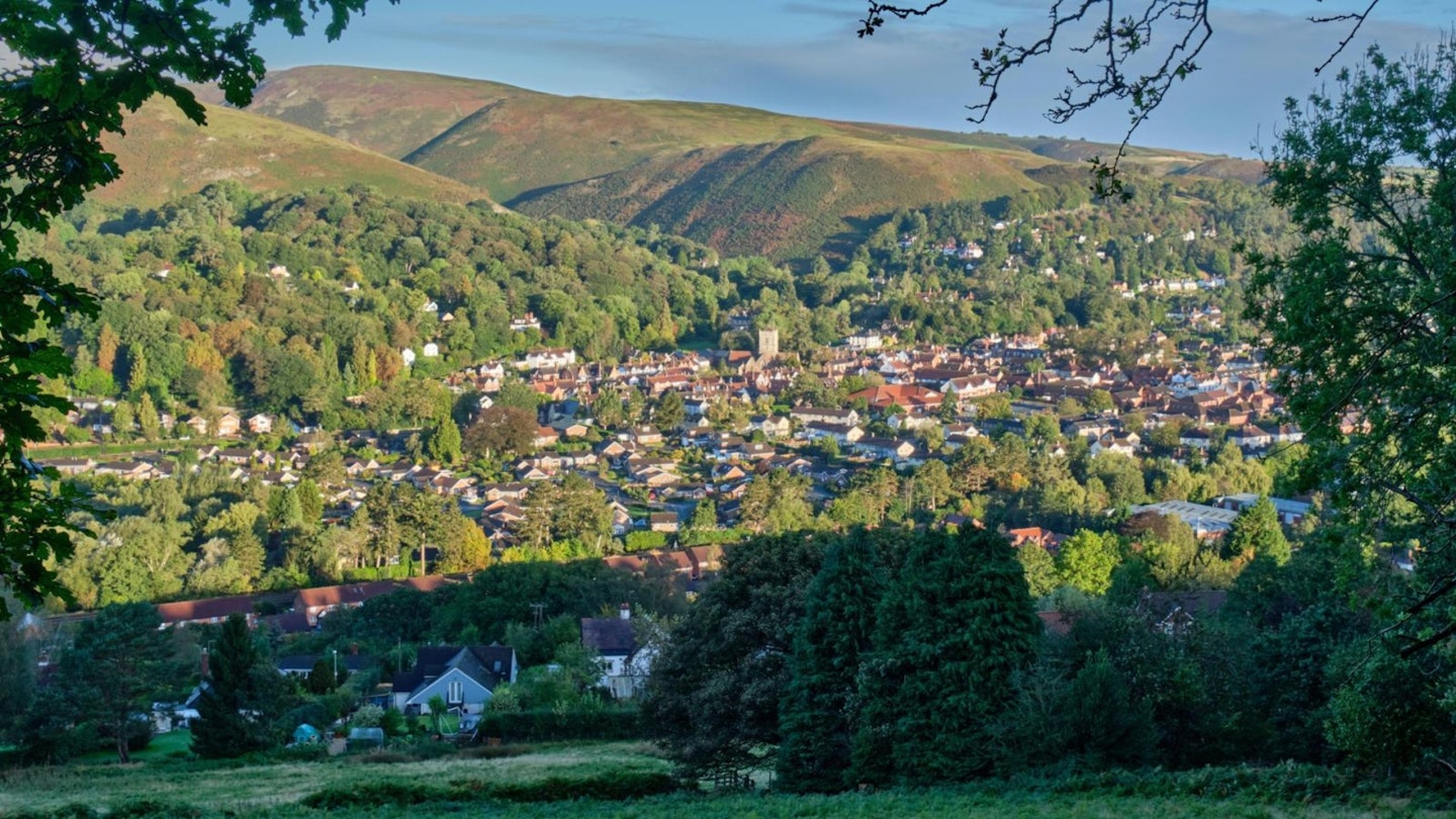
This is why there are at least four places in England which have the words ‘Little Switzerland’ attached to their tourism resources to this day: the Derbyshire valley of Matlock Dale, the twin Devon villages of Lynton and Lynmouth, the Kent Downs above Folkestone… and this place. The Stretton Gap in Shropshire.
This is the most ‘mountainous’ of the four, which is why I've come here. Of course, that’s not saying much by Alpine standards, or even UK ones. The highest point is the top of the Long Mynd (meaning Long Mountain) at 516m. You can almost hear the chuckles of Matterhorn and Macdui from here.
And yet. Adjust your sense of scale, and this area can certainly feel mountainous, if not actually alpine. All of those requirements are here: the big scenery, the gentle footpaths, the hill-tucked villages. Even a history as a spa resort.
Squint a bit, and the big, bubbly bulk of the Long Mynd, towering over the town of Church Stretton, could almost – almost – look like Skiddaw over Keswick, or even Mont Blanc over Chamonix (yes, I know the latter is in France not Switzerland, but it’s all Alps).
There are even tales of horror and mishap on these mountains; perhaps not quite Toni Kurz and Andreas Hinterstoisser, but alarming nonetheless. So here we are in Little Switzerland. Grab your alpenhorn and let’s see how it stacks up.
The Alpine round
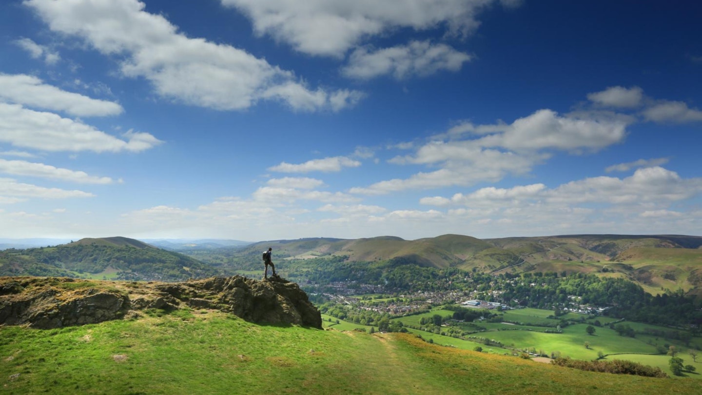
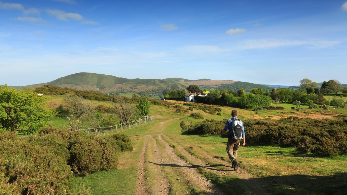
The Stretton Gap is an 8-mile north-south schism in the fabric of the Shropshire Hills, with the town of Church Stretton at its heart.
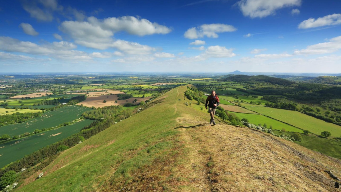
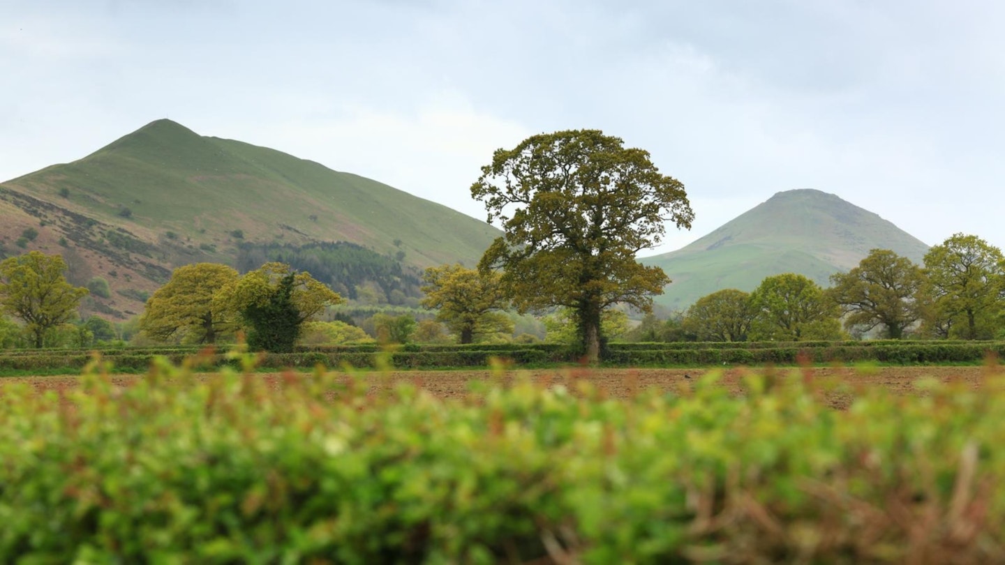
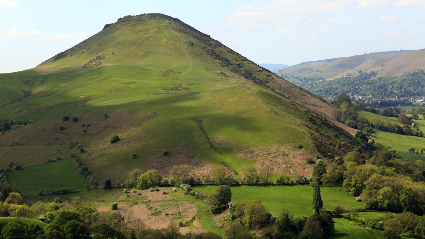
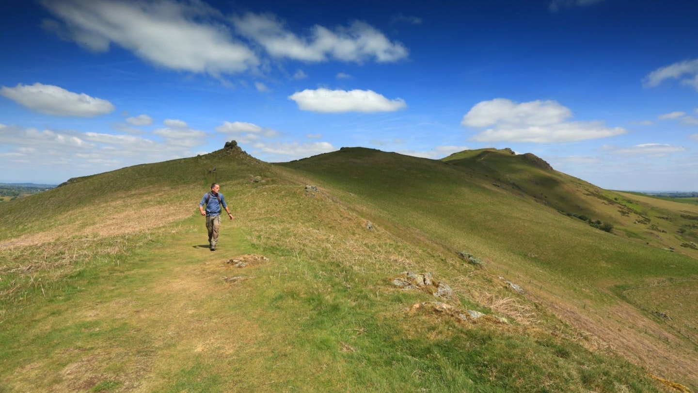
For hillwalkers, the gap is literally a game of two halves. To the east are three sleek and shapely mini-mountains, near-identical yet subtly different, which line up like supertankers going through the Panama Canal. They are the Lawley, Caer Caradoc and Ragleth.
To the west is the great lumpy mass of the Long Mynd, one of the most architecturally fascinating uplands in Britain; a vast moor riven by steep-sided valleys known as hollows and batches.
Our mission is to merge the whole damn lot by walking the skyline of the Stretton Gap; a 19-mile epic that’s perfect for a long day with plenty of sunlight. (Side-note: at 19 miles and with nearly 1500m of ascent, you could use it as an alternative to, or training for, the glory-hogging Yorkshire Three Peaks.)
We could start from any of the three hamlets in the Stretton Gap – Little, Church or All. Church Stretton is seemingly the most logical, having a railway station, the most central location, and a choice of hotels and hostelries. But for the sake of a short bus ride north, we can start at smaller All Stretton, which has three key advantages:
1. We get the flat bit out of the way first.
2. We get the best pub options midway round in Church Stretton.
3. We get the biggest and best finish on the Long Mynd.
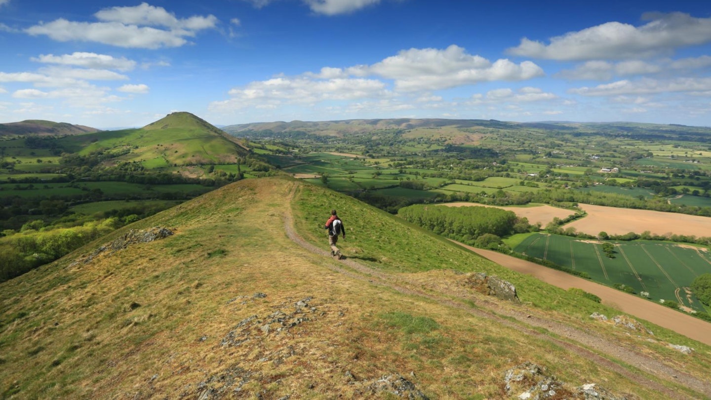
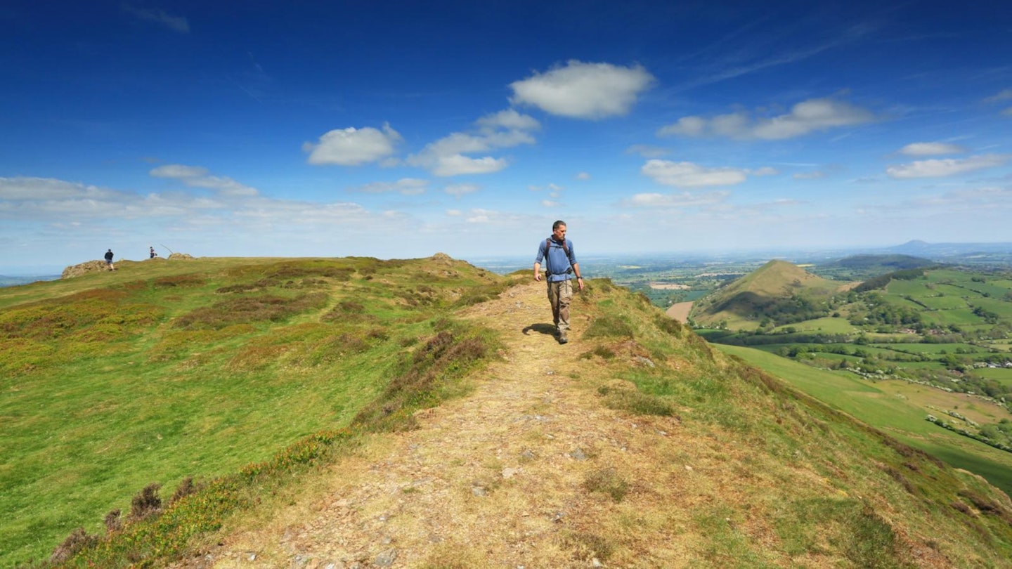
This means our first objective of the day is the northernmost of our trio of mini-mountains: the Lawley. To walkers of a certain vintage the name may conjure visuals of a newsreader, but this Lawley is a sleek, slender ridgeline, building to a perfect peak.
If it looks like a volcano as you stroll up its grassy flanks, that’s because it is. In fact, all three of the hills on this side of the gap are volcanic.
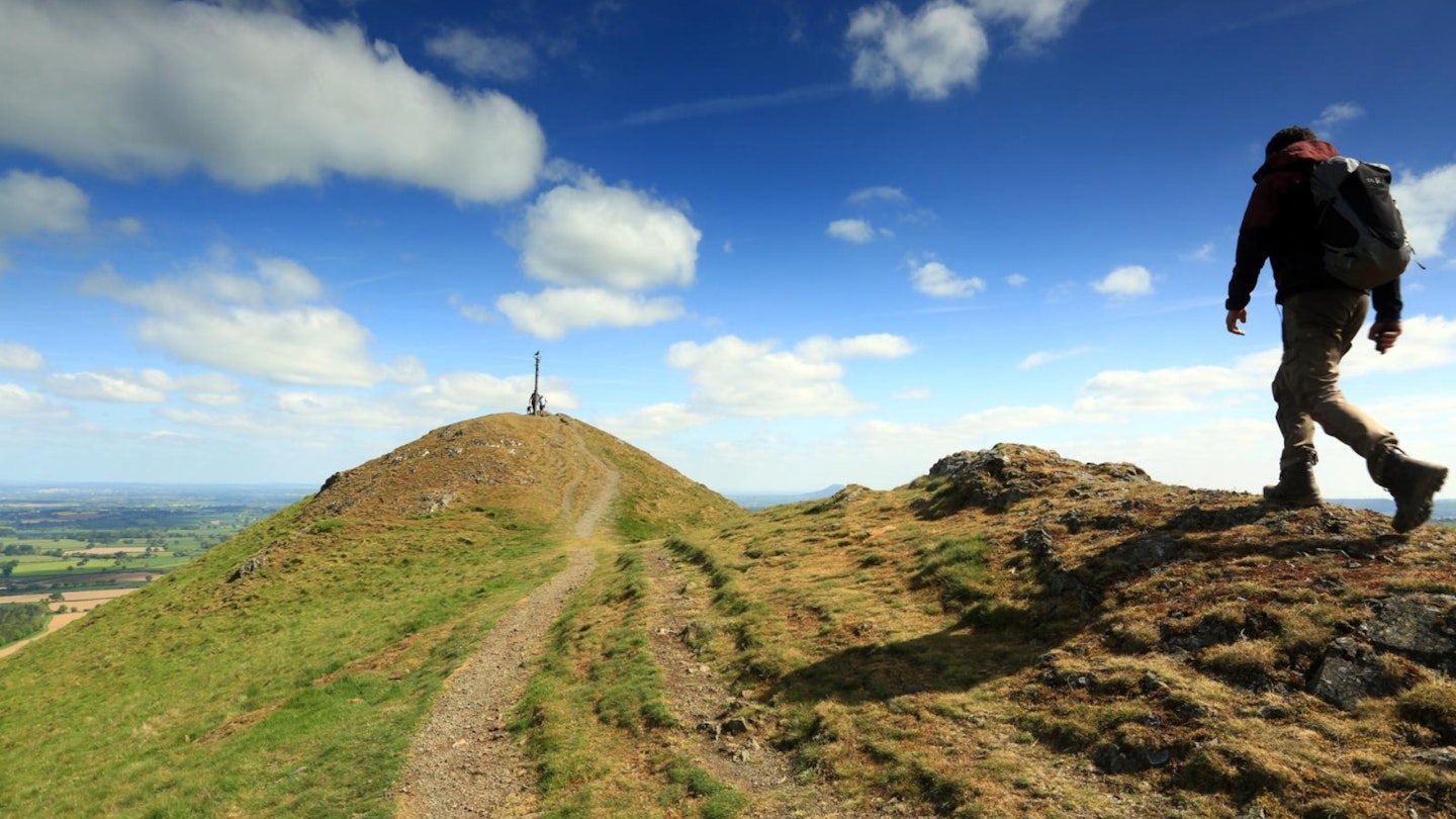
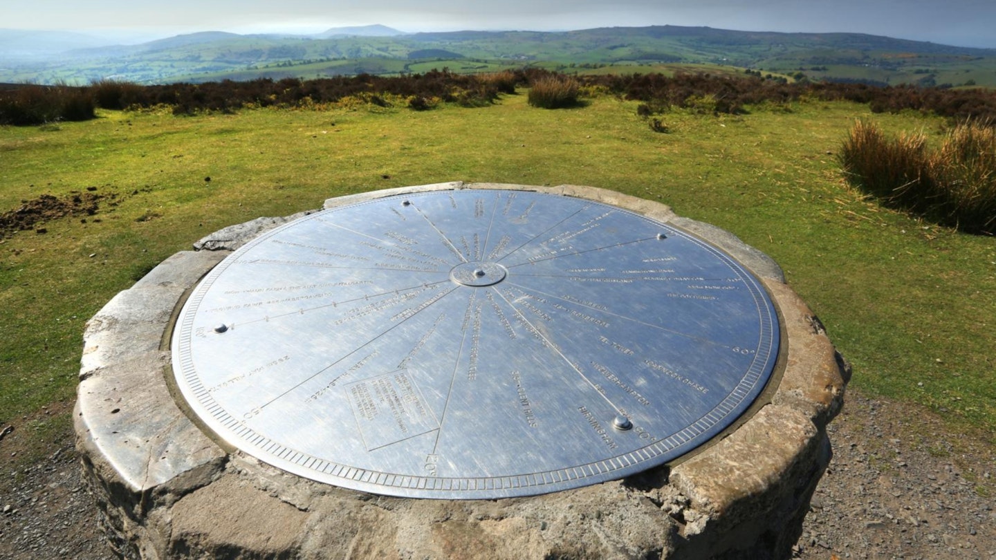
If this area is new to you, you’ll likely be gobsmacked by what you find at the top of the Lawley (apart from a pole topped by a weathervane topped by the inscrutable silhouette of a metal raven).
The views are simply exceptional, and you may feel that no landscape this bafflingly beautiful could exist so close to Birmingham. It’s often said of the Shropshire Hills that they’re the Peak District without the crowds, and once here, you may feel inclined to agree.
To the north-east is the Wrekin, another volcanically-spewed peak. To the south-east is Wenlock Edge, a 17-mile wooded escarpment running from Much Wenlock to Craven Arms. Also out that way are the twin peaks of Brown Clee, the highest of which, at 540m, is Shropshire’s highest point.
A little further off is the free-standing mass of Titterstone Clee, with its distinctive air traffic control golf balls. But the most mouth-watering prospects lie to the south and west. Which is handy, because that’s where we’re going.
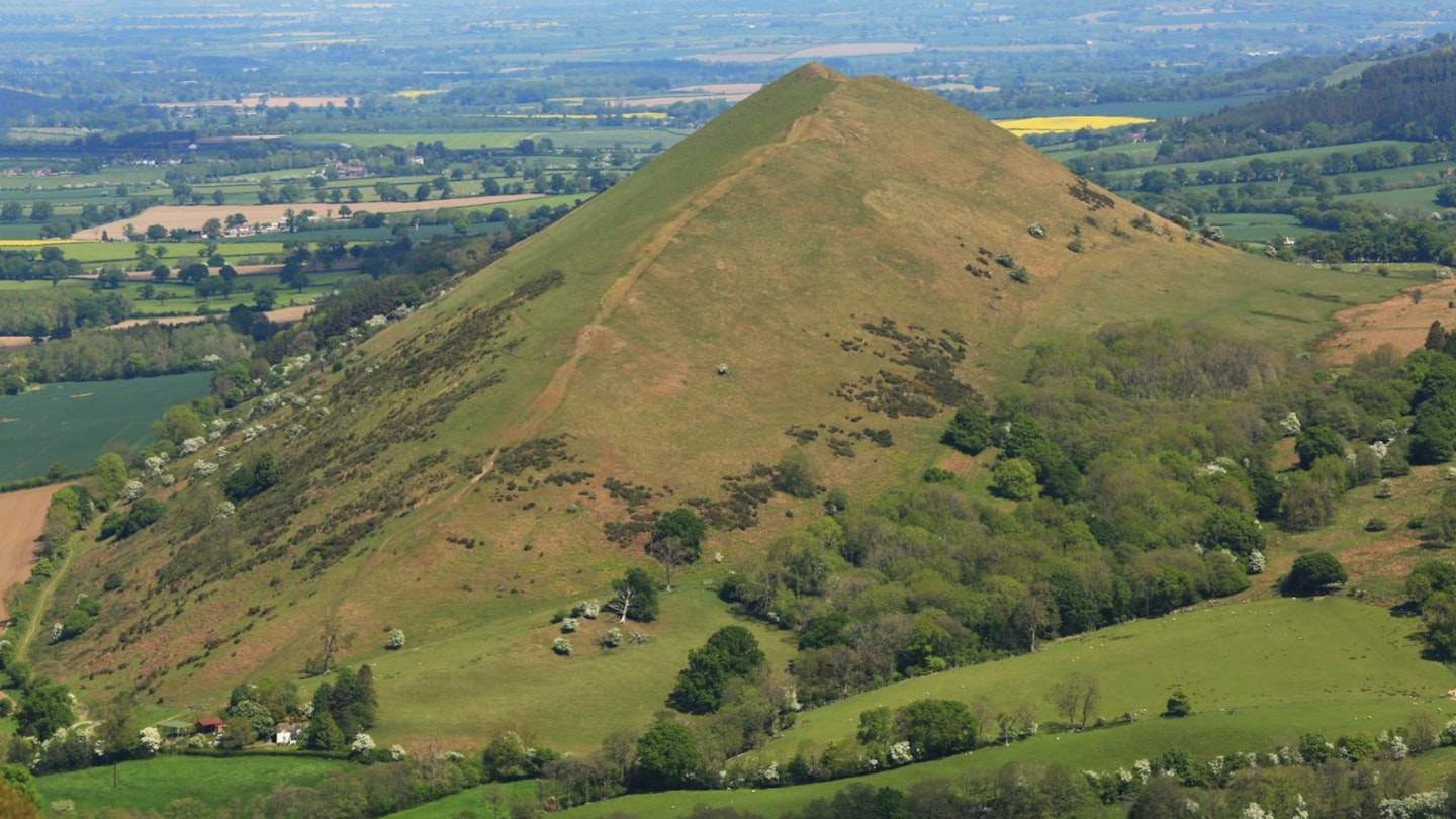
Down we go (with added woodland for a suitably Kleine Schweiz feel) and onwards and upwards to the next summit; the highest (459m) and arguably best known of the trio: Caer Caradoc. (A lot of things round here sound very Welsh, this being border country and having changed hands several times down the centuries.)
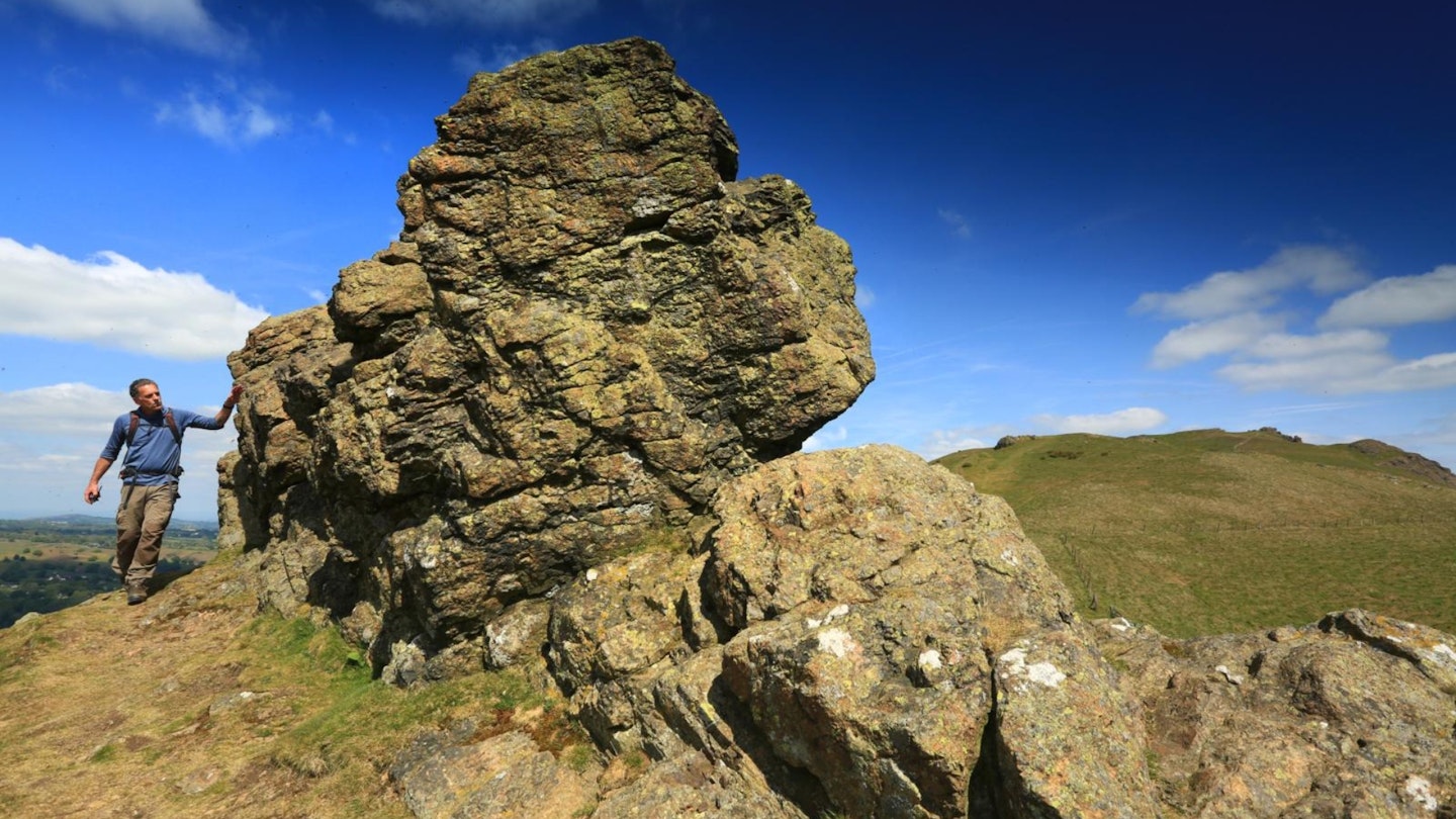
Like the Lawley only more knobbly, and crowned by one of the best-preserved Iron Age hill forts in the UK, Caer Caradoc is also drenched in histo-mythology.
Its name means ‘stronghold of Caractacus’, and it refers to a stubbornly resistant British chieftain of the first century AD, famed for holding out against the inexorable forces of the Roman Empire when all seemed hopeless.
Allegedly this dramatic hilltop is where he staged his last stand, which alas ended in heroic failure. Caractacus was carted off to Rome in chains for public mockery and execution. But he made such a good speech to the Emperor Claudius that the latter spared him and his family, and allowed them to live out their lives in Rome as his guests.
Caractacus later declared himself in awe of the city, adding pointedly, “And can you, who have such possessions and so many of them, still covet our poor huts?”.
Several other high points in this area also claim to be the site of Caractacus’ last stand, like British Camp in the Malverns and Caersws in Powys. But only this one is specifically named after him, and it’s very hard to be up on top of Caer Caradoc and not get swept away in a vision of a defiant Brit roaring at the oncoming storm.
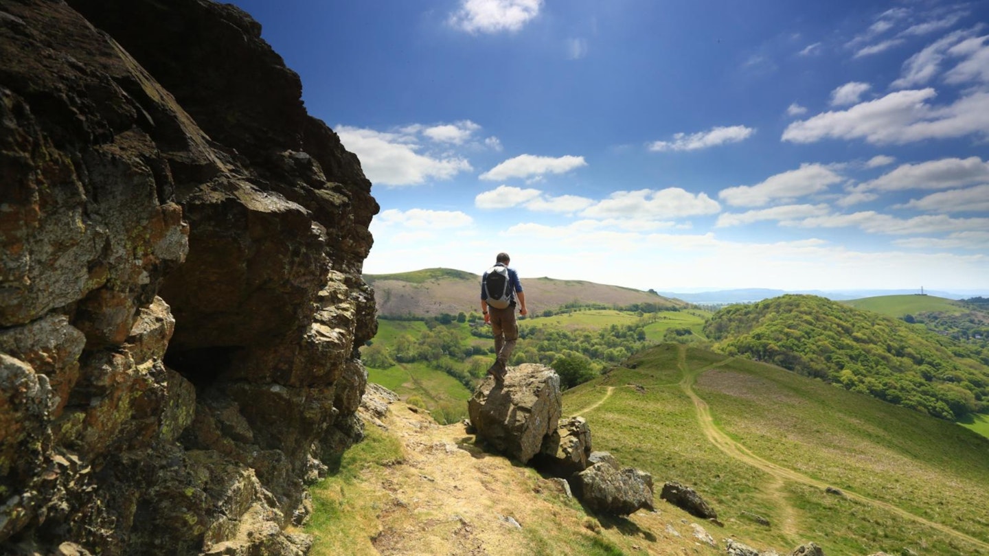
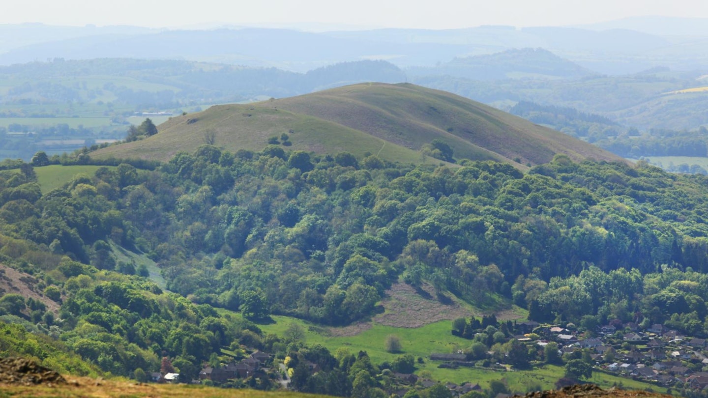
The next objective is the southernmost hill of the trio, Ragleth. But as Church Stretton is a short detour from the foot of the two peaks, a diversion to the Buck’s Head or King’s Arms may be hard to resist at this 10-mile point. While you’re here, take a moment to note the houses that perch higher up the surrounding hillsides; it was these that contributed to the whole Alpenvibe thing.
That public-house pause also has the benefit of putting a spring in your step for the ascent of Ragleth that follows. I love the summit of Ragleth.
I don’t know whether it’s cosmological harmony or just the beer buzz, but its grassy promenade in the sky is a fine place to sit and chill after racking up some good miles. It’s quite zen, is Ragleth.
A sharp descent takes us back across the gap at the hamlet of Little Stretton. There’s a nice pub here too, the aptly named Ragleth Inn. And now comes the biggie. The contrast. The Long Mynd.
A struggle for life
The ascent of the Long Mynd is a proper adventure. A long, snaking path winds up through the deep schism of Small Batch and around the heathery domes of Grindle and Callow, then crosses the earthworks of a massive Bronze Age cross-dyke.
After this we’re out on the vast upper plateau of the Mynd and making for its highest point, Pole Bank. There are other ways to ascend the Mynd, all of them good: Ashes Hollow, Townbrook Valley, Carding Mill Valley. But this is my favourite. Quieter, more offbeat.
At Pole Bank, the wonder of the Mynd’s position becomes clear, because in addition to our trio of lovely hills over to the east, we can now stare west.
The immediate horizon is claimed by the rocky ridge of Stiperstones; slightly beyond is conical Corndon Hill; and beyond all that is ruggedest north Wales.
That distant pointy thing you’ll see on a clear day? Yep, that’s Cadair Idris. Birmingham one way, Eryri (Snowdonia) the other: now that’s a panorama. Again, if it’s your first time here, you’re going to wonder where Shropshire’s been all your life.
In high summer, the Mynd is generally a kindly hill, but in winter it can be different beast. Just ask the Reverend Edmund Carr, the vicar of nearby Woolstaston, who got lost on its seemingly infinite plateau in a snowstorm in the winter of 1865.
He was found next morning by local schoolchildren, covered in snow; frozen stiff and a whisker from death. In fact, the kids had assumed he was a corpse until he scared them silly by groaning.
Carr described his ordeal in a book titled A Night in the Snow, Or, A Struggle for Life. (Handily, the proceeds paid for a refurb of his church, so it wasn’t all bad.)
I’ve walked the Mynd in winter and, for a hill mustering just 516m to its cause, it can indeed be a wild, disorientating and capricious place. Today though? It’s just stunning.
The standard descent from Pole Bank would be via Mott’s Road and Carding Mill Valley, but this is not a day for standard descents. Instead our route carries on to the northern tip of the Mynd, descending into the far less frequented reaches of Jonathan’s Hollow and the Batch Valley, and back down into All Stretton. Reisen ende.
So, then. Is there any measure by which this landscape ever truly deserved comparison with Switzerland? At first glance, no. If you’ve spent any time in the Alps you’ll know that their scale and spectacle is not something a British landscape can hope to imitate.
Thus it would be easy to dismiss the Little Switzerland thing as a shameless marketing gimmick, a Victorian parlour trick to capitalise on the romanticism of the Grand Tour – especially for those who couldn’t afford to go on one.
That said; could you swap glühwein and raclette for Three Tuns Pale Ale and Shrewsbury biscuit? Yes. Could you equate the terraced path up Small Batch with the gently winding Northface Trail in Mürren? At a pinch, yes.
Could the wildflower-rich slopes of the Lawley remind you, even momentarily, of an Alpine meadow? Could the panorama from Caer Caradoc stand in for the views from an Alpine foothill like Schynigge Platte or Gornergrat?
For me it’s a yes to all of the above. It’s in the little things, not the big comparisons.
Perhaps I’m just a Victorian Grand Tourer at heart. But try this walk out, and maybe you’ll turn into one, too. And next time you’re in Switzerland, you can confuse everyone by sizing it up and announcing: ‘Aha! Grosse Shropshire!’
The travelling hills
The Shropshire Hills have been on one heck of a journey. Around 600 million years ago they sat within the Antarctic Circle, but when the Earth’s tectonic plates began to shuffle about, the hills began a long, slow journey that would bring them all the way up here.
Along the way they picked up almost every kind of rock strata known to science, from coal seams to sandstone to limestone to coral reef. Fossils discovered in the Carding Mill Valley helped to prove that complex plant life evolved on Earth far sooner than previously thought.
And the Stretton Gap around which this route runs is actually the Stretton Fault, a huge geological fissure which tells the whole story of that remarkable journey. Little wonder that palaeontologist Tori Herridge, who grew up around here and went on to present Channel 4’s Walking Through Time, calls these hills ‘a classroom and a paradise’.
About the author
Nick Hallissey is head of content for Country Walking and Trail magazines and also serves on the LFTO team. He's explored more nooks and crannies of the UK than you've had hot dinners, and we love it when Nick gets a chance to visit a diamond in the rough and write up the magic of hillwalking the countryside.