The best hiking apps will prevent you from getting lost, help you plan your route and might even safe your life.
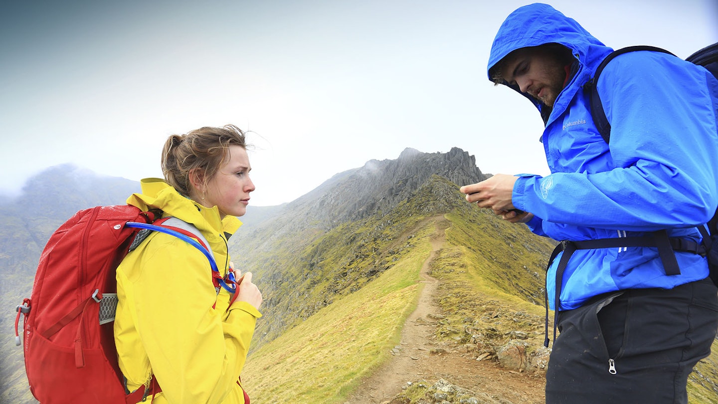
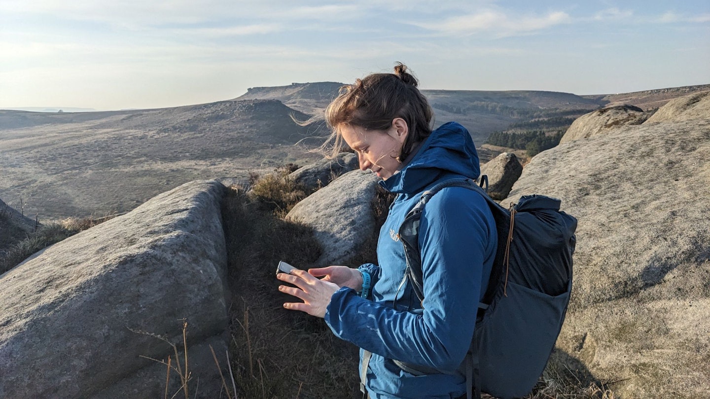
There's no doubt that a phone is a key walking accessory for many, if not all, modern walkers. It's not surprising, then, that the use of hiking and navigation apps (alongside a map and compass, of course!) has become increasingly widespread.
These apps do far more than just show you where you are on a map. Many offer turn-by-turn trail navigation, offline topographic maps, elevation profiles, route planning tools, weather forecasts, wildlife alerts and even SOS features that can notify emergency services if something goes wrong.
But which hiking app is best? Here at LFTO, we've tried a few over the years – to varying degrees of success. In this article, we'll take a look at our favourite trail mapping apps, and what they have to offer the mountain mobile user. We'll also highlight our favourite nature apps, which we enjoy using on a regular basis.
Best hiking apps at a glance
Best in test: OS Maps Premium
Best for trail inspiration: AllTrails
Best for offline access: OsmAnd
Best hiking and navigation apps in 2025
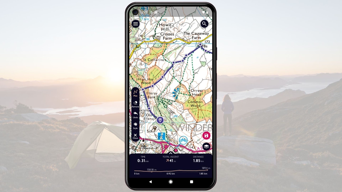

The paid version of this app is excellent: it provides very accurate and detailed coverage, plus it’s super easy to use. The free version is quite basic, which will be great for some, but the limited functionality may be a downside for others.
The free version is an OS Standard base map doesn't have offline access. It shows 10m or 20m contours depending on zoom level, plus basic terrain detail. You can plot a route, but there’s no ‘snap-to-path’ feature with this version, so it’s quite fiddly to plan your hike precisely.
On the other hand, the Premium version gives you full coverage of Great Britain (plus Australia and NZ). You can use the app to access a printable version of a paper map, which we find handy for adventures where you can’t completely rely on your phone.
We find this version very comprehensive, as it includes unlimited access to OS Explorer (detailed maps for hiking) and OS Landranger maps (covering a large area in less detail), plus aerial 3D maps and route fly-throughs on the web version.
Plus, it’s very easy to use, with an uncluttered interface and professionally written routes. And you can get it half-price with a Trail subscription.
Pros
- Accurate coverage of Great Britain
- Very easy to use
- Precise grid reference
- The plot-a-route feature works very well
- Handy printable maps
Cons
- Free version has limited functionality
| Premium cost: | £6.99/month; £34.99/year |

AllTrails
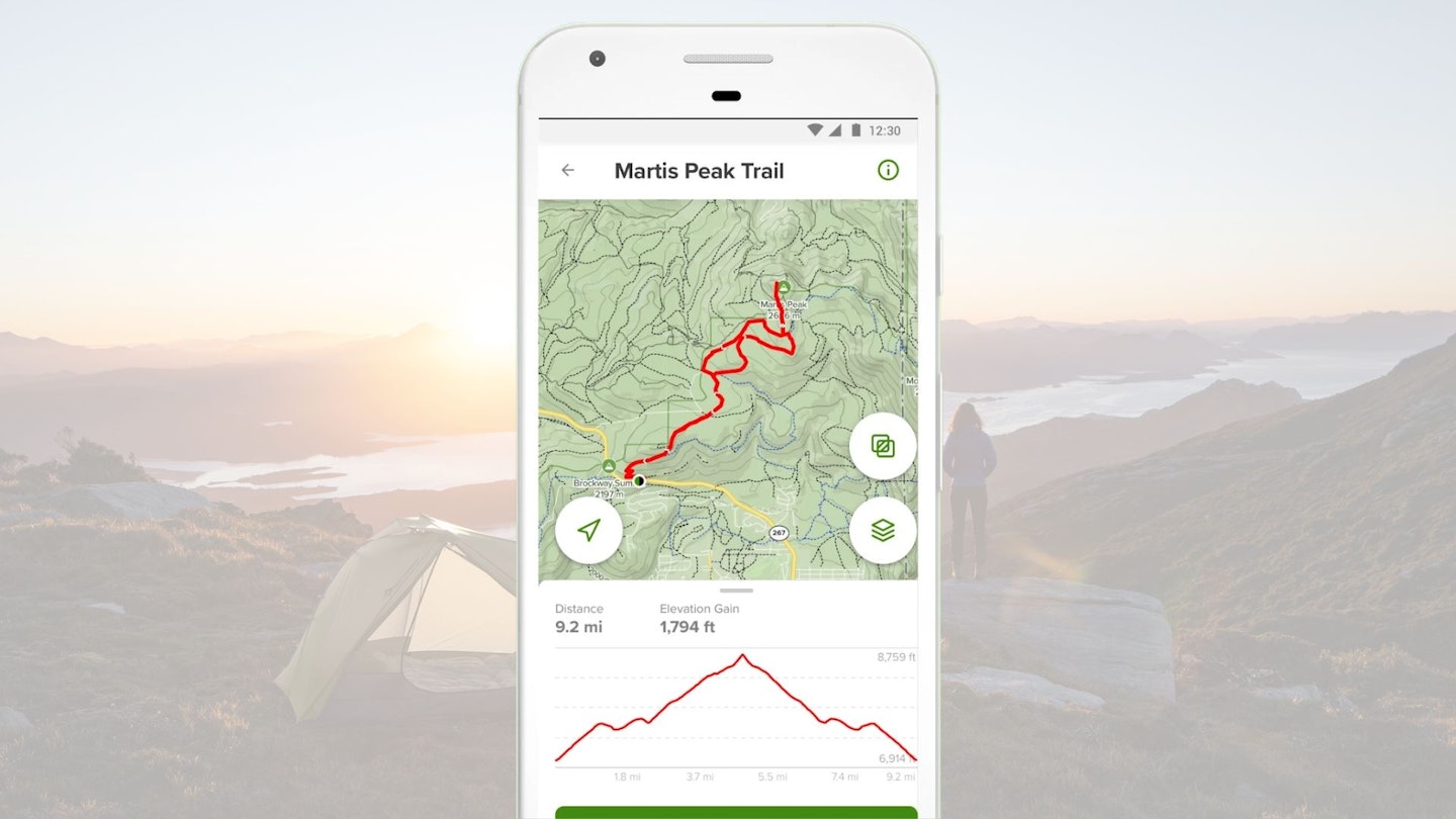
For a feature and information-rich app, AllTrails is easy to navigate and use. It offers quite a personalised experience if you want it, from curating favourites lists to logging your outings. Access to 300,000+ trails worldwide in the free version is also a major benefit.
This app outperforms the other apps in this test for trail search. You can filter according to all sorts of criteria, from location and activity type to whether the trail is dog friendly. This allows you to cut through the noise and find exactly what you’re looking for.
On the downside, some of the waypoints and other information is entered by other users. This can result in irrelevant or inaccurate information. Unlike OS Maps, you need a subscription if you want to use a map without a data signal.
There are some interesting free features, including the option to filter map types including terrain, satellite, and road; see photos along the trail and community heat maps; bookmark favourite trails and create lists.
The Pro version opens up the option to download offline maps, see maps in 3D, get alerts when you go off-trail. Like OS Maps, there’s a Lifeline feature that notifies a chosen friend or family member of your real-time trail progress.
Pros
- Easy to navigate
- Quick to find the best trails
- Feature and information-rich
- Personalised experience
- Access to 300,000+ trails in the free version
Cons
- Some irrelevant and inaccurate user-created content
- Need AllTrails Pro for offline access
| AllTrails Pro: | £35.99/year or £2.99/month |
OsmAnd

OsmAnd is an open source map and navigation app. There’s a lot of features and configurations, which makes it highly customisable, but perhaps not the most user-friendly for the average hiker.
The best feature is that once you've downloaded a region, you can actually plot a route offline. We find this very helpful for hikes without any signal, particularly if you want an estimate of how much longer and further it is. You can also get free offline maps.
Due the excellent offline capabilities, this app is great for battery life. With OsmAnd+, you’ll get unlimited map downloads (you get 7 for free, which we find to be plenty).
While the maps don’t quite have the same level of detail as an OS map, you can easily download your own GPX tracks onto the app. If you’re following a pre-planned track, it’s less necessary to have a detailed map. And with an extra plug-in, you can get contour lines, which we find helpful for knowing what’s ahead.
If you're not using your own GPX track, this may not be the best app. You can't search other people's routes and it's quite difficult to plot your own route accurately, unless you're going A to B in the most direct way possible.
Overall, we'd say that OsmAnd is an excellent option for long-distance hikes where you're following your own GPX and need to preserve battery life.
Pros
- Handles multiple GPX tracks
- Can plot a route offline
- Free offline access
- Detailed terrain information
- Great for battery life
Cons
- Not great for customised route planning
- A bit over-complicated for most users
| OsmAnd+ price: | £34.99 |
apps.apple.com
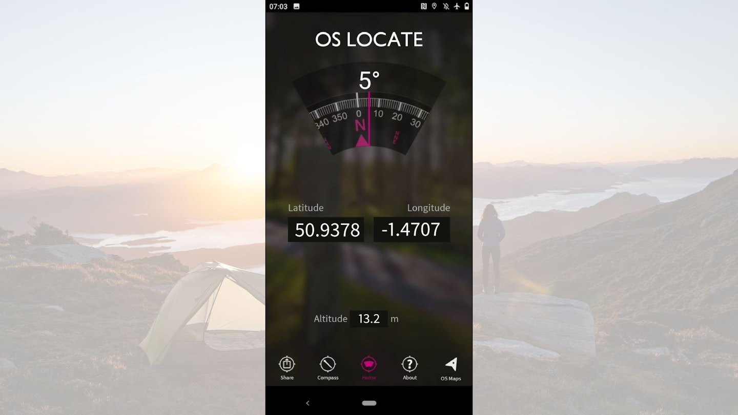
We like the simplicity of Locate Me because it provides easy but essential and potentially life-saving information.
It's a subsection of the main OS Maps app. It doesn’t provide maps, as it’s solely for the purpose of location.
Using your phone’s GPS, it will provide your exact location in the form of a 10-figure grid reference, allowing you to pin-point your position on a map and share your location with others. This is very useful for social or safety purposes.
The compass will still be affected by nearby magnets, so you need to keep it away from magnetic objects just like a regular compass.
Importantly, Locate Me gets its GPS reading from the phone’s GPS system, so no mobile signal is required. We particularly like how the app also has a ‘share’ feature so users can show others where they are via social media.
Pros
- Offline access (premium)
- Mini compass feature
- Option to share your exact location
- Free to use
Cons
- Will drain battery quickly with GPS location
- The compass will still be affected by nearby magnets
Komoot Maps
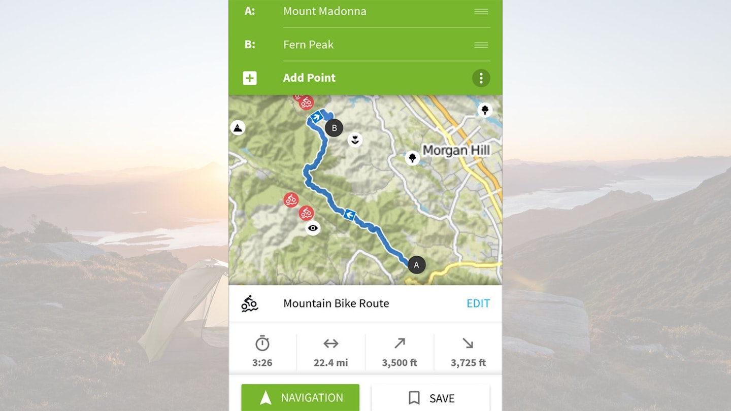
Komoot Maps offers a Base map with 20m contours when zoomed in, streams, gradient shading and a significant number of footpaths marked. It’s definitely not as comprehensive or detailed as an OS Map though, so in mountainous areas, you’d be wise to supplement with a printed OS map or guidebook.
It’s quick and accurate enough to inspire hours of map-based explorations, even of areas you know well. There’s also a library of route collections, some algorithmically generated ‘smart tours’ and others authored by users with comments and photographs.
Sport-specific maps include the Hiking map, which highlights long-distance trails like the Pennine Way and shorter trails colour coded for difficulty, from T1 (no worries) to T6 (Alpine level).
We find this app becomes difficult to use when you want to customise your route, as there’s no option of drawing your own route. But if you’re happy for Komoot to plan your route for you, based on your starting point and destination, then it works well.
Komoot is particularly handy for multi-day route planning, as there’s the option to create and browse routes that span several days. Though to download a route to use offline, the corresponding region must be bought.
You have to use it with care, though. One trial route generated up Sgurr Alasdair on Skye is described as ‘intermediate’, on ‘mostly accessible paths’, with ‘sure-footedness required’ which doesn’t convey the severity of the route’s relentless scree slope and extremely exposed finishing scramble.
Pros
- Will plan a route for you
- Plenty of route collections
- Helpful photographs and comments
Cons
- Customised route-planning isn’t user-friendly
- No detailed OS maps
- Misleading route descriptions
| Single region: | £3.99 once |
| Region bundle: | £8.99 once |
| World pack: | £29.99 |
| Premium: | £59.99 |
What to consider in trail and navigation apps
System compatibility: While most of the best apps are available for both Apple and Android phones, there are still some that are only available on one or the other – something to be aware of particularly if changing phones and switching operating systems.
Battery usage: The most critical thing a phone has to do is call for help in the event of an emergency, something it can’t do with a flat battery. Apps that require the screen to be kept on for extended periods or that require ongoing GPS tracking will put extra drain on your phone’s power.
Offline functionality: The hills aren’t always awash with phone signal, so apps that require a link to the web via a cell network in order to work may be of limited use in some more remote areas.
File size: Most apps require some info to be saved on your phone, but in some cases these file sizes can be huge – particularly if the app offers offline use.
Price: There are plenty of excellent free apps available, while others require a small payment. It’s sometimes worth paying a little extra if it improves functionality of the app or gives access to offline maps. However, some digital services may require a monthly subscription, and this can become expensive – particularly if the app isn’t used regularly.
Best nature apps
Learning about the natural world whole new level of interest to your hikes. If you've ever wanted to know a little more about what you see and hear when you're out in the hills, here's our list of top nature apps, which we use enjoy using regularly.
We're gear experts, not naturalists, so we haven't given them an official rating – but they're all free, so you can try them out for yourselves.
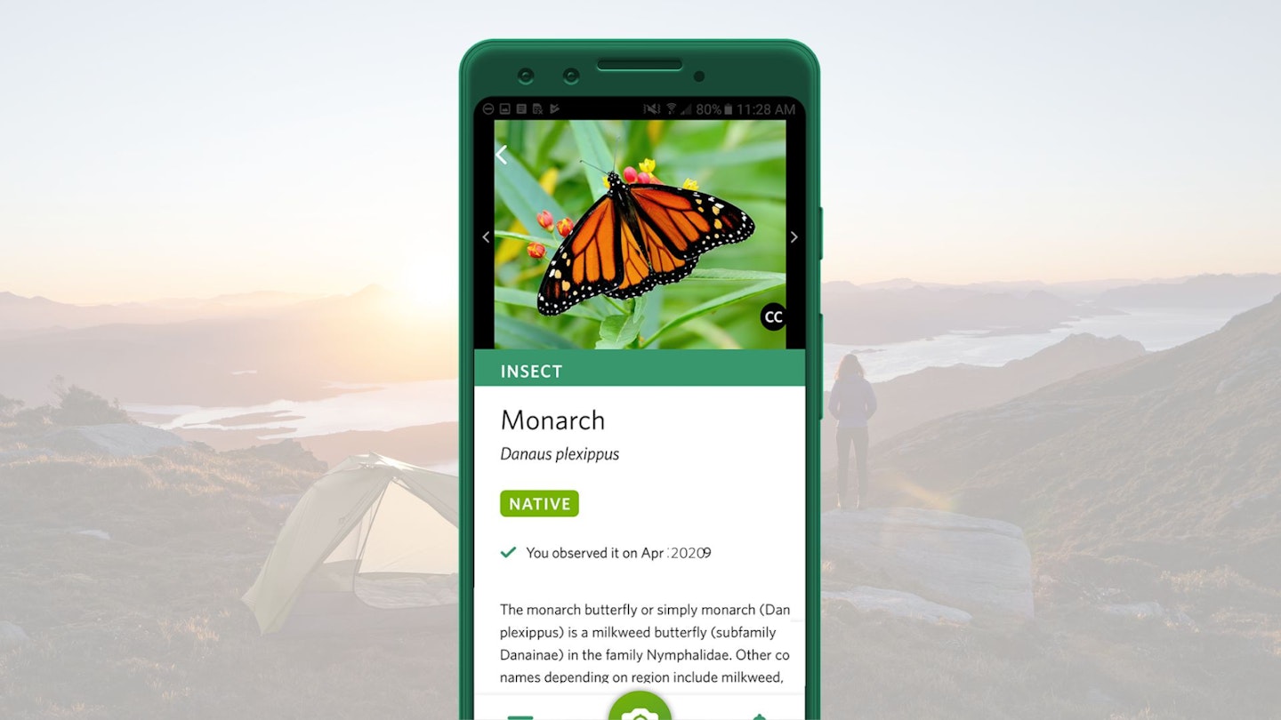
Seek by iNaturalist
Available on:
About:
If you want to up your natural world knowledge but are struggling to commit the details to memory, then this is the app for you.
Seek uses your phone’s camera and the power of image recognition technology to identify plants and animals. We find it works very well: it’s quick to identify the species, and seems pretty accurate.
It’s particularly handy for occupying children on walks where they’d otherwise get bored. There’s some gamification involved, as you can earn badges.
Amazingly, Seek is available completely for free – it’s an independent non-profit, funded partly by donations. We love it!
Price:
Free
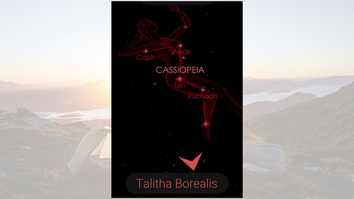
Star Walk 2
Available on:
About:
This app makes use of your phone’s camera and GPS to identify celestial objects in the night sky above you.
Whether it’s stars, planets, or entire constellations, Star Walk will help you to get more information about what’s going on above your head.
We particularly enjoy using it on clear wild camping nights, away from any light pollution. It’s simple to use and very informative.
Price:
Free
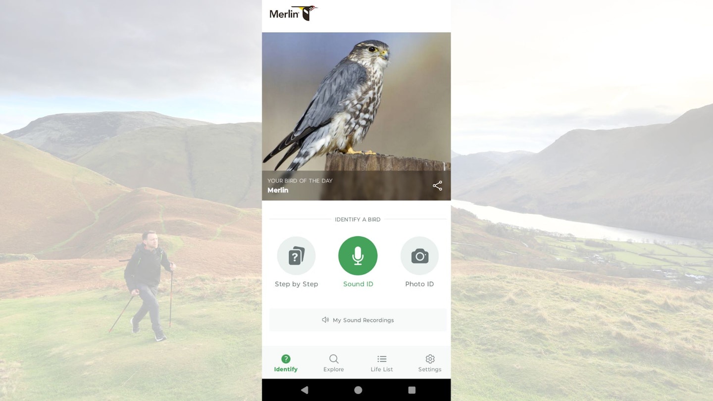
Merlin Bird ID
Available on:
About:
The standout feature of Merlin Bird ID is its ability to identify birds by their songs. Simply start recording, and the app listens to the surrounding sounds, then highlights the species it detects.
It's also very user-friendly. Even complete beginners will have no trouble navigating its features. It’s free to download and works without a phone signal, making it usable in remote locations.
Another feature we love is the step-by-step bird ID tool, which guides users through a simple question-based process to help them determine a bird’s species. The app also allows users to identify birds using photos they’ve taken on their phones.
Overall, this is an excellent tool for learning about birds in an easy and engaging way – no binoculars or guide books needed. Plus, it’s available completely for free.
Price:
Free
About the author

The chief tester for this review, Ben, has been with Trail for over 10 years and is our main point of contact for all gear reviews. As well as being a hugely talented writer and photographer, Ben is also a qualified Mountain Leader and Climbing Instructor.