Total distance 10+8km | Total ascent 1200m | Scramble rating Grade 2 | Go there on a beautiful day when you’ll enjoy it, not fear it
Glen Coe must rank as one of the most spectacular mountain locations anywhere in the UK. Shame, then, that many visitors are merely passing though, often on their way to Ben Nevis. And know nothing of the Aonoach Eagach ridge above.
Some of those may pull into one of the roadside car parks to take a few snaps of the guardian of the Glen, Buachaille Etive Mor, or the epically photogenic Three Sisters on the southern side of the valley. But then they’ll be moving on again, completely ignoring – perhaps because they’re totally oblivious to – the magnificent mountains that form the northern barrier of Glen Coe. But we know different.
Scrambling guide: Aonach Eagach ridge
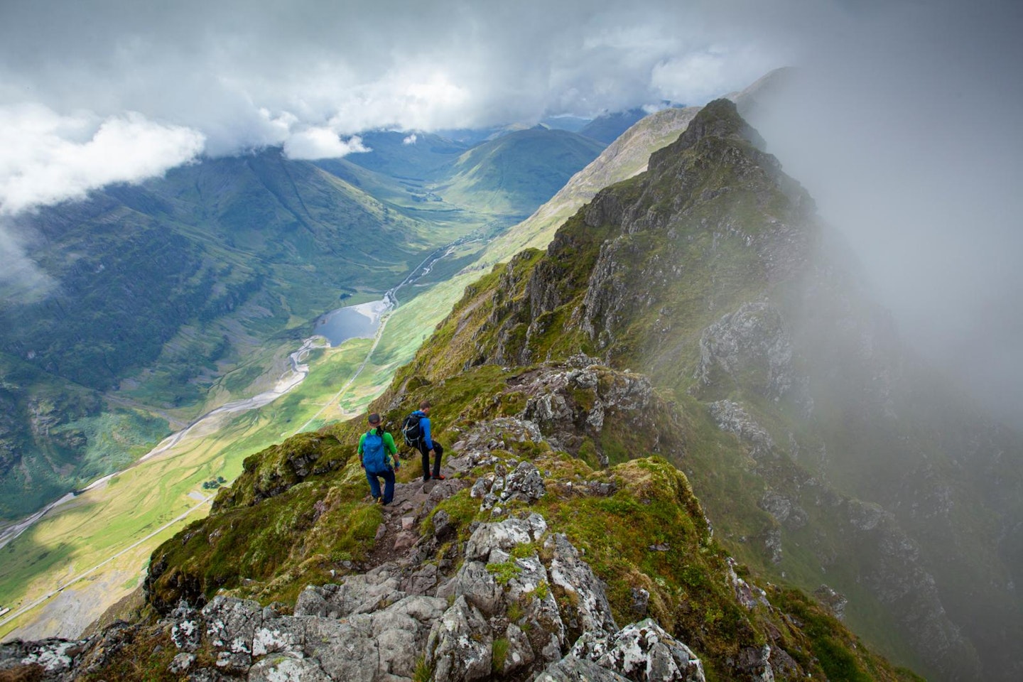
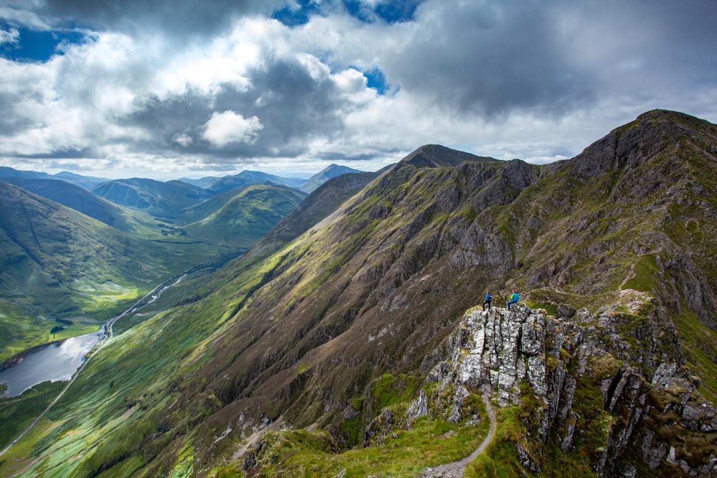
Four mountains in particular are worthy of note: two Munros – Meall Dearg (953m) and Sgorr nam Fiannaidh (967m) – and two Munro Tops – Am Bodach (943m) and Stob Coire Leith (940m). The four summits are linked by an airy, snaking ridgeline that provides phenomenal views of the south Glen Coe peaks and over the Mamores to Ben Nevis and beyond in the north.
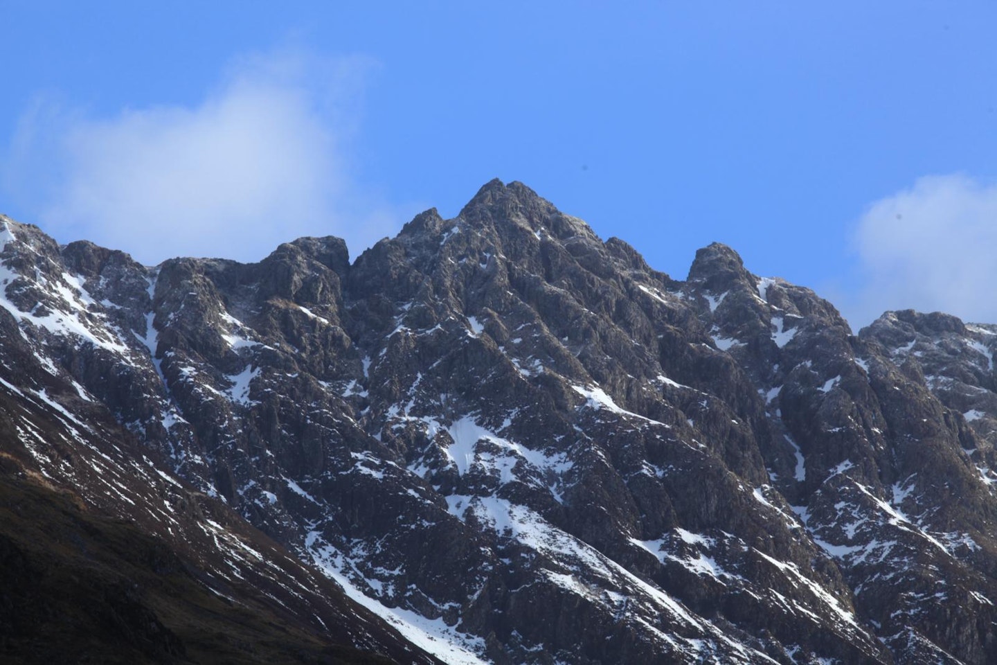
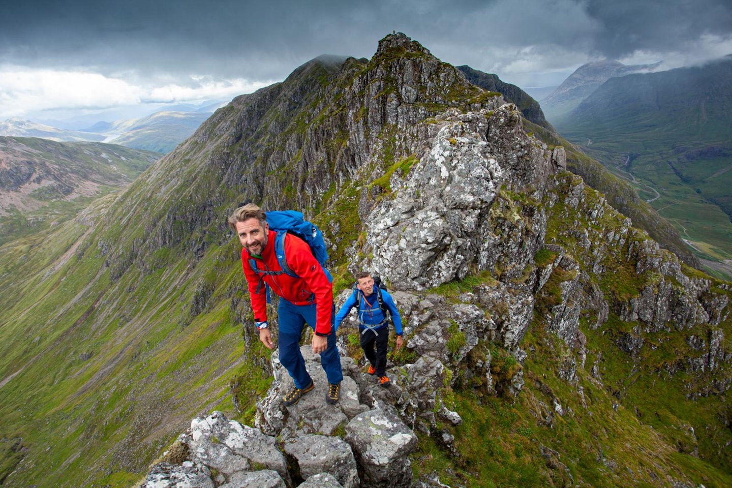
This ridge is in part wide and grassy, but often narrow and scrambly, requiring some tricky descents and ascents. One section specifically gives the whole traverse its notorious reputation. Between Meall Dearg and Stob Coire Leith the ridge thins, twists, and takes on outrageous forms; razor-sharp arêtes, awkward pinnacles, and tricky clefts. This, then, is the notched ridge: Aonach Eagach.
The traverse is usually tackled from east to west, taking advantage of the higher start point. This means tackling some tricky down climbs which might be easier in ascent were you going west to east, but it also means that you finish the day at the Clachaig Inn end of the ridge, and by then you’ll probably need a stiff drink.
Of course, at this point your car is some 8km away at the other end of the ridge, but you might decide that’s a problem for another day!
Step 1
There’s a small parking area directly by the path up onto the Aonach Eagach at NN173567, but you may need to park at the larger viewpoint car park at NN170568 and walk the 300m along the A82. The path winds up above the western bank of the Allt Ruigh, eventually zigzagging to the summit of Am Bodach.
Step 2
A difficult descent from Am Bodach gives you a taste of what’s coming. If you’re not sure it’s for you, now’s the time to turn back as retreat options soon disappear. The ridge drops steeply, requiring an exposed downclimb to the right before cutting back left past a square block to descend a short chimney.
Rusty fence posts are followed over easier ground before bearing to the right (by the 924m spot height marked on the OS 1:25k mapping) to pass above the top of a deep gully. From here an easy clamber leads up to the broad summit of Meall Dearg. If that’s all been a little too much for you, it is possible to escape north from Meall Dearg, although it will require a long, rough walk to get you back to where you started.
Step 3
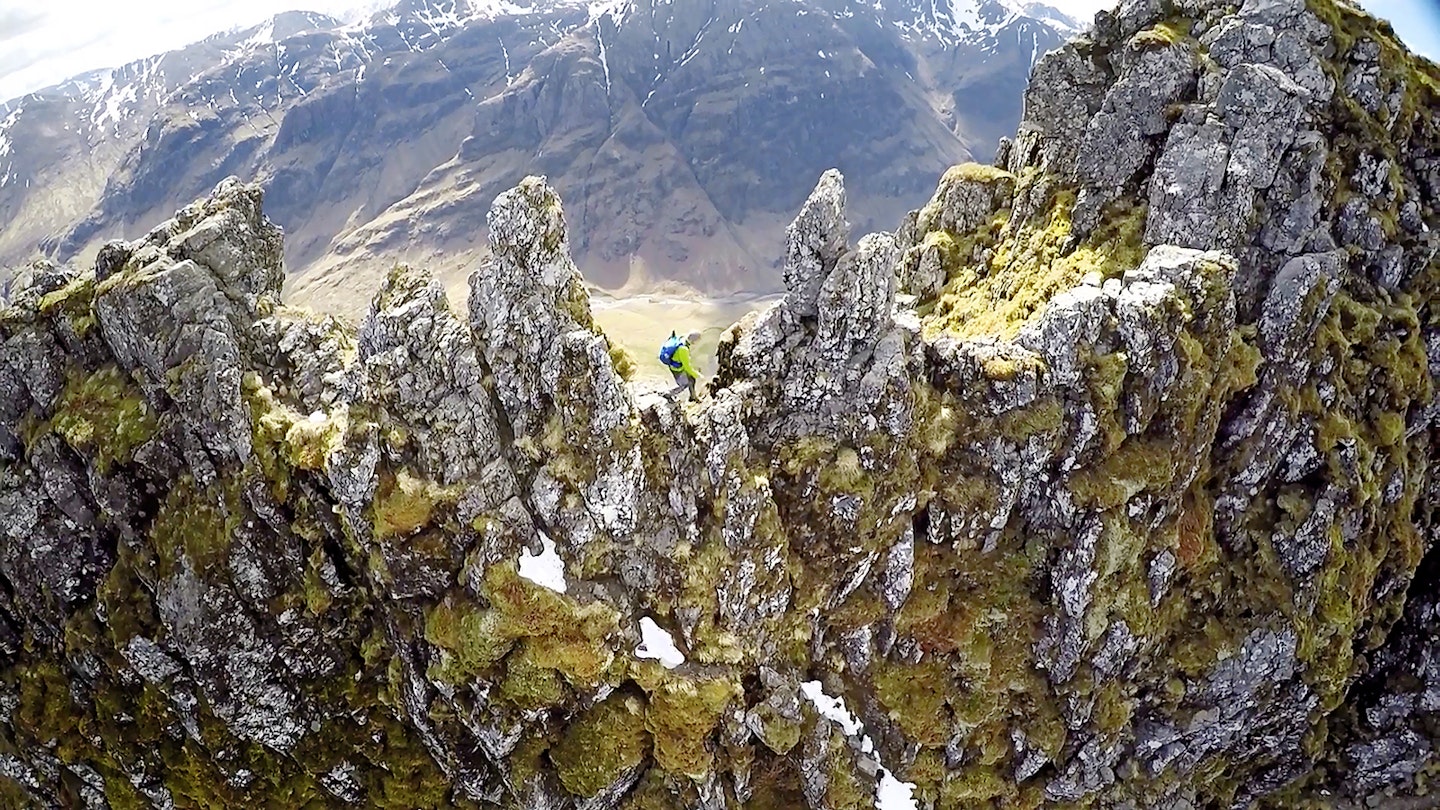
The view of the onward ridge is spectacular as you admire the beckoning pinnacles. Be aware that if you head onwards, the only way to retreat is to retrace your steps. NOTE – there is NO possible descent directly down to Glen Coe. The way ahead is obvious, following the ridge.
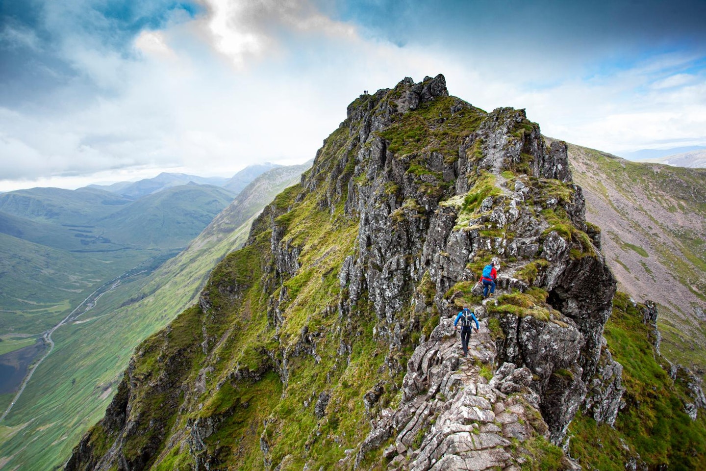
An easy scrambling descent leads to a steep chimney, beyond which more easy scrambling and a walking section offers some respite. Follow the crest over some ups and downs to arrive at a top on the ridge with a sudden jaw-dropping view of the next section: the pinnacles.
Step 4
Follow the signs of traffic on the polished rock and tackle the obstacles as they present themselves. The larger blocks can be climbed over, whereas the smaller, spikier pinnacles can be threaded. The scrambling here is not too difficult, but the exposure is vast – this is probably the most nerve-racking section if you’re at all uncomfortable with heights.
Step 5
After a series of exposed descents you arrive at a narrow notch in the ridge. The easiest way out is up the rock to the right before some easier scrambling leads to the summit of Stob Coire Leith and the end of any hard ground.
Step 6
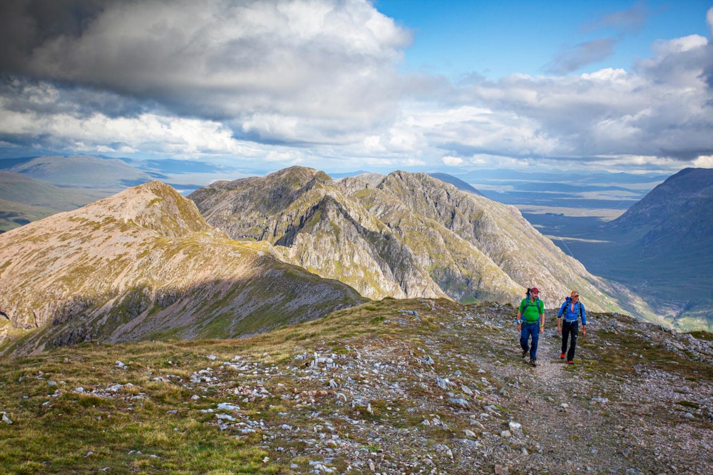
Enjoy the easier ridge walking with incredible views all around as you head over to the final and highest summit, Sgorr nam Fiannaidh. As tempting as it may be to take the shortest route down into Glen Coe, the southern slopes of Sgorr nam Fiannaidh are steep and difficult and best avoided. Clachaig Gully has become exceptionally loose and eroded and is particularly dangerous. The safest descent is to head north-west over Cnap Glas to the col below the Pap of Glencoe and take the paths from here down west to the minor road, following this south to the ever-welcoming Clachaig Inn.
Step 7
Now, unless you’ve got a second vehicle waiting, the car that you left at the start of the day is 8km of tarmac trudging back along the A82. You might be able to hitch, but if you’re staying locally and want to enjoy a more extended recovery in the Clachaig, you can always collect your car the following day when your legs might appreciate being loosened up with a gentle walk through the splendid scenery of Glen Coe.
Follow this route with HALF-PRICE digital Ordnance Survey Maps for the whole of Great Britain by subscribing to Trail magazine.
