-3.jpg?ar=16%3A9&fit=crop&crop=top&auto=format&w=1440&q=80)
Trail magazine’s 'Walks of a Lifetime' series takes you on a guided tour of the greatest mountain routes in Britain. This time we’re heading to the Lake District and the mighty twin giants of Blencathra and Skiddaw with experienced mountain connoisseur Tom Bailey as our guide.
Click here to download this walk of a lifetime route from OS Maps
I’ve long thought the two towering mountains at the northern end of the Lake District, with their feet in the coffee shops and pubs of conviviality, are the perfect bedfellows. A sense of betrayal when climbing one without the other is often felt, because they’re joined at the hip.
Skiddaw is higher and larger, a whale of a mountain. Blencathra, on the other hand, is obliging in every way, with a way up for every interest and ability. Not only do you get to climb these peaks, you get to sample the promised land that is the ‘Back o’ Skiddaw’. If such a thing as an experienced, fit hillwalker, with no experience of the Lakes existed, this is the walk I would take them on. For the views south, for the ridges and for the quietness of those forgotten far northern fells.
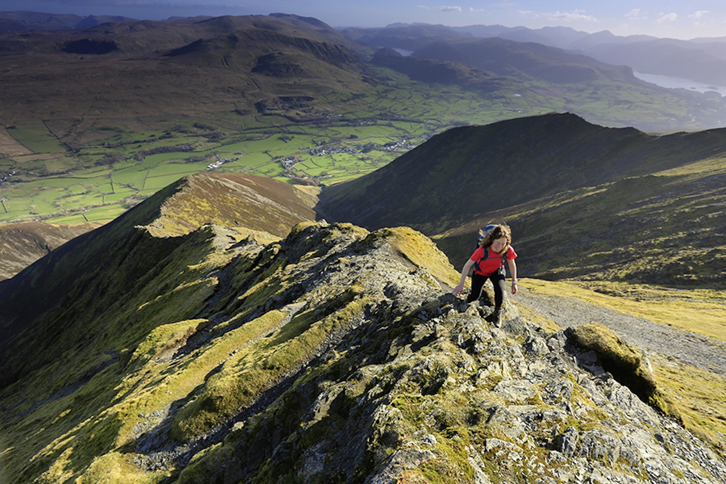
Head for Hall’s Fell
Nestling at the foot of Blencathra, Threlkeld is a perfect walkers’ village, with pubs, views, hills and, er… pubs. It’s a great place to start this full day’s yomp. Park at map point 1 (grid ref NY318256) and follow a footpath north-east out of the village towards Gategill. You’ll notice the fine line up the mountain that is Hall’s Fell Ridge – now this really is something to get the party started. After crossing a shallow ford (map point 2, NY325262), take the left-hand path. Steep at first, this obvious but not ugly track zigzags its way into the sky.
Before you know it the densely packed Lake District mountains come into view one by one. Gradually the ridge narrows and rock bands form to our obvious pleasure. Again, the path is easily followed, although it often avoids some of the rock fins. There’s nothing stopping you, so long as it’s within your ability, to take as many of them on the nose as possible. Hall’s Fell Ridge is fun, particularly in dry conditions, steepening only at the very last moment, and all difficulties can be avoided.
The main reward for the ridge is the summit, which is at the very head of the ridge (map point 3,NY323277). Views south include the Dodds leading on towards Helvellyn. To the south-west Derwentwater is partially visible, and beyond that the real high stuff surrounding the Scafell massif way in the distance.
Once you’ve savoured the moment, turn north, for there’s a (very) large part of the day left. Head very slightly east of north and you’ll descend into the grassy col of Blencathra, passing a tiny tarn on your way. In clear conditions a white cross made out of rocks can be seen on the ground. Here lies a bit of a mystery, the true origins of which aren’t known, although a local chap is thought to have extended it sometime after WWII.


Into the wild north
At the cairn on Atkinson Pike (map point 4, NY324282) we’re going to leave the well-trampled paths and head off initially in a north-westerly direction over the broad mass of Mungrisdale Common. You’re keeping to the high ground for as long as possible, avoiding the moistness of Roughten Gill. There’s a thin path that heads in the correct direction, but if visibility is poor you really need to concentrate on navigation.
One of the checkpoints to look out for on this leg is the Cloven Stone (map point 5, NY303288). As its name might suggest, it’s a large rock with a split in it, with the whole thing resembling a cloven hoof. It sits right on the edge of steepening ground, in an otherwise featureless bit of hillside.
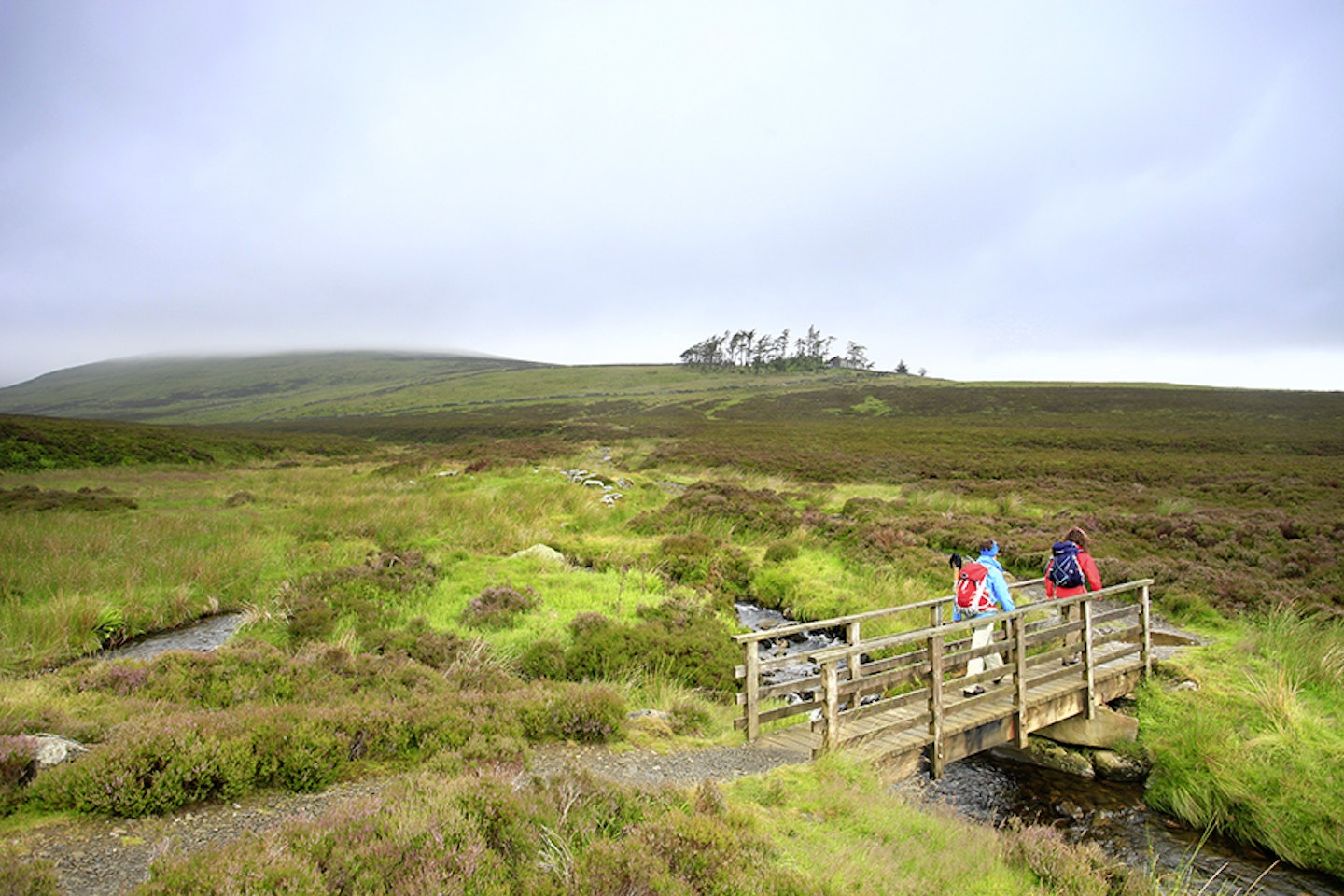
Almost due west from the Cloven stone, in the dip, is a boggy area, passing ‘The Stake’. Climb westwards until you reach the main path at the foot of the Burnt Horse ridge. This cuts north-west, leading to the surprisingly situated YHA Skiddaw House Hostel (map point 6, NY287291). Around 4km from the nearest road, this characterful hostel is one of those hidden gems that could transform the possibilities for future trips. It’s open from March to October and was originally built around 1829 as two cottages – one for a shepherd and one for a gamekeeper.
From this point, looking north, Great & Little Calva loom heavily, dividing the view northwards into two valleys. The easy track to the north-west does its best to stay out of boggy trouble by sauntering up the lower flanks of the surrounding hills. Shortly after Whitewater Dash waterfall, the wonderfully named Black Nettle Hause is reached (map point 7, NY272313). You’ve come to an edge of the Lake District. Through the valley to the north-west is the lone form of Binsey (447m) – one of those outliers that, on the right day, is a rewarding place to visit.
Keep an eye out for red deer as you walk because, other than here and Place Fell near Ullswater, they’re rare in the Lake District.


Secret Skiddaw
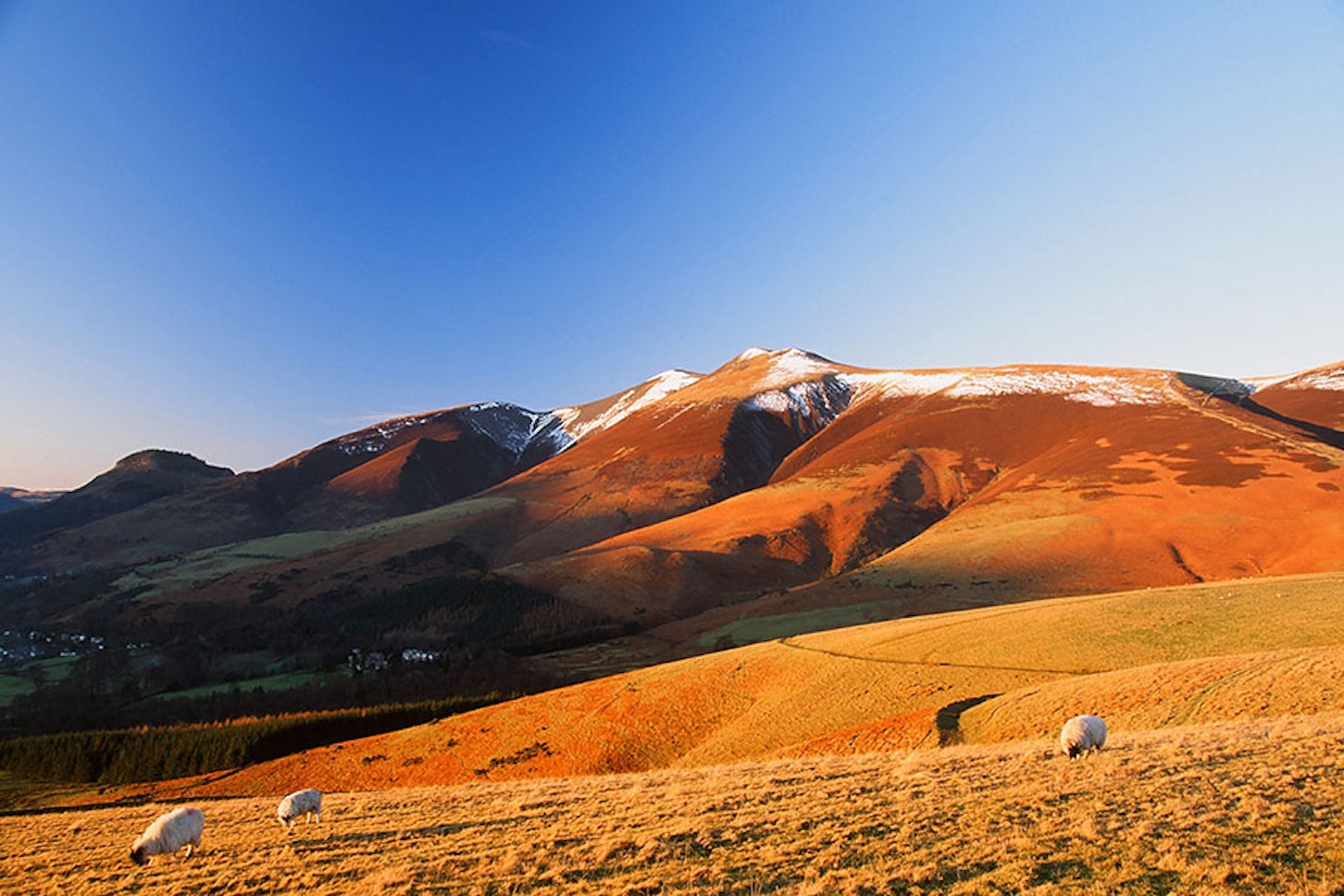
The point of exploring this remote part of the Lakes is to take Skiddaw via the back door. The spur to the south-west that heads up Bakestall is the key to unlock this Lakeland giant. Climb we must, but the good news is the views to the north are epic, with the Solway Firth and the Galloway Hills seeming impossibly near. There’s a path on the northern side of the wall and fence as you climb. The summit of Bakestall provides the perfect place for a breather. Lunch will, I’m sure, have been eaten long ago, so I find the secret with big days is to have a second, usually full of things you really like.
With a belly full of fuel, keep following the fence line initially south, then south-west, climbing all the time (and it’s a hard climb) until you reach the most northern end of the summit ridge (map point 8, NY261298). The immensity of Skiddaw is now no longer in doubt. The steeply-falling scree-covered slopes to the west give way to Bassenthwaite Lake, home of the Lake District ospreys in summer.
Heading south now up the final, much easier contours, summit fever will strike for the second time today. Up here it’s not too different to Scotland’s famous Cairngorm plateau – rock strewn, very high and strangely level for a mountain top. For the Lake District, this place feels truly mountainous, epic and huge. I’ve been up here in all sorts of weather, from savage winter snows with cutting winds to lazy summer evenings when it refuses to get dark. I once crawled up the summit ridge, wind speed recorder in hand, determined to know if the 90mph winds forecast were accurate (they were, we recorded 89.4mph). Twenty years before this, I was blown off my feet on Skiddaw, surviving with nothing more than a few bruises. It’s the unrelenting, open-to-everything nature of the summit (map point 9, NY260291) that makes it the King of the Lakes, in my opinion. There is a low summit shelter, so you can usually linger to savour the moment.
Lakeland panorama
The summit ridge is surprisingly long, continuing south for 500m before you get the big view over the whole Lake District. I think the best view south is from Little Man (map point 10, NY266278). You’ll need to turn off the main path at the col between Skiddaw and Little Man, but the small extra ascent is definitely worth it.
Now the romp back begins. The day is downwards, in the most positive of ways. Heading south-east off the summit of Little Man, follow the main route to the high car park north of Latrigg (map point 11, NY281253). Then head 2km eastwards on a bridleway until you reach a bridge over a river (map point 12, NY299248). Continue through the hamlet of Wescoe, then through endless fields back into Threlkeld and your starting point.
Congratulations! Two of the most prominent mountain scalps in the Lake District are now yours, along with a glimpse into the secret north.


Fact file
WHERE DO I START?
You’ll start and finish in the village of Threlkeld, a few miles up the road from Keswick. There are a couple of car parks, plus it’s easy to reach by bus from Keswick and Penrith.
WHAT’S THE TERRAIN LIKE?
A real mixture of narrow rocky ridge, flat grass paths, rocky mountain plateau, moorland slopes, wide tracks, river valley and stream crossing.
HOW HARD IS THE WALK?
Hall’s Fell Ridge on Blencathra is rocky but not too technical or exposed, so the real test is in your fitness. It’s a long walk, with two big mountain ascents. Not one for total beginners.
WHAT MAP SHOULD I USE?
OS Explorer OL4 & OL5 (1:25k); OS Landranger 90 (1:50k); Harvey Superwalker XT25 Lake District North (1:25k); Harvey British Mountain Map Lake District (1:40k)
WHERE CAN I STAY?
You’re spoiled for choice with Keswick on the doorstep, but we’re big fans of Keswick YHA and the self-catering cottages at the Blencathra Field Studies Centre.
Click here to download this walk of a lifetime route from OS Maps

Get HALF-PRICE digital Ordnance Survey Maps for the whole of Great Britain by subscribing to Trail magazine.
Need help with OS Maps? Try the OS Maps online FAQ and OS Maps quick start guide for further assistance
