Here you’ll find all the walking and hiking routes featured in the most recent issue of Trail magazine. You can view the routes on the OS Maps website and, if you’re an OS Maps Premium subscriber, overlay them on 1:25,000 Explorer or 1:50,000 Landranger leisure mapping.
Trail magazine subscribers can claim a half-price subscription to OS Maps Premium - click here to find out more!

Route 1: Crib Goch, Snowdonia

Crossing Snowdonia classic Crib Goch will test the nerves of most scramblers, so here’s the lowdown to make your first time both safe and thrilling.
Click here to view and download the Crib Goch route from OS Maps

Route 2: Steeple, Lake District

Standing on a cloud in the heavens: we head to the Lake District’s Ennerdale to give Steeple the attention it deserves.
Click here to view and download the Steeple route from OS Maps

Route 3: Angel’s Peak, Cairngorms

Among the broad, hulking Cairngorm mountains, scrambles are rare. Which makes this one up Sgor an Lochain Uaine all the more astonishing.
Click here to view and download the Angel’s Peak route from OS Maps

Route 4: High Raise via Eagle Crag, Lake District

Clamber on to a less-frequented summit and stride out along a broad ridge far from Lakeland’s madding crowds.
Click here to view and download the High Raise via Eagle Crag route from OS Maps

Route 5: Nantlle Ridge, Snowdonia

Could the Nantlle Ridge be Snowdonia’s finest ridge walk? The answer lies on this end-to-end, 7-peak, bagging fest.
Click here to view and download the Nantlle Ridge route from OS Maps

Route 6: The Ring of Steall, Central Highlands

Jagged ridges, steep peaks and scenery like no other it’s time for a trip around the Mamores.
Click here to view and download the Ring of Steall route from OS Maps

Routes 7: Wessex Ridgeway, Dorset

Whether you’re a new walker or a seasoned pro, you’ll be enchanted by the views from Dorset’s lofty whaleback ridge, while bagging the county’s highest point too.
Click here to view and download the Wessex Ridgeway route from OS Maps
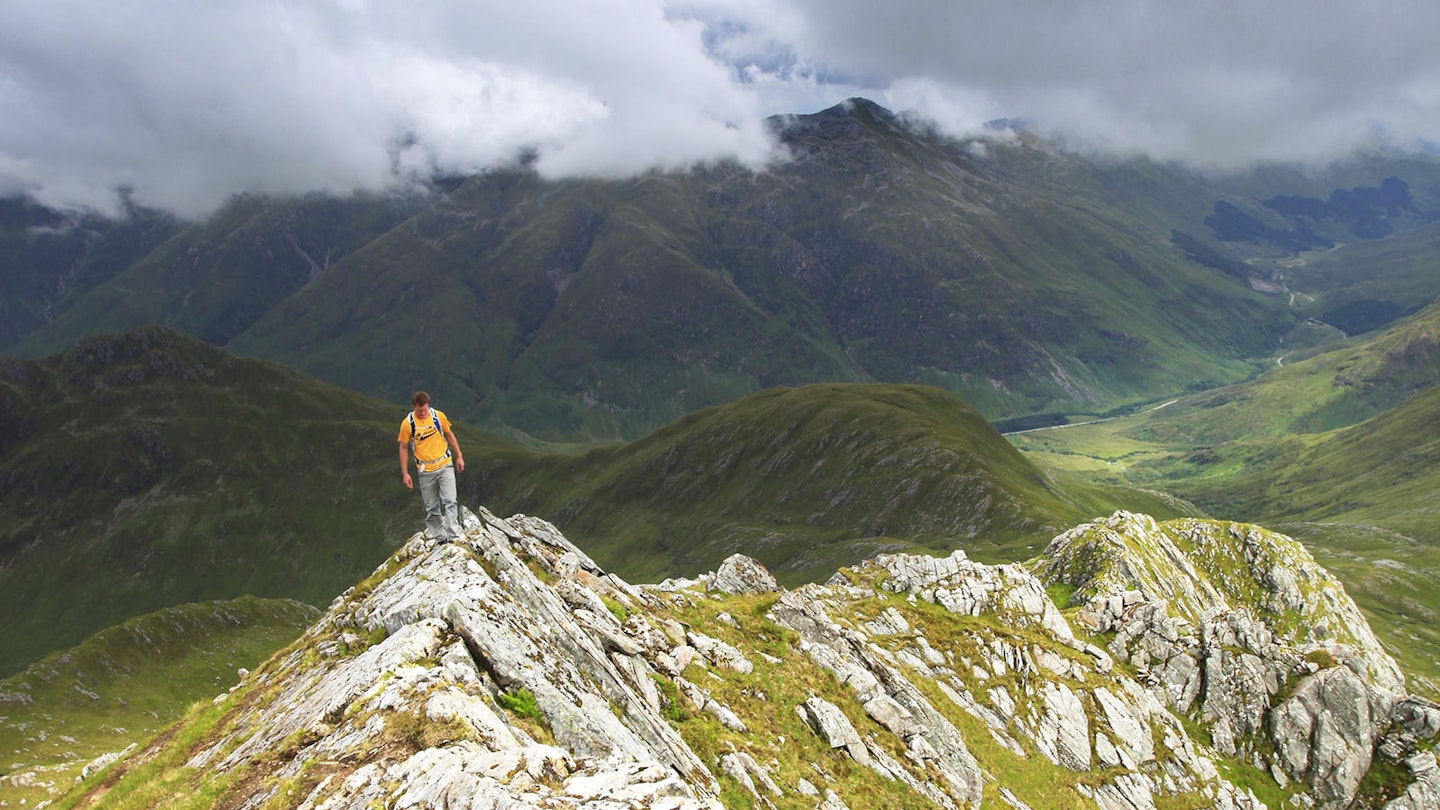
Routes 8, 9 & 10: Ultimate Weekend – Glen Shiel weekender, North-West Highlands

Enjoy three solid days of ridge walking and scrambling around Glen Shiel with a visit to the Cluanie Inn for a refresher.
Click here to view and download the Brothers of Kintail route from OS Maps
Click here to view and download the Five Sisters of Kintail route from OS Maps
Click here to view and download the Saddle via Forcan Ridge route from OS Maps

Routes 11, 12 & 13: Ultimate Weekend – Ambleside to Keswick, Lake District

Red Screes, Fairfield, Helvellyn to the Dodds: this has to be England’s longest ridge. Walk it over 2 days, plus a sneaky ending.
Click here to view and download the Red Screes & Fairfield route from OS Maps
Click here to view and download the Helvellyn & the Dodds route from OS Maps
Click here to view and download the High Rigg route from OS Maps
