Total distance 9km | Total ascent 380m | Scramble rating Grade 1 | Go there after a dry spell for the best scrambling options
Kinder Scout is a big, flat-topped lump. So featureless and nondescript is its sprawling summit plateau that the precise location of its summit isn’t entirely clear. In fact, thanks to the tor-like hags and deep-channelled groughs that shift and change with erosion, it’s entirely possible that Kinder’s highest point moves. But Kinder’s edges are a whole different story. Rugged, craggy, and scored by cloughs – clefts in the rocky plateau walls – the periphery of Kinder is potentially far more interesting that its interior. At least, it certainly is to scramblers.
The path which skirts the banks of Crowden Clough offers walkers a convenient way onto Kinder’s top, but by leaving the main path and heading into the riverbed scramblers will find a challenge superbly suited to their own preferences. And when the scrambling is done, a quick exploration of some other fun edge features and an easy route down means you don’t even have to set foot on the eternal bog of the high moorland plateau. Sound good? This is how it goes…
1.
From the car park between Barber Booth and Upper Booth follow the minor road north into Upper Booth, go past a phone box on your left and the entrance to the farm and campsite on your right, cross a bridge in shaded woodland and turn right through a small wooden gate to follow the path beside Crowden Brook through the trees.
2.
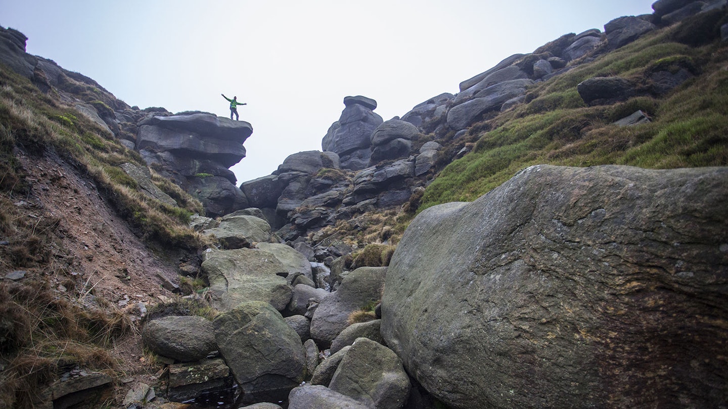
The path follows the west bank for about 700m before crossing it via a footbridge, passing through a wall and into open access land shortly after. The path climbs gently, occasionally drifting away from the east bank of the brook before tracking back towards it to cross once more to the west bank. After about 500m the path veers left towards Crowden Tower and away from the forming clough. It’s time to abandon the main path and head along the riverbed.
3.
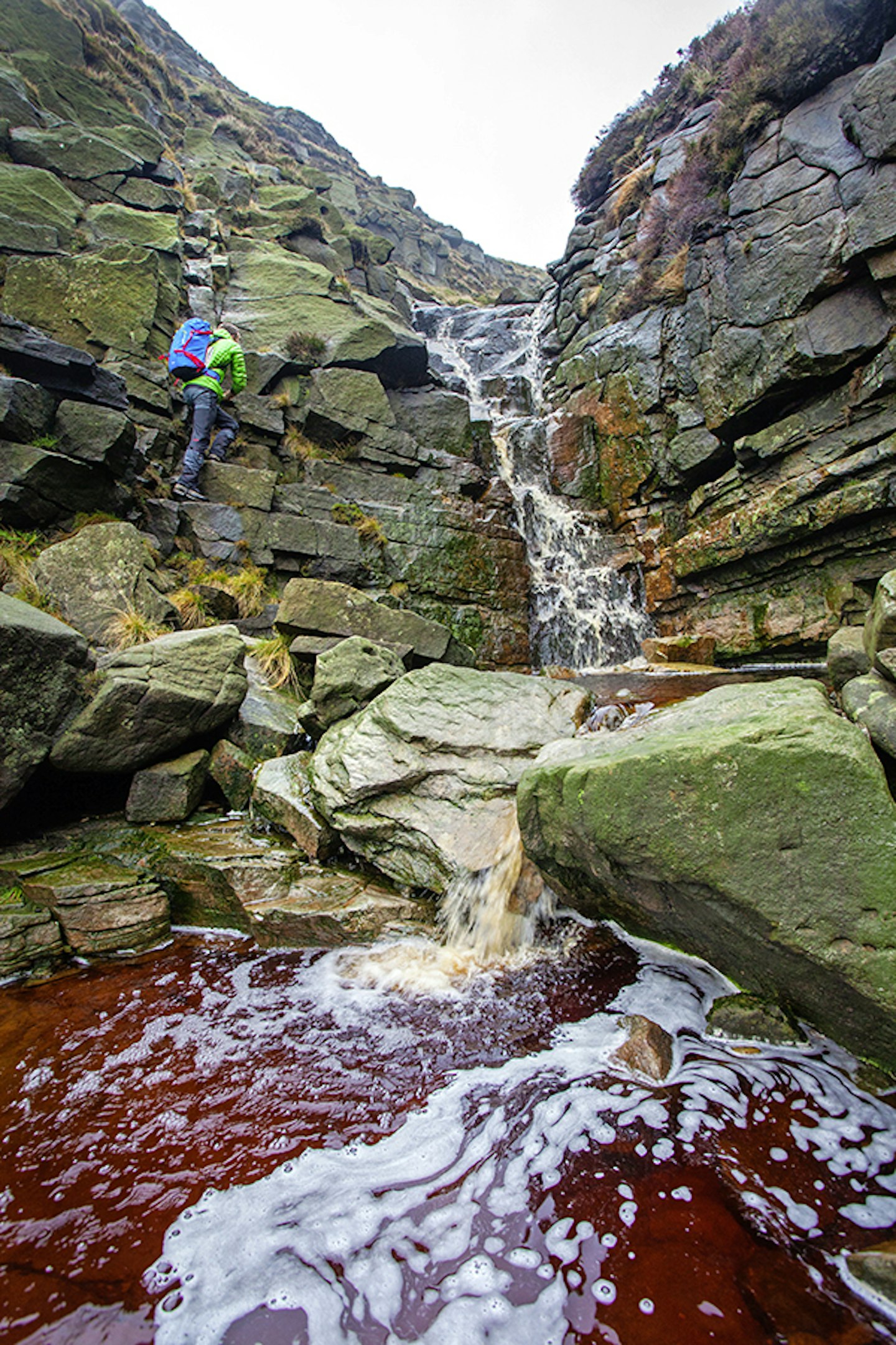
Clamber at will over the rocks to the first section of proper scrambling where the brook tumbles over a series of ledges. It’s only around 4m of height, but a good warm-up. It’ll also give you a clue as to how much water is in the clough and how dry the rock is. Above this step, clamber on to the next and more significant scrambling section.
4.
Above a small pool (which may be devoid of water after an extended dry period) a steeper, higher challenge beckons. Some rocky steps in the back corner make the best approach, trending towards a more direct line if water volume permits it. If the brook is too full, stay over to the left to reach the upper streambed beyond.
5.
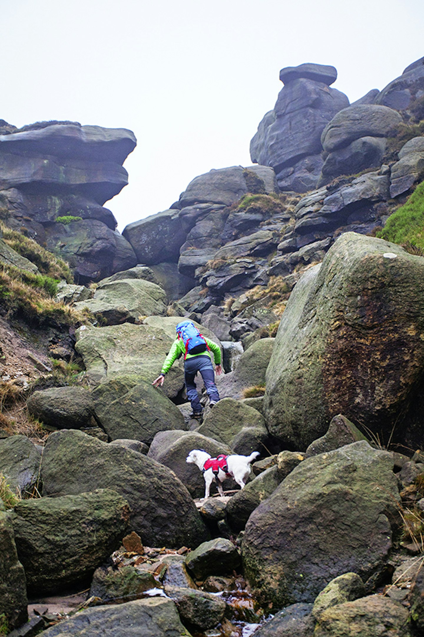
Continue along the streambed, tackling a few more fun ledges and steps as they present themselves – there’s nothing too difficult here. Eventually the clough meets the path that runs around Kinder’s southern rim.
6.
Ignore the path for now and head west along the stream bed to a small rocky outcrop on the plateau. After a final bit of scrambling join the rim path south to Crowden Tower and then west past the bizarre weathered shapes of the Wool Packs, Pym Chair and Noe Stool (there’s more fun clambering to be found on these rounded gritstone lumps).
7.
Continue south-west until the path meets the Pennine Way between Edale Rocks and Swine’s Back. Follow the Pennine Way south then east to descend via Jacob’s Ladder; if you’ve not seen it before you’re likely to be hugely underwhelmed. Back in Upper Booth, leave the Pennine Way, pass the phone box and follow the minor road back to the car park.

Get HALF-PRICE digital Ordnance Survey Maps for the whole of Great Britain by subscribing to Trail magazine.
Need help with OS Maps? Try the OS Maps online FAQ and OS Maps quick start guide for further assistance
