%20or%20jm%20sc%20(Twist%20RD%20PDF)-3.jpg?ar=16%3A9&fit=crop&crop=top&auto=format&w=1440&q=80)
Trail magazine’s 'Walks of a Lifetime' series takes you on a guided tour of the greatest mountain routes in Britain. This time we’re heading to the incredible Isle of Skye and the awesome Blà Bheinn, with experienced mountain connoisseur Tom Bailey as our guide.
Click here to download this walk of a lifetime route from OS Maps
There are many things wrong with the world, so when something right comes on your radar, you just have to do it. Blà Bheinn (or Blaven) is one of those things. Who can resist such temptation? Sat on its own, yet close to the Cuillin Ridge of Skye, it’s a mountain that roars at you the moment you set eyes on it.
For all of its rocky magnificence, it provides the mountain walker with what I think is the best day’s striding (with a little scrambling, this is Skye after all) anywhere on this highly regarded island. Couple this with the fact that the mountain rises from a wild beach – to go from sea to summit in a day is always special – and you’ve got a seriously good mountain day. So come on… let me take you to Skye’s sleeping lion...
Spectacular approach
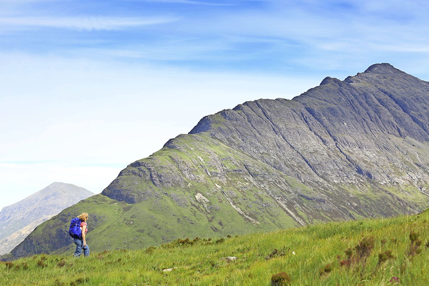
You’ll have noticed Blà Bheinn on your drive around Loch Slapin, as it fills the western skyline. Parking at grid ref NG545172, a pleasant 4x4 track leads off up a shallow incline to the west-north-west. After a couple of kilometres you’ll reach the top of the pass (map point 1, NG527181). Here look north and survey the ground in front because you’ll be heading back across it later to rejoin the track at this point. Turning back to the westerly track, follow it as it starts to swing to the north, descending as it does so. Blà Bheinn will be right in front of you when you get to this point, with the south ridge spewing right down to the bay below, daring you to take up the challenge that is this stairway to heaven.
At a switch back in the track (map point 2, NG524189), pause for a while. Northwards is a shortcut, getting you to the mountain quicker. If you want to make the day as brief as possible this is the direction to go, but you might as well come along for the full ride. The track cuts back down to Camasunary Bay, a beautiful oasis, with Sgurr na Stri looming to the west above it. This is a haven for much of Scotland’s marine life, and in the winter Great Northern Divers feed in the calm waters.
There is a building at the western end of the beach that used to be the bothy, but a few years ago a new one was built (map point 3, NG517183) and that’s where we’re heading. The new Camasunary bothy is in a better location than the old one, in my opinion. A few minutes spent inside it, looking out at the bay and Sgurr na Stri, soon makes you realise this is a prime spot. Alas, the lack of a fireplace means it will never be the cosy dream that many bothies are.


The south ridge
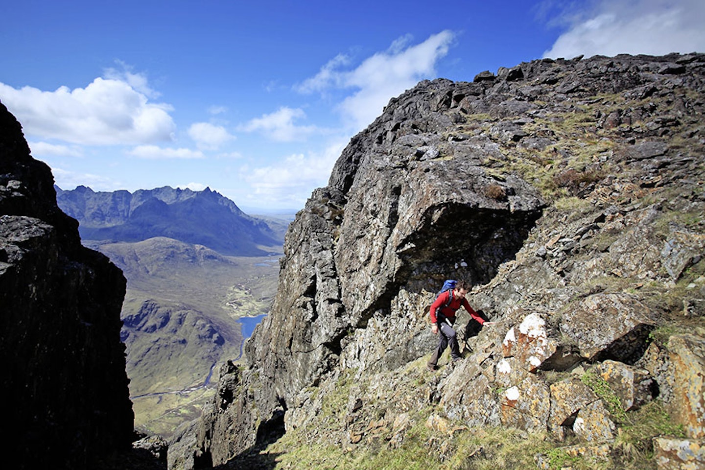
Are you ready to kick the arse of this mountain? With your back to the sea, find your way to the bridge (map point 4,NG518186). We’re off-path for the next 1km or so, heading for a weakness in the flank of the nose of the ridge. There are some crags low down that prevent a perfect line being taken, but our line is good enough. We’ve passed map point 5 (NG522194) and used those calf muscles to breach the ridge at map point 6 (NG522200). A thin, snaking path is followable all the way up this triangle of sheer of mountain perfection. Rock bands are scrambled but nothing too hairy, this is enjoyable stuff. Just keep an eye out for the line of travel worn by the passage of feet, normally betrayed by lighter coloured rock.
Some might say the view from the summit of Sgurr na Stri into the Cuillin mountains and Loch Coruisk is the finest in the land. It’s troublingly good, dramatic even, but in my humble opinion it lacks a certain cold edge that the view into the same area (minus the loch – seen one, seen them all, right?) has from high on Blà Bheinn’s south ridge.
Where eagles dare
Golden eagles thrive in Skye’s mountains. At any point in the journey they may put in an appearance, but here, up amongst it, they seem splendid, timeless. At 926m high, the first and lower summit of Blà Bheinn (map point 7, NG529215) is a great place for many things, especially lunch. The main summit will inevitably be busier, so enjoy the relative peace while you can.
A steep but ok downclimb into the col between the twin tops puts us in striking distance of the true top. A trig point marks the summit (map point 8, NG530218). More than any other time, reflect on where you are, and remember how impressive this mountain looked from the other side of Loch Slapin, or from over on the Rum Cuillin if you’ve been lucky enough to visit that rugged island. Blà Bheinn is a landmark peak – how can something be this smokin’ hot when so close to water? But hold on a minute, we’re only halfway. Let’s get down this thing safely.


Wild, lonely descent
We’re going to follow the ‘normal’ route off, heading initially east-south-east down a steep, loose at times, exposed flank. Somewhere in the upper reaches of Coire Uaigneich, near map point 9 (NG536213) ignore the turn to the north-east that the path takes and forge your own way to the south-west up the head wall to a break in the shallow col.
Climb again towards the south-south-east and you’ll now have the vast plateau of Slat Bheinn before you. I promise you won’t see another soul on this section of the walk. Come here in the late spring and you’ll see Golden Plover on their breeding grounds. The call of this wading bird is one of the most plaintive in the bird world.
Coming this way gives you an opposite feel to the south ridge of Blà Bheinn – that being steep and rocky, while here on Slat Bheinn it’s flat and boggy in places, but wild and lonely.
A southerly saunter of 1.5km brings you close to the end of the plateau (map point 10, NG535194). Here, steer south-west onto a lower, southerly facing tongue of land that rejoins the main track used on the way in. A last, satisfied look back to Blà Bheinn is called for, as it’ll slip from view shortly. In June I’ve seen the jewel that is the azure hawker dragonfly in this area, so stay vigilant, as every season has its wonders.
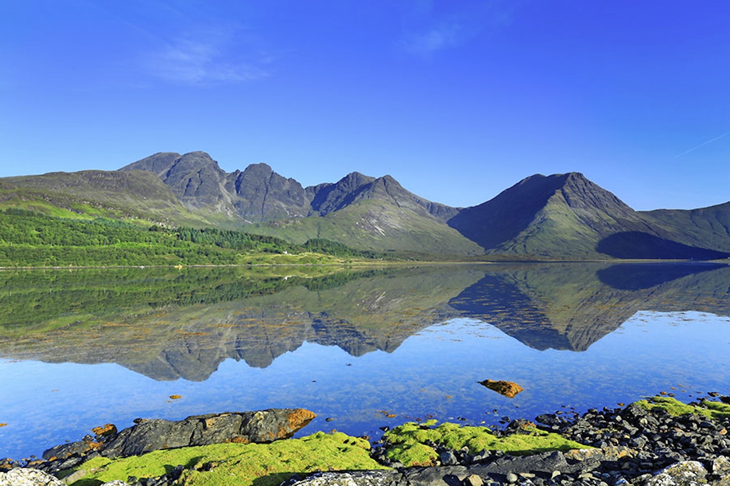
Two kilometres south-east brings you back to the car, where, with your rucksack off and your back airing, you might spy an eagle one last time. Then before leaving the island, take one last, long look at Blà Bheinn from the eastern shore of Loch Slapin…


Fact file
WHERE DO I START?
The route starts and finishes in a lay-by at grid reference NG545172 near Kilmarie and Kirkibost on the B8083. The nearest town is Broadford.
WHAT’S THE TERRAIN LIKE?
You get a real mixed bag on this walk, crossing a variety of landscapes. You’ll walk on gravel track, beach, boggy moor, grassy slopes, rocky mountain ridge, steep scree and boulder fields.
HOW HARD IS THE WALK?
High on Blà Bheinn has a feel of the nearby Black Cuillin peaks, without being quite as intimidating or technical. The real challenge of this route is the distance and ascent, so you need to be fit!
WHAT MAP SHOULD I USE?
OS Explorer OL411 (1:25k); OS Landranger 32 (1:50k); Harvey Superwalker XT25 Skye The Cuillin (1:25k)
WHERE CAN I STAY?
Plenty of options on Skye in summer, but many close in the off season. Camasunary Bothy is great but basic, Broadford Youth Hostel is close, as are good self catering cottages, including Allt Slapin in Torrin.
Click here to download this walk of a lifetime route from OS Maps

Get HALF-PRICE digital Ordnance Survey Maps for the whole of Great Britain by subscribing to Trail magazine.
Need help with OS Maps? Try the OS Maps online FAQ and OS Maps quick start guide for further assistance
