
It’s kind of funny, our love for trig points. Usually, if someone comes along and clutters up the countryside with stuff that nature didn’t put there, at least some corner of the outdoors community feels aggrieved.
Wind turbines set pulses racing. There have been campaigns to limit the number of signposts in fields. Even benches can be contentious.
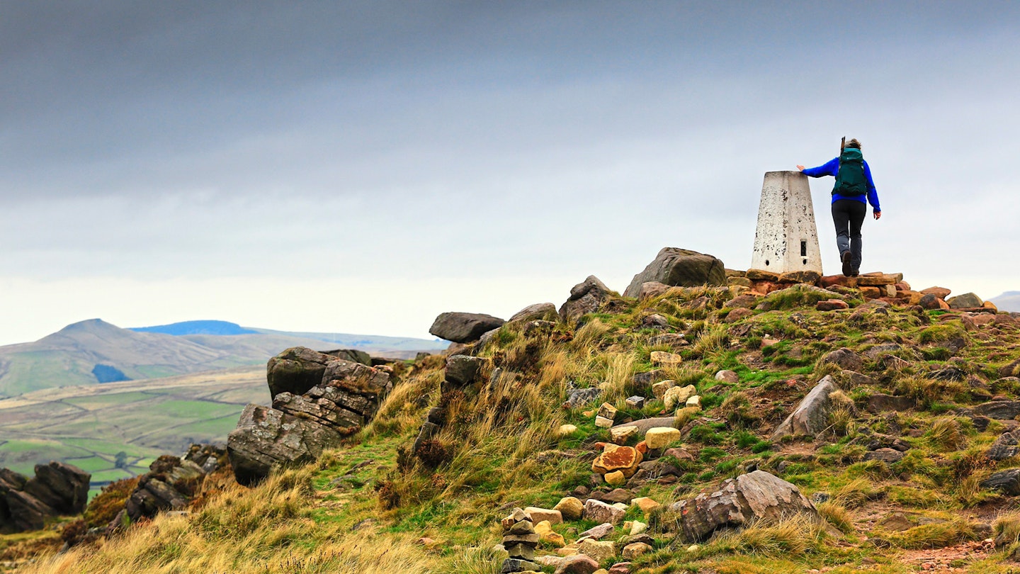
And yet, we don’t mind that between 1935 and 1962, around 6500 squat concrete pillars (often painted bright white) appeared on high points all around Britain. Trig points are okay. They’re friendly. In fact, some people love them. I mean, really really love them.
Maybe it’s the aesthetic: a simple, clean pillar. English and Welsh ones taper upwards and have cutely angled corner edges.
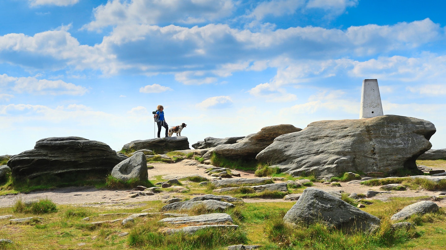
In some quarters (especially the Yorkshire Dales and the Lake District) they’re even more scenic, as they’re made from stones gathered from the very summits they stand on.
The Highland version – an elegant circular column – is no less magnetic.
Or maybe it’s their hidden complexity. A trig point looks like a dead, solid lump of concrete or stone, and yet the maths, physics and geometry going on inside it is slightly mind-boggling.
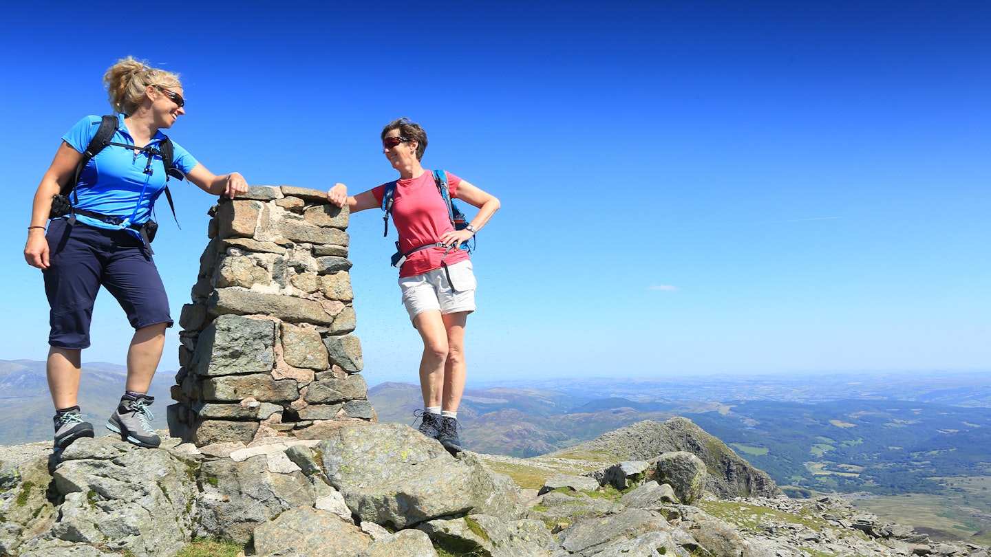
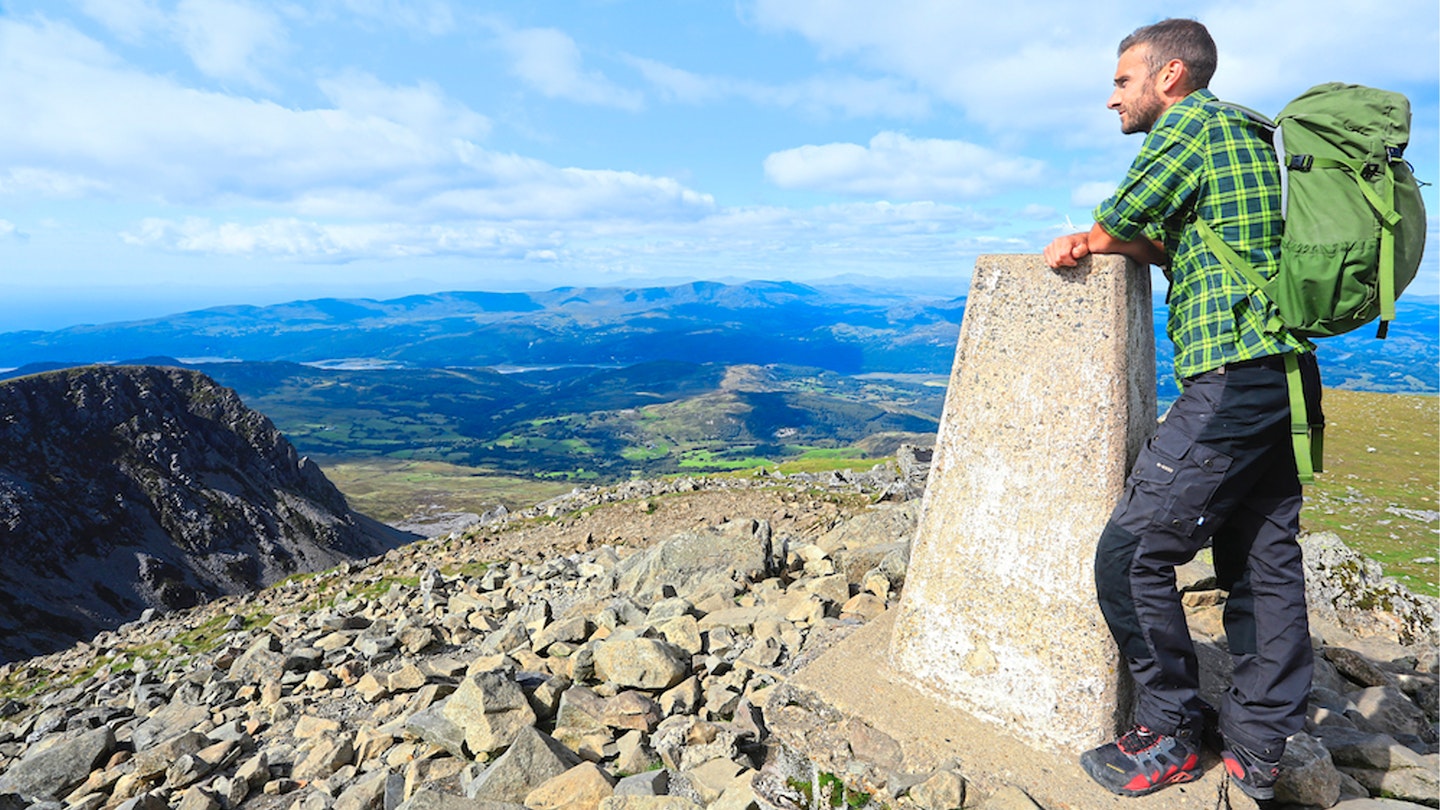
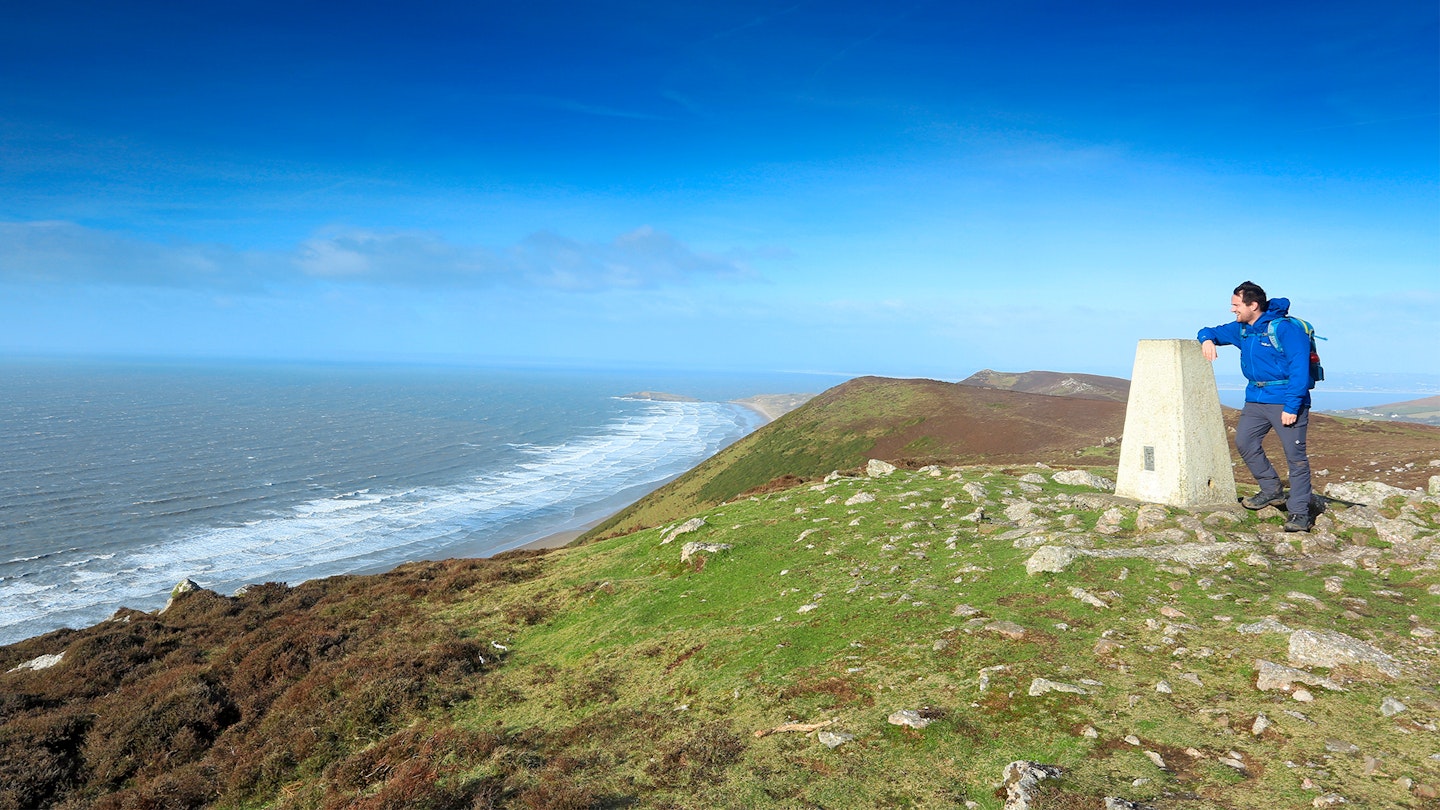
Or it’s their place in history. Trig points helped to create the most accurate and artistically pleasing maps the world has ever seen. Or it’s the fact that we can stand on them and have our photo taken.
The nature of a trig
But what are these things, anyway?
To tell the story of the trig point, we have to go back to a project called the Retriangulation of Great Britain, embarked upon by our national mapping agency, Ordnance Survey.
The nation’s first triangulation took place between 1783 and 1851, and it did a damn fine job for its time.
But by the 1930s, OS realised that a more refined and accurate triangulation was possible – and needed. And so, in 1935, they kicked off version 2.0.
The principle procedure would involve standing atop a high point and taking accurate measurements of the angles and distances between this point and two neighbouring high points, using a theodolite.
By connecting the data from the three points you would create a triangle whose distances are known precisely.
That triangle could then be connected to another using two more high points, then two more, then two more, and so on.
Eventually you get a network of triangles giving a complete and accurate record of the entire country.
For it all to work, an OS surveyor needed two things:
1. A fixed record of the height and location of the point on which they stood
2. A stable, weather-resistant platform on which to mount and operate the theodolite.
And Brigadier Martin Hotine had an idea that would provide for both needs: the triangulation column.
The dedicated Mr Hotine
Mathematician, cartographer, First World War army hero and now director of the retriangulation project, Hotine (say it like ‘hotline’ but without the L) was a stickler for absolute accuracy. His trig point was a simple structure but it would have surprisingly complex depths.
Buried in its base (for a trig point is like an iceberg; there’s more of it below the surface than there is above) would be an accurate marker for its exact location.
On top would be a flat platform containing a mounting bracket for a theodolite.
And fashioned out of concrete or stone, it would withstand the worst winds that the highest, remotest trig point could ever experience. The triangulation column, AKA Hotine pillar, AKA trig point: a masterpiece of simple but functional design.
(Their common name is curious, since ‘trig’ is short for trigonometric rather than triangulation. But ‘trigonometric point’ is just as accurate a description and ‘triang point’ just doesn’t sound right, does it?)
Under Hotine’s watchful eye, some 6500 trig points were established across the nation, starting with the one at Cold Ashby in Northamptonshire on 18th April 1936.
They ranged in height from -1m at Little Ouse in Cambridgeshire to 1345m on the summit of Ben Nevis.
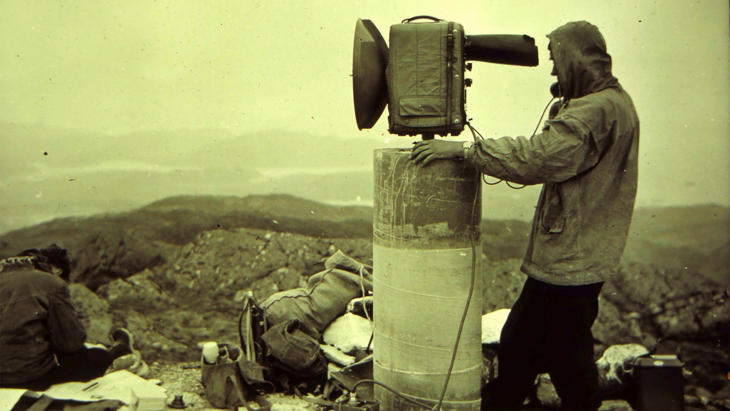
Each had to be close enough to its neighbours to be seen with a telescope, but far enough away to create the largest and most efficient triangles. The task of building them could be arduous, especially on high, remote or jagged summits.
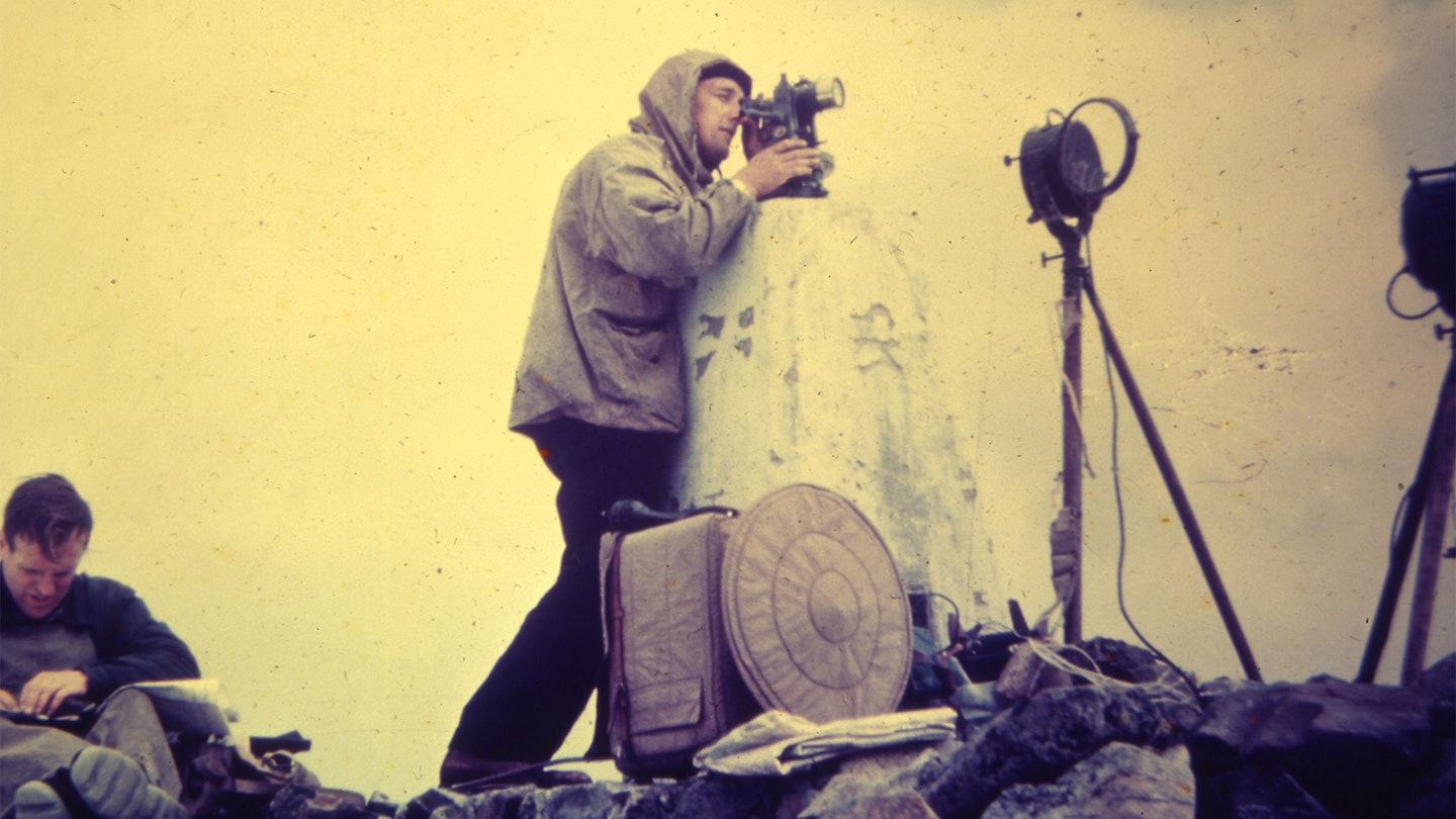
Teams of seven would lug 200lbs of equipment (including bags of concrete mix) to each chosen summit, with no guarantee of clear visibility at the top, entailing a long stay in sometimes frightful conditions.
Hotine’s chosen theodolite, the Cook, Troughton & Simms, weighed 45lbs by itself.
Once there, they’d have to establish the exact location (which meant they needed clear sight to the neighbouring heights before they could even start building), pour the concrete mix into its moulds (below ground and above), insert the accoutrements, and let it set.
Then wait. Sometimes horses could be commandeered to help carry the load up, but not always.
When a team arrived at Cadair Idris in Snowdonia, no horses were available as they’d pitched up in the middle of hay-making. And the construction took two weeks as the fog just wouldn’t lift.
In Scotland, the Ben Nevis team spent 22 nights on the summit, praying for a break in the cloud. And it wasn’t just a question of taking one or two readings in between the hailstones.
Hotine wanted dozens, so as to ensure the most accurate mean could be used afterwards. But, in testament to Hotine’s doggedness and the resilience of his teams, the job got done.
Britain was successfully retriangulated – and even today’s hyper-accurate GPS measurements are rarely able to correct their findings.
The trig today
Ever since, people have found all sorts of uses for them. Athletic types perform planks or heel-pulls upon them. Yoga enthusiasts assume Tree.
In some cases they’ve had national emblems such as rose, dragon or thistle stencilled on. Some have been artistically rendered as Wombles or Minions.
And some people bag them. Trig-bagging, the art of ‘collecting’ trig points, is a big thing.
At least two websites (trigpointing.uk and trigbagging.co.uk) exist to help you do it, with listings, top tens, advice, guidance, science and history.
But the Baron of All Baggers is Rob Woodall, from Peterborough, who in 2016 completed his 16-year mission to visit all of Britain’s 6190 still-standing trigs.
His final one was Benarty Hill in Fife, where OS execs presented Rob with a mounted flush bracket in recognition of his achievement.
His favourite, he says, is the one on An Teallach. Which brings us, handily, to Vanessas. They are the alternative trig design, used on remote or challenging Highland summits where a lighter load made all the difference.
At around 330kg, they are less than half the weight of a typical Hotine pillar. Hotine considered them less aesthetically pleasing, and insisted they should only be used where a standard pillar would be impractical.
The name Vanessa is a corruption of Venesta, the industrial washroom outfitting firm who provided the cylindrical mould for the columns (although contrary to myth, the mould was not based on a giant loo roll tube).
Silent and still
Somewhat sadly, trig points are now redundant. In the GPS era, the data they once gathered is now available on your phone, accurate to the millimetre, within seconds.
OS still owns the nation’s trigs, but they are mostly left to their own devices, and are only removed if they become unstable or dangerous.
But here’s the thing: they still work, because the tiny brass bolt at the core of every intact trig is still sitting there, ready for use. If GPS died tomorrow, you could pretty much retriangulate Britain from the trigs again, with a few gaps.
In that respect they remind me of the two manmade objects that are furthest from Planet Earth: the space probes Voyager 1 and 2, whose transmitter signals have vastly exceeded their expected battery life and who are now way beyond our solar system in interstellar space.
Still out there, still working. Same with trigs. Somewhere, Brigadier Martin Hotine must be a very proud man.
What’s inside a trig point?
Deep in the foundations of each trig point is the lower centre mark, a brass bolt which is set at the highest available level of firm rock (if the topsoil is soft, like peat, the centre mark had to be buried down at the first stratum of rock – sometimes 15ft below the surface).
This marks the exact location of the trig. The bolt is encased in a wooden box to separate it from the trig structure, so that even if the trig is moved, the bolt stays where it’s meant to be.
An upper centre bolt sits directly above the lower one, at the foot of the above-ground structure.
A centre pipe directly connects that bolt to the base of the spider (the mounting for the theodolite), enabling the spider to be fixed in precisely the right place.
Four angle irons bind the base block to the upper structure. Finally, the flush bracket is an ID plate giving the trig point’s number and its benchmark (the triangular symbol).
About the author
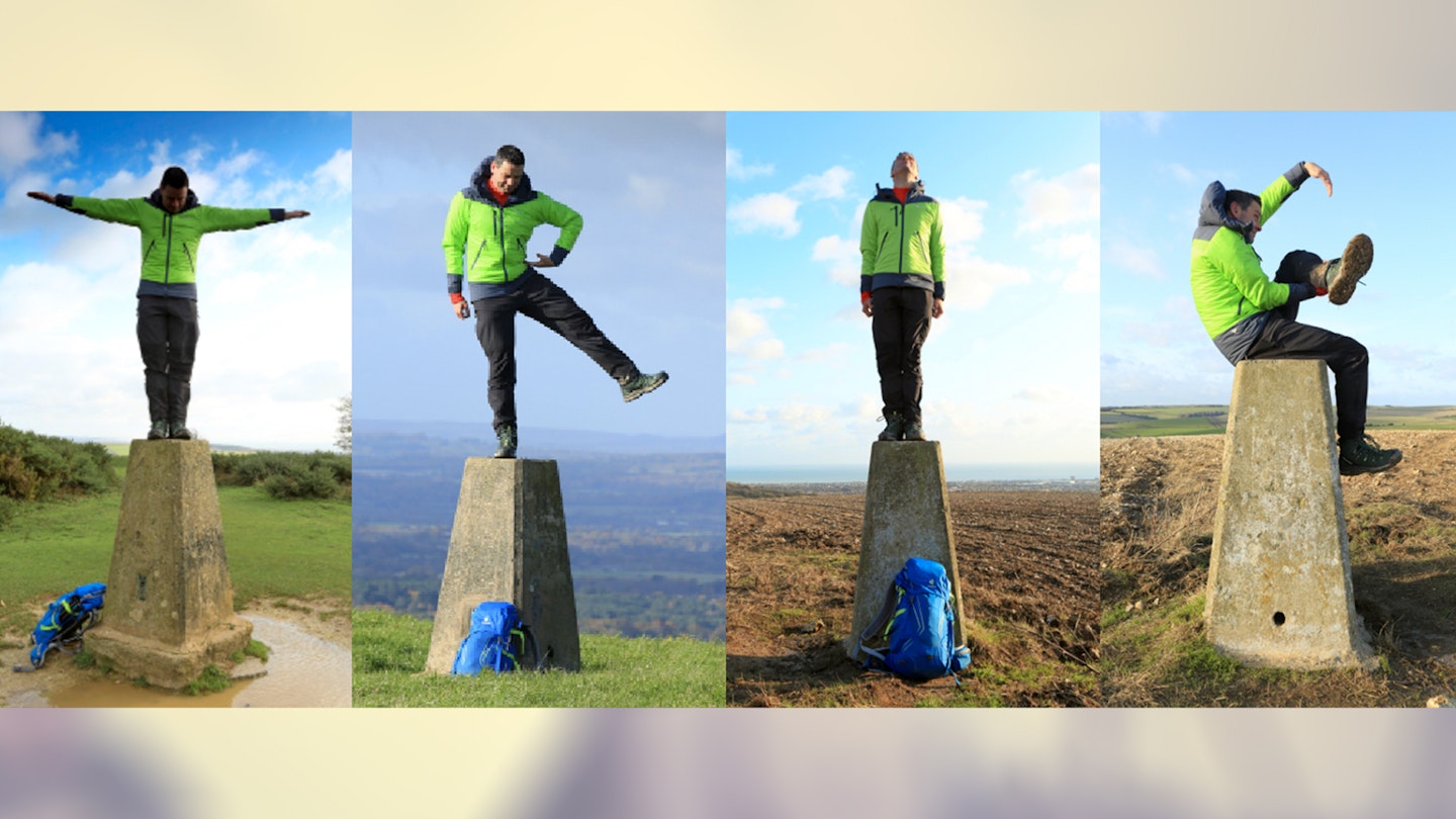
Nick Hallissey is the head of content for Country Walking (in which this story originally appeared) and Trail magazine, and he’s been chipping in on LFTO since the site was born over 15 years ago – and doing stupid things on trig points for much, much longer.
Here he is trying to spell out TRIG on four different trig points using his body. Apparently the human body is not designed to mimic the shape of a G.