
There’s something very special about climbing every inch of a hill or mountain’s full height, and there’s no better way to appreciate doing so than by literally starting at sea level.
Many UK mountains dip their toes in the sea before rocketing to the skyline – here are eight of the very finest, from mini to mighty.
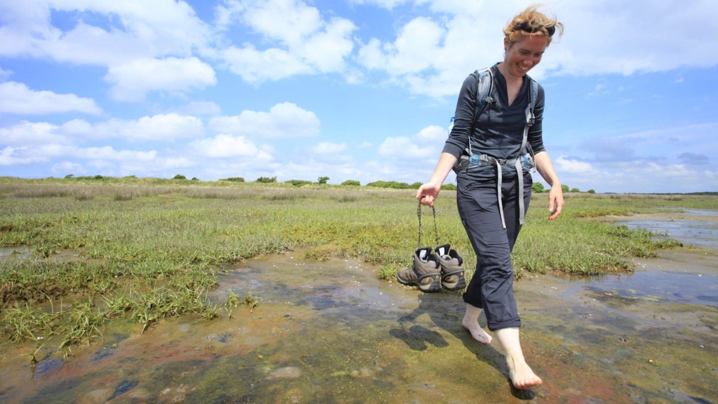
Beacon Hill, Norfolk
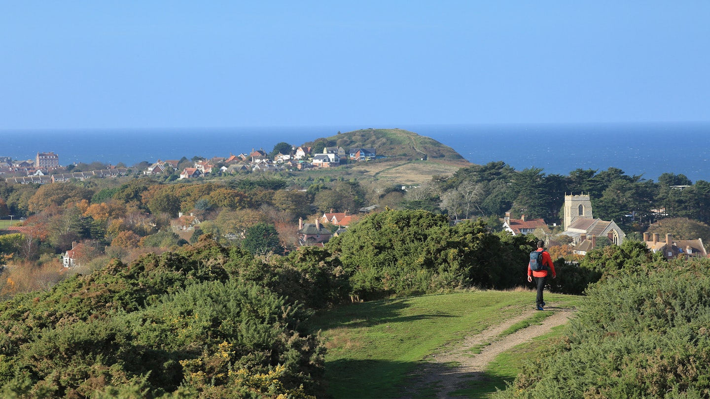
The east of England isn’t famed for its mountains, but a fabulous walk from the bright beach huts of Sheringham will put you on top of three surprising ‘peaks’, including a county summit. First is Beeston Hill.
Fondly known to locals as Beeston Bump, it’s a 207-ft tall walnut whip of glacial till left by retreating ice. It was once bumps plural; the sea ate its twin and it’s now eroding the survivor, forcing Black Shuck, the ghostly black hound with red eyes said to live inside the bump, into increasingly cramped conditions.
Long sandy views morph to woods as you turn inland for Beacon Hill, and the top of Norfolk at 344 feet. The triumphant spot where a fire beacon once stood is now marked with a flagpole, and earthworks have earned the hill the name Roman Camp (although it’s likely that bit of ancient history was made up by the drivers of horse-drawn cabs in the 19th century to boost tourism).
The last in the trio is Incleborough Hill, a gorse-flecked ridge set a little back from the coast but yielding possibly the best views of the day, with its terrific panorama of the shoreline and Beeston Bump.
Just don’t mistype the name of Incleborough in your sat nav; you’ll end up in the Yorkshire Dales at a far more famous hill which is very nice but nowhere near the sea.
Arnside Knott, Cumbria
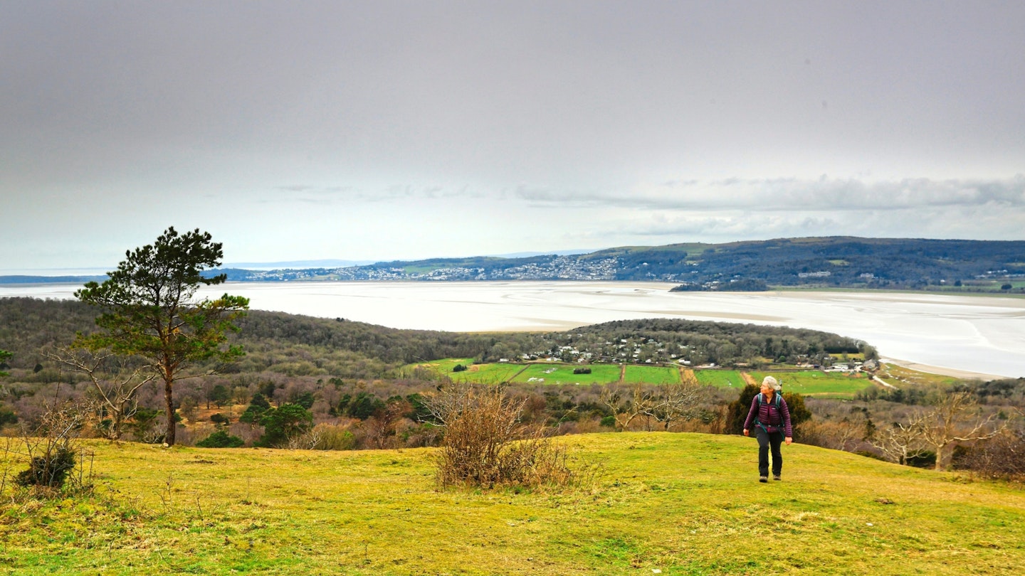
Such a little hill; such a grand view. Just 522 feet (159m) from sea to summit, Arnside Knott pops up in the tiny Arnside and Silverdale Area of Outstanding Natural Beauty to claim the title of ‘smallest Marilyn’ (the 1557 peaks in Britain with a prominence of 150m).
The estuary of the River Kent runs down the fell’s north side, sweeps round its western foot and fans out into Morecambe Bay to the south – which means more than half of the Knott’s hem rests in the tidal zone, sometimes gilded in sand, sometimes silvered in brine.
Paths meander this way and that around the hill, so you can flit between views much like the butterflies that relish the Knott’s mix of limestone grassland and deciduous woodland. And a topograph up top (but not at the summit trig point) explains the many, many Lakeland fells you can see to the north.
The national park begins in the sands of the Kent – while out in the western vista, subtly curving above Hampsfield Fell is a hill called Black Combe. More on that one later…
Golden Cap, Dorset
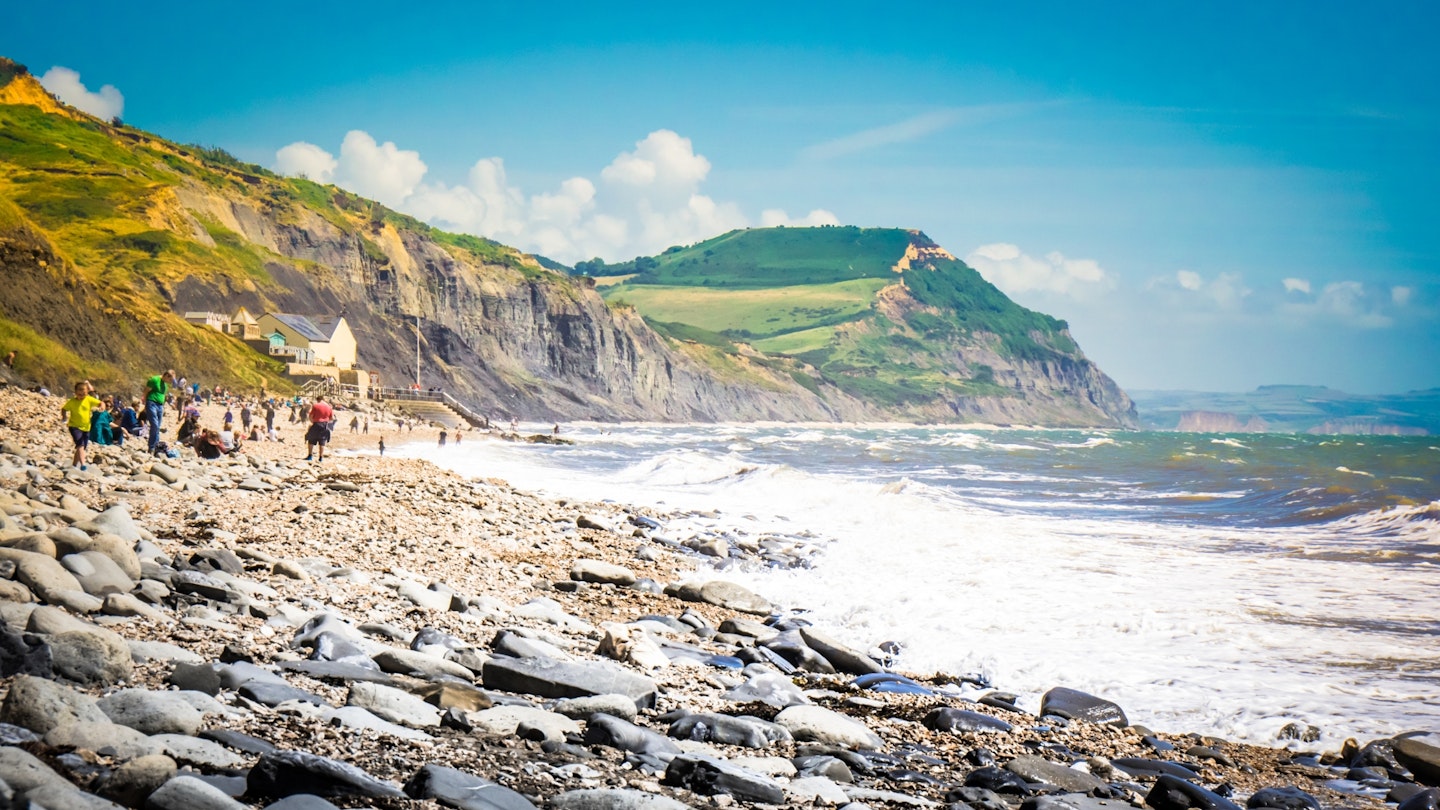
Is it a hill? Is it a cliff? Many (including us) dodge this technical hair-splitting and describe the flat-topped summit as both – because what does it really matter when the view’s this good?
At 627 feet (191m) it’s the highest point on the south coast of England, a perch from which you can see right around Lyme Bay from Portland Bill in the east to Start Point in the west.
Its lower slopes are built of dark Jurassic mudrock, its cap made of golden Cretaceous sandstone which gives the hill/cliff its name, and it’s all a bit fragile in construction so check for warning signs of recent landslips.
Its profile has been likened to the front end of a Boeing 747 or one of the old Carvair car-transporter planes, but we’ve occasionally referred to it as Ingleborough-on-Sea because of that flat top and plunging prow. (That’s two references to Ingleborough in the same article; we’re not obsessed, honest.)
Trace a loop from Seatown to Charmouth and you’ll walk from sea level onto Golden Cap twice, as the South West Coast Path leads you up past the Cap’s trig point, returning by paths high on its inland slopes looking across the lush fields of Dorset.
Rhossili Down, Swansea
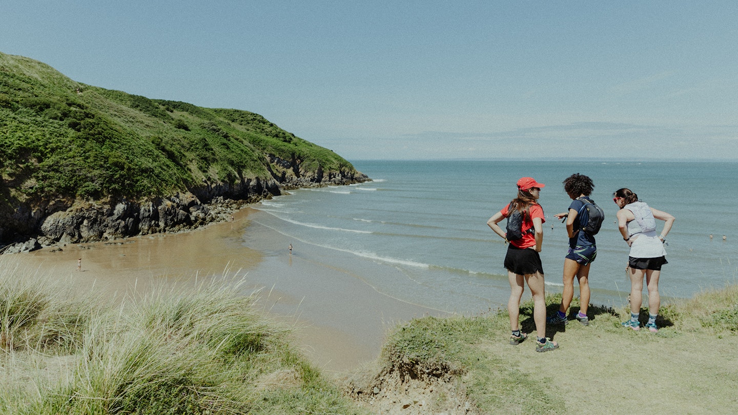
The beach at the tip of the Gower Peninsula in south Wales is one of the most perfect in Britain. The golden sands of Rhossili stretch almost three miles in a gentle arc, bookended by the tidal islands of Burry Holms and Worms Head, and it all faces due west into the sunset.
And there’s more. Two thirds of it is backed by a shelf of downland, so you can walk out by the waves, turn through the dunes, and return a few hundred feet above, with panoramic views across it all.
On the sand you’ll pass the wooden bones of the Helvetia, wrecked in 1887; up on the heathery heights of Rhossili Down you’ll pass a WWII radar station and Stone Age burial chambers, and at The Beacon – the highest point on Gower at 633 feet – you’ll be standing on the site of a Bronze Age cairn.
As the tide goes out, four more summits by the sea become accessible to adventurous walkers: Burry Holms, and the three tops of Worms Head - from wyrm meaning sea serpent – as it writhes a mile out into the waves.
Watch those tide times carefully though or you could get stranded, and the outer top of Worms Head is closed March to August to protect nesting birds.
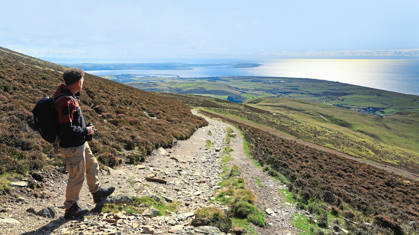
Black Combe, Cumbria
Poet William Wordsworth said of this fell: ‘the amplest range of unobstructed prospect may be seen that British ground commands.’ Lakeland’s most famous guidebook writer, Alfred Wainwright, wrote: ‘Its ascent… is one of the most rewarding. As a viewpoint it is unique.’
But forget those two, TV presenter Paul Rose told us: “You just can’t go wrong with this one… there is an immediate sense of space and wild places, the views are terrific.” Beat that, TGO!
Black Combe sprawls – like a jelly melting on a hot day – at the southern cusp of the Lake District, just before the national park sinks into the Irish Sea.
At 1970 feet it’s a wafer shy of the 2000 feet commonly used to define a mountain, but surroundings are as important as height. It’s at least 10 miles before the ground climbs as tall inland, 46 before Snaefell crowns the Isle of Man out to sea, and thus the view sprawls far and wide.
The most popular route climbs from Whicham Mill on the fell’s eastern side, but if you’d like more sea before your summit, start at Silecroft (station, or park at beach) and stroll the England Coast Path to Gutterby.
Turn inland on paths to Whitbeck, where a bridleway heads north to lasso round Little Fell to the top of Black Combe, and back down to Kirkbank and Silecroft – keeping the sea in view for 12 shining miles.
Criffel, Dumfries and Galloway
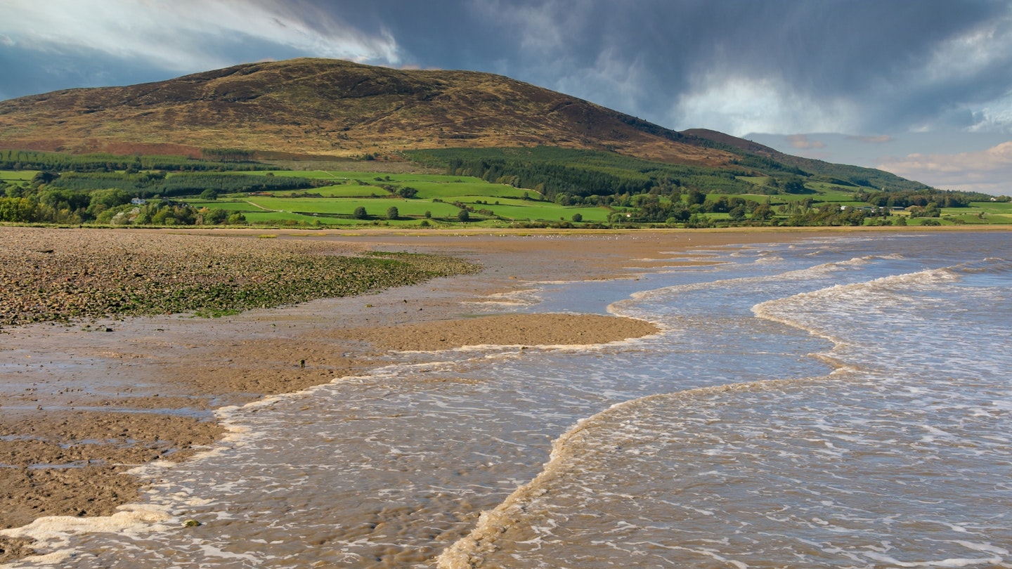
Look north from Black Combe, across the western foothills of the Lake District, across the Solway Firth, across the border into Scotland, and on a clear day you can pick out the rounded summit of Criffel.
It too has a foot in the water and an isolated position that lets the views unfurl uninterrupted, except the one from here extends deep into the Southern Uplands, to Merrick and White Coomb.
The path to the crown of Criffel starts on the inland side at New Abbey (which means sea to summit purists will need to add a detour). Like a trailer for what’s to come, the ever-shifting, shining channels of the Nith estuary soon dominate the scene to the east.
And then, as you climb the last few yards to the trig point (what are trig points anyway?) at 1867 feet, the full panorama south across the Solway to the Lake District is revealed in a sudden, spectacular ta-da. For many, it will be a view of such giants as Skiddaw and Grasmoor as they have never been seen before.
As if to signal the magnificence of the view, there’s also a six-foot tall cairn, named after a Douglas who might have been an Earl of Morton.
If you’re in this locality and in the mood for more sea-to-summit thrills, try Screel Hill a little further west, just south of Castle Douglas. It’s a shorter, sweeter climb than Criffel with forested flanks, a rough, rocky summit (1129 feet) and views that can rival those of its larger neighbour.
Ben More Coigach, NW Highlands
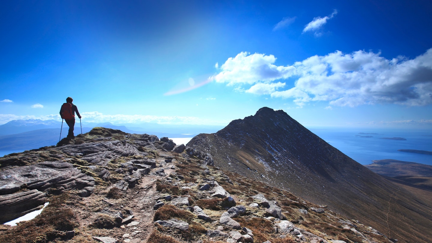
Like the prow of an ocean-going liner about to launch, Garbh Choireachan angles above the waves of the sea-greeting Loch Broom. Close behind, and forming the bulk of this rocky ship, sails Ben More Coigach, the two tops linked by a bridge of sandstone.
From the end of the lane near the crofts of Culnacraig – just half a mile from the sea, seven miles north west of Ullapool – the massif looks about as scalable as the hull of the QE2, and as you walk closer the gradient only gets more daunting.
Have faith though: there is a way up. Dashes of path sketch a just about traceable, sometimes hands-on route through rubbly ledges to the seaside end of the ridge; here you can imagine you’re Rose, soaring high above the waves, surrounded by sky.
The Summer Isles speckle the sea over 2000 feet below, while a car ferry looks as tiny as a Tonka toy as it heads for the Outer Hebrides on the horizon.
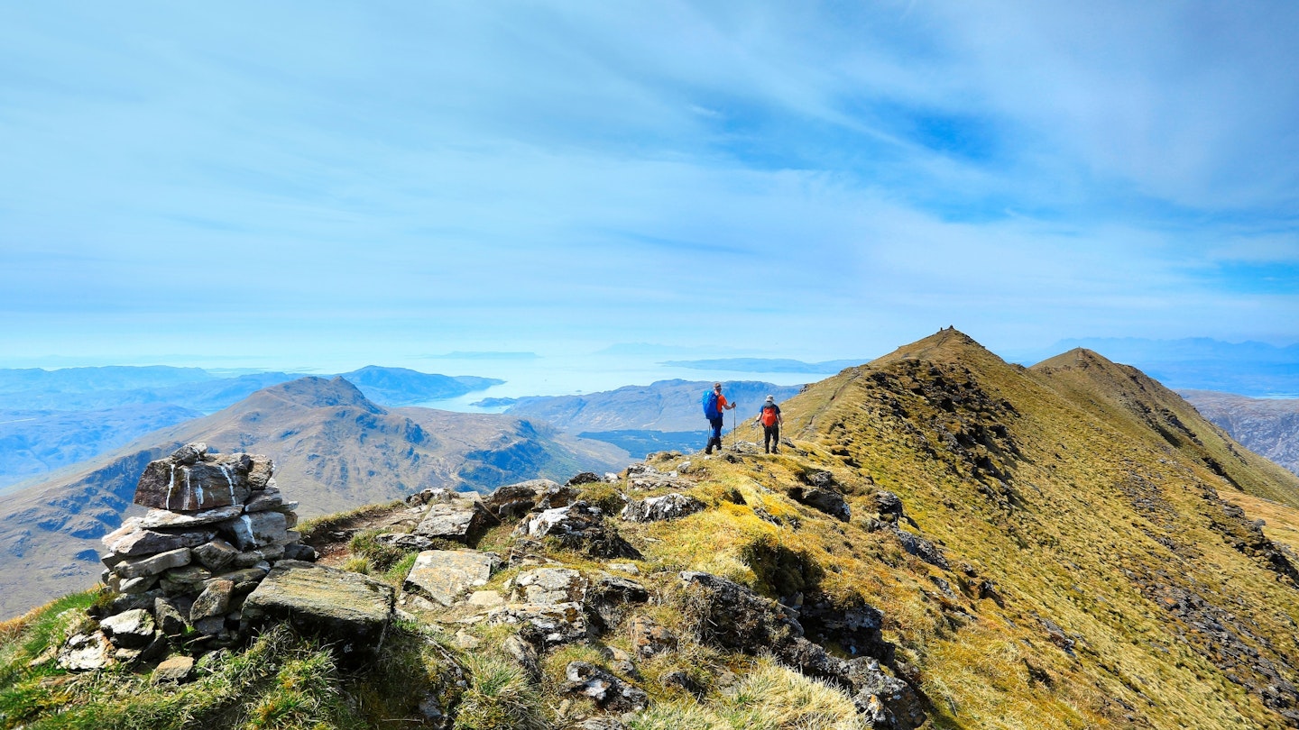
Thrills lie inland too. First, you cross the narrow, crenellated ridge to Ben More Coigach, its airiest spots bypassed by paths just below. Second, you stand on the summit at 2438 feet, at the highest point in the Scottish Wildlife Trust’s largest nature reserve, with views over what must be nearly all its 6000 hectares.
And third, after a deep dip and climb, you reach the top of Sgùrr an Fhìdhleir which is arguably the best spot there is for admiring the island mountains, or inselbergs, of the Assynt to the north.
Stac Pollaidh lies just across Loch Lurgainn, Suilven and Cùl Mòr beyond and Quinag beckons in the distance, while the sea sparkles to the side.
The Fiddler, as this peak is fondly known, presents pyramid-sharp contours to those much-admired peaks, as if competing with their eye-catching lines. But to the south-east it drops a moorland ramp back to Culnacraig, with Ben More Coigach and Loch Broom filling the prospect.
And if you’re keen to explore more beside the sea, the Postie’s Path clings, often narrowly, to the cliffs round to Strathcanaird. Recently repaired, its seven miles are just part of the long route once trodden by hardy posties as they delivered mail from Ullapool to this wild Coigach peninsula.
Ladhar Bheinn, Knoydart
At 3346 feet (1020 metres) this is the highest peak in our sea to summit line-up and the only one to qualify as a Munro (Scottish mountain over 3000 feet). Just getting to where it dips a toe into the salty water of Loch Hourn, far out in the ‘Rough Bounds’ of Knoydart, is a big adventure.
From the village of Invergarry in the Great Glen, the trip includes a 22-mile drive down the longest dead-end road in Britain to Kinloch Hourn, then a seven-mile waterside walk to Barrisdale Bay.
What rewards await, though. The fjord-like upper reaches of Loch Hourn widen, gold sands collect in the bay, and Ladhar Bheinn rakes skywards in bewitching cliffs, ribs, ridges, points. To fully relish this beauty, we’d suggest staying the night at Barrisdale (campsite and bothy) to give yourself a full day on this ‘hoofed mountain’.
The route starts steadily on an old drovers’ route to Mam Barrisdale, before tussocking steeply up to the ridge between Aonach Sgoilte and Stob a’ Chearcaill, where things get a whole lot rockier.
Below, the ice-riven hollow of Coire Dhorrcail opens up; ahead a sharp line of crag, hands-on and high, scrambles to the top of Ladhar Bheinn, with the trig point a short way beyond the true summit.
Mountains fill the view around the compass, including out to sea where the Cuillin of both the Isle of Skye and of Rum crinkle sharply.
The descent is as thrilling as the ascent, first crossing a cloud-scraping blade to Stob a’ Coire Odhair, then setting out on a plumper ridge beyond, before angling into the depths of Coire Dhorrcail, and a stalkers’ path back to Barrisdale Bay. It’s a tough walk – remote, scrambly, steep, frequently vertiginous – but it’s one that will linger long in the memory.
About the author
Jenny Walters has been writing for Country Walking magazine for almost 20 years. She's tramped in New Zealand, trekked in Peru, hiked in the Alps and walked all over the British Isles, from Cape Wrath to Cape Cornwall, Mount Brandon to Yr Wyddfa.