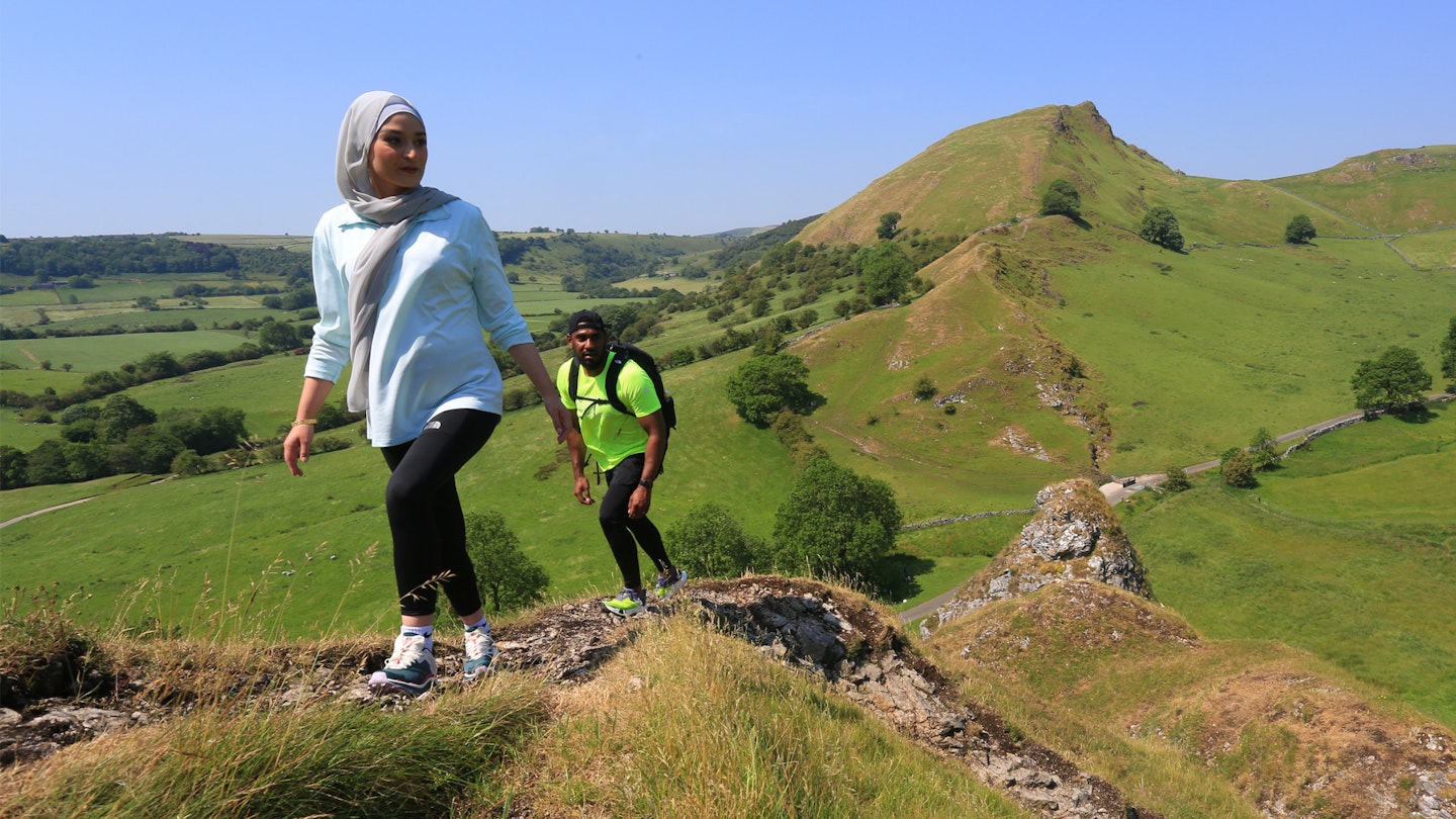
The Peak District is the oldest National Park in Britain, with a wide variety of walking and hiking routes for all ages and abilities.
The park's identity is inextricably tied to the famous Pennine Way long-distance trail, which starts in Edale. But there's plenty more to see in this vibrant and varied region, including iconic gritstone edges and limestone caves. While the Peak District shares the rolling hills and stunning landscapes with its sister park, the Lake District, this area has a lot more to offer for those more inclined towards climbing and caving.
Put simply, if you buzz off big rocks, go see these peaks immediately. Be sure to also explore the vast moorland plateaus, plus too many pubs and cafes to pick from in quaint villages and towns like Castleton and Bakewell.
We’ve rounded up some of the most popular Peak District walks below, with mapped digital routes for you to download and follow in OS Maps.
The best walking routes:
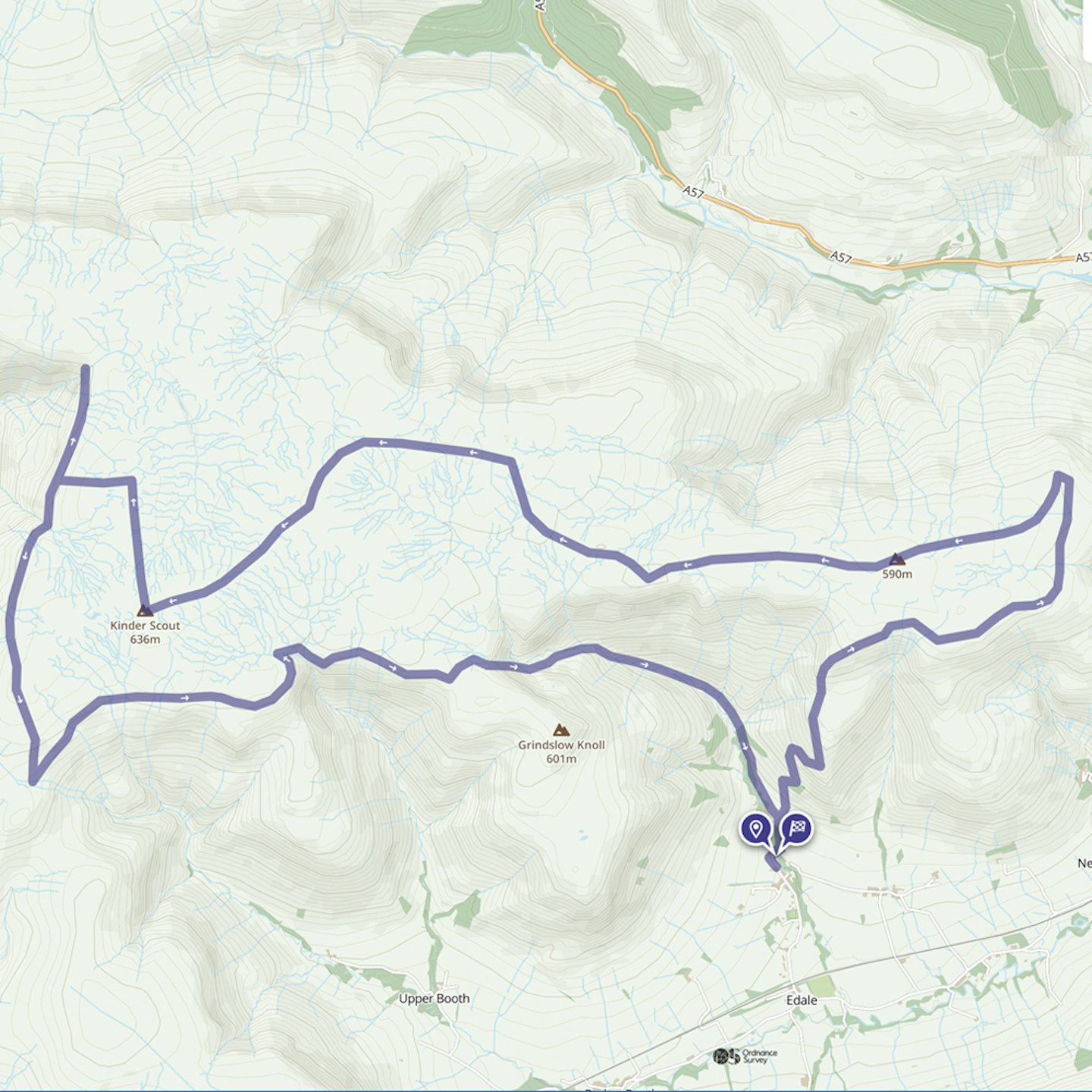
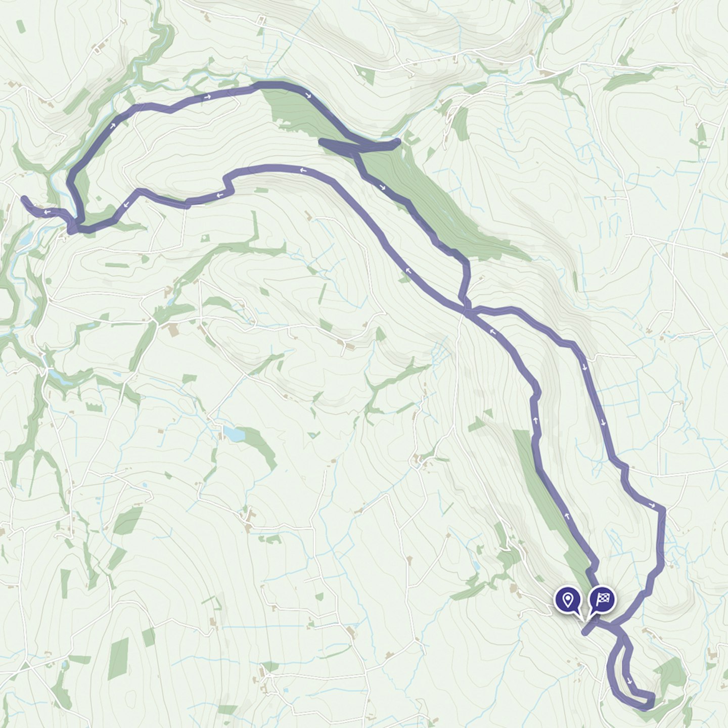
Kinder Scout Edges | 20.36km | 585m ascent
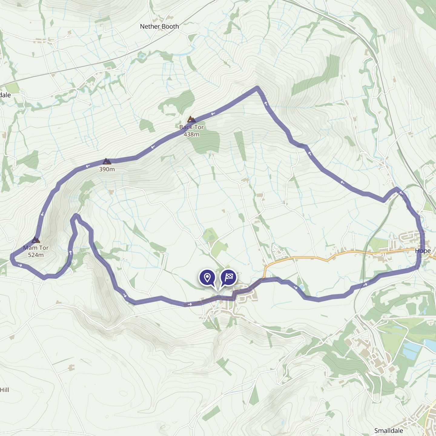
Mam Tor and the Great Ridge | 13.17km | 473m ascent
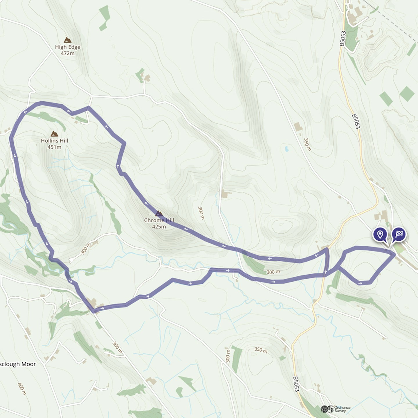
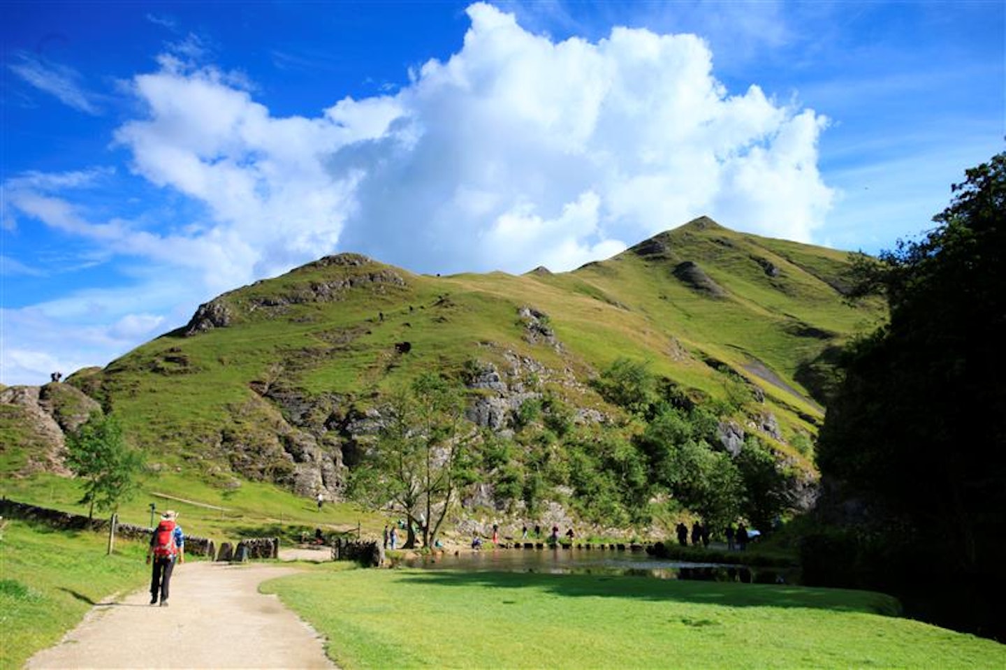
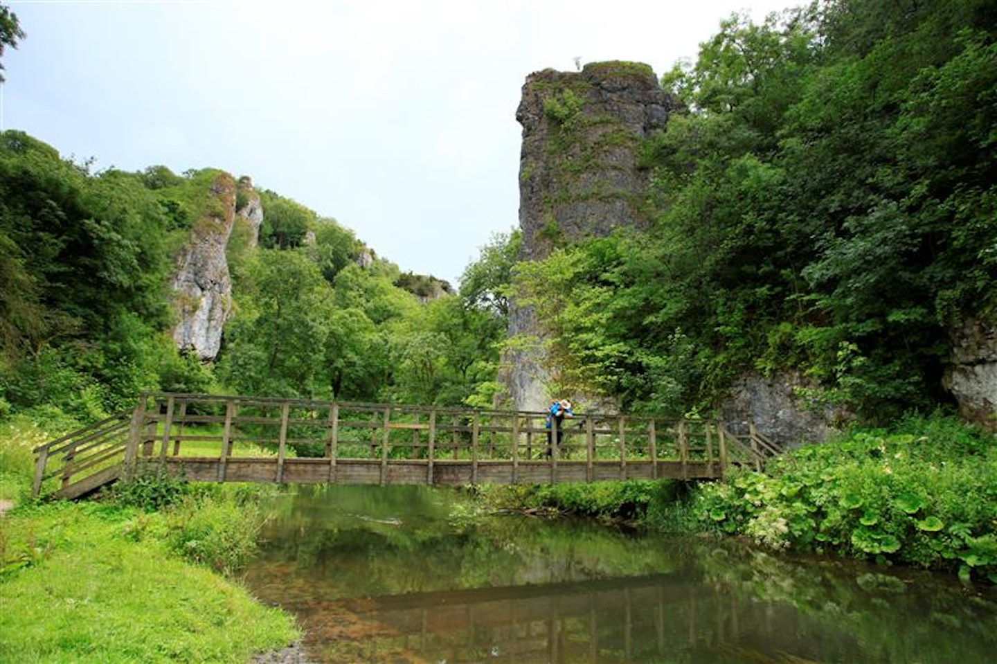
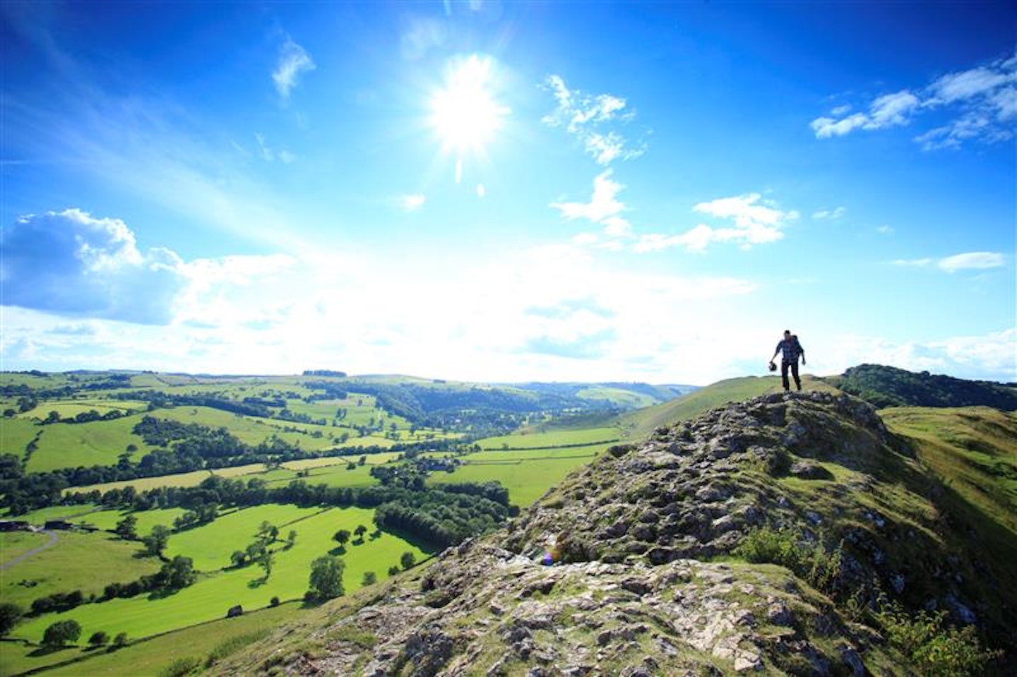
Chrome Hill and Parkhouse Hill | 8.95km | 475m ascent
The Roaches | 18.92km | 685m ascent
Stanage Edge | 22.48km | 592m
We've included routes ranging from intermediate to expert difficulty. Be sure to read our mountain safety advice at the bottom of this article if you're thinking about bagging some peaks. This region is ideal for gaining confidence on technical terrain and improving your scrambling.
Don't forget Trail magazine members get 50% off an annual subscription to OS Maps.
The best Peak District walks in detail
wild moorland plateau
The Route
Distance: 20.36km / 12.7 miles
Elevation Gain: 585.23m
Difficulty: Expert
A circuit of the highest peak in the National Park, with its wide-ranging views and rock features, is probably the most rewarding Peak District route of all. You can start from Edale with a steep pull up to the rock formation of Ringing Roger via The Nab. Make tracks past Ringing Roger’s dramatic geology and cling to the barren plateau of Kinder Scout, with the steep drops behind you delivering far-reaching views.
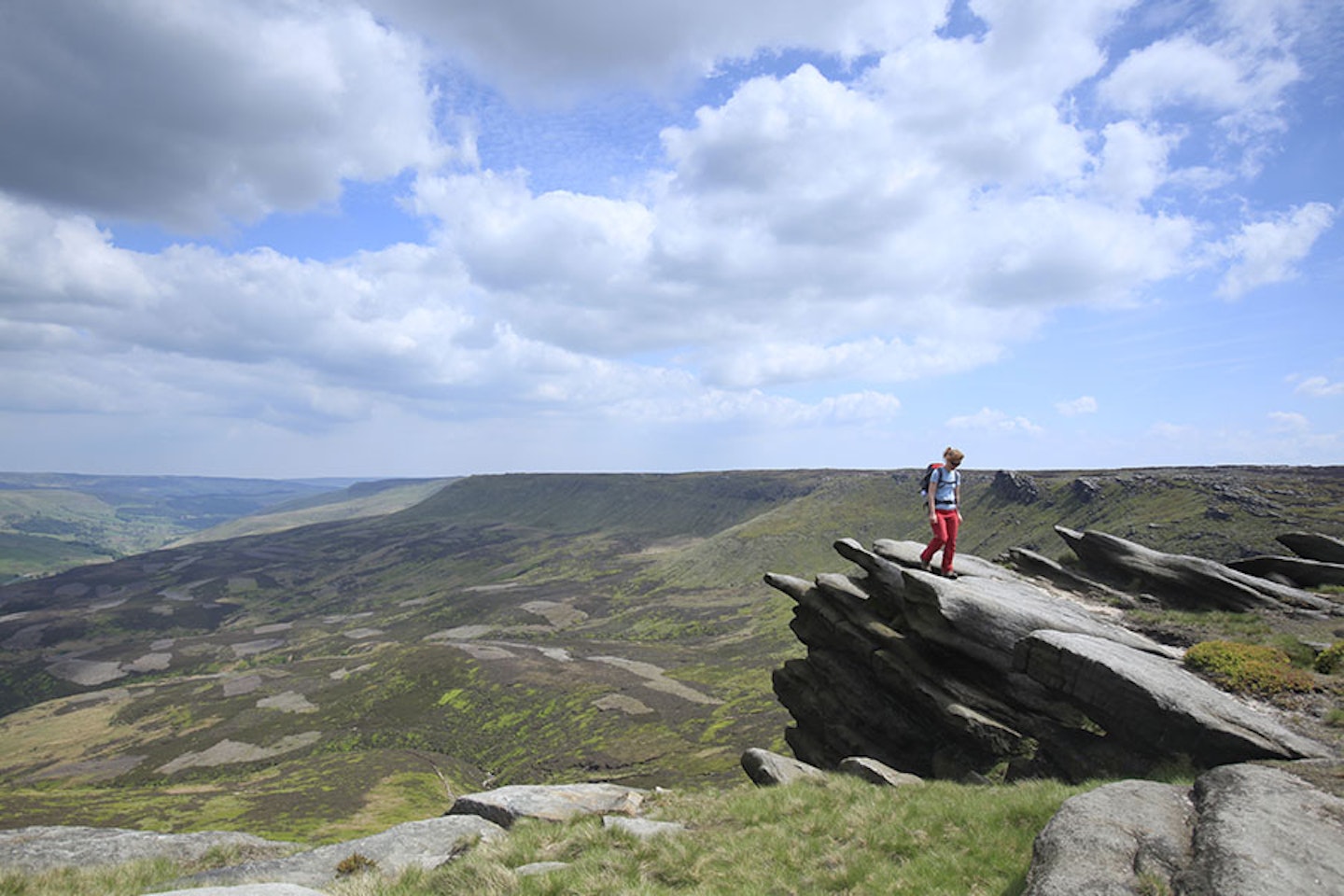
From here, you can make it up as you go because this vast expanse of peat bog has no real defined summit, yet plenty of fascinating features to explore. Those include the waterfall of Kinder Downfall, the Seal Stones rocks, Noe Stool, the Wool Packs and Jacob’s Ladder. Make sure you brush up on your map and compass skills though, because it’s a nightmare to navigate in poor visibility.
rolling ridge walk
The Route
Distance: 13.17km / 8.1 miles
Elevation Gain: 473.4m
Difficulty: Advanced
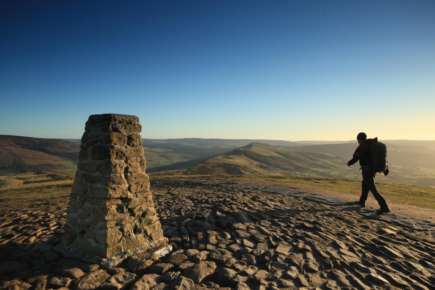
There are many great reasons to walk Mam Tor and The Great Ridge, but one of the biggest has to be witnessing the Peak District’s contrasting geology. Start in the village of Castleton where, if you fancy making this a long walk, you can add early excitement to the lower elevations by hiking The Limestone Way through Cave Dale before tackling the ascent to Mam Tor’s 517m summit. From there the whole of the Great Ridge strings out ahead of you to the north-east, heading over Hollins Cross and Back Tor to its finish at Lose Hill.
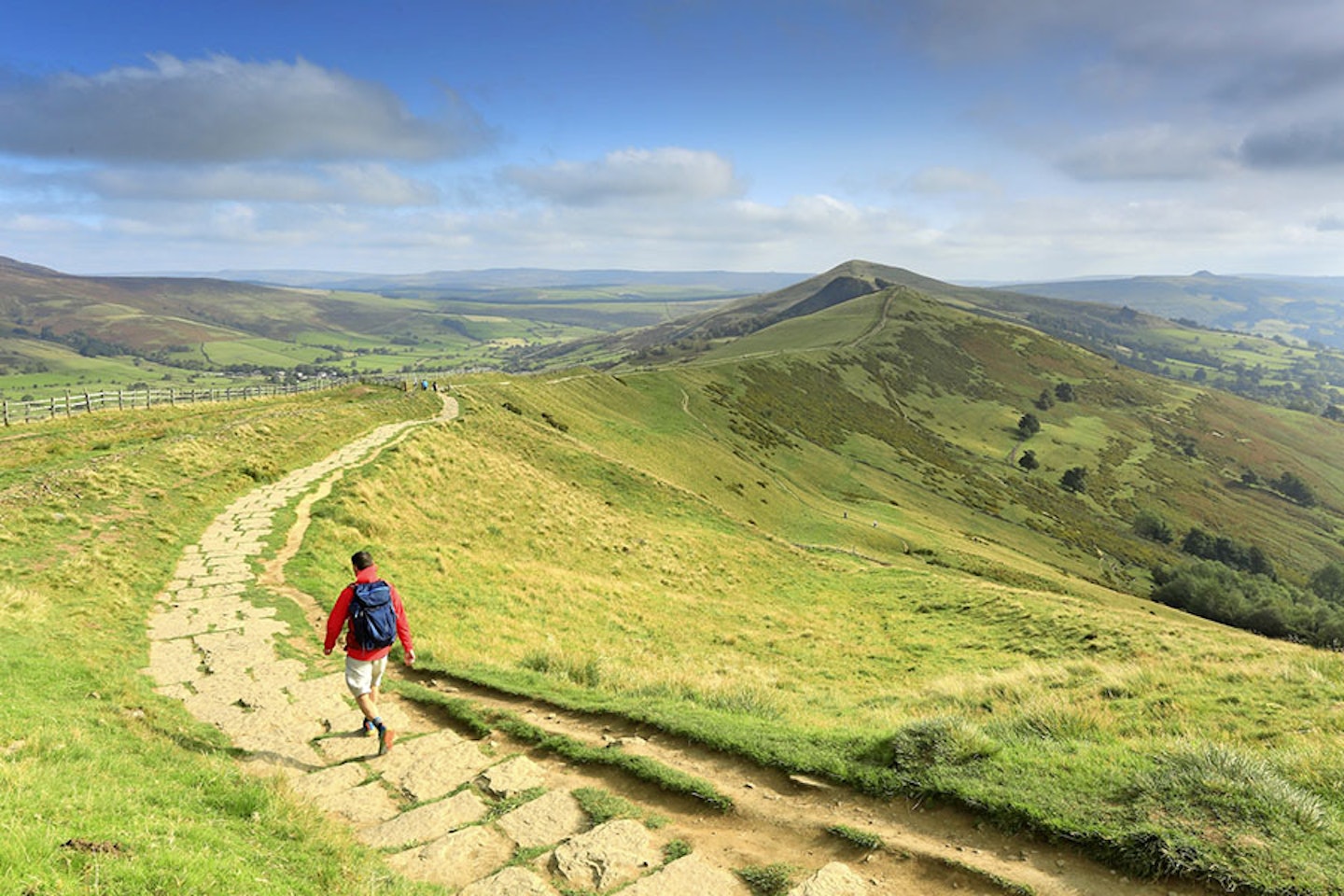
As you walk the backbone of the ridge you get to appreciate the landscape of both the White and Dark Peak, with views stretching across the limestone hills in the south and gritstone edges in the north that define the two key characteristics of this famous National Park. This well-marked ridge is a fantastic family option and is not complete without a cuppa in Castleton when you finish.
Get Trail magazine's Mam Tor and the Great Ridge digital route
perfect pointy peaks
The Route
Distance: 8.95km / 5.5 miles
Elevation Gain: 475.69m
Difficulty: Advanced
The classic White Peak territory of Chrome Hill and Parkhouse Hill makes for beautiful hillwalking. Intersecting dry stone walls, stiles and plenty of suspicious sheep definitely give it the feel of a proper English countryside walk.
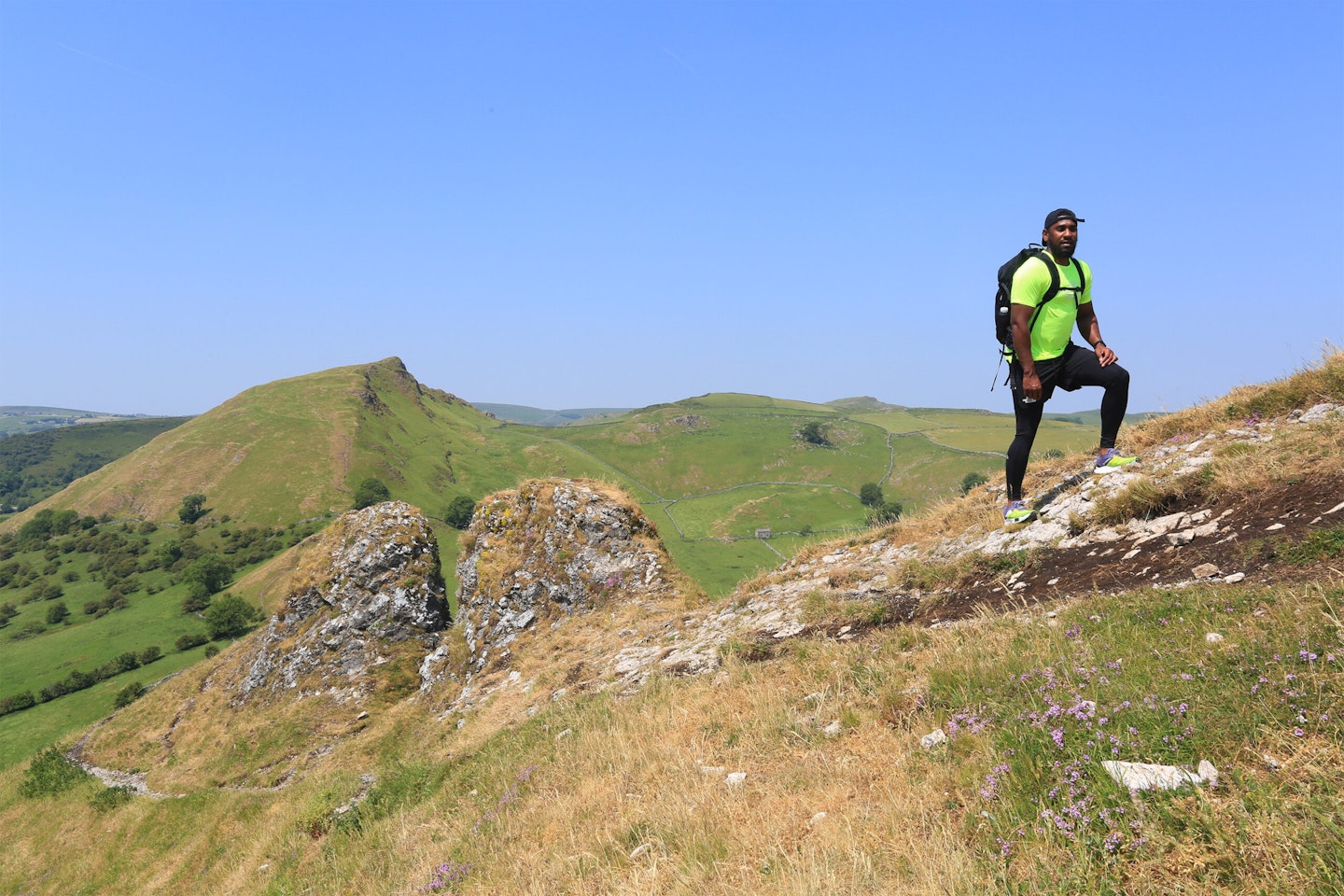
As you climb up and down these spectacular limestone protrusions, you’ll be walking atop former sea-beds. And don’t be fooled by their relatively low elevations because – on Parkhouse Hill particularly – there are plenty of steep drops and descents where you’ll need to carefully watch your step. You can bag both hills in a relatively short loop that will be over way too quickly, but this is as spectacular a landscape as you’ll find anywhere in the Peak District so linger as long as you can and take plenty of photos.
Get Trail magazine's Chrome Hill and Parkhouse Hill digital route
4.
The Roaches
jagged rocky edge
The Route
Distance: 18.92km / 11.7 miles
Elevation Gain: 685.54m
Difficulty: Advanced
Wildlife, stunning terrain and mythical tales make the Roaches a top choice for hillwalkers. These iconic crags deliver a classic hike with expansive views to Cheshire and even Snowdon on a very clear day. If you’ve ever driven the A53 from Buxton to Leek, you’ll know the views out of the car window compel you to pull over, lace up your boots and walk The Roaches.
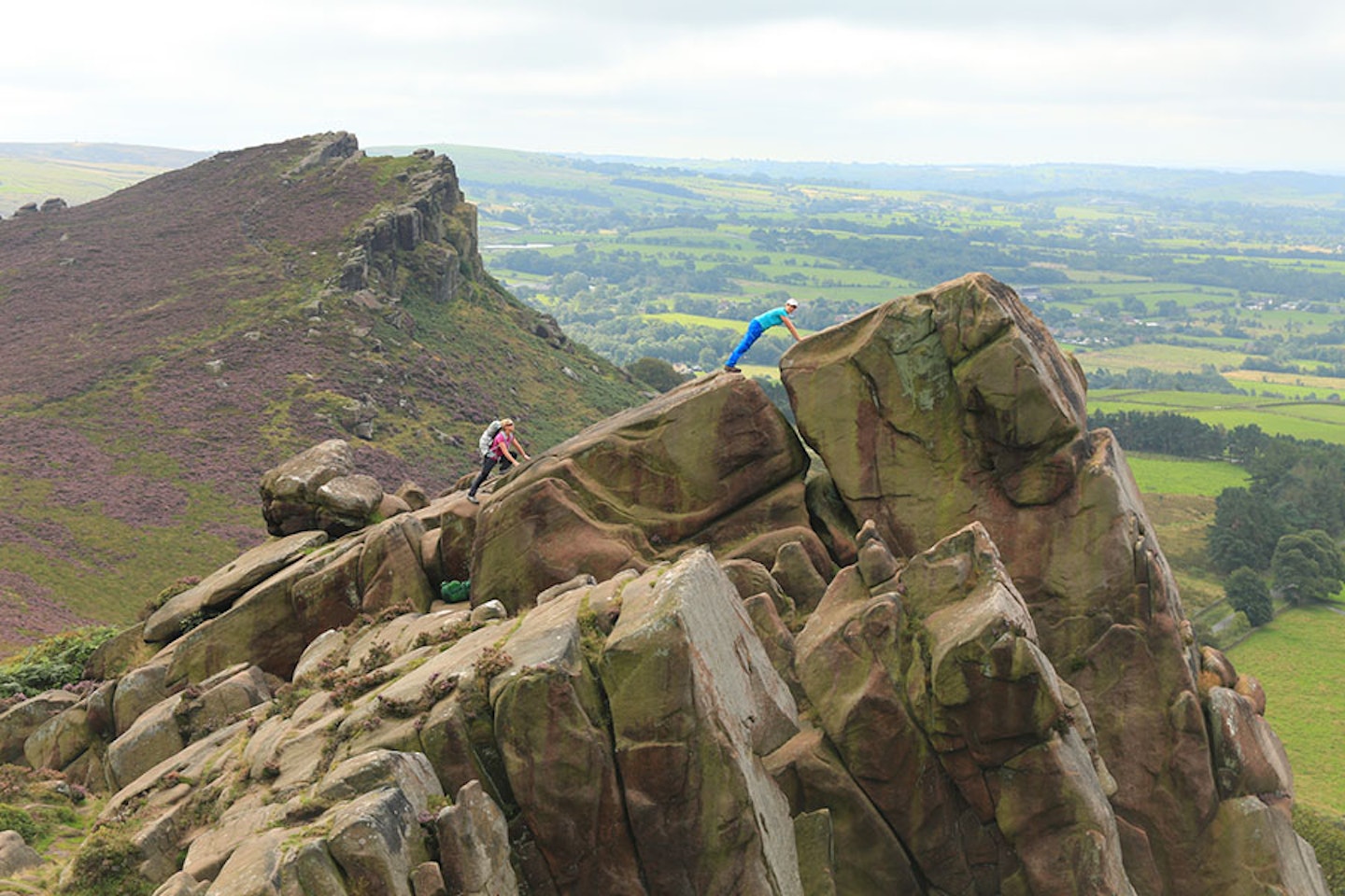
Up on the dramatic outcrops, surrounding the 505m summit, birdlife is abundant, with grouse, swooping buzzards and even peregrine falcons hiding in the crags. Keep a watchful eye for a bounding wallaby, which were accidentally released in the area back in WW2 and are rumoured still to be bouncing around the hills. If you’re feeling extra determined, throw in the climb of neighbouring Hen Cloud. The escarpment certainly has a mystical quality, especially given that Doxey Pool, which you’ll pass on the way, is said to be inhabited by the spooky mermaid Wicked Jenny Greenteeth.
5.
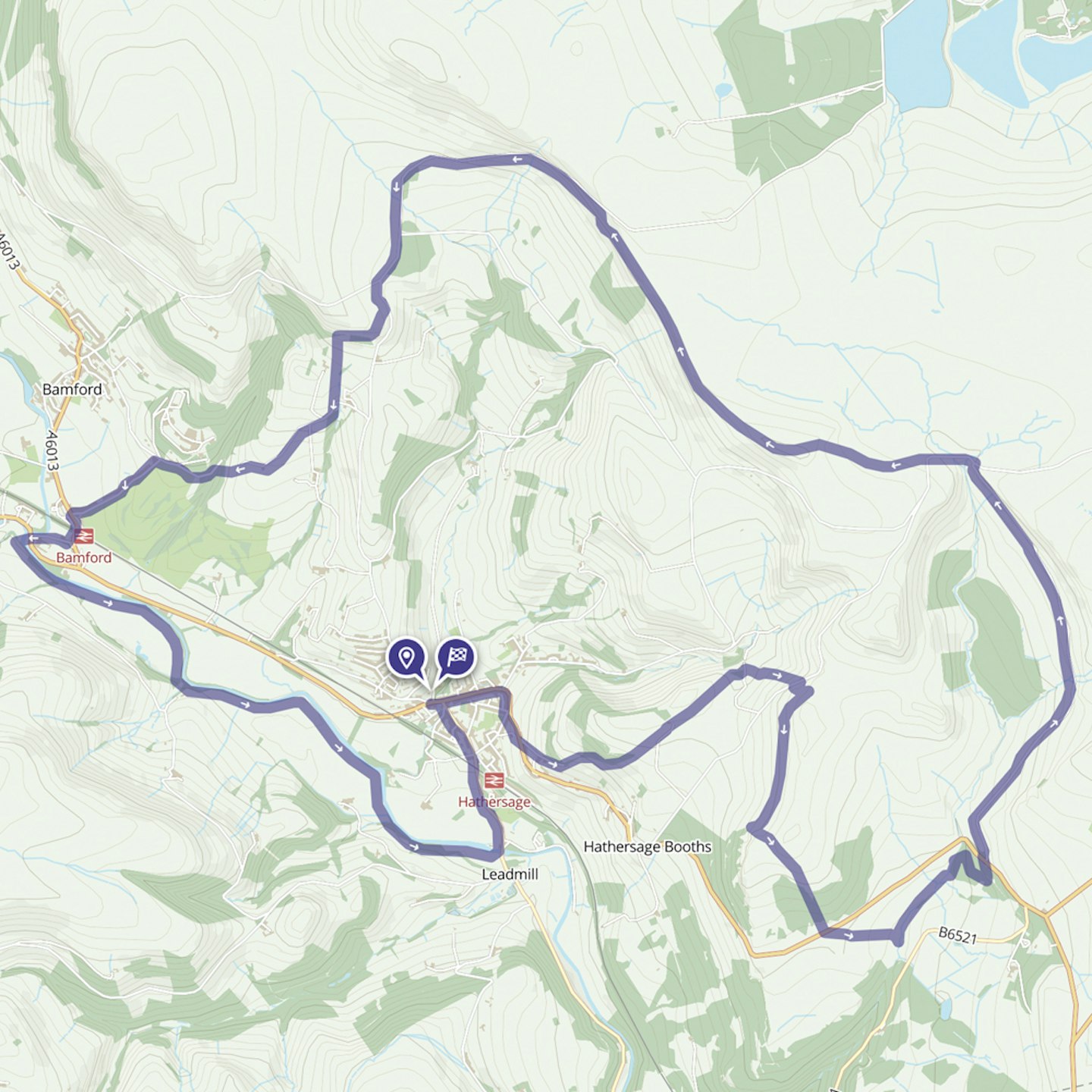
Stanage Edge
iconic gritstone escarpment
The Route
Distance: 22.48km / 14 miles
Elevation Gain: 592.25m
Difficulty: Intermediate
After walking the long, impressive escarpment of Stanage Edge you’ll get a real feel for the tremendous variety on offer in the Peak District National Park. The exposed gritstone and adjacent moorland give a rawness and atmosphere that makes it hard to believe the grassy limestone caves and valleys of the south are within the same park.
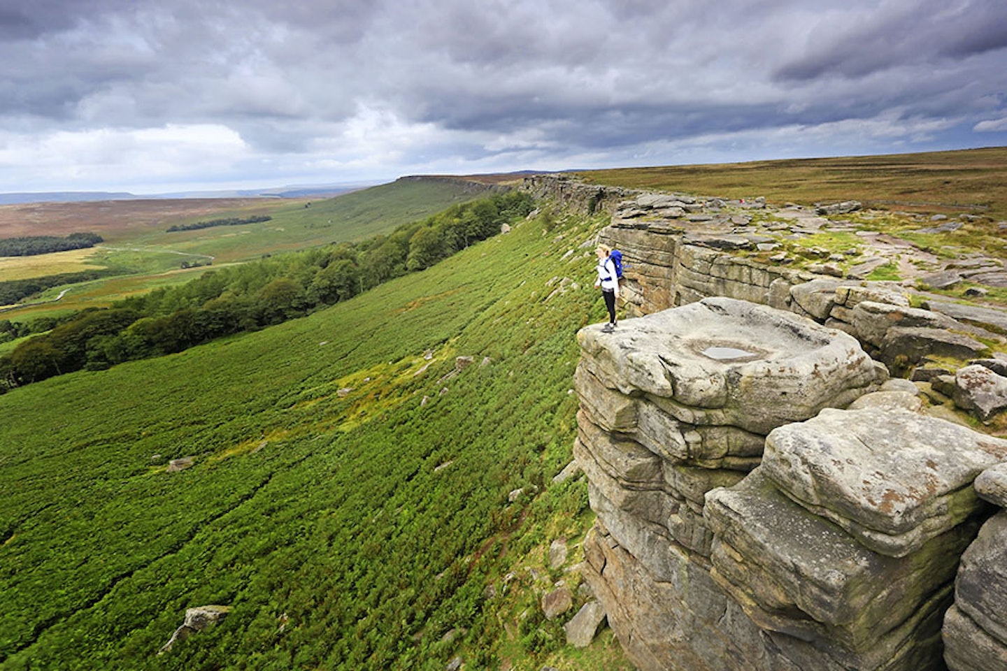
Stanage Edge is a climber’s dream, so keep a lookout below for boulderers taking on daring ascents up the broken crags. This is a straightforward place to navigate with plenty of starting points along the 6km length of the escarpment, which can be easily walked in a lovely loop walk from the village of Hathersage that takes in a variety scenery including rivers and woodland.
{#h-}
What to consider when planning a hiking trip
Terrain
Regions like the Peak District offer a diverse range of landscapes, from grassy rolling hills to rugged, rocky mountains. We'd recommend researching the hiking routes you want to undertake and making sure they match your experience and fitness level. You also want to make sure you've got the appropriate gear, such as a durable pair of hiking boots that can handle rougher ground.
Season
As you might've guessed, summer and winter are worlds apart when it comes to hiking. However, you may be surprised to learn that every season comes with its fair share of advantages and disadvantages. Sure, spring and summer will likely offer pleasant weather and beautiful vertiginous scenes, but things can take a turn when Mr. Hay fever comes a-knocking.
Summer is also when hiking – pardon the pun – peaks in popularity. So, prepare to deal with crowds, or seek out lesser-known routes for a better experience. Autumn, meanwhile, can showcase some absolutely stunning sights with less than half the crowds. The weather can start getting hairy around here, so be sure to pack a waterproof jacket.
Winter brings some peace and quiet, along with chances to see some breathtaking snow-covered landscapes. It also brings the most severe challenges, including low temperatures and icy paths. Insulated jackets are a must-have. Additionally, you'll want to consider researching the best winter hiking boots.
Accommodation
To camp or not to camp? The choice is yours; both approaches have their merits. The Peak District s furnished with dozens of warm and welcoming inns. They provide a great opportunity to mingle with the locals and meet some fellow hikers. Not to mention immediate access to hearty meals and a brew or two. Be sure to find the right location for your hikes, and book well in advance. The nice rooms sell like hotcakes, especially during peak seasons.
Of course, you can always save yourself the hassle (and cost) of hotels by simply pitching a tent.
Camping in the Peak District is an excellent way to immerse yourself in this gorgeous area. There are several well-equipped campsites throughout the national park. Conversely, you could explore wild camping in accordance with the local guidelines.
Undoubtedly, this option has the highest effort-reward ratio. It can be hassle to pitch in the middle of the wilderness, but you may also wake up to your new all-time favourite view. Check out our wild camping guide to learn more.
Mountain Safety
Walking in the UK mountains can be dangerous, with rough terrain, exposure and changeable weather. Always check weather forecasts and make sure you have suitable clothing and navigation tools. Ice axes and crampons are essential for walking in snow and ice – as are the knowledge and skills to use them.
Useful Resources
Met Office Mountain Weather Forecast: metoffice.gov.uk
Mountain Weather Information Service: mwis.org.uk
Avalanche forecasts: sais.gov.uk
Mountain Rescue: Call 999, ask for police, then mountain rescue
Skills courses: mountain-training.org
Get half-price digital OS Maps. Trail and Country Walking magazine members get 50% off an annual subscription to OS Maps for 12 months. Find out more here.
Need help with OS Maps? Try the OS Maps online FAQ and OS Maps quick start guide for further assistance
