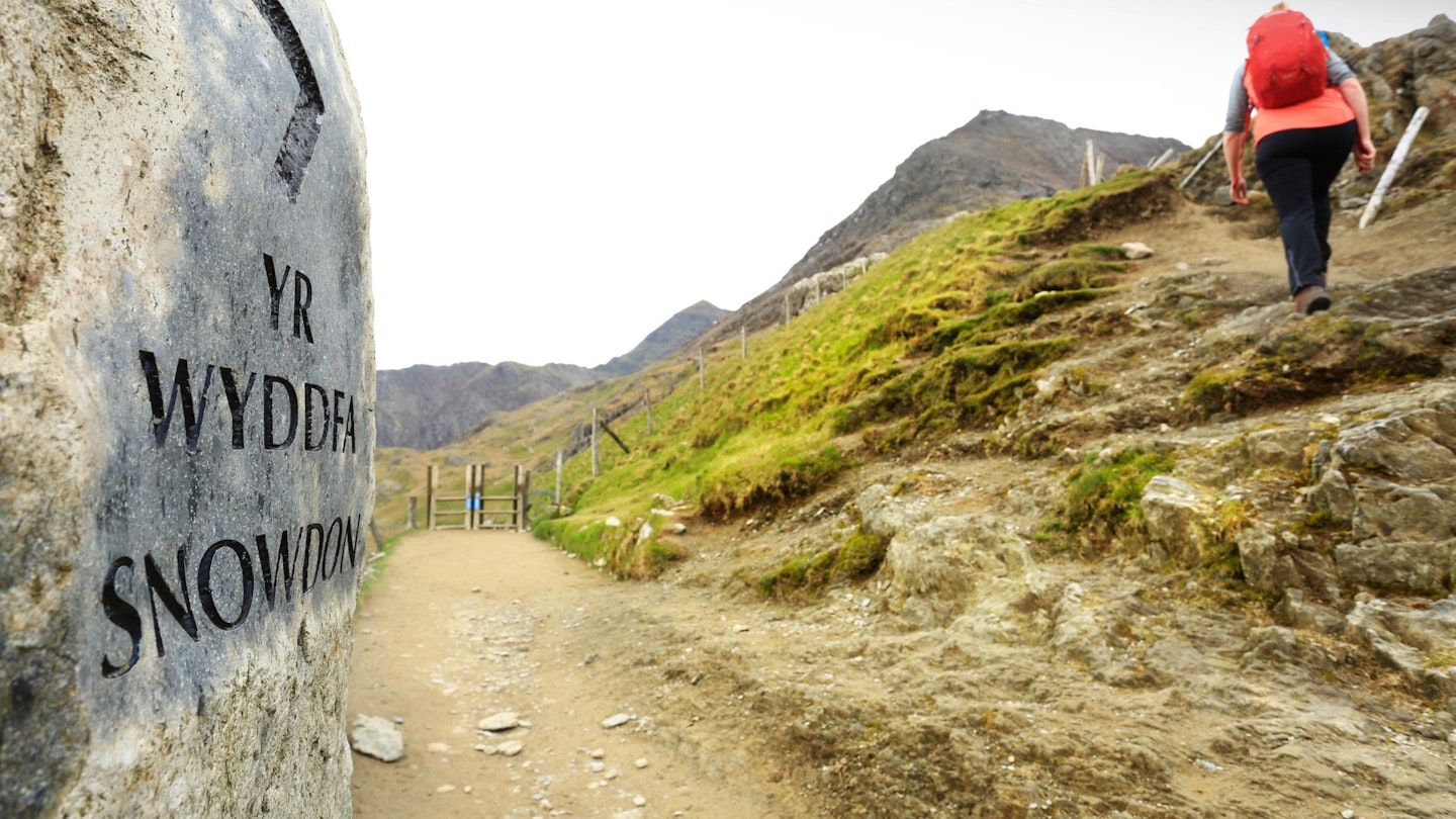
Snowdon. Misconceptions cling to it like its own malignant weather systems. It’s cursed with being The Highest Peak in Wales, therefore everyone’s opinion is primed and armed before the beast’s even left the cage.
Highest? Pah. Highest is for tourists. Snowdon is nothing more than a once-grand pompadour of a mountain now defiled by a café on the top and a train up the side and a queue everywhere else. Right? A ghetto for people who climb one hill in their life, and want it, need it, to be the highest.
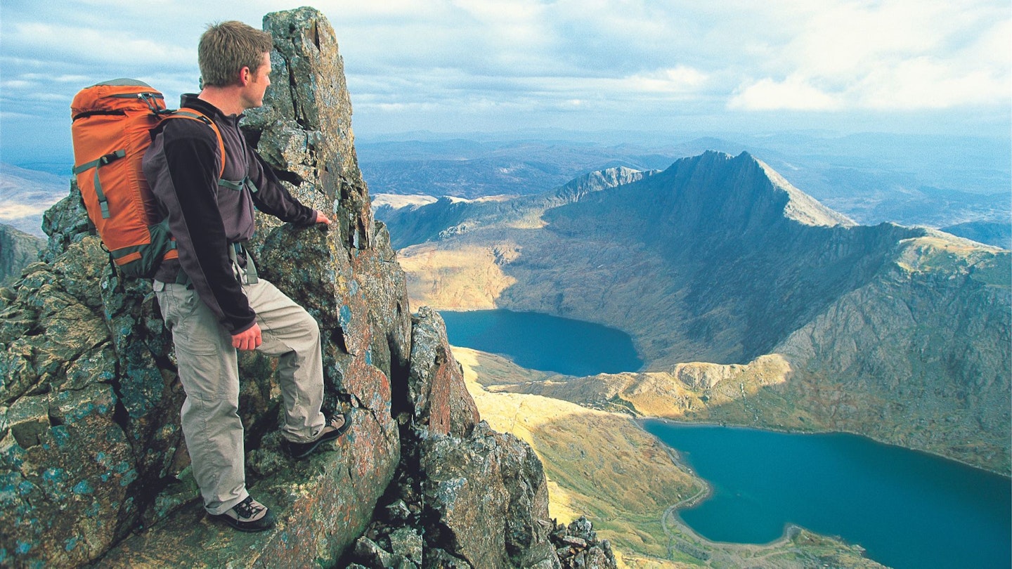
Trinity Face, Clogwyn y Person Arête, and the legendary Clogwyn Du’r Arddu – the ‘black cliff’, and finest climbing crag in Wales, some say the world – are criss-crossed by routes steepled by some of the mountain legends who revered Snowdon: Geoffrey Winthrop Young, George Mallory, Edmund Hillary, Joe Brown, Don Whillans, Johnny Dawes.
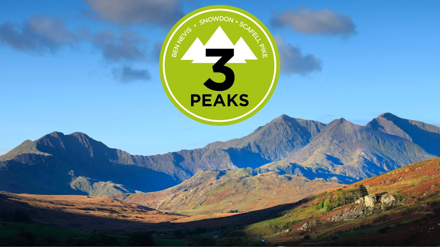
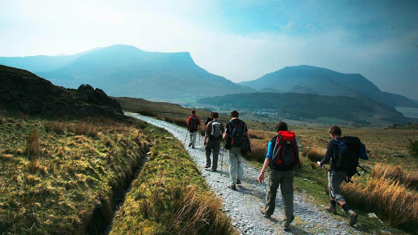
It’s fortuitous that such a wonderous peak is Wales’ highest. It means Three Peaks Challenge walkers get to experience its mystique annually and tread its array of routes.
This guide is all about how to get the most out of climbing Snowdon.
Jump to:
Get half-price digital OS Maps! Trail and Country Walking magazine members get 50% off an annual subscription to OS Maps for 12 months! Find out more here.
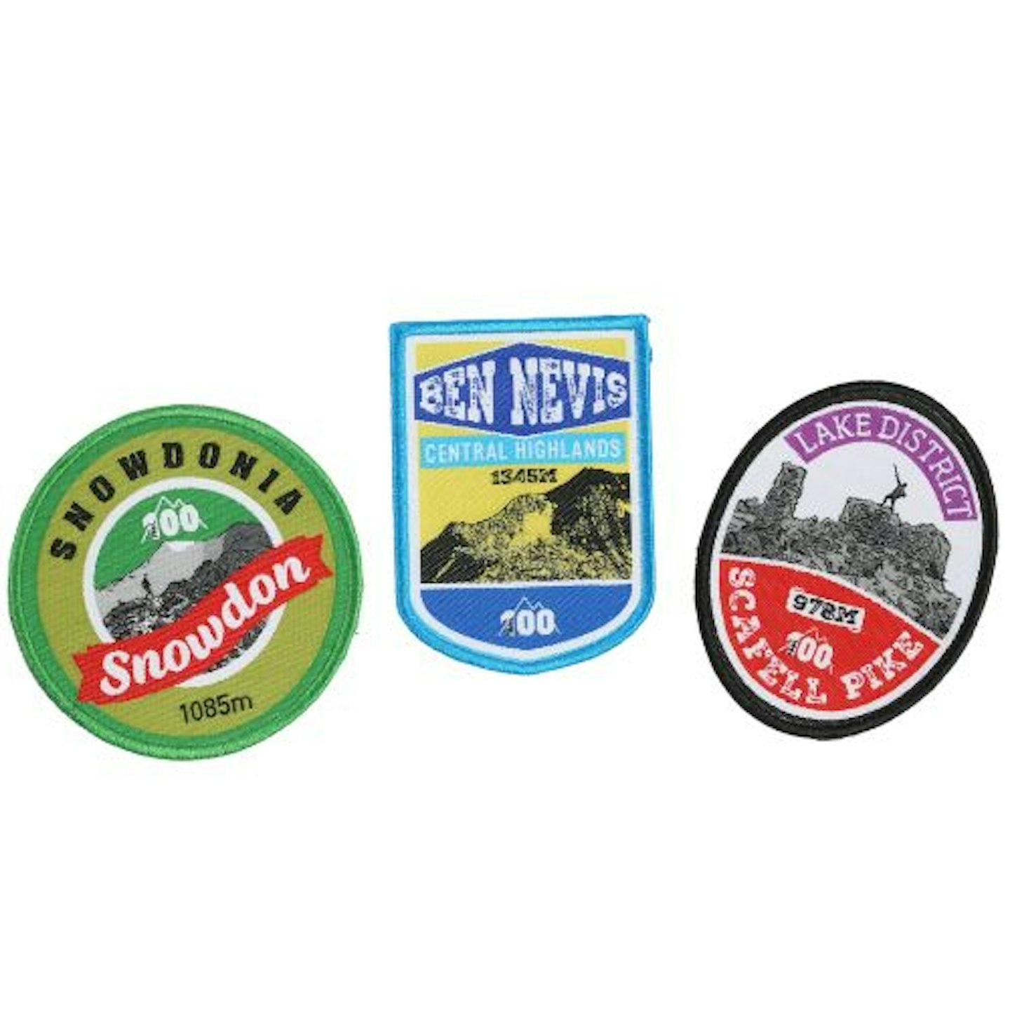
Three Peaks patches
 1 of 2
Trail 100 Patch Bundle
 2 of 2
Trail 100 Snowdon Patch
Snowdon FAQs
How hard is it?
Snowdon is probably one of the UK’s most dangerous mountains due to the sheer variety of routes and their wildly different levels of exposure and technicality.
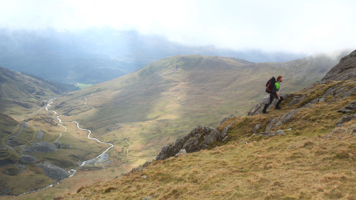
On a clear day the Llanberis Path can feel like a long uphill stroll, but find yourself on the razor-sharp ridge of Crib Goch and you’ll face a severe test of nerve and scrambling ability. Snowdon is an awesome, fearsome mountain with highly changeable weather, plus cliffs and arêtes that will make your knees tremble. Select your route wisely.
How long does it take?
That very much depends on your route (there are 10 recognised ways to the summit of Snowdon) and level of fitness.
The Pen-y-Pass car park at an altitude of 359m means an ascent via the Pyg or Miners’ Tracks can see you reach the summit in less than 3 hours, whereas longer routes such as the Llanberis Path or south ridge are likely to take much longer. Do your research before setting off.
How do I get there?
Snowdon is a huge, sprawling mountain with many access points, but the two main ways to reach it are via the A55 from the north or A5 from the south.
The A55 dual carriageway runs along the north coast of Wales before breaking off near Bangor on the A4244 to Llanberis. The A5 travels into Wales via Shropshire, through Betws-y-Coed and into Capel Curig, where you turn left on the A4086 towards Snowdon and the Pass of Llanberis.
Where you’re planning to start your walk from will determine how much driving you still need to do once you reach the mountain.
The Snowdon Sherpa bus network shuttles around the base of the mountain, connecting various footpaths and surrounding villages. It’s a great service that – if the timings match up – allows you to walk up one path and descend a different one, then still make it back to your starting point.
If you hadn’t heard, there’s also a rather impressive train that will take you all the way to Snowdon’s 1085m summit from Llanberis. But assuming you want to walk or scramble up the mountain the most convenient train stations to access it from are Bangor and Betws-y-Coed.
Where do I park?
The pay and display Pen-y-Pass car park is the most popular place as it gives direct access to the Pyg and Miners’ Tracks, plus Crib Goch and the full Snowdon Horseshoe. However, it costs £10 per day and fills up quickly so it may be worth parking lower down and catching the Sherpa bus up.
There are plenty of parking options in Llanberis and on the opposite side of the mountain if you’re planning to walk from Rhyd-Ddu or Nantgwynant.
Where can I buy food and drink?
Make sure you take supplies to last the whole day. There is a café on top of Snowdon, which serves great food, but you should never rely on it. It’s best to carry too much and not need it. Stock up on the way to the peak.
Are there bins on the mountain?
Litter is a huge problem on Snowdon due to this being one of the world’s busiest mountains. And disposing of waste has become costly for the National Park. Note there are no bins at Pen-y-Pass, and you’re asked to take all litter home with you.
Are there toilets?
The nearest toilets are at Pen-y-Pass.
Will my phone have signal?
Mobile reception in Snowdonia is notoriously poor – and there is no signal at Pen-y-Pass. The higher you get, the better the signal may become but it’s unreliable. If you’re using a GPS app that needs internet, it can’t be relied on for navigation.
Can I take my dog?
You can, but always under close control. Snowdon is a busy mountain so don’t let your dog impede other walkers and be aware that this is an important sheep grazing area.
The terrain is a mixture of paths, scree, bare rock and ridges, which can be harsh on a dog’s pads, so test them on similar routes first.
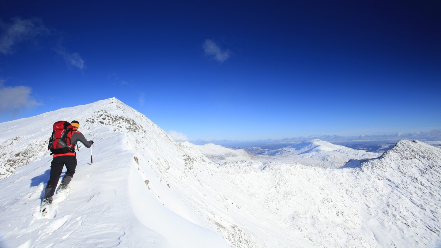
What’s the weather like?
Low cloud, wind and rain are common on Snowdon, with summit temperatures ranging from -20 deg C to 30 deg C. Take good gear and brush up on map and compass skills.
The Mountain Weather Information Service is updated twice daily and the Met Office Mountain Forecast provides an hourly overview of the conditions you could face on the summit.
How do I contact Mountain Rescue?
First up, are you sure you need rescuing? The Llanberis Mountain Rescue team is the busiest in Britain, often with multiple callouts on busy days, so being tired or running out of Snickers bars aren’t good enough reasons to mobilise an entire team of volunteers.
But if it’s a genuine emergency, and you believe you or one of your party are in danger, dial 999 or 112 and ask for Police, then Mountain Rescue. Have your location and emergency details ready before you call.
Where should I stay?
Llanberis, Beddgelert, Capel Curig, Rhyd-Ddu and Betws-y-Coed have a huge variety of accommodation options, ranging from campsites, inns, B&Bs and hostels to luxury hotels. The official tourism website is a useful place to start looking.
What’s the best pub?
In terms of history, you can’t beat the Pen-y-Gwryd Hotel. Located at the base of the Pass of Llanberis, it’s full of memorabilia from the 1953 Everest team who used it as their training headquarters.
Similarly, Mallory’s Bar at YHA Snowdon Pen-y-Pass was once a popular watering hole with many UK mountaineering greats.
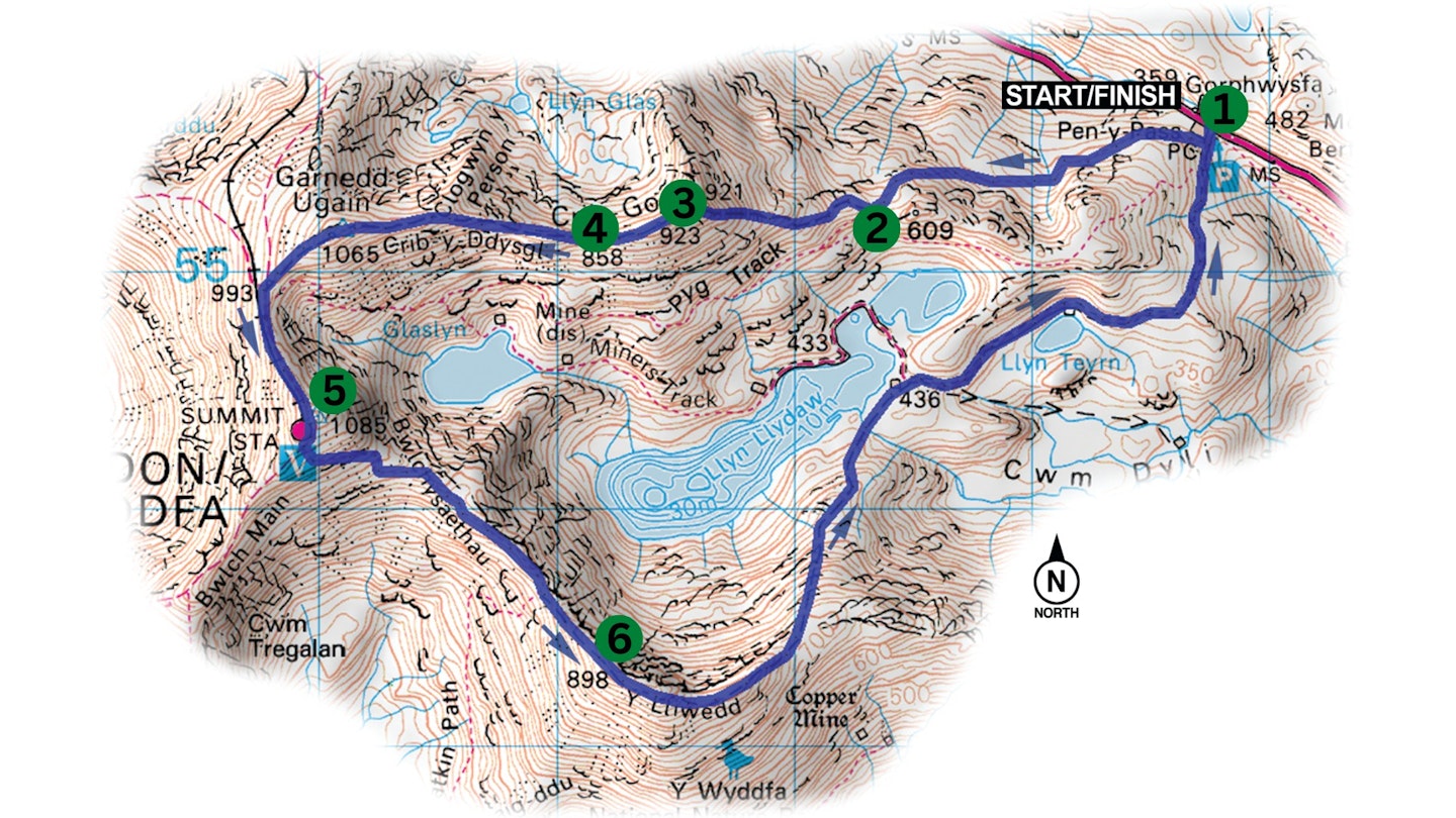
Snowdon Pyg Track
This little path with massive views unlocks Snowdon’s summit for a wide range of walkers.
Distance: 10.6km (6.5 miles)
Total ascent: 750m
Time: 6 hours
Start/finish: car park at Pen-y-Pass (SH647555)
Terrain: rocky slopes, craggy corries, steep head wall, exposed col and broad summit ridge; easy-to-follow paths and tracks with some steep sections. The zigzags are prone to hard snow and ice in winter.
Maps: OS Landranger (1:50,000) 115; OS Explorer (1:25,000) 17; Harvey British Mountain Maps (1:40,000) Snowdonia
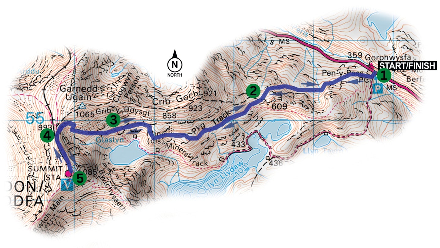
1. Grid Reference: SH647555
After leaving your car or taking the bus to Pen-y-Pass, take the Pyg Track west-south-west to Bwlch y Moch.
2. Grid reference: SH634553
Cross Bwlch y Moch and continue west-south-west then west as the path skirts across the southern slopes of Crib Goch to a junction with the Miners’ Track high above the concealed mountain lake of Glaslyn.
3. Grid reference: SH614548
From the junction climb the steep zigzags west up the head wall to Bwlch Glas, which is marked by a large stone ’finger post’ – a handy navigational waypoint in poor weather conditions.
4. Grid reference: SH608548
At Bwlch Glas the path joins the Llanberis Path (bridleway) that is taken south then south-south-east to Snowdon’s summit, which is marked by an elevated trig point, a large grey café building – and often hundreds of people!
5. Grid reference: SH609543
To descend from the summit station take the bridleway north-north-west back to Bwlch Glas. At the stone marker turn east and descend the zigzags towards Glaslyn.
Midway down the corrie head wall the path splits. Take the left-hand fork (the right is the Miners’ Track) and follow it east then east-north-east across the southern slopes of Crib Goch to Bwlch y Moch. Continue east-north-east across Bwlch y Moch then make the final descent to Pen-y-Pass.
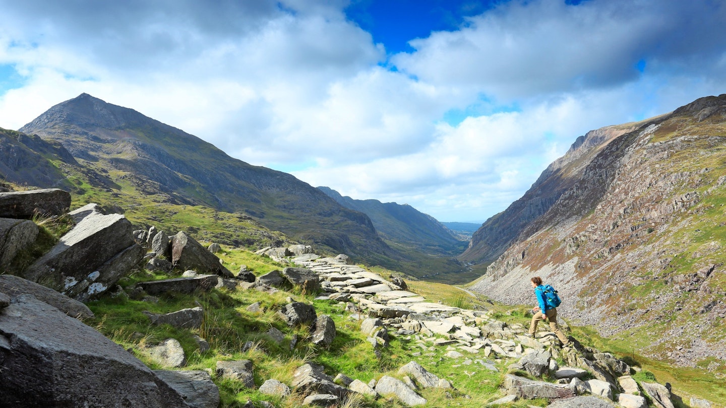
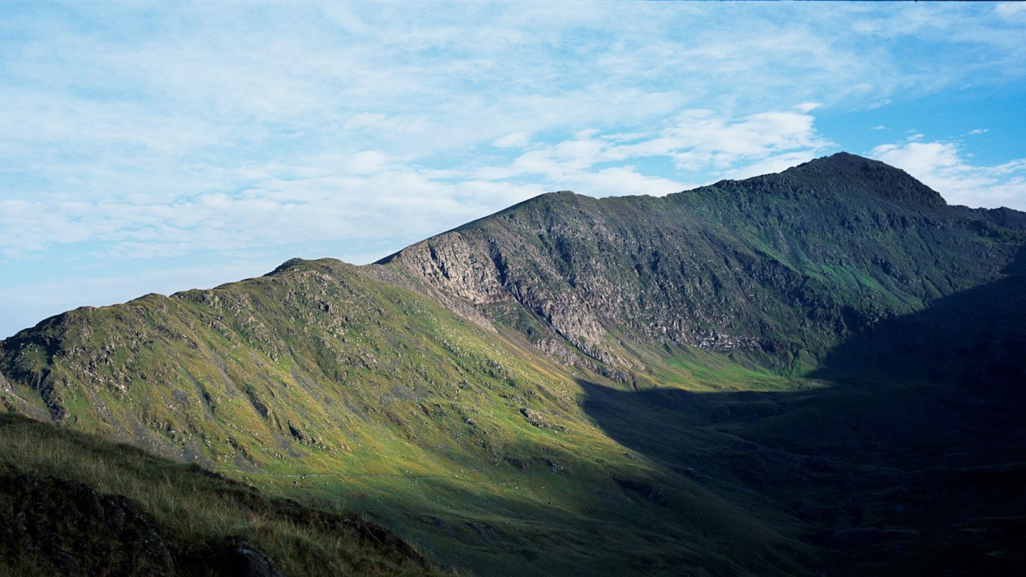
Snowdon South Ridge
Quiet and remote, angular and adventurous; this is the side of Snowdon you’re not supposed to know about.
Distance: 10.5km (6.5 miles)
Total ascent: 1180m
Time: 5-6 hours
Start/finish: car park in Rhyd-Ddu (SH571525)
Terrain: mainly good paths over steep hillsides but there are a couple of places where hands may be needed; this is exciting rocky terrain, especially on the south ridge, but you can keep away from the most exposed sections
Maps: OS Landranger (1:50,000) 115; OS Explorer (1:25,000) 17; Harvey British Mountain Maps (1:40,000) Snowdonia
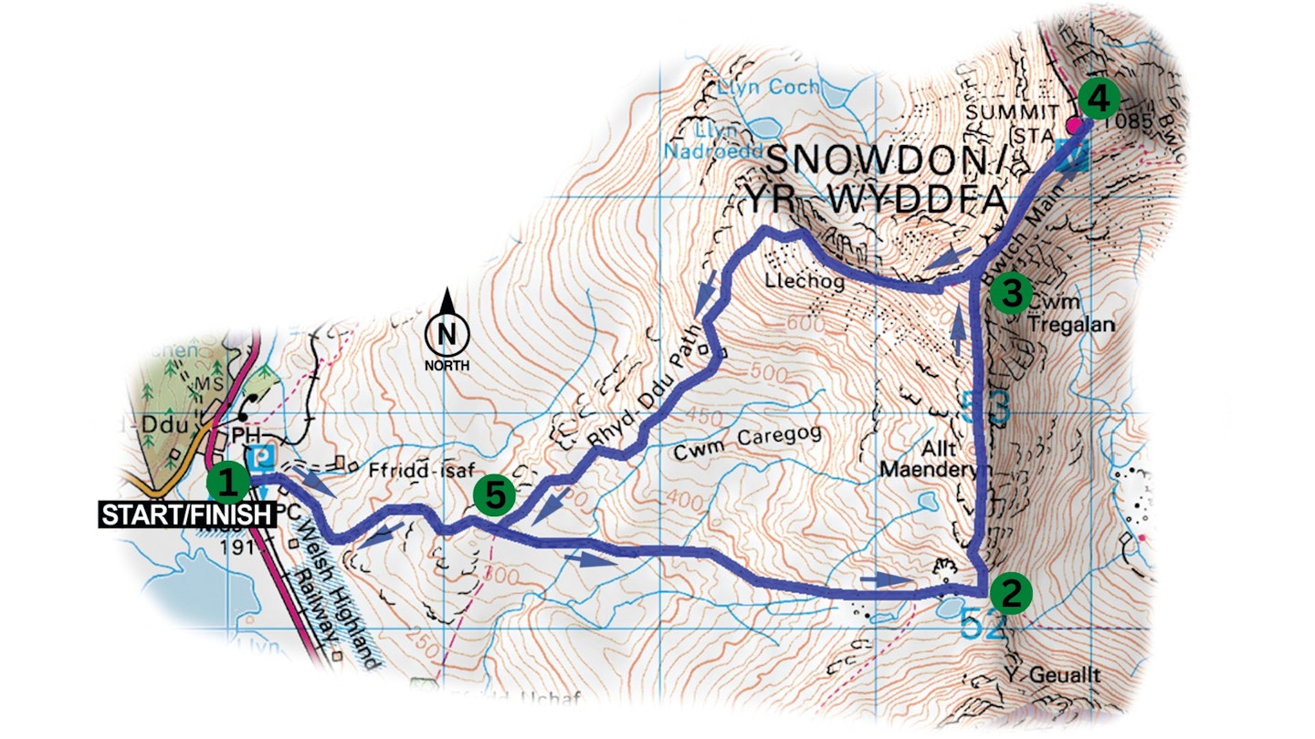
1. Grid reference: SH571525
Head up to the top of the car park, and turn right to cross the railway and gain a broad, stony track that was once a quarry road. Follow this around to the right and keep right, almost immediately at the junction with the drive of Fridd-Isaf farm.
Continue past a modern-looking barn on the left and the old quarry and its ruined buildings on the right, then continue easily between rocky knolls and outcrops. After 1.5km, almost immediately after crossing a wall, ignore the track through a gate on your left waymarked to Snowdon summit. Your route continues east along a broad track that eventually leads through old quarry buildings into the deep notch of Bwlch Cwm Llan.
2. Grid reference: SH605521
This is a good place to take a quick breather, because the next section is a steep pull up to your left on a path that leads straight to the 704m rocky outpost of Allt Maenderyn. From here Snowdon’s south ridge stretches out before you, providing over a kilometre of wonderful high-level walking.
Some sections can feel exposed and you may need your hands on occasion, but the crest can be avoided if you feel uncomfortable.
3. Grid reference: SH605537
At Bwlch Main you’ll meet the Rhyd-Ddu Path coming up from your left. Remember this point, because that’s the route you’ll be taking in descent. At Bwlch Main the path swings north-east up a narrowing ridge towards Snowdon’s summit, with the café clearly visible above you.
4. Grid reference: SH609543
If you can get the summit to yourself (unlikely in high summer), it’s a great place to be with amazing views – especially over Glaslyn and the eastern cwm to the jagged crest of Crib Goch, which looks notably lower from here.
To descend, head back down the ridge you’ve just ascended to Bwlch Main. This time take the right fork that descends a series of steep zigzags then swings around the top of Llechog, with amazing views over the gaping chasm of Cwm Clogwyn to the imposing and often forgotten west face of Snowdon.
The path eventually breaks left then threads its way down fairly steep and rocky ground back to the path you left Rhyd-Ddu on at the start of the walk.
5. Grid reference: SH583525
From here turn right and follow your outward route back to the car park.
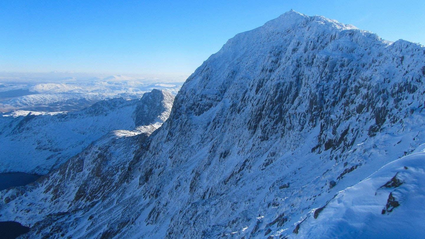
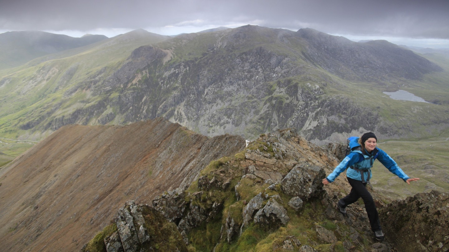
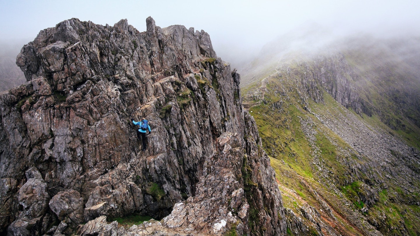
Snowdon Horseshoe via Crib Goch
The blade-like ridge of Crib Goch is Snowdon’s ultimate test of nerve – and the first leg of the mountain’s legendary horsehoe. But how hard is it? Read on to find out...
Distance: 11km (7 miles)
Total ascent: 1200m
Time: 6 hours
Start/finish: car park at Pen-y-Pass (SH647555)
Terrain: a high-level mountain walk with some sections of very exposed but technically simple Grade 1 scrambling on the ascent of Crib Goch, the subsequent traverse and the continuation to Garnedd Ugain
Maps: OS Landranger (1:50,000) 115; OS Explorer (1:25,000) 17; Harvey British Mountain Maps (1:40,000) Snowdonia
1. Grid reference: SH647555
Pen-y-Pass is a popular place to park, so arrive early if you want to be sure of a space or catch the bus up from Llanberis. Head out from the top of the car park onto an obvious path, marked as the Pyg Track.
Follow this easily across the hillside, climbing steadily as you go until you arrive at the deeply cut saddle of Bwlch y Moch
2. Grid reference: SH633552
Turn right and follow the clear path along the crest of the saddle towards the obvious blunt nose of Crib Goch ahead. Make as direct an assault here as you feel comfortable with, and after the opening steep section the grade eases and you are left with a delightful staircase of small, blocky holds that enable easy progress up the eastern summit
3. Grid reference: SH625552
There’s little chance of going wrong now, as the narrow ridge ahead is the only option. Scramble carefully along it, using the crest itself for holds when the going gets steep.
Continue like this to the first of the pinnacles, which can be scrambled easily enough or bypassed on clear paths, before a second similar pinnacle soon blocks your progress. This too can be scrambled easily enough or bypassed on a narrow path. Continue into Bwlch Coch.
4. Grid reference: SH621551
Ahead now lies the peak of Garnedd Ugain, which offers more scrambling for those who want it, or a good path for those who have had enough.
Either way, continue along the ridge to the 1065m trig point and keep ahead to drop to Bwlch Glas, where you meet the main path from Llanberis and the railway line. Head left to Snowdon’s summit.
5. Grid reference: SH609543
To descend, continue in the same direction to follow the south ridge until you reach a tall standing stone, where you turn left to follow an awkward, loose path down into Bwlch y Saethau.
Now follow the good path towards Y Lliwedd and then, as it bears right, keep ahead to follow the crest of the ridge. This soon jacks up into a steep, scrambly path, leading onto Y Lliwedd’s 898m West Peak.
6. Grid reference: SH622533
Continue over the East Peak and follow the escarpment along over Lliwedd Bach before the path bears left to descend steeply to join the Miners’ Track by the shores of Llyn Llydaw. Turn right onto this and follow it easily back down to the car park at Pen-y-Pass.
Other routes on Snowdon
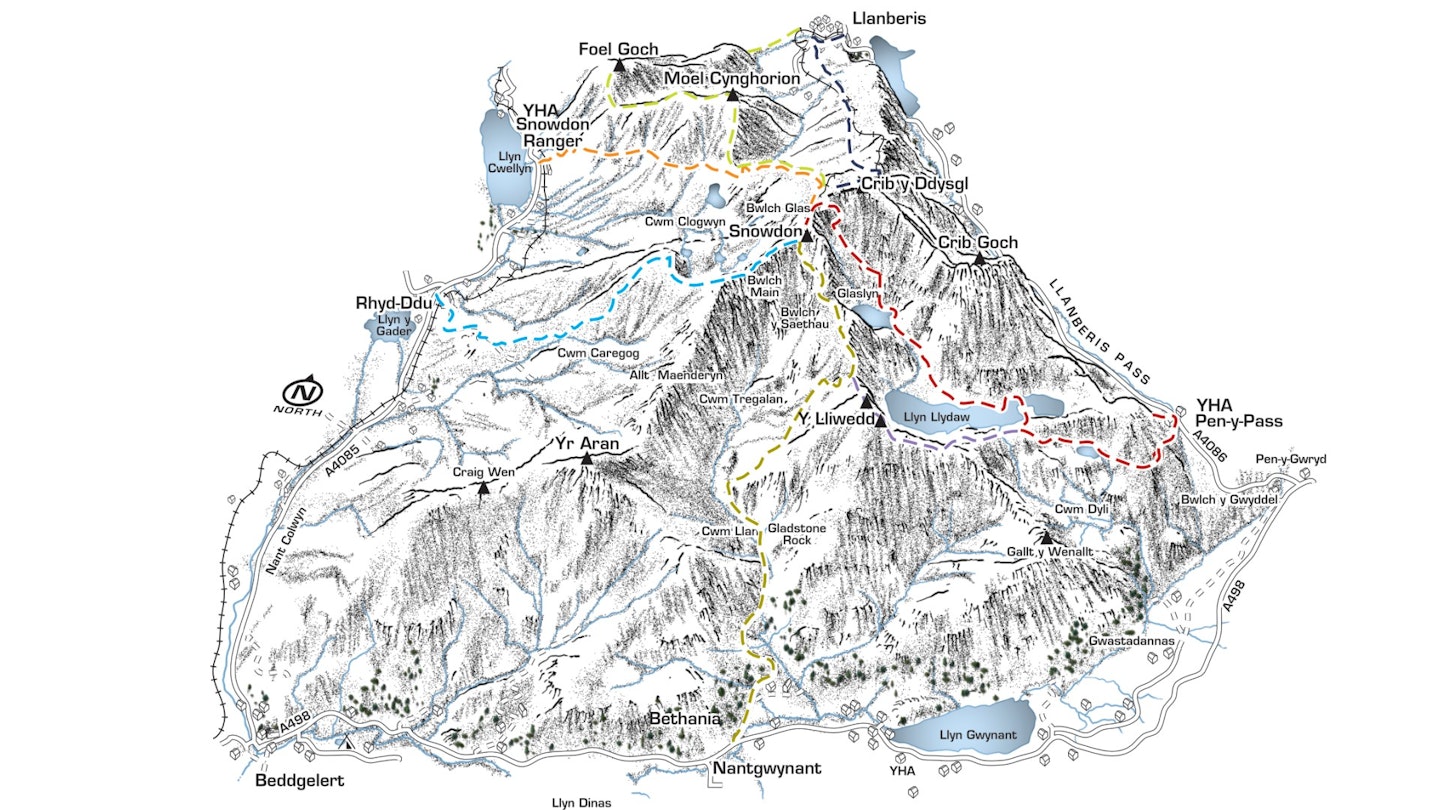
Rhyd-Ddu Path (blue)
Distance: 6km/3.75 miles
Best in ascent, as a slow-building attack which takes in the climax of the south ridge.
Snowdon's oft forgotten route has one big plus: it takes you on a high traverse around the edge of Cwm Clogwyn, the monstrous western corrie beneath Snowdon's summit pyramid. The craggy rim of Llechlog is a particular highlight, and the path's steady ascent has made it popular with mountain bikers.
Snowdon Ranger (orange)
Distance: 6.4km/4 miles
Best in either direction – however the views are better in ascent.
The oldest route on the mountain, and it shows. A slow crawl up or a leisurely meander down, it's very similar in difficulty to the Llanberis Path, but has a more pleasant feel to it. It's popular with mountain bikers, though, so be warned...
Via Moel Eilio (green)
Distance: 10.5km/6.5 miles
Best in descent, for the superb views and pleasing line. Plus, it's a slog to walk up from Llanberis.
A stunning, rolling ridge that takes in several satellite tops including Foel Goch, Foel Gron and Moel Eilio. The highlight is the summit of Moel Cynghorion, where a look back towards Snowdon rewards you with a view to stun: the entire western aspect, with the legendary cliffs of Clogwyn Du'r Arddu in front of you.
Llanberis Path (navy)
Distance: 8km/5 miles
Best in descent, as it's gentle on the knees and the warm pubs of Llanberis are at the end.
Perhaps Snowdon's most pedestrian route (and certainly the busiest) the long Llanberis path takes broadly the same line as the Snowdon mountain railway. A nice flip-side to a strenuous ascent, but something of a motorway – and home to a nasty blackspot in winter, so take care.
Miner’s Track (red)
Distance: 6km/3.5 miles
Best in ascent, but also handy for a fast descent to Pen-y-Pass.
Perhaps Snowdon's most pedestrian route (and certainly the busiest) the long Llanberis path takes broadly the same line as the Snowdon mountain railway. A nice flip-side to a strenuous ascent, but something of a motorway – and home to a nasty blackspot in winter, so take care.
Via Y Lliwedd (violet)
Distance: 6.4km/4 miles
Best in descent, as it's long, steep and difficult to climb up.
The mirror to Crib Goch across Llyn Llydaw, Y Lliwedd is a staggering mountain in its own right. A descent across its crest completes the Snowdon horseshoe in grand (if knackering) style with a near-vertical cliff to your left and an absolutely extraordinary view everywhere else.
Watkin Path (dark green)
Distance: 6.4km/4 miles
Best in ascent, as it's easier to maintain your heading from below.
Pleasingly green and staggeringly steep up top, the Watkin Path is a well-built route full of interest that twists and turns up Snowdon from pleasant Nantgwynant. Gorgeous views abound whichever way you tackle it, making this a splendid middle-of-the-road option.
Snowdon danger spots
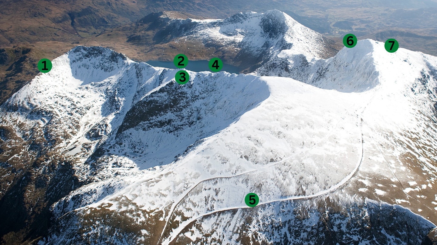
1. Crib Goch 1 (SH627552)
The first major rock step on Crib Goch. A surprising number of people who arrive at this point think they’re heading for Snowdon – which they are eventually, if they’re fortunate and prepared; but if they’re unprepared for the exposure of Crib Goch, they could be climbing themselves into a trap they may find it very difficult to retreat from.
2. Crib Goch 2 (SH617551)
This is where Crib Goch rears up again with an imposing rock tower that deflects people to the left (south). Several small footpaths also develop in this area, which cross some steep and unpleasant ground.
3. Crib Goch 3 (SH615552)
In poor weather some people pick up the top of the Clogwyn y Person arête. They mistakenly think this is the main ridge and continue descending until they either realise what they’re doing, or it becomes too late.
4. Crib Goch 4 (SH614552)
Here’s another area that tends to deflect people away from the ridge and to the south – very loose, rocky and unpleasant.
5. Llanberis Path (SH609557)
This is the railway cutting off the Llanberis descent, which can fill with snow and then freeze. This route is often seen as an easy-to-follow descent in poor conditions in winter – but where it passes above a convex slope, it is very dangerous. There have been fatalities here.
A safer option if you find yourself here may be to detour and descend via the Snowdon Ranger Path (seen heading west off the bottom left of this square), rather than trying to re-find the Llanberis Path.
6. South-east ridge (SH610543)
People often try to descend this as they can’t find the start of the Watkin Path. It is possible either in descent or ascent – but the ground is loose and dangerous with a big drop to the north.
7. Watkin Path (SH609542)
At the top of the Watkin Path there are several paths. Due to the nature of the terrain they are often confusing as they appear and disappear. This area is very loose, and the ground is slippery, slaty and quite steep.